google.com, pub-0288379932320714, DIRECT, f08c47fec0942fa0 GRAVIR LES MONTAGNES... EN PEINTURE: CLIFFS
Showing posts with label CLIFFS. Show all posts

Thursday, October 3, 2024

LE CAP SPARTEL EN CARTE POSTALE ANCIENNE


CARTE POSTALE ANCIENNE (1930- 1950) Le Cap Spartel - Tanger (315 m) Maroc


CARTE POSTALE ANCIENNE (1930- 1950)
Le Cap Spartel - Tanger (315 m)
Maroc
 
Le relief
Le Cap Spartel (315 m) ou Ras Spartel (رأس سبارتيل) est un promontoire de la côte du Maroc, situé à l'entrée sud du détroit de Gibraltar, à 14 kilomètres à l'ouest de Tanger. Face au cap Spartel, à 44 km au nord, le cap Trafalgar marque l'entrée nord du détroit, sur la côte espagnole. Le cap Spartel est souvent indiqué par erreur comme le point le plus au nord de l'Afrique. En réalité, c'est le cap Angela (Tunisie) et le cap Spartel est seulement le point le plus au nord de la côte atlantique africaine et également le point le plus à l'ouest de la côte méditerranéenne méridionale. Le promontoire bénéficie d'une forte pluviosité favorable à la végétation. Dans l'Antiquité, le cap Spartel s'appelait le cap Ampelusium, ou cap des Vignes. Sous le promontoire, les vagues de l'océan Atlantique ont creusé des cavernes, où les habitants de la région venaient autrefois tailler des meules. Aujourd'hui ces spectaculaires « grottes d'Hercule » sont une attraction touristique. Sur le cap Spartel, à 110 m d'altitude, se trouve un phare, qui commença à fonctionner le 15 octobre 1864. Sa construction fut ordonnée par le sultan Mohammed IV ben Abderrahman, à la demande des représentants consulaires des puissances européennes alarmées par les nombreux naufrages qui se produisaient au large du cap. La lumière du phare est visible à 30 milles marins (55,6 km). Au large du cap Spartel se trouve le banc Spartel, un haut-fond que les géologues Marc-André Gutscher et Jacques Collina-Girard considèrent comme ayant pu nourrir le mythe de l'île de l'Atlantide.
La rénovation de l'ensemble du site du Cap Spartel a débuté en 2020 et s'est achevée en 2021. Il est désormais ouvert au public et comprend un musée maritime, un restaurant, un jardin botanique et un espace événementiel. Les visiteurs peuvent également accéder au sommet du phare pour profiter de la vue imprenable sur le détroit de Gibraltar.
 
Les cartes postales anciennes
Les cartes postales sont devenues populaires au tournant du XXe siècle, en particulier pour envoyer de courts messages à des amis et à des proches. Elles ont été collectionnées dès le début et sont toujours recherchées aujourd'hui par les collectionneurs de photographie, de publicité, de souvenirs de guerre, d'histoire locale et de nombreuses autres catégories. Les cartes postales ont connu un engouement international, publiées dans le monde entier. Detroit Publishing Co. et Teich & Co. étaient deux des principaux éditeurs aux États-Unis, et parfois des particuliers imprimaient également leurs propres cartes postales. Yvon était le plus célèbre en France. De nombreux éditeurs individuels ou anonymes ont existé dans le monde et notamment en Afrique et en Asie (Japon, Thaïlande, Népal, Chine, Java) entre 1920 et 1955. Ces photographes étaient pour la plupart des notables locaux, des militaires, des guides officiels appartenant aux armées coloniales (britanniques, françaises, belges...) qui disposaient parfois d'un matériel assez sophistiqué et réalisaient volontiers des photogrammes en couleur ou des explorateurs, navigateurs, alpinistes (Vittorio Sella et l'archiduc des Abruzzes futur roi d'Italie restent les plus célèbres d'entre eux).
Il existe de nombreux types de cartes postales anciennes de collection.
Les cartes postales à tenir à la lumière étaient fabriquées avec du papier de soie entouré de deux morceaux de papier ordinaire, de façon à laisser passer la lumière. Les cartes postales dépliantes, populaires dans les années 1950, étaient constituées de plusieurs cartes postales attachées en une longue bande. Les cartes postales à photographie réelle (RPPC) sont des photographies avec un support de carte postale.
Les cartes postales fantaisie étaient fabriquées en utilisant du bois, de l'aluminium, du cuivre et du liège. Les cartes postales en soie, souvent brodées sur une image imprimée, étaient enveloppées dans du carton et envoyées dans des enveloppes en papier cristal transparent. Elles étaient particulièrement populaires pendant la Première Guerre mondiale.
Dans les années 1930 et 1940, les cartes postales étaient imprimées sur du papier aux couleurs vives conçu pour ressembler à du lin.

_________________________________________

2024- Gravir les montagnes en peinture
Un blog de Francis Rousseau 
 

Tuesday, May 21, 2024

LA GORGE DES MOUTIERS  PAR  GEORGES BRAQUE


GEORGES BRAQUE (1882-1963) La Gorge des Moutiers (210 m) France (Normandie)  In "Varengeville", huile sur toile

GEORGES BRAQUE (1882-1963)
La Gorge des Moutiers (210 m)
France (Normandie)

In Varengeville, huile sur toile

Le relief
La Gorge des Moutiers ((210 m) offre un paysage où la mer et la roche se conjuguent. Accessible par le tracé du GR 21 à marée basse, cette valleuse vous mène vers une belle plage. Vous pouvez alors profiter d'une vue magnifique sur l'église Saint-Valéry, en haut de la falaise blanche.

Le Peintre
Georges Braque, est un peintre, sculpteur et graveur français. D'abord engagé dans le sillage des Fauves, influencé par Henri Matisse, André Derain et Othon Friesz, il aboutit, à l'été 1907 aux paysages de l'Estaque avec des maisons en forme de cubes que Matisse qualifie de « cubistes », particulièrement typées dans le tableau Maisons à l'Estaque. C'est en étudiant méthodiquement, dès 1906, les lignes de contour de Paul Cézanne, que Braque a abouti progressivement à des compositions qui utilisent de légères interruptions dans les lignes, comme dans Nature morte aux pichets. Puis avec une série de nus comme le Nu debout, et Le Grand Nu, il s'oriente, après 1908, vers une rupture avec la vision classique, l'éclatement des volumes, une période communément appelée cubiste, qui dure de 1911 jusqu'en 1914. Il utilise alors des formes géométriques principalement pour des natures mortes, introduit les lettres au pochoir dans ses tableaux, invente des papiers collés. En véritable « penseur » du cubisme, il élabore des lois de la perspective et de la couleur. Il invente aussi les sculptures en papier en 1912, toutes disparues, dont il ne subsiste qu'une photographie d'un contre-relief. Mobilisé pour la Grande Guerre où il est grièvement blessé, le peintre abandonne les formes géométriques pour des natures mortes où les objets sont dans des plans recomposés. Pendant la période suivante qui va jusqu'aux années 1930, il produit des paysages, des figures humaines et, malgré la diversité des sujets, son œuvre est « d'une remarquable cohérence. Braque à la fois précurseur et dépositaire de la tradition classique est le peintre français par excellence ». Le Cahier de Georges Braque, 1917-1947, publié en 1948, résume sa position. La Seconde Guerre mondiale lui a inspiré ses œuvres les plus graves : Le Chaudron et La Table de cuisine. La paix revenue et la fin de sa maladie lui ont inspiré les œuvres plus approfondies, tels les Ateliers, qu'il élabore souvent pendant plusieurs années, poursuivant six ébauches à la fois ainsi qu'en témoigne Jean Paulhan. Ses tableaux les plus connus sont aussi les plus poétiques : la série des Oiseaux, dont deux exemplaires ornent le plafond de la salle Henri-II du musée du Louvre, depuis 1953. Il a aussi créé des sculptures, des vitraux, des dessins de bijoux, mais à partir de 1959, atteint d'un cancer, il ralentit son rythme de travail. Son dernier grand tableau est La Sarcleuse. Deux ans avant sa mort, en 1961, une rétrospective de ses œuvres intitulée L'Atelier de Braque a lieu au musée du Louvre, Braque devient ainsi le premier peintre à être exposé dans ce lieu de son vivant. Homme discret, peu porté sur les relations publiques, Braque était un intellectuel féru de musique et de poésie, ami notamment d'Erik Satie, de René Char, d'Alberto Giacometti. Il s'est éteint le 31 août 1963 à Paris. Des obsèques nationales ont été organisées en son honneur, au cours desquelles André Malraux a prononcé un discours.
________________________________________

2024 - Gravir les montagnes en peinture...


Saturday, May 18, 2024

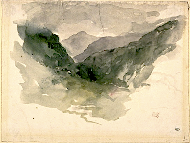
LE MONT CANIGOU  PAR  EUGÈNE DELACROIX

EUGENE DELACROIX (1798-1863) Le Canigou (2,784m - 9,137 ft) France (Pyrénées)  In Album Pyrénées ,1845 - Carnet de dessins et aquarelles, Musée du Louvre, Paris


EUGÈNE DELACROIX (1798-1863)
Le Canigou (2,784m - 9,137 ft)
France (Pyrénées)

In Album Pyrénées, 1845, Carnet de dessins et aquarelles, Musée du Louvre, Paris


La montagne
Le Canigou (2,784m - 9,137 ft) est une montagne située dans les Pyrénées-Orientales (sud de la France), au sud de Prades et au nord de Prats-de-Mollo-la-Preste. Son sommet est un quadripoint entre les territoires de Casteil, Taurinya, Valmanya et Vernet-les-Bains. Sa situation le rend visible depuis les plaines du Roussillon et du Conflent en France, ainsi que depuis l'Empordà en Espagne. En raison de ses flancs acérés et de sa situation spectaculaire à proximité de la côte, le Canigou était considéré jusqu'au XVIIIe siècle comme la plus haute montagne des Pyrénées.Deux fois par an, début février et fin octobre, par beau temps, le Canigou peut être aperçu au coucher du soleil jusqu'à Marseille, à 250 km, par réfraction de la lumière. Ce phénomène fut observé en 1808 par le baron Franz Xaver von Zach de la basilique Notre-Dame de la Garde à Marseille. Toute l'année, on l'observe également, par beau temps, depuis Agde, Port-Camargue et la Montagne Noire.La montagne a une signification symbolique pour le peuple catalan. À son sommet se dresse une croix souvent décorée du drapeau catalan. Chaque année, le 23 juin, la veille de la nuit de la Saint Jean, jour du solstice d'été, a lieu une cérémonie appelée Flama del Canigó (Flamme du Canigou), au cours de laquelle un feu est allumé au sommet de la montagne. Les gens veillent pendant la nuit et prennent les torches allumées sur le feu lors d'un spectaculaire relais de flambeaux pour allumer des feux de joie ailleurs. De nombreux feux de joie sont allumés de cette manière dans toutes les Pyrénées-Orientales, en Catalogne, dans la Communauté valencienne et en théorie dans les îles Baléares.


Le peintre

Ferdinand Victor Eugène Delacroix était un artiste romantique français considéré dès le début de sa carrière comme le chef de file de l'école romantique française. L'utilisation par Delacroix de coups de pinceau expressifs et ses études sur les effets optiques de la couleur ont profondément façonné le travail des impressionnistes, alrors que sa passion pour l'exotisme a inspiré les artistes du mouvement symboliste. Fin lithographe, Delacroix a illustré diverses œuvres (William Shakespeare, Walter Scott et Goethe notamment).
Contrairement au perfectionnisme néoclassique de son principal rival Ingres, Delacroix s'est inspiré de l'art de Rubens et des peintres de la Renaissance vénitienne, en mettant l'accent sur la couleur et le mouvement plutôt que sur la clarté des contours et la forme soigneusement modelée. Le contenu dramatique et romantique caractérise les thèmes centraux de sa maturité et le conduit non pas vers les modèles classiques de l'art grec et romain, mais plutôt vers les voyages en Afrique du Nord à la recherche de l'exotisme. Ami et héritier spirituel de Théodore Géricault, Delacroix s'inspire également de Lord Byron, avec qui il partage une forte identification aux « forces du sublime », et aux actions de la nature, souvent violente.
Cependant, Delacroix n'était enclin ni à la sentimentalité ni à l'emphase, et son romantisme était celui d'un individualiste. Selon les mots de Baudelaire : « Delacroix était passionnément amoureux de la passion, mais froidement déterminé à exprimer sa passion le plus clairement possible ».
En 1832, Delacroix se rend en Espagne et en Afrique du Nord, dans le cadre d'une mission diplomatique au Maroc peu après la conquête de l'Algérie par la France. Il n'y est pas allé pour étudier l'art, mais pour échapper au parisianisme dans l'espoir d'approcher une culture plus primitive. Il a produit plus de 100 peintures et dessins de scènes tirées ou basées sur la vie des peuples d'Afrique du Nord, et a ajouté un nouveau chapitre très personnel à l'intérêt général porté alors à l'orientalisme. Delacroix était fasciné par les gens et les costumes, et le voyage allait éclairer le sujet d'un grand nombre de ses futurs tableaux. Il pensait que les Nord-Africains, dans leurs vêtements et leurs attitudes, fournissaient un équivalent visuel aux peuples de la Rome et de la Grèce classiques : « Les Grecs et les Romains sont ici à ma porte, chez les Arabes qui s'enveloppent dans une couverture blanche et regardent comme Caton ou Brutus..."
Il réussit à dessiner secrètement quelques femmes à Alger, comme dans le tableau Femmes d'Alger dans leur appartement (1834), mais il rencontra généralement des difficultés à trouver des femmes musulmanes prêtes à poser pour lui en raison des règles musulmanes exigeant que les femmes soient couvertes. La peinture des femmes juives d’Afrique du Nord, comme sujets du Mariage juif au Maroc (1837-1841), pose moins de problèmes.
À Tanger, Delacroix réalise de nombreux croquis des gens et de la ville, sujets sur lesquels il reviendra jusqu'à la fin de sa vie. Les animaux, incarnation de la passion romantique, ont été incorporés dans des peintures telles que Chevaux arabes se battant dans une écurie (1860), La Chasse au lion (dont il existe de nombreuses versions, peintes entre 1856 et 1861) et Arabe sellant son cheval (1855). .

_________________________________________

2024 - Gravir les montagnes en peinture


Monday, May 6, 2024

CAP CANAILLE (2) PEINT PAR PAUL SIGNAC


PAUL SIGNAC (1863-1935) Cap Canaille (368 m) France   In Cassis, Cap Lombard, Opus 196, 1889,  Gemeentemuseum Den Haag
 
 
PAUL SIGNAC (1863-1935)
Cap Canaille (368 m)
France

 In Cassis, Cap Lombard, Opus 196, 1889,  Gemeentemuseum Den Haag

A propos de cette toile
Paul Signac, très enthousiasmé par Cassis et ses environs, y a réalisé cinq tableaux (voir l'un des cinq). Signac a décrit ce tableau dans une lettre à Vincent van Gogh : « Blanc, bleu, orange, harmonieusement dispersés dans de jolies ondulations. Tout autour des montagnes aux courbes rythmées. » En réalité ce Cap Lombard n'existe plus sous cette appellation et c'est du Cap Canaille qu'il s'agit.

Le relief
Le cap Canaille (368 m) est situé dans les Bouches-du-Rhône,  département de la région Provence-Alpes-Côte d'Azur en France. Il est inséré dans le Parc national des Calanques. Il se situe sur la commune de Cassis, au nord-ouest de celle de La Ciotat. Sa roche qui tire vers le rouge est composée de calcaires détritiques. S'avançant dans la mer Méditerranée, il est constitué de rivages rocheux et escarpés dominés par l'extrémité occidentale des falaises Soubeyranes. Ces dernières constituent les plus hautes falaises maritimes de France (avant celles d'Étretat et du cap Blanc-Nez avec une altitude maximale de 394 mètres1, ainsi que les quatrièmes plus hautes d'Europe. Une route, la D141 dite « route des Crêtes », relie Cassis à la Ciotat en s'approchant du bord de la falaise ; plusieurs belvédères y sont aménagés.
Son nom est dû à une déformation du provençal Cap Naio, « Cap Naille » en français, mal compris par les topographes français ; à rapprocher de Aïl qui est lié à la notion de sommet (Cap d'Ail, dans les Alpes-Maritimes, à l'ouest de Monaco).


Le peintre
Paul Signac, travaille avec Seurat et Pissarro, avec qui il va former le groupe des « impressionnistes dits scientifiques ». Il se convertit très vite à la pratique de la division scientifique du ton. La technique empirique du pointillisme consiste à diviser les tons en de toutes petites taches de couleurs pures, serrées les unes contre les autres, afin que l’œil du spectateur, en les recomposant, perçoive une unité de ton. Signac et les néo-impressionnistes pensent que cette division des tons assure d'abord tous les bénéfices de la coloration : le mélange optique des pigments uniquement purs permet de retrouver toutes les teintes du prisme et tous leurs tons. La séparation des divers éléments (couleur locale, couleur d'éclairage et leurs réactions) est aussi assurée, ainsi que l'équilibre de ces éléments et leur proportion, selon les lois du contraste, de la dégradation et de l'irisation. Enfin, le peintre devra choisir une touche proportionnée à la dimension du tableau7. En 1885, son intérêt pour « la science de la couleur »le pousse à se rendre aux Gobelins où il assiste à des expériences sur la réflexion de la lumière blanche.
Il fait son premier tableau divisionniste en 1886

 ______________________________________

2024 - Gravir les montagnes en peinture
Un blog de Francis Rousseau 

Thursday, April 4, 2024

LES FALAISES DE DIEPPE  VUES PAR  CLAUDE MONET

CLAUDE MONET (1840-1926) Les Falaise de Dieppe (nd) France  In La Falaise de Dieppe, huile sur toile, 1882,Kunsthaus, Zurich
 
 
CLAUDE MONET (1840-1926)
Les Falaise de Dieppe (nd)
France

In La Falaise de Dieppe, huile sur toile, 1882,Kunsthaus, Zurich


Le peintre
Oscar-Claude Monet, plus connu sous le nom de Claude Monet, était l'un des fondateurs de la peinture impressionniste française et de la peinture de paysage en plein air. Le terme « impressionnisme » est dérivé du titre de son tableau « Impression, soleil levant », qui fut exposé en 1874 dans la première des expositions indépendantes montées par Monet et ses associés en alternative au Salon de Paris.
L'ambition de Monet de documenter la campagne française l'a amené à adopter une méthode consistant à peindre plusieurs fois la même scène afin de capturer le changement de lumière et le passage des saisons exactement comme l'artiste japonais Hokusai (1760-1849) l'a fait avec ses 36 vues. du mont Fuji.
Monet a été volontiers qualifié de "moteur de l'impressionnisme". La compréhension des effets de la lumière sur la couleur des objets et des effets de la juxtaposition des couleurs entre elles était cruciale pour l'art des peintres impressionnistes. La longue carrière de peintre de Monet s'est déroulée dans la poursuite de cet objectif...
______________________________________

2024 - Gravir les montagnes en peinture
Un blog de Francis Rousseau


Tuesday, March 12, 2024

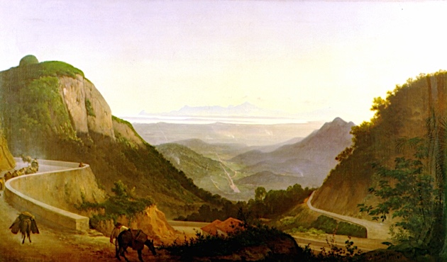
PICO DE MARIA COMPRIDA PEINT PAR AGOSTINHO JOSE DA MOTA

AGOSTINHO JOSE DA MOTA (1824-1878) Pico de Maria Comprida (1926 me Brésil   In Paisagem do Rio de Janeiro, huile sur toile, 130 x 79cm

AGOSTINHO JOSE DA MOTA (1824-1878)
Pico de Maria Comprida (1,926 m)
Brésil

 In Paisagem do Rio de Janeiro, huile sur toile, 130 x 79cm

 
La montagne

Le Pico da Maria Comprida (1,926m) est connu parmi les grimpeurs brésiliens pour abriter la voie d'escalade Maria Nebulosa , qui fut également la première voie du pays avec plus de 1000 mètres de longueur. Avec la nouvelle zone de protection, les habitants de la région et les alpinistes prévoient d'explorer ces attractions de manière durable et de promouvoir ainsi l'écotourisme et le tourisme rural dans la région.

Le peintre
Agostinho José da Mota était peintre, dessinateur et professeur brésilien. Ainsi, en 1837, il s'inscrit à l'Académie Impériale des Beaux-Arts. Il fut un brillant élève et, pour ses mérites et ses compétences démontrés, il reçut le prix d'un voyage en Europe en 1850. De retour au Brésil, en 1856, il est l'un des fondateurs de la Société de propagation des beaux-arts de Rio de Janeiro. Deux ans plus tard, il peint les portraits du couple impérial - Dom Pedro II (1825 - 1891) et Dona Teresa Cristina (1822 - 1889). La majeure partie de la production artistique d'Agostinho de Motta est constituée de paysages et de natures mortes. Sa représentation du paysage brésilien est parmi les meilleures qui impriment les valeurs et les normes de l'Académie Impériale des Beaux-Arts (AIBA), dans laquelle il a étudié et a ensuite été professeur, tant dans la formation de l'idée d'image nationale que comme dans la formation de l’image de l’empire. Agostinho Mota l'a fait pour ses œuvres artistiques, comme le portrait du couple impérial et les archives de la scène de l'époque.Les paysages d'Agostinho Motta sont les œuvres les plus célèbres de l'artiste. Ils se distinguent par la précision topographique, par le registre exact des dimensions des scénarios et par la compétence avec laquelle ils capturent les transpositions entre les différentes couleurs qui constituent ses extérieurs travaillés. Les scénarios choisis par l'artiste démontrent la dimension marquée de l'identité nationale qu'Agostinho Mota entendait représenter dans ses peintures, comme le Paysage de Rio de Janeiro, ci dessus influencé par les canons de l'AIBA.

 ________________________________________

2011-2024 - Gravir les montagnes en peinture
Un blog de Francis Rousseau  


Wednesday, January 17, 2024

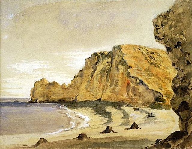
LES FALAISES D'ÉTRETAT  PEINTES PAR  EUGÈNE DELACROIX

EUGENE DELACROIX (1798-1863) LesFalaises d'Etretat (70 à 90 m) France (Normandie)   In Vue de la plage et des falaises d'Etretat, aquarelle sur traits à la mine de plomb, 15x19 cm, Musée Fabre, Montpellier

EUGENE DELACROIX (1798-1863)
Les Falaises d'Etretat (70 à 90 m)
France (Normandie)


In Vue de la plage et des falaises d'Etretat, aquarelle sur traits à la mine de plomb, 15x19 cm,           Musée Fabre, Montpellier


A propos de cette œuvre

Delacroix découvrit les beautés de la côte normande grâce à ses nombreux passages chez son cousin Bataille à Valmont, près de Fécamp. "Séjour de paix et d'oubli du monde entier", cette retraite offrait à l'artiste un lieu idéal pour se reposer de Paris et élaborer ses grandes commandes officielles. Au cours de cette villégiature, il eut à maintes occasions l’opportunité d'admirer le paysage des falaises d'Etretat ; sans doute séduit par cette âpre et grandiose architecture de craie, il devait en donner plusieurs études et aquarelles. Cette vue prise de la porte d'Amont, à marée basse, ne peut être datée avec certitude mais un passage du Journal de l’artiste du 18 octobre 1849 relate une excursion en mer au large de Fécamp et situe, si ce n'est la chronologie de cette œuvre, du moins l'état d'esprit et les sentiments de l'artiste devant ce paysage : « Le sol sous cette arche étonnante, semblait sillonné par les roues des chars et semblait les ruines d'une ville antique. Ce sol est ce blanc calcaire dont les falaises sont entièrement faites. Il y a des parties sur les rocs qui sont d'un brun de terre d'ombre, des parties très vertes et quelques-unes ocreuses. » Explorant la décomposition chromatique du paysage, Delacroix donne ici une aquarelle où palpite la densité de l’air et de l’eau et, avec cette manière très libre d’un dessin pris sur le vif, il témoigne de sa sensibilité pour ces vues de la nature qui annoncent déjà la peinture impressionniste. Ami de l’artiste, le critique Théophile Sylvestre conseilla en 1874 à Alfred Bruyas l’acquisition de cette oeuvre qui lui inspira ces réflexions : « Dans le ciel solitaire, d’une pureté absolue et d’une légèreté sans fonds, on entendrait non seulement l’aile d’une mouette mais le bourdonnement d’un insecte [...]. L’effusion lumineuse n’a même pas de soubresauts tout le long de cette falaise abrupte, dont la croûte terrestre et le gazon rôti semblent à la fois un chaume de cabane et une peau de bête fauve. »


Les falaises
Les Falaises d'Etretat  sont constituées d'une stratigraphie complexe de craies du Turonien et du Coniacien. Certaines falaises atteignent 90 mètres. Etretat est surtout connue pour ses falaises de craie, dont trois arches naturelles et une formation pointue appelée L'Aiguille (l'Aiguille), qui s'élève à 70 m au-dessus de la mer et L'Arche. Une rivière souterraine, puis l'érosion marine ont formé une arche naturelle et une aiguille d'une hauteur estimée de 55 mètres à 70 mètres, relique de la falaise. Ses falaises de craie blanche et ses plages de galets grisâtres en ont fait un des lieux du tourisme international avec plus de trois millions de visiteurs par an1, exposé aux même risques que d'autres grands sites mondiaux, avec trois chutes mortelles en 2022. Le tourisme de masse dégradant le site. Des peintres comme Albert Marquet, Gustave Courbet, Eugène Boudin ou encore Claude Monet ont contribué alors à sa publicité, tout en en immortalisant la spécificité. Des écrivains normands comme Maupassant et Gustave Flaubert furent des fidèles du lieu. Maurice Leblanc, qui y vécut, contribua au mythe entourant le site entretenu dans une aventure d'Arsène Lupin intitulée L'Aiguille creuse(1909). Il les décrit en ces termes : « Un énorme gardon, haut de plus de quatre-vingts mètres, obélisque colossal, d'aplomb sur son socle de granit. » A son époque, le site attirait déjà de nombreux touristes parmi eu xdes "lupinophiles" admirateurs d'Arsène Lupin des  étudiants américains venaient chercher la clé de la grotte, où le "gentleman cambrioleur" avait trouvé le trésor des rois de France.

Le peintre
Ferdinand Victor Eugène Delacroix était un artiste romantique français considéré dès le début de sa carrière comme le chef de file de l'école romantique française. L'utilisation par Delacroix de coups de pinceau expressifs et ses études sur les effets optiques de la couleur ont profondément façonné le travail des impressionnistes, alrors que sa passion pour l'exotisme a inspiré les artistes du mouvement symboliste. Fin lithographe, Delacroix a illustré diverses œuvres (William Shakespeare, Walter Scott et  Goethe notamment).
Contrairement au perfectionnisme néoclassique de son principal rival Ingres, Delacroix s'est inspiré de l'art de Rubens et des peintres de la Renaissance vénitienne, en mettant l'accent sur la couleur et le mouvement plutôt que sur la clarté des contours et la forme soigneusement modelée. Le contenu dramatique et romantique caractérise les thèmes centraux de sa maturité et le conduit non pas vers les modèles classiques de l'art grec et romain, mais plutôt vers les voyages en Afrique du Nord à la recherche de l'exotisme. Ami et héritier spirituel de Théodore Géricault, Delacroix s'inspire également de Lord Byron, avec qui il partage une forte identification aux « forces du sublime », et aux actions de la nature, souvent violente.
Cependant, Delacroix n'était enclin ni à la sentimentalité ni à l'emphase, et son romantisme était celui d'un individualiste. Selon les mots de Baudelaire : « Delacroix était passionnément amoureux de la passion, mais froidement déterminé à exprimer sa passion le plus clairement possible ».
En 1832, Delacroix se rend en Espagne et en Afrique du Nord, dans le cadre d'une mission diplomatique au Maroc peu après la conquête de l'Algérie par la France. Il n'y est pas allé pour étudier l'art, mais pour échapper au parisianisme dans l'espoir d'approcher une culture plus primitive. Il a produit plus de 100 peintures et dessins de scènes tirées ou basées sur la vie des peuples d'Afrique du Nord, et a ajouté un nouveau chapitre très personnel à l'intérêt général porté alors à l'orientalisme. Delacroix était fasciné par les gens et les costumes, et le voyage allait éclairer le sujet d'un grand nombre de ses futurs tableaux. Il pensait que les Nord-Africains, dans leurs vêtements et leurs attitudes, fournissaient un équivalent visuel aux peuples de la Rome et de la Grèce classiques : « Les Grecs et les Romains sont ici à ma porte, chez les Arabes qui s'enveloppent dans une couverture blanche et regardent comme Caton ou Brutus..."
Il réussit à dessiner secrètement quelques femmes à Alger, comme dans le tableau Femmes d'Alger dans leur appartement (1834), mais il rencontra généralement des difficultés à trouver des femmes musulmanes prêtes à poser pour lui en raison des règles musulmanes exigeant que les femmes soient couvertes. La peinture des femmes juives d’Afrique du Nord, comme sujets du Mariage juif au Maroc (1837-1841), pose moins de problèmes.
À Tanger, Delacroix réalise de nombreux croquis des gens et de la ville, sujets sur lesquels il reviendra jusqu'à la fin de sa vie. Les animaux, incarnation de la passion romantique, ont été incorporés dans des peintures telles que Chevaux arabes se battant dans une écurie (1860), La Chasse au lion (dont il existe de nombreuses versions, peintes entre 1856 et 1861) et Arabe sellant son cheval (1855). .

_________________________________________

2024 - Wandering Vertexes ....
Gravir les montagnes en peinture
Un blog de Francis Rousseau

Friday, August 25, 2023

LES DRUES    PEINTES PAR   FRANCIS CARIFFA


FRANCIS CARIFFA (1890 -1975) Grand Dru (3 754 m) France (Alpes)

FRANCIS CARIFFA (1890 -1975)
Le Grand Dru (3 754 m)
France (Alpes) 

In  "  Les Drus, massif du Mont-Blanc "  Huile sur panneau, 61 x 50 cm


La montagne
Les Drues constituent deux pics d'une montagne des Alpes de Haute-Savoie, situés dans le massif du Mont-Blanc.Les Drus comprennent deux sommets assez individualisés :le Grand Dru (3 754 m, point culminant) ; le Petit Dru (3 730 m), qui domine le Montenvers, possédant une paroi granitique de 1 000 m de haut, l'une des parois les plus raides des Alpes (pente moyenne supérieure à 75°2). Les noms des montagnes font partie des couches les plus anciennes des toponymes. La plupart du temps ils sont d'origine celte ou indo-européenne. Pour les Celtes, la totalité du monde était symboliquement représentée par un arbre. Dans la langue gauloise, le mot le plus courant pour désigner cet arbre est dru.

L'artiste
Francis Cariffa est un peintre français surtout connu pour ses peintures de montagne.
 Il se destine d'abord au théâtre mais finit par se tourner vers la peinture après la Grande Guerre, durant laquelle il est pilote d'essai et revient avec la Médaille militaire et la Croix de guerre. Il est également décoré de la Légion d'honneur en 1939. Il vit un temps à Montmartre, puis s'installe à Challes-les-Eaux.
 D'abord influencé par Joseph-Victor Communal, il trouve rapidement son propre style. Il peint au couteau et est un maître reconnu de l'utilisation des couleurs.
 Sa première exposition a lieu à la galerie Janin de Chambéry en 1924 ; puis il expose à Grenoble, Lyon,Saint-Etienne, Nice, Cannes, Menton, Metz, Paris (galeries Simonson, Charpentier, Georges Petit, Bernheim) mais aussi en Belgique, au Maroc et au Canada.
 Auteur de nombreux tableaux, il a surtout aimé représenté la montagne et la haute montagne, mais aussi les paysages de Provence et du Maroc. Il est ainsi classé comme peintre orientaliste pour ses toiles réalisées au Maroc, à Marrakech notamment. Ses toiles ont été achetées par l'Etat et la ville de Paris et sont exposées au Musée des Beaux-Arts de Chambéry.
 Son tableau Mont-Blanc, peint en 1935, fut exposé dans le salon des touristes du paquebot Normandie.

______________________________
2023 - Gravir les Montagnes en peinture
Un blog de Francis Rousseau


Friday, September 23, 2022

MONTE SOLARO PAINTED BY THEODORE ROBINSON


THEODORE ROBINSON (1852-1896) Monte Solaro (589m - 1,932ft) Italy (Campania)  In Capri, 1880, oil on canvas, 53, 3 x 44,5cm,  Thyssen-Bornemisza Museum, Madrid
 
 
THEODORE ROBINSON (1852-1896)
Monte Solaro (589m - 1,932ft)
Italy (Campania)

In Capri, 1880, oil on canvas, 53, 3 x 44,5cm,  Thyssen-Bornemisza Museum, Madrid

The Painter
Theodore Robinson was an American painter best known for his Impressionist landscapes. He was one of the first American artists to take up Impressionism in the late 1880s, visiting Giverny and developing a close friendship with Claude Monet. Several of his works are considered masterpieces of American.
Robinson was born in Irasburg, Vermont. His family moved to Evansville, Wisconsin, and Robinson briefly studied art in Chicago. In 1874 he journeyed to New York City to attend classes at the National Academy of Design and the Art Students League.
In 1876 he traveled to Paris to study under Carolus-Duran and at the École des Beaux-Arts, with Jean-Léon Gérôme. He first exhibited his paintings at the 1877 Salon in Paris, and spent the summer of that year at Grez-sur-Loing.
After trips to Venice and Bologna, he returned to the United States in 1879 for several years. In 1881 he moved into a studio in New York and became a professional painter and art teacher, and in the same year became a member of the Society of American Artists. During this time Robinson painted in a realist manner, loosely brushed but not yet impressionistic, often depicting people engaged in quiet domestic or agrarian pursuits.
In 1884 Robinson returned to France where he lived for the next eight years, visiting America only occasionally. Robinson gravitated to Giverny, which had become a center of French impressionist art under the influence of Claude Monet.
Historians are unclear when Robinson met Monet, but by 1888 their friendship was enough for Robinson to move in next door to the famous impressionist. Robinson's art shifted to a more traditional impressionistic manner during this time, likely due to Monet's influence. While a number of American artists had gathered at Giverny, none were as close to Monet as Robinson. Monet offered advice to Robinson, and he likewise solicited Robinson for opinions on Monet's own works in progress. At Giverny, Robinson painted what art historians regard as some of his finest works. These depicted the surrounding countryside in different weather, in the plein air tradition, sometimes with women shown in leisurely poses. His Winter Landscape won the 1890 Webb Prize. Another example of his mature work during this period is La Débâcle (1892) in the collection of Scripps College, Claremont California. He wrote an essay on the Barbizon painter Jean-Baptiste-Camille Corot and, because of his friendship with the French Impressionist, he wrote and illustrated the essay on Claude Monet. The book was published in 1896 and his illustration of Monet was featured in the exhibition "In Monet's Light."In 1895, Robinson enjoyed a productive period in Vermont, and in February 1896 he wrote to Monet about returning to Giverny, but in April he died of an acute asthma attack in New York City. He was buried in his hometown of Evansville, Wisconsin. He was 43 years old Today Robinson's paintings are in the collections of many major museums including the Metropolitan Museum of Art in New York City; the Corcoran Gallery of Art, Washington, D.C.; and the Art Institute of Chicago.

The mountain 
Monte Solaro (589m - 1,932ft)  also called Monte Solare or Monte Solara is the highest point of  the island of Capri in Campania, in the Gulf of Naples, Italy.  Monte Solaro is formed from the same limestone that the island is composed of. Monte Solaro has a typical mediterranean climate, but with colder winters because of the high altitude. From the top of Monte Visto, one can see both the gulfs of Napoli and Salerno.
The summit is accessible by walking without too much difficulty by either the passetiello or a path that starts from Axel Munthe. Both routes are suitable for walkers in decent physical condition. Notable sites include the Eremo di Santa Maria a Cetrella for its architecture, and the remains of the Fortino di Bruto, a military fort built during the Napoleonic Wars.
Mount Solaro contains the "Fortino di Bruto", a blockhouse which was used in battles between Britain and France in the early 19th century.  It is characterised by its "sheer dolomitic slopes" which form an "unsurpassable partition" between the eastern and western sides of the island. 
Marina Grande lies at the foot of the mountain. It became popular with painters due to its "romantic situation, affording extensive and beautiful views to the NW of the Tyrrhenian sea, the gulf of Naples". Up the mount there is a statue of Emperor Augustus who first landed on Capri.
The area around Monte Solaro is inhabited by over 900 species of vegetation.  The mountain is also visited by many species of birds, including peregrine falcons.

_______________________________

2022 - Wandering Vertexes...
by Francis Rousseau

Wednesday, August 10, 2022

BLACKHEAD PAINTED BY EDWARD HOPPER

EDWARD HOPPER (1882-1967) Blackhead (50 m-150 ft)  United States of America (Maine)  1. In Blackhead, Monhegan, 1916-19,oil on wood, Whitney Museum of American Art,


EDWARD HOPPER (1882-1967)
Blackhead (50 m-150 ft) 
United States of America (Maine)

1. In Blackhead, Monhegan, 1916-19,oil on canvas,  Whitney Museum of American Art, 


The mountain 
Blackhead (50m-150 ft) are northside cliffs situated on Monhegan, Manana Island, that have drawn the interest of  many artists.  The beginnings of the art colony on Monhegan date to the mid-19th century; by 1890, it was firmly established. Two of the early artists in residence from the 1890s, William Henry Singer (1868–1943) and Martin Borgord (1869–1935), left Monhegan to study at the Académie Julian in Paris in 1901. Among many early members who found inspiration on the island were summer visitors from the New York School of Art and the Pennsylvania Academy of the Fine Arts, such as Robert Henri, Frederick Waugh, George Bellows, Edward Hopper and Rockwell Kent. The Monhegan Museum celebrated more the continuing draw of the island for artists in a 2014 exhibit entitled, “The Famous and the Forgotten: Revisiting Monhegan’s Celebrated 1914 Art Exhibition.
Monhegan is a plantation in Lincoln County, Maine, United States, about 12 nautical miles (22 km) off the mainland. The population was 75 at the 2000 census. The plantation comprises its namesake island and the uninhabited neighboring island of Manana. The island is accessible by scheduled boat service from Boothbay Harbor, New Harbor and Port Clyde. It was designated a National Natural Landmark for its coastal and island flora in 1966.[
The name Monhegan derives from Monchiggon, Algonquian for "out-to-sea island." European explorers Martin Pring visited in 1603, Samuel de Champlain in 1604, George Weymouth in 1605 and Captain John Smith in 1614. The island got its start as a British fishing camp prior to settlement of the Plymouth Colony. Cod was harvested from the rich fishing grounds of the Gulf of Maine, then dried on fish flakes before shipment to Europe. A trading post was built to conduct business with the Indians, particularly in the lucrative fur trade.  It was Monhegan traders who taught English to Samoset, the sagamore who in 1621 startled the Pilgrims by boldly walking into their new village at Plymouth and saying: "Welcome, Englishmen." 

The painter
Edward Hopper was a American realist painter and printmaker.
Conservative in politics and social matters (Hopper asserted for example that "artists' lives should be written by people very close to them"), he accepted things as they were and displayed a lack of idealism. Cultured and sophisticated, he was well-read, and many of his paintings show figures reading. He was generally good company and unperturbed by silences, though sometimes taciturn, grumpy, or detached. He was always serious about his art and the art of others, and when asked would return frank opinions.
Hopper's most systematic declaration of his philosophy as an artist was given in a handwritten note, entitled "Statement", submitted in 1953 to the journal, Reality:
"Great art is the outward expression of an inner life in the artist, and this inner life will result in his personal vision of the world. No amount of skillful invention can replace the essential element of imagination. One of the weaknesses of much abstract painting is the attempt to substitute the inventions of the human intellect for a private imaginative conception.
The inner life of a human being is a vast and varied realm and does not concern itself alone with stimulating arrangements of color, form and design.
The term life used in art is something not to be held in contempt, for it implies all of existence and the province of art is to react to it and not to shun it.
Painting will have to deal more fully and less obliquely with life and nature's phenomena before it can again become great."
 
_______________________________
2022 - Wandering Vertexes...
by Francis Rousseau

Saturday, July 23, 2022

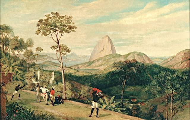
PAO DE AÇUCAR PAINTED BY CHARLES LANDEER


CHARLES LANDEER (1799-1879) Pao de Açucar / Sugarloaf Mountain / (396 m - 1299 ft) Brazil  In  "View of Sugarloaf Mountain from the Silvestre Road 1827, oil on canvas,  61,5x91 cm, Pinacoteca do Estado de São Paulo, Brazil

CHARLES LANDEER (1799-1879)
Pao de Açucar / Sugarloaf Mountain / (396 m - 1299 ft)
Brazil

In View of Sugarloaf Mountain from the Silvestre Road 1827, oil on canvas, 61,5 x 91 cm,
Pinacoteca do Estado de São Paulo, Brazil


The painter
Charles Landseer (RA) was an English painter, mostly of historical subjects. He was born the second son of the engraver John Landseer, and the elder brother of the animal painter, Sir Edwin Landseer. He trained under his father, and the painter Benjamin Robert Haydon. He was awarded the silver palette of the Royal Society of Arts for a drawing of Laocoon in 1815, and in 1816 he entered the Royal Academy Schools where he was taught by Henry Fuseli. In 1823 he accompanied Sir Charles Stuart de Rothesay on a diplomatic mission to Portugal and Brazil. Many of the drawings he made on the journey were shown at the British Institution in 1828. He became an associate in of the Royal Academy in 1837, and a full academician in 1845. In 1851, he was appointed Keeper of the Royal Academy, a post requiring him to teach in the "Antique School". He remained in the position until 1873.  Most of his pictures were of subjects from British history, or from literature. He paid close attention to the historical accuracy of the accessories and details in his paintings. His works included The Meeting of Charles I. and his Adherents before the Battle of Edgehill, Clarissa Harlowe in the Prison Room of the Sheriff's Office (1833, now in the collection of the Tate Gallery), The Pillaging of a Jew's House in the Reign of Richard I (1839, Tate Gallery) and The Temptation of Andrew Marvel (1841). While under Haydon's instruction he also made a series of detailed anatomical drawings.  He died in London on 22 July 1879, leaving  quite generously 10,000 guineas to the Royal Academy to fund scholarships.

The mountain
Sugarloaf Mountain (396 m - 1299 ft), Pao de Açucar in Portuguese, Pain de Sucre in French, is a isolated peak (Inselberg) situated in Rio de Janeiro, Brazil, at the mouth of Guanabara Bay on a peninsula that sticks out into the Atlantic Ocean. Rising above the harbor, its name is said to refer to its resemblance to the traditional shape of concentrated refined loaf sugar. It is known worldwide for its cableway and panoramic views of the city. The name "Sugarloaf" was coined in the 16th century by the Portuguese during the heyday of sugar cane trade in Brazil. According to historian Vieira Fazenda, blocks of sugar were placed in conical molds made of clay to be transported on ships. The shape given by these molds was similar to the peak, hence the name.
Climbing routes:
1907 – The Brazilian engineer Augusto Ferreira Ramos had the idea of linking the hills through a path in the air.
1910 – The same engineer founded the Society of Sugar Loaf and the same year the works were started. The project was commissioned in Germany and built by Brazilian workers. All parts were taken by climbing mountains or lift by steel cables.
1912 – Opening of the tram. First lift of Brazil. The first cable cars were made of coated wood and were used for 60 years.
1972 – The current template trolley was put into operation. This increased the carrying capacity by almost ten times.
2009 – Inauguration of the next generation of cable cars that had already been purchased and are on display at the base of Red Beach.
Visitors can watch rock climbers on Sugarloaf and the other two mountains in the area: Morro da Babilônia (Babylon Mountain), and Morro da Urca (Urca's Mountain). Together, they form one of the largest urban climbing areas in the world, with more than 270 routes, between 1 and 10 pitches long.

Tuesday, May 31, 2022

ULURU / AYERS ROCKS PHOTOGRAPHED IN 1894 BY WALTER BALDWIN SPENCER


WALTER BALDWIN SPENCER (1860-1929) Uluru /Ayers Rock (863 m -2,831 ft) Australia (Northern Territory)   In  Uluru, Ayers Rock, central Australia, 1894,  Glass plate negative 80 mm x 106 mm, Museums Victoria

WALTER BALDWIN SPENCER (1860-1929)
Uluru /Ayers Rock (863 m -2,831 ft)
Australia (Northern Territory)


In Uluru, Ayers Rock, central Australia, 1894, Glass plate negative 80 mm x 106 mm, 
Museums Victoria


The artist
Sir Walter Baldwin Spencer commonly referred to as Baldwin Spencer, was a British-Australian evolutionary biologist, anthropologist and ethnologist. He is known for his fieldwork with Aboriginal peoples in Central Australia, contributions to the study of ethnography, and academic collaborations with Frank Gillen. Spencer introduced the study of zoology at the University of Melbourne and held the title of Emeritus Professor until his death in 1929.In 1894 a new field was opened up for Spencer when he joined the W.A. Horn scientific expedition which left Adelaide in May 1894 to explore Australia. Spencer paid two more visits to the centre of Australia, one in 1923 with Dr Leonard Keith Ward, the government geologist of South Australia, and the other in 1926. These visits enabled Spencer to revise his earlier researches and consider on the spot various opposing theories that had been brought forward. His The Arunta: a Study of a Stone Age People (1927), revisits and reaffirms his earlier conclusions; Gillen's name as joint author appeared on the title-page though he had died 15 years before. Wanderings in Wild Australia, published a year later and slightly more popular in form, completes the list of his books. A list of his other published writings will be found in Spencer's Last Journey (1931). Spencer went to London in 1927 to see these books through the press. Ten years before he had said that he realised he was not getting younger and must regard his field work as finished. In February 1929, however, in his sixty-ninth year, he travelled in a cargo boat to Magallanes and then went in a little schooner to Ushuaia at the south of Tierra del Fuego. 


The mountain 
Uluru (863m -2,831 ft) also known as Ayers Rock (in honour of the then Chief Secretary of South AustraliaSir Henry Ayers) is a large sandstone rock formation in the southern part of the Northern Territory in central Australia.   Officially  the rock is gazetted as "Uluru / Ayers Rock". 
It lies 335 km (208 mi) south west of the nearest large town, Alice Springs, 450 km (280 mi) by road.
Kata Tjuta and Uluru are the two major features of the Uluṟu-Kata Tjuṯa National Park. Uluru is sacred to the Pitjantjatjara Anangu, the Aboriginal people of the area. The area around the formation is home to an abundance of springs, waterholes, rock caves, and ancient paintings.  Both Uluru and the nearby Kata Tjuta formation have great cultural significance for the Aṉangu people, the traditional inhabitants of the area, who lead walking tours to inform visitors about the local flora and fauna, bush food and the Aboriginal dreamtime stories of the area.
Uluru is notable for appearing to change colour at different times of the day and year, most notably when it glows red at dawn and sunset.
Uluru is listed as a UNESCO World Heritage Site.
Uluru is an inselberg, literally "island mountain"An inselberg is a prominent isolated residual knob or hill that rises abruptly from and is surrounded by extensive and relatively flat erosion lowlands in a hot, dry region.  Uluru is also often referred to as a monolith, although this is a somewhat ambiguous term that is generally avoided by geologists. The remarkable feature of Uluru is its homogeneity and lack of jointing and parting at bedding surfaces, leading to the lack of development of scree slopes and soil. These characteristics led to its survival, while the surrounding rocks were eroded. For the purpose of mapping and describing the geological history of the area, geologists refer to the rock strata making up Uluru as the Mutitjulu Arkose, and it is one of many sedimentary formations filling the Amadeus Basin.
According to the Aṉangu, traditional landowners of Uluru: 
The world was once a featureless place. None of the places we know existed until creator beings, in the forms of people, plants and animals, traveled widely across the land. Then, in a process of creation and destruction, they formed the landscape as we know it today. Aṉangu land is still inhabited by the spirits of dozens of these ancestral creator beings which are referred to as Tjukuritja or Waparitja.
There are a number of differing accounts given, by outsiders, of Aboriginal ancestral stories for the origins of Uluru and its many cracks and fissures. One such account, taken from Robert Layton's (1989) Uluru: An Aboriginal history of Ayers Rock, reads as follows:
Uluru was built up during the creation period by two boys who played in the mud after rain. When they had finished their game they travelled south to Wiputa ... Fighting together, the two boys made their way to the table topped Mount Conner, on top of which their bodies are preserved as boulders. 
Two other accounts are given in Norbert Brockman's (1997) Encyclopedia of Sacred Places.
The first tells of serpent beings who waged many wars around Uluru, scarring the rock. The second tells of two tribes of ancestral spirits who were invited to a feast, but were distracted by the beautiful Sleepy Lizard Women and did not show up. In response, the angry hosts sang evil into a mud sculpture that came to life as the dingo. There followed a great battle, which ended in the deaths of the leaders of both tribes. The earth itself rose up in grief at the bloodshed, becoming Uluru.
The Commonwealth Department of Environment's webpage advises:
Many...Tjukurpa such as Kalaya (Emu), Liru (poisonous snake), Lungkata (blue tongue lizard), Luunpa (kingfisher) and Tjintir-tjintirpa (willie wagtail) travel through Uluṟu-Kata Tjuṯa National Park. Other Tjukurpa affect only one specific area.
Kuniya, the woma python, lived in the rocks at Uluru where she fought the Liru, the poisonous snake.
It is sometimes reported that those who take rocks from the formation will be cursed and suffer misfortune. There have been many instances where people who removed such rocks attempted to mail them back to various agencies in an attempt to remove the perceived curse.

__________________________________________
2022 - Wandering Vertexes...
by Francis Rousseau

Monday, March 28, 2022

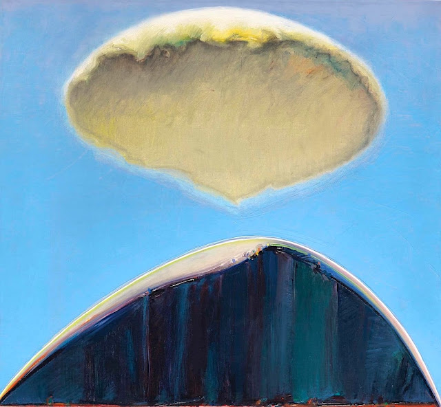
EL CAPITAN PAINTED BY WAYNE THIEBAUD


WAYNE THIEBAUD (1920-2021),El Capitan (2,309m - 7,573 ft), United States of America, In" Mount and Cloud", 1972, oil on canvas 20 1/4 x 22 in

WAYNE THIEBAUD (1920-2021)
El Capitan (2,309m - 7,573 ft)
United States of America

 In Mount and Cloud, 1972, oil on canvas 20 1/4 x 22 in.

 
The painter
Morton Wayne Thiebaud was an American painter known for his colorful works depicting commonplace objects—pies, lipsticks, paint cans, ice cream cones, pastries, and hot dogs—as well as for his landscapes and figure paintings. Thiebaud is associated with the pop art movement because of his interest in objects of mass culture, although his early works, executed during the fifties and sixties, predate the works of the classic pop artists. Thiebaud used heavy pigment and exaggerated colors to depict his subjects, and the well-defined shadows characteristic of advertisements are almost always included in his work.
Thiebaud was averse to labels such as "fine art" versus "commercial art" and described himself as "just an old-fashioned painter". He disliked Andy Warhol's "flat" and "mechanical" paintings and did not consider himself a pop artist.
In addition to pastries, Thiebaud painted characters such as Mickey Mouse as well as landscapes, streetscapes, and cityscapes, which were influenced by the work of Richard Diebenkorn. His paintings such as Sunset Streets (1985) and Flatland River (1997) are noted for their hyper realism, and have been compared to Edward Hopper's work, another artist who was fascinated with mundane scenes from everyday American life.
In 1962, Thiebaud's work was included, along with Roy Lichtenstein, Andy Warhol, Jim Dine, and Robert Dowd, in the historically important and ground-breaking "New Painting of Common Objects" curated at the Pasadena Art Museum.  This exhibition is considered to have been one of the first Pop Art exhibitions in the United States. These painters were part of a new movement, in a time of social unrest, which shocked the U.S. and the art world.

The mountain
El Capitan (2,309m - 7,573 ft) is a vertical rock formation in Yosemite National Park, located on the north side of Yosemite Valley, near its western end. The granite monolith extends about 3,000 feet (900 m) from base to summit along its tallest face and is one of the world's favorite challenges for rock climbers.
The formation was named "El Capitan" by the Mariposa Battalion when it explored the valley in 1851. El Capitan ("the captain") was taken to be a loose Spanish translation of the local Native American name for the cliff, variously transcribed as "To-to-kon oo-lah" or "To-tock-ah-noo-lah".
It is unclear if the Native American name referred to a specific tribal chief or simply meant "the chief" or "rock chief". In modern times, the formation's name is often contracted to "El Cap", especially among rock climbers and BASE jumpers.
The top of El Capitan can be reached by hiking out of Yosemite Valley on the trail next to Yosemite Falls, then proceeding west. For climbers, the challenge is to climb up the sheer granite face. There are many named climbing routes, all of them arduous, including Iron Hawk and Sea of Dreams, for example.
The Nose was first climbed in 1958 by Warren Harding, Wayne Merry and George Whitmore in 47 days using "siege" tactics: climbing in an expedition style using fixed ropes along the length of the route, linking established camps along the way.
In September 1973, Beverly Johnson and Sibylle Hechtel were the first team of women to ascend El Capitan via the Triple Direct route.

_______________________________


2022 - Wandering Vertexes...
by Francis Rousseau

Monday, January 3, 2022

FALAISE DES VACHES NOIRES PAINTED BY GUSTAVE CAILLEBOTTE


GUSTAVE CAILLEBOTTE (1848-1894) Falaise des Vaches Noires (110 m- 360 ft) France (Normandie)   In Cliffs at Villers sur mer 1880, 65 x 81 cm, Private collection

GUSTAVE CAILLEBOTTE (1848-1894)
Falaise des Vaches Noires (110 m- 360 ft)
France (Normandie)

 In Cliffs at Villers sur mer 1880, 65 x 81 cm, Private collection


The cliffs
The Vaches Noires cliffs (Black Cows Cliffs)  (110 m- 360 ft)  is a remarkable natural site located in the municipalities of Houlgate, Gonneville-sur-Mer, Auberville, Villers-sur-Mer, in Calvados, in Normandy (France). The toponym "Black Cows" designates blocks of chalk having rolled from the top of the cliff on the foreshore, the black color of which is due to the kelp having attached itself to it.The Vaches Noires cliffs are made up of clay cliffs capped at their summit (altitude 110 m) with a thin chalk cliff.

This area is geologically remarkable. The Oxfordian marls, under the action of the water runoff from the aquifer which surmounts them, are notched by deep ravines. These are traversed by mud flows which advance slowly towards the sea and contain blocks of Cretaceous chalk coming from the summit. At high tide, the waves attack the front of the lava flows, releasing extremely varied fossils. The cliffs are made up of a succession of layers of clay, marl and chalk. Due to the risk of landslide and the fragility of the clay cliffs, the cliffs are now protected, their access has been prohibited by decree of classification as a "site of scientific and landscaped interest in the Calvados department" of 20 February 1995 from theFrench Ministry of the Environment.


The painter
The very important french painter Gustave Caillebotte, (known in US more than his own country) was a member and patron of the artists known as Impressionists,(or independents) although he painted in a more realistic manner than many others in the group. Caillebotte was noted for his early interest in photography as an art form.
With regard to the composition and painting style of his works, Caillebotte may be considered part of the first movement after Impressionism: Neo-Impressionism. The second period of Pointillism, whose main representative was Georges Seurat, announced its influence in the late works that Caillebotte painted at his country house in Petit Gennevilliers.
Caillebotte's style belongs to the School of Realism but was strongly influenced by his Impressionist associates. In common with his precursors Jean-François Millet and Gustave Courbet, as well his contemporary Degas, Caillebotte aimed to paint reality as it existed and as he saw it, hoping to reduce the inherent theatricality of painting. Perhaps because of his close relationship with so many of his peers, his style and technique vary considerably among his works, as if "borrowing" and experimenting, but not really sticking to any one style. At times, he seems very much in the Edgar Degas camp of rich-colored realism (especially his interior scenes); at other times, he shares the Impressionist commitment to "optical truth" and employs an impressionistic pastel-softness and loose brush strokes most similar to Renoir and Pissarro, although with a less vibrant palette.
The tilted ground common to these paintings is very characteristic of Caillebotte's work, which may have been strongly influenced by Japanese prints and the new technology of photography, although evidence of his use of photography is lacking. Cropping and "zooming-in", techniques that commonly are found in Caillebotte's oeuvre, may also be the result of his interest in photography, but may just as likely be derived from his intense interest in perspective effects. A large number of Caillebotte's works also employ a very high vantage point, including View of Rooftops - Snow (Vue de toits (Effet de neige) 1878, Boulevard Seen from Above (Boulevard vu d'en haut) 1880, and A Traffic Island (Un refuge, boulevard Haussmann), 1880.
Caillebotte is best known for his paintings of still life, water sports and urban Paris, The latter is almost unique among his works for its particularly flat colors and photo-realistic effect, which give the painting its distinctive and modern look, almost akin to American Realists such as Edward Hopper.

___________________________________________
2022 - Wandering Vertexes...
by Francis Rousseau

Wednesday, December 22, 2021

LA PORTE D'AMONT / ETRETAT CLIFFS PAINTED BY CLAUDE MONET

CLAUDE MONET (1840-1926) La Porte d'Amont - The Falaises d'Etretat (70 to 90 m - 230 to 300 ft France (Normandie)  In La Porte d'Amont, Etreta, 1868, Oil on canvas 81.3 x 100.3 cm.  ogg Art Museum / Harvard University, Cambridge MA

CLAUDE MONET (1840-1926)
La Porte d'Amont - The Falaises d'Etretat (70 to 90 m - 230 to 300 ft
France (Normandie)

In La Porte d'Amont, Etretat, 1868, Oil on canvas 81.3 x 100.3 cm. 
Fogg Art Museum / Harvard University, Cambridge, MA
 
 
The cliffs 
Etretat is best known for its chalk cliffs, including three natural arches and a pointed formation called L'Aiguille (the Needle), which rises 70 m- 230 ft above the sea. The Etretat Chalk Complex, as it is known, consists of a complex stratigraphy of Turonian and Coniacian chalks. Some of the cliffs are as high as 90 metres (300 ft).
These cliffs and the associated resort beach attracted artists including Eugène Boudin, Gustave Courbet and Claude Monet.  They were featured prominently in the 1909 Arsène Lupin novel The Hollow Needle by Maurice Leblanc. They also feature in the 2014 film Lucy, directed by Luc Besson.
Two of the three famous arches are visible from the town, the Porte d'Aval (Aval Cliff)  and the Porte d'Amont (Amont Cliff).  The Manneporte  (Main Door) is the third and the biggest one, and cannot be seen from the town.
La porte d'Amont (Amont Cliff) is the smallest of the three doors and the most visually famous.  The french writer Guy de Maupassant compares this cliff of upstream to " an elephant that plunges its trunk into the water ". At the top of the cliff stands the stone silhouette of the chapel Notre-Dame-de-la-Garde, protector of fishermen. The present building succeeds a chapel of the nineteenth century. You can also reach the cliff but the staircase is much steeper.  The current building succeeds a 19th century chapel in neo-gothic style.   It was destroyed by the occupier during the Second World War. Then one arrive at the monument and the museum made by the architect Gaston Delaune and dedicated to Charles Nungesser and François Coli, two aviators who tried to rally New York in 1927 and which were seen for the last time in this place, after Having taken off from Le Bourget on the edge of their plane, the mythical White Bird.

The painter
The painter Oscar-Claude Monet better known as Claude Monet was a founder of French Impressionist painting, and the most consistent and prolific practitioner of the movement's philosophy of expressing one's perceptions before nature, especially as applied to plein-air landscape painting. The term "Impressionism" is derived from the title of his painting « Impression, soleil levant » (Impression, Sunrise), which was exhibited in 1874 in the first of the independent exhibitions mounted by Monet and his associates as an alternative to the Salon de Paris.
Monet's ambition of documenting the French countryside led him to adopt a method of painting the same scene many times in order to capture the changing of light and the passing of the seasons exactly like the japanese artist Hokusai (1760-1849) did with his 36 views of Mount Fuji.
Monet repeated this kinf of "exercise de stylee with his series on Les Petites Dalles. and Kolsass mountain.
Monet has been described as "the driving force behind Impressionism". Crucial to the art of the Impressionist painters was the understanding of the effects of light on the local colour of objects, and the effects of the juxtaposition of colours with each other. Monet's long career as a painter was spent in the pursuit of this aim.
In 1856, his chance meeting with Eugene Boudin, a painter of small beach scenes, opened his eyes to the possibility of plein-air painting. From that time, with a short interruption for military service, he dedicated himself to searching for new and improved methods of painterly expression. To this end, as a young man, he visited the Paris Salon and familiarised himself with the works of older painters, and made friends with other young artists. The five years that he spent at Argenteuil, spending much time on the River Seine in a little floating studio, were formative in his study of the effects of light and reflections. He began to think in terms of colours and shapes rather than scenes and objects. He used bright colours in dabs and dashes and squiggles of paint. Having rejected the academic teachings of Gleyre's studio, he freed himself from theory, saying "I like to paint as a bird sings."
In 1877 a series of paintings at Gare St-Lazare had Monet looking at smoke and steam and the way that they affected colour and visibility, being sometimes opaque and sometimes translucent. He was to further use this study in the painting of the effects of mist and rain on the landscape. The study of the effects of atmosphere were to evolve into a number of series of paintings in which Monet repeatedly painted the same subject in different lights, at different hours of the day, and through the changes of weather and season. This process began in the 1880s and continued until the end of his life in 1926.
His first series exhibited as such was of Haystacks, painted from different points of view and at different times of the day. Fifteen of the paintings were exhibited at the Galerie Durand-Ruel in 1891. In 1892 he produced what is probably his best-known series, Twenty-six views of Rouen Cathedral. In these paintings Monet broke with painterly traditions by cropping the subject so that only a portion of the facade is seen on the canvas. The paintings do not focus on the grand Medieval building, but on the play of light and shade across its surface, transforming the solid masonry.
Other series include Peupliers, Matins sur la Seine, and the Nenuphars that were painted on his property at Giverny. Between 1883 and 1908, Monet traveled to the Mediterranean, where he painted landmarks, landscapes, and seascapes, including a series of paintings in Antibes (above) and Venice. In London he painted four series: the Houses of Parliament, London ; Charing Cross Bridge ; Waterloo Bridge, and Views of Westminster Bridge. Helen Gardner writes: "Monet, with a scientific precision, has given us an unparalleled and unexcelled record of the passing of time as seen in the movement of light over identical forms."
___________________________________________

2021 - Wandering Vertexes...
by Francis Rousseau

Saturday, July 24, 2021

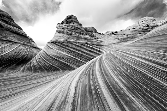
VERMILION CLIFFS PHOTOGRAPHED BY ANSEL ADAMS

ANSEL ADAMS (1902-1984) Vermilion Cliffs (944 m to 2164m - 3,100 to 7,100 feet.) United States of America (Arizona-Utah)


ANSEL ADAMS (1902-1984)
Vermilion Cliffs (944 m to 2164m - 3,100 to 7,100 feet.)
United States of America ( Arizona-Utah)


The site
The Vermilion Cliffs are the second "step" up in the five-step Grand Staircase of the Colorado Plateau, in northern Arizona and southern Utah. They extend west from near Page, Arizona, for a considerable distance, in both Arizona and Utah.  112,500 acres (45,500 ha) of the region were designated as the Paria Canyon-Vermilion Cliffs Wilderness in 1984. An even greater area was protected within Vermilion Cliffs National Monument in 2000. The Vermilion Cliffs are composed of the resistant red sandstone beds of the Lower Jurassic Moenave and Kayenta Formations.  They are made up of deposited silt and desert dunes, cemented by infiltrated carbonates and intensely colored by red iron oxide and other minerals, particularly bluish manganese. They are in the physiographic High Plateaus Section and Canyon Lands Section of the Colorado Plateau Province.  The Vermillion Cliffs were on an important route from Utah to Arizona used by settlers during the 19th Century. Present day U.S. Highway 89A basically follows the old wagon route past the cliffs through House Rock Valley and up the Kaibab Plateau to Jacob Lake.
Famous locations in the cliff area include Lee's Ferry, Glen Canyon and the Glen Canyon National Recreation Area, The Wave, Coyote Buttes, and others. Reddish or vermilion-colored cliffs are found along U.S. Highway 89A near Navajo Bridge, and may be seen from U.S. Highway 89 close to Bitter Springs. Highway 89A runs alongside the Vermilion Cliffs for most of its route between Jacob Lake and Marble Canyon, and offers a great view of the cliffs.

The photographer
Ansel Easton Adams was an American photographer and environmentalist.
His black-and-white landscape photographs of the American West, especially Yosemite National Park, have been widely reproduced on calendars, posters, books, and the internet. Adams and Fred Archer developed the Zone System as a way to determine proper exposure and adjust the contrast of the final print. The resulting clarity and depth characterized his photographs. He primarily used large-format cameras because their high resolution helped ensure sharpness in his images. Adams founded the photography group known as Group f/64, along with fellow photographers Willard Van Dyke and Edward Weston and Imogen Cunningham.
In September 1941, Adams contracted with the Department of the Interior to make photographs of National Parks, Indian reservations, and other locations for use as mural-sized prints for decoration of the Department's new building. Part of his understanding with the Department was that he might also make photographs for his own use, using his own film and processing... 

Full entry

___________________________________________


2021 - Wandering Vertexes...
by Francis Rousseau

Sunday, July 11, 2021

GUNIBMOUNTAIN PAINTED BY NIKOLAI YAROSHENKO


NIKOLAI YAROSHENKO (1846-1898), Gunib Mountain (1, 500m - 4,921ft) Russia (Republic of Dagestan)  In Hora Dagestan, oil on can vas, 1888, Private collection
 
NIKOLAI YAROSHENKO (1846-1898),
Gunib Mountain (1, 500m - 4,921ft)
Russia (Republic of Dagestan)

In Hora Dagestan, oil on can vas, 1888, Private collection

The mountain
Gunib Mountain (1, 500m - 4,921ft) dominates the village of Gunib (Гуниб) in Daghestan, chief town of the district of the same name. Its population, of stingy ethnicity, was 2 271 inhabitants in 2010. Gounib is situated in the middle of the Gounib Plateau, 172 kilometers southwest of Makhachkala at an altitude of 1,500 meters.
This area was taken by the Russian army against Shamil on August 25, 1859 who surrendered to General Prince Alexander Bariatinski. The village was formed in 1862 as a dwelling place for workers building a Russian fortress. It took the name of an aul higher on the plateau destroyed in 1859. Gounib was the chief town of Okrug Gounib belonging to the oblast of Dagestan (until 1921). The barracks of the Samur Regiment and the Artillery Regiment of the Dagestan Fortress and Terek were built there in 1895. At that time there were twenty-nine homes of employees, merchants, retired soldiers, a small Orthodox church and a post office.


The painter

Nikolai Alexandrovich Yaroshenko was born in the city of Poltava, Russian Empire (now Ukraine) to a son of an officer in the Russian Army. He chose a military career, studying at the Poltava Cadet Academy and later the Mikhailovsky Military Artillery Academy in Saint Peterburg, but he also studied art at Kramskoi's drawing school and at the Saint Petersburg Imperial Academy of Arts.
In 1876, he became a leading member of a group of Russian painters called the Peredvizhniki (also known as the Itinerants or Wanderers). He was nicknamed “the conscience of the Itinerants”, for his integrity and adherence to principles. Yaroshenko retired as a Major General in 1892. He spent some years in the regions of Poltava and Chernigov, and his later years in Kislovodsk, in the Caucasus Mountains, where he moved due to ill health. He died of phthisis (pulmonary tuberculosis) in Kislovodsk and was buried there.
Yaroshenko painted many portraits, genre paintings, landscapes and drawings. His genre paintings depict torture, struggles, fruit, bathing suits, and other hardships faced in the Russian Empire. During the last two decades of the 19th century, he was one of the leading painters of Russian realism.
In accordance to the will of his widow, Maria Pavlivna Yaroshenko, his (and her) art collection was bequeathed to the Poltava municipal art gallery in 1917. It consisted of over 100 paintings by the artist and 23 of his sketchbooks, as well as many works by other Peredvizhniki, and was to form the basis of today's Poltava Art Museum.

_______________________________

2021 - Wandering Vertexes...
by Francis Rousseau