google.com, pub-0288379932320714, DIRECT, f08c47fec0942fa0 GRAVIR LES MONTAGNES... EN PEINTURE: - ANTARCTICA
Showing posts with label - ANTARCTICA. Show all posts

Saturday, March 16, 2024

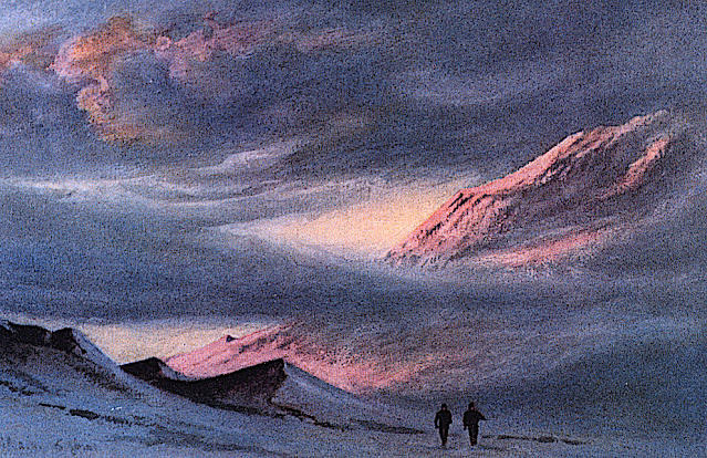
MONT KYFFIN  DÉSSINÉ PAR  EDWARD ADRIAN WILSON

EDWARD ADRIAN WILSON (1872-1912) Mont Kyffin (1, 670m -5, 480ft) Antarctique (Nouvelle-Zélande)

EDWARD ADRIAN WILSON (1872-1912)
Mont Kyffin (1, 670m -5, 480ft)
Antarctique (Nouvelle-Zélande)

L'artiste
Edward Adrian Wilson, surnommé « Oncle Bill » était un médecin anglais, explorateur polaire, historien naturel, peintre et ornithologue. Wilson a participé à deux expéditions britanniques en Antarctique, la Discovery Expedition (1901-1904) et la tragique expédition Terra Nova (1907-1912), toutes deux sous la direction de Scott.
Le Dr Edward A. Wilson est - considéré comme l’un des meilleurs artistes ayant jamais travaillé en Antarctique. Naviguant avec le capitaine Scott à bord du « Discovery » (1901-1904), il est devenu le dernier d'une longue tradition d'« artistes d'exploration » d'une époque où le crayon et l'aquarelle étaient les principales méthodes permettant de produire des enregistrements scientifiques précis de nouvelles terres et d'espèces animalières. Il a combiné des techniques scientifiques, topographiques et paysagères pour produire des images précises et magnifiques du dernier continent inconnu. La force de son œuvre fut telle qu’elle contribua également à fonder la tradition de la peinture animalière moderne. Wilson a notamment capturé sur papier l’essence du vol et du mouvement des oiseaux marins de l’océan Austral.
De retour avec le capitaine Scott à bord du « Terra Nova » (1910-1913) en tant que chef du personnel scientifique, il a continué à decrire le continent et sa faune avec une habileté extraordinaire. Choisi pour accompagner le capitaine Scott au pôle Sud, ses derniers dessins sont issus de l'un des voyages épiques les plus célèbres de l'histoire de l'exploration. Parallèlement à son travail scientifique, le crayon de Wilson a capturé la découverte de la tente de Roald Amundsen au pôle Sud par le capitaine Scott. Wilson mourut, avec les autres membres du British Pole Party, pendant le voyage de retour, en mars 1912. Les dessins et les peintures furent créés au prix d'un travail personnel considérable dans les conditions glaciales dans lesquelles Wilson travaillait. Il souffrait souvent gravement du froid lorsqu'il dessinait, ainsi que de la cécité des neiges ou de coups de soleil aux yeux. Ils constituent un remarquable témoignage de l’une des grandes figures de l’époque héroïque de l’exploration de l’Antarctique. Le livre a été produit en complément des « Carnets de la nature d'Edward Wilson » par deux des petits-neveux de Wilson, pour marquer le centenaire de sa mort.

 
La montagne

Le mont Kyffin (1, 670m -5, 480ft) est un relief brun rougeâtre avec un éperon en pente s'étendant sur4 milles marins au nord, à l'extrême nord de la chaîne du Commonwealth, se projetant du côté Est de Beardmore. Un glacier s'éleve précipitamment au-dessus de lui. Découvert par l'expédition antarctique britannique, 1907-1909 et nommé en l'honneur d'Evan Kyffin-Thomas, l'un des propriétaires du Register, compagnon de voyage de Shackleton lors du voyage depuis l'Angleterre. La chaîne du Commonwealth est une chaîne de montagnes escarpées orientées nord-sud, longue de 60 milles marins (110 km; 69 mi), située dans les montagnes Queen Maud sur la côte Dufek du continent Antarctique. 

 _______________________________________

2011-2024 - Gravir les montagnes en peinture
Un blog de Francis Rousseau  

Wednesday, August 16, 2023

LE MONT KIRKPATRICK PEINT PAR EDWARD ADRIAN WILSON


EDWARD ADRIAN WILSON (1872-1912), Mont Kirkpatrick  (4,528m) Antarctique  (Ile de Ross)   In "Sunset from Hut Point April 2nd 1911 ,watercolor


EDWARD ADRIAN WILSON (1872-1912)
Mont Kirkpatrick  (4,528m)
Antarctique  (Ile de Ross)

In "Sunset from Hut Point", April 2nd 1911, watercolor 


La montagne
Le mont Kirkpatrick est le point culminant du chaînon de la Reine-Alexandra, en Antarctique. Situé à 8 kilomètres à l'ouest du mont Dickerson, le mont Kirkpatrick est aussi le point culminant de la chaîne Transantarctique. Découvert et nommé par l'expédition Nimrod en 1908-1909, la montagne doit son nom à un homme d'affaires de Glasgow, qui était l'un des sponsors de l'expédition.
Sur les pentes du mont Kirkpatrick se trouve l'un des plus importants sites paléontologiques de l'Antarctique : la formation de Hanson, datée du Jurassique inférieur. À cette période, l'Antarctique était plus chaud et faisait partie due l'unique supercontinent qeu compteaut la planete et que l'on nomme Pangée. Ceci explique pourquoi les fossiles trouvés sur ce site peuvent l'être partout ailleurs dans le monde. À plus de 4 000 mètres d'altitude, des restes fossiles de vertébrés y ont été découverts, dont ceux du premier dinosaure trouvé sur le continent, Cryolophosaurus ellioti, nommé en 1994. Une autre espèce de dinosaures, Glacialisaurus hammeri, a été découverte durant une campagne de recherche en 2003-2004. Ce site a également livré les restes d'un cynodonte de la famille des tritylodontidés et un humérus de ptérosaure

 
Le peintre
Edward Adrian Wilson, surnommé « oncle Bill », est un explorateur polaire britannique, médecin, naturaliste, peintre et ornithologue.
Il fait partie des expéditions polaires Discovery et Terra Nova de Robert Falcon Scott. Il trouve la mort, lors de cette dernière, avec toute l'équipe de Scott composée de cinq hommes, en revenant du pôle Sud où ils avaient découvert qu'Amundsen et ses hommes les avaient précédés.

 ________________________________________

2023 - Gravir les montagnes en peinture
Un blog de Francis Rousseau


Monday, March 6, 2023

PETOOWACK ARCTIC HIGHLANDS PEINT PAR CHARLES HAMILTON SMITH


CHARLES HAMILTON SMITH (1776-1859) Petoowack Arctic Highlands Formation (500 m) Antarctica  In Petoowack Arctic Highlands Formation, watercolor, Yale Center for British Art
 
CHARLES HAMILTON SMITH (1776-1859)
Petoowack Arctic Highlands Formation (500 m)
Antarctica

In Petoowack Arctic Highlands Formation, watercolor, Yale Center for British Art

L'artiste
Le lieutenant-colonel Charles Hamilton Smith, était un artiste anglais, naturaliste, antiquaire, illustrateur, soldat, et... aussi espion  !  Sa carrière militaire débute en 1787, lorsqu'il étudie à l'académie d'artillerie et de génie à Malines et Louvain en Belgique (son pays natal). Son service militaire, qui s'est terminé en 1820 et comprenait les guerres napoléoniennes, l'a vu beaucoup voyager (y compris les Antilles, le Canada, les États-Unis, l'Europe du Sud et du Nord et ... l'Antarctique).
Illustrateur autodidacte prolifique (plus de 38 000 dessins !), il a laissé un nombre assez important de livres de paysages magnifiquement aquarellés pris dans le monde entier. ces recoins d'aquarelles sont aujourd'hui dans les collections du Yale Center From British Art. Parmi eux :
- Vues de France, tome I (81 aquarelles), Vues de France, tome II (93 aquarelles),
- Vues d'Angleterre et du Pays de Galles, Tome I (82 aquarelles), Vues d'Angleterre et du Pays de Galles, Tome II (74 aquarelles),
- Vues d'Europe du Nord, Tome I (68 aquarelles), Vues d'Europe du Nord, Tome II (78 aquarelles),
- Vues des régions polaires (75 aquarelles) (voir ci-dessus)
- Vues d'Espagne, Volume I (69 aquarelles), Vues d'Espagne, Volume II (72 aquarelles), Mais l'une de ses réalisations remarquables fut une expérience de 1800 pour déterminer quelle couleur devait être utilisée pour les uniformes militaires. Il est également connu dans les cercles d'histoire militaire pour le costume de l'armée de l'Empire britannique, produit vers la fin des guerres napoléoniennes et une représentation précise de l'uniforme britannique contemporain.
En tant qu'antiquaire, il a également produit, en collaboration avec Samuel Rush Meyrick, Costume of the Original Inhabitants of the British Islands, 1815, et The Ancient Costume of England, avec des illustrations historiques de chevaliers médiévaux, de dames, de navires et de batailles.
Il a également écrit sur l'histoire de la guerre de Sept Ans et sur l'histoire naturelle des chiens.
Un type plutôt productif !
_________________________________________

2023 - Wandering Vertexes ....
Errant au-dessus des Sommets Silencieux...
Un blog de Francis Rousseau

Monday, September 5, 2022

PATON PEAK PAINTED BY EDWARD ADRIAN WILSON

EDWARD ADRIAN WILSON (1872-1912), Paton Peak (771 m -2530 ft) Antarctica (Beaufort Island)  In Beaufort Island, Ross Sea, watercolor, 1911

EDWARD ADRIAN WILSON (1872-1912),
Paton Peak (771 m -2530 ft)
Antarctica (Beaufort Island)

In Beaufort Island, watercolor, 1911, Royal Geographical Society Museum, London


The mountain
Paton Peak (771m-2,530 ft) is the highest point in Beaufort Island, an island in Antarctica's Ross Sea,  probably an  eroded basaltic stratovolcano of unknown age.  It is semi-circular in shape. It is the northernmost feature of the Ross Archipelago, lying 21 kilometres (13 miles) north of Cape Bird, Ross Island. It is approximately 18.4 km2 (7 square miles) in area. It was first charted by James Clark Ross in 1841. Ross named the island for Sir Francis Beaufort, hydrographer to the British Royal Navy. Much of the western side of the island is covered by moderately sloping ice fields with ice cliffs about 20 m (66 ft) high on the coast. The east and south sides of the island are mostly free of ice, with steep inaccessible cliffs that rise straight from the sea. Here the ice-free ground has a gentle slope and has ponds in summer and small meltwater streams that drain to the coast. The island has a small colony of breeding emperor penguins on nearshore sea ice at the northern end, a large Adélie penguin colony on a raised beach called Cadwalader Beach at the south-western end, and several breeding colonies of south polar skua.  It has been designated an Important Bird Area by BirdLife International.


The artist
Edward Adrian Wilson, nicknamed "Uncle Bill" was an English physician, polar explorer, natural historian, painter and ornithologist. Wilson took part in two British expeditions to Antarctica, the Discovery Expedition (1901-1904) and the tragic Terra Nova Expedition (1907-1912), both under the leadership of Scott.
Dr. Edward A. Wilson is widely regarded as one of the finest artists ever to have worked in the Antarctic. Sailing with Captain Scott aboard 'Discovery' (1901-1904), he became the last in a long tradition of 'exploration artists' from an age when pencil and water-colour were the main methods of producing accurate scientific records of new lands and animal species. He combined scientific, topographical and landscape techniques to produce accurate and beautiful images of the last unknown continent. Such was the strength of his work that it also helped to found the tradition of modern wildlife painting. In particular Wilson captured the essence of the flight and motion of Southern Ocean sea-birds on paper.
Returning with Captain Scott aboard 'Terra Nova' (1910-1913) as Chief of Scientific Staff, he continued to record the continent and its wildlife with extraordinary deftness. Chosen to accompany Captain Scott to the South Pole, his last drawings are from one of the most famous epic journeys in exploration history. Along with his scientific work, Wilson's pencil recorded the finding of Roald Amundsen's tent at the South Pole by Captain Scott. Wilson died, along with the other members of the British Pole Party, during the return journey, in March 1912. The drawings and paintings were created at considerable personal cost in the freezing conditions in which Wilson worked. He often suffered severely from the cold whilst sketching and also from snow-blindness, or sunburn of the eye. They provide a remarkable testament to one of the great figures of the heroic age of Antarctic exploration. The book has been produced as a companion volume to 'Edward Wilson's Nature Notebooks' by two of Wilson's great nephews, to mark the centenary of his death.

_______________________________
2022 - Wandering Vertexes..
Un blog de Francis Rousseau

Thursday, July 14, 2022

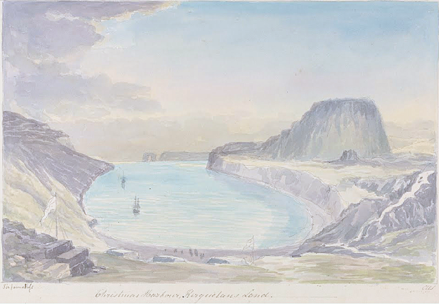
LA TABLE DE L'OISEAU SKETCHED BY CHARLES HAMILTON SMITH

CHARLES HAMILTON SMITH (1776-1859) La Table de l'Oiseau (403m - 1,322 ft) Antarctica - France   In Christmas Harbour,  Kerguelen's Land, watercolor,

CHARLES HAMILTON SMITH (1776-1859)
La Table de l'Oiseau (403m - 1,322 ft)
Antarctica - France

 In Christmas Harbour,  Kerguelen's Land, watercolor


The hill
The Table de l'Oiseau (403m - 1,322 ft) (Table ot the Bird) is a hill overlooking Port-Christmas by the north. Port-Christmas is one of the most isolated and difficult to reach points in the archipelagok.  Given the distance and especially the rugged topography, the site is almost never reached by land. However, it can be reached by sea after sailing for at least 100 nautical miles (190 km). The baie de l'Oiseau, at the bottom of which it is located, forms the first indentation at the northeast end of the Loranchet peninsula. The bay is closed to the north by Cap Français, to the south by Pointe de l'Arche (seen in the foreground).
While the shores of the bay are mostly rocky and often steep, the bottom is occupied by a strike, about 350 meters long, of black sand resulting from the erosion of the surrounding basaltic rocks. pours into the sea, after having collected runoff water from Mount Havergal on the one hand, and that from the outlet of Rochegude Lake on the other. This lake, located about 500 m from the shore and 40 m above sea level, marks the shoulder that separates Port-Christmas from Ducheyron Bay, to the west.
The anchorage at Port-Christmas allows you to anchor at a depth of 11 meters. It offers relatively safe shelter to sailors who frequent this particularly turbulent ocean sector of the Roaring Forties.

The artist
Lieutenant-Colonel Charles Hamilton Smith, was an English artist, naturalist, antiquary, illustrator, soldier, and... spy as well !. His military career began in 1787, when he studied at the Austrian academy for artillery and engineers at Mechelen and Leuven in Belgium (his native country). Although his military service, which ended in 1820 and included the Napoleonic Wars, saw him travel extensively (including the West Indies, Canada, United States, Southern and Northern Europe and ...Antarctica).
As a prolific self-taught illustrator (over 38,000 drawings!) He left quite an important number of books of beautifully watercolored landscapes taken all around the world. those nooks of watercolors are nowadays in the collections of the Yale Center From British Art. Among them :
- Views of France, Volume I (81 watercolors), Views of France, Volume II (93 watercolors),
- Views of England and Wales, Volume I (82 watercolors), Views of England and Wales, Volume II (74 watercolors),
- Views of Northern Europe, Volume I (68 watercolors), Views of Northern Europe, Volume II (78) watercolors),
- Views of Polar Regions (75 watercolors) (see above)
- Views of Spain, Volume I (69 watercolors), Views of Spain, Volume II (72 watercolors), But one of his noteworthy achievements was an 1800 experiment to determine which color should be used for military uniforms. He is also known in military history circles for Costume of the Army of the British Empire, produced towards the end of the Napoleonic Wars and an accurate depiction of contemporary British uniform.
As an antiquarian, he also produced, in collaboration with Samuel Rush Meyrick, Costume of the Original Inhabitants of the British Islands, 1815, and The Ancient Costume of England, with historical illustrations of medieval knights, ladies, shipsm and battles.
He also wrote on the history of the Seven Years' War and The Natural history of dogs.
Quite a productive fellow !
___________________________________________

2022 - Wandering Vertexes...
by Francis Rousseau

Friday, March 25, 2022

MOUNT LISTER & MOUNT HOOKER PAINTED BY DAVID ROSENTHAL


DAVID ROSENTHAL (bn. 1953) Mount Lister ( 4,025m- 13, 200ft) Antarctica (Victoria Land)

DAVID ROSENTHAL (bn. 1953)
Mount Lister  ( 4,025m- 13, 200ft)
Mount Hooker ( 3, 800m - 12, 500 ft)
Antarctica (Victoria Land)


The mountain
Mount Lister is a massive mountain,forming the highest point in the Royal Society Range of Victoria Land, Antarctica. It was discovered by the British National Antarctic Expedition (1901–1904) which named it for Lord Joseph Lister, President of the Royal Society, 1895–1900. Waikato Spur, a rock spur about 3 nmi (5.6 km) long, extends northwestward from Mount Lister. The spur separates the upper part of Emmanuel Glacier from the Carleton Glacier. The spur was named by the US Advisory Committee on Antarctic Names (US-ACAN) in 1994 after the University of Waikato in Hamilton, New Zealand, in association with nearby features that are named after colleges and universities. 

Mount Hooker standing immediately south of Mount Lister in the Royal Society Range of Victoria Land, Antarctica. It was discovered by the British National Antarctic Expedition, 1901–04, which named it for Sir Joseph Dalton Hooker.


The Painter
David Rosenthal is known as one of the best Antarctic Painter, Painter of Ice, Arctic Artist, Alaskan Artist and an Extreme Artist. He has been lured to cold climates regularly to record snow, ice, and landscapes. Davids paintings of glaciers and icebergs are astoundingly realistic and at the same ethereal at the same time. However his work also includes much more than ice, icebergs and glaciers... Cordova, Alaska is the place David Rosenthal calls home. As an artist and art teacher David has taught and continues to teach many students in Alaska. While teaching art in Alaska, David has instructed students and artist in many programs including the Alaska Artists in the Schools Program, Prince William Sound Community College and University of Alaska Fairbanks Summer Sessions. Alaskan artist David Rosenthal makes it a priority to travel around Alaska as much as possible to continue to capture the incredible beauty in his artwork of Alaska.
Having spent over sixty months on the Ice, including four austral winters and six austral summers, David became an Antarctic artist and has created art images from a large variety of places in every season. David has completed paintings of the antarctic landscape from all across Antarctica. Time in Antarctica included travel as a participant in the National Science Foundation Antarctic Artists and Writers Program during a summer and a winter at McMurdo Station as well as most of a winter at Palmer Station. David has also worked for the NSF contractor for two winters and four summers in various job capacities as a way to spend time and become familiar with the landscape.
Rosenthal's work also includes many water colors, oil paintings, sketches and small studies. The paintings seem to magically reflect the intensity of nature's colors and the atmospheric phenomena that David witnesses. David really is a master of Extreme Art!

_______________________________
2022 - Wandering Vertexes...
by Francis Rousseau

Friday, September 10, 2021

TROLLSLOTTET MOUNTAIN PAINTED BY VEJBJØRN SAND


VEJBJØRN SAND (bn. 1966), Trollslottet mountain (2,737 m- 8,930 ft) Antarctica,   In  Trollslottet, 1997, Antarctica


VEJBJØRN SAND (bn. 1966)
Trollslottet mountain (2,737 m- 8,930 ft)
Antarctica

In Trollslottet, 1997, Antarctica  


About this Painting
After an expedition to Antarctica, Queen Maud Land (Independent Norwegian territory in Antarctica) , Vebjørn completed his first public work, The Troll Castle (Trollslottet) which was inspired by the voyage. In collaboration with the team who arranged the opening of the Winter Olympics at Lillehammer in 1994, Vebjørn constructed a “Mini Antarctica” formed by 10 towers surrounding a circle, all reminiscent of Arnesteinen, a mountain shooting out of the ice in the shape of a cathedral. Inside the castle Vebjørn included paintings (as the one above) conceived and executed in Antarctica, stored inside glass boxes to resemble ice. The castle was designed so that visitors could walk inside the space and experience a frigid atmosphere similar to the one Vebjørn did when he painted them. During the first 3 months of its opening in the winter of 1997/98, 180,000 people visited the Troll Castle.


The mountain
Trollslottet Mountain (2,737m - 8,930ft) situated at 71°56′S 7°14′E, is a high ridgelike mountain with several prominent peaks  forming the northwest limit of the Filchner Mountains in Queen Maud Land (Independant Norwegian territory in Antarctica). Plotted from surveys and air photos by Norwegian Antarctic Expedition (1956–60) and named Trollslottet (the troll castle). The Filchner Mountains are a group of mountains 11 km (7 mi) southwest of the Drygalski Mountains, at the western end of the Orvin Mountains of Queen Maud Land, Antarctica. They were discovered by the Third German Antarctic Expedition (1938–1939), led by Capt. Alfred Ritscher, and named for Wilhelm Filchner, leader of the German expedition to the Weddell Sea area in 1911–12. They were remapped from air photos taken by the Sixth Norwegian Antarctic Expedition, 1958–59

The Painter
Vebjørn Sand (born March 11, 1966) is a Norwegian painter and artist. He is known for his paintings as well as his public arts projects, such as the Da Vinci Project, and the Kepler Star monument (Norwegian Peace Star) at Oslo Airport, Gardermoen.
Building off the original Da Vinci bridge in Norway, Vebjørn used Leonardo's philosophy of encompassing all fields of research to use the project to discuss global warming. First he used ice to reinterpret and construct a new bridge during his expedition to Queen Maud Land in Antarctica. After that, in December of 2007, Vebjørn erected a temporary ice bridge to dramatize the melting glaciers of Antarctica due to climate change outside of the United Nations Plaza in New York. During the unveiling at the U.N. Headquarters, Vebjørn said of the bridge in Antarctica,
“Our future lays underneath that ice glacier. So to erect it on that glacier, and that part of Antarctica, (it) must never melt. The one outside the United Nations is intended to melt to show that Antarctica is melting.”
The bridge was unveiled earlier that year two days after nearly 200 nations agreed at the U.N.-led talks in Bali to launch negotiations on a new pact to fight global warming.
In 2009, Vebjørn built another ice bridge in Ilulissat, Greenland (where most icebergs are borne into the sea). Later that year in Copenhagen, as part of the United Nations Climate Change Conference, also known as COP15, Vebjørn constructed yet another ice bridge in front of the Danish Parliament to raise global awareness of climate change.


___________________________________________


2021 - Wandering Vertexes...

by Francis Rousseau 


Wednesday, February 17, 2021

MOUNT EREBUS BY EDWARD ADRIAN WILSON


https://wanderingvertexes.blogspot.com/2021/02/mount-erebus-by-edward-adrian-wilson.html

EDWARD ADRIAN WILSON (1872-1912)
Mount Erebus (3, 794 m - 12, 448ft)
Antarctica (Ross Island)


In Mount Erebus, 1906, watercolour, Royal Geographical Society Museum, London


The mountain
Mount Erebus (3, 794 m - 12, 448ft), not to be confused with Mount Elbrus is the second-highest volcano in Antarctica (after Mount Sidley) and the southernmost active volcano on Earth. It is the sixth highest ultra mountain on an island, located on Ross Island, which is also home to three inactive volcanoes: Mount Terror, Mount Bird, and Mount Terra Nova.
The volcano has been active since c. 1.3 million years ago and is the site of the Mount Erebus Volcano Observatory run by the New Mexico Institute of Mining and Technology.
Mount Erebus was discovered on January 27, 1841 (and observed to be in eruption) by polar explorer Sir James Clark Ross who named it and its companion, Mount Terror, after his ships, Erebus and Terror (which were later used by Sir John Franklin on his disastrous Arctic expedition). Erebus is a dark region in Hades in Greek mythology. Present with Ross on the Erebus was the young Joseph Hooker, future president of the Royal Society and close friend of Charles Darwin. Erebus was an Ancient Greek primordial deity of darkness, the son of Chaos.
Mount Erebus is classified as a polygenetic stratovolcano. The bottom half of the volcano is a shield and the top half is a stratocone. The composition of the current eruptive products of Erebus is anorthoclase-porphyritic tephritic phonolite and phonolite, which are the bulk of exposed lava flow on the volcano. Erebus is the world's only presently erupting phonolite volcano.
Researchers spent more than three months during the 2007–08 field season installing an unusually dense array of seismometers around Mount Erebus to listen to waves of energy generated by small, controlled blasts from explosives they buried along its flanks and perimeter and to record scattered seismic signals generated by lava lake eruptions and local ice quakes. By studying the refracted and scattered seismic waves, the scientists produced an image of the uppermost (top few km) of the volcano to understand the geometry of its "plumbing" and how the magma rises to the lava lake. These results demonstrated a complex upper-volcano conduit system with appreciable upper-volcano magma storage to the northwest of the lava lake at depths hundreds of meters below the surface.


The artist
Edward Adrian Wilson, nicknamed "Uncle Bill" was an English physician, polar explorer, natural historian, painter and ornithologist. Wilson took part in two British expeditions to Antarctica, the Discovery Expedition (1901-1904) and the tragic Terra Nova Expedition (1907-1912), both under the leadership of Scott.
Dr. Edward A. Wilson is widely regarded as one of the finest artists ever to have worked in the Antarctic. Sailing with Captain Scott aboard 'Discovery' (1901-1904), he became the last in a long tradition of 'exploration artists' from an age when pencil and water-colour were the main methods of producing accurate scientific records of new lands and animal species. He combined scientific, topographical and landscape techniques to produce accurate and beautiful images of the last unknown continent. Such was the strength of his work that it also helped to found the tradition of modern wildlife painting. In particular Wilson captured the essence of the flight and motion of Southern Ocean sea-birds on paper.
Returning with Captain Scott aboard 'Terra Nova' (1910-1913) as Chief of Scientific Staff, he continued to record the continent and its wildlife with extraordinary deftness. Chosen to accompany Captain Scott to the South Pole, his last drawings are from one of the most famous epic journeys in exploration history. Along with his scientific work, Wilson's pencil recorded the finding of Roald Amundsen's tent at the South Pole by Captain Scott. Wilson died, along with the other members of the British Pole Party, during the return journey, in March 1912. The drawings and paintings were created at considerable personal cost in the freezing conditions in which Wilson worked. He often suffered severely from the cold whilst sketching and also from snow-blindness, or sunburn of the eye. They provide a remarkable testament to one of the great figures of the heroic age of Antarctic exploration. The book has been produced as a companion volume to 'Edward Wilson's Nature Notebooks' by two of Wilson's great nephews, to mark the centenary of his death.


_______________________________
2021 - Wandering Vertexes..
Un blog de Francis Rousseau

Saturday, October 10, 2020

MOUNT HAWKES / HAWKES HEIGHTS BY CHARLES HAMILTON SMITH


CHARLES HAMILTON SMITH (1776-1859), Mount Hawkes / Hawkes Heights ( 2,000 m- 6,600 ft) Antarctic (Coulman Island)  In Coulman Island, discovered Jan.4. 1844, watercolor on paper,Yale Center for BRitish Art, New Haven, USA

CHARLES HAMILTON SMITH (1776-1859),
Mount Hawkes / Hawkes Heights (2,000 m- 6,600 ft)
Antarctic (Coulman Island)

In Coulman Island, discovered Jan.4. 1844, watercolor on paper,
Yale Center for BRitish Art, New Haven, USA


The mountain
Mount Hawkes ( 2,000 m- 6,600 ft) also called  Hawkes Heights  is an ice-filled volcanic crater that dominates the southern part of Coulman Island, in the Ross Sea, Antarctica and marks the island's summit. The feature was named by the New Zealand Geological Survey Antarctic Expedition (NZGSAE), 1958–59, for Captain William M. Hawkes, U.S. Navy, who took a leading part in early air operations from Williams Field near McMurdo Station, including long range photo reconnaissance and supply flights, and the first air landing at the South Pole. He was commander of one of the two planes which made the historic first flight from Christchurch to McMurdo Station on December 17, 1955. His air photos proved of great value to two NZGSAE parties to this part of Victoria Land. Mount Hawkes is also named for Hawkes, who was assigned to Air Development Squadron Six (VX-6) in 1955–56.


The artist
Lieutenant-Colonel Charles Hamilton Smith, was an English artist, naturalist, antiquary, illustrator, soldier, and... spy as well !. His military career began in 1787, when he studied at the Austrian academy for artillery and engineers at Mechelen and Leuven in Belgium (his native country). Although his military service, which ended in 1820 and included the Napoleonic Wars, saw him travel extensively (including the West Indies, Canada, United States, Southern and Northern Europe and ...Antarctica).
As a prolific self-taught illustrator (over 38,000 drawings!) He left quite an important number of books of beautifully watercolored landscapes taken all around the world. those nooks of watercolors are nowadays in the collections of the Yale Center From British Art. Among them :
- Views of France, Volume I (81 watercolors), Views of France, Volume II (93 watercolors),
- Views of England and Wales, Volume I (82 watercolors), Views of England and Wales, Volume II (74 watercolors),
- Views of Northern Europe, Volume I (68watercolors) , Views of Northern Europe, Volume II (78) watercolors),
- Views of Polar Regions (75 watercolors) (see above)
- Views of Spain, Volume I (69 watercolors), Views of Spain, Volume II (72 watercolors), But one of his noteworthy achievements was an 1800 experiment to determine which color should be used for military uniforms. He is also known in military history circles for Costume of the Army of the British Empire, produced towards the end of the Napoleonic Wars and an accurate depiction of contemporary British uniform.
As an antiquarian, he also produced, in collaboration with Samuel Rush Meyrick, Costume of the Original Inhabitants of the British Islands, 1815, and The Ancient Costume of England, with historical illustrations of medieval knights, ladies, shipsm and battles.
He also wrote on the history of the Seven Years' War and The Natural history of dogs.
Quite a productive fellow !

___________________________________________

2020 - Wandering Vertexes...
by Francis Rousseau

Monday, August 17, 2020

MOUNT SCOTT BY HERBERT PONTING IN 1911


HERBERT PONTING (1870-1935)
Mount Scott (880 m-2,887 ft)
Antarctica (Grahamland)

In  Berg with Dog Sledge, September 17, 1911,  Scott Polar Research Institute, University of Cambridge

The mountain
Mount Scott (880 m - 2,887 ft) is a mountain in Grahamland in Antarctica. The mountain is a horseshoe-shaped massif on the Kiev Peninsula on the west coast of Grahamland, which on the southwest side is in open communication with Girard Bay and the northwestern side with Lemaire Channel. The mountain was discovered by the Belgian Antarctic expedition from 1897-1899. The mountain was mapped by Jean-Baptiste Charcot, leader of the French Antarctic Expedition in 1908-1910, and named after Captain Robert Falcon Scott.

The photographer 
Herbert George Ponting  is  known as the expedition photographer and cinematographer for Robert Falcon Scott's Terra Nova Expedition to the Ross Sea and South Pole (1910–1913). In this role, he captured some of the most enduring images of the Heroic Age of Antarctic Exploration.
During the 1911 winter, Ponting took many flash photographs of Scott and the other members of the expedition in their Cape Evans hut. With the start of the 1911–12 sledging season, Ponting's field work began to come to an end. As a middle-aged man, he was not expected to help pull supplies southward over the Ross Ice Shelf for the push to the South Pole. Ponting photographed other members of the shore party setting off for what was expected to be a successful trek. After 14 months at Cape Evans, Ponting, along with eight other men, boarded the Terra Nova in February 1912 to return to civilization, arrange his inventory of more than 1,700 photographic plates, and shape a narrative of the expedition. Ponting's illustrated narrative would be waiting for Captain Scott to use for lectures and fundraising in 1913.

_________________________________________
2020 - Wandering Vertexes...
Un blog de Francis Rousseau

Wednesday, March 11, 2020

MOUNT EREBUS (5) BY EDWARD ADRIAN WILSON


EDWARD ADRIAN WILSON (1872-1912)
Mount Erebus (3, 794 m - 12, 448ft)
Antarctica (Ross Island)

 In  Mountain range, McMurdo Strait, watercolor, 7.4 x 11.3 cm, Private collection 


The mountain
Mount Erebus (3, 794 m - 12, 448ft), not to be confused with Mount Elbrus is the second-highest volcano in Antarctica (after Mount Sidley) and the southernmost active volcano on Earth. It is the sixth highest ultra mountain on an island, located on Ross Island, which is also home to three inactive volcanoes: Mount Terror, Mount Bird, and Mount Terra Nova.
More about the mountain

The artist
Edward Adrian Wilson, nicknamed "Uncle Bill" was an English physician, polar explorer, natural historian, painter and ornithologist. Wilson took part in two British expeditions to Antarctica, the Discovery Expedition (1901-1904) and the tragic Terra Nova Expedition (1907-1912), both under the leadership of Scott.
More about the artist 

_______________________________ 

2020 - Wandering Vertexes...
by Francis Rousseau


Wednesday, February 12, 2020

MOUNT EREBUS (5) BY EDWARD ADRIAN WILSON


EDWARD ADRIAN WILSON (1872-1912)
Mount Erebus (3, 794 m - 12, 448ft)
Antarctica

In Slopes of Mount Erebus,  Watercolour on paper laid down on card Painting, 13.3 x 21.6 cm, 1911,  Royal Geographical Society Museum, London

The mountain 
Mount Erebus (3, 794 m - 12, 448ft), not to be confused with Mount Elbrus is the second-highest volcano in Antarctica (after Mount Sidley) and the southernmost active volcano on Earth. It is the sixth highest ultra mountain on an island, located on Ross Island, which is also home to three inactive volcanoes:  Mount Terror, Mount Bird, and Mount Terra Nova.
The volcano has been active since c. 1.3 million years ago and is the site of the Mount Erebus Volcano Observatory run by the New Mexico Institute of Mining and Technology.
Mount Erebus was discovered on January 27, 1841 (and observed to be in eruption) by polar explorer Sir James Clark Ross who named it and its companion, Mount Terror, after his ships, Erebus and Terror (which were later used by Sir John Franklin on his disastrous Arctic expedition). 
The artist
Edward Adrian Wilson,  nicknamed "Uncle Bill" was an English physician, polar explorer, natural historian, painter and ornithologist. Wilson took part in two British expeditions to Antarctica, the Discovery Expedition (1901-1904)  and the tragic Terra Nova Expedition (1907-1912), both under the leadership of Scott.
_______________________________ 

2020 - Wandering Vertexes..
Un blog de Francis Rousseau


Tuesday, January 14, 2020

MOUNT EREBUS (2) BY EDWARD ADRIAN WILSON


EDWARD ADRIAN WILSON (1872-1912)
Mount Erebus (3, 794 m - 12, 448ft)
Antarctica

 In  Mt Erebus - Aug. 17. 1911 - Noon.' on the mount,  Watercolour on paper, 13.1 x 21.1cm, 
Private collection (via Christie's)

About this watercolour
'The Summit of Mount Erebus' taken in August 1911, facing p.150.
Very similkar to  Mount Erebus 1911, watercolour,  Museum- Royal Geographical Society,
Notes :
"Thursday, August 17. - The weather has been extremely kind to us of late; we haven't a single grumble against it. Th temperature hovers pretty constantly at about -35°, there is very little wind and the sky is clear and bright. In such weather one sees well for more than three hours before and after noon, the landscape unfolds itself, and the sky colours are always delicate and beautiful. At noon today there was bright sunlight on the tops of the Western Peaks and on the summit and steam of Erebus -- of late the vapour cloud of Erebus has been exceptionally heavy and fantastic in form."

About Mount Erebus 

About the artist  


_______________________________

2020 - Wandering Vertexes.
Un blog de Francis Rousseau

Monday, November 11, 2019

MOUNT SABINE BY CHARLES HAMILTON SMITH


CHARLES HAMILTON SMITH (1776-1859)
Mount Sabine  (3,729m - 12, 205 ft) 
Antarctica (Victoria Land) 

In Mount Sabine and Possession Islands -  Watercolour from  Views of Polar region
Yale Center for British arts

The mountain
Mount Sabine (3,729m - 12, 205 ft)  is a prominent, relatively snow-free mountain rising between the heads of Murray Glacier and Burnette Glacier. Discovered on January 11, 1841, by Captain James Ross, Royal Navy, who named this feature for Lieutenant Colonel Edward Sabine of the Royal Artillery, Foreign Secretary of the Royal Society, one of the most active supporters of the expedition.
Mount Sabine is part of The Admiralty Mountains (alternatively Admiralty Range), a large group of high mountains and individually named ranges and ridges in northeastern Victoria Land, Antarctica. This mountain group is bounded by the Ross Sea, the Southern Ocean, and by the Dennistoun, Ebbe, and Tucker glaciers. The mountain range is situated on the Pennell Coast, a portion of Antarctica lying between Cape Williams and Cape Adare.
The Admiralty Mountains are divided into the Dunedin Range, Homerun Range, and Lyttelton Range and named them for the Lords Commissioners of the Admiralty under whose orders Captain James Ross served.

The artist 
Lieutenant-Colonel Charles Hamilton Smith,  was an English artist, naturalist, antiquary, illustrator, soldier, and... spy as well !. His military career began in 1787, when he studied at the Austrian academy for artillery and engineers at Mechelen and Leuven in Belgium (his native country). Although his military service, which ended in 1820 and included the Napoleonic Wars, saw him travel extensively (including the West Indies, Canada, United States, Southern and Northern Europe and ...Antarctica).
As a prolific self-taught illustrator (over 38,000 drawings!) He left quite an important number of books of  beautifully watercolored landscapes taken all around the world. those nooks of watercolors are nowadays in the collections of  the Yale Center From British Art. Among them  :
Views of France, Volume I (81 watercolors), Views of France, Volume II (93 watercolors), 
Views of England and Wales, Volume I (82  watercolors),  Views of England and Wales, Volume II (74  watercolors),
Views of Northern Europe, Volume I (68watercolors) , Views of Northern Europe, Volume II (78)  watercolors),  
Views of Polar Regions (75  watercolors) (see above) 
Views of Spain, Volume I (69 watercolors), Views of Spain, Volume II (72 watercolors), 
But one of his noteworthy achievements was an 1800 experiment to determine which color should be used for military uniforms.  He is also known in military history circles for Costume of the Army of the British Empire, produced towards the end of the Napoleonic Wars and an accurate depiction of contemporary British uniform.
As an antiquarian, he also produced, in collaboration with Samuel Rush Meyrick, Costume of the Original Inhabitants of the British Islands, 1815, and The Ancient Costume of England, with historical illustrations of medieval knights, ladies, shipsm and battles. 
He also wrote on the history of the Seven Years' War and TheNatural history of dogs.
Quite a productive fellow !

__________________________________________
2019 - Wandering Vertexes...
by Francis Rousseau

Wednesday, October 23, 2019

MOUNT EREBUS BY CHARLES HAMILTON SMITH

 
CHARLES HAMILTON SMITH (1776-1859) 
Mont Erebus (3, 794 m - 12, 448ft)
Antarctica (Ross Island)
In Mount Erebus and Beaufort Island- Watercolour from Views of Polar region, 
 Yale Center for British arts, Connectitcut, USA


The mountain
Mount Erebus (3, 794 m - 12, 448ft), not to be confused with Mount Elbrus is the second-highest volcano in Antarctica (after Mount Sidley) and the southernmost active volcano on Earth. It is the sixth highest ultra mountain on an island, located on Ross Island, which is also home to three inactive volcanoes: Mount Terror, Mount Bird, and Mount Terra Nova.
The volcano has been active since c. 1.3 million years ago and is the site of the Mount Erebus Volcano Observatory run by the New Mexico Institute of Mining and Technology.
Mount Erebus was discovered on January 27, 1841 (and observed to be in eruption) by polar explorer Sir James Clark Ross who named it and its companion, Mount Terror, after his ships, Erebus and Terror (which were later used by Sir John Franklin on his disastrous Arctic expedition). Erebus is a dark region in Hades in Greek mythology. Present with Ross on the Erebus was the young Joseph Hooker, future president of the Royal Society and close friend of Charles Darwin. Erebus was an Ancient Greek primordial deity of darkness, the son of Chaos.
The mountain was surveyed in December 1912 by a science party from Scott’s Terra Nova Expedition who also collected geological samples. Two of the camp sites they used have been recognised for their historic significance:
- Upper “Summit Camp” site (HSM 89) consists of part of a circle of rocks, which were probably used to weight the tent valances.
- Lower “Camp E” site (HSM 90) consists of a slightly elevated area of gravel as well as some aligned rocks, which may have been used to weight the tent valances.
They have been designated Historic Sites or Monuments following a proposal by the United Kingdom, New Zealand and the United States to the Antarctic Treaty Consultative Meeting.
Mount Erebus is classified as a polygenetic stratovolcano. The bottom half of the volcano is a shield and the top half is a stratocone. The composition of the current eruptive products of Erebus is anorthoclase-porphyritic tephritic phonolite and phonolite, which are the bulk of exposed lava flow on the volcano. Erebus is the world's only presently erupting phonolite volcano.

The artist 
Lieutenant-Colonel Charles Hamilton Smith,  was an English artist, naturalist, antiquary, illustrator, soldier, and... spy as well !. His military career began in 1787, when he studied at the Austrian academy for artillery and engineers at Mechelen and Leuven in Belgium (his native country). Although his military service, which ended in 1820 and included the Napoleonic Wars, saw him travel extensively (including the West Indies, Canada, United States, Southern and Northern Europe and ...Antarctica).
As a prolific self-taught illustrator (over 38,000 drawings!) He left quite an important number of books of  beautifully watercolored landscapes taken all around the world. those nooks of watercolors are nowadays in the collections of  the Yale Center From British Art. Among them  :
Views of France, Volume I (81 watercolors), Views of France, Volume II (93 watercolors), 
Views of England and Wales, Volume I (82  watercolors),  Views of England and Wales, Volume II (74  watercolors),
Views of Northern Europe, Volume I (68watercolors) , Views of Northern Europe, Volume II (78)  watercolors),  
Views of Polar Regions (75  watercolors) (see above) 
Views of Spain, Volume I (69 watercolors), Views of Spain, Volume II (72 watercolors), 
But one of his noteworthy achievements was an 1800 experiment to determine which color should be used for military uniforms.  He is also known in military history circles for Costume of the Army of the British Empire, produced towards the end of the Napoleonic Wars and an accurate depiction of contemporary British uniform.
As an antiquarian, he also produced, in collaboration with Samuel Rush Meyrick, Costume of the Original Inhabitants of the British Islands, 1815, and The Ancient Costume of England, with historical illustrations of medieval knights, ladies, shipsm and battles. 
He also wrote on the history of the Seven Years' War and TheNatural history of dogs.
Quite a productive fellow ! 
___________________________________________
2019 - Wandering Vertexes...
by Francis Rousseau

Wednesday, October 2, 2019

EREBUS SEEN BY CHARLES HAMILTON SMITH


CHARLES HAMILTON SMITH (1776-1859) 
Mont Erebus (3, 794 m - 12, 448ft)
Antarctica (Ross Island)

In Mount Erebus- Watercolour from Views of Polar region, Yale Center for British arts, Connectitcut,USA


The mountain
Mount Erebus (3, 794 m - 12, 448ft), not to be confused with Mount Elbrus is the second-highest volcano in Antarctica (after Mount Sidley) and the southernmost active volcano on Earth. It is the sixth highest ultra mountain on an island, located on Ross Island, which is also home to three inactive volcanoes: Mount Terror, Mount Bird, and Mount Terra Nova.
The volcano has been active since c. 1.3 million years ago and is the site of the Mount Erebus Volcano Observatory run by the New Mexico Institute of Mining and Technology.
Mount Erebus was discovered on January 27, 1841 (and observed to be in eruption) by polar explorer Sir James Clark Ross who named it and its companion, Mount Terror, after his ships, Erebus and Terror (which were later used by Sir John Franklin on his disastrous Arctic expedition). Erebus is a dark region in Hades in Greek mythology. Present with Ross on the Erebus was the young Joseph Hooker, future president of the Royal Society and close friend of Charles Darwin. Erebus was an Ancient Greek primordial deity of darkness, the son of Chaos.
The mountain was surveyed in December 1912 by a science party from Scott’s Terra Nova Expedition who also collected geological samples. Two of the camp sites they used have been recognised for their historic significance:
- Upper “Summit Camp” site (HSM 89) consists of part of a circle of rocks, which were probably used to weight the tent valances.
- Lower “Camp E” site (HSM 90) consists of a slightly elevated area of gravel as well as some aligned rocks, which may have been used to weight the tent valances.
They have been designated Historic Sites or Monuments following a proposal by the United Kingdom, New Zealand and the United States to the Antarctic Treaty Consultative Meeting.
Mount Erebus is classified as a polygenetic stratovolcano. The bottom half of the volcano is a shield and the top half is a stratocone. The composition of the current eruptive products of Erebus is anorthoclase-porphyritic tephritic phonolite and phonolite, which are the bulk of exposed lava flow on the volcano. Erebus is the world's only presently erupting phonolite volcano.

The artist 
Lieutenant-Colonel Charles Hamilton Smith,  was an English artist, naturalist, antiquary, illustrator, soldier, and... spy as well !. His military career began in 1787, when he studied at the Austrian academy for artillery and engineers at Mechelen and Leuven in Belgium (his native country). Although his military service, which ended in 1820 and included the Napoleonic Wars, saw him travel extensively (including the West Indies, Canada, United States, Southern and Northern Europe and ...Antarctica).
As a prolific self-taught illustrator (over 38,000 drawings!) He left quite an important number of books of  beautifully watercolored landscapes taken all around the world. those nooks of watercolors are nowadays in the collections of  the Yale Center From British Art. Among them  :
Views of France, Volume I (81 watercolors), Views of France, Volume II (93 watercolors), 
Views of England and Wales, Volume I (82  watercolors),  Views of England and Wales, Volume II (74  watercolors),
Views of Northern Europe, Volume I (68watercolors) , Views of Northern Europe, Volume II (78)  watercolors),  
Views of Polar Regions (75  watercolors) (see above) 
Views of Spain, Volume I (69 watercolors), Views of Spain, Volume II (72 watercolors), 
But one of his noteworthy achievements was an 1800 experiment to determine which color should be used for military uniforms.  He is also known in military history circles for Costume of the Army of the British Empire, produced towards the end of the Napoleonic Wars and an accurate depiction of contemporary British uniform.
As an antiquarian, he also produced, in collaboration with Samuel Rush Meyrick, Costume of the Original Inhabitants of the British Islands, 1815, and The Ancient Costume of England, with historical illustrations of medieval knights, ladies, shipsm and battles. 
He also wrote on the history of the Seven Years' War and TheNatural history of dogs.
Quite a productive fellow ! 

___________________________________________
2019 - Wandering Vertexes...
by Francis Rousseau 

Sunday, September 8, 2019

MOUNT TERROR AND CAPE CROZIER BY CHARLES HAMILTON SMITH


CHARLES HAMILTON SMITH (1776-1859)
Mount Terror (3, 262m - 10, 702 ft) 
Antarctica (Ross Island)

In Cap Crozier and Mount Terror - Watercolour from Views of Polar region, Connecticut Yale Center for British arts


The mountain 

Mount Terror (3, 262m - 10, 702 ft) is a large shield volcano that forms the eastern part of Ross Island, Antarctica. It has numerous cinder cones and domes on the flanks of the shield and is mostly under snow and ice. It is the second largest of the four volcanoes which make up Ross Island and is somewhat overshadowed by its neighbor, Mount Erebus, 30 km (19 mi) to the west. Mt. Terror was named in 1841 by Sir James Clark Ross for his second ship, HMS Terror. The captain of Terror was Captain Francis Crozier who was a close friend of Ross.
Those areas are from 0.82 to 1.75 million years old. Mount Terror showed no signs of volcanic activity more recent than that.
The first ascent of Mt. Terror was made by a New Zealand party in 1959.
Cape Crozier is the most easterly point on Ross Island in Antarctica. It was discovered in 1841 during the Erebus and Terror expedition of James Clark Ross, and was named after Francis Crozier, captain of HMS Terror. The Mount Terror volcano is located near the cape and the edge of the Ross barrier extends to the east.
This cape is a breeding area of the Adélie penguin and emperor penguin. It is a specially protected zone (zone n ° 6) by international agreement: any crossing of the zone, or overflight, is prohibited.
The message board erected on January 22, 1902 by Robert F. Scott during the Discovery Expedition and the remains of the hut built in July 1911 by the members of Edward Wilson's expedition are classified as a historic monument of the Antarctic.

The artist 
Lieutenant-Colonel Charles Hamilton Smith,  was an English artist, naturalist, antiquary, illustrator, soldier, and... spy as well !. His military career began in 1787, when he studied at the Austrian academy for artillery and engineers at Mechelen and Leuven in Belgium (his native country). Although his military service, which ended in 1820 and included the Napoleonic Wars, saw him travel extensively (including the West Indies, Canada, United States, Southern and Northern Europe and ...Antarctica).
As a prolific self-taught illustrator (over 38,000 drawings!) He left quite an important number of books of  beautifully watercolored landscapes taken all around the world. those nooks of watercolors are nowadays in the collections of  the Yale Center From British Art. Among them  :
Views of France, Volume I (81 watercolors), Views of France, Volume II (93 watercolors), 
Views of England and Wales, Volume I (82  watercolors),  Views of England and Wales, Volume II (74  watercolors),
Views of Northern Europe, Volume I (68watercolors) , Views of Northern Europe, Volume II (78)  watercolors),  
Views of Polar Regions (75  watercolors) (see above) 
Views of Spain, Volume I (69 watercolors), Views of Spain, Volume II (72 watercolors), 
But one of his noteworthy achievements was an 1800 experiment to determine which color should be used for military uniforms.  He is also known in military history circles for Costume of the Army of the British Empire, produced towards the end of the Napoleonic Wars and an accurate depiction of contemporary British uniform.
As an antiquarian, he also produced, in collaboration with Samuel Rush Meyrick, Costume of the Original Inhabitants of the British Islands, 1815, and The Ancient Costume of England, with historical illustrations of medieval knights, ladies, shipsm and battles. 
He also wrote on the history of the Seven Years' War and TheNatural history of dogs.
Quite a productive fellow ! 

___________________________________________
2019 - Wandering Vertexes...
by Francis Rousseau 

Tuesday, August 27, 2019

MOUNT HADDINGTON BY CHARLES HAMILTON SMITH


CHARLES HAMILTON SMITH (1776-1859),
Mount Haddington (1,630 m - 5,350 ft) 
Antarctica  (Ross Island) 

In Mount Haddington and Cape Gage from Views of Polar region, Watercolor and graphite, 
Yale Center for British Arts

The mountain 
Mount Haddington  (1,630 m - 5,350 ft) is a massive  high shield volcano comprising much of James Ross Island in Graham Land, Antarctica.  Mount Haddington was discovered on December 31, 1842 by the Ross expedition, a voyage of scientific exploration of the Antarctic from 1839 to 1843 led by James Clark Ross. Ross named the mountain after the Earl of Haddington, then First Lord of the Admiralty.
Mount Haddington is 60 km (37 mi) wide and has had numerous subglacial eruptions throughout its history, forming many tuyas. Some of its single eruptions were bigger in volume than a whole normal-sized volcano. Old eruption shorelines are widespread on the volcano's deeply eroded flanks.
Haddington formed along the Larsen Rift dominantly during the Miocene and Pliocene epochs but more recent eruptions have produced tuff cones on its slopes. The youngest tuff cones and pyroclastic cones on the eastern slope are situated below the summit icecap and may have formed in the last few thousand years. Effusive eruptions have created large deltas composed of hyaloclastite breccia and lava flows.

The artist 
Lieutenant-Colonel Charles Hamilton Smith,  was an English artist, naturalist, antiquary, illustrator, soldier, and... spy as well !. His military career began in 1787, when he studied at the Austrian academy for artillery and engineers at Mechelen and Leuven in Belgium (his native country). Although his military service, which ended in 1820 and included the Napoleonic Wars, saw him travel extensively (including the West Indies, Canada, United States, Southern and Northern Europe and ...Antarctica).
As a prolific self-taught illustrator (over 38,000 drawings!) He left quite an important number of books of  beautifully watercolored landscapes taken all around the world. those nooks of watercolors are nowadays in the collections of  the Yale Center From British Art. Among them  :
- Views of France, Volume I (81 watercolors), Views of France, Volume II (93 watercolors), 
- Views of England and Wales, Volume I (82  watercolors),  Views of England and Wales, Volume II (74  watercolors),
- Views of Northern Europe, Volume I (68watercolors) , Views of Northern Europe, Volume II (78)  watercolors),  
- Views of Polar Regions (75  watercolors) (see above) 
- Views of Spain, Volume I (69 watercolors), Views of Spain, Volume II (72 watercolors), 
But one of his noteworthy achievements was an 1800 experiment to determine which color should be used for military uniforms.  He is also known in military history circles for Costume of the Army of the British Empire, produced towards the end of the Napoleonic Wars and an accurate depiction of contemporary British uniform.
As an antiquarian, he also produced, in collaboration with Samuel Rush Meyrick, Costume of the Original Inhabitants of the British Islands, 1815, and The Ancient Costume of England, with historical illustrations of medieval knights, ladies, shipsm and battles. 
He also wrote on the history of the Seven Years' War and TheNatural history of dogs.
Quite a productive fellow ! 

___________________________________________
2019 - Wandering Vertexes...
by Francis Rousseau 


Sunday, August 11, 2019

MOUNT MINTO & MOUNT ADAM BY CHARLES HAMILTON SMITH


CHARLES HAMILTON SMITH (1776-1859)
Mount Minto  (4,165m - 13,665 ft)
Mount Adam (4, 010m -  13,516 ft)
 Antarctica (Victoria Land) 


In Mount Minto and Mount Adams,  watercolor and graphite on moderately thick, moderately textured, cream wove paper , 32, 7x 41cm, from Views of Polar Regions 
Yale Center for British Art, Connecticut USA


The mountains 
Mount Minto (4,165m - 13,665 ft) not to be confused with Mount Minto (Canada British Columbia) is the highest peak of The Admiralty Mountains (alternatively Admiralty Range), a large group of high mountains and individually named ranges and ridges in northeastern Victoria Land, Antarctica. This mountain group is bounded by the Ross Sea, the Southern Ocean, and by the Dennistoun, Ebbe, and Tucker glaciers. The mountain range is situated on the Pennell Coast, a portion of Antarctica lying between Cape Williams and Cape Adare. It was discovered in January 1841 by Captain James Ross, who named them for the Lords Commissioners of the Admiralty under whose orders he served. The first ascent was made in 1988 by the Australian Bicentennial Antarctic Expedition led by Greg Mortimer and included Lincoln Hall.
Mount Adam (4,010m - 13,516 ft), not to be confused with Mount Adams / Pahto (USA)  is the second highest peak of The Admiralty Mountains. Mount Adam is situated 4 km (2.5 mi) WNW of Mount Minto. Discovered in January 1841 by Captain Ross who named this feature for Vice Admiral Sir Charles Adam, a senior naval lord of the Admiralty.

The artist 
The artist 
Lieutenant-Colonel Charles Hamilton Smith,  was an English artist, naturalist, antiquary, illustrator, soldier, and... spy as well !. His military career began in 1787, when he studied at the Austrian academy for artillery and engineers at Mechelen and Leuven in Belgium (his native country). Although his military service, which ended in 1820 and included the Napoleonic Wars, saw him travel extensively (including the West Indies, Canada, United States, Southern and Northern Europe and ...Antarctica).
As a prolific self-taught illustrator (over 38,000 drawings!) He left quite an important number of books of  beautifully watercolored landscapes taken all around the world. those nooks of watercolors are nowadays in the collections of  the Yale Center From British Art. Among them  :
Views of France, Volume I (81 watercolors), Views of France, Volume II (93 watercolors), 
Views of England and Wales, Volume I (82  watercolors),  Views of England and Wales, Volume II (74  watercolors),
Views of Northern Europe, Volume I (68watercolors) , Views of Northern Europe, Volume II (78)  watercolors),  
Views of Polar Regions (75  watercolors) (see above) 
Views of Spain, Volume I (69 watercolors), Views of Spain, Volume II (72 watercolors), 
But one of his noteworthy achievements was an 1800 experiment to determine which color should be used for military uniforms.  He is also known in military history circles for Costume of the Army of the British Empire, produced towards the end of the Napoleonic Wars and an accurate depiction of contemporary British uniform.
As an antiquarian, he also produced, in collaboration with Samuel Rush Meyrick, Costume of the Original Inhabitants of the British Islands, 1815, and The Ancient Costume of England, with historical illustrations of medieval knights, ladies, shipsm and battles. 
He also wrote on the history of the Seven Years' War and TheNatural history of dogs.
Quite a productive fellow ! 

___________________________________________
2019 - Wandering Vertexes...
by Francis Rousseau 

Saturday, July 13, 2019

MOUNT DISCOVERY (2) BY EDWARD ADRIAN WILSON


EDWARD ADRIAN WILSON (1872-912)
Mount Discovery (2, 681m - 8,796 ft)
Antarctica

In The Last Sight of Mount Discovery, watercolour on paper (12.1 x 20.6cm.), 1904, Private owner 

About this painting
"And so that night [19 February 1904], running swiftly through the water with a howling gale behind, we saw the last of the McMurdo Sound. It was a fine scene, for although the wind blew with great force, the sky was comparatively clear. Away to the south-west behind the ragged storm clouds could be seen the deep red of the setting sun, against which there stood in sharp outline the dark forms of the western mountains and the familiar cone of Mount Discovery. On our right in a gloomy threatening sky rose the lofty snow-clad slopes of Erebus and the high domed summit of Cape Bird. For the last time we gazed at all these well-known landmarks with feelings that were not far removed from sadness...'
(R.F. Scott, The Voyage of the 'Discovery', London: 1907, II, pp.274-5).

The mountain
Mount Discovery (2, 681m - 8,796 ft) is a conspicuous, isolated stratovolcano, lying at the head of McMurdo Sound and east of Koettlitz Glacier, overlooking the NW portion of the Ross Ice Shelf. It forms the center of a three-armed mass of which Brown Peninsula is one extension to the north; Minna Bluff is a second to the east; the third is Mount Morning to the west. It was discovered by the Discovery British National Antarctic Expedition (1901-1904) and named for their expedition ship Discovery.

The artist
Edward Adrian Wilson, nicknamed "Uncle Bill" was an English physician, polar explorer, natural historian, painter and ornithologist. Wilson took part in two British expeditions to Antarctica, the Discovery Expedition (1901-1904) and the tragic Terra Nova Expedition (1907-1912), both under the leadership of Scott.
Dr. Edward A. Wilson is widely regarded as one of the finest artists ever to have worked in the Antarctic. Sailing with Captain Scott aboard 'Discovery' (1901-1904), he became the last in a long tradition of 'exploration artists' from an age when pencil and water-colour were the main methods of producing accurate scientific records of new lands and animal species. He combined scientific, topographical and landscape techniques to produce accurate and beautiful images of the last unknown continent. Such was the strength of his work that it also helped to found the tradition of modern wildlife painting. In particular Wilson captured the essence of the flight and motion of Southern Ocean sea-birds on paper.
Returning with Captain Scott aboard 'Terra Nova' (1910-1913) as Chief of Scientific Staff, he continued to record the continent and its wildlife with extraordinary deftness. Chosen to accompany Captain Scott to the South Pole, his last drawings are from one of the most famous epic journeys in exploration history. Along with his scientific work, Wilson's pencil recorded the finding of Roald Amundsen's tent at the South Pole by Captain Scott. Wilson died, along with the other members of the British Pole Party, during the return journey, in March 1912. The drawings and paintings were created at considerable personal cost in the freezing conditions in which Wilson worked. He often suffered severely from the cold whilst sketching and also from snow-blindness, or sunburn of the eye. They provide a remarkable testament to one of the great figures of the heroic age of Antarctic exploration. The book has been produced as a companion volume to 'Edward Wilson's Nature Notebooks' by two of Wilson's great nephews, to mark the centenary of his death.

2019 - Wandering Vertexes...
Un blog de Francis Rousseau