google.com, pub-0288379932320714, DIRECT, f08c47fec0942fa0 GRAVIR LES MONTAGNES... EN PEINTURE: August 2018

Friday, August 31, 2018

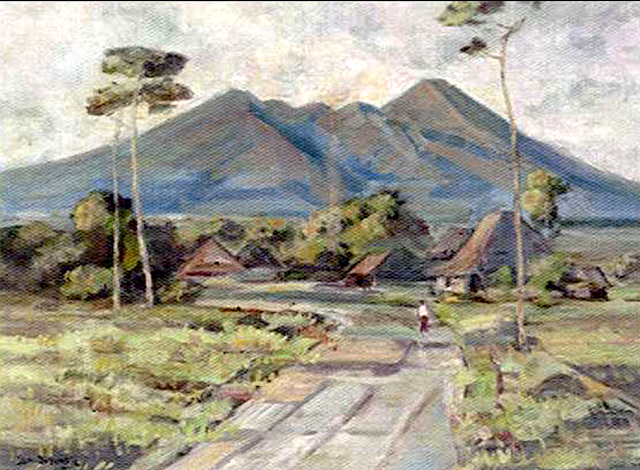
GUNUNG RINJANI PAINTED BY ERNEST DEZENTJE

http://wanderingvertexes.blogspot.com

ERNEST DEZENTJE (1885- 1972)
Gunung Rinjani (3,727m - 12,224ft)
Indonesia (Lombok) 
The mountain
Gunung Rinjani (3,727m - 12,224ft) is an active volcano in Indonesia on the island of Lombok, the second highest volcano in Indonesia. On the top of the volcano is a 6-by-8.5-kilometre (3.7 by 5.3 mi) caldera, which is filled partially by the crater lake known as Segara Anak or Anak Laut (Child of the Sea), due to the color of its water, as blue as the sea (laut).This lake is approximately 2,000 metres (6,600 ft) above sea level and estimated to be about 200 metres (660 ft) deep; the caldera also contains hot springs. Sasak tribe and Hindu people assume the lake and the mount are sacred and some religious activities are occasionally done in the two areas.[3] On 27 September 2016 14:45 WITA Rinjani erupted.
UNESCO has made Mount Rinjani Caldera a part of the Global Geoparks Network in April 2018.

The painter
The ‘Indisch’- Indonesian landscape painter Ernest Regnard Leonce Dezentjé was an autodidact. His career (mostly local) began when first president of the Republic of Indonesia, Soekarno (1901-1970), - who declared the independence of the country in 1945, felt in love with his painting and decided to make him the "court painter". Dezentje was then labelled an impressionist of the early Indonesian School, being considered by critics and young artists as a typical establishment artist. Along his eminently nationalistic themas the mountains and volcanoes of Indonesia took a important place.
_________________________________
2018 - Wandering Vertexes...
by Francis Rousseau

Thursday, August 30, 2018

MOUNT ELBRUS AND CAUCASUS RANGE BY IVAN AIVAZOVSKY

http://wanderingvertexes.blogspot.com


IVAN AIVAZOVSKY (1817-1900) 
Mount Elbrus (5,642 m - 18,510 ft)
Russia 

In Caucasus range with Mount Elbrus in the foreground, oil on canvas

The mountain 
Mount Elbrus (Эльбру́с) (5,642 m - 18,510 ft) also called  Karachay-Balkar (Минги таy) is the highest mountain in Europe, and the seven highest summit in the world.  The seven summit (which are obviously 8, with  2 in Europe !) are : Mount Everest (8,848m), Aconcagua (6,961m), Mt Denali or Mc Kinley (6,194m),  Kilimandjaro (5,895m), Mt Elbrus (5,642m), Vinson  Massif (4,892m), Mt Blanc (4,807m) and Mount Kosciuszko  (2,228m) in Australia.
Mount Elbrus should not be confused with the Alborz (also called Elburz) mountains in Iran, which also derive their name from the legendary mountain Harā Bərəzaitī in Persian mythology.
A dormant volcano, Elbrus forms part of the Caucasus Mountains in Southern Russia, near the border with Georgia. Elbrus has two summits, both of which are dormant volcanic domes.  The east summit is 5,621 metres (18,442 ft) was first ascended on 10 July 1829 by Khillar Khachirov, a Karachayguide for an Imperial Russian army scientific expedition led by General Emmanuel, and the higher in 1874 by an British expedition led by F. Crauford Grove and including Frederick Gardner, Horace Walker, and the Swiss guide Peter Knubel of St. Niklaus in the canton Valais.
While there are differing authorities on how the Caucasus are distributed between Europe and Asia, most relevant modern authorities define the continental boundary as the Caucasus watershed, placing Elbrus in Europe due to its position on the north side in Russia.
Mount Elbrus was formed more than 2.5 million years ago. The volcano is currently considered inactive.

The painter 
Ivan Konstantinovich Aivazovsky (Ива́н Константи́нович Айвазо́вский)  was a Russian Romantic painter. Despite he is considered one of the greatest marine artists in history, he painted a few mountains landscapes.  Aivazovsky was born into an Armenian family in the Black Sea port of Feodosia and was mostly based in his native Crimea.  Following his education at the Imperial Academy of Arts, Aivazovsky traveled to Europe and lived briefly in Italy in the early 1840s. He then returned to Russia and was appointed the main painter of the Russian Navy. Aivazovsky had close ties with the military and political elite of the Russian Empire and often attended military maneuvers. He was sponsored by the state and was well-regarded during his lifetime. The saying "worthy of Aivazovsky's brush", popularized by Anton Chekhov, was used in Russia for "describing something ineffably lovely.One of the most prominent Russian artists of his time, Aivazovsky was also popular outside Russia. He held numerous solo exhibitions in Europe and the United States. During his almost 60-year career, he created around 6,000 paintings, making him one of the most prolific artists of his time. The vast majority of his works are seascapes, but he often depicted battle scenes, Armenian themes, and portraiture. Most of Aivazovsky's works are kept in Russian, Ukrainian and Armenian museums as well as private collections.

2018 - Wandering Vertexes...

by Francis Rousseau 


Wednesday, August 29, 2018

AORAKI / MOUNT COOK PAINTED BY AUSTEN DEANS

http://wanderingvertexes.blogspot.com

AUSTEN DEANS (1915-2011)
Aoraki/ Mount Cook (3,724m - 12, 218ft) 
New Zealand (South Island)

  In Rangitata near the sky, watercolor, 1968 

The mountain 
Aoraki / Mount Cook (3,724m - 12, 218ft)  is the highest mountain in New Zealand.  It lies in the Southern Alps, the mountain range which runs the length of the South Island. A popular tourist destination, it is also a favourite challenge for mountain climbers. Aoraki / Mount Cook consists of three summits, from South to North the Low Peak (3,593 m or 11,788 ft), Middle Peak (3,717 m or 12,195 ft) and High Peak. The summits lie slightly south and east of the main divide of the Southern Alps, with the Tasman Glacier to the east and the Hooker Glacier to the southwest.The mountain is in the Aoraki/Mount Cook National Park, in the Canterbury region. The park was established in 1953 and along with Westland National Park, Mount Aspiring National Park and Fiordland National Park forms one of the UNESCO World Heritage Sites. The park contains more than 140 peaks standing over 2,000 metres (6,600 ft) and 72 named glaciers, which cover 40 percent of its 700 square kilometres (170,000 acres).
Aoraki is the name of a person in the traditions of the Ngāi Tahu iwi; an early name for the South Island is Te Waka o Aoraki (Aoraki's Canoe). In the past many believed it meant "Cloud Piercer",  Historically, the Māori name has been spelt Aorangi, using the standard Māori form.
Aoraki / Mount Cook has been known to Maori since their arrival in New Zealand some time around the 14th century CE. The first Europeans who may have seen Aoraki / Mount Cook were members of Abel Tasman's crew, who saw a "large land uplifted high" while off the west coast of the South Island, just north of present-day Greymouth on 13 December 1642 during Tasman's first Pacific voyage. The English name of Mount Cook was given to the mountain in 1851 by Captain John Lort Stokes to honour Captain James Cook who surveyed and circumnavigated the islands of New Zealand in 1770. Captain Cook did not sight the mountain during his exploration.
Following the settlement between Ngāi Tahu and the Crown in 1998, the name of the mountain was officially changed from Mount Cook to Aoraki / Mount Cook to incorporate its historic Māori name, Aoraki. As part of the settlement, a number of South Island placenames were amended to incorporate their original Māori name. Signifying the importance of Aoraki / Mount Cook, it is the only one of these names where the Māori name precedes the English.

The painter
Art historian Dr Warren Feeney, a former director of Christchurch's Centre of Contemporary Art, said Deans was an artist "incredibly sensitive'' to the Canterbury landscape. "There's absolutely no doubt that Austen was a very good painter indeed. No-one could do a watercolour wash like him - he was a master in the medium. "

2018 - Wandering Vertexes...
by Francis Rousseau

Tuesday, August 28, 2018

PICO CALDOVEIRO PAINTED BY DAVID BOMBERG


http://wanderingvertexes.blogspot.com

DAVID BOMBERG (1890-1957) 
Pico Caldoveiro (1,357 m - 4,452 ft)
Spain (Asturias) 

In The Mountains of Asturias, Spain, 1925,  oil on canvas, Private collection 

The Mountain 
Pico Caldoveiro (1,357 m - 4,452 ft) is a protected mountain range in Asturias, Northern Spain, It spans the parishes of Yernes, Proaza, Tameza, Grau (Grado), and Teberga (Teverga). Minerals found in Caldoveiro mines include Fluorite, Calcite, and Quartz. The Asturian administration uses Pico Caldoveiro in its tourism advertising, describing the mountain range as so:
The varied vegetation of this nature area and the different processes of erosion that sculpt contrasting terrain form a picturesque landscape dotted with small mountain lakes and high pastures with stone huts known as corros.

The painter 
David Garshen Bomberg was an English painter, and one of the Whitechapel Boys. Bomberg was one of the most audacious of the exceptional generation of artists who studied at the Slade School of Art under Henry Tonks, and which included Mark Gertler, Stanley Spencer, C.R.W. Nevinson and Dora Carrington.  Bomberg painted a series of complex geometric compositions combining the influences of cubism and futurism in the years immediately preceding World War I; typically using a limited number of striking colours, turning humans into simple, angular shapes, and sometimes overlaying the whole painting a strong grid-work colouring scheme. He was expelled from the Slade School of Art in 1913, with agreement between the senior teachers Tonks, Frederick Brown and Philip Wilson Steer, because of the audacity of his breach from the conventional approach of that time.
Whether because his faith in the machine age had been shattered by his experiences as a private soldier in the trenches or because of the pervasive retrogressive attitude towards modernism in Britain Bomberg moved to a more figurative style in the 1920s and his work became increasingly dominated by portraits and landscapes drawn from nature. Gradually developing a more expressionist technique, he travelled widely through the Middle East and Europe.

2018 - Wandering Vertexes...
by Francis Rousseau 


Monday, August 27, 2018

TENZING MONTES BY NASA NEW HORIZONS


NASA NEW HORIZONS (2006-2019...)
Tenzing Montes (6, 200m / 6.2km - 20, 344ft / 3.9 mi)
PLUTO
 About image
This close-up image of a Tenzing Montes near Pluto’s equator captured by NASA’s New Horizons spacecraft on July 14, 2015 reveals a range of youthful mountains  above the surface of the dwarf planet. This iconic image of the mountains, informally named Norgay Montes (Norgay Mountains) was captured about 1 ½ hours before New Horizons’ closest approach to Pluto, when the craft was 47,800 miles (77,000 kilometers) from the surface of the icy body.  The star in the foreground is the Sun, Pluto  being the  farthest planet from the sun of our solar system.

The mountains
The Tenzing Montes (6, 200m / 6.2km - 20, 344ft / 3.9 mi) formerly Norgay Montes are icy mountains, near the Hillary Montes, bordering the southwest region of Sputnik Planitia in the south of Tombaugh Regio (or the part of Tombaugh Regio south of the equator).  They are the highest mountain range on Pluto, and also the steepest, with a mean slope of 19.2 degrees.
The mountains, first viewed by the New Horizons spacecraft on 14 July 2015, and announced by NASA on 15 July 2015, are named after the Nepalese mountaineer Tenzing Norgay, who, along with Sir Edmund Hillary, made the first successful ascent of the highest peak on Earth, Mount Everest (29 May 1953). The mountains were informally called Norgay Montes by the New Horizons team, but that name was later changed from Norgay to Tenzing. On 7 September 2017, the name Tenzing Montes was officially approved together with the names of Tombaugh Regio and twelve other nearby surface features.
The Tenzing Montes rise up to 6.2 km (3.9 mi) high, about twice as high as the Hillary Montes. In comparison, Mount Everest rises 4.6 km (2.9 mi) base-to-peak though to an altitude of 8.8 km (5.5 mi) above sea level making it the highest peak on earth.

The space mission
New Horizons is an interplanetary space probe that was launched as a part of NASA's New Frontiers program. Engineered by the Johns Hopkins University Applied Physics Laboratory (APL) and the Southwest Research Institute (SwRI), with a team led by S. Alan Stern,  the spacecraft was launched in 2006 with the primary mission to perform a flyby study of the Pluto system in 2015, and a secondary mission to fly by and study one or more other Kuiper belt objects (KBOs) in the decade to follow. It is the fifth artificial object to achieve the escape velocity needed to leave the Solar System.
Most of the post-Jupiter voyage was spent in hibernation mode to preserve on-board systems, except for brief annual checkouts. On December 6, 2014, New Horizons was brought back online for the Pluto encounter, and instrument check-out began. On January 15, 2015, the New Horizons spacecraft began its approach phase to Pluto.
On July 14, 2015, at 11:49 UTC, it flew 12,500 km (7,800 mi) above the surface of Pluto, making it the first spacecraft to explore the dwarf planet. On October 25, 2016, at 21:48 UTC, the last of the recorded data from the Pluto flyby was received from New Horizons. Having completed its flyby of Pluto,  New Horizons has maneuvered for a flyby of Kuiper belt object (486958) 2014 MU69, expected to take place on January 1, 2019, when it will be 43.4 AU from the Sun.
In August 2018, NASA confirmed, based on results by Alice on the New Horizons spacecraft, of a "hydrogen wall" at the outer edges of the Solar System that was first detected in 1992 by the two Voyager spacecraft.

Sunday, August 26, 2018

GUNUNG BROMO PAINTED BY ERNEST DEZENTJE


ERNEST DEZENTJE (1885- 1972),
Gunung Bromo (2,329m - 7,641ft)
Indonesia (Java Timur)

The mountain 
Gunung Bromo (2,329m - 7,641ft) or Gunung Brama, an active volcano,in East Java, Indonesia,  is not the highest peak of the Tengger massif, but the best known. The massif area is one of the most visited tourist attractions in East Java, Indonesia. The volcano belongs to the Bromo Tengger Semeru National Park. The name of Bromo derived from Javanese pronunciation of Brahma, the Hindu creator god. Gunung Bromo sits in the middle of a plain called the "Sea of Sand"  a protected nature reserve since 1919. The best way to visit Gunung Bromo is from the nearby mountain village of Cemoro Lawang, from where it is possible to walk during 45 mn to the volcano. It is also possible to take an organised jeep tour, which includes a stop at the viewpoint on Gunung Penanjakan (2,770 m - 9,088 ft).
On the fourteenth day of the Hindu festival of Yadnya Kasada, the Tenggerese people of Probolinggo, East Java, travel up the mountain in order to make offerings of fruit, rice, vegetables, flowers and sacrifices to the mountain gods by throwing it into the caldera of the volcano. The origin of the ritual lies in the 15th century legend when princess  Roro Anteng started the principality of Tengger with her husband, Joko Seger. The couple were childless and therefore beseeched the assistance of the mountain gods. The gods granted them 24 children but stipulated that the 25th child, named Kesuma, must be thrown into the volcano as a human sacrifice. The gods' request was implemented. The tradition of throwing sacrifices into the volcano to appease these ancient deities continues today and is called the Yadnya Kasada ceremony. Though fraught with danger, some locals risk climbing down into the crater in an attempt to recollect the sacrificed goods that they believe could bring them good luck.
Depending on the degree of volcanic activity, the Indonesian Centre for Volcanology and Disaster Hazard Mitigation sometimes issues warnings against visiting Mount Bromo.
 Mount Bromo recently erupted in 2004, 2010, 2011 and 2015.

The painter
The ‘Indisch’- Indonesian landscape painter Ernest Regnard Leonce Dezentjé was an autodidact.  His career  (mostly local) began when first president of the Republic of Indonesia, Soekarno (1901-1970), - who declared the independence of the country in 1945, felt in love with his painting and decided to make him the  "court painter".  Dezentje was then labelled an impressionist of the early Indonesian School, being considered by critics and young artists as a  typical establishment artist.  Along his eminently nationalistic themas the mountains and volcanoes of Indonesia took a important place.


Saturday, August 25, 2018

AORAKI / MOUNT COOK PAINTED BY SIR WILLIAM FOX


SIR WILLIAM FOX (1812-1893)
Aoraki / Mount Cook (3,724m - 12, 218ft) 
New Zealand

 In Mount Cook and Franz Josef Glacier from freshwater Vreek about 40 miles, watercolor, 1872
 Christshurch Art Gallery 

The mountain 
Aoraki / Mount Cook (3,724m - 12, 218ft)  is the highest mountain in New Zealand. Its height since 2014 is listed as 3,724 m since December 1991, due to a rockslide and subsequent erosion. It lies in the Southern Alps, the mountain range which runs the length of the South Island. A popular tourist destination, it is also a favourite challenge for mountain climbers. Aoraki / Mount Cook consists of three summits, from South to North the Low Peak (3,593 m or 11,788 ft), Middle Peak (3,717 m or 12,195 ft) and High Peak. The summits lie slightly south and east of the main divide of the Southern Alps, with the Tasman Glacier to the east and the Hooker Glacier to the southwest.The mountain is in the Aoraki/Mount Cook National Park, in the Canterbury region. The park was established in 1953 and along with Westland National Park, Mount Aspiring National Park and Fiordland National Park forms one of the UNESCO World Heritage Sites. The park contains more than 140 peaks standing over 2,000 metres (6,600 ft) and 72 named glaciers, which cover 40 percent of its 700 square kilometres (170,000 acres).
Aoraki is the name of a person in the traditions of the Ngāi Tahu iwi; an early name for the South Island is Te Waka o Aoraki (Aoraki's Canoe). In the past many believed it meant "Cloud Piercer",  Historically, the Māori name has been spelt Aorangi, using the standard Māori form.
Aoraki / Mount Cook has been known to Maori since their arrival in New Zealand some time around the 14th century CE. The first Europeans who may have seen Aoraki / Mount Cook were members of Abel Tasman's crew, who saw a "large land uplifted high" while off the west coast of the South Island, just north of present-day Greymouth on 13 December 1642 during Tasman's first Pacific voyage. The English name of Mount Cook was given to the mountain in 1851 by Captain John Lort Stokes to honour Captain James Cook who surveyed and circumnavigated the islands of New Zealand in 1770. Captain Cook did not sight the mountain during his exploration.

The artist 
Sir William Fox was the second Premier of New Zealand and held that office on four separate occasions in the 19th century, while New Zealand was still a colony. He was known for his confiscation of Māori land rights, his contributions to the education system (such as establishing the University of New Zealand), and his work to increase New Zealand's autonomy from Britain. He has been described as determined and intelligent, but also as bitter and "too fond" of personal attacks. Different aspects of his personality are emphasised by different accounts, changing mainly due to the reviewers' political beliefs. HU use to be a  "amateur "watercolourist as well. 

Friday, August 24, 2018

MOUNT ETNA (2) PAINTED BY THOMAS COLE


THOMAS COLE (1801-1848)
 Mount Etna or Mongibello (3,329 m - 10,922ft) 
 Italy (Sicily) 

 In Mount Etna from Taormina, oil on canvas, 1842, Wadsworth Atheneum Museum of Art, Hartford 


The mountain 
Mount Etna (3,329 m - 10,922ft) or Mongibello, Mungibeddu in Sicilian, Aetna in Latin is an active stratovolcano on the east coast of Sicily, in the Province of Catania, between Messina and Catania. It lies above the convergent plate margin between the African Plate and the Eurasian Plate. It is the tallest active volcano in Europe. It is the highest mountain in Italy south of the Alps. Etna covers an area of 1,190 km2 (459 sq mi) with a basal circumference of 140 km. This makes it by far the largest of the three active volcanoes in Italy, being about two and a half times the height of the next largest, Mount Vesuvius. Only Mount Teide in Tenerife surpasses it in the whole of the European–North-African region.
In Greek Mythology, the deadly monster Typhon was trapped under this mountain by Zeus, the god of the sky and thunder and king of gods, and the forges of Hephaestus were said to also be located underneath it.
Mount Etna is one of the most active volcanoes in the world and is in an almost constant state of activity. The fertile volcanic soils support extensive agriculture, with vineyards and orchards spread across the lower slopes of the mountain and the broad Plain of Catania to the south. 
Due to its history of recent activity and nearby population, Mount Etna has been designated a Decade Volcano by the United Nations.
 In June 2013, it was added to the list of UNESCO World Heritage Sites.

The painter 
Thomas Cole (1801– 848) was an American artist known for his landscape and history paintings. He is regarded as the founder of the Hudson River School, an American art movement that flourished in the mid-19th century. Cole's work is known for its romantic portrayal of the American wilderness.
In New York, Cole sold five paintings to George W. Bruen, who financed a summer trip to the Hudson Valley where the artist produced two Views of Coldspring, the Catskill Mountain House and painted famous Kaaterskill Falls and the ruins of Fort Putnam. Returning to New York, he displayed five landscapes in the window of William Colman's bookstore; according to the New York Evening Post Two Views of Coldspring were purchased by Mr. A. Seton, who lent them to the American Academy of the Fine Arts annual exhibition in 1826. This garnered Cole the attention of John Trumbull, Asher B. Durand, and William Dunlap. Among the paintings was a landscape called "View of Fort Ticonderoga from Gelyna". Trumbull was especially impressed with the work of the young artist and sought him out, bought one of his paintings, and put him into contact with a number of his wealthy friends including Robert Gilmor of Baltimore and Daniel Wadsworth of Hartford, who became important patrons of the artist.
Cole was primarily a painter of landscapes, but he also painted allegorical works. Cole influenced his artistic peers, especially Asher B. Durand and Frederic Edwin Church, who studied with Cole from 1844 to 1846. Cole spent the years 1829 to 1832 and 1841 to 1842 abroad, mainly in England and Italy.
Thomas Cole died at Catskill on February 11, 1848. The fourth highest peak in the Catskills is named Thomas Cole Mountain in his honor. 

Thursday, August 23, 2018

MOUNT IDA BY WILLIAM CHARLES PINGUENIT


WILLIAM CHARLES PINGUENIT (1836-1914)
Mount Ida (1,176 m - 3,858ft) 
Australia (Tasmania) 

In Mount Ida and Lake St Clair Tasmania, watercolor, 1881 Art Gallery of New South Wales .

About this painting 
Although this watercolour was awarded second prize in the John Sands competition of 1881, its three judges, E L Montefiore, Eccleston Du Faur and John Garbett, were reported in the 'Telegraph' as stating that for 'purely artistic qualities' they considered it better than the work to which they gave first prize, C E Hern's 'Govett's Gorge looking towards the Valley of the Grose'. However, they believed that Hern's work (also purchased by the Gallery in 1881) suited the requirements of the prize better – 'being an excellent representation of a well-known and very characteristic scene, familiar to all tourists in New South Wales.'

The painter 
William Charles Piguenit was born in Hobart, the son of a convict of French Huguenot extraction. He was employed as a mapmaker by the Tasmanian Lands and Survey Department in 1850 and learnt lithography there from the painter Frank Dunnett (1822-91) and Robin Vaughan Hood (best remembered now as a framer, 1802-88) and developed an interest in photography.
Piguenit accompanied James R Scott's expedition to Arthur Plains and Port Davey in 1871, to Lake St Clair in 1873 and exhibited photographs and paintings throughout the 1870s. He moved to Sydney in 1880, settled in Hunter's Hill and travelled extensively in search of landscape subjects. He visited England and Wales in 1898 and 1900. He is perhaps best known for his Tasmanian landscapes and his monumental painting 'The flood on the Darling 1890' (1895) in the Gallery's collection.

About the mountain 
In Greek mythology, two sacred mountains are called Mount Ida, the "Mountain of the Goddess": Mount Ida in Crete; and Mount Ida in the ancient Troad region of western Anatolia (in modern-day Turkey) which was also known as the Phrygian Ida in classical antiquity and is the mountain that is mentioned in the Iliad of Homer and the Aeneid of Virgil. Both are associated with the mother goddess in the deepest layers of pre-Greek myth, in that Mount Ida in Anatolia was sacred to Cybele, who is sometimes called Mater Idaea ("Idaean Mother"), while Rhea, often identified with Cybele, put the infant Zeus to nurse with Amaltheia at Mount Ida in Crete. Thereafter, his birthplace was sacred to Zeus, the king and father of Greek gods and goddesses. Several Mountains around the world still have the name of Mount Ida  : there is one in Antarctica, British Columbia (Canada),
in United States of America (Colorado), in Greece (Crete), in Turkey and in Australia (Tasmania).


Wednesday, August 22, 2018

MOUNT EVEREST / CHOMOLUNGA AND THE HIMALAYAS BY NICHOLAS ROERICH

http://wanderingvertexes.blogspot.com

NICHOLAS ROERICH (1874-1947)
Mount Everest / Chomolunga  (8,848 m - 29,029ft)
China-Nepal border 

In  Kuluta. 1937. Tempera on canvas.  
The Museum of Latvian and Russian Art of Latvia, Riga, Latvia. 

The mountain 
Mount Everest (8,848 m - 29,029ft), also known in Nepal as Sagarmāthā and in Tibet as Chomolungma, is Earth's highest mountain. It is located in the Mahalangur mountain range in Nepal and Tibet. The international border between China (Tibet Autonomous Region) and Nepal runs across Everest's precise summit point. Its massif includes neighbouring peaks Lhotse (8,516 m -27,940 ft); Nuptse (7,855 m -25,771 ft) and Changtse (7,580 m -24,870 ft).
In 1856, the Great Trigonometrical Survey of India established the first published height of Everest, then known as Peak XV, at (8,840 m -29,002 ft). The current official height of (8,848 m -29,029 ft) as recognised by China and Nepal was established by a 1955 Indian survey and subsequently confirmed by a Chinese survey in 1975. In 1865, Everest was given its official English name by the Royal Geographical Society upon a recommendation by Andrew Waugh, the British Surveyor General of India. As there appeared to be several different local names, Waugh chose to name the mountain after his predecessor in the post, Sir George Everest, despite George Everest's objections.
Mount Everest attracts many climbers, some of them highly experienced mountaineers. There are two main climbing routes: one approaching the summit from the southeast in Nepal (known as the standard route) and the other from the north in Tibet. While not posing substantial technical climbing challenges on the standard route, Everest presents dangers such as altitude sickness, weather, wind as well as significant objective hazards from avalanches and the Khumbu Icefall. As of 2016, there are well over 200 corpses still on the mountain, with some of them even serving as landmarks.
Tenzing Norgay and Edmund Hillary made the first official ascent of Everest in 1953 using the southeast ridge route. Tenzing had reached 8,595 m - 28,199 ft) the previous year as a member of the 1952 Swiss expedition. The Chinese mountaineering team of Wang Fuzhou, Gonpo and Qu Yinhua made the first reported ascent of the peak from the North Ridge on 25 May 1960.
Mount Everest is one of the Seven Summits, which includes the highest mountains of each of the seven  continents. Summiting all of them is regarded as a mountaineering challenge, first achieved on April 30, 1985 by Richard Bass. 
The 7 summits (which are obviously 8 !)... are :  
Mount Everest (8,848 m), Aconcagua (6,961m), Mt Denali or Mc Kinley (6,194 m), Kilimandjaro (5,895 m), Mt Elbrus (5,642 m), Vinson  Massif (4,892 m), Mt Blanc (4,807 m) and Mount Kosciuszko  (2,228 m) in Australia.

The painter 
Nicholas Roerich known also as Nikolai Konstantinovich Rerikh (Никола́й Константи́нович Ре́рих) is quite an important figure of mountain paintings in the early 20th century.  He was a Russian painter, writer, archaeologist, theosophist, perceived by some in Russia as an enlightener, philosopher, and public figure. In his youth was he was quite influenced by a movement in Russian society around the occult and was interested in hypnosis and other spiritual practices. His paintings are said to have hypnotic expression.
After the October Revolution and the acquisition of power of Lenin's Bolshevik Party, Roerich became increasingly discouraged about Russia's political future. During early 1918, he, Helena, and their two sons George and Sviatoslav emigrated to Finland. After some months in Finland and Scandinavia, the Roerichs relocated to London, arriving in mid-1919. Later, a successful exhibition resulted in an invitation from a director at the Art Institute of Chicago, offering to arrange for Roerich's art to tour the United States. During the autumn of 1920, the Roerichs traveled to America by sea.  The Roerichs remained in the United States from October 1920 until May 1923.
In 1929 Nicholas Roerich was nominated for the Nobel Peace Prize by the University of Paris. He received two more nominations in 1932 and 1935. His concern for peace resulted in his creation of the Pax Cultura, the "Red Cross" of art and culture. His work for this cause also resulted in the United States and the twenty other nations of the Pan-American Union signing the Roerich Pact on April 15, 1935 at the White House. The Roerich Pact is an early international instrument protecting cultural property.
In 1934–1935, the U.S. Department of Agriculture (then headed by Roerich admirer Henry A. Wallace) sponsored an expedition by Roerich and USDA scientists H. G. MacMillan and James F. Stephens to Inner Mongolia, Manchuria, and China.
Roerich was in India during the Second World War, where he painted Russian epic heroic and saintly themes, including: Alexander Nevsky, The Fight of Mstislav...
In 1942, Roerich received Jawaharlal Nehru at his house in Kullu. Together they discussed the fate of the new world: "We spoke about Indian-Russian cultural association, it is time to think about useful and creative cooperation ...”.
Gandhi would later recall about several days spent together with Roerich's family: "That was a memorable visit to a surprising and gifted family where each member was a remarkable figure in himself, with a well-defined range of interests." ..."Roerich himself stays in my memory. He was a man with extensive knowledge and enormous experience, a man with a big heart, deeply influenced by all that he observed". During the visit, "ideas and thoughts about closer cooperation between India and USSR were expressed. Now, after India wins independence, they have got its own real implementation[clarification needed]. And as you know, there are friendly and mutually-understanding relationships today between both our countries".

_______________________________
2018 - Wandering Vertexes...
by Francis Rousseau 
Tuesday, August 21, 2018

MOUNT GOODSIR PAINTED BY LAWREN HARRIS


LAWREN S. HARRIS (1885-1970)
Mount Goodsir  (3,525 m -11,565 ft)
Canada (British Columbia) 

The mountain 
Mount Goodsir  (2,567m - 11,703ft)  or the Goodsir Towers is the highest mountain in the Ottertail Range, a subrange of the Canadian Rockies in British Columbia. It is located in Yoho National Park, near its border with Kootenay National Park. The mountain has two major summits, the South Tower (the higher summit) and the North Tower, 3,525 metres (11,565 ft).
The mountain was named by James Hector in 1859 after two brothers, John Goodsir, a professor of anatomy at the University of Edinburgh, and Harry Goodsir, a surgeon on the ship HMS Erebus.
The standard route on the South Tower is the southwest ridge, a straightforward but long climb (Grade III), which consists primarily of non-technical terrain, but includes short sections of narrow ridge graded YDS 5.4. Access to any route on either Tower requires a long hike.

The painter 
Lawren Stewart Harris  was a leading landscape canadian painter, imbuing his paintings with a spiritual dimension. An inspirer of other artists, he was a key figure in the Group of Seven and gave new vision to representations of the northern Canadian landscape. During the 1920s, Harris's works became more abstract and simplified, especially his stark landscapes of the Canadian north and Arctic.  He also stopped signing and dating his works so that people would judge his works on their own merit and not by the artist or when they were painted.
In 1924, a sketching trip with A.Y. Jackson to Jasper National Park in the Canadian Rockies marked the beginning of Harris' mountain subjects, which he continued to explore with annual sketching trips until 1929, exploring areas around Banff National Park, Yoho National Park and Mount Robson Provincial Park. In 1930, Harris went on his last extended sketching trip, travelling to the Arctic aboard the supply ship SS. Beothic for two months, during which time he completed over 50 sketches.  "We are on the fringe of the great North and its living whiteness, its loneliness and replenishment, its resignations and release, tis call and answer, its cleansing rhythms. It seems that the top of the continent is a source of spiritual flow that will ever shed clarity into the growing race of America."(Lawren S. Harris, 1926)
In 1969, he was made a Companion of the Order of Canada.
Harris died in Vancouver in 1970, at the age of 84, as a well-known artist.


Monday, August 20, 2018

THEODULE PASS BY EUGENE VIOLLET-LE-DUC


EUGENE VIOLLET-LE-DUC (1814-1879)
Theodul Pass (3,295 m- 10,810 ft)
Switzerland - Italy border 

The mountain 
Theodul Pass (3,295 m- 10,810 ft), is a high mountain pass across the eastern Pennine Alps, connecting Zermatt in the Swiss canton of Valais and Breuil-Cervinia in the Italian region of Aosta Valley. Theodul Pass is the second lowest pass (after Furggjoch) and the easiest pass between the valleys of Zermatt and Valtournanche.
The pass lies between the Matterhorn on the west and the Breithorn on the east and is overlooked by the Theodulhorn and Testa Grigia. The Rifugio del Teodulo (hut) is located just above the pass. The east side of the pass is covered by large glaciers part of the Theodul Glacier system and is part of a year-round ski area. On the Italian side, the pass can be reached from Breuil-Cervinia by a dead-end trail. On the Swiss side, trails go up from Trockener Steg and Gandegg Hut.


The artist 
Eugène Emmanuel Viollet-le-Duc (not to be confused with the writer Violette Leduc) was a French architect and theorist, famous for his interpretive "restorations" of medieval buildings.  But he was, as well, an excellent but less famous watercolorist, sketching quite a number of mountains and volcanoes all over Europe.
Strongly contrary to the prevailing Beaux-Arts architectural trend of his time, much of his design work was largely derided by his contemporaries. He was the architect hired to design the internal structure of the Statue of Liberty, but died before the project was completed.
During the early 1830s, a popular sentiment for the restoration of medieval buildings developed in France. Viollet-le-Duc, returning during 1835 from study in Italy, was commissioned by Prosper Mérimée to restore the Romanesque Abbey of Vézelay (France). This work was the first of a long series of restorations; Viollet-le-Duc's restorations at Notre Dame de Paris (France) with Jean-Baptiste Lassus brought him national attention. His other main works include Mont Saint-Michel, Carcassonne, Roquetaillade castle and Pierrefonds.
Viollet-le-Duc's "restorations" frequently combined historical fact with creative modification. For example, under his supervision, Notre Dame was not only cleaned and restored but also "updated", gaining its distinctive third tower (a type of flèche) in addition to other smaller changes. 
Another of his most famous restorations, the medieval fortified town of Carcassonne,(South of france) was similarly enhanced, gaining atop each of its many wall towers a set of pointed roofs that are actually more typical of northern France. Many of these reconstructions were controversial. Viollet-le-duc wanted what he called ‘a condition of completeness' which never actually existed at any given time. This approach to restoration was particularly problematic when buildings survived in a mixture of styles.  When monuments was to much damaged, he sometimes obtain from the emperor Napoleon III the permission to entirely rebuilt it,  like he did in Avignon with the Popes ramparts all around the city.

Sunday, August 19, 2018

MOUNT MANSFIELD PAINTED BY GEORGIA O'KEEFFE


GEORGIA O' KEEFFE (1887-1986) 
 Mount Mansfield  (1,339m - 4,393ft) 
United States of America (Vermont) - Canada border 

In  The Green Mountains, oil on canvas, 1932, The Art Institute of Chicago

The mountains
Mount Mansfield   (1,339m - 4,393ft)  is the highest point of The Green Mountains, a mountain range in the U.S. state of Vermont,  part of the Appalachian Mountains, that stretches from Quebec in the north to Alabama in the south. The Green Mountains are part of the New England/Acadian forests ecoregion. The range runs primarily south to north and extends approximately 250 miles (400 km) from the border with Massachusetts to the border with Quebec, Canada. The part of the same range that is in Massachusetts and Connecticut is known as The Berkshires or the Berkshire Hills (with the Connecticut portion, mostly in Litchfield County, locally called the Northwest Hills or Litchfield Hills) and the Quebec portion is called the Sutton Mountains, or Monts Sutton in French.
All mountains in Vermont are often referred to as the "Green Mountains". However, other ranges within Vermont, including the Taconics — in southwestern Vermont's extremity—and the Northeastern Highlands, are not geologically part of the Green Mountains.

The painter 
Georgia O’Keeffe is one of the most significant and intriguing artists of the twentieth century, known internationally for her boldly innovative art. Her distinct flowers, dramatic cityscapes, glowing landscapes, and images of bones against the stark desert sky are iconic and original contributions to American Modernism.
She studied at the Art Institute of Chicago in 1905-1906 and the Art Students League in New York in 1907-1908. Under the direction of William Merritt Chase, F. Luis Mora, and Kenyon Cox she learned the techniques of traditional realist painting. The direction of her artistic practice shifted dramatically in 1912 when she studied the revolutionary ideas of Arthur Wesley Dow. Dow’s emphasis on composition and design offered O’Keeffe an alternative to realism. Seeking to find a personal visual language through which she could express her feelings and ideas, she began a series of abstract charcoal drawings in 1915 that represented a radical break with tradition and made O’Keeffe one of the very first American artists to practice pure abstraction.
O’Keeffe mailed some of these highly abstract drawings to a friend in New York City, who showed them to Alfred Stieglitz. An art dealer and internationally known photographer, he was the first to exhibit her work in 1916. He would eventually become O’Keeffe’s husband.
In the summer of 1929, O’Keeffe made the first of many trips to northern New Mexico. The stark landscape, distinct indigenous art, and unique regional style of adobe architecture inspired a new direction in O’Keeffe’s artwork. For the next two decades she spent part of most years living and working in New Mexico . She made the state her permanent home in 1949, three years after Stieglitz’s death. O’Keeffe’s New Mexico paintings coincided with a growing interest in regional scenes by American Modernists seeking a distinctive view of America. Her simplified and refined representations of this region express a deep personal response to the high desert terrain.
In the 1950s, O’Keeffe began to travel internationally. She created paintings that evoked a sense of the spectacular places she visited, including the mountain peaks of Peru and Japan’s Mount Fuji. 
Suffering from macular degeneration and discouraged by her failing eyesight, O’Keeffe painted her last unassisted oil painting in 1972.  Late in life, and almost blind, she enlisted the help of several assistants to enable her to again create art.  In these works she returned to favorite visual motifs from her memory and vivid imagination.


Saturday, August 18, 2018

ACROCORINTH PAINTED BY CARL ROTTMANN


CARL ROTTMANN (1797-1850)
Acrocorinth (575m - 1,886 ft)
Greece
 In Corinth with Akrocorinth, 1847, oil on canvas, Neue Pinacothek Munchen 
The rock formation
Acrocorinth (575m - 1,886 ft) (Ακροκόρινθος) or "Upper Corinth", the acropolis of ancient Corinth, is a monolithic rock overseeing the ancient city of Corinth, Greece. Acrocorinth was continuously occupied from archaic times to the early 19th century. Along with Demetrias and Chalcis, the Acrocorinth during the Hellenistic period formed one of the so-called "Fetters of Greece" - three fortresses garrisoned by the Macedonians to secure their control of the Greek city-states. The city's archaic acropolis, already an easily defensible position due to its geomorphology, was further heavily fortified during the Byzantine Empire as it became the seat of the strategos of the thema of Hellas and later of the Peloponnese. It was defended against the Crusaders for three years by Leo Sgouros.
The highest peak on the site was home to a temple to Aphrodite which was converted to a church in  and then became a mosque. The American School's Corinth Excavations began excavations on it in 1929. Currently, Acrocorinth is one of the most important medieval castle sites of Greece.
In a Corinthian myth related in the 2nd century CE to Pausanias, Briareus, one of the Hecatonchires, was the arbitrator in a dispute between Poseidonand Helios, between the sea and the sun: his verdict was that the Isthmus of Corinth belonged to Poseidon and the acropolis of Corinth (Acrocorinth) to Helios.
The Upper Pirene spring is located within the encircling walls. "The spring, which is behind the temple, they say was the gift of Asopus to Sisyphus. The latter knew, so runs the legend, that Zeus had ravished Aegina, the daughter of Asopus, but refused to give information to the seeker before he had a spring given him on the Acrocorinthus."

The painter 
Carl Anton Joseph Rottmann was a German landscape painter and the most famous member of the Rottmann family of painters. Rottmann belonged to the circle of artists around the Ludwig I of Bavaria, who commissioned large landscape paintings exclusively from him. He is best known for mythical and heroising landscapes. The landscape painter Karl Lindemann-Frommel belonged to his school. Rottmann  received his first drawing lessons from his father, Friedrich Rottmann, who taught drawing at the university in Heidelberg. He formed himself chiefly through the study of nature and of great masterworks. In his first artistic period, he painted atmospheric phenomena. After gaining prominence with Heidelberg at Sunset (a water color), and Castle Eltz, he settled in Munich in 1822 and devoted himself to Bavarian scenery. Here his second period began, and in 1824 he married Friedericke, the daughter of his uncle, Friedrich Ludwig von Sckell, who served as an attendant at court. Through this connection, he made the acquaintance of King Ludwig I of Bavaria, who in 1826/27 sponsored his travels in Italy in order to widen his repertoire, which up to that point consisted solely of domestic, German, landscapes. In Italy, Rottmann made sketches for the 28 Italian landscapes in fresco which he was commissioned to paint in the arcades of the Hofgarten at Munich. The cycle, completed in 1833, gave visual expression to Ludwig’s alliance with Italy, and raised the genre of landscape painting to the height of history painting, the preferred mode of the King’s other great commissions for monumental painting. The frescos unfortunately deteriorated under climatic influences. The cartoons for them are in the Darmstadt Gallery.
In 1834 Rottmann traveled to Greece to prepare for a commission from Ludwig for a second cycle; one might mark here the beginning of his third period. At first also intended for the Hofgarten arcade, the 23 great landscapes (of which the one above) were eventually installed in the newly built Neue Pinakothek where they were given their own hall.

Friday, August 17, 2018

EL COTOPAXI PAINTED BY RAFAEL SALAS


RAFAEL SALAS (1824-1906) 
El Cotopaxi (5,897 m - 19,347 ft) 
Ecuador

 In Vista del volcán Cotopaxi, 1870, oil on canvas, Museo Arocena, Mexico City 

The mountain 
El Cotopaxi  (5,897 m - 19,347 ft)  is an active stratovolcano in the Andes Mountains, located in the Latacunga canton of Cotopaxi Province, about 50 km (31 mi) south of Quito, and 33 km (21 mi) northeast of the city of Latacunga, Ecuador, in South America.  It is the second highest summit in Ecuador, reaching a height of 5,897 m (19,347 ft). It is one of the world's highest volcanoes. Many sources claim that Cotopaxi means "Neck of the Moon" in an indigenous language, but this is unproven. The mountain was honored as a "Sacred Mountain" by local Andean people, even prior to the Inca invasion in the 15th century.
Most of the time, Cotopaxi is clearly visible on the skyline from Quito and is part of the chain of volcanoes around the Pacific plate known as the Pacific Ring of Fire. It has an almost symmetrical cone that rises from a highland plain of about 3,800 m (12,500 ft), with a width at its base of about 23 km (14 mi). It has one of the few equatorial glaciers in the world, which starts at the height of 5,000 m (16,400 ft). At its summit, Cotopaxi has an 800 X 550 m wide crater which is 250 m deep. The crater consists of two concentric crater rims, the outer one being partly free of snow and irregular in shape. The crater interior is covered with ice cornices and rather flat. The highest point is on the outer rim of the crater on the north side.
The first recorded eruption of Cotopaxi was in 1534.  With 87 known eruptions since then, Cotopaxi is one of Ecuador's most active volcanoes.

The painter 
Rafael Salas was an important Ecuadorian  landscape and genre painter  of nineteenth century South America neoclassicism. He was the last son of the famous Salas artists dynasty among which  his  half brother Ramon Salas ( 1815-1880), the fist professor a t Academy of fine Arts of Quito and  responsive for the taste of Costumbrismo; and above all their father Antonio Salas (1795-1860) a colonial artist specialized in religious themes like La Muerte de San José and La Negacion de San Pedro in the Cathedral of Quito. 

Thursday, August 16, 2018

THE BRENNER PASS BY JEAN-FRANÇOIS ALBANIS BEAUMONT (1753-1812)


JEAN-FRANÇOIS ALBANIS BEAUMONT (1753-1812)
The Brenner Pass (1,372m - 4,501ft)  
Austria - Italy border 

In Montagne de Brenner, 1797, drawing from Picturesque travel to the Pennine Alps

The mountain
The Brenner pass (1,372m - 4,501ft) is an Alpine pass separating Italy (the municipality of Brennero in the Autonomous Province of Bolzano) from Austria (Gries in Tyrol).  The Brenner pass connects the Stubai Alps to the west to the Zillertal Alps to the east, between the peaks of Sattelberg (2,115m - 6,939ft) and Wolfendorn (2,776m - 9,107ft). It separates the southern and northern parts of the Wipptal, a valley formed by Isarco to the south and Sill to the north, extending from Fortezza to Innsbruck. The pass marks the Italian-Austrian border and the watershed between the drainage basin of the Adriatic Sea (Adige) and the Black Sea (Inn and Danube). It is the lowest and most frequented passage between the north and the south of the main ridge of the Alps and the only one that a large transit railway crosses in the open sky. It is also crossed by the Brenner motorway leading from Modena to Innsbruck, part of the European Route 45.
The construction of the motorway began in 1957. On this occasion was built the Europabrücke, which was until 1974 the highest bridge in Europe with 190 m  (623 ft)high.

The painter
Sir  Jean-François Albanis Beaumont, draughtsman, aquatint engraver, and landscape painter, was born in Chambery in 1753, but naturalized in England.  He studied classics in Chambéry and when he was 17 years old went to Paris. He studied 4 years at the Royal College of Engineering of Mézières and received several commissions in the Bourbonnais.
Returning in 1775 to Chambéry, he designed the decorations for the celebrations of the marriage of Clotilde de France and Prince Charles-Emmanuel. Engineer Filippo Nicolis di Robilant encouraged him to work for king Victor Amadeus III, who placed him with the chief engineer of the county of Nice, where he took part in the important works underway in Port Lympia. He was inscribed on April 30, 1780, in the class of civil architects of the University of Turin.
He accompanied the Duke of Gloucester, William Frederick of Hanover in his Grand Tour (Germany, Italy, France and Switzerland), who subsequently entrusted him with the education of his children. He then settled in Britain and married an Englishwoman of Protestant religion.
In 1787 he began to publish his first works illustrated with his own drawings "Picturesque travel to the Pennine Alps", "Historical and picturesque journey of the County of Nice", "Journey through the Rhaetian Alps in 1786", "Selected views of antiquities And ports in the south of France "and" Travel through the Maritime Alps".
In 1796, his mission was completed and he could return to Savoie and settle near Genevawhere in 1798 he bought a small agricultural estate on the commune of Thônex with which he planned to enter the  trade of wool. He does not find the success expected and must soon resell everything and resume his work as geographer and traveler.
In 1800, he published "Journey in the Alps Lepontine from France to Italy" and then "Description of the Greek and CoteAlps" (1802 and 1806).
In 1810, he died at the monastery of Sixt of which he became the owner. He had resumed the exploitation of the iron mines, but he faced too many difficulties. He is buried on the spot.
The views of the towns and landscapes he drew are very sought after and give an idea of ​​the appearance of these places at the time.

Wednesday, August 15, 2018

MITTAGSKOGEL / KEPA PAINTED BY MARCUS PERNHART


MARCUS PERNHART (1824-1871)
Mittagskogel / Kepa (2,145 m - 7,037 ft)
Austria, Slovenia border

In Mittagskogel ud Villacher Becken vom Dobratsch gegen Osten, oil on canvas, 1850 

The mountain 
The Mittagskogel in Austrian or Kepa in Slovenian ( 2,145 m- 7,037 ft) is the third highest mountain in the Karawanks range, after Hochstuhl/Stol and the Vertratscha/Vrtača. It is located on the border between Slovenia and Austria.
The massif consisting of main dolomite and Dachstein limestone beds rises between the Slovene Sava valley in the south and the Austrian Drau basin in the north. Its steep northern face, resembling a rocky pyramid with a rounded summit is a landmark in Carinthia.
The mountain is usually climbed from the village of Belca on its Slovenian side.  An Alpine club hut, the Berta Hut, located at an elevation of 1,567 m (5,141 ft), can be reached from the Austrian municipality of Finkenstein; from here, the normal route leads to the summit.
Mentioned as Copan mons in a 1650 map, the German oronym Mittagskogel (Midday Peak) denotes the position of the sun above the summit at noon.

The painter 
Markus Pernhart was a Carinthian Slovenian / Austrian painter. He is considered the first Slovene realistic landscape painter. Early on, he began to paint panels ans humorous works, offered at Klagenfurt weekly market. At  barely 12 years, he painted the guest rooms of Krajcar Restaurant between Klagenfurt and Völkermarkt. The innkeeper made, the bishop's chaplain Henr. Hermann discovered the talented boys. At 15, he trained in painting first with Andreas Hauser in Klagenfurt.  Soon after, he got contact with the Viennese art scene, particularly to Franz Steinfeld, who taught at the Academy of Fine Arts. It was forwarded to the Munich Academy, but soon returned to Carinthia. There he was promoted by his stage name Pernhart the famous landscape painter of his time.
When Pernhart's drawing style had fully developed, he was asked by Max Moro to draw all Castles Carinthia. The idea was to these buildings if they could often for financial reasons can not be obtained, at least to preserve the picture, thereby preserving from decay. Markus Pernhart does not disappoint its customers and held in pencil drawings smallest details of the well-preserved, but also the already partly decayed plants firmly. Already in 1853, he produced 40 drawings followed by 198 others, he property of the Historical Association for Carinthia. In 1855  he gave the Carinthian estates Empress Elisabeth, an album of 21 drawings to which Max Moro contributed. Entitled images from Carinthia  appeared  in 1863-1868 in deliveries as steel engravings with accompanying. After his death appeared 5 lithographic panoramic images (Klagenfurt in 1875 and 1889). 
His entire painted oeuvre consists of approximately 1,200  paintings, drawings and engravings that delight even after his death a large appreciation. Pernhart presented landscapes, preferably lakes and high mountain motifs or castles, but also animals and still life subjects, in an idyllic and pathetic style. His works can be seen against the background of an incipient leisure society, they lead before the regional status objects of his home.


Tuesday, August 14, 2018

OIL NOYNO EBURRU BY ROBERT MC LELLAN-SIM


ROBERT MC LELLAN-SIM  (1907-1985)
Ol Doinyo Eburru (2,856m- 9,370ft)
 Kenya

 In Mount Eburu and Lake Navaisha, oil on canvas, 1960 

The mountain 
Ol Doinyo Eburru (2,856m- 9,370ft) is an active complex of volcanoes in the Great Rift Valley, Kenya to the northwest of Lake Naivasha.  The volcanic complex has an area of 470 square kilometres (180 sq mi). There are two summits, Eburru hill and West hill.[1] There are young craters on the eastern part of the ridge. It is being exploited for geothermal energy. Soysambu Conservancy is located to the north of the massif, between Lake Elmenteita to the east and Lake Nakuru to the west.

The painter 
Robert Mc Lellan Sim (RMS) attended Newport Secondary School from 1919 to 1924. In 1926 he won three prizes for graphic arts at the National Eisteddfod of Wales and in 1926 he was awarded a scholarship to study at the Newport School of Arts and Crafts (now part of the University of Wales). After finishing college with a Board of Education Teachers Certificate he attended the Newport Institute for Research into Art and Design (N.I.R.A.D.). 
RMS was a prolific artist, and during his time in East Africa (he travelled throughout Kenya, Uganda, Tanganyika and Zanzibar) he completed as many as 40 paintings a year. His work was in great demand, mostly in Kenya and purchased by many eminent people and was extremely popular as an official gift or a farewell present. The Colony of Kenya presented a McLellan-Sim painting to HM The Queen on the occasion of her Coronation in 1953, and HM The Queen Mother was presented with another to commemorate her Visit to Kenya in 1959. 
RMS’s move to Kenya in 1947 was a search for colour and space. His brief war service in the Far East obviously gave him a taste for warmer climes, brighter colours and wide spaces, aspects that were to feature strongly in his African paintings. He is on record as saying that he preferred landscapes and seascapes to portraits because he could go away on his own, often combining his field trips with fishing expeditions, during which he could turn to his sketch book when the trout would not jump! 


Monday, August 13, 2018

MOUNT HOOD / WY'EAST (1) PAINTED BY CHILDE HASSAM


CHILDE HASSAM (1859-1935)
  Mount Hood  / Wy'east (3,429m-11,249ft) 
United States of America (Oregon)

The mountain 
Mount Hood  / Wy'east (3,429m-11,249ft) is a potentially active stratovolcano in the Cascade Volcanic Arc of northern Oregon. It was formed by a subduction zone on the Pacific coast and rests in the Pacific Northwest region of the United States. It is located about 50 miles (80 km) east-southeast of Portland, on the border between Clackamas and Hood River counties. In addition to being Oregon's highest mountain, it is one of the loftiest mountains in the nation based on its prominence.
The height assigned to Mount Hood's snow-covered peak has varied over its history. 
The peak is home to 12 named glaciers and snowfields. It is the highest point in Oregon and the fourth highest in the Cascade Range. Mount Hood is considered the Oregon volcano most likely to erupt, though based on its history, an explosive eruption is unlikely. Still, the odds of an eruption in the next 30 years are estimated at between 3 and 7 %, so the U.S. Geological Survey (USGS) characterizes it as "potentially active", but the mountain is informally considered dormant.

The painter
Frederick Childe Hassam was an American Impressionist painter, noted for his urban and coastal scenes. Along with Mary Cassatt and John Henry Twachtman, Hassam was instrumental in promulgating Impressionism to American collectors, dealers, and museums. He produced over 3,000 paintings, oils, watercolors, etchings, and lithographs over the course of his career, and was an influential American artist of the early 20th century.

Saturday, August 4, 2018

THE ESJA (2) BY JOHANNES SVEINSSON KJARVAL

http://wanderingvertexes.blogspot.com


JOHANNES SVEINSSON KJARVAL (1885-1972) 
The Esja or Esjan  (914 m - 2, 999ft)
Iceland  

The mountain
Esja (914 m - 2,999 ft) often called "Esjan" or "The Esja" is situated in the south-west of Iceland, about 10 km to the north of Iceland's capital city Reykjavik. Esja is not a single mountain, but a volcanic mountain range, made from basalt and tuff. The etymology of the name is unclear. Esja can be used as a first name in Iceland. In the Kjalnesingasaga, there is a rich widow among Irish settlers named Esja, but it is likely that the women's name is derived from the mountain and not vice versa.
The easternmost summits of the mountain range, called Móskarðshnúkar, are of an unusually light colour. An Icelandic writer in the 19th century, so goes the story, hoped to see the sun there after a long period of rain. But when he looked closer, it was only the mountaintops with their colours. In reality, it is the rhyolite stone, often to be found in Icelandic nature near old (and also active) central volcanoes.

The painter
Johannes Sveinsson Kjarval was an Icelandic painter. He is considered one of the most important artists of Iceland. Born in poverty, he was adopted and, as a young man, worked as a fisherman. However, he spent every spare time drawing and painting and managed to learn basics from artist Ásgrímur Jónsson. At age 27 with financial support from fishermen and the Icelandic Confederation of Labour he passed an entrance examination and was admitted to the Royal Danish Academy of Fine Arts for higher education in the arts where he completed his studies. During the Copenhagen years he became acquainted with various styles including impressionism, expressionism and cubism but he also became an accomplished draughtsman. Later he also took shorter trips to France and Italy.
Kjarval was a prolific painter, leaving thousands of drawings and paintings after a long life. The paintings vary greatly in style and frequently mix different styles into a very personal style. Although not surreal, some of his works include absurd and symbolist elements mixing elves and myths into landscape. Many of his works include Icelandic landscape and lava formation but many of his landscape paintings are partially "cubist" and abstract with his focus on zooming on the closest ground and less the impressive mysterious mountains in the background. Later in his life his art frequently also included abstract painting.
Because of the unique mix of styles, it is an oversimplification to classify him has a landscape painter. His work includes expressionist, abstract, cubist, landscape and portrait paintings and drawings - and his "style promiscuity" was highly original as the man himself was. He was a highly original modernizer of his time and still remains quite unique among Icelandic and world painters. In 1958 he was awarded the Prince Eugen Medal by the King of Sweden.

_______________________________
2018 - Wandering Vertexes...
by Francis Rousseau 


Friday, August 3, 2018

MOUNT STELLER BY DAVID ROSENTHAL


DAVID ROSENTHAL (bn. 1953)
Mount Steller (3, 266m- 10, 715 ft) 
United States of America (Alaska) 

The mountain 
Mount Steller (3,266m - 10, 715 ft)  is a peak at the far eastern end of the Chugach Mountains of Alaska, United States. It is notable for its isolated location among extensive icefields, and for its large rise above local terrain. For example, it rises 8,000 feet (2,440 m) above the Bering Glacier to the south in about 4 horizontal miles (6.4 km).
Mount Steller is the high point of Waxell Ridge, an east-west trending ridge on the south side of the Bagley Icefield, one of the largest icefields in North America. The large Bering Glacier flows past the east and south slopes of the ridge, while the Steller Glacier flows from its west side.
The mountain was named for the naturalist Georg Wilhelm Steller.
Due to its isolated location, poor weather, and comparatively low absolute elevation by Alaskan standards, Mount Steller was not climbed until recently. The first ascent was in 1992.

The Painter 
David Rosenthal is known as an Antarctic Painter, Painter of Ice, Arctic Artist, Alaskan Artist and an Extreme Artist. He has been lured to cold climates regularly to record snow, ice, and landscapes. Davids paintings of glaciers and icebergs are astoundingly realistic and at the same ethereal at the same time. However his work also includes much more than ice, icebergs and glaciers... Cordova, Alaska is the place David Rosenthal calls home. As an artist and art teacher David has taught and continues to teach many students in Alaska. While teaching art in Alaska, David has instructed students and artist in many programs including the Alaska Artists in the Schools Program, Prince William Sound Community College and University of Alaska Fairbanks Summer Sessions. Alaskan artist David Rosenthal makes it a priority to travel around Alaska as much as possible to continue to capture the incredible beauty in his artwork of Alaska.
Having spent over sixty months on the Ice, including four austral winters and six austral summers, David became an Antarctic artist and has created art images from a large variety of places in every season. David has completed paintings of the antarctic landscape from all across Antarctica. Time in Antarctica included travel as a participant in the National Science Foundation Antarctic Artists and Writers Program during a summer and a winter at McMurdo Station as well as most of a winter at Palmer Station. David has also worked for the NSF contractor for two winters and four summers in various job capacities as a way to spend time and become familiar with the landscape.
Rosenthal's work also includes many water colors, oil paintings, sketches and small studies. The paintings seem to magically reflect the intensity of nature's colors and the atmospheric phenomena that David Rosenthal  witnesses. David Rosenthal really is a master of Extreme Art!

_______________________________
2018 - Wandering Vertexes...
by Francis Rousseau


Thursday, August 2, 2018

THE MONT BLANC (2) BY GABRIEL LOPPÉ

http://wanderingvertexes.blogspot.com

GABRIEL LOPPÉ (1825-1913)
The Mont Blanc (4,808.13 m - 15,776.7 ft)
France, Italy border

In Sunset on MontBlanc seen from Le Buet, oil on card

The painter
Toussaint Gabriel Loppé was a French painter, photographer and mountaineer. He became the first foreigner to be made a member of the Alpine Club in London. His father was a captain in the French Engineers and Loppé's childhood was spent in many different towns in south-eastern France. Aged twenty-one Loppé climbed a small mountain in the Languedoc and found a group of painters sketching on the summit. He had found his calling and subsequently went off to Geneva where he met the reputed leading Swiss landscapist, Alexandre Calame (1810 -1864). Loppé took up mountaineering in Grindelwald in the 1850s and made friends easily with the many English climbers in France and Switzerland. Although he was frequently labelled as a pupil of Calame and his rival François Diday, Loppé was almost an entirely self-taught artist. He became the first painter to work at higher altitudes during climbing expeditions earning the right to be considered the founder of the peintres-alpinistes school, which became established in the Savoie at the turn of the nineteenth century.
Notable followers of Loppé include, Charles Henri Contencin (1875-1955) and Jacques Fourcy (1906-1990). Together with the first ascent of Mt Mallet in Chamonix’s Grandes Jorasses range, Loppé made over 40 ascents of Mont Blanc during his climbing career, which lasted until the late 1890s. He frequently made oil sketches from alpine summits, including a panorama of the view from the summit of Mont Blanc.
His paintings became celebrated for their atmosphere and spontaneity and he soon found himself taking part in many exhibitions in London and in Paris.
By 1896 Loppé had spent over fifty seasons climbing and painting in Chamonix. As the valley’s unrivalled ‘Court painter’ his work was in constant demand with the majority of his pictures going to English climbers and summer tourists.
In his later years, Loppé became fascinated with photography and was quite an innovator in this field too. His long exposure photograph of the Eiffel Tower struck by lightning, now in the Musée d'Orsay in Paris remains one of his iconic images.


The mountain
The Mont Blanc (4,808.73 m -15,777 ft) or Monte Bianco, both meaning "White Mountain", is the highest mountain in the Alps and the highest in Europe after the Caucasus peaks. It is ranked 11th in the world in topographic prominence. The Mont Blanc is one of the Seven Summit, which includes the highest mountains of each of the seven continents. Summiting all of them is regarded as a mountaineering challenge, first achieved on April 30, 1985 by Richard Bass. The 7 highest summits, (which are obviously 8 with 2 in Europe !) are :
Mount Everest (8,848m), Aconcagua (6,961m), Mt Denali or Mc Kinley (6,194m), Kilimandjaro (5,895m), Mt Elbrus (5,642m), Mount Vinson (4,892m) and Mount Kosciuszko (2,228m) in Australia.
The mountain lies in a range called the Graian Alps, between the regions of Aosta Valley, Italy, and Savoie and Haute-Savoie, France. The location of the summit is on the watershed line between the valleys of Ferret and Veny in Italy and the valleys of Montjoie, and Arve in France. The Mont Blanc massif is popular for mountaineering, hiking, skiing, and snowboarding.
The three towns and their communes which surround Mont Blanc are Courmayeur in Aosta Valley, Italy, and Saint-Gervais-les-Bains and Chamonix in Haute-Savoie, France. A cable car ascends and crosses the mountain range from Courmayeur to Chamonix, through the Col du Géant. Constructed beginning in 1957 and completed in 1965, the 11.6 km (7¼ mi) Mont Blanc Tunnel runs beneath the mountain between these two countries and is one of the major trans-Alpine transport routes.
Since the French Revolution, the issue of the ownership of the summit has been debated.
From 1416 to 1792, the entire mountain was within the Duchy of Savoy. In 1723 the Duke of Savoy, Victor Amadeus II, acquired the Kingdom of Sardinia. The resulting state of Sardinia was to become preeminent in the Italian unification.[ In September 1792, the French revolutionary Army of the Alps under Anne-Pierre de Montesquiou-Fézensac seized Savoy without much resistance and created a department of the Mont-Blanc. In a treaty of 15 May 1796, Victor Amadeus III of Sardinia was forced to cede Savoy and Nice to France. A Sardinian Atlas map of 1869 showing the summit lying two thirds in Italy and one third in France.
Although the Franco-Italian border was redefined in both 1947 and 1963, the commission made up of both Italians and French ignored the Mont Blanc issue. In the early 21st century, administration of the mountain is shared between the Italian town of Courmayeur and the French town of Saint-Gervais-les-Bains, although the larger part of the mountain lies within the commune of the latter.

_______________________________________
2018 - Wandering Vertexes...
by Francis Rousseau