google.com, pub-0288379932320714, DIRECT, f08c47fec0942fa0 GRAVIR LES MONTAGNES... EN PEINTURE: 5000 - 6000 meters
Showing posts with label 5000 - 6000 meters. Show all posts

Friday, July 19, 2024

PICO DE ORIZABA / CITLALTÉPETL  PEINT PAR   DIEGO RIVERA

DIEGO RIVERA (1886-1957) Pico de Orizaba / Citlaltépetl (5,636 m -18,491 ft) Mexique  In Mountain peaks, aquarelle  26.6 x 37.4 cm


DIEGO RIVERA (1886-1957)
Pico de Orizaba / Citlaltépetl (5,636 m -18,491 ft)
Mexique

In Mountain peaks, aquarelle  26.6 x 37.4 cm

La montagne
Pico de Orizaba  (5,636 m -18,491 ft) ou Citlaltépetl est un volcan du Mexique, à la limite entre les États de Veracruz et Puebla. Il est  situé dans la cordillère Néovolcanique, il constitue le point culminant du pays et de cette chaîne de montagnes, mais également le plus haut volcan d'Amérique du Nord ce qui en fait un des sept sommets volcaniques. Sa dernière éruption remonte à 1846. Sa première ascension officielle a lieu deux ans plus tard, à la fin de la Guerre américano-mexicaine, par les lieutenants américains F. Maynard et G. Reynolds.
Le parc national Pico de Orizaba a été créé le 16 décembre 1936 sur une superficie de 19 750 ha afin de protéger la richesse naturelle du volcan, ses environs et les localités de Tlachichuca, Ciudad Serdán, La Perla, Mariano Escobedo et Calcahualco. Le décret fédéral a été traduit en loi fédérale le 4 janvier 1937.
Le pic d'Orizaba est une figure majeure dans les cultures pré-hispaniques, comme chez les Aztèques et les Totonaques. Le volcan est l'objet de nombreuses mythologies autochtones. Chez les Olmèques, Orizaba est l'esprit d'un aigle réincarné en volcan ; le fait de le gravir et de prier au sommet prévient de ses colères et l'empêche d'entrer en éruption.

Le peintre
Diego María de la Concepción Juan Nepomuceno Estanislao de la Rivera y Barrientos Acosta y Rodríguez, plus connu sous le nom de Diego Rivera  est un peintre mexicain. Bien qu'il ait tout au long de sa vie pratiqué la peinture de chevalet, Rivera est mondialement connu pour ses peintures murales, réalisées au Mexique, principalement à Mexico, et aux États-Unis. Ses peintures murales sont indissociables de ses convictions communistes et de sa fascination pour le passé préhispanique du Mexique. Il fut l'époux de l'artiste Frida Kahlo. De 1913 à 1918, ses peintures sont d'inspiration cubiste (dont Paysage zapatiste - Le Guérillero, 1915). À la suite d'un conflit avec le critique d'art Pierre Reverdy, il rompt avec le cubisme et revient à la figuration. Son voyage en Italie en 1920 lui fait découvrir les fresques murales qui vont l'inspirer pour son œuvre ultérieure la plus connue, ses immenses peintures murales. Il utilise pour cela les pigments traditionnels utilisés à l'époque pré-hispanique. Les thèmes traités sur commande du gouvernement sont sociaux et historiques, concernant l'histoire officielle récente du Mexique. L'inspiration est également politique avec la représentation du travail ouvrier (L'industrie de Detroit, 1932-1933).
Rivera a fait l'objet de nombreuses critiques de son vivant, notamment de la part de David Alfaro Siqueiros, qui l'accusa, dans un article publié le 29 mai 1934 par le magazine New Masses d'être un opportuniste, d'avoir une vision idéalisée et fausse des indigènes, d'être un touriste mental (parce qu'il s'était « planqué » à l'étranger durant la révolution), un snob, un saboteur du travail collectif, le peintre de la nouvelle bourgeoisie et des millionnaires, techniquement dépassé, de dépendre financièrement des subsides du gouvernement et d'être un de ses agents, un esthète de l'impérialisme.

 ______________________________
2024 - Gravir les montagnes en peinture
Un blog de Francis Rousseau   

Sunday, April 14, 2024

LE PIC ALEXANDRA PHOTOGRAPHIÉ PAR VITTORIO SELLA EN 1906

VITTORIO SELLA (1859-1943) Alexandra Peak / Mount Stanley (5, 091m) Congo - Uganda border  In Alexandra peak , western glacier, photographie à la chambre, 1906

VITTORIO SELLA (1859-1943)
Alexandra Peak / Mount Stanley (5, 091m)
Congo - Uganda border

In Alexandra peak , western glacier, photographie à la chambre, 1906


Le photographe
Vittorio Sella est un alpiniste et photographe italien qui a hérité sa passion pour la montagne de son oncle, Quintino Sella, fondateur du Club Alpin Italien. Il accomplit de nombreuses ascensions remarquables dans les Alpes, le premier hivernage au Cervin et au Mont Rose (1882) et la première traversée hivernale du
Mont Blanc (1888) et des Rouies (1900).
Il participe à diverses expéditions hors d'Italie :
- Trois dans le Caucase en 1889, 1890 et 1896 où un sommet porte encore son nom ;
- L'ascension du Mont Saint Elias en Alaska en 1897 ;
- Sikkim et Népal en 1899 ;
- Gravit le mont Stanley en Ouganda en 1906 lors d'une expédition dans le Rwenzori ;
- Reconnaissance au K2 en 1909 ;
- Au Maroc en 1925.
Lors d'expéditions en Alaska, en Ouganda et au Karakoram, il accompagne le duc des Abruzzes, le prince Luigi Amedeo di Savoia.
Sella continue la pratique de l'escalade jusqu'à ses vieux jours, complétant sa dernière tentative sur le Cervin à l'âge de 76 ans ; une ascension dont il a dû interrompre la montée suite à un accident dans lequel l'un de ses guides s'est blessé. Il mourut dans sa ville natale pendant la Seconde Guerre mondiale. Sa collection photographique est désormais gérée par la Fondation Sella.
Ses photos de montagne sont encore aujourd'hui considérées comme parmi les plus belles jamais réalisées.
Jim Curran estime que « Sella reste probablement le plus grand photographe de montagne. Son nom est synonyme de perfection technique et de raffinement esthétique. »
La qualité des images de Vittorio Sella s'explique en partie par l'utilisation d'une caméra de visualisation 30 × 40 cm, malgré la difficulté de transport d'un tel appareil, à la fois lourd et fragile dans des endroits inaccessibles ; pour pouvoir le transporter en toute sécurité, il a dû fabriquer des pièces spéciales pouvant être rangées dans des sacoches. Ses photographies ont été largement diffusées, soit dans la presse, soit dans les galeries, et ont été unanimement saluées ; Ansel Adams, qui a pu en admirer trente et un lors d'une exposition organisée au Sella American Sierra Club, a déclaré qu'ils lui avaient inspiré « un sentiment d'émerveillement religieux ». Beaucoup de ses clichés ont été pris en montagne pour la toute première fois dans l'Histoire, ce qui leur confère une grande valeur artistique, historique mais aussi scientifique ; par exemple, on pourrait mesurer le déclin des glaciers du Rwenzori en Afrique centrale.

La montagne
Le pic Alexandra (5 091 m) fait partie du mont Stanley situé dans la chaîne du Rwenzori, la plus haute montagne de la République démocratique du Congo et de l'Ouganda, et la troisième plus haute d'Afrique, après le mont Kilimandjaro (5 895 m). et le mont Kenya (5 199 m).
Le mont Stanley se compose de deux sommets jumeaux et de plusieurs sommets inférieurs qui sont :
Pic Margherita (5 109 m), Pic Alexandra (5 091 m), Pic Albert (5 087 m), Pic Savoia (4 977 m - 16 330 pieds), Pic Ellena (4 968 m - 16 300 pieds), Elizabeth Peak (4 929 m), Phillip Peak (4 920 m), Moebius Peak (4 916 m) et Great Tooth (4 603 m).
Le pic et plusieurs autres sommets environnants sont suffisamment hauts pour supporter des glaciers. Le mont Stanley doit son nom au journaliste et explorateur Sir Henry Morton Stanley. Il fait partie du parc national des Monts Rwenzori, un site classé au patrimoine mondial de l'UNESCO.
Le mont Stanley a été escaladé pour la première fois en 1906 par le prince Luigi Amedeo di Savoia, duc des Abruzzes (1873-1933), J. Petigax, C. Ollier et J. Brocherel. Il est également connu pour ses explorations de l'Arctique et pour ses expéditions d'alpinisme, notamment au Mont Saint Elias (Alaska-Yukon) et au K2 (Pakistan-Chine). Margherita Peak doit son nom à la reine Margherita d'Italie, cousine du prince.

 ______________________________________

2024 - Gravir les montagnes en peinture
Un blog de Francis Rousseau


Friday, February 16, 2024

VOLCÀN SAN JOSÉ   PHOTOGRAPHIÉ PAR   ROBERT GERSTMANN


ROBERT GERSTMANN (1896-1960) Volcán San José (5,856m) Chili - Argentine  Photographié en 1932 à bord d'un aéroplane


ROBERT GERSTMANN (1896-1960)
Volcán San José (5,856m)
Chili - Argentine

Photographié en 1932 à bord d'un aéroplane

 Le volcan
Le San José (5 856 mètres) est un volcan des Andes centrales d'Argentine (province de Mendoza, Tunuyán) et du Chili (Région métropolitaine de Santiago).
Il est situé à 40 kilomètres au sud du volcan Tupungato, à quelque 80 kilomètres à l'est-sud-est de Santiago du Chili, et à 80 kilomètres à l'ouest de la ville argentine de San Carlos.
Son altitude est de (sommet sud-oriental) et 5 820 mètres (sommet sud-occidental).
Le volcan comporte plusieurs sommets secondaires. La première ascension du sommet nord du San José date de l'année 1920 (5 740 mètres). C'est en 1931, qu'Otto Pfnninger et Sebastián Krückel surmontèrent le sommet principal (sommet sud-est). Ils furent surpris de découvrir l'importance du cratère et des glaciers qui occupaient l'intérieur de ce dernier.
À 3 130 mètres d'altitude se trouve le refuge refugio Plantat, qui fut édifié en par Enrique Plantat en 1937, utilisant les plans d'un refuge déjà existant dans les Alpes. Au début, il était pourvu d'eau potable et de chauffage ainsi que d'autres commodités, mais il s'est dégradé faute d'entretien.
Lorsqu'on aborde le volcan du côté chilien, près de la localité de San Gabriel, il surprend par son énorme taille et contribue à impressionner les touristes.

Le photographe
Robert Gerstmann fut un photographe très connu en Amérique du Sud. Gerstmann était un ingénieur électricien né à Vienne qui, dans sa jeunesse, développa un intérêt pour la photographie. En 1924, il immigre au Chili et de là se rend en Bolivie, où il réalise quelque 5 000 photographies, dont une sélection apparaît sous forme de photogravures dans son Bolivie, 150 Grabados en Cobre (1928), réédité en 1996 par la Fundación Quipus en La Paz. Gerstmann a parcouru de longues distances, photographiant l'altiplano de La Paz au sud jusqu'à la frontière argentine, à l'ouest jusqu'à la frontière chilienne et à l'est jusqu'aux Yungas, Cochabamba, Santa Cruz et les basses terres le long des Ríos Beni et Mamoré. Seuls Tarija et le Chaco ont échappé à son objectif. Cinq de ses photographies illustrent le magazine National Geographic "The Heart of Aymara Land" de Stewart E. McMillan (février 1927), et plusieurs apparaissent dans Bolivia (Guía Sinóptica) 1929 de Gustavo-Adolfo Otero. Gerstmann s'installe à Santiago en 1929. Il publie d'autres photos. albums, dont Chili : 280 grabados en cobre (1932), Colombie : 200 grabados en cobre (1951) et Chili en 110 cuadros (1960 ?), et s'est essayé au cinéma en Bolivie. On pense qu'il est mort à Santiago ca. 1960. Plusieurs milliers de ses plaques de verre se trouveraient dans une université d'Antofagasta.

 ________________________________________

2011-2024 - Gravir les montagnes en peinture
Un blog de Francis Rousseau

Monday, January 29, 2024

LE POPOCATEPETL  PEINT PAR MARSDEN HARTLEY

MARSDEN HARLEY (1877-1943) Popocatepetl (5,426 m) Mexique   In "Popocatepetl, Spirited Morning, Mexico" (1932) Oil on board, 63.5 x 73.7 cm. Smithsonian American Art Museum, Washington DC

 
MARSDEN HARLEY (1877-1943)
Popocatepetl (5,426 m)
Mexique


In "Popocatepetl, Spirited Morning, Mexico" (1932), Oil on board, 63.5 x 73.7 cm. Smithsonian American Art Museum, Washington DC


Le peintre
Marsden Hartley était un peintre, poète et essayiste moderniste américain.
Hartley a commencé sa formation artistique au Cleveland Institute of Art après que sa famille ait déménagé à Cleveland, Ohio, en 1892. En 1898, à 22 ans, il s'installe à New York pour étudier la peinture à la New York School of Art sous la direction de William Merritt Chase, puis fréquente la National Academy of Design. Hartley était un grand admirateur d'Albert Pinkham Ryder et visitait son studio de Greenwich Village aussi souvent que possible. Son amitié avec Ryder, ainsi que les écrits de Walt Whitman et des transcendantalistes américains Henry David Thoreau et Ralph Waldo Emerson, ont largement inscliné Hartley à considérer l'art comme une quête spirituelle. Hartley voyage pour la première fois en Europe en avril 1912 et fait la connaissance du cercle d'écrivains et d'artistes d'avant-garde de Gertrude Stein à Paris. Stein, avec Hart Crane et Sherwood Anderson,  encouragéèrent Hartley à écrire ainsi qu'à peindre. En 1913, Hartley s'installe à Berlin, où il continue à peindre et se lie d'amitié avec les peintres Vassily Kandinsky et Franz Marc. Il collectionnait également l'art populaire bavarois. Son travail durant cette période était une combinaison d’abstraction et d’expressionnisme allemand, alimenté par sa marque personnelle de mysticisme. À Berlin, Hartley développa une relation étroite avec un lieutenant prussien, Karl von Freyburg. Les références à Freyburg sont un motif récurrent dans l'œuvre de Hartley, notamment dans Portrait d'un officier allemand (1914). La mort de Freyburg pendant la guerre a durement frappé Hartley. Hartley retourna aux États-Unis au début de 1916 mais Il vécut de nouveau en Europe entre 1921 et 1930, avant de retourner définitivement aux États-Unis. Il  peignit alors dans tout le pays, au Massachusetts, au Nouveau-Mexique, en Californie et à New York. Il retourna dans le Maine en 1937, après avoir déclaré vouloir devenir « le peintre du Maine » et dépeindre la vie américaine locale. Il s'alignait ainsi sur le mouvement régionaliste, un groupe d'artistes actifs du début au milieu du 20e siècle qui tentaient de représenter un « art américain » distinct. Il  continua à peindre dans le Maine, principalement des scènes autour de Lovell, jusqu'à sa mort à Ellsworth en 1943. La plupart de ses peintures de montagnes du Maine font aujourd'hui partie des collections du MET.

Le volcan
Le Popocatépetl (5 426 m ) est un volcan actif, situé dans les États de Puebla, au Mexique et de Morelos, au centre du Mexique, et setrouve dans la moitié orientale de la ceinture volcanique trans-mexicaine. Le nom Popocatépetl vient des mots nahuatl popōca (ça fume) et tepetl (montagne), signifiant montagne fumante. C'est le deuxième plus haut sommet du Mexique, après le Citlaltépetl (Pico de Orizaba) à 5 636 m (18 491 pi). Il est relié au volcan Iztaccihuatl au nord par la haute selle connue sous le nom de Paso de Cortés.Popocatépetl se trouve à 70 km (43 mi) au sud-est de Mexico, d'où il peut être vu régulièrement, en fonction des conditions atmosphériques. Jusqu'à récemment, le volcan était l'un des trois hauts sommets du Mexique à contenir des glaciers, les autres étant Iztaccihuatl et Pico de Orizaba. Dans les années 1990, la taille des glaciers tels que Glaciar Norte (Glacier Nord) a considérablement diminué, en partie à cause des températures plus chaudes, mais en grande partie à cause de l'augmentation de l'activité volcanique. Début 2001, les glaciers du Popocatépetl avaient disparu ; la glace restait sur le volcan, mais ne présentait plus les traits caractéristiques des glaciers comme les crevasses. Le magma en éruption du Popocatépetl a toujours été principalement andésitique, mais il a également produit de grands volumes de dacite. Le magma produit au cours du cycle d’activité actuel a tendance à être un mélange des deux.

____________________________________
2024 - 13e année de publication - Gravir les montagnes en peinture
Un blog de Francis Rousseau


PODCAST / LES TABLEAUX QUI PARLENT


Tuesday, July 5, 2022

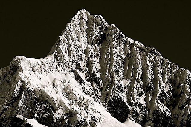
ALPAMAYO SUMMIT PHOTOGRAPHED IN 1936 BY ERWIN SCHNEIDER


ERWIN SCHNEIDER (1906-1987) Alpamayo ( 5,947m - 19,511 ft) Peru  In  "Alpamayo summit", argentic photo 1936 
 
 
ERWIN SCHNEIDER (1906-1987) 
Alpamayo ( 5,947m - 19,511 ft) 
Peru

In  "Alpamayo summit", argentic photo 1936


The mountain

Alpamayo ( 5,947m - 19,511 ft) possibly named from Quechua words is one of the most conspicuous peaks in the Cordillera Blanca of the Peruvian Andes. Alpamayo Creek originates northwest of it. The Alpamayo lies next to the slightly higher Quitaraju. n July 1966, the German magazine "Alpinismus", published a photo of Alpamayo taken by American photographer Leigh Ortenburger accompanied by an article on a survey among mountaineering experts, who chose Alpamayo as "The Most Beautiful Mountain in the World". Not defined by a single summit Alpamayo has two sharp summits, the North and south, which are separated by a narrow corniced ridge.
The first attempt on Alpamayo's summit was in 1948 by a Swiss expedition. Climbing by way of the heavily corniced North Ridge, the three climbers came within sight of the virgin summit when a large cornice broke under them and they were carried down the precipitous Northwest Face. By some amazing piece of good fortune, the three were neither buried nor injured by the 650 foot fall and they were able to make an 'orderly retreat' from the mountain. In 1951, a Franco-Belgian expedition including George and Claude Kogan claimed to have made the first ascent via the North Ridge. After studying the photos in George Kogan's book The Ascent of Alpamayo, the German team of Günter Hauser, Frieder Knauss, Bernhard Huhn and Horst Wiedmann came to the conclusion that the 1951 team did not reach the actual summit, thereby making their ascent via the South Ridge in 1957 the first. Although the South Ridge is no less steep or dangerous than the North Ridge, it has the advantage of leading directly to the higher south summit. This was written up in Hauser's book White Mountain and Tawny Plain. Although there are several climbing routes on the Southwest Face the most common is known as the Ferrari or Italian Route. It was opened in 1975 by a group of Italian alpinists led by Casimiro Ferrari. It begins at the top of the highest point of the snow slope where the bergshrund separates the upper face on the left and then ascends a steep runnel to the summit ridge. Because of its esthetic beauty, Alpamayo is one of the most climbed mountains in the Andes and the base camp can be a hodge-podge of nationalities. Each year the route is made easy by the first party to ascend the route as they usually leave snow-stakes in place at the belay stations. Then it is just a matter of finding out what length of rope they used so that your rope is long enough to reach each station. In the summer of 1988, they had used 50m ropes.

The photographer
Erwin Hermann Manfred Schneider was an Austrian mountaineer. On July 25, 1928, he was part of the German-Soviet expedition for the first ascent of Lenin Peak. They reach the top with Karl Wien and Eugen Allwein. In 1930, he participated in an expedition in the Himalayas led by Günter Dyhrenfurth to Kangchenjunga. On June 21, 1931, he made the first ascent of Jongsong Peak at 7,462 meters1,2. They climb the Ramthang Chang at 6,802 meters. In 1932 and 1936, he took part in two expeditions organized by the German-Austrian Alpine Club (DuOeAV). During these expeditions, Schneider and his companions made about ten first ascents.

___________________________________________
2022 - Wandering Vertexes...
by Francis Rousseau

Friday, May 13, 2022

ALEXANDRA PEAK AND MARGHERITA PEAK BY VITTORIO SELLA


VITTORIO SELLA (1859-1943) Alexandra Peak / Mount Stanley (5,091m - 16,703 ft) Congo - Uganda border    In Alexandra peak and Margherita peak from the Stanley Plateau, photo, 1906


VITTORIO SELLA (1859-1943)
Alexandra Peak / Mount Stanley (5, 091m - 16,703 ft)
Margherita Peak / mount stanley (5,109 m-16,763 ft)
Congo - Uganda border

  In Alexandra peak  and Margherita peak from the Stanley Plateau, photo, 1906


The mountain
Alexandra Peak (5,091m - 16,703ft) is part of Mount Stanley located in the Rwenzori range, the highest mountain of both Democratic Republic of the Congo and Uganda, and the third highest in Africa, after Mount Kilimanjaro (5,895 m -19,340ft) and Mount Kenya (5,199 m - 17,057ft).
Mount Stanley consists of two twin summits and several lower peaks which are :
Margherita Peak (5,109m - 16,763ft), Alexandra Peak (5,091m - 16,703ft), Albert Peak (5,087m - 16,690ft), Savoia Peak (4,977m - 16,330ft), Ellena Peak (4,968m -16,300ft), Elizabeth Peak (4,929m - 16,170 ft), Phillip Peak (4,920m - 16,140ft), Moebius Peak (4,916m - 16,130 ft) and Great Tooth (4,603m - 15,100ft).
The peak and several other surrounding peaks are high enough to support glaciers. Mount Stanley is named for the journalist and explorer, Sir Henry Morton Stanley. It is part of the Rwenzori Mountains National Park, a UNESCO world Heritage Site.
Mt. Stanley was first climbed in 1906 by the Prince Luigi Amedeo di Savoia , Duke of the Abruzzi, (1873-1933), J. Petigax, C. Ollier, and J. Brocherel. He is known as well for his Arctic explorations and for his mountaineering expeditions, particularly to Mount Saint Elias (Alaska–Yukon) and K2 (Pakistan–China). Margherita Peak is named after Queen Margherita of Italy the prince's cousin.
The Rwenzori Mountains National Park is considered a model for integration of cultural values into the Protected Area Management framework as an innovative approach to resource management, the first of its kind in Africa. As a result the local communities have embraced collaborative resource management initiatives. Given its significance as one of the biodiversity hotspots in the Albertine Rift, various local and international NGOs have supported the management and conservation of the property. A General Management Plan guides management operations on-site. Key challenges to address include illegal felling of trees, snow recession due to global warming, human population pressure adjacent to the property and management of waste generated through tourism operations. UWA is addressing the above threats through resource protection, community conservation education, research and ranger-based monitoring, ecotourism and transboundary initiatives with the DRC. The long-term maintenance of the integrity of the property will be achieved through sustainable financing, ecological monitoring, continued collaboration with key stakeholders and regional cooperation.

The artist
Vittorio Sella is a mountain italian climber and photographer who took his passion for mountains from his uncle, Quintino Sella, founder of the Italian Alpine Club. He accomplished many remarkable climbs in the Alps, the first wintering in the Matterhorn and Mount Rose (1882) and the first winter crossing of Mont Blanc (1888) and Les Rouies (1900).
He took part in various expeditions outside Italy:
- Three in the Caucasus in 1889, 1890 and 1896 where a summit still bears his name;
- The ascent of Mount Saint Elias in Alaska in 1897;
- Sikkim and Nepal in 1899;
- Possibly climb Mount Stanley in Uganda in 1906 during an expedition to the Rwenzori;
- Recognition at K2 in 1909;
- In Morocco in 1925.
During expeditions in Alaska, Uganda and Karakoram, he accompanied the Duke of Abruzzi, Prince Luigi Amedeo di Savoia.
Sella continues the practice of climbing into his old age, completing his final attempt in the Matterhorn at the age of 76; a climb he had to interrupt the rise following an accident in which one of his guides injured. He died in his hometown during World War II. His photographic collection is now managed by the Sella Foundation.
His photos mountain are still considered today to be among the finest ever made.
Jim Curran believes that "Sella remains probably the greatest photographer of the mountain. His name is synonymous with technical perfection and aesthetic refinement. "
The quality of the pictures of Vittorio Sella is partly explained by the use of a view camera 30 × 40 cm, despite the difficulty of the transportation of such a device, both heavy and fragile in places inaccessible; to be able to transport it safely, he had to make special pieces that can be stored in saddle bags. His photographs have been widely distributed, either through the press or in the galleries, and were unanimously celebrated; Ansel Adams, who was able to admire thirty-one in an exhibition that was organized at Sella American Sierra Club, said they inspired him "a religious kind of sense of wonder." Many of his pictures were taken in the mountains for the very first time in the History, which give them a much artistic, historical but also scientific value ; for example, one could measure the decline in the Rwenzori glaciers in Central Africa.
___________________________

2022 - Wandering Vertexes...
by Francis Rousseau

Thursday, March 31, 2022

PICO DE ORIZABA / CILALTÉPETL PAINTED BY DIEGO RIVERA

DIEGO RIVERA (1886-1957) Pico de Orizaba / Citlaltépetl (5,636 m -18,491 ft)  Mexico (Vera Cruz)
 
DIEGO RIVERA (1886-1957)
Pico de Orizaba / Citlaltépetl (5,636 m -18,491 ft) 
Mexico (Vera Cruz)


The mountain
Pico de Orizaba (5,636 m -18,491 ft) also known as Citlaltépetl is a stratovolcano, the highest mountain in Mexico and the third highest in North America, after Denali of Alaska in the United States and Mount Logan of Canada. It rises in the eastern end of the Trans-Mexican Volcanic Belt, on the border between the states of Veracruz and Puebla. The volcano is currently dormant but not extinct, with the last eruption taking place during the 19th century. It is the second most prominent volcanic peak in the world after Africa's Mount Kilimanjaro. Pico de Orizaba was important in pre-Hispanic cultures, such as those of the Nahuatl-speaking Aztecs and the Totonacs. The volcano is part of many native mythologies. Pico de Orizaba is located 200 kilometres (120 mi) east of Mexico City and approximately 480 kilometres (300 mi) south of the Tropic of Cancer. A companion peak lying about six km to the southwest of Pico de Orizaba is the Sierra Negra, at 4,640 metres (15,223 ft). Pico de Orizaba is one of only three volcanoes in México that continue to support glaciers and is home to the largest glacier in Mexico, Gran Glaciar Norte. Orizaba has nine known glaciers: Gran Glaciar Norte, Lengua del Chichimeco, Jamapa, Toro, Glaciar de la Barba, Noroccidental, Occidental, Suroccidental, and Oriental. Pico de Orizaba, like the Sierra Madre Oriental, forms a barrier between the coastal plains of the Gulf of Mexico and the Mexican Plateau. The volcano blocks the moisture from the Gulf of Mexico from saturating central Mexico and influences the climates of both areas. Both the state of Veracruz and Puebla depend on Pico de Orizaba for supplying fresh water. The largest river originating on the volcano is the Jamapa River.

The painter
Diego María de la Concepción Juan Nepomuceno Estanislao de la Rivera y Barrientos Acosta y Rodríguez, known as Diego Rivera was a prominent Mexican painter. His large frescoes helped establish the Mexican mural movement in Mexican art. Between 1922 and 1953, Rivera painted murals in, among other places, Mexico City, Chapingo, Cuernavaca, San Francisco, Detroit, and New York City. In 1931, a retrospective exhibition of his works was held at the Museum of Modern Art in New York. Rivera had a volatile marriage with fellow Mexican artist Frida Kahlo. In 1926, Rivera became a member of AMORC, the Ancient Mystical Order Rosae Crucis, an occult organization founded by American occultist Harvey Spencer Lewis. In 1926, Rivera was among the founders of AMORC's Mexico City lodge, called Quetzalcoatl, and painted an image of Quetzalcoatl for the local temple. In 1954, when he tried to be readmitted into the Mexican Communist Party from which he had previously been excluded because of his support of Trotsky, Rivera had to justify his AMORC activities. The Mexican Communist Party at that time excluded from its ranks members of Freemasonry, and regarded AMORC as suspiciously similar to Freemasonry. Rivera answered that, by joining AMORC, he wanted to infiltrate a typical “Yankee” organization on behalf of Communism. However, he also claimed that AMORC was “essentially materialist, insofar as it only admits different states of energy and matter, and is based on ancient Egyptian occult knowledge from Amenhotep IV and Nefertiti.”
___________________________________________ 


2022 - Wandering Vertexes...
by Francis Rousseau

Tuesday, February 8, 2022

AEOLIS MONS OR MOUNT SHARP BY NASA CURIOSITY MISSION


NASA CURIOSITY MISSION (since 2012) Aeolis Mons or Mount Sharp (5, 500 m - 18, 000 ft) Mars  In at the base of Aeolis Mons on Mars (23 August 2012)

NASA CURIOSITY MISSION (since 2012)
Aeolis Mons or Mount Sharp (5, 500 m - 18, 000 ft)
Mars

From "At the base of Aeolis Mons on Mars ", photo, 23 August 2012


The mountain
Aeolis Mons (5, 500 m - 18, 000 ft) also called Mount Sharp is a mountain on the surface of the planet Mars. It forms the central peak within Gale crater and is located around 5.08°S 137.85°E, rising 5.5 km (18,000 ft) high from the valley floor. Aeolis Mons is about the same height as Mons Huygens, the tallest lunar mountain, and taller than Mons Hadley visited by Apollo 15. The tallest mountain known in the Solar System is in Rheasilvia crater on the asteroid Vesta, which contains a central mound that rises 22 km or 22.000 m - 14 mi or 72,000 ft high.
Olympus Mons on Mars is nearly the same height, at 21.9 km (13.6 mi; 72,000 ft) high.
In comparison, Mount Everest / Chomolunga rises to 8.8 km -29,000 ft altitude above sea level, but is only 4.6 km - 15,000 ft base-to-peak. Africa's Mount Kilimanjaro is about 5.9 km - 19,000 ft altitude above sea level also 4.6 km base-to-peak. America's Denali, also known as Mount McKinley, has a base-to-peak of 5.5 km -18,000 ft. The Franco-Italian Mont Blanc/Monte Bianco is 4.8 km -16,000 ft in altitude above sea level. Mount Fuji, which overlooks Tokyo, Japan, is about 3.8 km -12,000 ft altitude. Compared to the Andes, Aeolis Mons would rank outside the hundred tallest peaks, being roughly the same height as Argentina's Cerro Pajonal; the peak is higher than any above sea level in Oceania, but base-to peak it is considerably shorter than Hawaii's Mauna Kea and its neighbors.
Discovered in the 1970s by NAS, the mountain remained nameless for perhaps 40 years. When it became a likely landing site, it was given various labels; for example, in 2010 a NASA photo caption called it "Gale crater mound". In March 2012, NASA unofficially named it "Mount Sharp", for American geologist Robert P. Sharp. The International Astronomical Union, which is responsible for planetary nomenclature for its participants, names large Martian mountains after the Classical albedo feature in which it is located, not for people. In May 2012 the IAU thus named the mountain Aeolis Mons, and gave the name Aeolis Palus to the crater floor plain between the northern wall of Gale and the northern foothills of the mountain. Despite the official name, NASA and the ESA continue to refer to the mountain as "Mount Sharp" in press conferences and press releases
Aeolis is the ancient name of the Izmir region in western Turkey.

The NASA mission
On August 6, 2012, Curiosity (the Mars Science Laboratory rover) landed in "Yellowknife" Quad of Aeolis Palus, next to the mountain. NASA named the landing site Bradbury Landing on August 22, 2012. Aeolis Mons is a primary goal for scientific study.
On June 5, 2013, NASA announced that Curiosity would begin a 8 km (5.0 mi) journey from the Glenelg area to the base of Aeolis Mons.
On November 13, 2013, NASA announced that an entryway Curiosity would traverse on its way to Aeolis Mons was to be named "Murray Buttes", in honor of planetary scientist Bruce C. Murray (1931–2013). The trip was expected to take about a year and would include stops along the way to study the local terrain.
On September 11, 2014, NASA announced that the Curiosity rover had reached Aeolis Mons, the rover mission's long-term prime destination.
On October 5, 2015, possible recurrent slope lineae, wet brine flows, were reported on Mount Sharp near Curiosity.
As of January 20, 2017, Curiosity has been on the planet Mars for 1585 sols (1628 days) since landing on August 6, 2012. 

___________________________________________
2022 - Wandering Vertexes...
by Francis Rousseau


Tuesday, December 28, 2021

AZHDAHAK VOLCANO PAINTED BY MARTIROS SARYAN

MARTIROS SERGEYEVICH SARYAN (1880-1972) Azhdahak Volcano (3,597 m - 11,801 ft) Armenia   In Gegham Mountains, oil on canvas, Saryan Museum, Erevan


MARTIROS SERGEYEVICH SARYAN (1880-1972)
Azhdahak Volcano (3,597 m - 11,801 ft)
Armenia 

In Gegham Mountains, oil on canvas, Saryan Museum, Erevan

The volcano
Azhdahak (Աժդահակ)  (3,597 m - 11,801 ft) is a volcano in Armenia, the highest point of Gegham mountains.  It is part of the Ghegam Ridge volcanic field, which last erupted at 1900 BC ± 1000. There is a lake in the crater of volcano Azhdahak that is formed from melting snow. From the top of the mountain opens the pictorial landscape of mountains Ararat, Hatis, Ara, Aragats, Lake Sevan, the whole Gegham mountains and the Kotayk valley. In the surroundings of Azhdahak there is a lake, Akna  of volcanic origin. “Akn” means "spring (water)" in Armenian.  A great number of petroglyphs – rock-carvings has been found in the surroundings of Azhdahak. Most images depict men in scenes of hunting and fighting, as well as astronomical bodies and phenomena: the Sun, the Moon, constellations, the stellar sky, lightning, etc.
In Gegham mountains are engaged the cattle breeding people called Yazidi – one of national minorities of Armenia, who move to the mountains for the summer and live in tents with families and even with infants. The Yazidis are an ethno-confessional group, whose main identity is religion; Yazidism or Sharfadin. Nomadic stockbreeding is their major occupation. The Yazidi society is a caste system including three main components: the Shaykhs, the Pirs (clergy) and murids (laymen).
The beauty of the Azhdahak surroundings have long attracted tourists. However, the probability of running across each other different hiking groups is insignificant. It depends on the remoteness from the civilization, orientation complexities, that aggravate with weather condition factors, such as: thunder and lightning, hail and snow, fog with visibility down to 2-3m.

The painter
Martiros Saryan ( Մարտիրոս Սարյան) was the founder of a modern Armenian national school of painting. In 1895, aged 15, he completed the Nakhichevan school and from 1897 to 1904 studied at the Moscow School of Arts, including in the workshops of Valentin Serov and Konstantin Korovin. He was heavily influenced by the work of Paul Gauguin and Henri Matisse. He exhibited his works in various shows. He had works shown at the Blue Rose Exhibit in Moscow.
He first visited Armenia, then part of the Russian Empire, in 190. He composed his first landscapes depicting Armenia (1902-1903- which were highly praised in the Moscow press.
From 1910 to 1913 he traveled extensively in Turkey, Egypt and Iran. In 1915 he went to Echmiadzin to help refugees who had fled from the Armenian genocide in the Ottoman Empire.
In 1916 he traveled to Tiflis (now Tbilisi) where he married Lusik Agayan. It was there that he helped organise the Society of Armenian Artists.
After the Bolshevik seizure of power in 1917 he went with his family to live in Russia. In 1921 they moved to Armenia. While most of his work reflected the Armenian landscape, he also designed the coat of arms for Armenian SSR and designed the curtain for the first Armenian state theatre.
From 1926–1928 he lived and worked in Paris, but most works from this period were destroyed in a fire on board the boat on which he returned to the Soviet Union. From 1928 until his death, Saryan lived in Soviet Armenia.
In the difficult years of the 1930s, he mainly devoted himself again to landscape painting, as well as portraits. He also was chosen as a deputy to the USSR Supreme Soviet and was awarded the Order of Lenin three times and other awards and medals. He was a member of the USSR Art Academy (1974) and Armenian Academy of Sciences (1956).
Saryan died in Yerevan on 5 May 1972. His former home in Yerevan is now a museum dedicated to his work with hundreds of items on display. He was buried in Yerevan at the Pantheon next to Komitas Vardapet.
___________________________________________
2021 - Wandering Vertexes...
by Francis Rousseau

Sunday, October 24, 2021

ILLINIZAS VOLCANOES SKETCHED BY FREDERIC EDWIN CHURCH (1826-1900)

FREDERIC EDWIN CHURCH (1826-1900), Illiniza Sur  (5,248 m-17, 218ft) Illiniza Norte 5,126 m-16, 818ft) Ecuador   In Mount Iliniza, Ecuador, July 3, 1857,  Graphite, brush and white gouache on green paper, 31.1 x 43.2 cm, Smithsonian / Cooper Hewitt, Smithsonian Design Museum

FREDERIC EDWIN CHURCH (1826-1900),
Illiniza Sur  (5,248 m-17, 218ft)
Illiniza Norte 5,126 m-16, 818ft)
Ecuador

 In Mount Iliniza, Ecuador, July 3, 1857,  Graphite, brush and white gouache on green paper, 31.1 x 43.2 cm, Smithsonian / Cooper Hewitt, Smithsonian Design Museum 


The volcanoes
The Illinizas are a pair of volcanic mountains that are located to the south of Quito, Ecuador. They are located in the Illinizas Ecological Reserve (Reserva Ecológica Los Illinizas). These twin mountains are separated by a saddle that is about a kilometer long. The peaks are among the highest in Ecuador, with Illiniza Sur (5248 m-17, 218ft) standing slightly taller than Illiniza Norte 5126 m- 16, 818ft) its northern counterpart.
Most guidebooks (for example, Lonely Planet Ecuador, Ecuador: A Climbing Guide) spell the mountain with only one "l" as in Iliniza. The name Illinizas is derived from the Kunza words for "masculine hill."
Whilst Illiniza Sur (the southern peak) is a more difficult climb due to its glacial nature, Illiniza Norte requires little or no climbing expertise, and may be climbed as a trekking peak. A guide is still recommended, however, as the path becomes hard to navigate as it approaches the summit.
The Illinizas are excellent mountains for acclimatization to altitude, and are frequently used as a preparatory climb to higher peaks such as Cotopaxi, Chimborazo and Cayambe.
There is a rustic refuge located between the north and south peaks. It can be reached in one hour by car from El Chaupi, followed by a three-hour climb. The refuge has gas stoves, pots and pans and bunk beds. It is necessary to bring warm sleeping bags and food, but water is available to be boiled. The Englishman Edward Whymper tried and failed twice to make the first ascent of Iliniza Sur. It was climbed for the first time in 1880 by his two Italian guides Jean-Antoine Carrel and Louis Carrel. The first ascent of Iliniza Norte was made in 1912 by the Ecuadorians Nicolás Martínez and Alejandro Villavicencio.


The painter

Frederic Edwin Church was an American landscape painter born in Hartford, Connecticut. He was a central figure in the Hudson River School of American landscape painters, perhaps best known for painting large panoramic landscapes, often depicting mountains, waterfalls, and sunsets, but also sometimes depicting dramatic natural phenomena that he saw during his travels to the Arctic and Central and South America. Church's paintings put an emphasis on light and a romantic respect for natural detail. In his later years, Church painted classical Mediterranean and Middle Eastern scenes and cityscapes.
Church was the product of the second generation of the Hudson River School and the pupil of Thomas Cole, the school’s founder. The Hudson River School was established by the British Thomas Cole when he moved to America and started painting landscapes, mostly of mountains and other traditional American scenes. Both Cole and Church were devout Protestants and the latter's beliefs played a role in his paintings especially his early canvases. Church did differ from Cole in the topics of his paintings: he preferred natural and often majestic scenes over Cole's propensity towards allegory.
Church, like most second generation Hudson River School painters, used extraordinary detail, romanticism, and luminism in his paintings. Romanticism was prominent in Britain and France in the early 1800s as a counter-movement to the Enlightenment virtues of order and logic. Artists of the Romantic period often depicted nature in idealized scenes that depicted the richness and beauty of nature, sometimes also with emphasis on the grand scale of nature.
This tradition carries on in the works of Frederic Church, who idealizes an uninterrupted nature, highlighted by creating excruciatingly detailed art. The emphasis on nature is encouraged by the low horizontal lines, and preponderance of sky to enhance the wilderness; humanity, if it is represented, is depicted as small in comparison with the greater natural reality. The technical skill comes in the form of luminism, a Hudson River School innovation particularly present in Church's works. Luminism is also cited as encompassing several technical aspects, which can be seen in Church’s works. One example is the attempt to “hide brushstrokes,” which makes the scene seem more realistic and lessen the artist’s presence in the work. Most importantly is the emphasis on light (hence luminism) in these scenes. The several sources of light create contrast in the pictures that highlights the beauty and detailed imagery in the painting.

___________________________________________
2021 - Wandering Vertexes...
by Francis Rousseau


Wednesday, September 8, 2021

MOUNT KILIMANDJARO PAINTED BY PILLY TURNER

PILLY TURNER (active 1955-1970)
 Kilimandjaro (5,885m - 19,340ft)n 
Tanzania,  In Kilimandjaro from Tanzania's Lake Chala, oil on canvas, 1961, Private Collection

PILLY TURNER (active 1955-1970)

Kilimandjaro (5,885m - 19,340ft)

Tanzania

In Kilimandjaro from Tanzania's Lake Chala, oil on canvas, 1961, Private Collection 


The mountain

Mount Kilimanjaro (5,885m - 19, 340ft) is a dormant volcano in Tanzania composed of three volcanic cones, "Kibo", "Mawenzi", and "Shira. The Kilimandjaro is the highest mountain in Africa. The first recorded ascent to the summit was by Hans Meyer and Ludwig Purtscheller in 1889.
The mountain is part of the Kilimanjaro National Park and is a major climbing destination. The mountain has been the subject of many scientific studies because of its shrinking glaciers, especially since 200.
The origin of the name "Kilimanjaro" is not precisely known, but a number of theories exist. European explorers had adopted the name by 1860 and reported that "Kilimanjaro" was the mountain's Kiswahili name. The 1907 edition of The Nuttall Encyclopædia also records the name of the mountain as "Kilima-Njaro", as well as the title of the watercolor above. Johann Ludwig Krapf wrote in 1860 that Swahilis along the coast called the mountain Kilimanjaro. Although he did not support his claim, he claimed that "Kilimanjaro" meant either "mountain of greatness" or "mountain of caravans". Under the latter meaning, "Kilima" meant "mountain" and "Jaro" possibly meant "caravans". Jim Thompson claimed in 1885, although he also did not support his claim, that the term Kilima-Njaro "has generally been understood to mean" the Mountain (Kilima) of Greatness (Njaro). Though not improbably it may mean the "White" mountain. "Njaro" is an ancient Kiswahili word for "shining". Others have assumed that "Kilima" is Kiswahili for "mountain".
In the 1880s, the mountain became a part of German East Africa and was called "Kilima-Ndscharo" in German following the Kiswahili name components.
On 6 October 1889, Hans Meyer reached the highest summit on the crater ridge of Kibo. He named it "Kaiser-Wilhelm-Spitze" ("Kaiser Wilhelm peak").
That name apparently was used until Tanzania was formed in 1964, when the summit was renamed "Uhuru", meaning "Freedom Peak" in Kiswahili.The mountain Mount Kilimanjaro (5,885m - 19, 340ft) is a dormant volcano in Tanzania composed of three volcanic cones, "Kibo", "Mawenzi", and "Shira. The Kilimandjaro is the highest mountain in Africa. The first recorded ascent to the summit was by Hans Meyer and Ludwig Purtscheller in 1889.
The mountain is part of the Kilimanjaro National Park and is a major climbing destination. The mountain has been the subject of many scientific studies because of its shrinking glaciers, especially since 2000....


The artist

Pilly Turner is a kenyan watercolourist, active during the 1955-1970 's. The watercolor she painted are always very realistic, and with exemples of wild life animals and animals of the country. There are no other information available about this artist and only a few amount of paintings on the art market (more than 10).


___________________________________________


2021 - Wandering Vertexes...

by Francis Rousseau 


Friday, August 20, 2021

EL COTOPAXI PAINTED BY FREDERIC EDWIN CHURCH


FREDERIC EDWIN CHURCH (1826-1900) Cotopaxi (5, 897 m - 19, 347 ft) Ecuador   In Cotopaxi Seen from Ambato, 1853, Medium/ Brush and oil paint, graphite on paperboard, 17.5 × 28.9 cm Smithsonian/ Cooper Hewitt, Smithsonian

FREDERIC EDWIN CHURCH (1826-1900)
Cotopaxi (5, 897 m - 19, 347 ft)
Ecuador

In Cotopaxi Seen from Ambato, 1853,  Brush and oil paint, graphite on paperboard, 17.5 × 28.9 cm Smithsonian-Cooper Hewitt


About the Cotopaxi paintings
Church has painted such a lot of times the Cotopaxi than you must have a second look to determine it the one you are looking at is the good one or a new view.
Church took two trips to South America, and stayed predominantly in Quito, Ecuador, the first in 1853 and the second in 1857. One trip was financed by businessman Cyrus West Field, who wished to use Church's paintings to lure investors to his South American ventures. Church was inspired by the Prussian polymath geographer Alexander von Humboldt's Cosmos (about “the Earth, matter, and space”) and his exploration of the continent in the early 1800s; Humboldt had challenged artists to portray the "physiognomy" of the Andes. After Humboldt’s Personal Narrative of Travels to the Equinoctial Regions of America was published in 1852, Church jumped at the chance to travel and study in his icon’s footsteps (literally, as he stayed in Humboldt’s old house) in Quito, Ecuador. When Church returned in 1857 he added to his landscape paintings of the area. After both trips, Church had produced four landscapes of Ecuador: The Andes of Ecuador (1855), Cotopaxi (1855), Cayambe (1858), The Heart of the Andes (1859), and Cotopaxi while erupting in 1862 (see above). The Heart of The Andes as week as the Cotopaxi paintings are precious and precise documentation, scientific studies of every natural feature that exists in that area of the Andes. Every species of plant and animal is readily identifiable; even climatic zonation by altitude is delineated precisely.
In this way, Church pays a unique tribute to Humboldt (who inspired his journey) as well as maintains his Hudson River School roots. “Therefore instead of the fiery crimsons and oranges of his emotional crepuscular scenes, the palette here is comparatively restrained by Church's standards: quiet greens, blues, browns, ochres and subdued grayish purples of sky, stone, verdure and water in full, even daylight.”

The mountain

Cotopaxi (5,897 m - 19,347 ft) is an active stratovolcano in the Andes Mountains, located in the Latacunga canton of Cotopaxi Province, about 50 km (31 mi) south of Quito, and 33 km (21 mi) northeast of the city of Latacunga, Ecuador, in South America. It is the second highest summit in Ecuador, reaching a height of 5,897 m (19,347 ft). It is one of the world's highest volcanoes. Many sources claim that Cotopaxi means "Neck of the Moon" in an indigenous language, but this is unproven. The mountain was honored as a "Sacred Mountain" by local Andean people, even prior to the Inca invasion in the 15th century.
Most of the time, Cotopaxi is clearly visible on the skyline from Quito and is part of the chain of volcanoes around the Pacific plate known as the Pacific Ring of Fire. It has an almost symmetrical cone that rises from a highland plain of about 3,800 metres (12,500 ft), with a width at its base of about 23 kilometres (14 mi). It has one of the few equatorial glaciers in the world, which starts at the height of 5,000 metres (16,400 ft). At its summit, Cotopaxi has an 800 X 550 m wide crater which is 250 m deep. The crater consists of two concentric crater rims, the outer one being partly free of snow and irregular in shape. The crater interior is covered with ice cornices and rather flat. The highest point is on the outer rim of the crater on the north side.
The first recorded eruption of Cotopaxi was in 1534. With 87 known eruptions since then, Cotopaxi is one of Ecuador's most active volcanoes.

The painter

Frederic Edwin Church was an American landscape painter born in Hartford, Connecticut. He was a central figure in the Hudson River School of American landscape painters, perhaps best known for painting large panoramic landscapes, often depicting mountains, waterfalls, and sunsets, but also sometimes depicting dramatic natural phenomena that he saw during his travels to the Arctic and Central and South America. Church's paintings put an emphasis on light and a romantic respect for natural detail. In his later years, Church painted classical Mediterranean and Middle Eastern scenes and cityscapes.
Church was the product of the second generation of the Hudson River School and the pupil of Thomas Cole, the school’s founder. The Hudson River School was established by the British Thomas Cole when he moved to America and started painting landscapes, mostly of mountains and other traditional American scenes. Both Cole and Church were devout Protestants and the latter's beliefs played a role in his paintings especially his early canvases. Church did differ from Cole in the topics of his paintings: he preferred natural and often majestic scenes over Cole's propensity towards allegory.
Church, like most second generation Hudson River School painters, used extraordinary detail, romanticism, and luminism in his paintings. Romanticism was prominent in Britain and France in the early 1800s as a counter-movement to the Enlightenment virtues of order and logic. Artists of the Romantic period often depicted nature in idealized scenes that depicted the richness and beauty of nature, sometimes also with emphasis on the grand scale of nature.
This tradition carries on in the works of Frederic Church, who idealizes an uninterrupted nature, highlighted by creating excruciatingly detailed art. The emphasis on nature is encouraged by the low horizontal lines, and preponderance of sky to enhance the wilderness; humanity, if it is represented, is depicted as small in comparison with the greater natural reality. The technical skill comes in the form of luminism, a Hudson River School innovation particularly present in Church's works. Luminism is also cited as encompassing several technical aspects, which can be seen in Church’s works. One example is the attempt to “hide brushstrokes,” which makes the scene seem more realistic and lessen the artist’s presence in the work. Most importantly is the emphasis on light (hence luminism) in these scenes. The several sources of light create contrast in the pictures that highlights the beauty and detailed imagery in the painting.

___________________________________________
2021 - Wandering Vertexes...
by Francis Rousseau

Monday, August 16, 2021

ALPAMAYO PHOTOGRAPHED BY LEIGH ORTENBURGER

LEIGH ORTENBURGER (1929- 1991), Alpamayo ( 5,947m - 19,511 ft),  Peru,   In  "Cordillera Blanca - Alpamayo - Peru, South West face" , 1959 et 1960 , blanc and white photos published in 1966,  Courtsesy Stanford University Archives

LEIGH ORTENBURGER (1929- 1991), Alpamayo ( 5,947m - 19,511 ft),  Peru,   In  "Cordillera Blanca - Alpamayo - Peru, South West face" , 1959 et 1960 , blanc and white photos published in 1966,  Courtsesy Stanford University Archives
 

LEIGH ORTENBURGER (1929-1991)
Alpamayo (5,947m - 19,511 ft)
Peru

In Cordillera Blanca - Alpamayo - Peru, South West face, 1959 et 1960, black and white photos published in 1966, Courtsesy Stanford University Archives and collections


About the photo
In the July 1966 issue of the German magazine Alpinismus, a photo taken by American photographer Leigh Ortenburger, accompanied by an article resulting from an international survey among climbers and photographers, chose Alpamayo as "The Most Beautiful Mountain in the World." The photo (above) was of its Southwest Face which is a steep, almost perfect pyramid of ice? Although slightly smaller than many of its neighboring peaks, it is distinguished by its unusual ice runnels and overwhelming beauty especially when seen in the evening alpenglow. Günter Hauser, who made the first ascent, wrote: "As we pitched our tents the sun went down and Alpamayo became a kaleidoscope of swiftly-changing colour altogether becoming suffused with the pale lunar radiance of the evening before against the background of the dark blue sky with its diadem of stars."
This mountain was first photographed in 1936 by Erwin Schneider.

The photographer
Leigh Ortenburger (1929-1991) climbed and photographed for more than forty years in the world's greatest mountain ranges. He graduated from the University of Oklahoma in 1952 with a degree in mathematics, and earned a master’s degree in mathematics from the University of California at Berkeley in 1953 and a second in statistics from Stanford in 1963, where he did additional work toward a Ph.D. He worked several years as a Teton mountain guide and served a two-year stint in the Army before settling into a career as a mathematician with Sylvania. His classic guidebook, A Climber’s Guide to the Teton Range, is now in its third edition. Ortenburger’s extensive knowledge of the terrain equipped him to play a key role in the rescue of two climbers trapped on the North Face of the Grand Teton in 1967. Together with fellow climber Irene Beardsley, whom he met through the student-run Stanford Alpine Club in the 1950s, he raised a family in Palo Alto, California. He died October 20, 1991, in the firestorm that swept the Oakland, California hills.
No less impressive than the photographs of Alpamayo themselves is the process of making them, said Glen Denny, also a mountaineering photographer:  “Few realize the difficulty of creating images like Ortenburger's. During hard climbs, while others rested, he performed a painstaking ritual countless times: Plunge the tripod legs into soft snow until they are solid, mount and level the camera, select and attach the lens, huddle under the head cloth while composing the dim, upside-down image on the ground glass, with the wind snatching at the cloth and shaking the camera. Then take off your gloves and spin the delicate dials on the light meter, calibrate the exposure, set the aperture, and cock the shutter, while your fingers still have feeling left. Insert the film holder, pull out the slide, squeeze the cable release--very gently--and replace the slide. There! One shot taken.”

The mountain
Alpamayo ( 5,947m - 19,511 ft) possibly named from Quechua words is one of the most conspicuous peaks in the Cordillera Blanca of the Peruvian Andes. Alpamayo Creek originates northwest of it. The Alpamayo lies next to the slightly higher Quitaraju. n July 1966, the German magazine "Alpinismus", published a photo of Alpamayo taken by American photographer Leigh Ortenburger accompanied by an article on a survey among mountaineering experts, who chose Alpamayo as "The Most Beautiful Mountain in the World". Not defined by a single summit Alpamayo has two sharp summits, the North and south, which are separated by a narrow corniced ridge.
The first attempt on Alpamayo's summit was in 1948 by a Swiss expedition. Climbing by way of the heavily corniced North Ridge, the three climbers came within sight of the virgin summit when a large cornice broke under them and they were carried down the precipitous Northwest Face. By some amazing piece of good fortune, the three were neither buried nor injured by the 650 foot fall and they were able to make an 'orderly retreat' from the mountain. In 1951, a Franco-Belgian expedition including George and Claude Kogan claimed to have made the first ascent via the North Ridge. After studying the photos in George Kogan's book The Ascent of Alpamayo, the German team of Günter Hauser, Frieder Knauss, Bernhard Huhn and Horst Wiedmann came to the conclusion that the 1951 team did not reach the actual summit, thereby making their ascent via the South Ridge in 1957 the first. Although the South Ridge is no less steep or dangerous than the North Ridge, it has the advantage of leading directly to the higher south summit. This was written up in Hauser's book White Mountain and Tawny Plain. Although there are several climbing routes on the Southwest Face the most common is known as the Ferrari or Italian Route. It was opened in 1975 by a group of Italian alpinists led by Casimiro Ferrari. It begins at the top of the highest point of the snow slope where the bergshrund separates the upper face on the left and then ascends a steep runnel to the summit ridge. Because of its esthetic beauty, Alpamayo is one of the most climbed mountains in the Andes and the base camp can be a hodge-podge of nationalities. Each year the route is made easy by the first party to ascend the route as they usually leave snow-stakes in place at the belay stations. Then it is just a matter of finding out what length of rope they used so that your rope is long enough to reach each station. In the summer of 1988, they had used 50m ropes.
___________________________________________

2021 - Wandering Vertexes...
by Francis Rousseau


Sunday, April 18, 2021

THE MOUNT STANLEY BY VITTORIO SELLA


VITTORIO SELLA (1859-1943)
Margherita Peak / Mont Stanley (5,109 m-16,763 ft)
Congo - Uganda border

In Mt Stanley from the Esward Peak of Mt Baker - Photographed in 1906 during the Duke of Abruzzi expedition


The Mountain
Mount Stanley (5,109 m -16,762 ft) is located in the Rwenzori range and is the highest mountain of both the Democratic Republic of the Congo and Uganda, and the third highest in Africa, after Mount Kilimanjaro (5,895 m -19,340ft) and Mount Kenya (5,199 m - 17,057ft). The peak and several other surrounding peaks are high enough to support glaciers. Mount Stanley is named for the journalist and explorer, Sir Henry Morton Stanley. It is part of the Rwenzori Mountains National Park, a UNESCO world Heritage Site.
Mt. Stanley consists of two twin summits and several lower peaks which are :
Margherita Peak (5,109m - 16,763ft), Alexandra Peak (5,091m - 16,703ft), Albert Peak (5,087m - 16,690ft), Savoia Peak (4,977m - 16,330ft), Ellena Peak (4,968m -16,300ft), Elizabeth Peak (4,929m - 16,170 ft), Phillip Peak (4,920m - 16,140ft), Moebius Peak (4,916m - 16,130 ft) and Great Tooth (4,603m - 15,100ft).
Mt. Stanley was first climbed in 1906 by the Prince Luigi Amedeo di Savoia , Duke of the Abruzzi, (1873-1933), J. Petigax, C. Ollier, and J. Brocherel. He is known as well for his Arctic explorations and for his mountaineering expeditions, particularly to Mount Saint Elias (Alaska–Yukon) and K2 (Pakistan–China). Margherita Peak is named after Queen Margherita of Italy the prince's cousin.
The Rwenzori Mountains National Park is considered a model for integration of cultural values into the Protected Area Management framework as an innovative approach to resource management, the first of its kind in Africa. As a result the local communities have embraced collaborative resource management initiatives. Given its significance as one of the biodiversity hotspots in the Albertine Rift, various local and international NGOs have supported the management and conservation of the property. A General Management Plan guides management operations on-site. Key challenges to address include illegal felling of trees, snow recession due to global warming, human population pressure adjacent to the property and management of waste generated through tourism operations. UWA is addressing the above threats through resource protection, community conservation education, research and ranger-based monitoring, ecotourism and transboundary initiatives with the DRC. The long-term maintenance of the integrity of the property will be achieved through sustainable financing, ecological monitoring, continued collaboration with key stakeholders andregional cooperation.

The photographer
Vittorio Sella is a mountain italian climber and photographer who took his passion for mountains from his uncle, Quintino Sella, founder of the Italian Alpine Club. He accomplished many remarkable climbs in the Alps, the first wintering in the Matterhorn and Mount Rose (1882) and the first winter crossing of Mont Blanc (1888).
He took part in various expeditions outside Italy:
- Three in the Caucasus in 1889, 1890 and 1896 where a summit still bears his name;
- The ascent of Mount Saint Elias in Alaska in 1897
- Sikkim and Nepal in 1899
- Possibly climb Mount Stanley in Uganda in 1906 during an expedition to the Rwenzori
- Recognition at K2 and Mustagh Tower in 1909
- In Morocco in 1925.
During expeditions in Alaska, Uganda and Karakoram (K2-Chogolisa), he accompanied the Duke of Abruzzi, Prince Luigi Amedeo di Savoia.
Sella continues the practice of climbing into his old age, completing his final attempt in the Matterhorn at the age of 76; a climb he had to interrupt the rise following an accident in which one of his guides injured. He died in his hometown during World War II. His photographic collection is now managed by the Sella Foundation.
His photos mountain are still considered today to be among the finest ever made.
Jim Curran believes that "Sella remains probably the greatest photographer of the mountain. His name is synonymous with technical perfection and aesthetic refinement. "
The quality of the pictures of Vittorio Sella is partly explained by the use of a view camera 30 × 40 cm, despite the difficulty of the transportation of such a device, both heavy and fragile in places inaccessible; to be able to transport it safely, he had to make special pieces that can be stored in saddle bags. His photographs have been widely distributed, either through the press or in the galleries, and were unanimously celebrated; Ansel Adams, who was able to admire thirty-one in an exhibition that was organized at Sella American Sierra Club, said they inspired him "a religious kind of sense of wonder." Many of his pictures were taken in the mountains for the very first time in the History, which give them a much artistic, historical but also scientific value ; for example, one could measure the decline in the Rwenzori glaciers in Central Africa.

___________________________________________
2021 - Wandering Vertexes...
by Francis Rousseau

Saturday, January 16, 2021

POPOCATEPETL AND IZTACCHIHUATL (6) PAINTED BY JOSÉ MARIRA VELASCO


JOSE MARIA VELASCO (1840-1912)
Popocatépetl (5, 426 m -17, 802 ft) on left)
Iztaccíhuatl (5,230 m - 17,160 ft) (on right)
Mexico

In Popocatepetl and Iztacchihuatl , 1895, watercolor, The José María Velasco Museum, Mexico


The volcanoes
Popocatépetl (5,426 m - 17,802 ft), on right in this painting, is an active volcano, located in the states of Puebla, Mexico, and Morelos, in Central Mexico, and lies in the eastern half of the Trans-Mexican volcanic belt. The name Popocatépetl comes from the Nahuatl words Popōca (It smokes) and Tepētl (mountain), meaning Smoking Mountain. It is the second highest peak in Mexico, after Citlaltépetl (Pico de Orizaba) at 5,636 m (18,491 ft).
It is linked to the Iztaccihuatl volcano to the north by the high saddle known as the Paso de Cortés.
Popocatépetl is 70 km (43 mi) southeast of Mexico City, from where it can be seen regularly, depending on atmospheric conditions. Until recently, the volcano was one of three tall peaks in Mexico to contain glaciers, the others being Iztaccihuatl and Pico de Orizaba.
Iztaccíhuatl (5,230 m - 17,160 ft) is dormant volcanic mountain in Mexico located on the border between the State of Mexico and Puebla. It is the nation's third highest, after Pico de Orizaba 5,636 m (18,491 ft) and Popocatépetl 5,426 m (17,802 ft). The name "Iztaccíhuatl" is Nahuatl for "White woman", reflecting the four individual snow-capped peaks which depict the head, chest, knees and feet of a sleeping female when seen from east or west.The peak is sometimes nicknamed La Mujer Dormida (The Sleeping Woman.) Iztaccíhuatl is to the north of Popocatépetl, to which it is connected by the high altitude Paso de Cortés. Depending on atmospheric conditions Iztaccíhuatl is also visible much of the year from Mexico City some 70 km (43 mi) to the northwest.
The first recorded ascent was made in 1889, though archaeological evidence suggests the Aztecs and previous cultures climbed it previously. It is the lowest peak containing permanent snow and glaciers in Mexico.
In Aztec mythology : Iztaccíhuatl was a princess who fell in love with one of her father's warriors, Popocatépetl. The emperor sent Popocatépetl to war in Oaxaca, promising him Iztaccíhuatl as his wife when he returned (which Iztaccíhuatl's father presumed he would not). Iztaccíhuatl was falsely told that Popocatépetl had died in battle, and believing the news, she died of grief. When Popocatépetl returned to find his love dead, he took her body to a spot outside Tenochtitlan and kneeled by her grave. The gods covered them with snow and changed them into mountains.
Popocatépetl became an active volcano, raining fire on Earth in blind rage at the loss of his beloved.

The painter

José Maria Tranquilino Francisco de Jesus Velasco Gomez Obregуn, generally known as José Maria Velasco, was a 19th-century Mexican polymath, most famous as a painter who made Mexican geography a symbol of national identity through his paintings. He was both one of the most popular artists of the time and internationally renowned. He received many distinctions such as the gold medal of the Mexican National Expositions of Bellas Artes in 1874 and 1876; the gold medal of the Philadelphia International Exposition in 1876, on the centenary of U.S. independence; and the medal of the Paris Universal Exposition in 1889, on the centenary of the outbreak of the French Revolution. His painting El valle de Mexico is considered Velasco's masterpiece, of which he created seven different renditions. Of all the nineteenth-century painters, Velasco was the "first to be elevated in the post-Revolutionary period as an exemplar of nationalism."
Velasco's long career elevated Mexican landscape painting to international standing. One of his landscapes of the Valley of Mexico is in the Vatican Museum, a gift to Pope Leo XIII. His scenes of the Mexican landscape are a visual source for environmental historians, since they show the Valley of Mexico before its degradation in the twentieth century, with air pollution and urban sprawl. His landscape art has a wide appeal, since it is more accessible than history paintings that require the viewer to understand a particular event.
Today the Government of the State of Mexico, where Velasco was from, presents an award for artistic merit in his name to painters born in that state. Among the most outstanding winners are Luis Nishizawa, Leopoldo Flores, Ignacio Barrios and Héctor Cruz.
The José María Velasco Museum was opened in 1992 in Toluca City with the task of preserving and promoting his paintings.

_______________________________

2021 - Wandering Vertexes...
by Francis Rousseau

Wednesday, November 4, 2020

MOUNT ELBRUS/ EASTERN SUMMIT PAINTED BY ILYA NIKOLAEVICH ZANKOVSKY

https://wanderingvertexes.blogspot.com/2020/11/ilya-nikolaevich-zankovsky-1832-1919.html

ILYA NIKOLAEVICH ZANKOVSKY  (1832-1919)
Mount Elbrus / eastern summit (5,621 m-18,442 ft)
Russia

In  Frosty morning in Caucasus, oil on canvas, 1832, Private collection


The mountain 

Mount Elbrus (5,642 m -18,510 ft)should not be confused with the Alborz (also called Elburz) mountains in Iran, which also derive their name from the legendary mountain Harā Bərəzaitī in Persian mythology. A dormant volcano, Elbrus forms part of the Caucasus Mountains in Southern Russia, near the border with Georgia. Elbrus has two summits, both of which are dormant volcanic domes. With its slightly taller west summit, the mountain stands at 5,642 metres ; the east summit (see painting above) is 5,621 metres (18,442 ft). The lower east summit was first ascended on 10 July 1829 by Khillar Khachirov, a Karachayguide for an Imperial Russian army scientific expedition led by General Emmanuel, and the higher in 1874 by an British expedition led by F. Crauford Grove and including Frederick Gardner, Horace Walker, and the Swiss guide Peter Knubel of St. Niklaus in the canton Valais. While there are differing authorities on how the Caucasus are distributed between Europe and Asia, most relevant modern authorities define the continental boundary as the Caucasus watershed, placing Elbrus in Europe due to its position on the north side in Russia. Mount Elbrus was formed more than 2.5 million years ago. The volcano is currently considered inactive. Elbrus was active in the Holocene, and according to the Global Volcanism Program, the last eruption took place about AD 50. Mount Elbrus also called Karachay-Balkar is the highest mountain in Europe, and the seven highest summit in the world. The seven summit (which are obviously 8, with 2 in Europe !) are : Mount Everest (8,848m), Aconcagua (6,961m), Mt Denali or Mc Kinley (6,194m), Kilimandjaro (5,895m), Mt Elbrus (5,642m), Vinson Massif (4,892m), Mt Blanc (4,807m) and Mount Kosciuszko (2,228m) in Australia.

The painter
Ilya Zankovsky was a russian painter and graphic artist who studied as a noncredit student in the Imperial Academy of Arts (IAKh, 1862–1863) and who did not finish the course. Zankovsky lived in Tiflis, served in the Military topographic department of the Caucasus military region. He painted landscapes of the Caucasus (Mount Elbrus (above), Georgian military road, The Darial Gorge, From the main mountain range, Mount Ushba. Hunters halt). He worked a lot in watercolor. His works were shown at the exhibitions of the Caucasian Society for Encouragement of Fine Arts, the Society for mutual aid of Caucasian artists, the Society of Russian Watercolorists, and at the Autumn exhibitions in the halls of the IAKh. Zankovsky taught in the Drawing School under the Caucasian Society for Encouragement of Fine Arts in 1880s–1910s.
In 2009 an exhibition of Zankovsky’s works was held in Moscow. Works by Ilya Zankovsky are in many museum collections, including the State Russian Museum, Odessa Fine Arts Museum, Omsk Regional Museum of Fine Arts named after M. A. Vrubel, and Dagestan Museum of Local History.

_______________________________

2020 - Wandering Vertexes...
by Francis Rousseau


Wednesday, October 21, 2020

POPOCATEPETL PAINTED BY JOSÉ MARIRA VELASCO


JOSÉ MARIA VELASCO (1840-1912) The Popocatépetl (5,426 m -17,802 ft) Mexico  In Popocatepetl and Iztacchihuatl , oil on canvas, Private owner

JOSÉ MARIA VELASCO (1840-1912)
The Popocatépetl (5,426 m -17,802 ft)
Mexico

In Popocatepetl , oil on canvas, Private owner

The mountain
Popocatépetl (5,426 m - 17,802 ft) is an active volcano, located in the states of Puebla, Mexico, and Morelos, in Central Mexico, and lies in the eastern half of the Trans-Mexican volcanic belt. The name Popocatépetl comes from the Nahuatl words popōca (it smokes) and tepētl (mountain), meaning Smoking Mountain. It is the second highest peak in Mexico, after Citlaltépetl (Pico de Orizaba) at 5,636 m (18,491 ft).
It is linked to the Iztaccihuatl volcano to the north by the high saddle known as the Paso de Cortés.
Popocatépetl is 70 km (43 mi) southeast of Mexico City, from where it can be seen regularly, depending on atmospheric conditions. Until recently, the volcano was one of three tall peaks in Mexico to contain glaciers, the others being Iztaccihuatl and Pico de Orizaba. In the 1990s, the glaciers such as Glaciar Norte (North Glacier) greatly decreased in size, partly due to warmer temperatures but largely due to increased volcanic activity. By early 2001, Popocatépetl's glaciers were gone; ice remained on the volcano, but no longer displayed the characteristic features of glaciers such as crevasses.
Magma erupting from Popocatépetl has historically been predominantly andesitic, but it has also erupted large volumes of dacite. Magma produced in the current cycle of activity tends to be a mixture of the two.

The Painter
José Maria Tranquilino Francisco de Jesus Velasco Gomez Obregуn, generally known as José Marнa Velasco, was a 19th-century Mexican polymath, most famous as a painter who made Mexican geography a symbol of national identity through his paintings.
Velasco's long career elevated Mexican landscape painting to international standing. One of his landscapes of the Valley of Mexico is in the Vatican Museum, a gift to Pope Leo XIII. His scenes of the Mexican landscape are a visual source for environmental historians, since they show the Valley of Mexico before its degradation in the twentieth century, with air pollution and urban sprawl. His landscape art has a wide appeal, since it is more accessible than history paintings that require the viewer to understand a particular event.
Today the Government of the State of Mexico, where Velasco was from, presents an award for artistic merit in his name to painters born in that state. Among the most outstanding winners are Luis Nishizawa, Leopoldo Flores, Ignacio Barrios and Héctor Cruz.
The José María Velasco Museum was opened in 1992 in Toluca City with the task of preserving and promoting his paintings

_______________________________
2020 - Wandering Vertexes...
by Francis Rousseau