google.com, pub-0288379932320714, DIRECT, f08c47fec0942fa0 GRAVIR LES MONTAGNES... EN PEINTURE

Saturday, May 29, 2021

LONGS PEAK PAINTED BY THOMAS WORTHINGTON WHITTREDGE


THOMAS WORTHINGTON WHITTREDGE (1820-1910) Longs Peak (4,346 m - 14, 259 ft) United States of America (Colorado)  In Longs Peak (Colorado), oil on canvas, c1870, Museum of Fine Arts, Boston, american painter


THOMAS WORTHINGTON WHITTREDGE (1820-1910)
Longs Peak (4,346 m - 14, 259 ft)
United States of America (Colorado)

In Longs Peak (Colorado), oil on canvas, c1870, Museum of Fine Arts, Boston 


The mountain
Longs Peak (4,346 m - 14, 259 ft) is a high and prominent mountain summit in the northern Front Range of the Rocky Mountains of North America. This fourteener is located in the Rocky Mountain National Park Wilderness, 9.6 miles (15.5 km) southwest by south (bearing 209°) of the town of Estes Park, Colorado, United States. Longs Peak is the northernmost fourteener in the Rocky Mountains and the highest point in Boulder County and Rocky Mountain National Park. The mountain was named in honor of explorer Stephen Harriman Long and is featured on the Colorado state quarter. Longs Peak can be prominently seen from Longmont, Colorado, as well as from most of the northern Front Range Urban Corridor, being is one of the most prominent mountains in Colorado, rising 9,000 feet (2,700 m) above the western edge of the Great Plains. The peak is named for Major Stephen Long, who is said to be the first to spot the great mountains on behalf of the U.S. Government on June 30, 1820. Together with the nearby Mount Meeker, the two are sometimes referred to as the Twin Peaks (not to be confused with a nearby lower mountain called Twin Sisters). As the only fourteener in Rocky Mountain National Park, the peak has long been of interest to climbers. The easiest route is not "technical" during the summer season. It was probably first used by pre-Columbian indigenous people collecting eagle feathers.

The first recorded ascent was in August 23, 1868 by the surveying party of John Wesley Powell via the south side. The East Face of the mountain is 1,675 feet steep and is surmounted by a 1,000 feet steep sheer cliff known as "The Diamond" (so-named because of its shape, approximately that of a cut diamond seen from the side and inverted - see image at right).  The oldest person to summit Longs Peak was Rev. William "Col. Billy" Butler, who climbed it on September 2, 1926, his 85th birthday. In 1932, Clerin “Zumie” Zumwalt summited Longs Peak 53 times.
Longs Peak has one remaining glacier named Mills Glacier. The glacier is located around 12,800 feet (3,900 m) at the base of the Eastern Face, just above Chasm Lake. A permanent snowfield, called The Dove, is located north of Longs Peak. Longs Peak is one of fewer than 50 mountains in Colorado that have a glacier.


The painter
Thomas Worthington Whittredge was an American artist of the Hudson River School. Whittredge was a highly regarded artist of his time, and was friends with several leading Hudson River School artists including Albert Bierstadt and Sanford Robinson Gifford. He traveled widely and excelled at landscape painting, many examples of which are now in major museums. He served as president of the National Academy of Design from 1874 to 1875 and was a member of the selection committees for the 1876 Philadelphia Centennial Exposition and the 1878 Paris Exposition, both important venues for artists of the day.  Whittredge journeyed across the Great Plains to the Rocky Mountains in 1865 with Sanford Gifford and John Frederick Kensett. The trip resulted in some of Whittredge's most important works—unusually oblong, sparse landscapes that captured the stark beauty and linear horizon of the Plains. Whittredge later wrote in his autobiography, "I had never seen the plains or anything like them. They impressed me deeply. I cared more for them than for the mountains... Whoever crossed the plains at that period, notwithstanding its herds of buffalo and flocks of antelope, its wild horses, deer and fleet rabbits, could hardly fail to be impressed with its vastness and silence and the appearance everywhere of an innocent, primitive existence."
______________________________________

2021 - Wandering Vertexes...
by Francis Rousseau

Wednesday, May 26, 2021

ROMAN KOCH / CRIMEAN MOUNTAINS PAINTED BY ISAAC LEVITAN

ISAAC LEVITAN (1860-1900) The Roman-Koch (1,545 m - 5, 069 ft) Ukraine (de jure) / Russia (de facto)   From  In the Crimean Mountains, oil on canvas,  1886,  Tretyakov Gallery Moscow, russian painter, ukraine,

ISAAC LEVITAN (1860-1900)
The Roman-Koch (1,545 m - 5, 069 ft)
Ukraine (de jure) / Russia (de facto) 

From  In the Crimean Mountains, oil on canvas,  1886,  Tretyakov Gallery Moscow

The mountain
The Roman-Koch (1545m- ) or Mountain of the Romans is the highest peak of the Crimean mountain. Its name recalls the ancient Roman prefecture of the East of Cherson. This natural space is protected by the Crimean Nature Reserve. The Crimean Mountains form the Crimean extension of the Greater Caucasus. At its feet, along the Black Sea, lie the towns of Sevastopol, the largest port in Crimea, and Yalta, a seaside resort famous for agreements signed in 1945. Archaeologists have found the oldest anatomically modern human in Europe at the Buran-Kaya site in the Crimean Mountains. The fossils are 32,000 years old with artefacts related to Gravettian culture.

The painter

Isaac Ilyich Levitan (Исаа́к Ильи́ч Левита́н) was a classical Russian landscape painter who advanced the genre of the "mood landscape". Levitan's work was a profound response to the lyrical charm of the Russian landscape. Levitan did not paint urban landscapes; with the exception of the View of Simonov Monastery (whereabouts unknown), mentioned by Nesterov, the city of Moscow appears only in the painting Illumination of the Kremlin. During the late 1870s he often worked in the vicinity of Moscow, and created the special variant of the "landscape of mood"(see above), in which the shape and condition of nature are spiritualized, and become carriers of conditions of the human soul. During work in Ostankino, he painted fragments of the mansion’s house and park, but he was most fond of poetic places in the forest or modest countryside. Characteristic of his work is a hushed and nearly melancholic reverie amidst pastoral landscapes largely devoid of human presence. Fine examples of these qualities include The Vladimirka Road, 1892, Evening Bells, 1892, and Eternal Rest, 1894, all in the Tretyakov Gallery. Though his late work displayed familiarity with Impressionism, his palette was generally muted, and his tendencies were more naturalistic and poetic than optical or scientific. 

_________________________________________

2021 - Wandering Vertexes...
by Francis Rousseau

Saturday, May 22, 2021

THE NGORONGORO CRATER PAINTED BY A. G. CARRICK / H.M KING CHARLES III


A. G. CARRICK / H.M KING CHARLES III former PRINCE OF WALES (bn.1948) Kilimandjaro (5,885m - 19,340ft) Tanzania    In  Ngorongoru from Hugo Hill, Serengeti plains, Tanzania, 1997, watercolor on paper

A. G. CARRICK / H.M KING CHARLES III former PRINCE OF WALES (bn.1948)
The Ngorongoro Crater ( -600m / - 1968ft)
Tanzania


 In  Ngorongoru from Hugo Hill, Serengeti plains, Tanzania, 1997, watercolor on paper, 

 
The volcano
The Ngorongoro Crater is a large circular caldera over twenty kilometers in diameter located in the heart of the Ngorongoro massif in northern Tanzania, in the eastern branch of the Great Rift Valley. This crater, now extinct, was formed following the collapse of a volcano on itself when its magma chamber emptied during a volcanic eruption. Ngorongoro is the largest intact and unsubmerged caldera in the world1 with 326 km2 in area. It is located in the Ngorongoro conservation area, a World Heritage protected area. Hotels are located on the edges of the crater and organize day and night excursions there to observe wildlife.Four hundred species of birds inhabit the crater.The forest lining the inner wall of the caldera descends sparingly to the meadows where herbivores graze. Trees store moisture during the rainy season and release it in the dry season.


The painter
Arthur George Carrick is actually H.M. the King Charles III, former Prince of Wales.
When he began showing his paintings, he was too nervous to display his name so displayed under a pseudonym. Arthur George are two of his names (Charles Phillip Arthur George) and one of his titles is Earl of Carrick. King Charles III is an experienced watercolourist.  He has been painting for most of his adult life, during holidays or when his official diary allows. King Charles' interest began during the 1970s and 1980s when he was inspired by Robert Waddell, who had been his art master at Gordonstoun in Scotland. In time, King Charles met leading artists such as Edward Seago, with whom he discussed watercolour technique, and received further tuition from John Ward, Bryan Organ and Derek Hill.
The Royal Family has a tradition of drawing and painting, and King Charles’ work first came to public notice at a 1977 exhibition at Windsor Castle at which other Royal artists included Queen Victoria, The Duke of Edinburgh and The Duke of York.
King Charles paints in the open air, often finishing a picture in one go and his favourite locations include The Queen's estate at Balmoral in Scotland and Sandringham House in Norfolk, England. Sometimes King Charles  III paints during his skiing holidays, and during overseas tours when possible.
The copyright of King Charles' watercolours belongs to A. G. Carrick Ltd, a trading arm of The King's Charities Foundation. Over the years King Charles III has agreed to exhibitions of his watercolours and of lithographs made from them, on the understanding that any income they generate goes to The Prince of Wales's Charitable Foundation.
Money from the sale of the lithographs also goes to the Foundation but the paintings themselves are never for sale.
In the 1980s King Charles III, then Prince of Wales,  began inviting young British artists to accompany him on official tours overseas and record their impressions, a tradition that has continued to this day.
Reference :
- The prince of Wales paintings 

_________________________________________

2021 - Wandering Vertexes...
by Francis Rousseau


Wednesday, May 19, 2021

MOUNT ZEIL /URLATHERRKE PAINTED BY PETER TAYLOR TJUTJATJA

PETER TAYLOR TJUTJATJA (1940-2014) Mount Zeil ot Urlatherrke (1,531 m - 5,023 ft) Australia  In Glenn Helen / Yapalpe, 74 x 69 cm Watercolor, Australian painters, Arboreginal paintings

PETER TAYLOR TJUTJATJA (1940-2014)
Mount Zeil ot Urlatherrke (1,531 m - 5,023 ft)
Australia

In Glenn Helen / Yapalpe, 74 x 69 cm Watercolor, Private collection

The mountain 
Mount Zeil (1,531m - 5,023ft)  Urlatherrke  in aboriginal naming,  is a mountain situated in the western MacDonnell Ranges in Australia's Northern Territory. It is the highest peak in the Northern Territory, and the highest peak on the Australian mainland west of the Great Dividing Range. The others peaks of MacDonell Ranges are:  Mount Liebig (1,524m - 5,000 ft), Mount Edward  (1,423m - 4,669 ft), Mount Giles (1,389m - 4,557 ft) and Mount Sonder (1,380m - 4,530 ft). 
It is believed that Mount Zeil was named during or following Ernest Giles' 1872 expedition, probably after Count Zeil, who had recently distinguished himself with geographic explorations in Spitzbergen; a footnote in Giles' published journal implies that the naming was instigated by his benefactor, Baron Ferdinand von Mueller.
The MacDonnell Ranges, a mountain range and an interim Australian bioregion, is located in the Northern Territory, comprising 3,929,444 hectares (9,709,870 acres). 
Glen Helen is called by the Aboriginal traditional owners, the Arrernte people as Yalalpe. It is said long time ago in the Dreamtime there lived in a waterhole of Yapalpe a rainbow serpent. The Aboriginal people did not camp close to waters edge, as the serpent might take them and drown them. This waterhole is a sacred place, as the serpent might still be lying there (The Rainbow Serpent story). Yapalpe was also a favourite place of Albert Namatjira and depicted the landscape in this work. Yapalpe is often a meeting place for the Aboriginal people from the West and Central MacDonnell Ranges in Central Australia.


The painter
Peter Taylor Tjutjatja was born c. 1940 at Oodnadatta, south-east of Alice Springs, in the Simpson Desert. As a small boy he travelled with his father often by camel or horse, to Horseshoe Bend Station, where his father worked as a station-hand. From there they travelled north working from station to station until they came to Hermannsburg, a Western Arrernte community in the MacDonnell Ranges, west of Alice Springs.
Hermannsburg in central Australia is the homeland of Albert Namatjira - the most famous Aboriginal painter of all time. Peter, as a small boy living in Hermannsburg was influenced by Albert Namatjira's central desert landscapes. While attending school in Adelaide, Peter showed an interest in drawing and his skills were further developed by his art teacher Trevor Clare.
Peter attended an exhibition of Albert Namatjira in Adelaide, which made him very homesick for his old beloved homeland. Peter returned to Alice Springs in his twenties, where he sat with Keith Namatjira and Clem Abbott to paint landscapes in watercolours which was later purchased in 1995 by Peter's tribal group Pwerte Marnte Marnte.
Peter travelled to Shanghai in 2013 as part of a Desart program and his work is exhibited in numerous private collections and important galleries. Peter was commissioned by Princess Anne to paint five landscapes of Central Australia.
Sadly in November 2014 Peter was involved in a car accident and tragically passed away. Out of respect of Aboriginal culture and Peter’s family Central Art has removed his photograph. Naming Aboriginal people who have passed away was traditionally forbidden. Traditionally you are required to avoid referring to the deceased directly by name as a sign of respect. This has also come to include photographs, filming and voice recordings as technology has grown. Central Art acknowledges that we have named Peter on our website however it is linguistically difficulty to promote his works without naming him.

___________________________________________

2021 - Wandering Vertexes...
by Francis Rousseau

Saturday, May 15, 2021

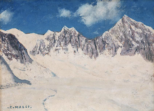
MONTE BIANCO PAINTED BY CESARE MAGGI


Cesare Maggi (1881–1962) The Mont Blanc (4,808.13 m - 15,776.7 ft) France - Italy border  In  A view of Mont Blanc from Entrèves, Oil on canvas ,70x100 cm,  Private collection
 
 CESARE MAGGI (1881-1962)
The Mont Blanc (4,808.13 m - 15,776.7 ft)
France - Italy border

In  A view of Monte Bianco from Entrèves, Oil on canvas, 70x100 cm,  Private collection 


The painter
The italian painter Cesare Maggi was born into a family of actors, Maggi embarked on classical studies at his father’s wish but also took up painting at a very early age His debut in Florence at the Esposizione Annuale della Società di Belle Arti di Firenze in 1898 was followed by a short trip to Paris to catch up with the latest developments.
The crucial turning point in Maggi’s art came in 1889 with the posthumous show of work by Giovanni Segantini held by the Milanese Society of Fine Arts, which prompted a definitive shift to landscape painting of a Divisionist character. After a short stay in the Engadin, he returned to Milan before finally settling in Turin. Commercial collaboration with Alberto Grubicy until 1913 enabled Maggi to establish himself quickly as one of the leading representatives of the second generation of Divisionist painters in Italy. He painted a repertoire of readily comprehensible mountain landscapes focusing primarily on aspects of the visual perception of the reflection of light and colour but lacking the deep spirituality of Segantini’s work. He took part in the major Italian and European exhibitions and the Venice Biennale devoted an entire room to his work at the Esposizione Internazionale d’Arte of Venice in 1912. After an interlude devoted to portrait painting in the same decade, the artist’s mature work focused on greater simplification of subject matter, mostly in landscapes.
Maggi obtained the chair in painting at the Albertina Academy, Turin, in 1936.


The mountain
Mont Blanc (in French) or Monte Bianco (in Italian), both meaning "White Mountain", is the highest mountain in the Alps and the highest in Europe after the Caucasus peaks. It rises 4,808.73 m (15,777 ft) above sea level and is ranked 11th in the world in topographic prominence. The Mont Blanc is one of the Seven Summit, which includes the highest mountains of each of the seven continents. Summiting all of them is regarded as a mountaineering challenge, first achieved on April 30, 1985 by Richard Bass. The 7 highest summit, (which are obviously 8 with 2 in Europe !) are : Mount Everest (8,848m), Aconcagua (6,961m), Mt Denali or Mc Kinley (6,194m), Kilimandjaro (5,895m), Mt Elbrus (5,642m), Mount Vinson (4,892m) and Mount Kosciuszko (2,228m) in Australia.
The mountain lies in a range called the Graian Alps, between the regions of Aosta Valley, Italy, and Savoie and Haute-Savoie, France. The location of the summit is on the watershed line between the valleys of Ferret and Veny in Italy and the valleys of Montjoie, and Arve in France. The Mont Blanc massif is popular for mountaineering, hiking, skiing, and snowboarding.
The three towns and their communes which surround Mont Blanc are Courmayeur in Aosta Valley, Italy, and Saint-Gervais-les-Bains and Chamonix in Haute-Savoie, France. A cable car ascends and crosses the mountain range from Courmayeur to Chamonix, through the Col du Géant. Constructed beginning in 1957 and completed in 1965, the 11.6 km (7¼ mi) Mont Blanc Tunnel runs beneath the mountain between these two countries and is one of the major trans-Alpine transport routes.
Since the French Revolution, the issue of the ownership of the summit has been debated.
From 1416 to 1792, the entire mountain was within the Duchy of Savoy. In 1723 the Duke of Savoy, Victor Amadeus II, acquired the Kingdom of Sardinia. The resulting state of Sardinia was to become preeminent in the Italian unification.[ In September 1792, the French revolutionary Army of the Alps under Anne-Pierre de Montesquiou-Fézensac seized Savoy without much resistance and created a department of the Mont-Blanc. In a treaty of 15 May 1796, Victor Amadeus III of Sardinia was forced to cede Savoy and Nice to France. In article 4 of this treaty it says: "The border between the Sardinian kingdom and the departments of the French Republic will be established on a line determined by the most advanced points on the Piedmont side, of the summits, peaks of mountains and other locations subsequently mentioned, as well as the intermediary peaks, knowing: starting from the point where the borders of Faucigny, the Duchy of Aoust and the Valais, to the extremity of the glaciers or Monts-Maudits: first the peaks or plateaus of the Alps, to the rising edge of the Col-Mayor". This act further states that the border should be visible from the town of Chamonix and Courmayeur. However, neither the peak of the Mont Blanc is visible from Courmayeur nor the peak of the Mont Blanc de Courmayeur is visible from Chamonix because part of the mountains lower down obscure them. A Sardinian Atlas map of 1869 showing the summit lying two thirds in Italy and one third in France.
After the Napoleonic Wars, the Congress of Vienna restored the King of Sardinia in Savoy, Nice and Piedmont, his traditional territories, overruling the 1796 Treaty of Paris. Forty-five years later, after the Second Italian War of Independence, it was replaced by a new legal act. This act was signed in Turin on 24 March 1860 by Napoleon III and Victor Emmanuel II of Savoy, and deals with the annexation of Savoy (following the French neutrality for the plebiscites held in Tuscany and Emilia-Romagna to join the Kingdom of Sardinia, against the Pope's will). A demarcation agreement, signed on 7 March 1861, defines the new border. With the formation of Italy, for the first time Mont Blanc is located on the border of France and Italy.
The 1860 act and attached maps are still legally valid for both the French and Italian governments. One of the prints from the 1823 Sarde Atlas positions the border exactly on the summit edge of the mountain (and measures it to be 4,804 m (15,761 ft) high). The convention of 7 March 1861 recognises this through an attached map, taking into consideration the limits of the massif, and drawing the border on the icecap of Mont Blanc, making it both French and Italian.Watershed analysis of modern topographic mapping not only places the main summit on the border, but also suggests that the border should follow a line northwards from the main summit towards Mont Maudit, leaving the southeast ridge to Mont Blanc de Courmayeur wholly within Italy.
Although the Franco-Italian border was redefined in both 1947 and 1963, the commission made up of both Italians and French ignored the Mont Blanc issue. In the early 21st century, administration of the mountain is shared between the Italian town of Courmayeur and the French town of Saint-Gervais-les-Bains, although the larger part of the mountain lies within the commune of the latter.
 
___________________________________________
2021- Wandering Vertexes...
by Francis Rousseau 


Wednesday, May 12, 2021

VOLCAN PUNTIAGUDO PHOTOGRAPHED IN 1932 BY ROBERT GERSTMANN

ROBERT GERSTMANN (1896-1960) Volcàn Puntiagudo (2, 493 m - 8, 179ft) Chile  In Volcàn Puntiagudo, photograph,1932, Photographer

ROBERT GERSTMANN (1896-1960)
Volcàn Puntiagudo (2, 493 m - 8, 179ft)
Chile

In Volcàn Puntiagudo, photograph,1932, Private collection


The volcano
Volcàn Puntiagudo (2, 493 m - 8, 179ft) also called Cerro Cenizas or Cerro Puntiagudo is a volcano in Chile remarkable for its volcanic chimney released by erosion and forming a summit neck. Puntiagudo is located in central Chile, in the Andes mountain range, between the Rupanco lakes to the north and Todos Los Santos to the south. Administratively, it is located on the border between the provinces of Llanquihue and Osorno of the Region of Lakes. Puntiagudo is an andesitic stratovolcano whose flanks have been eroded by glaciers, especially in their upper par1. Its summit is thus made up of a neck by the release of the volcanic chimney. This physiognomy makes it resemble Corcovado, another Chilean volcano located further south. Cordón Cenizos is a group of fissures and volcanic cones, stretches from Puntiagudo to the northeast. Puntiagudo began to be built at the end of the Pleistocene. However, its last eruption occurred on an unknown date.


The photographer
Robert Gerstmann was a photographer very famous in South America. Gerstmann was a Vienna born electrical engineer who, as a young man, developed an interest in photography. In 1924, he immigrated to Chile and from there traveled to Bolivia, where he made some 5000 photographs, a selection of which appear as photogravures in his Bolivia, 150 Grabados en Cobre (1928), which was reissued in 1996 by the Fundación Quipus in La Paz. Gerstmann ranged far, photographing the altiplano from La Paz south to the Argentine border, west to the Chilean border, and east to the Yungas, Cochabamba, Santa Cruz, and the lowlands along the Ríos Beni and Mamoré. Only Tarija and the Chaco escaped his lens. Five of his photographs illustrate Stewart E. McMillan's "The Heart of Aymara Land" National Geographic Magazine (February 1927), and several appear in Gustavo-Adolfo Otero's Bolivia (Guía Sinóptica) 1929. Gerstmann settled in Santiago in 1929. He published other photo albums, including Chile: 280 grabados en cobre (1932), Colombia: 200 grabados en cobre (1951), and Chile en 110 cuadros (1960?), and dabbled in film-making in Bolivia. He is thought to have died in Santiago ca. 1960. Several thousand of his glass plates are said to be at a university in Antofagasta.

_______________________________
2021 - Wandering Vertexes...
by Francis Rousseau

Sunday, May 9, 2021

CEMBA VELLEY PAINTED BY ALBRECHT DÜRER


ALBRECHT  DÜRER (1471-1528) Cemba Valley (200 m -656 ft) Italy   In Landscape near Segonzano in the Cembra Valley (1495), Watercolor on paper, 21 x 31.2 cm. The Ashmolean Museum, Oxford

ALBRECHT  DÜRER (1471-1528)
Cemba Valley (200 m - 656 ft)
Italy

 In Landscape near Segonzano in the Cembra Valley (1495), Watercolour on paper, 21 x 31.2 cm.
The Ashmolean Museum, Oxford


About this watercolor

Dürer called this landscape watercolor, which was created during his second Italian journey, "wehlsch pirg" (Italian hills). Its topographical location was long disputed. The most convincing suggestion is that this is a depiction of the Cembra Valley near Segonzano. The free manner in which the scene is captured, with the relaxed light brushstrokes in the foreground while the background is recorded with a naturalistic delicacy, makes it understandable why Dürer's watercolor technique at this time has been compared with that of Paul Cézanne. Watercolours by Dürer mark him as one of the first European landscape artists, while his woodcuts revolutionized the potential of that medium.


The valley
Trentino Alto Adige is the northernmost Italian region and is overwhelmingly mountainous, marked by the steep and picturesque shapes of the Dolomites, with the exception of the Adige Valley and the Dei Laghi Valley, both located below 200 m altitude and therefore considered as a plain. These valleys include large flat areas such as Piana Rotaliana and Piana dell'Alto Garda. While in the southern part of the region, on the shores of Lake Garda, the altitude drops to 65m, the highest mountain ranges peak at over 3,900m. The topographic prominence thus reaches almost 4,000 m. The region is bordered to the east and southeast by Veneto, to the west and southwest by Lombardy, to the north and northeast by the Austrian Land of Tyrol and Salzburg, and to the north -west with the Swiss canton of Graubünden 2. Predoi is the northernmost municipality in the region and in Italy; the municipality is the only one in Italy to be located further north than the 47th parallel.
The region lies between the central and eastern Alps, while to the south the border is delimited by Lake Garda and the Vicentine Pre-Alps.


The artist
Within three months of his marriage, Dürer left for Italy, alone, perhaps stimulated by an outbreak of plague in Nuremberg. He made watercolour sketches as he traveled over the Alps. Some have survived and others may be deduced from accurate landscapes of real places in his later work, for example his engraving Nemesis. In Italy, he went to Venice to study its more advanced artistic world. Through Wolgemut's tutelage, Dürer had learned how to make prints in drypoint and design woodcuts in the German style, based on the works of Schongauer and the Housebook Master. He also would have had access to some Italian works in Germany, but the two visits he made to Italy had an enormous influence on him. He wrote that Giovanni Bellini was the oldest and still the best of the artists in Venice. His drawings and engravings show the influence of others, notably Antonio Pollaiuolo, with his interest in the proportions of the body; Lorenzo di Credi; and Andrea Mantegna, whose work he produced copies of while training. Dürer probably also visited Padua and Mantua on this trip.  Albrecht Dürer was a German painter, printmaker, and theorist of the German Renaissance. Born in Nuremberg, Dürer established his reputation and influence across Europe in his twenties due to his high-quality woodcut prints. He was in contact with the major Italian artists of his time, including Raphael, Giovanni Bellini and Leonardo da Vinci, and from 1512 was patronized by Emperor Maximilian I. Dürer's vast body of work includes engravings, his preferred technique in his later prints, altarpieces, portraits and self-portraits, watercolours and books. The woodcuts series are more Gothic than the rest of his work. His well-known engravings include the three Meisterstiche (master prints) Knight, Death and the Devil (1513), Saint Jerome in his Study (1514) and Melencolia (1514). Dürer's introduction of classical motifs into Northern art, through his knowledge of Italian artists and German humanists, has secured his reputation as one of the most important figures of the Northern Renaissance. This is reinforced by his theoretical treatises, which involve principles of mathematics, perspective, and ideal proportions.

_______________________________
2021 - Wandering Vertexes...
by Francis Rousseau 

Wednesday, May 5, 2021

LA TETE D'AUGUSTE PAINTED BY PAUL CEZANNE

PAUL CEZANNE (1839-1906)
 La Tête d'Auguste (278m
 - 912ft) France (Bouche du Rhône)
  In Au fond du ravin, L’Estaque, 1882 Huile sur toile, 73 x 54 cm, The Museum of Fine Arts, Houston

PAUL CEZANNE (1839-1906)

La Tête d'Auguste (278m
 - 912ft)
France (Bouche du Rhône)


In Au fond du ravin, L’Estaque, 1882 Huile sur toile, 73 x 54 cm, The Museum of Fine Arts, Houston


The Hill
The Tête d'Auguste (278m - ) is the highest point of the Chaîne de l'Estaque or the Nerthe chain, a massif of white limestone hills around 28 kilometers long which extends from L'Estaque to Martigues. The Estaque chain is part of the Pyrenean-Provençal chain, a former massif which stretched continuously before the Oligocene, from the Pyrenees to the Estaque massif, in place of the current Gulf of Lion. Nowadays, it forms a sort of isthmus about 8 kilometers wide between the Mediterranean Sea to the south and the Etang de Berre to the north.
The coastline of the Estaque range forms the Côte Bleue with its steep shores cut into deep creeks. The railway line from Miramas to Estaque runs along the coast clinging to the side of the massif. The Estaque range is also home to several gray limestone quarries, two of which are exploited for the manufacture of lime, the others for the general and aggregates and other quarry products (Lafarge).


The painter

The mount Sainte-Victoire appears to have been the subject of a true love story with the painter (Paul Cézanne). He painted this subject more than 80 times, in oil paintings, watercolors and drawings ! but he diddn't painted only the Sainte Victoire... others landscape and mountains of Provence were in his mind too... 
Cézanne had a considerable influence on the art of the late nineteenth and the early twentieth century. Acknowledged master of his time, he attended during stays in Paris between 1862 and 1882, the Impressionist band: Camille Pissarro, Auguste Renoir (who also ended his life in the Provencal brightness), Claude Monet, Alfred Sisley and others. He participated in the Impressionist adventure while keeping his personality: it is the time of the shock of the en plein air, easels in the grass, looking for natural light and emotion. 
The influence of the Aix painter is recognized in the history of art since it would be the cause of the Cubist movement embodied in 1906 by Pablo Picasso and Georges Braque. The first historically so called Cubist painting ' Les Demoiselles d'Avignon' would, a true artistic shock shown by Picasso in 1907 (one year after the death of Cézanne) is today one of the masterpieces of the MoMA in New York. 
It is the search of volumes around which leads to the appearance of geometry in landscapes or still lifes of Cézanne.In 20 years, Cézanne pushes his style to express the emotion of the landscape, suggesting the wind, involving movement just like if we can breathe the air of the scene.


__________________________________________
2021 - Wandering Vertexes...
by Francis Rousseau

Saturday, May 1, 2021

MOUNT VESUVIUS PAINTED BY CHARLES-FRANÇOIS DE LA CROIX DE MARSEILLE

CHARLES-FRANÇOIS DE LA CROIX DE MARSEILLE (1700-1782) Mount Vesuvius (1,281m - 4,203ft) Italy  In Eruption du Vésuve en 1770, oil on canvas, Private collection

CHARLES-FRANÇOIS DE LA CROIX DE MARSEILLE (1700-1782)
Mount Vesuvius (1,281m - 4,203ft)
Italy

In Eruption du Vésuve en 1770, oil on canvas, Private collection


The volcano
Mount Vesuvius (1,281 meters- 4,203 ft at present) is one of those legendary and mythic mountains the Earth paid regularly tribute. Monte Vesuvius or Vesuvio  in Italian modern langage or Mons Vesuvius in antique Latin langage is a stratovolcano in the Gulf of Naples (Italy) about 9 km (5.6 mi) east of Naples and a short distance from the shore.  It is one of several volcanoes which form the Campanian volcanic arc. Vesuvius consists of a large cone partially encircled by the steep rim of a summit caldera caused by the collapse of an earlier and originally much higher structure.
Mount Vesuvius is best known for its eruption in AD 79 that led to the burying and destruction of the Roman antique cities of Pompeii, Herculaneum, and several other settlements. That eruption ejected a cloud of stones, ash, and fumes to a height of 33 km (20.5 mi), spewing molten rock and pulverized pumice at the rate of 1.5 million tons per second, ultimately releasing a hundred thousand times the thermal energy released by the Hiroshima bombing. At least 1,000 people died in the eruption. The only surviving eyewitness account of the event consists of two letters by Pliny the Younger to the historian Tacitus.  Since the eruption of AD 79, Vesuvius has erupted around three dozen times.
It erupted again in 203, during the lifetime of the historian Cassius Dio.
In 472, it ejected such a volume of ash that ashfalls were reported as far away as Constantinople (760 mi.; 1,220 kms).
The eruptions of 512 were so severe that those inhabiting the slopes of Vesuvius were granted exemption from taxes by Theodoric the Great, the Gothicking of Italy.
Further eruptions were recorded in 787, 968, 991, 999, 1007 and 1036 with the first recorded lava flows. The volcano became quiescent at the end of the 13th century and in the following years it again became covered with gardens and vineyards as of old. Even the inside of the crater was moderately filled with shrubbery.
Vesuvius entered a new phase in December 1631, when a major eruption buried many villages under lava flows, killing around 3,000 people. Torrents of lahar were also created, adding to the devastation. Activity thereafter became almost continuous, with relatively severe eruptions occurring in 1660, 1682, 1694, 1698, 1707, 1737, 1760, 1767, 1779, 1794, 1822, 1834, 1839, 1850, 1855, 1861, 1868, 1872, 1906, 1926, 1929, and 1944.  Nowadays, it is regarded as one of the most dangerous volcanoes in the world because of the population of 3,000,000 people living nearby and its tendency towards explosive eruptions (said Plinian eruptions). It is the most densely populated volcanic region in the world.
Vesuvius was formed as a result of the collision of two tectonic plates, the African and the Eurasian.
The area around Vesuvius was officially declared a national park on June 5, 1995. The summit of Vesuvius is open to visitors and there is a small network of paths around the mountain that are maintained by the park authorities on weekends.


The painter

Charles François Grenier de Lacroix, called Charles Francois Lacroix de Marseille, was a French painter
reknown for his landscapes and marines, in the style of Claude Joseph Vernet, Jean-Joseph Kapeller and Henry of Arles. He was a pupil and imitator of Joseph Vernet, and stayed in Rome in 1754. From 1776, he exhibited with great success and spent a good part of his life between Italy and Provence. In 1780, he published an ad to welcome students in his studio in Paris. Jean-Jacques Le Veau and Noël Le Mire engraved some of his paintings.


__________________________________________
2021 - Wandering Vertexes...
by Francis Rousseau

Wednesday, April 28, 2021

MOUNT SINAI / JABAL MUSA PAINTED BY JAN ASSELIJN

Jan Asselijn (c.1610 – October 1, 1652) Mount Sinaï / Jabal Musa (2,285 m - 7,496ft) Egypt In Flight into Egypt, c. 1640, oil on canvas, Rijksmuseum, Amsterdam


Jan Asselijn (c.1610 – October 1, 1652)
Mount Sinaï / Jabal Musa (2,285 m - 7,496ft)
Egypt

In Flight into Egypt, c. 1640, oil on canvas, Rijksmuseum, Amsterdam

 
About the painting 
Flight into Egypt used to be a very popular subject. Hundreds of canvas were painted on this subject between the 14th and 19th centuries, showing Mary with the baby on a donkey, led by Joseph, borrowing older iconography from the rare Byzantine journey to Bethlehem. Nevertheless, Joseph sometimes holds the child on his shoulders. Prior to about 1525, it was generally part of a larger cycle, whether it was the Nativity, the Life of Christ, or the Life of the Virgin. The background of these scenes generally (until the Council of Trent tightened up on such additions to the Scriptures) included a number of apocryphal miracles and provided an opportunity for the emerging genre of landscape painting.  The mountain deputed is supposed to be Mount Sinaï,  each painter giving his own vision of the sacred mountain or taking inspiration from what had already been painted in the past. The painted mountain  has generally very little to do with what Mount Sinaï really is.

The mountain
Mount Sinaï (2,285 m - 7,496 ft) or Jabal Mūsā or Gabal Mūsā (in arab : "Moses' Mountain" or "Mount Moses"), also known as Mount Horeb or Jebel Musa (a similarly named mountain in Morocco), is a mountain in the Sinai Peninsula of Egypt that is a possible location of the biblical Mount Sinai. The latter is mentioned many times in the Book of Exodus (and other books of the Bible) and the Quran. According to Jewish, Christian, and Islamic tradition, the biblical Mount Sinai was the place where Moses received the Ten Commandments.
Mount Sinai is a moderately high mountain near the city of Saint Katherine in the Sinai region.
It is next to Mount Katherine (2,629 m - 8,625 ft), the highest peak in Egypt.
Mount Sinai's rocks were formed in the late stage of the Arabian-Nubian Shield's (ANS) evolution. Mount Sinai displays a ring complex that consists of alkaline granites intruded into diverse rock types, including volcanics. The granites range in composition from syenogranite to alkali feldspar granite. The volcanic rocks are alkaline to peralkaline and they are represented by subaerial flows and eruptions and subvolcanic porphyry. Generally, the nature of the exposed rocks in Mount Sinai indicates that they originated from differing depths.
There are two principal routes to the summit. The longer and shallower route, Siket El Bashait, takes about 2.5 hours on foot, though camels can be used. The steeper, more direct route (Siket Sayidna Musa) is up the 3,750 "steps of penitence" in the ravine behind the monastery.
The summit of the mountain has a mosque that is still used by Muslims. It also has a Greek Orthodox chapel, constructed in 1934 on the ruins of a 16th-century church, that is not open to the public. The chapel encloses the rock which is considered to be the source for the biblical Tablets of Stone. At the summit also is "Moses' cave", where Moses was said to have waited to receive the Ten Commandments.

The painter
Asselijn was born at Dieppe from a French Huguenot family as Jean Asselin. He received instruction from Esaias van de Velde (1587–1630), and distinguished himself particularly in landscape and animal painting, though his historical works and battle pieces are also admired. He traveled in France and Italy, and modeled his style after Bamboccio (Pieter van Laer), also a member of the Bentvueghels. Nicolaes de Helt Stockade and Asselijn married two sisters in Lyons in 1645, both daughters of Houwaart Koorman of Antwerp. According to Houbraken, he heard this story from Abraham Genoels, who in turn heard it from Laurens Frank, an artist who was staying in the Koorman household with Artus Quellinus in Lyons at the time. Their marriages brought both Asselijn and Helt-Stockade back to the Netherlands after their travels. Asselijn had a withered hand and was small of stature, which gave him the nickname in France of petit Jean Hollandois, and which gave him the nickname Krabbetje (little claw) in the Bentvueghels. He seems to have befriended Rembrandt. In the etching that Rembrandt made of him, Asselijn appears in some states to be standing before an easel. His hands are not shown. Frederick de Moucheron, another Italianate landscape painter, was his pupil. He was one of the first Dutch painters who introduced a fresh and clear manner of painting landscapes in the style of Claude Lorrain, and his example was speedily followed byer artists. Asselijn's pictures were in high estimation at Amsterdam, and several of them are in the museums of that city. Twenty-four, painted in Italy, were engraved. One of his paintings, The Threatened Swan, which portrays a swan aggressively defending its nest, became a symbol of Dutch national resistance, although it is unknown if Asselijn intended it to be so.  The painting has been dated to the 1640s. It is considered to be Asselijn's most famous work  and was the Rijksmuseum's first acquisition.

__________________________________________
2021 - Wandering Vertexes...
by Francis Rousseau

Saturday, April 24, 2021

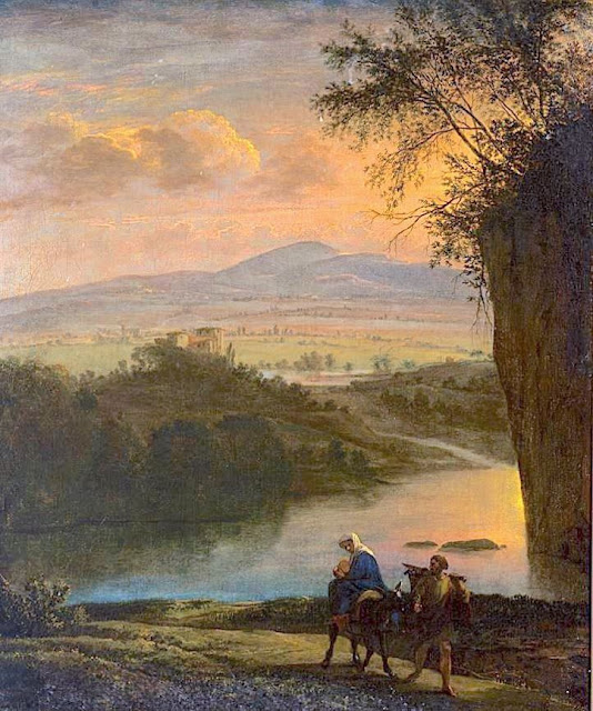
ANAMUNDI & WESTERN GHATS BY HENRY SALT

HENRY SALT (1780-1827) Anamundi (2,479 m - 8,133 ft) India   In The Baramahal, Poonah,1809, hand colored aquatints, Western Ghats

HENRY SALT (1780-1827)
Anamundi (2,479 m - 8,133 ft)
India

In The Baramahal, Poonah,1809, hand colored aquatints, private collection


The mountain
Anamudi is a mountain located in the Indian state of Kerala. It is the highest peak in the Western Ghats and South India.  It lies on the border of Devikulam Taluk, Idukki district and Kothamangalam Taluk, Ernakulam district. The name Anamudi literally translates to "elephant's head" a reference to the resemblance of the mountain to an elephant's head. Anamudi Shola National Park (ASNP) was declared as National Park in December 2003. Anamudi is the highest mountain in peninsular India as well as the largest mountain in Kerala. 
The first recorded ascent of Anamudi was by General Douglas Hamilton of the Madras Army on 4 May 1862, but it is likely that there had been earlier ascents by local people. Anamudi peak is one of only three ultra prominent peaks in South India. It is also the peak with the greatest topographic isolation within India. It is the highest point in India south of Himalayas. Thus it is known as "Everest of South India".

 
The artist
Henry Salt was an English artist, traveller, collector of antiquities, diplomat, and Egyptologist.
After a time as a portrait painter, Salt was permitted to travel with the English nobleman George Annesley, Viscount Valentia as his secretary and draughtsman after being recommended by Thomas Simon Butt. They started on an eastern tour in June 1802, traveling on the British East India Company's extra (chartered) ship Minerva to India via the Cape Colony. In 1805, Valentia sent Salt on a journey into the Abyssinian area (now Ethiopia) to meet with the ras of Tigré to open up trade relations on behalf of the English. While visiting there, Salt gained the respect of the ras. He returned to England on 26 October 1806. His journey home took him through Egypt where he met the pasha Mehmet Ali. Salt's paintings from the trip were used in Valentia's Voyages and Travels to India, published in 1809. The originals of all the drawings were kept by Valentia, as also the copper plates after Salt's death. The format and style of the plates is similar to Thomas and William Daniell's work, "Oriental Scenery" (1795-1808).
Salt returned to Ethiopia in 1809 on a government mission to explore trade and diplomatic links with the Tigrayan warlord Ras Wolde Selassie. Upon arrival, he was unable to meet with the king due to unrest in the country, so instead he went to stay with his friend the ras of Tigré. During this venture, Salt took on the side mission of verifying and correcting the information about the region reported by the Scottish traveler, James Bruce many years earlier. Salt came back to England in 1811 with numerous specimens of both plants and animals.

___________________________________________
2021 - Wandering Vertexes...
by Francis Rousseau


Wednesday, April 21, 2021

HUANGSHAN / 黄山 (3) BY HONG REN / 弘仁


HONG REN / 弘仁 (1610-1663) Huangshan / 黄山 (1,864m - 6,115ft) China  In Painting with shitang, ink on paper, 60.2 x 46.8 cm, Qing dynasty, ca. 1657–58, Yale University Art Gallery - Mary Griggs Burke Collection

HONG REN / 弘仁 (1610-1663)
Huangshan / 黄山 (1,864m - 6,115ft)
China

In Painting with shitang, ink on paper, 60.2 x 46.8 cm, Qing dynasty, ca. 1657–58,
Yale University Art Gallery - Mary Griggs Burke Collection

The mountain 
Huangshan  /  黄山, sometimes called Yellow Mountains, is a mountain range in southern Anhui province in eastern China. Vegetation on the range is thickest below 1,100 meters (3,600 ft), with trees growing up to the treeline at 1,800 meters (5,900 ft). The Huangshan mountain range has many peaks, some more than 1,000 meters (3,250 feet) high. The three tallest and best-known peaks are Lotus Peak (Lian Hua Feng, 1,864 m), Bright Summit Peak (Guang Ming Ding, 1,840 m), and Celestial Peak (Tian Du Feng, literally Capital of Heaven Peak, 1,829 m).
The area is well known for its scenery, sunsets, peculiarly-shaped granite peaks, Huangshan pine trees, hot springs, winter snow, and views of the clouds from above. Much of Huangshan's reputation derives from its significance in Chinese arts and literature.  In addition to inspiring poets such as Li Bai, Huangshan and the scenery therein has been the frequent subject of poetry and artwork, especially Chinese ink painting and, more recently, photography.  Overall, from the Tang Dynasty to the end of the Qing Dynasty, more than 20,000 poems were written about Huangshan, and a school of painting named after it.  The mountains also have appeared in modern works.  James Cameron, director of the 2009 film Avatar, cited Huangshan as one of his influences in designing the fictional world of that film.  The area also has been a location for scientific research because of its diversity of flora and wildlife. In the early part of the twentieth century, the geology and vegetation of Huangshan were the subjects of multiple studies by both Chinese and foreign scientists. The mountain is still a subject of research.  For example, in the late twentieth century a team of researchers used the area for a field study of Tibetan macaques, a local species of monkey.
Huangshan is a UNESCO World Heritage Site, and one of China's major tourist destinations.  The World Heritage Site covers a core area of 154 square kilometres and a buffer zone of 142 square kilometres. In 2002, Huangshan was named the "sister mountain" of Jungfrau in the Swiss Alps.

The painter 
Hong Ren  / 弘仁 who is also known as Hongren, was an early Qing dynasty painter and a member of the Anhui (or Xin'an) school of painting. His birth name was Jiang Fang. After the fall of the Ming dynasty he became a monk, as did Zhu Da, Shitao, and Kun Can. They protested the fall of the Ming dynasty by becoming monks. Hong Ren's style has been said to "represent the world in a dematerialized, cleansed version ... revealing his personal peace through the liberating form of geometric abstraction."


___________________________________________
2021 - Wandering Vertexes...
by Francis Rousseau

Sunday, April 18, 2021

THE MOUNT STANLEY BY VITTORIO SELLA


VITTORIO SELLA (1859-1943)
Margherita Peak / Mont Stanley (5,109 m-16,763 ft)
Congo - Uganda border

In Mt Stanley from the Esward Peak of Mt Baker - Photographed in 1906 during the Duke of Abruzzi expedition


The Mountain
Mount Stanley (5,109 m -16,762 ft) is located in the Rwenzori range and is the highest mountain of both the Democratic Republic of the Congo and Uganda, and the third highest in Africa, after Mount Kilimanjaro (5,895 m -19,340ft) and Mount Kenya (5,199 m - 17,057ft). The peak and several other surrounding peaks are high enough to support glaciers. Mount Stanley is named for the journalist and explorer, Sir Henry Morton Stanley. It is part of the Rwenzori Mountains National Park, a UNESCO world Heritage Site.
Mt. Stanley consists of two twin summits and several lower peaks which are :
Margherita Peak (5,109m - 16,763ft), Alexandra Peak (5,091m - 16,703ft), Albert Peak (5,087m - 16,690ft), Savoia Peak (4,977m - 16,330ft), Ellena Peak (4,968m -16,300ft), Elizabeth Peak (4,929m - 16,170 ft), Phillip Peak (4,920m - 16,140ft), Moebius Peak (4,916m - 16,130 ft) and Great Tooth (4,603m - 15,100ft).
Mt. Stanley was first climbed in 1906 by the Prince Luigi Amedeo di Savoia , Duke of the Abruzzi, (1873-1933), J. Petigax, C. Ollier, and J. Brocherel. He is known as well for his Arctic explorations and for his mountaineering expeditions, particularly to Mount Saint Elias (Alaska–Yukon) and K2 (Pakistan–China). Margherita Peak is named after Queen Margherita of Italy the prince's cousin.
The Rwenzori Mountains National Park is considered a model for integration of cultural values into the Protected Area Management framework as an innovative approach to resource management, the first of its kind in Africa. As a result the local communities have embraced collaborative resource management initiatives. Given its significance as one of the biodiversity hotspots in the Albertine Rift, various local and international NGOs have supported the management and conservation of the property. A General Management Plan guides management operations on-site. Key challenges to address include illegal felling of trees, snow recession due to global warming, human population pressure adjacent to the property and management of waste generated through tourism operations. UWA is addressing the above threats through resource protection, community conservation education, research and ranger-based monitoring, ecotourism and transboundary initiatives with the DRC. The long-term maintenance of the integrity of the property will be achieved through sustainable financing, ecological monitoring, continued collaboration with key stakeholders andregional cooperation.

The photographer
Vittorio Sella is a mountain italian climber and photographer who took his passion for mountains from his uncle, Quintino Sella, founder of the Italian Alpine Club. He accomplished many remarkable climbs in the Alps, the first wintering in the Matterhorn and Mount Rose (1882) and the first winter crossing of Mont Blanc (1888).
He took part in various expeditions outside Italy:
- Three in the Caucasus in 1889, 1890 and 1896 where a summit still bears his name;
- The ascent of Mount Saint Elias in Alaska in 1897
- Sikkim and Nepal in 1899
- Possibly climb Mount Stanley in Uganda in 1906 during an expedition to the Rwenzori
- Recognition at K2 and Mustagh Tower in 1909
- In Morocco in 1925.
During expeditions in Alaska, Uganda and Karakoram (K2-Chogolisa), he accompanied the Duke of Abruzzi, Prince Luigi Amedeo di Savoia.
Sella continues the practice of climbing into his old age, completing his final attempt in the Matterhorn at the age of 76; a climb he had to interrupt the rise following an accident in which one of his guides injured. He died in his hometown during World War II. His photographic collection is now managed by the Sella Foundation.
His photos mountain are still considered today to be among the finest ever made.
Jim Curran believes that "Sella remains probably the greatest photographer of the mountain. His name is synonymous with technical perfection and aesthetic refinement. "
The quality of the pictures of Vittorio Sella is partly explained by the use of a view camera 30 × 40 cm, despite the difficulty of the transportation of such a device, both heavy and fragile in places inaccessible; to be able to transport it safely, he had to make special pieces that can be stored in saddle bags. His photographs have been widely distributed, either through the press or in the galleries, and were unanimously celebrated; Ansel Adams, who was able to admire thirty-one in an exhibition that was organized at Sella American Sierra Club, said they inspired him "a religious kind of sense of wonder." Many of his pictures were taken in the mountains for the very first time in the History, which give them a much artistic, historical but also scientific value ; for example, one could measure the decline in the Rwenzori glaciers in Central Africa.

___________________________________________
2021 - Wandering Vertexes...
by Francis Rousseau

Wednesday, April 14, 2021

AIGUILLE NOIRE DE PEUTEREY PAINTED BY CHARLES-HENRI CONTENCIN

EUROPE,- 3000 - 4000 metres d'altitude, ,Italy, Aiguille Noire de Peuterey,Mont-Blanc,ALPS,EARTH,PEAKS,GLACIERS,CHARLES-HENRI CONTENCIN (1898-1955),

CHARLES-HENRI CONTENCIN (1898 - 1955)
Aiguille Noire de Peuterey (3,773 m - 12,379 ft)
Italy

 In The Aiguille Noire de Peuterey, Mont Blanc, France Huile sur toile 54x73, John Mitchell Gallery London


The mountain  

The Aiguille Noire de Peuterey (3,773 m - 12,379 ft) is a mountain of the Mont Blanc massif in Italy, forming part of the Peuterey ridge to the summit of Mont Blanc with its higher neighbour, the Aiguille Blanche de Peuterey. The best-known route on the mountain is the south ridge (TD), first climbed by Karl Brendelet and Hermann Schaller, on 26 and 27 August 1930; it remains one of the great classic rock routes in the massif. The first ascent of the complete Peuterey ridge including the Aiguille Noire de Peuterey (the Intégrale) was on 28–31 July 1934 by Adolf Göttner, Ludwig Schmaderer and Ferdinand Krobath. On 21 August 2010 23-year-old Chloé Graftiaux, a leading Belgian sport climber, fell to her death on the mountain.


The painter
Charles-Henri Contencin (1898-1955) is a French painter who painted many landscapes of mountains and high mountains of the great Alpine peaks (mainly Mont Blanc and Massif and the Écrins). His palette is very characteristic. He particularly used the effects of sunrise or sunset over snow or glaciers. Raised in the Bernese Oberland to the age of 10-12 years, it was a lifelong mountain lover. Good climber, he was a member of the French Alpine Club, where he made the connection with the Mountain Painters Society (SPM). He made the First World War in the infantry and he received the War Cross. He then worked in an architectural office and at the Compagnie des chemins de Fer du Nord before joining the french national railways company, the SNCF, where he was responsible for engineering structures.
In addition to his professional designs it is also author of posters and handbills for the railways under the pseudonym "Charles-Henri." He is best known for its mountain paintings and left an important work. After many years of contempt coming mainly from parisian critics and intelligentsia, Contencin is now recognized worldwide as one of the major mountain painters of the 20th century.

__________________________________________________
2021 -  Wandering Vertexes...
by Francis Rousseau

Saturday, April 10, 2021

THE JUNGFRAU PAINTED BY GIORGIO AVANTI

GIORGIO AVANTI (c.1946), Jungfrau (4,158 m - 13, 642 ft) Switzerland, John Mitchell Gallery, Swiss painters, 
 
GIORGIO AVANTI (c.1946)
Jungfrau (4,158 m - 13, 642 ft) 
Switzerland
 
In Jungfrau 2019, oil on acrylic on canvas, 100 x 120 cm. Courtesy John Mitchell Gallery, London

The artist
A recognized Swiss author, poet and painter, Peter Studer uses ‘Giorgio Avanti’ as a pseudonym. He lives and works from a studio in Walchwil on the eastern shore of Lake Zug, in the heart of Switzerland.
Avanti’s use of intense colour has earned him the epithet as the colourist of the Alps and a lengthy article published about his life and work that came out in the October and November 2020 edition of Munich’s art magazine, Mundus, was subtitled The Kolorist der Alpen. Drawing parallels with the Polish colourists of the 1930s and 1940s, the closest living counterpart to Avanti is the recently deceased American painter, Wolf Kahn.
Studer was born in Luzern and studied for a career in law before taking up abstract painting in the 1980s. Moving to portraiture and genre scenes a decade later, Studer has spent the latter half of his career concentrating on the Swiss Alps. Mundus’s journalist, Lena Naumann, characterizes Avanti as a twenty-first century disciple of Giovanni Segantini in his interpretation of the Alps whereas the painter would align himself just as closely with the work of Ferdinand Hodler, the leading Swiss painter of the late nineteenth century and Willy Guggenheim, known as Varlin.
Peter Studer refers to his gift for poetry and short stories as ‘painting with words’. His vibrant canvases display their own poetry, one derived entirely from colour.

The mountain
The Jungfrau (4,158 m - 13,642 ft)
("The virgin" in german) is one of the main summits of the Bernese Alps, located between the northern canton of Bern and the southern canton of Valais, halfway between Interlaken and Fiesch. Together with the Eiger and Mönch, the Jungfrau forms a massive wall overlooking the Bernese Oberland and the Swiss Plateau, one of the most distinctive sights of the Swiss Alps. It is one of the most represented by artists summits with the Matterhorn and the Mont Blanc. The summit was first reached on August 3, 1811 by the Meyer brothers of Aarau and two chamois hunters from Valais. The ascent followed a long expedition over the glaciers and high passes of the Bernese Alps. It was not until 1865 that a more direct route on the northern side was opened. The construction of the Jungfrau railway in the early 20th century, which connects Kleine Scheidegg to the Jungfraujoch, the saddle between the Mönch and the Jungfrau, made the area one of the most-visited places in the Alps. Along with the Aletsch Glacier to the south, the Jungfrau is part of the Jungfrau-Aletsch area, which was declared a World Heritage Site in 2001.
Politically, the Jungfrau is split between the municipalities of Lauterbrunnen (Bern) and Fieschertal (Valais). It is the third-highest mountain of the Bernese Alps after the nearby Finsteraarhorn and Aletschhorn, respectively 12 and 8 km away. But from Lake Thun, and the greater part of the canton of Bern, it is the most conspicuous and the nearest of the Bernese Oberland peaks; with a height difference of 3,600 m between the summit and the town of Interlaken. This, and the extreme steepness of the north face, secured for it an early reputation for inaccessibility.
The landscapes around the Jungfrau are extremely contrasted. Instead of the vertiginous precipices of the north-west, the south-east side emerges from the upper snows of the Aletsch Glacier at around 3,500 metres. The 20 km long valley of Aletsch on the south-east is completely uninhabited and also surrounded by other similar glacier valleys. The whole area constitutes the largest glaciated area in the Alps as well as in Europe.
___________________________________________
2021 - Wandering Vertexes...
by Francis Rousseau

Wednesday, April 7, 2021

FUJIYAMA / 富士山 BY SHIRO KASAMATSU / 笠松 紫浪


SHIRO  KASAMATSU, 笠松 紫浪, biography,  FujiYama,  富士山,  Japan, Fuji from Yoshida Yamanashi, 1958,  Woodblock Print

SHIRO  KASAMATSU / 笠松 紫浪) (1898-1991)
FujiYama / 富士山 (3,776 m - 12,389 ft)
Japan


In Fuji from Yoshida Yamanashi, 1958,  Woodblock Print Ink and color on paper, Private collection

 
The artist
Shiro Kasamatsu (笠松 紫浪) was a Japanese engraver and print maker trained in the Shin-Hanga and Sōsaku-Hanga styles of woodblock printing. Kasamatsu was born in Tokyo in 1898 and apprenticed at the age of 13 to Kaburagi Kiyokata (1878-1973), a traditional master of Bijin-ga, pictures of beautiful women. Kasamatsu however took an interest in landscape and was given the pseudonym Shiro by his teacher, which he used as a signature mark in his prints.  Kasamatsu made woodblock prints for the publisher Shōzaburō Watanabe from 1919.  Almost all the woodblocks were destroyed in a fire in Watanabe's print shop following the Great Kanto Earthquake of 1923. Around 50 prints were published by Watanabe by the late 1940s. Kasamatsu began to partner with Unsodo in Kyoto from the 1950s and produced nearly 102 prints by 1960. He also began to print and publish on his own in the Sōsaku-Hanga style. He produced nearly 80 Sōsaku-Hanga prints between 1955 and 1965.


The mountain

Mount Fuji or Fujiyama (富士山) is located on Honshu Island and is the highest mountain peak in Japan at 3,776.24 m (12,389 ft). Several names are attributed to it: "Fuji-san", "Fujiyama" or, redundantly, "Mt. Fujiyama". Usually Japanese speakers refer to the mountain as "Fuji-san". The other Japanese names for Mount Fuji, have become obsolete or poetic like: Fuji-no-Yama (ふじの山 - The Mountain of Fuji), Fuji-no-Takane (The High Peak of Fuji), Fuyō-hō (The Lotus Peak), and Fugaku , created by combining the first character of 富士, Fuji, and 岳, mountain.
Mount Fuji is an active stratovolcano that last erupted in 1707–08. Mount Fuji lies about 100 kilometres (60 mi) south-west of Tokyo, and can be seen from there on a clear day.
Mount Fuji's exceptionally symmetrical cone, which is snow-capped several months a year, is a well-known symbol of Japan and it is frequently depicted in art and photographs, as well as visited by sightseers and climbers.
Mount Fuji is one of Japan's Three Holy Mountains along with Mount Tate and Mount Haku. It is also a Special Place of Scenic Beauty and one of Japan's Historic Sites.
It was added to the World Heritage List as a Cultural Site on June 22, 2013. As per UNESCO, Mount Fuji has “inspired artists and poets and been the object of pilgrimage for centuries”. UNESCO recognizes 25 sites of cultural interest within the Mt. Fuji locality. These 25 locations include the mountain itself, Fujisan Hongū Sengen Shrine and six other Sengen shrines, two lodging houses, Lake Yamanaka, Lake Kawaguchi, the eight Oshino Hakkai hot springs, two lava tree molds, the remains of the Fuji-kō cult in the Hitoana cave, Shiraito Falls, and Miho no Matsubara pine tree grove; while on the low alps of Mount Fuji lies the Taisekiji temple complex, where the central base headquarters of Nichiren Shoshu Buddhism is located....

___________________________________________
2021 - Wandering Vertexes...
by Francis Rousseau

Sunday, April 4, 2021

LES ROCHERS DU PARQUET (VERCORS) PAINTED BY JEAN-BAPTISTE NÉE


JEAN-BAPTISTE NÉE (b.1986), Les Rochers du Parquet, gouache, french painters,


JEAN-BAPTISTE NÉE (b.1986)
Les Rochers du Parquet  2, 004 m - 6, 574 ft)
France

In "Vercors, hiver, plateau, vent",gouache sur papier  2019, 32, 5  x 50cm,
©Jean-Baptiste Née @jeanbaptiste.nee


The artist
Jean-Baptiste Née, born in 1986. is a french painter, scenographer and visual artist, graduated from Arts-Décoratifs of Paris in 2012. Jean-Baptiste Née works in the mountains and high mountains, always in situ, in direct confrontation with the movements of the earth and water and wind. He gives a growing place for the action of the elements on the work in progress (rain, snow, frost, etc.). He established his "large workshop" in the Swiss Alps or in the Vercors massif - especially in winter -, as well as during long hikes in the Italian Alps. In the winter of 2018, he worked in the massifs of Wudangshan and Lushan, in China, and became interested in the Taoist notion of "Sky" (t’ien.
Since 2016, Jean-Baptiste Née exhibits regularly in galleries in France and Switzerland. His workshop is in Montreuil, France. Next exhibition th 8th April  in Galeria Obsucra in Paris. A book was recently published about his work  "Le monde nu" Éditions Hartpon. Contact @jeanbaptiste.nee


The mountain  
The Rochers du Parquet (2,004 m-) make the eastern edge of the Vercors to the west of Mont Aiguille. They take the form of a long cliff  facing Mont Aiguille. They support the highlands of Vercors and its nature reserve. A few climbing routes have been traced there. They are separated from the more northerly steep slopes of the Grand Veymont by the deep notch of the Pas des Bachassons. The deep indentation of the cliff separates the towers of Rochers du Parquet from the rest of the long cliff which runs towards the Pas de l'Aiguille. 
The crossing of the Rochers du Parquet is a superb hike typical of the Hauts Plateaux du Vercors. 
The course takes place in a landscape where Mont Aiguille is constantly visible.
The Vercors presents the characteristic of presenting numerous possible passages, talwegs, ridges, valleys and basins, without any obvious particularity to facilitate the description of a route - no cairns either at the beginning of the crossing.

___________________________________________
2021- Wandering Vertexes...
by Francis Rousseau

Wednesday, March 31, 2021

PIZ ROSEG PAINTED BY JOHANNES SCHÜTZ

JOHANNES SCHÜTZ (1886-1953) ,Piz Roseg (3,937 m -12,917 ft) Switzerland - Italy, In Piz Roseg, Sellagruppe,Fuorcla-Surlej, Graubunden, Switzerland, Italy, John Mitchell Gallery


JOHANNES SCHÜTZ (1886-1953)
Piz Roseg (3,937 m -12,917 ft)
Switzerland - Italy border

In Piz Roseg and the Sellagruppe as seen from Fuorcla-Surlej, Graubunden, Switzerland. oil on canvas, 82 x 62cm, 1934, Courtesy John Mitchell Gallery


The mountain

Piz Roseg (3,937 m -12,917 ft)  is a mountain of the Bernina Range, overlooking the Val Roseg in the Swiss canton of Graubünden.There are two summits on its main ridge:
- the south-east and higher summit (3,937 m)
- the north-west summit, known as the Schneekuppe (3,920 m). There is also a prominent top on the east-north-east ridge, called the Roseg Pitschen (3,868 m) (Italian border).
The first ascent of the mountain to the Schneekuppe was by F. T. Bircham with guides Peter Jenny and Alexander Fleury on 31 August 1863. The highest point of the mountain was reached two years later by A. W. Moore and Horace Walker with guide Jakob Anderegg on 28 June 1865.
Piz Roseg is separated from the neighbouring Piz Scerscen by the Porta da Roseg (3,522 m), also called the Güssfeldtsattel. The Swiss side of this col – a steep ice slope of up to 70° – was first climbed by Paul Güssfeldt, with guides Hans Grass, Peter Jenny and Caspar Capat on 13 September 1872. Grass and Capat had spent the previous day cutting steps up the first two-fifths of the route. The following day they added at least another 450 steps on the first ascent.
The 700-metre north-east face of Piz Roseg was first climbed by Christian Klucker and L. Norman-Neruda on 16 July 1890; the face – with a notable serac band halfway up – sports a number of difficult routes. Klucker, together with M. Barberia, also made the first traverse from the Italian side of the Porta da Roseg on 21 June 1898.


The artist
Schütz is a academic Swiss painter, born in the Netherlands. He comes from a family of artists. He is reknown for having painted the Swiss and Italian Alps mountains. No biographical details are avalaible about him, even if his works appears quite often in auctions.


___________________________________________
2021- Wandering Vertexes...
by Francis Rousseau


Saturday, March 27, 2021

MONT-BLANC DU TACUL PAINTED BY CESARE MAGGI


Cesare Maggi (1881-1961),  Mont-Blanc du Tacul (4,248m -13,937 ft), France, Haute-Savoie,  Alpes, Alpes, Graian Alps Glacier du Géant, Chamonix, France, John Mitchell Gallery, London ,


CESARE MAGGI (1881-1962)
Mont Blanc du Tacul (4,248m -13,937 ft)
France ( Haute-Savoie)

 In Mont Blanc du Tacul seen from the Glacier du Géant, Chamonix, France. oil on panel, 27 x 37cm, courtesy John Mitchell Gallery, London 


The mountain
Mont Blanc du Tacul (4,248m - 13,937 ft) is a mountain in the Mont Blanc massif of the French Alps situated midway between the Aiguille du Midi and Mont Blanc. The Mont Blanc du Tacul looks like a large, snow-covered trapezoid. It is part of the peaks of the Alps over 4,000 meters, of which it is the twenty-fourth highest. To the north of the summit is the Aiguille du Midi, from which it is separated by the Col du Midi (3,532 m), to the south the Mont Maudit, from which it is separated by the Col Maudit (4,035 m), at the is the Aiguilles du Diable then the Glacier du Géant and to the west the Aiguille de Saussure (3,839 m) then the Bossons glacier which rises to its summit. It has a secondary summit, the eastern summit (4,247 m), which is the exit from the Gervasutti pillar. The official first ascent of Mont Blanc du Tacul was by a guideless party comprising Charles Hudson, Edward John Stevenson, Christopher and James Grenville Smith, E. S. Kennedy, Charles Ainslie and G. C. Joad on 8 August 1855. However, Courmayeur guides may have already ascended the peak during their attempts in 1854 and 1855 to force a way up Mont Blanc from the Italian side.

The painter
The italian painter Cesare Maggi was born into a family of actors, Maggi embarked on classical studies at his father’s wish but also took up painting at a very early age His debut in Florence at the Esposizione Annuale della Società di Belle Arti di Firenze in 1898 was followed by a short trip to Paris to catch up with the latest developments.
The crucial turning point in Maggi’s art came in 1889 with the posthumous show of work by Giovanni Segantini held by the Milanese Society of Fine Arts, which prompted a definitive shift to landscape painting of a Divisionist character. After a short stay in the Engadin, he returned to Milan before finally settling in Turin. Commercial collaboration with Alberto Grubicy until 1913 enabled Maggi to establish himself quickly as one of the leading representatives of the second generation of Divisionist painters in Italy. He painted a repertoire of readily comprehensible mountain landscapes focusing primarily on aspects of the visual perception of the reflection of light and colour but lacking the deep spirituality of Segantini’s work. He took part in the major Italian and European exhibitions and the Venice Biennale devoted an entire room to his work at the Esposizione Internazionale d’Arte of Venice in 1912. After an interlude devoted to portrait painting in the same decade, the artist’s mature work focused on greater simplification of subject matter, mostly in landscapes.
Maggi obtained the chair in painting at the Albertina Academy, Turin, in 1936.


___________________________________________
2021- Wandering Vertexes...
by Francis Rousseau