google.com, pub-0288379932320714, DIRECT, f08c47fec0942fa0 GRAVIR LES MONTAGNES... EN PEINTURE: SACRED MOUNTAIN
Showing posts with label SACRED MOUNTAIN. Show all posts

Wednesday, November 10, 2021

MOUNT SINAÏ -JABAL MUSA PAINTED BY GIOTTO

GIOTTO (1266-1337) Mount Sinaï or Jabal Musa (2,285 m - 7,496ft) Egypt  In The flight into Egypt, fresco, Basilica inferiore di Assisi, 1308-1

GIOTTO (1266-1337)
Mount Sinaï or Jabal Musa (2,285 m - 7,496ft)
Egypt

In The flight into Egypt, fresco, Basilica inferiore di Assisi, 1308-10


About this work
The right transept of the Lower Basilica of Assisi has numerous frescoes by important fourteenth-century authors. On the large barrel vault there are the Stories of Christ's Childhood and the Crucifixion with Franciscan Saints by Giotto and collaborators, dated 1308-1311. The image depicts the scene of the Flight into Egypt already apunted by Giotto few years before in the interior frescoes of the Scrovegni Chapel in Padua, also known as the Arena Chapel. Inetrestirng to have a look at the differencies.

The mountain
Mount Sinaï (2,285 m - 7,496ft) or Jabal Mūsā or Gabal Mūsā (in arab : "Moses' Mountain" or "Mount Moses"), also known as Mount Horeb or Jebel Musa (a similarly named mountain in Morocco), is a mountain in the Sinai Peninsula of Egypt that is a possible location of the biblical Mount Sinaï.
The latter is mentioned many times in the Book of Exodus (and other books of the Bible) and in the Quran. According to Jewish, Christian, and Islamic tradition, the biblical Mount Sinai was the place where Moses received the Ten Commandments (depicted in the Jean-Léon Gérôme painting above).
Mount Sinai is a moderately high mountain near the city of Saint Katherine in the Sinai region. It is next to Mount Katherine (2,629m - 8,625 ft), the highest peak in Egypt.
Mount Sinai's rocks were formed in the late stage of the Arabian-Nubian Shield's (ANS) evolution. Mount Sinai displays a ring complex that consists of alkaline granites intruded into diverse rock types, including volcanics. The granites range in composition from syenogranite to alkali feldspar granite. The volcanic rocks are alkaline to peralkaline and they are represented by subaerial flows and eruptions and subvolcanic porphyry. Generally, the nature of the exposed rocks in Mount Sinai indicates that they originated from differing depths.
There are two principal routes to the summit. The longer and shallower route, Siket El Bashait, takes about 2.5 hours on foot, though camels can be used. The steeper, more direct route (Siket Sayidna Musa) is up the 3,750 "steps of penitence" in the ravine behind the monastery.
The summit of the mountain has a mosque that is still used by Muslims. It also has a Greek Orthodox chapel, constructed in 1934 on the ruins of a 16th-century church, that is not open to the public. The chapel encloses the rock which is considered to be the source for the biblical Tablets of Stone. At the summit also is "Moses' cave", where Moses was said to have waited to receive the Ten Commandments.

The painter
Giotto di Bondone known mononymously as Giotto was an Italian painter and architect from Florence during the Late Middle Ages. He worked during the "Gothic or Proto-Renaissance" period.
Giotto's contemporary, the banker and chronicler Giovanni Villani, wrote that Giotto was "the most sovereign master of painting in his time, who drew all his figures and their postures according to nature" and of his publicly recognized "talent and excellence".
In his Lives of the Most Excellent Painters, Sculptors, and Architects, Giorgio Vasari described Giotto as making a decisive break with the prevalent Byzantine style and as initiating "the great art of painting as we know it today, introducing the technique of drawing accurately from life, which had been neglected for more than two hundred years".
That Giotto painted the Arena Chapel and that he was chosen by the Commune of Florence in 1334 to design the new campanile (bell tower) of the Florence Cathedral are among the few certainties about his life. Almost every other aspect of it is subject to controversy: his birth date, his birth place, his appearance, his apprenticeship, the order in which he created his works, whether or not he painted the famous frescoes in the Upper Basilica of Saint Francis in Assisi and his burial place.

_______________________________

2021 - Wandering Vertexes...
by Francis Rousseau

Friday, October 8, 2021

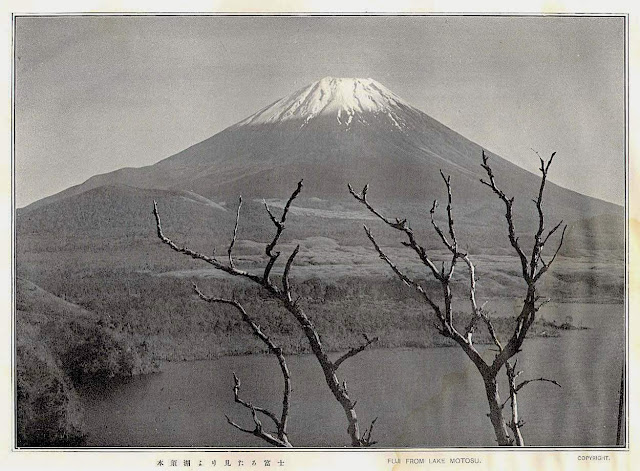
FUJIYAMA / 富士山 BY TSUCHIYA KOITSU /土屋光逸


Tsuchiya Koitsu / 土屋光逸 (1870-1949) Fujiyama / 富士山 (3, 776 m -12,389 ft) Japan  In Fuji from Lake Motosu, woodblock pirnt, 1934

TSUCHIYA KOITSU / 土屋光逸 (1870-1949)
Fujiyama / 富士山 (3, 776 m -12,389 ft)
Japan

In Fuji from Lake Motosu, woodblock print, 1934


The artist

Tsuchiya Koitsu (土屋光逸) was an important artist in the Shin-hanga movement. He trained under the ukiyo-e master Kobayashi Kiyochika for 19 years, and initially focused on works depicting scenes from the First Sino-Japanese War. In 1931, at the age of 60, he began work for Shōzaburō Watanabe and his art publishing establishment which also published the work of artists like Kawase Hasui and Yoshida Hiroshi. His later work incorporated light effects to increase the emotional impact of his art.
Born on September 23, 1870, in Hamamatsu, Shizuoka, Japan. His birth name was either Koichi or Sahei. He moved to Tokyo at age 15. He first had an apprenticeship for the woodblock carver Matsuzaki, but soon became a student of ukiyo-e master Kiyochika Kobayashi. He worked for Kiyochika for 19 years and lived in his house.
He initially published prints made during the First Sino-Japanese War, before developing his skill with dramatic light effects, learned from Kiyochika. Koitsu published through the Watanabe publishing house after Watanabe and Koitsu met at an exhibition commemorating the 17th anniversary of Kiyochika's death. He also produced prints for publishers Doi Sadaichi, Kawaguchi, Baba Nobuhiko, Tanaka Shobido, and Takemura.

The mountain
This is the legendary Mount Fuji or Fujiyama (富士山).
It is located on Honshu Island and is the highest mountain peak in Japan at 3,776.24 m (12,389 ft). Several names are attributed to it: "Fuji-san", "Fujiyama" or, redundantly, "Mt. Fujiyama". Usually Japanese speakers refer to the mountain as "Fuji-san". The other Japanese names for Mount Fuji, have become obsolete or poetic like: Fuji-no-Yama (ふじの山 - The Mountain of Fuji), Fuji-no-Takane (ふじの高嶺- The High Peak of Fuji), Fuyō-hō (芙蓉峰 - The Lotus Peak), and Fugaku (富岳/富嶽), created by combining the first character of 富士, Fuji, and 岳, mountain.
Mount Fuji is an active stratovolcano that last erupted in 1707–08. Mount Fuji lies about 100 kilometres (60 mi) south-west of Tokyo, and can be seen from there on a clear day.
Mount Fuji's exceptionally symmetrical cone, which is snow-capped several months a year, is a well-known symbol of Japan and it is frequently depicted in art and photographs, as well as visited by sightseers and climbers.
Mount Fuji is one of Japan's Three Holy Mountains (三霊山) along with Mount Tate and Mount Haku. It is also a Special Place of Scenic Beauty and one of Japan's Historic Sites.
It was added to the World Heritage List as a Cultural Site on June 22, 2013. As per UNESCO, Mount Fuji has “inspired artists and poets and been the object of pilgrimage for centuries”. UNESCO recognizes 25 sites of cultural interest within the Mt. Fuji locality. These 25 locations include the mountain itself, Fujisan Hongū Sengen Shrine and six other Sengen shrines, two lodging houses, Lake Yamanaka, Lake Kawaguchi, the eight Oshino Hakkai hot springs, two lava tree molds, the remains of the Fuji-kō cult in the Hitoana cave, Shiraito Falls, and Miho no Matsubara pine tree grove; while on the low alps of Mount Fuji lies the Taisekiji temple complex, where the central base headquarters of Nichiren Shoshu Buddhism is located.
______________________________

2021 - Wandering Vertexes...
by Francis Rousseau
Sunday, October 3, 2021

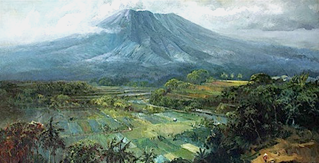
GUNUNG BROMO PAINTED BY SUDJONO ABDULLAH


SUDJONO ABDULLAH (1911-1993) Gunung Bromo (2,329m - 7,641ft) Indonesia (Java Timur)  In Gunung Bromo, 1960, oil on canvas,Ptviatre collection


SUDJONO ABDULLAH (1911-1993)
Gunung Bromo (2,329m - 7,641ft)
Indonesia (Java Timur)

In Gunung Bromo, 1960, oil on canvas, Private collection


The volcano
Gunung Bromo (2,329m - 7,641ft) or Gunung Brama, an active volcano,in East Java, Indonesia, is not the highest peak of the Tengger massif, but the best known. The massif area is one of the most visited tourist attractions in East Java, Indonesia. The volcano belongs to the Bromo Tengger Semeru National Park. The name of Bromo derived from Javanese pronunciation of Brahma, the Hindu creator god. Gunung Bromo sits in the middle of a plain called the "Sea of Sand"  a protected nature reserve since 1919. The best way to visit Gunung Bromo is from the nearby mountain village of Cemoro Lawang, from where it is possible to walk during 45 mn to the volcano. It is also possible to take an organised jeep tour, which includes a stop at the viewpoint on Gunung Penanjakan (2,770 m - 9,088 ft).

On the fourteenth day of the Hindu festival of Yadnya Kasada, the Tenggerese people of Probolinggo, East Java, travel up the mountain in order to make offerings of fruit, rice, vegetables, flowers and sacrifices to the mountain gods by throwing it into the caldera of the volcano. The origin of the ritual lies in the 15th century legend when princess  Roro Anteng started the principality of Tengger with her husband, Joko Seger. The couple were childless and therefore beseeched the assistance of the mountain gods. The gods granted them 24 children but stipulated that the 25th child, named Kesuma, must be thrown into the volcano as a human sacrifice. The gods' request was implemented. The tradition of throwing sacrifices into the volcano to appease these ancient deities continues today and is called the Yadnya Kasada ceremony. Though fraught with danger, some locals risk climbing down into the crater in an attempt to recollect the sacrificed goods that they believe could bring them good luck.
Depending on the degree of volcanic activity, the Indonesian Centre for Volcanology and Disaster Hazard Mitigation sometimes issues warnings against visiting Mount Bromo.
 Mount Bromo recently erupted in 2004, 2010, 2011 and 2015.


The painter
Raden Soedjono Abdullah was born in Yogyakarta, the son of Abdullah Suriosubroto, a famous landscape painter and was also the brother of Basoeki Abdullah. He used to help his father cleaning the pallet from which he found his way to be a painter. He finished his school from HIS Indonesian Dutch School and worked as a poster artist for the Rex Theater in Yogyakarta. During the Japanese colonization in Indonesia, Sudjono went to Parangtritis, Parangkusumo where he continued to paint. During the 1970s, Soedjono moved to Kertosono in East Java, where he lived up to his death.

___________________________________________

2021 - Wandering Vertexes...
by Francis Rousseau

Sunday, September 12, 2021

MOUNT GILES PAINTED BY ALBERT NAMATJIRA


ALBERT NAMATJIRA (1902-1959) Mount Giles (1, 389 m - 4, 557 ft) Australia (Northern territory),  In Yuendumu, watercolor, 1948


ALBERT NAMATJIRA (1902-1959)
Mount Giles (1, 389 m - 4, 557 ft)
Australia (Northern territory) 

In Yuendumu, watercolor, 1948

The mountain
Mount Giles (1, 389 m - 4, 557 ft) is one of the highest mountains in the Northern Territory, Australia. It lies along the MacDonnell Ranges, dominating Ormiston Pound, in the West MacDonnell National Park, approximately 80 kilometres (50 mi) west of Alice Springs. It can be visited via the celebrated Larapinta Trail and has views of Mount Sonder, Ormiston Gorge and Pound, and the surrounding range. Climbing the mountain requires a hard two- or three-day hike. The MacDonnell Ranges is located in the Northern Territory, comprising 3,929,444 hectares (9,709,870 acres). The range is a 644 km (400 mi) long series of mountains located in the centre of Australia, and consist of parallel ridges running to the east and west of Alice Springs. The mountain range contains many spectacular gaps and gorges as well as areas of Aboriginal significance.
The ranges were named after Sir Richard MacDonnell (the Governor of South Australia at the time) by John McDouall Stuart, whose 1860 expedition reached them in April of that year. The Horn Expedition investigated the ranges as part of the scientific expedition into central Australia. Other explorers of the range included David Lindsay and John Ross.
The MacDonnell Ranges are famous to have been often depicted in the paintings by Albert Namatjira.

The painter
Albert Namatjira born Elea Namatjira, was a Western Arrernte-speaking Aboriginal artist from the MacDonnell Ranges in Central Australia. As a pioneer of contemporary Indigenous Australian art, he was the most famous Indigenous Australian of his generation.
Born and raised at the Hermannsburg Lutheran Mission outside Alice Springs, Namatjira showed interest in art from an early age, but it was not until 1934 (aged 32), under the tutelage of Rex Battarbee, that he began to paint seriously. Namatjira's richly detailed, Western art-influenced watercolours of the outback departed significantly from the abstract designs and symbols of traditional Aboriginal art, and inspired the Hermannsburg School of painting. He became a household name in Australia—indeed, reproductions of his works hung in many homes throughout the nation—and he was publicly regarded as a model Aborigine who had succeeded in mainstream society.
Although not the first Aboriginal artist to work in a European style, Albert Namatjira is certainly the most famous. Ghost gums with luminous white trunks, palm-filled gorges and red mountain ranges turning purple at dusk are the hallmarks of the Hermannsburg school. Hermannsburg Mission was established by Lutheran missionaries in 1877 on the banks of the Finke River, west of Mparntwe (Alice Springs). Namatjira learnt watercolour technique from the artist, Rex Battarbee.
Initially thought of as having succumbed to European pictorial idioms – and for that reason, to ideas of European privilege over the land – Namatjira’s landscapes have since been re-evaluated as coded expressions on traditional sites and sacred knowledge. Ownership of country is hereditary, but detailed knowledge of what it ‘contains’ is learnt in successive stages through ceremony, song, anecdote and contact. Namatjira’s father’s country lay towards Mount Sonder and Glen Helen Gorge, in the MacDonnell Ranges, and his mother’s country was in the region of Palm Valley in Central Australia. In Namatjira’s paintings, the totemic connections to his country are so indelible that, for example, Palm Valley the place and Palm Valley, c.1940s, the painting seem to intersect, detailing Namatjira’s artistic, cultural and proprietorial claim on the land.
One of his first landscapes from 1936, Central Australian Landscape, shows a land of rolling green hills. Another early work, Ajantzi Waterhole (1937), shows a close up view of a small waterhole, with Namatjira capturing the reflection in the water. The landscape becomes one of contrasting colours, a device that is often used by Western painters, with red hills and green trees in Red Bluff (1938). Central Australian Gorge (1940) shows detailed rendering of rocks and reflections in the water. In Flowering Shrubs Namatjira contrasts the blossoming flowers in the foreground with the more barren desert and cliffs in the background. Namatjira's love of trees was often described so that his paintings of trees were more portraits than landscapes, which is shown in the portrait of the often depicted ghost gum in Ghost Gum Glen Helen (c.1945-49). Namatjira's skills at colouring trees can be clearly seen in this portrait. Namatjira was fully aware of his own talent, as was shown when he was describing another landscape painter to William Dargie: "He does not know how to make the side of a tree which is in the light look the same colour as the side of the tree in shadow...I know how to do better."
Namatjira's skills kept increasing with experience as is shown in the highly photographic quality of Mt Hermannsburg (1957), painted only two years before he died.
In 1957, Namatjira became the first Aboriginal person to be granted conditional Australian citizenship. This entitled him to limited social freedoms and to live in Mparntwe, although he was prohibited from purchasing land. His relations, including his children, were not permitted the same privileges.
After an incident in 1958 that didn’t directly involve the artist, Namatjira was charged with supplying alcohol to members of the Aboriginal community – at the time, it was illegal for all Aboriginal people, except Namatjira, to possess and consume alcohol. Namatjira was sentenced to six months labour at Papunya and this, exacerbated by the authorities’ refusal to allow him to purchase the land of his ancestors, caused him profound despair. He served only two months, and died shortly after.
The more recent, dramatic success of the nearby Papunya Tula movement must be read against the history of its predecessor, the Hermannsburg school, which has endured for over half a century. In 2002, the centenary of Namatjira’s birth was celebrated with a major retrospective at the National Gallery of Australia, Canberra.

___________________________________________
2021 - Wandering Vertexes...
by Francis Rousseau

Friday, August 20, 2021

EL COTOPAXI PAINTED BY FREDERIC EDWIN CHURCH


FREDERIC EDWIN CHURCH (1826-1900) Cotopaxi (5, 897 m - 19, 347 ft) Ecuador   In Cotopaxi Seen from Ambato, 1853, Medium/ Brush and oil paint, graphite on paperboard, 17.5 × 28.9 cm Smithsonian/ Cooper Hewitt, Smithsonian

FREDERIC EDWIN CHURCH (1826-1900)
Cotopaxi (5, 897 m - 19, 347 ft)
Ecuador

In Cotopaxi Seen from Ambato, 1853,  Brush and oil paint, graphite on paperboard, 17.5 × 28.9 cm Smithsonian-Cooper Hewitt


About the Cotopaxi paintings
Church has painted such a lot of times the Cotopaxi than you must have a second look to determine it the one you are looking at is the good one or a new view.
Church took two trips to South America, and stayed predominantly in Quito, Ecuador, the first in 1853 and the second in 1857. One trip was financed by businessman Cyrus West Field, who wished to use Church's paintings to lure investors to his South American ventures. Church was inspired by the Prussian polymath geographer Alexander von Humboldt's Cosmos (about “the Earth, matter, and space”) and his exploration of the continent in the early 1800s; Humboldt had challenged artists to portray the "physiognomy" of the Andes. After Humboldt’s Personal Narrative of Travels to the Equinoctial Regions of America was published in 1852, Church jumped at the chance to travel and study in his icon’s footsteps (literally, as he stayed in Humboldt’s old house) in Quito, Ecuador. When Church returned in 1857 he added to his landscape paintings of the area. After both trips, Church had produced four landscapes of Ecuador: The Andes of Ecuador (1855), Cotopaxi (1855), Cayambe (1858), The Heart of the Andes (1859), and Cotopaxi while erupting in 1862 (see above). The Heart of The Andes as week as the Cotopaxi paintings are precious and precise documentation, scientific studies of every natural feature that exists in that area of the Andes. Every species of plant and animal is readily identifiable; even climatic zonation by altitude is delineated precisely.
In this way, Church pays a unique tribute to Humboldt (who inspired his journey) as well as maintains his Hudson River School roots. “Therefore instead of the fiery crimsons and oranges of his emotional crepuscular scenes, the palette here is comparatively restrained by Church's standards: quiet greens, blues, browns, ochres and subdued grayish purples of sky, stone, verdure and water in full, even daylight.”

The mountain

Cotopaxi (5,897 m - 19,347 ft) is an active stratovolcano in the Andes Mountains, located in the Latacunga canton of Cotopaxi Province, about 50 km (31 mi) south of Quito, and 33 km (21 mi) northeast of the city of Latacunga, Ecuador, in South America. It is the second highest summit in Ecuador, reaching a height of 5,897 m (19,347 ft). It is one of the world's highest volcanoes. Many sources claim that Cotopaxi means "Neck of the Moon" in an indigenous language, but this is unproven. The mountain was honored as a "Sacred Mountain" by local Andean people, even prior to the Inca invasion in the 15th century.
Most of the time, Cotopaxi is clearly visible on the skyline from Quito and is part of the chain of volcanoes around the Pacific plate known as the Pacific Ring of Fire. It has an almost symmetrical cone that rises from a highland plain of about 3,800 metres (12,500 ft), with a width at its base of about 23 kilometres (14 mi). It has one of the few equatorial glaciers in the world, which starts at the height of 5,000 metres (16,400 ft). At its summit, Cotopaxi has an 800 X 550 m wide crater which is 250 m deep. The crater consists of two concentric crater rims, the outer one being partly free of snow and irregular in shape. The crater interior is covered with ice cornices and rather flat. The highest point is on the outer rim of the crater on the north side.
The first recorded eruption of Cotopaxi was in 1534. With 87 known eruptions since then, Cotopaxi is one of Ecuador's most active volcanoes.

The painter

Frederic Edwin Church was an American landscape painter born in Hartford, Connecticut. He was a central figure in the Hudson River School of American landscape painters, perhaps best known for painting large panoramic landscapes, often depicting mountains, waterfalls, and sunsets, but also sometimes depicting dramatic natural phenomena that he saw during his travels to the Arctic and Central and South America. Church's paintings put an emphasis on light and a romantic respect for natural detail. In his later years, Church painted classical Mediterranean and Middle Eastern scenes and cityscapes.
Church was the product of the second generation of the Hudson River School and the pupil of Thomas Cole, the school’s founder. The Hudson River School was established by the British Thomas Cole when he moved to America and started painting landscapes, mostly of mountains and other traditional American scenes. Both Cole and Church were devout Protestants and the latter's beliefs played a role in his paintings especially his early canvases. Church did differ from Cole in the topics of his paintings: he preferred natural and often majestic scenes over Cole's propensity towards allegory.
Church, like most second generation Hudson River School painters, used extraordinary detail, romanticism, and luminism in his paintings. Romanticism was prominent in Britain and France in the early 1800s as a counter-movement to the Enlightenment virtues of order and logic. Artists of the Romantic period often depicted nature in idealized scenes that depicted the richness and beauty of nature, sometimes also with emphasis on the grand scale of nature.
This tradition carries on in the works of Frederic Church, who idealizes an uninterrupted nature, highlighted by creating excruciatingly detailed art. The emphasis on nature is encouraged by the low horizontal lines, and preponderance of sky to enhance the wilderness; humanity, if it is represented, is depicted as small in comparison with the greater natural reality. The technical skill comes in the form of luminism, a Hudson River School innovation particularly present in Church's works. Luminism is also cited as encompassing several technical aspects, which can be seen in Church’s works. One example is the attempt to “hide brushstrokes,” which makes the scene seem more realistic and lessen the artist’s presence in the work. Most importantly is the emphasis on light (hence luminism) in these scenes. The several sources of light create contrast in the pictures that highlights the beauty and detailed imagery in the painting.

___________________________________________
2021 - Wandering Vertexes...
by Francis Rousseau

Sunday, July 18, 2021

HUANGSHAN / 黄山 PAINTED BY CHEN RUYAN / 陳汝言

CHEN RUYAN / 陳汝言 ( c. 1331-bef 1380) Huangshan / 黄山 (1,864m - 6,115ft) China   In Mountains of the Immortals Handscroll, ink and color on silk, 33X97 cm.  The Cleveland Museum of Art

CHEN RUYAN / 陳汝言 ( c. 1331-bef 1380) Huangshan / 黄山 (1,864m - 6,115ft) China   In Mountains of the Immortals Handscroll, ink and color on silk, 33X97 cm.  The Cleveland Museum of Art


CHEN RUYAN / 陳汝言 ( c. 1331-bef 1380)
Huangshan / 黄山 (1,864m - 6,115ft)
China

In Mountains of the Immortals, Handscroll, ink and color on silk, 33X97 cm. 
(Detail and full scroll )
The Cleveland Museum of Art

About the painting
This extraordinary painting reveals the intense desire by Yuan artists to capture and renew the flavor of past generations. The fantastic landscape is painted in the "blue and green" style associated with the Tang dynasty (618–907), a period of superb cultural achievement in China. Athough the intense mineral pigments have faded with the passage of time, the artist's vision of an imaginary land remains intact for the modern viewer.


The artist
There is no detailed biography that can define the dates of Chen Ruyan's birth and death. Only his works allow us to locate his period of activity which begins around 1340, and ends in 1380, possible date of its execution. The latter is in perfect contradiction with the inscription of Ni Zan situating his death in 1371.
Poet and painter, friend of the artist Wang Meng (painter), he held a post of provincial secretary in Shandong province at the beginning of the Ming dynasty. He makes landscapes in the style of Zhao Mengfu and characters in that of Ma Hozhi.
Chen Ruyan is part of the same circle of literate amateurs with his friends Ni Zan and Wang Meng and he also holds office in the short-lived government of Zhang Shicheng. He accepts a provincial post under the new Ming regime and suffers the same fate as the others, execution, for certain unspecified transgression. His Kingdoms of Immortals portable scroll probably dates from the time he was in the service of Zhang Shicheng; according to an inscription written by Ni Zan in 1371, in which he notes that by then the artist is already dead, the scroll is a birthday present for Mr. Pan, Zhang Shicheng's brother-in-law2.


The mountains
Huangshan - 黄山 is a mountain range in southern Anhui province in eastern China. Vegetation on the range is thickest below 1,100 meters -3,600 ft), with trees growing up to the treeline at 1,800 meters -5,900 ft). The Huangshan mountain range has many peaks, some more than 1,000 meters (3,250 feet) high. The three tallest and best-known peaks are Lotus Peak (Lian Hua Feng, 1,864 m), Bright Summit Peak (Guang Ming Ding, 1,840 m), and Celestial Peak (Tian Du Feng, literally Capital of Heaven Peak, 1,829 m).
The area is well known for its scenery, sunsets, peculiarly-shaped granite peaks, Huangshan pine trees, hot springs, winter snow, and views of the clouds from above. Much of Huangshan's reputation derives from its significance in Chinese arts and literature. In addition to inspiring poets such as Li Bai, Huangshan and the scenery therein has been the frequent subject of poetry and artwork, especially Chinese ink painting and, more recently, photography. Overall, from the Tang Dynasty to the end of the Qing Dynasty, more than 20,000 poems were written about Huangshan, and a school of painting named after it. The mountains also have appeared in modern works. James Cameron, director of the 2009 film Avatar, cited Huangshan as one of his influences in designing the fictional world of that film. The area also has been a location for scientific research because of its diversity of flora and wildlife. In the early part of the twentieth century, the geology and vegetation of Huangshan were the subjects of multiple studies by both Chinese and foreign scientists. The mountain is still a subject of research. For example, in the late twentieth century a team of researchers used the area for a field study of Tibetan macaques, a local species of monkey.
Huangshan is a UNESCO World Heritage Site, and one of China's major tourist destinations. The World Heritage Site covers a core area of 154 square kilometres and a buffer zone of 142 square kilometres. In 2002, Huangshan was named the "sister mountain" of Jungfrau in the Swiss Alps.

_______________________________

2021 - Wandering Vertexes...
by Francis Rousseau

Wednesday, June 30, 2021

MOUNT HIEI / 比叡山 PAINTED BY GUYOSHŪ HAYAMI / 速水 御舟


GUYOSHŪ HAYAMI / 速水 御舟 (1894-1935) Mount Hiei / 比叡山 (848m - 2,762ft) Japan  In Mont Hiei,   colors on silk, 1920,  Tokyo National Museum

GUYOSHŪ HAYAMI / 速水 御舟 (1894-1935)
Mount Hiei / 比叡山 (848m - 2,762ft)
Japan

In Mont Hiei,   colors on silk, 1920,  Tokyo National Museum


The mountain

Mount Hiei / 比叡山 (848m - 2,762ft) is a mountain to the northeast of Kyoto, lying on the border between the Kyoto and Shiga Prefectures, Japan.  The temple of Enryaku-ji, the first outpost of the Japanese Tendai  sect of Buddhism, was founded atop Mount Hiei by Saichōin 788 and rapidly grew into a sprawling complex of temples and buildings that were roughly divided into three areas:

The Saitō ("West Pagoda") area near the summit, and technically in Kyoto Prefecture.
The Tōdō ("East Pagoda") area, also near the summit, where Enryaku-ji Temple was first founded, and located just within Shiga Prefecture.
The Yokawa  ("Along the river") area near the northernmost end of Mount Hiei. Due to its remoteness, as a temple complex it experienced periods of revival and decline, starting with Ennin, later revived by Ryōgen and made famous by the scholar-monk Genshin.   Due to its position north-east of Kyoto, it was thought in ancient geomancy practices to be a protective bulwark against negative influences on the capitol, which along with the rise of the Tendai sect in Heian period Japan (8th - 12th centuries) meant that the mountain and the temple complex were politically powerful and influential. Later schools of Buddhism in Japan were almost entirely founded by ex-monks of the Tendai sect, who all studied at the temple before leaving Mount Hiei to start their own practices.
The temple complex was razed by Oda Nobunaga in 1571 to quell the rising power of Tendai's warrior monks (sōhei), but it was rebuilt and remains the Tendai headquarters to this day.
The 19th-century Japanese ironclad Hiei was named after this mountain, as was the more famous World War II-era battleship Hiei, the latter having initially been built as a battlecruiser.
The mountain is a popular area for hikers and a toll road provides access by automobile to the top of the mountain; there are also buses that connect the mountaintop to town a few times a day. There are also two routes of funiculars: the Eizan Cable from the Kyoto side to the connecting point with an aerial tramway ("ropeway") to the top, and the Sakamoto Cable from the Shiga side to the foot of Enryaku-ji. The attractions on the mountain are quite spread out, so there are regular buses during the daytime connecting the attractions. The center for these is the bus center, in front of the entrance to the main temple complex at Tō-tō (東塔, "East Pagoda").


The painter
Gyoshū Hayami (速水 御舟) was the pseudonym of a Japanese painter in the Nihonga style, active during the Taishō and Shōwa eras. His real name was Eiichi Maita. Gyoshū was born in the plebeian downtown district of Asakusa in Tokyo. He studied traditional painting techniques as an apprentice to Matsumoto Fuko from the age of 15. When he was 17, his talent was recognized by Shikō Imamura, who invited him to join the Kojikai circle of leading young artists. With the revival of the Japan Fine Arts Academy (Nihon Bijutsuin), Gyoshū became a founding member. He worked in many schools of painting, including Yamato-e, Rinpa and Bunjinga, with his style evolving gradually towards a detailed realism influenced also by his studies of Chinese paintings from the Song dynasty and the Yuan dynasty. His later works evolved further towards Symbolism. In 1914, Gyoshū formed a group called Sekiyokai to study new styles of Japanese painting. He had a leg amputated after being hit by a train in 1919, but the incident did not affect his artistic output. He devoted himself to creation, submitting numerous works to the Inten Exhibition, as well as touring Europe in 1930. His flower and bird drawings in India ink painting style and his portraits were especially well received by art critics. His most famous work, Dance of Flames (炎舞) dates from 1925. It was the first art work of the Shōwa period to be accorded the status of Important Cultural Property (ICP) by the Japanese government's Agency for Cultural Affairs. Gyoshū died suddenly from typhoid fever in 1935 at the age of 40. Over 104 of his paintings were collected by the Yamatane Museum in Tokyo. One of Gyoshū's works, Dance of Flames, was selected as the subject of a commemorative postage stamp as part of the Japanese government's Modern Art Series in 1979. In the year 1994, Gyoshū himself was the subject of a commemorative postage stamp under the Cultural Leaders Series by Japan Post.


_______________________________


2021 - Wandering Vertexes...
by Francis Rousseau

Wednesday, June 23, 2021

FUJIYAMA / 富士山 PHOTOGRAPHED BY HERBERT PONTING

HERBERT PONTING (1870-1935), FujiYama / 富士山 (3,776 m - 12,389 ft) Japan  In Fujisan from Lake Motosu, 1905 June-1st,  postcard, private collection

HERBERT PONTING (1870-1935),
FujiYama / 富士山 (3,776 m - 12,389 ft)
Japan

In Fuji from Lake Motosu, 1905 June-1st, postcard, private collection


The photographer
Herbert George Ponting, FRGS is best known as the expedition photographer and cinematographer for Robert Falcon Scott's Terra Nova Expedition to the Ross Sea and South Pole (1910–1913). In this role, he captured some of the most enduring images of the Heroic Age of Antarctic Exploration.
As a member of the shore party in early 1911, Ponting helped set up the Terra Nova Expedition's Antarctic winter camp at Cape Evans, Ross Island. The camp included a tiny photographic darkroom. Although the expedition came more than 20 years after the invention of photographic film, Ponting preferred high-quality images taken on glass plates.
Ponting was one of the first men to use a portable movie camera in Antarctica. The primitive device, called a cinematograph, could take short video sequences. Ponting also brought some autochrome plates to Antarctica and took some of the first known color still photographs there.
The catastrophic end of "Scott's Last Expedition" also affected Ponting's later life and career. When the Terra Nova had sailed south in 1910, it had left massive debts behind. It was expected that Scott would return from the South Pole as a celebrity and that he could use moving images from his expedition in a one-man show. Ponting's cinematograph sequences, pieced out with magic lantern slides, were to have been a key element in the expedition's financial payback.
In 2009, SPRI and publisher Salto Ulbeek platinum-printed and published a selection of the Collection. In addition, one of Ponting's photographic darkrooms was reconstructed in the collections of the Ferrymead Heritage Park in Christchurch, New Zealand.

The mountain
Mount Fuji or Fujiyama (富士山) is located on Honshu Island and is the highest mountain peak in Japan at 3,776.24 m (12,389 ft). Several names are attributed to it: "Fuji-san", "Fujiyama" or, redundantly, "Mt. Fujiyama". Usually Japanese speakers refer to the mountain as "Fuji-san". The other Japanese names for Mount Fuji, have become obsolete or poetic like: Fuji-no-Yama (ふじの山 - The Mountain of Fuji), Fuji-no-Takane (The High Peak of Fuji), Fuyō-hō (The Lotus Peak), and Fugaku , created by combining the first character of 富士, Fuji, and 岳, mountain.
Mount Fuji is an active stratovolcano that last erupted in 1707–08. Mount Fuji lies about 100 kilometres (60 mi) south-west of Tokyo, and can be seen from there on a clear day.
Mount Fuji's exceptionally symmetrical cone, which is snow-capped several months a year, is a well-known symbol of Japan and it is frequently depicted in art and photographs, as well as visited by sightseers and climbers.
Mount Fuji is one of Japan's Three Holy Mountains along with Mount Tate and Mount Haku. It is also a Special Place of Scenic Beauty and one of Japan's Historic Sites.
It was added to the World Heritage List as a Cultural Site on June 22, 2013. As per UNESCO, Mount Fuji has “inspired artists and poets and been the object of pilgrimage for centuries”. UNESCO recognizes 25 sites of cultural interest within the Mt. Fuji locality. These 25 locations include the mountain itself, Fujisan Hongū Sengen Shrine and six other Sengen shrines, two lodging houses, Lake Yamanaka, Lake Kawaguchi, the eight Oshino Hakkai hot springs, two lava tree molds, the remains of the Fuji-kō cult in the Hitoana cave, Shiraito Falls, and Miho no Matsubara pine tree grove; while on the low alps of Mount Fuji lies the Taisekiji temple complex, where the central base headquarters of Nichiren Shoshu Buddhism is located....

___________________________________________


2021 - Wandering Vertexes...
by Francis Rousseau
Wednesday, June 9, 2021

JABAL AN-NOUR PAINTED BY NICHOLAS ROERICH


NICHOLAS ROERICH (1874-1947) Jabal an-Nour (640m -2,100ft) Saudi Arabia  In Mohammed on Mount Hira. 1925.Tempera on canvas. 73.6 x 117 cm, Roerich Museum, NYC

NICHOLAS ROERICH (1874-1947)
Jabal an-Nour (640m -2,100ft)
Saudi Arabia

In Mohammed on Mount Hira. 1925.Tempera on canvas. 73.6 x 117 cm, Roerich Museum, NYC


The mountain
Jabal an-Nour ( 640 m -2,100 ft) meaning Mountain of the Light or Hill of the Illumination, is a mountain near Mecca in the Hejazi region of Saudi Arabia. The mountain houses the grotto or cave of Hira' which holds sacred significance for Muslims throughout the world, as the Islamic prophet Muhammad is said to have spent time in this cave meditating, and it is widely believed that it was here that he received his first revelation, which consisted of the first five ayats of Surah Al-Alaq from the angel Jibra'il (as is pronounced in certain Quran recitation schools and some Arab tribes; also known as Gabriel.  It is one of the most popular tourist attractions in Makkah. Nonetheless one to two hours are needed to make the strenuous hike to the cave. There are 1750 steps to the top which, even for a fit individual, can take anywhere between half an hour and one-and-a-half hours. One physical feature that differentiates Jabal al-Nour from other mountains and hills is its unusual summit, which makes it look as if two mountains are on top of each other. The top of this mountain in the mountainous desert is one of the loneliest of places. However, the cave within, which faces the direction of the Kaaba, is even more isolated. While standing in the courtyard back then, people could only look over the surrounding rocks. Nowadays, people can see the surrounding rocks as well as buildings that are hundreds of meters below and hundreds of meters to many kilometers away. Hira is both without water or vegetation other than a few thorns. Hira is higher than Thabīr and is crowned by a steep and slippery peak, which Muhammad with some companions once climbed. Taking 1750 walking steps to reach, the cave itself is about 3.7 m (12 ft) in length and 1.60 m (5 ft 3 in) in width. The cave is situated at a height of 270 m (890 ft).  During the season of Ḥajj ('Pilgrimage'), an estimated five thousand visitors climb to the cave daily to see the place where Muhammad is believed to have received the first revelation of the Quran on the Night of Power by the angel Jibreel. 

The painter
Nicholas Roerich known also as Nikolai Konstantinovich Rerikh (Никола́й Константи́нович Ре́рих) is quite an important figure of mountain paintings in the early 20th century. He was a Russian painter, writer, archaeologist, theosophist, perceived by some in Russia as an enlightener, philosopher, and public figure. In his youth was he was quite influenced by a movement in Russian society around the occult and was interested in hypnosis and other spiritual practices. His paintings are said to have hypnotic expression. In

 __________________________________________

2021 - Wandering Vertexes / Mountain paintings
By Francis Rousseau

Wednesday, April 28, 2021

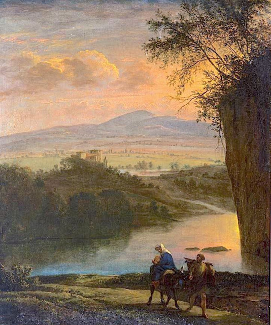
MOUNT SINAI / JABAL MUSA PAINTED BY JAN ASSELIJN

Jan Asselijn (c.1610 – October 1, 1652) Mount Sinaï / Jabal Musa (2,285 m - 7,496ft) Egypt In Flight into Egypt, c. 1640, oil on canvas, Rijksmuseum, Amsterdam


Jan Asselijn (c.1610 – October 1, 1652)
Mount Sinaï / Jabal Musa (2,285 m - 7,496ft)
Egypt

In Flight into Egypt, c. 1640, oil on canvas, Rijksmuseum, Amsterdam

 
About the painting 
Flight into Egypt used to be a very popular subject. Hundreds of canvas were painted on this subject between the 14th and 19th centuries, showing Mary with the baby on a donkey, led by Joseph, borrowing older iconography from the rare Byzantine journey to Bethlehem. Nevertheless, Joseph sometimes holds the child on his shoulders. Prior to about 1525, it was generally part of a larger cycle, whether it was the Nativity, the Life of Christ, or the Life of the Virgin. The background of these scenes generally (until the Council of Trent tightened up on such additions to the Scriptures) included a number of apocryphal miracles and provided an opportunity for the emerging genre of landscape painting.  The mountain deputed is supposed to be Mount Sinaï,  each painter giving his own vision of the sacred mountain or taking inspiration from what had already been painted in the past. The painted mountain  has generally very little to do with what Mount Sinaï really is.

The mountain
Mount Sinaï (2,285 m - 7,496 ft) or Jabal Mūsā or Gabal Mūsā (in arab : "Moses' Mountain" or "Mount Moses"), also known as Mount Horeb or Jebel Musa (a similarly named mountain in Morocco), is a mountain in the Sinai Peninsula of Egypt that is a possible location of the biblical Mount Sinai. The latter is mentioned many times in the Book of Exodus (and other books of the Bible) and the Quran. According to Jewish, Christian, and Islamic tradition, the biblical Mount Sinai was the place where Moses received the Ten Commandments.
Mount Sinai is a moderately high mountain near the city of Saint Katherine in the Sinai region.
It is next to Mount Katherine (2,629 m - 8,625 ft), the highest peak in Egypt.
Mount Sinai's rocks were formed in the late stage of the Arabian-Nubian Shield's (ANS) evolution. Mount Sinai displays a ring complex that consists of alkaline granites intruded into diverse rock types, including volcanics. The granites range in composition from syenogranite to alkali feldspar granite. The volcanic rocks are alkaline to peralkaline and they are represented by subaerial flows and eruptions and subvolcanic porphyry. Generally, the nature of the exposed rocks in Mount Sinai indicates that they originated from differing depths.
There are two principal routes to the summit. The longer and shallower route, Siket El Bashait, takes about 2.5 hours on foot, though camels can be used. The steeper, more direct route (Siket Sayidna Musa) is up the 3,750 "steps of penitence" in the ravine behind the monastery.
The summit of the mountain has a mosque that is still used by Muslims. It also has a Greek Orthodox chapel, constructed in 1934 on the ruins of a 16th-century church, that is not open to the public. The chapel encloses the rock which is considered to be the source for the biblical Tablets of Stone. At the summit also is "Moses' cave", where Moses was said to have waited to receive the Ten Commandments.

The painter
Asselijn was born at Dieppe from a French Huguenot family as Jean Asselin. He received instruction from Esaias van de Velde (1587–1630), and distinguished himself particularly in landscape and animal painting, though his historical works and battle pieces are also admired. He traveled in France and Italy, and modeled his style after Bamboccio (Pieter van Laer), also a member of the Bentvueghels. Nicolaes de Helt Stockade and Asselijn married two sisters in Lyons in 1645, both daughters of Houwaart Koorman of Antwerp. According to Houbraken, he heard this story from Abraham Genoels, who in turn heard it from Laurens Frank, an artist who was staying in the Koorman household with Artus Quellinus in Lyons at the time. Their marriages brought both Asselijn and Helt-Stockade back to the Netherlands after their travels. Asselijn had a withered hand and was small of stature, which gave him the nickname in France of petit Jean Hollandois, and which gave him the nickname Krabbetje (little claw) in the Bentvueghels. He seems to have befriended Rembrandt. In the etching that Rembrandt made of him, Asselijn appears in some states to be standing before an easel. His hands are not shown. Frederick de Moucheron, another Italianate landscape painter, was his pupil. He was one of the first Dutch painters who introduced a fresh and clear manner of painting landscapes in the style of Claude Lorrain, and his example was speedily followed byer artists. Asselijn's pictures were in high estimation at Amsterdam, and several of them are in the museums of that city. Twenty-four, painted in Italy, were engraved. One of his paintings, The Threatened Swan, which portrays a swan aggressively defending its nest, became a symbol of Dutch national resistance, although it is unknown if Asselijn intended it to be so.  The painting has been dated to the 1640s. It is considered to be Asselijn's most famous work  and was the Rijksmuseum's first acquisition.

__________________________________________
2021 - Wandering Vertexes...
by Francis Rousseau


Wednesday, April 21, 2021

HUANGSHAN / 黄山 (3) BY HONG REN / 弘仁


HONG REN / 弘仁 (1610-1663) Huangshan / 黄山 (1,864m - 6,115ft) China  In Painting with shitang, ink on paper, 60.2 x 46.8 cm, Qing dynasty, ca. 1657–58, Yale University Art Gallery - Mary Griggs Burke Collection

HONG REN / 弘仁 (1610-1663)
Huangshan / 黄山 (1,864m - 6,115ft)
China

In Painting with shitang, ink on paper, 60.2 x 46.8 cm, Qing dynasty, ca. 1657–58,
Yale University Art Gallery - Mary Griggs Burke Collection

The mountain 
Huangshan  /  黄山, sometimes called Yellow Mountains, is a mountain range in southern Anhui province in eastern China. Vegetation on the range is thickest below 1,100 meters (3,600 ft), with trees growing up to the treeline at 1,800 meters (5,900 ft). The Huangshan mountain range has many peaks, some more than 1,000 meters (3,250 feet) high. The three tallest and best-known peaks are Lotus Peak (Lian Hua Feng, 1,864 m), Bright Summit Peak (Guang Ming Ding, 1,840 m), and Celestial Peak (Tian Du Feng, literally Capital of Heaven Peak, 1,829 m).
The area is well known for its scenery, sunsets, peculiarly-shaped granite peaks, Huangshan pine trees, hot springs, winter snow, and views of the clouds from above. Much of Huangshan's reputation derives from its significance in Chinese arts and literature.  In addition to inspiring poets such as Li Bai, Huangshan and the scenery therein has been the frequent subject of poetry and artwork, especially Chinese ink painting and, more recently, photography.  Overall, from the Tang Dynasty to the end of the Qing Dynasty, more than 20,000 poems were written about Huangshan, and a school of painting named after it.  The mountains also have appeared in modern works.  James Cameron, director of the 2009 film Avatar, cited Huangshan as one of his influences in designing the fictional world of that film.  The area also has been a location for scientific research because of its diversity of flora and wildlife. In the early part of the twentieth century, the geology and vegetation of Huangshan were the subjects of multiple studies by both Chinese and foreign scientists. The mountain is still a subject of research.  For example, in the late twentieth century a team of researchers used the area for a field study of Tibetan macaques, a local species of monkey.
Huangshan is a UNESCO World Heritage Site, and one of China's major tourist destinations.  The World Heritage Site covers a core area of 154 square kilometres and a buffer zone of 142 square kilometres. In 2002, Huangshan was named the "sister mountain" of Jungfrau in the Swiss Alps.

The painter 
Hong Ren  / 弘仁 who is also known as Hongren, was an early Qing dynasty painter and a member of the Anhui (or Xin'an) school of painting. His birth name was Jiang Fang. After the fall of the Ming dynasty he became a monk, as did Zhu Da, Shitao, and Kun Can. They protested the fall of the Ming dynasty by becoming monks. Hong Ren's style has been said to "represent the world in a dematerialized, cleansed version ... revealing his personal peace through the liberating form of geometric abstraction."


___________________________________________
2021 - Wandering Vertexes...
by Francis Rousseau
Wednesday, April 7, 2021

FUJIYAMA / 富士山 BY SHIRO KASAMATSU / 笠松 紫浪


SHIRO  KASAMATSU, 笠松 紫浪, biography,  FujiYama,  富士山,  Japan, Fuji from Yoshida Yamanashi, 1958,  Woodblock Print

SHIRO  KASAMATSU / 笠松 紫浪) (1898-1991)
FujiYama / 富士山 (3,776 m - 12,389 ft)
Japan


In Fuji from Yoshida Yamanashi, 1958,  Woodblock Print Ink and color on paper, Private collection

 
The artist
Shiro Kasamatsu (笠松 紫浪) was a Japanese engraver and print maker trained in the Shin-Hanga and Sōsaku-Hanga styles of woodblock printing. Kasamatsu was born in Tokyo in 1898 and apprenticed at the age of 13 to Kaburagi Kiyokata (1878-1973), a traditional master of Bijin-ga, pictures of beautiful women. Kasamatsu however took an interest in landscape and was given the pseudonym Shiro by his teacher, which he used as a signature mark in his prints.  Kasamatsu made woodblock prints for the publisher Shōzaburō Watanabe from 1919.  Almost all the woodblocks were destroyed in a fire in Watanabe's print shop following the Great Kanto Earthquake of 1923. Around 50 prints were published by Watanabe by the late 1940s. Kasamatsu began to partner with Unsodo in Kyoto from the 1950s and produced nearly 102 prints by 1960. He also began to print and publish on his own in the Sōsaku-Hanga style. He produced nearly 80 Sōsaku-Hanga prints between 1955 and 1965.


The mountain

Mount Fuji or Fujiyama (富士山) is located on Honshu Island and is the highest mountain peak in Japan at 3,776.24 m (12,389 ft). Several names are attributed to it: "Fuji-san", "Fujiyama" or, redundantly, "Mt. Fujiyama". Usually Japanese speakers refer to the mountain as "Fuji-san". The other Japanese names for Mount Fuji, have become obsolete or poetic like: Fuji-no-Yama (ふじの山 - The Mountain of Fuji), Fuji-no-Takane (The High Peak of Fuji), Fuyō-hō (The Lotus Peak), and Fugaku , created by combining the first character of 富士, Fuji, and 岳, mountain.
Mount Fuji is an active stratovolcano that last erupted in 1707–08. Mount Fuji lies about 100 kilometres (60 mi) south-west of Tokyo, and can be seen from there on a clear day.
Mount Fuji's exceptionally symmetrical cone, which is snow-capped several months a year, is a well-known symbol of Japan and it is frequently depicted in art and photographs, as well as visited by sightseers and climbers.
Mount Fuji is one of Japan's Three Holy Mountains along with Mount Tate and Mount Haku. It is also a Special Place of Scenic Beauty and one of Japan's Historic Sites.
It was added to the World Heritage List as a Cultural Site on June 22, 2013. As per UNESCO, Mount Fuji has “inspired artists and poets and been the object of pilgrimage for centuries”. UNESCO recognizes 25 sites of cultural interest within the Mt. Fuji locality. These 25 locations include the mountain itself, Fujisan Hongū Sengen Shrine and six other Sengen shrines, two lodging houses, Lake Yamanaka, Lake Kawaguchi, the eight Oshino Hakkai hot springs, two lava tree molds, the remains of the Fuji-kō cult in the Hitoana cave, Shiraito Falls, and Miho no Matsubara pine tree grove; while on the low alps of Mount Fuji lies the Taisekiji temple complex, where the central base headquarters of Nichiren Shoshu Buddhism is located....

___________________________________________
2021 - Wandering Vertexes...
by Francis Rousseau

Wednesday, February 10, 2021

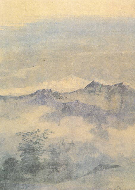
KANGCHENJUNGA PAINTED BY GAGANENDRANATH TAGORE


https://wanderingvertexes.blogspot.com/2021/02/kangchenjunga-painted-by-gaganendranath.html

GAGANENDRANATH  TAGORE  (1867-1938)
Kangchenjunga (8, 538m - 28,169 ft)
India, Népal

In Kangchenjunga, watercolor,  National Gallery of Modern Art, New Delhi


The painter
Gaganendranath Tagore was an Indian painter and cartoonist of the Bengal school. Along with his brother Abanindranath Tagore, he was counted as one of the earliest modern artists in India. Gaganendranath Tagore was born at Jorasanko into a family whose creativity defined Bengal's cultural life. Gaganendranath was the eldest son of Gunendranath Tagore, grandson of Girindranath Tagore and a great-grandson of Prince Dwarkanath Tagore. His brother Abanindranath was a pioneer and leading exponent of the Bengal School of Art. He was a nephew of the poet Rabindranath Tagore and the paternal great-grandfather of actress Sharmila Tagore. Gaganendranath received no formal education but trained under the watercolourist Harinarayan Bandopadhyay. In 1907, along with his brother Abanindranath, he founded the Indian Society of Oriental Art which later published the influential journal Rupam. Between 1906 and 1910, the artist studied and assimilated Japanese brush techniques and the influence of Far Eastern art into his own work, as demonstrated by his illustrations for Rabindranath Tagore's autobiography Jeevansmriti (1912). He went on to develop his own approach in his Chaitanya and Pilgrim series. Gaganendranath eventually abandoned the revivalism of the Bengal School and took up caricature. The Modern Review published many of his cartoons in 1917. From 1917 onwards, his satirical lithographs appeared in a series of books, including Play of Opposites, Realm of the Absurd and Reform Screams.
Between 1920 and 1925, Gaganendranath pioneered experiments in modernist painting.  Partha Mitter describes him as "the only Indian painter before the 1940s who made use of the language and syntax of Cubism in his painting". From 1925 onwards, the artist developed a complex post-cubist style.

The mountain
Kangchenjunga (8,586 m - 28,169 ft) is the third highest mountain in the world. It lies partly in Nepal and partly in Sikkim, India. Kangchenjunga is the second highest mountain of the Himalayas after Mount Everest. Three of the five peaks – Main, Central and South – are on the border between North Sikkim and Nepal. Two peaks are in the Taplejung District, Nepal.
Kangchenjunga Main is the highest mountain in India, and the easternmost of the mountains higher than 8,000 m (26,000 ft).
Until 1852, Kangchenjunga was assumed to be the highest mountain in the world, but calculations based on various readings and measurements made by the Great Trigonometrical Survey of India in 1849 came to the conclusion that Mount Everest., known as Peak XV at the time, was the highest.
It is listed int the Eight Thousanders and as Seven Third Summits
Kangchenjunga is the official spelling adopted by Douglas Freshfield, A. M. Kellas, and the Royal Geographical Society that gives the best indication of the Tibetan pronunciation. Freshfield referred to the spelling used by the Indian Government since the late 19th century. There are a number of alternative spellings including Kangchendzцnga, Khangchendzonga, and Kanchenjunga.
Local Lhopo people believe that the treasures are hidden but reveal to the devout when the world is in peril; the treasures comprise salt, gold, turquoise and precious stones, sacred scriptures, invincible armor or ammunition, grain and medicine. Kangchenjunga's name in the Limbu language is Senjelungma or Seseylungma, and is believed to be an abode of the omnipotent goddess Yuma Sammang.
It rises in a section of the Himalayas called Kangchenjunga Himal that is limited in the west by the Tamur River, in the north by the Lhonak Chu and Jongsang La, and in the east by the Teesta River. It lies about 128 km (80 mi) east of Mount Everest.
Allowing for further verification of all calculations, it was officially announced in 1856 that
Kangchenjunga was first climbed on 25 May 1955 by Joe Brown and George Band, who were part of a British expedition. They stopped short of the summit as per the promise given to the Chogyal that the top of the mountain would remain inviolate. Every climber or climbing group that has reached the summit has followed this tradition...

____________________________

2021 - Wandering Vertexes...
by Francis Rousseau

Wednesday, February 3, 2021

FUJIYAMA / 富士山 (n°13) BY KATSUSHIKA HOKUSAÏ


KATSUSHIKA HOKUSAÏ (1760-1849)
Fujiyama / 富士山 (3,776.24 m -12,389 ft)
Japan

In Fujiyama from the Village of Sekiya at Sumida river,
n °13 from the series 36 Views of Mt. Fuji, 1830-32,
Edo Tokyo Museum, Japan


About the 36 Views of Mt Fuji

Thirty-six Views of Mount Fuji (富嶽三十六景 Fugaku Sanjūrokkei) is a series of landscape prints created by the Japanese ukiyo-e artist Hokusai (1760?1849). The series depicts Mount Fuji from different locations and in various seasons and weather conditions. The original thirty-six prints were so popular that Hokusai expanded the series by ten.
The earliest impressions appear faded when compared to the versions usually seen, but are closer to Hokusai's original conception. The original prints have a deliberately uneven blue sky, which increases the sky's brightness and gives movement to the clouds. The peak is brought forward with a halo of Prussian blue. Subsequent prints have a strong, even blue tone and the printer added a new block, overprinting the white clouds on the horizon with light blue. Later prints also typically employ a strong benigara (Bengal red) pigment, which lent the painting its common name of Red Fuji. The green block colour was recut, lowering the meeting point between forest and mountain slope.

The artist
Katsushika Hokusai (葛飾 北斎) was a Japanese artist, ukiyo-e painter and printmaker of the Edo period. He was influenced by such painters as Sesshu, and other styles of Chinese painting. Born in Edo (now Tokyo), Hokusai is best known as author of the woodblock print series Thirty-six Views of Mount Fuji (富嶽三十六景 c. 1831) which includes the internationally recognized print, The Great Wave off Kanagawa, created during the 1820s.
Hokusai created the "Thirty-Six Views of Mt Fuji " both as a response to a domestic travel boom and as part of a personal obsession with Mount Fuji. In this series, Mt Fuji is painted on different meteorological conditions, in different hours of the days, in different seasons and from different places.

The mountain
This is the legendary Mount Fuji or Fujiyama (富士山).
It is located on Honshu Island and is the highest mountain peak in Japan at 3,776.24 m (12,389 ft). Several names are attributed to it: "Fuji-san", "Fujiyama" or, redundantly, "Mt. Fujiyama". Usually Japanese speakers refer to the mountain as "Fuji-san". The other Japanese names for Mount Fuji, have become obsolete or poetic like: Fuji-no-Yama (ふじの山 - The Mountain of Fuji), Fuji-no-Takane (ふじの高嶺- The High Peak of Fuji), Fuyō-hō (芙蓉峰 - The Lotus Peak), and Fugaku (富岳/富嶽), created by combining the first character of 富士, Fuji, and 岳, mountain.
Mount Fuji is an active stratovolcano that last erupted in 1707–08. Mount Fuji lies about 100 kilometres (60 mi) south-west of Tokyo, and can be seen from there on a clear day.
Mount Fuji's exceptionally symmetrical cone, which is snow-capped several months a year, is a well-known symbol of Japan and it is frequently depicted in art and photographs, as well as visited by sightseers and climbers.
Mount Fuji is one of Japan's Three Holy Mountains (三霊山) along with Mount Tate and Mount Haku. It is also a Special Place of Scenic Beauty and one of Japan's Historic Sites.
It was added to the World Heritage List as a Cultural Site on June 22, 2013. As per UNESCO, Mount Fuji has “inspired artists and poets and been the object of pilgrimage for centuries”. UNESCO recognizes 25 sites of cultural interest within the Mt. Fuji locality. These 25 locations include the mountain itself, Fujisan Hongū Sengen Shrine and six other Sengen shrines, two lodging houses, Lake Yamanaka, Lake Kawaguchi, the eight Oshino Hakkai hot springs, two lava tree molds, the remains of the Fuji-kō cult in the Hitoana cave, Shiraito Falls, and Miho no Matsubara pine tree grove; while on the low alps of Mount Fuji lies the Taisekiji temple complex, where the central base headquarters of Nichiren Shoshu Buddhism is located.


______________________________

2021 - Wandering Vertexes...
by Francis Rousseau

Saturday, January 16, 2021

POPOCATEPETL AND IZTACCHIHUATL (6) PAINTED BY JOSÉ MARIRA VELASCO


JOSE MARIA VELASCO (1840-1912)
Popocatépetl (5, 426 m -17, 802 ft) on left)
Iztaccíhuatl (5,230 m - 17,160 ft) (on right)
Mexico

In Popocatepetl and Iztacchihuatl , 1895, watercolor, The José María Velasco Museum, Mexico


The volcanoes
Popocatépetl (5,426 m - 17,802 ft), on right in this painting, is an active volcano, located in the states of Puebla, Mexico, and Morelos, in Central Mexico, and lies in the eastern half of the Trans-Mexican volcanic belt. The name Popocatépetl comes from the Nahuatl words Popōca (It smokes) and Tepētl (mountain), meaning Smoking Mountain. It is the second highest peak in Mexico, after Citlaltépetl (Pico de Orizaba) at 5,636 m (18,491 ft).
It is linked to the Iztaccihuatl volcano to the north by the high saddle known as the Paso de Cortés.
Popocatépetl is 70 km (43 mi) southeast of Mexico City, from where it can be seen regularly, depending on atmospheric conditions. Until recently, the volcano was one of three tall peaks in Mexico to contain glaciers, the others being Iztaccihuatl and Pico de Orizaba.
Iztaccíhuatl (5,230 m - 17,160 ft) is dormant volcanic mountain in Mexico located on the border between the State of Mexico and Puebla. It is the nation's third highest, after Pico de Orizaba 5,636 m (18,491 ft) and Popocatépetl 5,426 m (17,802 ft). The name "Iztaccíhuatl" is Nahuatl for "White woman", reflecting the four individual snow-capped peaks which depict the head, chest, knees and feet of a sleeping female when seen from east or west.The peak is sometimes nicknamed La Mujer Dormida (The Sleeping Woman.) Iztaccíhuatl is to the north of Popocatépetl, to which it is connected by the high altitude Paso de Cortés. Depending on atmospheric conditions Iztaccíhuatl is also visible much of the year from Mexico City some 70 km (43 mi) to the northwest.
The first recorded ascent was made in 1889, though archaeological evidence suggests the Aztecs and previous cultures climbed it previously. It is the lowest peak containing permanent snow and glaciers in Mexico.
In Aztec mythology : Iztaccíhuatl was a princess who fell in love with one of her father's warriors, Popocatépetl. The emperor sent Popocatépetl to war in Oaxaca, promising him Iztaccíhuatl as his wife when he returned (which Iztaccíhuatl's father presumed he would not). Iztaccíhuatl was falsely told that Popocatépetl had died in battle, and believing the news, she died of grief. When Popocatépetl returned to find his love dead, he took her body to a spot outside Tenochtitlan and kneeled by her grave. The gods covered them with snow and changed them into mountains.
Popocatépetl became an active volcano, raining fire on Earth in blind rage at the loss of his beloved.

The painter

José Maria Tranquilino Francisco de Jesus Velasco Gomez Obregуn, generally known as José Maria Velasco, was a 19th-century Mexican polymath, most famous as a painter who made Mexican geography a symbol of national identity through his paintings. He was both one of the most popular artists of the time and internationally renowned. He received many distinctions such as the gold medal of the Mexican National Expositions of Bellas Artes in 1874 and 1876; the gold medal of the Philadelphia International Exposition in 1876, on the centenary of U.S. independence; and the medal of the Paris Universal Exposition in 1889, on the centenary of the outbreak of the French Revolution. His painting El valle de Mexico is considered Velasco's masterpiece, of which he created seven different renditions. Of all the nineteenth-century painters, Velasco was the "first to be elevated in the post-Revolutionary period as an exemplar of nationalism."
Velasco's long career elevated Mexican landscape painting to international standing. One of his landscapes of the Valley of Mexico is in the Vatican Museum, a gift to Pope Leo XIII. His scenes of the Mexican landscape are a visual source for environmental historians, since they show the Valley of Mexico before its degradation in the twentieth century, with air pollution and urban sprawl. His landscape art has a wide appeal, since it is more accessible than history paintings that require the viewer to understand a particular event.
Today the Government of the State of Mexico, where Velasco was from, presents an award for artistic merit in his name to painters born in that state. Among the most outstanding winners are Luis Nishizawa, Leopoldo Flores, Ignacio Barrios and Héctor Cruz.
The José María Velasco Museum was opened in 1992 in Toluca City with the task of preserving and promoting his paintings.

_______________________________

2021 - Wandering Vertexes...
by Francis Rousseau

Thursday, December 24, 2020

MOUNT SINAÏ PAINTED BY JEAN-LÉON GERÔME


https://wanderingvertexes.blogspot.com/2020/12/mount-sinai-painted-by-jean-leon-gerome.html

JEAN-LÉON GERÔME (1824-1904)
Mount Sinaï / Jabal Musa (2,285 m - 7,496ft)
Egypt

In La fuite en Egypte , oil and tempera on panel, 1897, Musée Georges Garret, Vesoul (France)


About the painting
Jean Leon Gérome painted Mount Sinai on several occasions and often for its historical religious content as on the canvas above or in his Moses at Mount Sinai. Each time the painter added details of miraculous appearances! Here, it is an white angel who guides in a halo of light Mary and Joseph on the way of the Flight into Egypt. The description of Mount Sinai (on the bacjground) and its surroundings, seen from above (from the point of view of the Angel) adds an additional element to the strangeness of this painting.


The painter
Jean-Léon Gérôme was a French painter and sculptor in the style now known as academicism. The range of his oeuvre included historical painting, Greek mythology, Orientalism, portraits, and other subjects, bringing the academic painting tradition to an artistic climax. He is considered one of the most important painters from this academic period. He was also a teacher with a long list of students.
In 1856, he visited Egypt for the first time. Gérômes recurrent itinerary followed the classic grand tour of most occidental visitors to the Orient; up the nile to Cairo, across to Fayoum, then further up the Nile to Abu Simbel, then back to Cairo, across the Sinai Peninsula through Sinai and up the Wadi el-Araba to the Holy land, Jerusalem and finally Damascus. This would herald the start of many orientalist paintings depicting Arab religion, genre scenes and North African landscapes. In an autobiographical essay of 1878, Gérôme described how important oil sketches made on the spot were for him: "even when worn out after long marched under the bright sun, as soon as our camping spot was reached I got down to work with concentration. But Oh! How many things were left behind of which I carried only the memory away! And I prefer three touches of colour on a piece of canvas to the most vivid memory, but one had to continue on with some regret.
He did not only gather themes, artefacts and costumes for his oriental scenes, but also made oil studies from nature for their backgrounds. Several of these quick sketches are filled with details that exceed his wished for three touches of colour.
Gérôme's reputation was greatly enhanced at the Salon of 1857 by a collection of works of a more popular kind : The Duel ; After the Masked Ball (Musée Condé, Chantilly); Egyptian Recruits crossing the Desert; Memnon and Sesostris and Camels Watering.

The mountain
Mount Sinaï (2,285 m - 7,496 ft) or Jabal Mūsā or Gabal Mūsā (in arab : "Moses' Mountain" or "Mount Moses"), also known as Mount Horeb or Jebel Musa (a similarly named mountain in Morocco), is a mountain in the Sinai Peninsula of Egypt that is a possible location of the biblical Mount Sinai. The latter is mentioned many times in the Book of Exodus (and other books of the Bible) and the Quran. According to Jewish, Christian, and Islamic tradition, the biblical Mount Sinai was the place where Moses received the Ten Commandments.
Mount Sinai is a moderately high mountain near the city of Saint Katherine in the Sinai region.
It is next to Mount Katherine (2,629 m - 8,625 ft), the highest peak in Egypt.
Mount Sinai's rocks were formed in the late stage of the Arabian-Nubian Shield's (ANS) evolution. Mount Sinai displays a ring complex that consists of alkaline granites intruded into diverse rock types, including volcanics. The granites range in composition from syenogranite to alkali feldspar granite. The volcanic rocks are alkaline to peralkaline and they are represented by subaerial flows and eruptions and subvolcanic porphyry. Generally, the nature of the exposed rocks in Mount Sinai indicates that they originated from differing depths.
There are two principal routes to the summit. The longer and shallower route, Siket El Bashait, takes about 2.5 hours on foot, though camels can be used. The steeper, more direct route (Siket Sayidna Musa) is up the 3,750 "steps of penitence" in the ravine behind the monastery.
The summit of the mountain has a mosque that is still used by Muslims. It also has a Greek Orthodox chapel, constructed in 1934 on the ruins of a 16th-century church, that is not open to the public. The chapel encloses the rock which is considered to be the source for the biblical Tablets of Stone. At the summit also is "Moses' cave", where Moses was said to have waited to receive the Ten Commandments.

__________________________________________


2020 - Wandering Vertexes...
by Francis Rousseau


Tuesday, December 8, 2020

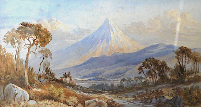
TARANAKI / MOUNT EGMONT PAINTED BY LAURENCE WILLIAM WILSON

https://wanderingvertexes.blogspot.com/2020/12/taranaki-mount-egmont-painted-by.html
 
 
LAURENCE WILLIAM WILSON (1851-1912)
Taranaki /Mount Egmont (2,518 m - 8,261 ft)
New Zealand (Northen Island)

The mountain
Taranaki or Mount Egmont (2,518 m - 8,261 ft) is an active but quiescent stratovolcano in the Taranaki region on the west coast of New Zealand's North Island. Although the mountain is more commonly referred to as Taranaki, it has two official names under the alternative names policy of the New Zealand Geographic Board. The mountain is one of the most symmetrical volcanic cones in the world. There is a secondary cone, Fanthams Peak or Panitahi in Māori (1,966 m - 6,450 ft), on the south side. Because of its resemblance to Mount Fuji, Taranaki provided the backdrop for the movie The Last Samurai.
For many centuries the mountain was called Taranaki by Māori. The Māori word tara means mountain peak, and naki is thought to come from ngaki, meaning "shining", a reference to the snow-clad winter nature of the upper slopes. It was also named Pukehaupapa and Pukeonaki by Iwi who live in the region in ancient times.
According to Māori mythology, Taranaki once resided in the middle of the North Island, with all the other New Zealand volcanoes. The beautiful Pihanga was coveted by all the mountains, and a great battle broke out between them. Tongariro eventually won the day, inflicted great wounds on the side of Taranaki, and causing him to flee. Taranaki headed westwards, following Te Toka a Rahotu and forming the deep gorges of the Whanganui River, paused for a while, creating the depression that formed the Te Ngaere swamp, then heading north. Further progress was blocked by the Pouakai ranges, and as the sun came up Taranaki became petrified in his current location. When Taranaki conceals himself with rainclouds, he is said to be crying for his lost love, and during spectacular sunsets, he is said to be displaying himself to her. In turn, Tongariro's eruptions are said to be a warning to Taranaki not to return.
Captain Cook named it Mount Egmont on 11 January 1770 after John Perceval, 2nd Earl of Egmont, a former First Lord of the Admiralty who had supported the concept of an oceanic search for Terra Australis Incognita. Cook described it as "of a prodigious height and its top cover'd with everlasting snow" surrounded by a "flat country ... which afforded a very good aspect, being clothed with wood and verdure".
When Marc-Joseph Marion du Fresne made landfall off Taranaki on 25 March 1772 he named the mountain Pic Mascarin. He was unaware of Cook's earlier visit. It appeared as Mount Egmont on maps until 29 May 1986, when the Minister of Lands ruled that "Mount Taranaki" would be an alternative and equal official name. The Egmont name still applies to the national park that surrounds the peak and geologists still refer to the peak as the Egmont Volcano.
Taranaki is geologically young, having commenced activity approximately 135,000 years ago. The most recent volcanic activity was the production of a lava dome in the crater and its collapse down the side of the mountain in the 1850s or 1860s. Between 1755 and 1800, an eruption sent a pyroclastic flow down the mountain's northeast flanks, and a moderate ash eruption occurred about 1755, of the size of Ruapehu's activity in 1995/1996. The last major eruption occurred around 1655. Recent research has shown that over the last 9,000 years minor eruptions have occurred roughly every 90 years on average, with major eruptions every 500 years.

The painter
Laurence William Wilson emigrated to Auckland in 1877 and then travelled extensively to settle in Dunedin in 1884. He painted in both oils and watercolours, became a painting companion of George O'Brien and a teacher. One of his pupils was the Dunedin artist Alfred O'Keefe. In 1895, LW Wilson together with Grace Joel, Alfred O'Keefe, Jane Wimperis and Girolami Nerli formed the Easel Club , a breakaway from the Dunedin Establishment, which offered a programme of special classes and the introduction of a professional lady model for life drawing. In 1904 LW Wilson left Dunedin for Melbourne where he spent 5 months on a commissioned painting of the city before he set out for England, eventually returning to New Zealand via India and Africa. He exhibited with the Canterbury Society of Arts in 1882 and the Otago Art Society between 1994 and 1904. His work was included in the NZ and South Seas Exhibition Dunedin 1889-90 and at the St Louis Exposition in 1904. LW Wilson is represented in the collections of all the major public galleries in New Zealand.

___________________________________________

2020 - Wandering Vertexes...
by Francis Rousseau