google.com, pub-0288379932320714, DIRECT, f08c47fec0942fa0 GRAVIR LES MONTAGNES... EN PEINTURE: ANDES
Showing posts with label ANDES. Show all posts

Tuesday, July 23, 2024

MONT MACHU PICCHU   PEINT PAR   GEORGIA O' KEEFFE


GEORGIA O' KEEFFE (1887–1986), El Machu Pichu Pérou  In Machu Picchu, Morning Light (1957) Huile sur toile, 61 x 45.7 cm. The Art Institute of Chicago (Donation Rosenbaum)

GEORGIA O' KEEFFE (1887–1986)
Mont Machu Picchu (2 430m)
Pérou

In Machu Picchu, Morning Light (1957) Huile sur toile, 61 x 45.7 cm. The Art Institute of Chicago (Donation Rosenbaum)


Le site
Machu Picchu (2430m) du quechua machu pikchu, litt. « vieux sommet », est une ancienne cité inca du xve siècle au Pérou, perchée sur un promontoire rocheux qui unit les monts Machu Picchu et Huayna Picchu (« le Jeune Pic » en quechua) sur le versant oriental des Andes centrales. Son nom aurait été Pikchu ou Picho. Considérée comme une œuvre maîtresse de l'architecture inca , elle est peu à peu abandonnée après l'effondrement de l'Empire inca au XVIe siècle, puis méconnue durant des siècles en dehors de la population locale. Cela lui a conféré une réputation de « cité oubliée ». Machu Picchu fut explorée en 1911 par l'archéologue américain Hiram Bingham (1875-1956), professeur assistant d'histoire de l'Amérique latine à l'université Yale, qui la fit connaître dans un ouvrage de référence. Le site est généralement considéré comme une des résidences de l'empereur inca Pachacútec. Quelques-unes des plus grandes constructions et le caractère cérémonial de la principale voie d'accès au llaqta évoquent un sanctuaire religieux. En revanche, les experts ont écarté l'idée d'un ouvrage militaire. Au centre d'un ensemble culturel et naturel connu sous le nom de « Sanctuaire historique de Machu Picchu », le site est depuis 1983 sur la liste du patrimoine mondial de l'UNESCO et depuis le XXIe siècle une des destinations touristiques les plus visitées de la planète, suscitant des mesures de régulation du surtourisme.


La peintre
Georgia O’Keeffe est une peintre américaine considérée comme une des peintres modernistes et des précisionnistes majeures du xxe siècle. L'art de Georgia O'Keeffe, un temps considéré moderniste et d'avant-garde, est basé sur une observation minutieuse de la nature et sur sa volonté de peindre ce qu'elle ressent. Elle demeurera à l'écart des courants, suivant sa propre voie. Ses gros plans de fleurs, qui caractérisent une bonne partie de sa production, révèlent son sens aigu de l'observation. Le format de ses toiles, les couleurs et les nuances rendent ses tableaux pratiquement abstraits. Les paysages du Nouveau-Mexique lui offrent de nouveaux sujets. Ses toiles représentant des crânes d'animaux, peints minutieusement, cherchent à symboliser la beauté du désert. Ses nombreux voyages en avion durant les années 1950 et 1960 lui inspirent sa série sur les nuages avec des toiles souvent de grandes dimensions.
À sa mort, Georgia O'Keeffe laisse environ 900 tableaux.
En novembre 2014, la vente aux enchères du tableau « Jimson Weed/White Flower No. 1 » en salle des ventes à New York, estimé initialement à 15 millions de dollars, monte à 44,4 millions de dollars, établissant par la même occasion un nouveau record mondial lors d'une vente aux enchères pour une artiste féminine.Le Georgia O'Keeffe Museum, un musée consacré à l'artiste, a été inauguré en 1997, à Santa Fe, grâce aux avoirs légués à sa mort. Sa maison à Abiquiú a été déclarée National Historic Landmark en 1998. Un film inspiré de son mariage a été réalisé par Edwin Sherin en 1991, A Marriage: Georgia O'Keeffe and Alfred Stieglitz. Un film biographique de Bob Balaban, Georgia O'Keeffe, est paru en 2009. Ses œuvres font partie des collections de nombreuses institutions muséales.

 ______________________________
2024 - Gravir les montagnes en peinture
Un blog de Francis Rousseau   

Sunday, June 23, 2024

LES ANDES DU SUD  PEINTES PAR RHOD WULFARS

RHOD WULFARS (bn. 1979) Andes du sud (6,991 m - 22, 838ft) Argentine    In « Twin", acrylic on hardboard, 2018, Private collection


RHOD WULFARS (bn. 1979)
Andes du sud (6,991 m - 22, 838ft)
Argentine

In « Twin", acrylic on hardboard, 2018, Private collection 
@rhodwulfars

D'autres œuvres de cet artiste sur son site : rhodwulfars.wixsite.com/rhodwulfars/


L'artiste
Rhod Wulfars est un peintre de montagne contemporain utilisant principalement la technique acrylique pour ses peintures. Il est né en 1979 à Mendoza (Argentine). Sur son site Internet, il écrit : "J'ai passé toute ma vie près des montagnes. Un jour, j'ai commencé à les peindre". Utilisant, à la manière de Nicolas de Staël, un style toujours entre abstrait et figuratif, ses peintures très fortes et très émouvantes décrivent parfaitement la majesté et le contenu spectaculaire des sommets qu'il peint. Rhod Wulfars fait un usage surprenant du médium acrylique, en pâte épaisse comme on pourrait le faire avec de la peinture à l'huile. Il avait l'habitude de ne nommer ses œuvres que par des chiffres et des lettres de série, mais parfois il écrit le nom des sommets et le rend plus facile à identifier.

A propos des tableaux
Le peintre écrit : " Ce n'est pas une vraie montagne. La plupart de mes peintures naissent de la combinaison de l'imagination et des heures passées à les regarder, à les parcourir et à les sentir. Elles ressemblent à ces reliefs de la Cordillera andine argentine appelés "acarreos", qui sont de longues pentes de roche meuble très populaires et facilement visibles. très fréquemment observée. Ce tableau est donc celui d'une montagne inconnue, rêvée qui en résume plusieurs, et qui est sortie de mon inconscient un après-midi où le pinceau lui a donné vie de façon mystérieuse sans que je puisse l'expliquer. " Le plus étonnant étant qu'ils le font d'un seul coup de pinceau aussi puissant et définitif que le soulèvement rocheux lui-même qui a crée ses reliefs.

Les montagnes
Les Andes (Cordillera de los Andes en espagnol) sont la plus longue chaîne de montagnes continentales du monde, formant un plateau continu le long de la bordure ouest de l'Amérique du Sud. Leur étendue est de 7000 km (4350 mi) de long, 200 à 700 km (124 à 435 mi) de large (la plus large entre 18 ° S et 20 ° S de latitude) et d'une hauteur moyenne d'environ 4000 m (13123 pieds). Les Andes s'étendent du nord au sud à travers sept pays d'Amérique du Sud : le Venezuela, la Colombie, l'Équateur, le Pérou, la Bolivie, le Chili et l'Argentine.
La Cordillère des Andes est la plus haute chaîne de montagnes en dehors de l'Asie. La plus haute montagne en dehors de l'Asie, le mont Aconcagua en Argentine, s'élève à une altitude d'environ 6 961 m (22 838 pieds) au-dessus du niveau de la mer. Le pic du Chimborazo dans les Andes équatoriennes est plus éloigné du centre de la Terre que tout autre endroit à la surface de la Terre, en raison du renflement équatorial résultant de la rotation de la Terre. Les plus hauts volcans du monde se trouvent dans les Andes, y compris Ojos del Salado à la frontière Chili-Argentine, qui culmine à 6 893 m (22 615 pieds).
Les Andes font également partie de la Cordillère américaine, une chaîne de chaînes de montagnes (cordillère) qui consiste en une séquence presque continue de chaînes de montagnes qui forment la "colonne vertébrale" occidentale de l'Amérique du Nord, de l'Amérique centrale, de l'Amérique du Sud et de l'Antarctique.

_________________________________________

2023 - Wandering Vertexes ....
Errant au-dessus des Sommets Silencieux...
Un blog de Francis Rousseau


Monday, September 18, 2023

LES ANDES DU SUD   PEINTES PAR   RHOD WULFARS (bn. 1979)


RHOD WULFARS (bn. 1979) Andes du Sud (6, 991 m - 22, 838 ft) Argentine  In Andes from Menodza, 2018, acrylique sur radiographie, 24 x 30cm, Collection de l'artiste  @rhodwulfars D'autres œuvres de cet artiste sur son site : rhodwulfars.wixsite.com/rhodwulfars/


RHOD WULFARS (bn. 1979)
Andes du Sud (6, 991 m - 22, 838 ft)
Argentine

In Andes from Mendoza, 2018, acrylique sur radiographie, 24 x 30cm, Collection de l'artiste

@rhodwulfars
D'autres œuvres de cet artiste sur son site : rhodwulfars.wixsite.com/rhodwulfars/


L'artiste
Rhod Wulfars est un peintre de montagne contemporain utilisant principalement la technique acrylique pour ses peintures. Il est né en 1979 à Mendoza (Argentine). Sur son site Internet, il écrit : "J'ai passé toute ma vie près des montagnes. Un jour, j'ai commencé à les peindre". Utilisant, à la manière de Nicolas de Staël, un style toujours entre abstrait et figuratif, ses peintures très fortes et très émouvantes décrivent parfaitement la majesté et le contenu spectaculaire des sommets qu'il peint. Rhod Wulfars fait un usage surprenant du médium acrylique, en pâte épaisse comme on pourrait le faire avec de la peinture à l'huile. Il avait l'habitude de ne nommer ses œuvres que par des chiffres et des lettres de série, mais parfois il écrit le nom des sommets et le rend plus facile à identifier.

A propos des tableaux
Le peintre écrit : " Ce n'est pas une vraie montagne. La plupart de mes peintures naissent de la combinaison de l'imagination et des heures passées à les regarder, à les parcourir et à les sentir. Elles ressemblent à ces reliefs de la Cordillera andine argentine appelés "acarreos", qui sont de longues pentes de roche meuble très populaires et facilement visibles. très fréquemment observée. Ce tableau est donc celui d'une montagne inconnue, rêvée qui en résume plusieurs, et qui est sortie de mon inconscient un après-midi où le pinceau lui a donné vie de façon mystérieuse sans que je puisse l'expliquer. " Le plus étonnant étant qu'ils le font d'un seul coup de pinceau aussi puissant et définitif que le soulèvement rocheux lui-même qui a crée ses reliefs.

Les montagnes
Les Andes (Cordillera de los Andes en espagnol) sont la plus longue chaîne de montagnes continentales du monde, formant un plateau continu le long de la bordure ouest de l'Amérique du Sud. Leur étendue est de 7000 km (4350 mi) de long, 200 à 700 km (124 à 435 mi) de large (la plus large entre 18 ° S et 20 ° S de latitude) et d'une hauteur moyenne d'environ 4000 m (13123 pieds). Les Andes s'étendent du nord au sud à travers sept pays d'Amérique du Sud : le Venezuela, la Colombie, l'Équateur, le Pérou, la Bolivie, le Chili et l'Argentine.
La Cordillère des Andes est la plus haute chaîne de montagnes en dehors de l'Asie. La plus haute montagne en dehors de l'Asie, le mont Aconcagua en Argentine, s'élève à une altitude d'environ 6 961 m (22 838 pieds) au-dessus du niveau de la mer. Le pic du Chimborazo dans les Andes équatoriennes est plus éloigné du centre de la Terre que tout autre endroit à la surface de la Terre, en raison du renflement équatorial résultant de la rotation de la Terre. Les plus hauts volcans du monde se trouvent dans les Andes, y compris Ojos del Salado à la frontière Chili-Argentine, qui culmine à 6 893 m (22 615 pieds).
Les Andes font également partie de la Cordillère américaine, une chaîne de chaînes de montagnes (cordillère) qui consiste en une séquence presque continue de chaînes de montagnes qui forment la "colonne vertébrale" occidentale de l'Amérique du Nord, de l'Amérique centrale, de l'Amérique du Sud et de l'Antarctique.

_________________________________________

2023 - Wandering Vertexes ....
Errant au-dessus des Sommets Silencieux...
Un blog de Francis Rousseau

Tuesday, May 30, 2023

LES ANDES ARGENTINES PEINTES PAR RHOD WULFARS


RHOD WULFARS (né en 1979) Andes du Sud (6, 991 m - 22, 838 FT) Argentine  In Andes from Mendoza,  acrylique sur panneau dur, 2018, Collection de l'artiste @rhodwulfars D'autres œuvres de cet artiste sur son site : rhodwulfars.wixsite.com/rhodwulfars/

RHOD WULFARS (né en 1979)
Andes du Sud (6, 991 m - 22, 838 ft)
Argentine

In Andes from Menodza,  acrylique sur panneau dur, 2018, Collection de l'artiste @rhodwulfars
D'autres œuvres de cet artiste sur son site : rhodwulfars.wixsite.com/rhodwulfars/


L'artiste
Rhod Wulfars est un peintre de montagne contemporain utilisant principalement la technique acrylique pour ses peintures. Il est né en 1979 à Mendoza (Argentine). Sur son site Internet, il écrit : "J'ai passé toute ma vie près des montagnes. Un jour, j'ai commencé à les peindre". Utilisant, à la manière de Nicolas de Staël, un style toujours entre abstrait et figuratif, ses peintures très fortes et très émouvantes décrivent parfaitement la majesté et le contenu spectaculaire des sommets qu'il peint. Rhod Wulfars fait un usage surprenant du médium acrylique, en pâte épaisse comme on pourrait le faire avec de la peinture à l'huile. Il avait l'habitude de ne nommer ses œuvres que par des chiffres et des lettres de série, mais parfois il écrit le nom des sommets et le rend plus facile à identifier.

A propos des tableaux
Le peintre écrit : " Ce n'est pas une vraie montagne. La plupart de mes peintures naissent de la combinaison de l'imagination et des heures passées à les regarder, à les parcourir et à les sentir. Elles ressemblent à ces reliefs de la Coridilla andine argentine appelés "acarreos", qui sont de longues pentes de roche meuble très populaires et facilement visibles. très fréquemment observée. Ce tableau est donc celui d'une montagne inconnue, rêvée qui en résume plusieurs, et qui est sortie de mon inconscient un après-midi où le pinceau lui a donné vie de façon mystérieuse sans que je puisse l'expliquer. " Le plus étonnant étant qu'ils le font d'un seul coup de pinceau aussi puissant et définitif que le soulèvement rocheux lui-même qui a crée ses reliefs.

Les montagnes
Les Andes (Cordillera de los Andes en espagnol) sont la plus longue chaîne de montagnes continentales du monde, formant un plateau continu le long de la bordure ouest de l'Amérique du Sud. Leur étendue est de 7000 km (4350 mi) de long, 200 à 700 km (124 à 435 mi) de large (la plus large entre 18 ° S et 20 ° S de latitude) et d'une hauteur moyenne d'environ 4000 m (13123 pieds). Les Andes s'étendent du nord au sud à travers sept pays d'Amérique du Sud : le Venezuela, la Colombie, l'Équateur, le Pérou, la Bolivie, le Chili et l'Argentine.
La Cordillère des Andes est la plus haute chaîne de montagnes en dehors de l'Asie. La plus haute montagne en dehors de l'Asie, le mont Aconcagua en Argentine, s'élève à une altitude d'environ 6 961 m (22 838 pieds) au-dessus du niveau de la mer. Le pic du Chimborazo dans les Andes équatoriennes est plus éloigné du centre de la Terre que tout autre endroit à la surface de la Terre, en raison du renflement équatorial résultant de la rotation de la Terre. Les plus hauts volcans du monde se trouvent dans les Andes, y compris Ojos del Salado à la frontière Chili-Argentine, qui culmine à 6 893 m (22 615 pieds).
Les Andes font également partie de la Cordillère américaine, une chaîne de chaînes de montagnes (cordillère) qui consiste en une séquence presque continue de chaînes de montagnes qui forment la "colonne vertébrale" occidentale de l'Amérique du Nord, de l'Amérique centrale, de l'Amérique du Sud et de l'Antarctique.

_________________________________________

2023 - Wandering Vertexes ....
Errant au-dessus des Sommets Silencieux...
Un blog de Francis Rousseau

Monday, December 12, 2022

LES ANDES ARGENTINES PEINTES PAR RHOD WULFARS


RHOD WULFARS (né en 1979) Andes du Sud (6 991 m - 22 838 pieds) Argentine  In Andes, acrylique sur panneau dur, 2018, Collection de l'artiste @rhodwulfars D'autres oeuvres de cet artiste sur son site : rhodwulfars.wixsite.com/rhodwulfars/

RHOD WULFARS (né en 1979)
Andes du Sud (6 991 m - 22 838 pieds)
Argentine

In Andes, acrylique sur panneau dur, 2018, Collection de l'artiste @rhodwulfars
D'autres oeuvres de cet artiste sur son site : rhodwulfars.wixsite.com/rhodwulfars/


L'artiste
Rhod Wulfars est un peintre de montagne contemporain utilisant principalement la technique acrylique pour ses peintures. Il est né en 1979 à Mendoza (Argentine). Sur son site Internet, il écrit : "J'ai passé toute ma vie près des montagnes. Un jour, j'ai commencé à les peindre". Utilisant, à la manière de Nicolas de Staël, un style toujours entre abstrait et figuratif, ses peintures très fortes et très émouvantes décrivent parfaitement la majesté et le contenu spectaculaire des sommets qu'il peint. Rhod Wulfars fait un usage surprenant du médium acrylique, en pâte épaisse comme on pourrait le faire avec de la peinture à l'huile. Il avait l'habitude de ne nommer ses œuvres que par des chiffres et des lettres de série, mais parfois il écrit le nom des sommets et le rend plus facile à identifier. 

A propos des tableaux
Le peintre écrit : " Ce n'est pas une vraie montagne. La plupart de mes peintures naissent de la combinaison de l'imagination et des heures passées à les regarder, à les parcourir et à les sentir. Elles  ressemblent à ces reliefs de la Coridilla andine argentine appelés "acarreos", qui sont de longues pentes de roche meuble très populaires et facilement visibles. très fréquemment observée. Ce tableau est donc celui d'une montagne inconnue, rêvée qui en résume plusieurs, et qui est sortie de mon inconscient un après-midi où le pinceau lui a donné vie de façon mystérieuse sans que je puisse l'expliquer. "  Le plus étonnant étant qu'ils le font d'un seul coup de pinceau aussi puissant et définitif que le soulèvement rocheux lui-même qui a crée ses reliefs. 


Les montagnes
Les Andes (Cordillera de los Andes en espagnol) sont la plus longue chaîne de montagnes continentales du monde, formant un plateau continu le long de la bordure ouest de l'Amérique du Sud. Leur étendue est de  7000 km (4350 mi) de long, 200 à 700 km (124 à 435 mi) de large (la plus large entre 18 ° S et 20 ° S de latitude) et d'une hauteur moyenne d'environ 4000 m (13123 pieds). Les Andes s'étendent du nord au sud à travers sept pays d'Amérique du Sud : le Venezuela, la Colombie, l'Équateur, le Pérou, la Bolivie, le Chili et l'Argentine.
La Cordillère des Andes est la plus haute chaîne de montagnes en dehors de l'Asie. La plus haute montagne en dehors de l'Asie, le mont Aconcagua en Argentine, s'élève à une altitude d'environ 6 961 m (22 838 pieds) au-dessus du niveau de la mer. Le pic du Chimborazo dans les Andes équatoriennes est plus éloigné du centre de la Terre que tout autre endroit à la surface de la Terre, en raison du renflement équatorial résultant de la rotation de la Terre. Les plus hauts volcans du monde se trouvent dans les Andes, y compris Ojos del Salado à la frontière Chili-Argentine, qui culmine à 6 893 m (22 615 pieds).
Les Andes font également partie de la Cordillère américaine, une chaîne de chaînes de montagnes (cordillère) qui consiste en une séquence presque continue de chaînes de montagnes qui forment la "colonne vertébrale" occidentale de l'Amérique du Nord, de l'Amérique centrale, de l'Amérique du Sud et de l'Antarctique.

 _________________________________________

2022 - Wandering Vertexes ....
            Errant au-dessus des Sommets Silencieux...
            Un blog de Francis Rousseau

Monday, October 10, 2022

THE FIZTROY (?) PAINTED BY RHOD WULFARS


RHOD WULFARS (bn. 1979), The Fitz Roy / Cerro Chalten (3,405 m- 11, 171 ft) Chile - Argentina border


RHOD WULFARS (bn. 1979),
The Fitz Roy / Cerro Chalten (3,405 m- 11, 171 ft)
Chile - Argentina border

About this painting
The painter wrote: “It is not a real mountain. Most of my paintings are born from the combination of the imagination and the hours spent looking, walking and smelling them. I call them "Twins" because they are similar to those reliefs of the Argentinian Andean Coridilla called "acarreos", which are long slopes of very popular loose rock that can be easily viewed. very frequently observed. This painting is therefore that of an unknown mountain, dreamt up which sums up several, and which came out of my unconscious one afternoon when the brush gave it life in a mysterious way without my being able to explain it. "
The artist
Rhod Wulfars is a contemporary mountain painter using mainly acrylic technique for his paintings.
He was born in 1979 in Mendoza (Argentina). In his website he wrote: "I have spent my whole life by the mountains. On day I started to paint them". Using, in the manner of Nicolas de Staël, a style always beetween abstract and figurative, his very strong and very moving paintings described perfectly the majesty and the spectacular contents of the peaks he paints. Rhod Wulfars makes a surprising use of acrylic medium, in thick paste as one could do with oil paint. He used to named his works only bu numbers, and series letters, but sometime he writes the name of the peaks ans makes it more easy to identify. Other works by this artist on his website : rhodwulfars.wixsite.com/rhodwulfars/


The mountain
Fitz Roy / Cerro Chalten (3,405m- 11, 171 ft) is a mountain located near El Chaltèn village, in the Southern Patagonian Ice Field in Patagonia, on the border between Argentina and Chile. First climbed in 1952 by French alpinists Lionel Terray and Guido Magnone, " The Fitz Roy " remains among the most technically challenging mountains for mountaineers on Earth. Mount Fitz Roy is the basis for the Patagonia clothing logo following Yvon Chouinard's ascent and subsequent film in 1968.
Argentine explorer Francisco Moreno first saw the mountain on 2 March 1877. He named it Fitz Roy, in honour of Robert FitzRoy, who, as captain of the HMS Beagle had travelled up the Santa Cruz River in 1834 and charted large parts of the Patagonian coast.
Cerro is a Spanish word meaning mountain, while Chaltèn comes from a Tehuelche (Aonikenk) word meaning "smoking mountain", due to a cloud that usually forms around the mountain's peak. Fitz Roy, however, was only one of a number of peaks the Tehuelche called Chaltèn.
It has been agreed by Argentina and Chile that their international border detours eastwards to pass over the main summit, but a large part of the border to the south of the summit, as far as Cerro Murallуn, remains undefined.

______________________________
2022- Wandering Vertexes
Un blog de Francis Rousseau

Wednesday, August 31, 2022

CHIMBORAZO PAINTED BY FREDERIC EDWIN CHURCH

FREDERIC EDWIN CHURCH (1826-1900) El Chimborazo (6,263 m -20,548 ft) Ecuador  In Mount Chimborazo Shown From Riobamba, Ecuador, 1857, Brush and oil on thin board, 29.1 x 44.1 cm (11 7/16 x 17 3/8 in.) Smithsonian/ Cooper Hewitt, Smithsonian Design Museum

FREDERIC EDWIN CHURCH (1826-1900)
El Chimborazo (6,263 m -20,548 ft)
Ecuador

In Mount Chimborazo Shown From Riobamba, Ecuador, 1857, Brush and oil on thin board,
29.1 x 44.1 cm (11 7/16 x 17 3/8 in.) Smithsonian/ Cooper Hewitt, Smithsonian Design Museum

 
The mountain
Chimborazo (6,263 m -20,548 ft) is a currently inactive stratovolcano in the Cordillera Occidental range of the Andes ans the highest mountain in Ecuador and the Andes north of Peru ; it is higher than any more northerly summit in the Americas. Chimborazo is not the highest mountain by elevation above sea level, but its location along the equatorial bulge makes its summit the farthest point on the Earth's surface from the Earth's center. Chimborazo is at the main end of the Ecuadorian Volcanic Arc, north west of the town of Riobamba. Chimborazo is in la Avenida de los Volcanes (the Avenue of Volcanoes) west of the Sanancajas mountain chain. Carihuairazo, Tungurahua, Tulabug, and El Altar are all mountains that neighbor Chimborazo. The closest mountain peak, Carihuairazo, is 5.8 mi (9.3 km) from Chimborazo. There are many microclimates near Chimborazo, varying from desert in the Arenal to the humid mountains in the Abraspungo valley. Its last known eruption is believed to have occurred around A.D. 550. Until the beginning of the 19th century, it was thought that Chimborazo was the highest mountain on Earth (measured from sea level), and such reputation led to many attempts on its summit during the 17th and 18th centuries. In 1746, the volcano was explored by French academicians from the French Geodesic Mission. Their mission was to determine the sphericity of the Earth. Their work along with another team in Lapland established that the Earth was an oblate spheroid rather than a true sphere. They did not reach the summit of Chimborazo. In 1802, during his expedition to South America, Baron Alexander von Humboldt, accompanied by Aimé Bonpland and the Ecuadorian Carlos Montufar, tried to reach the summit. From his description of the mountain, it seems that before he and his companions had to return suffering from altitude sickness they reached a point at 5,875 m, higher than previously attained by any European in recorded history. (Incans had reached much higher altitudes previously; see Llullaillaco). In 1831, Jean-Baptiste Boussingault and Colonel Hall reached a new "highest point", estimated to be 6,006 m. On 4 January 1880, the English climber Edward Whymper reached the summit of Chimborazo. The route that Whymper took up Chimborazo is now known as the Whymper route. Edward Whymper, and his Italian guides Louis Carrel and Jean-Antoine Carrel, were the first Europeans to summit a mountain higher than 20,000 feet. As there were many critics who doubted that Whymper had reached the summit, later in the same year he climbed to the summit again, choosing a different route (Pogyos) with the Ecuadorians David Beltrбn and Francisco Campaсa.


The painter
Frederic Edwin Church was an American landscape painter born in Hartford, Connecticut. He was a central figure in the Hudson River School of American landscape painters, perhaps best known for painting large panoramic landscapes, often depicting mountains, waterfalls, and sunsets, but also sometimes depicting dramatic natural phenomena that he saw during his travels to the Arctic and Central and South America. Church's paintings put an emphasis on light and a romantic respect for natural detail. In his later years, Church painted classical Mediterranean and Middle Eastern scenes and cityscapes. Church was the product of the second generation of the Hudson River School and the pupil of Thomas Cole, the school’s founder. The Hudson River School was established by the British Thomas Cole when he moved to America and started painting landscapes, mostly of mountains and other traditional American scenes. Both Cole and Church were devout Protestants and the latter's beliefs played a role in his paintings especially his early canvases. Church did differ from Cole in the topics of his paintings: he preferred natural and often majestic scenes over Cole's propensity towards allegory.
Church, like most second generation Hudson River School painters, used extraordinary detail, romanticism, and luminism in his paintings. Romanticism was prominent in Britain and France in the early 1800s as a counter-movement to the Enlightenment virtues of order and logic. Artists of the Romantic period often depicted nature in idealized scenes that depicted the richness and beauty of nature, sometimes also with emphasis on the grand scale of nature.
This tradition carries on in the works of Frederic Church, who idealizes an uninterrupted nature, highlighted by creating excruciatingly detailed art. The emphasis on nature is encouraged by the low horizontal lines, and preponderance of sky to enhance the wilderness; humanity, if it is represented, is depicted as small in comparison with the greater natural reality. The technical skill comes in the form of Luminism, a Hudson River School innovation particularly present in Church's works. Luminism is also cited as encompassing several technical aspects, which can be seen in Church’s works. One example is the attempt to “hide brushstrokes” which makes the scene seem more realistic and lessen the artist’s presence in the work. Most importantly is the emphasis on light (hence luminism) in these scenes. The several sources of light create contrast in the pictures that highlights the beauty and detailed imagery in the painting.
_________________________________________

2022 - Wandering Vertexes...
by Francis Rousseau


Friday, July 8, 2022

EL VULCAN PLANCHÒN-PETEROA PHOTOGRAPHED BY LEO WEHRLI


LEO WEHRLI (1870–1954) El Planchón-Peteroa (4,107 m - 13,474 ft) Argentina- Chile border  In Planchon Vulcan photo1897, hand colorized by Anna Wehrli-Frey 1918, ETH Library, Zurich

LEO WEHRLI (1870–1954)
El Planchón-Peteroa (4,107 m - 13,474 ft)
Argentina- Chile border

In Planchon Vulcan, photo,1897, hand colorized by Anna Wehrli-Frey 1918,
ETH Library, Zurich


The volcano
EL Planchón-Peteroa (4,107m - 13,474 ft) also known as Azufre-Planchón-Peteroa or Nevado de los Banos is a complex of active volcanoes extending in a north–south direction along the border between Argentina and Chile. It consists of volcanoes of various ages with several overlapping calderas. Those include Volcán Planchón, Volcán Peteroa and Volcán Azufre. A partial collapse of the complex about 11,500 years ago produced a major debris avalanche, which followed the course of the Teno River until reaching the Chile Central Valley. Peteroa has a crater lake. Lagunas de Teno lies at the foot of Planchón volcano. In this area also is the Vergara International Pass.
Planchón-Peteroa Volcano erupted on September 6, followed by a stronger eruption on September 18. On September 6, 2010, , the volcano erupted once again, emitting a dark gray plume of volcanic ash. As winds blew the ash southeast into Argentina, residents there were warned by authorities to evacuate the nearby areas before Planchón-Peteroa would erupt again.

The photographer
Leo Wehrli was a Swiss geologist, professor and explorer. After studying music, botany, chemistry, mineralogy, petrography and geology in Berlin and Zurich, Wehrli became assistant to Albert Heim. Immediately after completing his thesis, he left for Argentina with the famous Carl Emanuel Burckhardt in 1896. Accredited by the La Plata Museum and the government of Argentina, he explored the Andes he crossed at least five times during a stay of two years. His work was more particularly oriented on the delimitation of the border between Argentina and Chile after the agreement signedbetween these two countries in 1881 and on the determination of the property of mountain peaks, ridge lines and basins slopes.
After his return to Switzerland, he worked between 1900 and 1935 as a teacher and then lecturer for the Geol. Centralblatt in Berlin ; between 1901 and 1912, he wrote nearly 500 articles. He made other trips through Europe and North Africa (Egypt) before going back to Argentina again in 1938. He has summarized his research results in numerous articles, notably in the Geographic Lexicon of Switzerland. He participated in the founding of the Zurich Adult Education Center and gave lectures there from 1921 to 1953. From 1931 to 1951 he was a member of the Swiss Alpine Club SAC commission for the Central Library and has was president for 14 years.
Wehrli left a collection of 15,000 slides, some of which were hand-colored by his wife, born Anna Frey. A large part of the works is made available online by the photographic archives of the ETH-Bibliothek in Zurich.

___________________________________________

2022 - Wandering Vertexes...
by Francis Rousseau

Tuesday, July 5, 2022

ALPAMAYO SUMMIT PHOTOGRAPHED IN 1936 BY ERWIN SCHNEIDER


ERWIN SCHNEIDER (1906-1987) Alpamayo ( 5,947m - 19,511 ft) Peru  In  "Alpamayo summit", argentic photo 1936 
 
 
ERWIN SCHNEIDER (1906-1987) 
Alpamayo ( 5,947m - 19,511 ft) 
Peru

In  "Alpamayo summit", argentic photo 1936


The mountain

Alpamayo ( 5,947m - 19,511 ft) possibly named from Quechua words is one of the most conspicuous peaks in the Cordillera Blanca of the Peruvian Andes. Alpamayo Creek originates northwest of it. The Alpamayo lies next to the slightly higher Quitaraju. n July 1966, the German magazine "Alpinismus", published a photo of Alpamayo taken by American photographer Leigh Ortenburger accompanied by an article on a survey among mountaineering experts, who chose Alpamayo as "The Most Beautiful Mountain in the World". Not defined by a single summit Alpamayo has two sharp summits, the North and south, which are separated by a narrow corniced ridge.
The first attempt on Alpamayo's summit was in 1948 by a Swiss expedition. Climbing by way of the heavily corniced North Ridge, the three climbers came within sight of the virgin summit when a large cornice broke under them and they were carried down the precipitous Northwest Face. By some amazing piece of good fortune, the three were neither buried nor injured by the 650 foot fall and they were able to make an 'orderly retreat' from the mountain. In 1951, a Franco-Belgian expedition including George and Claude Kogan claimed to have made the first ascent via the North Ridge. After studying the photos in George Kogan's book The Ascent of Alpamayo, the German team of Günter Hauser, Frieder Knauss, Bernhard Huhn and Horst Wiedmann came to the conclusion that the 1951 team did not reach the actual summit, thereby making their ascent via the South Ridge in 1957 the first. Although the South Ridge is no less steep or dangerous than the North Ridge, it has the advantage of leading directly to the higher south summit. This was written up in Hauser's book White Mountain and Tawny Plain. Although there are several climbing routes on the Southwest Face the most common is known as the Ferrari or Italian Route. It was opened in 1975 by a group of Italian alpinists led by Casimiro Ferrari. It begins at the top of the highest point of the snow slope where the bergshrund separates the upper face on the left and then ascends a steep runnel to the summit ridge. Because of its esthetic beauty, Alpamayo is one of the most climbed mountains in the Andes and the base camp can be a hodge-podge of nationalities. Each year the route is made easy by the first party to ascend the route as they usually leave snow-stakes in place at the belay stations. Then it is just a matter of finding out what length of rope they used so that your rope is long enough to reach each station. In the summer of 1988, they had used 50m ropes.

The photographer
Erwin Hermann Manfred Schneider was an Austrian mountaineer. On July 25, 1928, he was part of the German-Soviet expedition for the first ascent of Lenin Peak. They reach the top with Karl Wien and Eugen Allwein. In 1930, he participated in an expedition in the Himalayas led by Günter Dyhrenfurth to Kangchenjunga. On June 21, 1931, he made the first ascent of Jongsong Peak at 7,462 meters1,2. They climb the Ramthang Chang at 6,802 meters. In 1932 and 1936, he took part in two expeditions organized by the German-Austrian Alpine Club (DuOeAV). During these expeditions, Schneider and his companions made about ten first ascents.

___________________________________________
2022 - Wandering Vertexes...
by Francis Rousseau

Thursday, May 19, 2022

CERRO ACONCAGUA PAINTED BY RHOD WULFARS


RHOD WULFARS (bn. 1979) Aconcagua (6,961 m -22,838 ft) Argentina  In "Aconcagua," Acrylic on canvas, 18 x 24cm

RHOD WULFARS (bn. 1979)
Aconcagua (6,961 m -22,838 ft)
Argentina

In "Aconcagua," Acrylic on canvas, 18 x 24cm


The artist
Rhod Wulfars is a contemporary mountain painter using mainly acrylic technique for his paintings.
He was born in 1979 in Mendoza (Argentina). In his website he wrote: "I have spent my whole life by the mountains. On day I started to paint them". Using, in the manner of Nicolas de Staël, a style always beetween abstract and figurative, his very strong and very moving paintings described perfectly the majesty and the spectacular contents of the peaks he paints. Rhod Wulfars makes a surprising use of acrylic medium, in thick paste as one could do with oil paint. He used to named his works only bu numbers, and series letters, but sometime he writes the name of the peaks ans makes it more easy to identify.
Other works by this artist on his website : rhodwulfars.wixsite.com/rhodwulfars/
Contact : @rhodwulfars


The mountain
Cerro Aconcagua (6,961 meters -22,838 ft) or simplynThe Aconcagua is the highest mountain outside of Asia and by extension the highest point in both the Western Hemisphere and the Southern Hemisphere.
Aconcagua is not a volcano.  he origin of the name is contested; it is either from the Mapuche "Aconca-Hue", which refers to the Aconcagua River, the Quechua "Ackon Cahuak", meaning "Sentinel of Stone", or Quechua "Anco Cahuac", meaning "White Sentinel" or the Aymara "Janq'u Q'awa" meaning "White Ravine", "White Brook".
Aconcagua is located in the Andes mountain range, in the Mendoza Province, Argentina, and lies 112 kilometers (70 mi) northwest of its capital, the city of Mendoza and 108 km (67 mi) from Santiago de Chile (the capital of Chile). The summit is in fact located about 5 kilometers from San Juan Province and 15 kilometers from the international border with Chile; its nearest higher neighbor is Tirich Mir in the Hindu Kush, 16,520 kilometers (10,270 mi) away.
Aconcagua is one of the Seven Summit, which includes the highest mountains of each of the seven continents. The 7 summits (which are obviously 8 !)... are : Mt Everest (8,848m), Mt Denali or Mc Kinley (6,194m), Kilimandjaro (5,895m), Mt Elbrus (5,642m), Vinson Massif (4,892m), Mt Blanc (4,807m) and Mount Kosciuszko (2,228m). Summiting all of them is regarded as a mountaineering challenge, first achieved on April 30, 1985 by Richard Bass.
The mountain and its surroundings are part of the Aconcagua Provincial Park. The mountain has a number of glaciers. The largest glacier is the Ventisquero Horcones Inferior at about 10 km long, which descends from the south face to about 3600 m altitude near the Confluencia camp. Two other large glacier systems are the Ventisquero de las Vacas Sur and Glaciar Este/Ventisquero Relinchos system at about 5 km. 

___________________________

2022 - Wandering Vertexes...
by Francis Rousseau


Saturday, October 30, 2021

SOUTHERN ANDES (2) PAINTED BY RHOD WULFARS


RHOD WULFARS (bn. 1979), Southern Andes (6,991 m - 22, 838ft) Argentina  In Somewhere in Andes , acrylic on hardboard, 2018, Private collection @rhodwulfars

 
RHOD WULFARS (bn. 1979)
Southern Andes (6,991 m - 22, 838ft)
Argentina

In Somewhere in Andes, acrylic on hardboard, 2018, Private collection @rhodwulfars


About this painting
The painter wrote: “It is not a real mountain. Most of my paintings are born from the combination of the imagination and the hours spent looking, walking and smelling them. I call them "Twins" because they are similar to those reliefs of the Argentinian Andean Coridilla called "acarreos", which are long slopes of very popular loose rock that can be easily viewed. very frequently observed. This painting is therefore that of an unknown mountain, dreamt up which sums up several, and which came out of my unconscious one afternoon when the brush gave it life in a mysterious way without my being able to explain it. "
And indeed this mountain that looks a lot like the Alpamayo in Peru is not the Alpamayo (even if it could be the most famous South West face to be published very soon in this blog) !), any more than it is not the Cerro Poincenot, the Fitz Roy, the Cerro Torre or the Aconcagua, the highest peak in the Andes. These Twins imagined, encompassed, summarized and illustrated all these mountains at the same time. The most amazing being that they do it with a single stroke of the brushes as powerful and definitive as the rocky uplift itself.

The artist
Rhod Wulfars is a contemporary mountain painter using mainly acrylic technique for his paintings.
He was born in 1979 in Mendoza (Argentina). In his website he wrote: "I have spent my whole life by the mountains. On day I started to paint them". Using, in the manner of Nicolas de Staël, a style always beetween abstract and figurative, his very strong and very moving paintings described perfectly the majesty and the spectacular contents of the peaks he paints. Rhod Wulfars makes a surprising use of acrylic medium, in thick paste as one could do with oil paint. He used to named his works only bu numbers, and series letters, but sometime he writes the name of the peaks ans makes it more easy to identify. Other works by this artist on his website : rhodwulfars.wixsite.com/rhodwulfars/

The mountains
The Andes, Andes Mountains or Andean Mountains (Cordillera de los Andes in Spanish ) are the longest continental mountain range in the world, forming a continuous highland along the western edge of South America. The range is 7,000 km (4,350 mi) long, 200 to 700 km (124 to 435 mi) wide (widest between 18°S - 20°S latitude), and has an average height of about 4,000 m (13,123 ft). The Andes extend from north to south through seven South American countries: Venezuela, Colombia, Ecuador, Peru, Bolivia, Chile, and Argentina.
The Andes Mountains are the highest mountain range outside Asia. The highest mountain outside Asia, Argentina's Mount Aconcagua, rises to an elevation of about 6,961 m (22,838 ft) above sea level. The peak of Chimborazo in the Ecuadorian Andes is farther from the Earth's center than any other location on the Earth's surface, due to the equatorial bulge resulting from the Earth's rotation. The world's highest volcanoes are in the Andes, including Ojos del Salado on the Chile-Argentina border, which rises to 6,893 m (22,615 ft).
The Andes are also part of the American Cordillera, a chain of mountain ranges (cordillera) that consists of an almost continuous sequence of mountain ranges that form the western "backbone" of North America, Central America, South America and Antarctica.

 ___________________________________________

2021 - Wandering Vertexes...
by Francis Rousseau

Wednesday, October 27, 2021

TORRES DEL PAINE (4) PAINTED BY JAMES HART DYKE

JAMES HART DYKE (bn.1966) Torres del Paine (2,500 m - 8,200 ft)  Chile  In Torres del Paine first lights, study 2017, Courtesy John Mitchell Gallery London

 
JAMES HART DYKE (bn.1966)
Torres del Paine (2,500 m - 8,200 ft) 
Chile

In Torres del Paine first lights, study 2017, Courtesy John Mitchell Gallery London  


The mountains
The Torres del Paine (2,500 metres - 8,200 ft) are the distinctive three granite peaks of the Paine mountain range or Paine Massif. They are known as Torres d'Agostini, Torres Central and Torres Monzino. They are joined by the Cuernos del Paine. The area also boasts valleys, rivers such as the Paine, lakes, and glaciers. The well-known lakes include Grey, Pehoé, Nordenskiöld, and Sarmiento. The glaciers, including Grey, Pingo and Tyndall, belong to the Southern Patagonia Ice Field.
he landscape of the park is dominated by the Paine massif, which is an eastern spur of the Andes located on the east side of the Grey Glacier, rising dramatically above the Patagonian steppe. Small valleys separate the spectacular granite spires and mountains of the massif. These are: Valle del Francés (French Valley), Valle Bader, Valle Ascencio, and Valle del Silencio (Silence Valley).The Southern Patagonian Ice Field mantles a great portion of the park.


The painter
James Hart Dyke’s work is centred on landscape painting, from the domesticity of paintings of country houses to paintings generated from physically demanding expeditions over remote mountains. James has also undertaken a series of projects including accompanying HRH The Prince of Wales as the official artist on royal tours, working as ‘artist in residence’ for The British Secret Intelligence Service, working as an artist embedded with the British Forces in war zones, working for the producers of the James Bond films and working as ‘artist in residence’ for Aston Martin. These projects required him to respond in many different ways and have allowed him to experiment with more graphic forms of painting influenced by his studies as an architect at the Royal College of Art. His portraits have been shown at the National Portrait Gallery and at the Royal Society of Portrait Painters exhibitions.

___________________________


2020 - Wandering Vertexes
Un blog de Francis Rousseau

Sunday, October 24, 2021

ILLINIZAS VOLCANOES SKETCHED BY FREDERIC EDWIN CHURCH (1826-1900)

FREDERIC EDWIN CHURCH (1826-1900), Illiniza Sur  (5,248 m-17, 218ft) Illiniza Norte 5,126 m-16, 818ft) Ecuador   In Mount Iliniza, Ecuador, July 3, 1857,  Graphite, brush and white gouache on green paper, 31.1 x 43.2 cm, Smithsonian / Cooper Hewitt, Smithsonian Design Museum

FREDERIC EDWIN CHURCH (1826-1900),
Illiniza Sur  (5,248 m-17, 218ft)
Illiniza Norte 5,126 m-16, 818ft)
Ecuador

 In Mount Iliniza, Ecuador, July 3, 1857,  Graphite, brush and white gouache on green paper, 31.1 x 43.2 cm, Smithsonian / Cooper Hewitt, Smithsonian Design Museum 


The volcanoes
The Illinizas are a pair of volcanic mountains that are located to the south of Quito, Ecuador. They are located in the Illinizas Ecological Reserve (Reserva Ecológica Los Illinizas). These twin mountains are separated by a saddle that is about a kilometer long. The peaks are among the highest in Ecuador, with Illiniza Sur (5248 m-17, 218ft) standing slightly taller than Illiniza Norte 5126 m- 16, 818ft) its northern counterpart.
Most guidebooks (for example, Lonely Planet Ecuador, Ecuador: A Climbing Guide) spell the mountain with only one "l" as in Iliniza. The name Illinizas is derived from the Kunza words for "masculine hill."
Whilst Illiniza Sur (the southern peak) is a more difficult climb due to its glacial nature, Illiniza Norte requires little or no climbing expertise, and may be climbed as a trekking peak. A guide is still recommended, however, as the path becomes hard to navigate as it approaches the summit.
The Illinizas are excellent mountains for acclimatization to altitude, and are frequently used as a preparatory climb to higher peaks such as Cotopaxi, Chimborazo and Cayambe.
There is a rustic refuge located between the north and south peaks. It can be reached in one hour by car from El Chaupi, followed by a three-hour climb. The refuge has gas stoves, pots and pans and bunk beds. It is necessary to bring warm sleeping bags and food, but water is available to be boiled. The Englishman Edward Whymper tried and failed twice to make the first ascent of Iliniza Sur. It was climbed for the first time in 1880 by his two Italian guides Jean-Antoine Carrel and Louis Carrel. The first ascent of Iliniza Norte was made in 1912 by the Ecuadorians Nicolás Martínez and Alejandro Villavicencio.


The painter

Frederic Edwin Church was an American landscape painter born in Hartford, Connecticut. He was a central figure in the Hudson River School of American landscape painters, perhaps best known for painting large panoramic landscapes, often depicting mountains, waterfalls, and sunsets, but also sometimes depicting dramatic natural phenomena that he saw during his travels to the Arctic and Central and South America. Church's paintings put an emphasis on light and a romantic respect for natural detail. In his later years, Church painted classical Mediterranean and Middle Eastern scenes and cityscapes.
Church was the product of the second generation of the Hudson River School and the pupil of Thomas Cole, the school’s founder. The Hudson River School was established by the British Thomas Cole when he moved to America and started painting landscapes, mostly of mountains and other traditional American scenes. Both Cole and Church were devout Protestants and the latter's beliefs played a role in his paintings especially his early canvases. Church did differ from Cole in the topics of his paintings: he preferred natural and often majestic scenes over Cole's propensity towards allegory.
Church, like most second generation Hudson River School painters, used extraordinary detail, romanticism, and luminism in his paintings. Romanticism was prominent in Britain and France in the early 1800s as a counter-movement to the Enlightenment virtues of order and logic. Artists of the Romantic period often depicted nature in idealized scenes that depicted the richness and beauty of nature, sometimes also with emphasis on the grand scale of nature.
This tradition carries on in the works of Frederic Church, who idealizes an uninterrupted nature, highlighted by creating excruciatingly detailed art. The emphasis on nature is encouraged by the low horizontal lines, and preponderance of sky to enhance the wilderness; humanity, if it is represented, is depicted as small in comparison with the greater natural reality. The technical skill comes in the form of luminism, a Hudson River School innovation particularly present in Church's works. Luminism is also cited as encompassing several technical aspects, which can be seen in Church’s works. One example is the attempt to “hide brushstrokes,” which makes the scene seem more realistic and lessen the artist’s presence in the work. Most importantly is the emphasis on light (hence luminism) in these scenes. The several sources of light create contrast in the pictures that highlights the beauty and detailed imagery in the painting.

___________________________________________
2021 - Wandering Vertexes...
by Francis Rousseau


Friday, August 20, 2021

EL COTOPAXI PAINTED BY FREDERIC EDWIN CHURCH


FREDERIC EDWIN CHURCH (1826-1900) Cotopaxi (5, 897 m - 19, 347 ft) Ecuador   In Cotopaxi Seen from Ambato, 1853, Medium/ Brush and oil paint, graphite on paperboard, 17.5 × 28.9 cm Smithsonian/ Cooper Hewitt, Smithsonian

FREDERIC EDWIN CHURCH (1826-1900)
Cotopaxi (5, 897 m - 19, 347 ft)
Ecuador

In Cotopaxi Seen from Ambato, 1853,  Brush and oil paint, graphite on paperboard, 17.5 × 28.9 cm Smithsonian-Cooper Hewitt


About the Cotopaxi paintings
Church has painted such a lot of times the Cotopaxi than you must have a second look to determine it the one you are looking at is the good one or a new view.
Church took two trips to South America, and stayed predominantly in Quito, Ecuador, the first in 1853 and the second in 1857. One trip was financed by businessman Cyrus West Field, who wished to use Church's paintings to lure investors to his South American ventures. Church was inspired by the Prussian polymath geographer Alexander von Humboldt's Cosmos (about “the Earth, matter, and space”) and his exploration of the continent in the early 1800s; Humboldt had challenged artists to portray the "physiognomy" of the Andes. After Humboldt’s Personal Narrative of Travels to the Equinoctial Regions of America was published in 1852, Church jumped at the chance to travel and study in his icon’s footsteps (literally, as he stayed in Humboldt’s old house) in Quito, Ecuador. When Church returned in 1857 he added to his landscape paintings of the area. After both trips, Church had produced four landscapes of Ecuador: The Andes of Ecuador (1855), Cotopaxi (1855), Cayambe (1858), The Heart of the Andes (1859), and Cotopaxi while erupting in 1862 (see above). The Heart of The Andes as week as the Cotopaxi paintings are precious and precise documentation, scientific studies of every natural feature that exists in that area of the Andes. Every species of plant and animal is readily identifiable; even climatic zonation by altitude is delineated precisely.
In this way, Church pays a unique tribute to Humboldt (who inspired his journey) as well as maintains his Hudson River School roots. “Therefore instead of the fiery crimsons and oranges of his emotional crepuscular scenes, the palette here is comparatively restrained by Church's standards: quiet greens, blues, browns, ochres and subdued grayish purples of sky, stone, verdure and water in full, even daylight.”

The mountain

Cotopaxi (5,897 m - 19,347 ft) is an active stratovolcano in the Andes Mountains, located in the Latacunga canton of Cotopaxi Province, about 50 km (31 mi) south of Quito, and 33 km (21 mi) northeast of the city of Latacunga, Ecuador, in South America. It is the second highest summit in Ecuador, reaching a height of 5,897 m (19,347 ft). It is one of the world's highest volcanoes. Many sources claim that Cotopaxi means "Neck of the Moon" in an indigenous language, but this is unproven. The mountain was honored as a "Sacred Mountain" by local Andean people, even prior to the Inca invasion in the 15th century.
Most of the time, Cotopaxi is clearly visible on the skyline from Quito and is part of the chain of volcanoes around the Pacific plate known as the Pacific Ring of Fire. It has an almost symmetrical cone that rises from a highland plain of about 3,800 metres (12,500 ft), with a width at its base of about 23 kilometres (14 mi). It has one of the few equatorial glaciers in the world, which starts at the height of 5,000 metres (16,400 ft). At its summit, Cotopaxi has an 800 X 550 m wide crater which is 250 m deep. The crater consists of two concentric crater rims, the outer one being partly free of snow and irregular in shape. The crater interior is covered with ice cornices and rather flat. The highest point is on the outer rim of the crater on the north side.
The first recorded eruption of Cotopaxi was in 1534. With 87 known eruptions since then, Cotopaxi is one of Ecuador's most active volcanoes.

The painter

Frederic Edwin Church was an American landscape painter born in Hartford, Connecticut. He was a central figure in the Hudson River School of American landscape painters, perhaps best known for painting large panoramic landscapes, often depicting mountains, waterfalls, and sunsets, but also sometimes depicting dramatic natural phenomena that he saw during his travels to the Arctic and Central and South America. Church's paintings put an emphasis on light and a romantic respect for natural detail. In his later years, Church painted classical Mediterranean and Middle Eastern scenes and cityscapes.
Church was the product of the second generation of the Hudson River School and the pupil of Thomas Cole, the school’s founder. The Hudson River School was established by the British Thomas Cole when he moved to America and started painting landscapes, mostly of mountains and other traditional American scenes. Both Cole and Church were devout Protestants and the latter's beliefs played a role in his paintings especially his early canvases. Church did differ from Cole in the topics of his paintings: he preferred natural and often majestic scenes over Cole's propensity towards allegory.
Church, like most second generation Hudson River School painters, used extraordinary detail, romanticism, and luminism in his paintings. Romanticism was prominent in Britain and France in the early 1800s as a counter-movement to the Enlightenment virtues of order and logic. Artists of the Romantic period often depicted nature in idealized scenes that depicted the richness and beauty of nature, sometimes also with emphasis on the grand scale of nature.
This tradition carries on in the works of Frederic Church, who idealizes an uninterrupted nature, highlighted by creating excruciatingly detailed art. The emphasis on nature is encouraged by the low horizontal lines, and preponderance of sky to enhance the wilderness; humanity, if it is represented, is depicted as small in comparison with the greater natural reality. The technical skill comes in the form of luminism, a Hudson River School innovation particularly present in Church's works. Luminism is also cited as encompassing several technical aspects, which can be seen in Church’s works. One example is the attempt to “hide brushstrokes,” which makes the scene seem more realistic and lessen the artist’s presence in the work. Most importantly is the emphasis on light (hence luminism) in these scenes. The several sources of light create contrast in the pictures that highlights the beauty and detailed imagery in the painting.

___________________________________________
2021 - Wandering Vertexes...
by Francis Rousseau

Monday, August 16, 2021

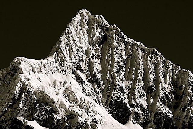
ALPAMAYO PHOTOGRAPHED BY LEIGH ORTENBURGER

LEIGH ORTENBURGER (1929- 1991), Alpamayo ( 5,947m - 19,511 ft),  Peru,   In  "Cordillera Blanca - Alpamayo - Peru, South West face" , 1959 et 1960 , blanc and white photos published in 1966,  Courtsesy Stanford University Archives

LEIGH ORTENBURGER (1929- 1991), Alpamayo ( 5,947m - 19,511 ft),  Peru,   In  "Cordillera Blanca - Alpamayo - Peru, South West face" , 1959 et 1960 , blanc and white photos published in 1966,  Courtsesy Stanford University Archives
 

LEIGH ORTENBURGER (1929-1991)
Alpamayo (5,947m - 19,511 ft)
Peru

In Cordillera Blanca - Alpamayo - Peru, South West face, 1959 et 1960, black and white photos published in 1966, Courtsesy Stanford University Archives and collections


About the photo
In the July 1966 issue of the German magazine Alpinismus, a photo taken by American photographer Leigh Ortenburger, accompanied by an article resulting from an international survey among climbers and photographers, chose Alpamayo as "The Most Beautiful Mountain in the World." The photo (above) was of its Southwest Face which is a steep, almost perfect pyramid of ice? Although slightly smaller than many of its neighboring peaks, it is distinguished by its unusual ice runnels and overwhelming beauty especially when seen in the evening alpenglow. Günter Hauser, who made the first ascent, wrote: "As we pitched our tents the sun went down and Alpamayo became a kaleidoscope of swiftly-changing colour altogether becoming suffused with the pale lunar radiance of the evening before against the background of the dark blue sky with its diadem of stars."
This mountain was first photographed in 1936 by Erwin Schneider.

The photographer
Leigh Ortenburger (1929-1991) climbed and photographed for more than forty years in the world's greatest mountain ranges. He graduated from the University of Oklahoma in 1952 with a degree in mathematics, and earned a master’s degree in mathematics from the University of California at Berkeley in 1953 and a second in statistics from Stanford in 1963, where he did additional work toward a Ph.D. He worked several years as a Teton mountain guide and served a two-year stint in the Army before settling into a career as a mathematician with Sylvania. His classic guidebook, A Climber’s Guide to the Teton Range, is now in its third edition. Ortenburger’s extensive knowledge of the terrain equipped him to play a key role in the rescue of two climbers trapped on the North Face of the Grand Teton in 1967. Together with fellow climber Irene Beardsley, whom he met through the student-run Stanford Alpine Club in the 1950s, he raised a family in Palo Alto, California. He died October 20, 1991, in the firestorm that swept the Oakland, California hills.
No less impressive than the photographs of Alpamayo themselves is the process of making them, said Glen Denny, also a mountaineering photographer:  “Few realize the difficulty of creating images like Ortenburger's. During hard climbs, while others rested, he performed a painstaking ritual countless times: Plunge the tripod legs into soft snow until they are solid, mount and level the camera, select and attach the lens, huddle under the head cloth while composing the dim, upside-down image on the ground glass, with the wind snatching at the cloth and shaking the camera. Then take off your gloves and spin the delicate dials on the light meter, calibrate the exposure, set the aperture, and cock the shutter, while your fingers still have feeling left. Insert the film holder, pull out the slide, squeeze the cable release--very gently--and replace the slide. There! One shot taken.”

The mountain
Alpamayo ( 5,947m - 19,511 ft) possibly named from Quechua words is one of the most conspicuous peaks in the Cordillera Blanca of the Peruvian Andes. Alpamayo Creek originates northwest of it. The Alpamayo lies next to the slightly higher Quitaraju. n July 1966, the German magazine "Alpinismus", published a photo of Alpamayo taken by American photographer Leigh Ortenburger accompanied by an article on a survey among mountaineering experts, who chose Alpamayo as "The Most Beautiful Mountain in the World". Not defined by a single summit Alpamayo has two sharp summits, the North and south, which are separated by a narrow corniced ridge.
The first attempt on Alpamayo's summit was in 1948 by a Swiss expedition. Climbing by way of the heavily corniced North Ridge, the three climbers came within sight of the virgin summit when a large cornice broke under them and they were carried down the precipitous Northwest Face. By some amazing piece of good fortune, the three were neither buried nor injured by the 650 foot fall and they were able to make an 'orderly retreat' from the mountain. In 1951, a Franco-Belgian expedition including George and Claude Kogan claimed to have made the first ascent via the North Ridge. After studying the photos in George Kogan's book The Ascent of Alpamayo, the German team of Günter Hauser, Frieder Knauss, Bernhard Huhn and Horst Wiedmann came to the conclusion that the 1951 team did not reach the actual summit, thereby making their ascent via the South Ridge in 1957 the first. Although the South Ridge is no less steep or dangerous than the North Ridge, it has the advantage of leading directly to the higher south summit. This was written up in Hauser's book White Mountain and Tawny Plain. Although there are several climbing routes on the Southwest Face the most common is known as the Ferrari or Italian Route. It was opened in 1975 by a group of Italian alpinists led by Casimiro Ferrari. It begins at the top of the highest point of the snow slope where the bergshrund separates the upper face on the left and then ascends a steep runnel to the summit ridge. Because of its esthetic beauty, Alpamayo is one of the most climbed mountains in the Andes and the base camp can be a hodge-podge of nationalities. Each year the route is made easy by the first party to ascend the route as they usually leave snow-stakes in place at the belay stations. Then it is just a matter of finding out what length of rope they used so that your rope is long enough to reach each station. In the summer of 1988, they had used 50m ropes.
___________________________________________

2021 - Wandering Vertexes...
by Francis Rousseau


Saturday, August 14, 2021

SOUTHERN ANDES SUMMIT PAINTED BY RHOD WULFARS (bn 1979)

RHOD WULFARS (bn. 1979), Southern Andes (6,991 m - 22, 838ft), Argentina,  In "Twin", acrylic on hardboard, 2018, Private collection @rhodwulfars
 
 
RHOD WULFARS (bn. 1979)
Southern Andes (6,991 m - 22, 838ft)
Argentina

In Twin, acrylic on hardboard, 2018, Private collection @rhodwulfars


About this painting
The painter wrote: “It is not a real mountain. Most of my paintings are born from the combination of the imagination and the hours spent looking, walking and smelling them. I call them "Twins" because they are similar to those reliefs of the Argentinian Andean Coridilla called "acarreos", which are long slopes of very popular loose rock that can be easily viewed. very frequently observed. This painting is therefore that of an unknown mountain, dreamt up which sums up several, and which came out of my unconscious one afternoon when the brush gave it life in a mysterious way without my being able to explain it. "
And indeed this mountain that looks a lot like the Alpamayo in Peru is not the Alpamayo (even if it could  be the most famous South West face to be published very soon in this blog) !), any more than it is not the Cerro Poincenot, the Fitz Roy, the Cerro Torre or the Aconcagua, the highest peak in the Andes. These Twins imagined, encompassed, summarized and illustrated all these mountains at the same time. The most amazing being that they do it with a single stroke of the brushes as powerful and definitive as the rocky uplift itself.


The artist
Rhod Wulfars is a contemporary mountain painter using mainly acrylic technique for his paintings.
He was born in 1979 in Mendoza (Argentina). In his website he wrote: "I have spent my whole life by the mountains. On day I started to paint them". Using, in the manner of Nicolas de Staël, a style always beetween abstract and figurative, his very strong and very moving paintings described perfectly the majesty and the spectacular contents of the peaks he paints. Rhod Wulfars makes a surprising use of acrylic medium, in thick paste as one could do with oil paint. He used to named his works only bu numbers, and series letters, but sometime he writes the name of the peaks ans makes it more easy to identify. Other works by this artist on his website : rhodwulfars.wixsite.com/rhodwulfars/

The mountains
The Andes, Andes Mountains or Andean Mountains (Cordillera de los Andes in Spanish ) are the longest continental mountain range in the world, forming a continuous highland along the western edge of South America. The range is 7,000 km (4,350 mi) long, 200 to 700 km (124 to 435 mi) wide (widest between 18°S - 20°S latitude), and has an average height of about 4,000 m (13,123 ft). The Andes extend from north to south through seven South American countries: Venezuela, Colombia, Ecuador, Peru, Bolivia, Chile, and Argentina.
The Andes Mountains are the highest mountain range outside Asia. The highest mountain outside Asia, Argentina's Mount Aconcagua, rises to an elevation of about 6,961 m (22,838 ft) above sea level. The peak of Chimborazo in the Ecuadorian Andes is farther from the Earth's center than any other location on the Earth's surface, due to the equatorial bulge resulting from the Earth's rotation. The world's highest volcanoes are in the Andes, including Ojos del Salado on the Chile-Argentina border, which rises to 6,893 m (22,615 ft).
The Andes are also part of the American Cordillera, a chain of mountain ranges (cordillera) that consists of an almost continuous sequence of mountain ranges that form the western "backbone" of North America, Central America, South America and Antarctica.

___________________________________________

2021 - Wandering Vertexes...
by Francis Rousseau

Wednesday, July 21, 2021

EL CHIMBORAZO SKETCHED BY ALEXANDER VON HUMBOLDT


ALEXANDER VON HUMBOLDT (1769-1859) Chimborazo (6,263 m-20,549 ft) Ecuador  In,  El Chimborazo vu de la plaine de Tapia, 1810


ALEXANDER VON HUMBOLDT (1769-1859)
Chimborazo (6,263 m-20,549 ft)
Ecuador

In  El Chimborazo vu de la plaine de Tapia, 1810


The mountain
El Chimborazo (6,263 m -20,548 ft) is a currently inactive stratovolcano in the Cordillera Occidental range of the Andes ans the highest mountain in Ecuador and the Andes north of Peru ; it is higher than any more northerly summit in the Americas. Chimborazo is not the highest mountain by elevation above sea level, but its location along the equatorial bulge makes its summit the farthest point on the Earth's surface from the Earth's center.
Chimborazo is at the main end of the Ecuadorian Volcanic Arc, north west of the town of Riobamba. Chimborazo is in la Avenida de los Volcanes (the Avenue of Volcanoes) west of the Sanancajas mountain chain. Carihuairazo, Tungurahua, Tulabug, and El Altar are all mountains that neighbor Chimborazo. The closest mountain peak, Carihuairazo, is 5.8 mi (9.3 km) from Chimborazo. There are many microclimates near Chimborazo, varying from desert in the Arenal to the humid mountains in the Abraspungo valley.
Its last known eruption is believed to have occurred around A.D. 550.
Until the beginning of the 19th century, it was thought that Chimborazo was the highest mountain on Earth (measured from sea level), and such reputation led to many attempts on its summit during the 17th and 18th centuries.
In 1746, the volcano was explored by French academicians from the French Geodesic Mission. Their mission was to determine the sphericity of the Earth. Their work along with another team in Lapland established that the Earth was an oblate spheroid rather than a true sphere. They did not reach the summit of Chimborazo.
In 1802, during his expedition to South America, Baron Alexander von Humboldt, accompanied by Aimé Bonpland and the Ecuadorian Carlos Montufar, tried to reach the summit. From his description of the mountain, it seems that before he and his companions had to return suffering from altitude sickness they reached a point at 5,875 m, higher than previously attained by any European in recorded history. (Incans had reached much higher altitudes previously). In 1831, Jean-Baptiste Boussingault and Colonel Hall reached a new "highest point", estimated to be 6,006 m.
On 4 January 1880, the English climber Edward Whymper reached the summit of Chimborazo. The route that Whymper took up Chimborazo is now known as the Whymper route. Edward Whymper, and his Italian guides Louis Carrel and Jean-Antoine Carrel, were the first Europeans to summit a mountain higher than 20,000 feet. As there were many critics who doubted that Whymper had reached the summit, later in the same year he climbed to the summit again, choosing a different route (Pogyos) with the Ecuadorians David Beltrбn and Francisco Campaсa.


The cartographer and artist
Friedrich Wilhelm Heinrich Alexander von Humboldt was a Prussian geographer, naturalist, explorer, and influential proponent of Romantic philosophy and science. He was the younger brother of the Prussian minister, philosopher, and linguist Wilhelm von Humboldt (1767–1835). Humboldt's quantitative work on botanical geography laid the foundation for the field of biogeography. Humboldt's advocacy of long-term systematic geophysical measurement laid the foundation for modern geomagnetic and meteorological monitoring.
Between 1799 and 1804, Humboldt travelled extensively in Latin America, exploring and describing it for the first time from a modern scientific point of view. His description of the journey was written up and published in an enormous set of volumes over 21 years. Humboldt was one of the first people to propose that the lands bordering the Atlantic Ocean were once joined (South America and Africa in particular). Humboldt resurrected the use of the word cosmos from the ancient Greek and assigned it to his multi-volume treatise, Kosmos, in which he sought to unify diverse branches of scientific knowledge and culture. This important work also motivated a holistic perception of the universe as one interacting entity.
On their way back to Europe from Mexico on their way to the United States, Humboldt and his fellow scientist Aimé Bonpland stopped in Cuba for a While. After their first stay in Cuba of three months they returned the mainland at Cartagena de Indias (now in Colombia), a major center of trade in northern South America. Ascending the swollen stream of the Magdalena River to Honda and arrived in Bogotá on July 6, 1801 where they met Spanish botanist José Celestino Mutis, the head of the Royal Botanical Expedition to New Granada, staying there until September 8, 1801. Mutis was generous with his time and gave Humboldt access to the huge pictorial record he had compiled since 1783. Humboldt had hopes of connecting with the French sailing expedition of Baudin, now finally underway, so Bonpland and Humboldt hurried to Ecuador. They crossed the frozen ridges of the Cordillera Real, they reached Quito on 6 January 1802, after a tedious and difficult journey.
Their stay in Ecuador was marked by the ascent of Pichincha and their climb of Chimborazo, where Humboldt and his party reached an altitude of 19,286 feet (5,878 m). This was a world record at the time, but a thousand feet short of the summit. Humboldt's journey concluded with an expedition to the sources of the Amazon en route for Lima, Peru.
At Callao, the main port for Peru, Humboldt observed the transit of Mercury. On 9 November and studied the fertilizing properties of guano, rich in nitrogen, the subsequent introduction of which into Europe was due mainly to his writings.

___________________________________________ 


2021 - Wandering Vertexes...
by Francis Rousseau