google.com, pub-0288379932320714, DIRECT, f08c47fec0942fa0 GRAVIR LES MONTAGNES... EN PEINTURE: Search results for Chile
Showing posts sorted by date for query Chile. Sort by relevance Show all posts

Monday, October 10, 2022

THE FIZTROY (?) PAINTED BY RHOD WULFARS


RHOD WULFARS (bn. 1979), The Fitz Roy / Cerro Chalten (3,405 m- 11, 171 ft) Chile - Argentina border


RHOD WULFARS (bn. 1979),
The Fitz Roy / Cerro Chalten (3,405 m- 11, 171 ft)
Chile - Argentina border

About this painting
The painter wrote: “It is not a real mountain. Most of my paintings are born from the combination of the imagination and the hours spent looking, walking and smelling them. I call them "Twins" because they are similar to those reliefs of the Argentinian Andean Coridilla called "acarreos", which are long slopes of very popular loose rock that can be easily viewed. very frequently observed. This painting is therefore that of an unknown mountain, dreamt up which sums up several, and which came out of my unconscious one afternoon when the brush gave it life in a mysterious way without my being able to explain it. "
The artist
Rhod Wulfars is a contemporary mountain painter using mainly acrylic technique for his paintings.
He was born in 1979 in Mendoza (Argentina). In his website he wrote: "I have spent my whole life by the mountains. On day I started to paint them". Using, in the manner of Nicolas de Staël, a style always beetween abstract and figurative, his very strong and very moving paintings described perfectly the majesty and the spectacular contents of the peaks he paints. Rhod Wulfars makes a surprising use of acrylic medium, in thick paste as one could do with oil paint. He used to named his works only bu numbers, and series letters, but sometime he writes the name of the peaks ans makes it more easy to identify. Other works by this artist on his website : rhodwulfars.wixsite.com/rhodwulfars/


The mountain
Fitz Roy / Cerro Chalten (3,405m- 11, 171 ft) is a mountain located near El Chaltèn village, in the Southern Patagonian Ice Field in Patagonia, on the border between Argentina and Chile. First climbed in 1952 by French alpinists Lionel Terray and Guido Magnone, " The Fitz Roy " remains among the most technically challenging mountains for mountaineers on Earth. Mount Fitz Roy is the basis for the Patagonia clothing logo following Yvon Chouinard's ascent and subsequent film in 1968.
Argentine explorer Francisco Moreno first saw the mountain on 2 March 1877. He named it Fitz Roy, in honour of Robert FitzRoy, who, as captain of the HMS Beagle had travelled up the Santa Cruz River in 1834 and charted large parts of the Patagonian coast.
Cerro is a Spanish word meaning mountain, while Chaltèn comes from a Tehuelche (Aonikenk) word meaning "smoking mountain", due to a cloud that usually forms around the mountain's peak. Fitz Roy, however, was only one of a number of peaks the Tehuelche called Chaltèn.
It has been agreed by Argentina and Chile that their international border detours eastwards to pass over the main summit, but a large part of the border to the south of the summit, as far as Cerro Murallуn, remains undefined.

______________________________
2022- Wandering Vertexes
Un blog de Francis Rousseau

Friday, October 7, 2022

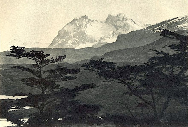
CERRO BALMACEDA PHOTOGRAPHED BY ROBERT GERSTMANN


ROBERT GERSTMANN (1896-1960), Cerro Balmaceda  (2,035 m  - 6,677 ft) Chile  In "Cerro Balmaceda",  glass plate, 1932, University of Antofagasta.

ROBERT GERSTMANN (1896-1960)
Cerro Balmaceda  (2,035 m  - 6,677 ft)
Chile

In "Cerro Balmaceda",  glass plate, 1932, University of Antofagasta.


The photographer
Robert Gerstmann was a photographer very famous in South America. Gerstmann was a Vienna born electrical engineer who, as a young man, developed an interest in photography. In 1924, he immigrated to Chile and from there traveled to Bolivia, where he made some 5000 photographs, a selection of which appear as photogravures in his Bolivia, 150 Grabados en Cobre (1928), which was reissued in 1996 by the Fundación Quipus in La Paz. Gerstmann ranged far, photographing the altiplano from La Paz south to the Argentine border, west to the Chilean border, and east to the Yungas, Cochabamba, Santa Cruz, and the lowlands along the Ríos Beni and Mamoré. Only Tarija and the Chaco escaped his lens. Five of his photographs illustrate Stewart E. McMillan's "The Heart of Aymara Land" National Geographic Magazine (February 1927), and several appear in Gustavo-Adolfo Otero's Bolivia (Guía Sinóptica) 1929. Gerstmann settled in Santiago in 1929. He published other photo albums, including Chile: 280 grabados en cobre (1932), Colombia: 200 grabados en cobre (1951), and Chile en 110 cuadros (1960?), and dabbled in film-making in Bolivia. He is thought to have died in Santiago ca. 1960. Several thousand of his glass plates are said to be at a university in Antofagasta.


The mountain
Cerro Balmaceda (2,035 m - 6,677 ft) is a heavily glaciated mountain located in the Magallanes Region of Chile. It stands at the head of Última Esperanza Sound, in the south portion of Bernardo O'Higgins National Park and near the mouth of the Serrano River. The glaciers Balmaceda and Serrano mantle the slopes of the mount.  In its vicinity is Torres del Paine National Park.
_______________________________
2022 - Wandering Vertexes...
by Francis Rousseau

Friday, July 8, 2022

EL VULCAN PLANCHÒN-PETEROA PHOTOGRAPHED BY LEO WEHRLI


LEO WEHRLI (1870–1954) El Planchón-Peteroa (4,107 m - 13,474 ft) Argentina- Chile border  In Planchon Vulcan photo1897, hand colorized by Anna Wehrli-Frey 1918, ETH Library, Zurich

LEO WEHRLI (1870–1954)
El Planchón-Peteroa (4,107 m - 13,474 ft)
Argentina- Chile border

In Planchon Vulcan, photo,1897, hand colorized by Anna Wehrli-Frey 1918,
ETH Library, Zurich


The volcano
EL Planchón-Peteroa (4,107m - 13,474 ft) also known as Azufre-Planchón-Peteroa or Nevado de los Banos is a complex of active volcanoes extending in a north–south direction along the border between Argentina and Chile. It consists of volcanoes of various ages with several overlapping calderas. Those include Volcán Planchón, Volcán Peteroa and Volcán Azufre. A partial collapse of the complex about 11,500 years ago produced a major debris avalanche, which followed the course of the Teno River until reaching the Chile Central Valley. Peteroa has a crater lake. Lagunas de Teno lies at the foot of Planchón volcano. In this area also is the Vergara International Pass.
Planchón-Peteroa Volcano erupted on September 6, followed by a stronger eruption on September 18. On September 6, 2010, , the volcano erupted once again, emitting a dark gray plume of volcanic ash. As winds blew the ash southeast into Argentina, residents there were warned by authorities to evacuate the nearby areas before Planchón-Peteroa would erupt again.

The photographer
Leo Wehrli was a Swiss geologist, professor and explorer. After studying music, botany, chemistry, mineralogy, petrography and geology in Berlin and Zurich, Wehrli became assistant to Albert Heim. Immediately after completing his thesis, he left for Argentina with the famous Carl Emanuel Burckhardt in 1896. Accredited by the La Plata Museum and the government of Argentina, he explored the Andes he crossed at least five times during a stay of two years. His work was more particularly oriented on the delimitation of the border between Argentina and Chile after the agreement signedbetween these two countries in 1881 and on the determination of the property of mountain peaks, ridge lines and basins slopes.
After his return to Switzerland, he worked between 1900 and 1935 as a teacher and then lecturer for the Geol. Centralblatt in Berlin ; between 1901 and 1912, he wrote nearly 500 articles. He made other trips through Europe and North Africa (Egypt) before going back to Argentina again in 1938. He has summarized his research results in numerous articles, notably in the Geographic Lexicon of Switzerland. He participated in the founding of the Zurich Adult Education Center and gave lectures there from 1921 to 1953. From 1931 to 1951 he was a member of the Swiss Alpine Club SAC commission for the Central Library and has was president for 14 years.
Wehrli left a collection of 15,000 slides, some of which were hand-colored by his wife, born Anna Frey. A large part of the works is made available online by the photographic archives of the ETH-Bibliothek in Zurich.

___________________________________________

2022 - Wandering Vertexes...
by Francis Rousseau

Thursday, May 19, 2022

CERRO ACONCAGUA PAINTED BY RHOD WULFARS


RHOD WULFARS (bn. 1979) Aconcagua (6,961 m -22,838 ft) Argentina  In "Aconcagua," Acrylic on canvas, 18 x 24cm

RHOD WULFARS (bn. 1979)
Aconcagua (6,961 m -22,838 ft)
Argentina

In "Aconcagua," Acrylic on canvas, 18 x 24cm


The artist
Rhod Wulfars is a contemporary mountain painter using mainly acrylic technique for his paintings.
He was born in 1979 in Mendoza (Argentina). In his website he wrote: "I have spent my whole life by the mountains. On day I started to paint them". Using, in the manner of Nicolas de Staël, a style always beetween abstract and figurative, his very strong and very moving paintings described perfectly the majesty and the spectacular contents of the peaks he paints. Rhod Wulfars makes a surprising use of acrylic medium, in thick paste as one could do with oil paint. He used to named his works only bu numbers, and series letters, but sometime he writes the name of the peaks ans makes it more easy to identify.
Other works by this artist on his website : rhodwulfars.wixsite.com/rhodwulfars/
Contact : @rhodwulfars


The mountain
Cerro Aconcagua (6,961 meters -22,838 ft) or simplynThe Aconcagua is the highest mountain outside of Asia and by extension the highest point in both the Western Hemisphere and the Southern Hemisphere.
Aconcagua is not a volcano.  he origin of the name is contested; it is either from the Mapuche "Aconca-Hue", which refers to the Aconcagua River, the Quechua "Ackon Cahuak", meaning "Sentinel of Stone", or Quechua "Anco Cahuac", meaning "White Sentinel" or the Aymara "Janq'u Q'awa" meaning "White Ravine", "White Brook".
Aconcagua is located in the Andes mountain range, in the Mendoza Province, Argentina, and lies 112 kilometers (70 mi) northwest of its capital, the city of Mendoza and 108 km (67 mi) from Santiago de Chile (the capital of Chile). The summit is in fact located about 5 kilometers from San Juan Province and 15 kilometers from the international border with Chile; its nearest higher neighbor is Tirich Mir in the Hindu Kush, 16,520 kilometers (10,270 mi) away.
Aconcagua is one of the Seven Summit, which includes the highest mountains of each of the seven continents. The 7 summits (which are obviously 8 !)... are : Mt Everest (8,848m), Mt Denali or Mc Kinley (6,194m), Kilimandjaro (5,895m), Mt Elbrus (5,642m), Vinson Massif (4,892m), Mt Blanc (4,807m) and Mount Kosciuszko (2,228m). Summiting all of them is regarded as a mountaineering challenge, first achieved on April 30, 1985 by Richard Bass.
The mountain and its surroundings are part of the Aconcagua Provincial Park. The mountain has a number of glaciers. The largest glacier is the Ventisquero Horcones Inferior at about 10 km long, which descends from the south face to about 3600 m altitude near the Confluencia camp. Two other large glacier systems are the Ventisquero de las Vacas Sur and Glaciar Este/Ventisquero Relinchos system at about 5 km. 

___________________________

2022 - Wandering Vertexes...
by Francis Rousseau


Sunday, January 23, 2022

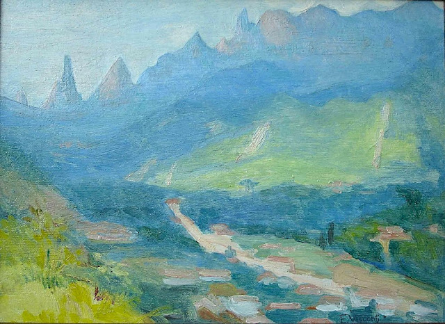
DEDO DE DEUS (2) PAINTED BY ELISEU VISCONTI

ELISEU VISCONTI (1866-1944) Dedo de Deus (1,682m - 5,551ft) Brazil


ELISEU VISCONTI (1866-1944)
Dedo de Deus (1,682m - 5,551ft)
Brazil


About this mainting
Eliseu Visconti painted a lot of times,the Dedo De Deus mountain in the Serra de Orgaos, in any season and in all possible light, at any time of day. It is THE  repetitive motif in his work, a bit like the Montagne Sainte-Victoire for Paul Cézanne or  the volcano Chimborazo for Frederic Edwin Church or Mount Everest for Nicholas Roerich.


The mountain
Dedo de Deus (The Finger of God) (1,682m - 5,551ft) is a peck whose outline resembles a hand pointing the index finger to the sky. It is one of the several geological monuments of Serra dos Órgãos which is located in Serra do Mar, between the cities of Petrópolis, Guapimirim and Teresópolis, in the state of Rio de Janeiro, in Brazil. The mountaineering in Brazil is closely linked to the achievement of the Dedo de deus. The peak is a state symbol Rio de Janeiro, appearing on its flag and coat of arms. As for the coat of arms of the State of Rio de Janeiro, the first section, occupying the upper half, is blue, representing the sky and symbolizing justice, truth and loyalty, with the silhouette of the Serra dos Órgãos, highlighting the Dedo de Deus. The symbol was created by the 1892 State Constitution and made official under the government of José Tomás da Porciúncula, with small differences over time. In 1912, José Guimarães Teixeira, Raul Carneiro and the brothers Américo, Alexandre and Acácio de Oliveira, all from Teresópolis, were the first to step on top of the rock formation.


The artist
Eliseu Visconti, born Eliseo d'Angelo Visconti was an Italian-born Brazilian painter, cartoonist, and teacher. He is considered one of the very few impressionist painters of Brazil. He is considered the initiator of the art nouveau in Brazil.
Thanks to a prize received in 1892, Visconti travelled to Paris, where he attended the École des Beaux Arts the following year. He also took classes at the Académie Julian and the École nationale supérieure des arts décoratifs, where he was a pupil of art nouveau master Eugène Grasset. He was accepted at the Salon de la Nationale des Beaux Arts and at the Salon of the Société of des Artistes Français. As one of the Brazilian representatives to the Exposition Universelle 1900 he exhibited the paintings Gioventú and Oréadas, for which he received a silver medal. Back in Brazil, Visconti exhibited in Rio de Janeiro and São Paulo, and obtained the first place in a contest for the drawing of postal stamps for the Brazilian Casa da Moeda. He traveled again to Europe, where he exhibited at the Paris Salon of 1905 the portrait of the artist Nicolina Vaz de Assis now at the Museu Nacional de Belas Artes. In this same year, he was invited to paint the stage curtain for the Teatro Municipal of Rio de Janeiro which he completed in his studio in Paris.
Decorative schemes executed for the National Library or Biblioteca Nacional in (Rio de Janeiro) date from this period as does another gold medal he received at the International Exhibition of Saint-Louis (Louisiana Purchase Exposition), in 1904, for the painting Recompensa de São Sebastião (see external links). The museum of Santiago of the Chile acquired his Sonho Místico (Mystical Dream) in 1912. In 1913, Visconti returned to Europe in order to paint large scale panels for the "foyer" of the Theatro Municipal do Rio de Janeiro. His plans to return were interrupted by the First World War so he stayed in France until 1920. The resulting paintings for the "foyer" were sent to Brazil during the war, in 1915. In 1922 his triptych "Lar" gained him the Medal of Honor in a large exhibition created in Rio de Janeiro to commemorate the first centennial of Brazilian Independence, the Exposição do Centenário. The following year Visconti painted the mural decoration of Rio de Janeiro's municipal council hall. In 1924, he painted the panel depicting the signature of the first Republican Constitution, for the old federal court, also in Rio de Janeiro.
_______________________________

2022 - Wandering Vertexes...
by Francis Rousseau

Saturday, October 30, 2021

SOUTHERN ANDES (2) PAINTED BY RHOD WULFARS


RHOD WULFARS (bn. 1979), Southern Andes (6,991 m - 22, 838ft) Argentina  In Somewhere in Andes , acrylic on hardboard, 2018, Private collection @rhodwulfars

 
RHOD WULFARS (bn. 1979)
Southern Andes (6,991 m - 22, 838ft)
Argentina

In Somewhere in Andes, acrylic on hardboard, 2018, Private collection @rhodwulfars


About this painting
The painter wrote: “It is not a real mountain. Most of my paintings are born from the combination of the imagination and the hours spent looking, walking and smelling them. I call them "Twins" because they are similar to those reliefs of the Argentinian Andean Coridilla called "acarreos", which are long slopes of very popular loose rock that can be easily viewed. very frequently observed. This painting is therefore that of an unknown mountain, dreamt up which sums up several, and which came out of my unconscious one afternoon when the brush gave it life in a mysterious way without my being able to explain it. "
And indeed this mountain that looks a lot like the Alpamayo in Peru is not the Alpamayo (even if it could be the most famous South West face to be published very soon in this blog) !), any more than it is not the Cerro Poincenot, the Fitz Roy, the Cerro Torre or the Aconcagua, the highest peak in the Andes. These Twins imagined, encompassed, summarized and illustrated all these mountains at the same time. The most amazing being that they do it with a single stroke of the brushes as powerful and definitive as the rocky uplift itself.

The artist
Rhod Wulfars is a contemporary mountain painter using mainly acrylic technique for his paintings.
He was born in 1979 in Mendoza (Argentina). In his website he wrote: "I have spent my whole life by the mountains. On day I started to paint them". Using, in the manner of Nicolas de Staël, a style always beetween abstract and figurative, his very strong and very moving paintings described perfectly the majesty and the spectacular contents of the peaks he paints. Rhod Wulfars makes a surprising use of acrylic medium, in thick paste as one could do with oil paint. He used to named his works only bu numbers, and series letters, but sometime he writes the name of the peaks ans makes it more easy to identify. Other works by this artist on his website : rhodwulfars.wixsite.com/rhodwulfars/

The mountains
The Andes, Andes Mountains or Andean Mountains (Cordillera de los Andes in Spanish ) are the longest continental mountain range in the world, forming a continuous highland along the western edge of South America. The range is 7,000 km (4,350 mi) long, 200 to 700 km (124 to 435 mi) wide (widest between 18°S - 20°S latitude), and has an average height of about 4,000 m (13,123 ft). The Andes extend from north to south through seven South American countries: Venezuela, Colombia, Ecuador, Peru, Bolivia, Chile, and Argentina.
The Andes Mountains are the highest mountain range outside Asia. The highest mountain outside Asia, Argentina's Mount Aconcagua, rises to an elevation of about 6,961 m (22,838 ft) above sea level. The peak of Chimborazo in the Ecuadorian Andes is farther from the Earth's center than any other location on the Earth's surface, due to the equatorial bulge resulting from the Earth's rotation. The world's highest volcanoes are in the Andes, including Ojos del Salado on the Chile-Argentina border, which rises to 6,893 m (22,615 ft).
The Andes are also part of the American Cordillera, a chain of mountain ranges (cordillera) that consists of an almost continuous sequence of mountain ranges that form the western "backbone" of North America, Central America, South America and Antarctica.

 ___________________________________________

2021 - Wandering Vertexes...
by Francis Rousseau

Wednesday, October 27, 2021

TORRES DEL PAINE (4) PAINTED BY JAMES HART DYKE

JAMES HART DYKE (bn.1966) Torres del Paine (2,500 m - 8,200 ft)  Chile  In Torres del Paine first lights, study 2017, Courtesy John Mitchell Gallery London

 
JAMES HART DYKE (bn.1966)
Torres del Paine (2,500 m - 8,200 ft) 
Chile

In Torres del Paine first lights, study 2017, Courtesy John Mitchell Gallery London  


The mountains
The Torres del Paine (2,500 metres - 8,200 ft) are the distinctive three granite peaks of the Paine mountain range or Paine Massif. They are known as Torres d'Agostini, Torres Central and Torres Monzino. They are joined by the Cuernos del Paine. The area also boasts valleys, rivers such as the Paine, lakes, and glaciers. The well-known lakes include Grey, Pehoé, Nordenskiöld, and Sarmiento. The glaciers, including Grey, Pingo and Tyndall, belong to the Southern Patagonia Ice Field.
he landscape of the park is dominated by the Paine massif, which is an eastern spur of the Andes located on the east side of the Grey Glacier, rising dramatically above the Patagonian steppe. Small valleys separate the spectacular granite spires and mountains of the massif. These are: Valle del Francés (French Valley), Valle Bader, Valle Ascencio, and Valle del Silencio (Silence Valley).The Southern Patagonian Ice Field mantles a great portion of the park.


The painter
James Hart Dyke’s work is centred on landscape painting, from the domesticity of paintings of country houses to paintings generated from physically demanding expeditions over remote mountains. James has also undertaken a series of projects including accompanying HRH The Prince of Wales as the official artist on royal tours, working as ‘artist in residence’ for The British Secret Intelligence Service, working as an artist embedded with the British Forces in war zones, working for the producers of the James Bond films and working as ‘artist in residence’ for Aston Martin. These projects required him to respond in many different ways and have allowed him to experiment with more graphic forms of painting influenced by his studies as an architect at the Royal College of Art. His portraits have been shown at the National Portrait Gallery and at the Royal Society of Portrait Painters exhibitions.

___________________________


2020 - Wandering Vertexes
Un blog de Francis Rousseau
Saturday, August 14, 2021

SOUTHERN ANDES SUMMIT PAINTED BY RHOD WULFARS (bn 1979)

RHOD WULFARS (bn. 1979), Southern Andes (6,991 m - 22, 838ft), Argentina,  In "Twin", acrylic on hardboard, 2018, Private collection @rhodwulfars
 
 
RHOD WULFARS (bn. 1979)
Southern Andes (6,991 m - 22, 838ft)
Argentina

In Twin, acrylic on hardboard, 2018, Private collection @rhodwulfars


About this painting
The painter wrote: “It is not a real mountain. Most of my paintings are born from the combination of the imagination and the hours spent looking, walking and smelling them. I call them "Twins" because they are similar to those reliefs of the Argentinian Andean Coridilla called "acarreos", which are long slopes of very popular loose rock that can be easily viewed. very frequently observed. This painting is therefore that of an unknown mountain, dreamt up which sums up several, and which came out of my unconscious one afternoon when the brush gave it life in a mysterious way without my being able to explain it. "
And indeed this mountain that looks a lot like the Alpamayo in Peru is not the Alpamayo (even if it could  be the most famous South West face to be published very soon in this blog) !), any more than it is not the Cerro Poincenot, the Fitz Roy, the Cerro Torre or the Aconcagua, the highest peak in the Andes. These Twins imagined, encompassed, summarized and illustrated all these mountains at the same time. The most amazing being that they do it with a single stroke of the brushes as powerful and definitive as the rocky uplift itself.


The artist
Rhod Wulfars is a contemporary mountain painter using mainly acrylic technique for his paintings.
He was born in 1979 in Mendoza (Argentina). In his website he wrote: "I have spent my whole life by the mountains. On day I started to paint them". Using, in the manner of Nicolas de Staël, a style always beetween abstract and figurative, his very strong and very moving paintings described perfectly the majesty and the spectacular contents of the peaks he paints. Rhod Wulfars makes a surprising use of acrylic medium, in thick paste as one could do with oil paint. He used to named his works only bu numbers, and series letters, but sometime he writes the name of the peaks ans makes it more easy to identify. Other works by this artist on his website : rhodwulfars.wixsite.com/rhodwulfars/

The mountains
The Andes, Andes Mountains or Andean Mountains (Cordillera de los Andes in Spanish ) are the longest continental mountain range in the world, forming a continuous highland along the western edge of South America. The range is 7,000 km (4,350 mi) long, 200 to 700 km (124 to 435 mi) wide (widest between 18°S - 20°S latitude), and has an average height of about 4,000 m (13,123 ft). The Andes extend from north to south through seven South American countries: Venezuela, Colombia, Ecuador, Peru, Bolivia, Chile, and Argentina.
The Andes Mountains are the highest mountain range outside Asia. The highest mountain outside Asia, Argentina's Mount Aconcagua, rises to an elevation of about 6,961 m (22,838 ft) above sea level. The peak of Chimborazo in the Ecuadorian Andes is farther from the Earth's center than any other location on the Earth's surface, due to the equatorial bulge resulting from the Earth's rotation. The world's highest volcanoes are in the Andes, including Ojos del Salado on the Chile-Argentina border, which rises to 6,893 m (22,615 ft).
The Andes are also part of the American Cordillera, a chain of mountain ranges (cordillera) that consists of an almost continuous sequence of mountain ranges that form the western "backbone" of North America, Central America, South America and Antarctica.

___________________________________________

2021 - Wandering Vertexes...
by Francis Rousseau

Wednesday, July 14, 2021

MOUNT WELLINGTON / KUNANYI PAINTED BY AUGUSTUS EARLE


AUGUSTUS EARLE (1793-1838) Mount Wellington - Kunanyi or Unghbanyahletta or Poorawetter (1,269m - 4,163ft) Australia (Tasmania)  In Tasmania - Van Dieman's Islands, waterolor, Pirivate collection


AUGUSTUS EARLE (1793-1838)
Mount Wellington - Kunanyi or Unghbanyahletta or Poorawetter (1,269m - 4,163ft)
Australia (Tasmania)

In Tasmania - Van Dieman's Islands, waterolor,1820,  Private collection,


The mountain
Mount Wellington (1,269m - 4,163ft) also known as Unghbanyahletta or Poorawetter or Kunanyi in Aboriginal langage, is located in the southeast coastal region of Tasmania, Australia. The Palawa, the surviving descendants of the original indigenous Tasmanians, tend to prefer the latter name. In 2013, a Tasmanian dual naming policy was announced and "Kunanyi - Mount Wellington" was named as one of the inaugural dual named geographic features.
The mountain is the summit of the Wellington Range on whose foothills is built much of the city of Hobart. Mount Wellington is frequently covered by snow, sometimes even in summer, and the lower slopes are thickly forested, but criss-crossed by many walking tracks and a few fire trails. There is also a sealed narrow road to the summit, about 22 kilometres (14 mi) from Hobart central business district. An enclosed lookout near the summit provides spectacular views of the city below and to the east, the Derwent estuary, and also glimpses of the World Heritage Area nearly 100 kilometres (62 mi) west. From Hobart, the most distinctive feature of Mount Wellington is the cliff of dolerite columns known as the Organ Pipes.
The first recorded European in the area Abel Tasman probably did not see the mountain in 1642, as his ship was quite a distance out to sea as he sailed up the South East coast of the island - coming closer in near present-day North and Marion Bays. No other Europeans visited Tasmania until the late eighteenth century, when several visited southern Tasmania (then referred to as Van Diemens Land) including Frenchman Marion du Fresne (1772), Englishmen Tobias Furneaux (1773), James Cook (1777) and William Bligh (1788 and 1792), and Frenchman Bruni d'Entrecasteaux (1792–93).
In February 1836, Charles Darwin visited Hobart Town and climbed Mount Wellington.


The artist
Augustus Earle was a London-born travel artist. Unlike earlier artists who worked outside Europe and were employed on voyages of exploration or worked abroad for wealthy, often aristocratic patrons, Earle was able to operate quite independently - able to combine his lust for travel with an ability to earn a living through art. The body of work he produced during his travels comprises a significant documentary record of the effects of European contact and colonisation during the early nineteenth century. From 1817 to 1832, Earle travelled trough Sicily, Malta, Gibraltar, North Africa, North Americas (New York Philadelphia), South America (Brazil, Peru, Chile), Tristan da Cunha (Antartica) the Pacific, Asia, India, Mauritius, St Helena (where he met the french emperor Napoleon in exil), New South Wales, New Zealand, Tasmania... he came back in England in 1832 ans died in London in 1838.

_____________________________

2021 - Wandering Vertexes...
by Francis Rousseau

Sunday, June 20, 2021

TORRES DEL PAINE (2) PAINTED BY JAMES HART DYKE


JAMES HART DYKE (bn.1966) Torres del Paine (2,500 m - 8,200 ft) Chile  In Los Cuernos del Paine last light, oil on vanvas 2018, courtesy John Mitchell Gallery
 
JAMES HART DYKE (bn.1966)
Torres del Paine (2,500 m - 8,200 ft)
Chile

In Los Cuernos del Paine last light, oil on vanvas 2018, courtesy John Mitchell Gallery 


The mountains
The Torres del Paine (2,500 metres - 8,200 ft) are the distinctive three granite peaks of the Paine mountain range or Paine Massif. They are known as Torres d'Agostini, Torres Central and Torres Monzino. They are joined by the Cuernos del Paine. The area also boasts valleys, rivers such as the Paine, lakes, and glaciers. The well-known lakes include Grey, Pehoé, Nordenskiöld, and Sarmiento. The glaciers, including Grey, Pingo and Tyndall, belong to the Southern Patagonia Ice Field.
he landscape of the park is dominated by the Paine massif, which is an eastern spur of the Andes located on the east side of the Grey Glacier, rising dramatically above the Patagonian steppe. Small valleys separate the spectacular granite spires and mountains of the massif. These are: Valle del Francés (French Valley), Valle Bader, Valle Ascencio, and Valle del Silencio (Silence Valley).
The Southern Patagonian Ice Field mantles a great portion of the park.

The painter
James Hart Dyke’s work is centred on landscape painting, from the domesticity of paintings of country houses to paintings generated from physically demanding expeditions over remote mountains. James has also undertaken a series of projects including accompanying HRH The Prince of Wales as the official artist on royal tours, working as ‘artist in residence’ for The British Secret Intelligence Service, working as an artist embedded with the British Forces in war zones, working for the producers of the James Bond films and working as ‘artist in residence’ for Aston Martin. These projects required him to respond in many different ways and have allowed him to experiment with more graphic forms of painting influenced by his studies as an architect at the Royal College of Art. His portraits have been shown at the National Portrait Gallery and at the Royal Society of Portrait Painters exhibitions.

___________________________________________
2021 - Wandering Vertexes and Mountain paintings
Un blog de Francis Rousseau

Wednesday, May 12, 2021

VOLCAN PUNTIAGUDO PHOTOGRAPHED IN 1932 BY ROBERT GERSTMANN

ROBERT GERSTMANN (1896-1960) Volcàn Puntiagudo (2, 493 m - 8, 179ft) Chile  In Volcàn Puntiagudo, photograph,1932, Photographer

ROBERT GERSTMANN (1896-1960)
Volcàn Puntiagudo (2, 493 m - 8, 179ft)
Chile

In Volcàn Puntiagudo, photograph,1932, Private collection


The volcano
Volcàn Puntiagudo (2, 493 m - 8, 179ft) also called Cerro Cenizas or Cerro Puntiagudo is a volcano in Chile remarkable for its volcanic chimney released by erosion and forming a summit neck. Puntiagudo is located in central Chile, in the Andes mountain range, between the Rupanco lakes to the north and Todos Los Santos to the south. Administratively, it is located on the border between the provinces of Llanquihue and Osorno of the Region of Lakes. Puntiagudo is an andesitic stratovolcano whose flanks have been eroded by glaciers, especially in their upper par1. Its summit is thus made up of a neck by the release of the volcanic chimney. This physiognomy makes it resemble Corcovado, another Chilean volcano located further south. Cordón Cenizos is a group of fissures and volcanic cones, stretches from Puntiagudo to the northeast. Puntiagudo began to be built at the end of the Pleistocene. However, its last eruption occurred on an unknown date.


The photographer
Robert Gerstmann was a photographer very famous in South America. Gerstmann was a Vienna born electrical engineer who, as a young man, developed an interest in photography. In 1924, he immigrated to Chile and from there traveled to Bolivia, where he made some 5000 photographs, a selection of which appear as photogravures in his Bolivia, 150 Grabados en Cobre (1928), which was reissued in 1996 by the Fundación Quipus in La Paz. Gerstmann ranged far, photographing the altiplano from La Paz south to the Argentine border, west to the Chilean border, and east to the Yungas, Cochabamba, Santa Cruz, and the lowlands along the Ríos Beni and Mamoré. Only Tarija and the Chaco escaped his lens. Five of his photographs illustrate Stewart E. McMillan's "The Heart of Aymara Land" National Geographic Magazine (February 1927), and several appear in Gustavo-Adolfo Otero's Bolivia (Guía Sinóptica) 1929. Gerstmann settled in Santiago in 1929. He published other photo albums, including Chile: 280 grabados en cobre (1932), Colombia: 200 grabados en cobre (1951), and Chile en 110 cuadros (1960?), and dabbled in film-making in Bolivia. He is thought to have died in Santiago ca. 1960. Several thousand of his glass plates are said to be at a university in Antofagasta.

_______________________________
2021 - Wandering Vertexes...
by Francis Rousseau

Sunday, March 21, 2021

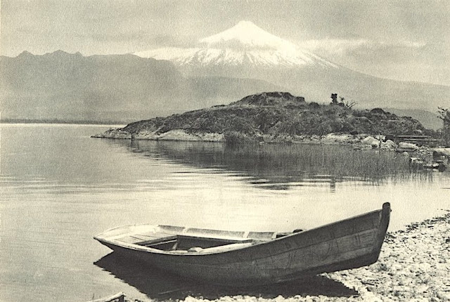
VOLCÀN ORSONO PHOTOGRAPHED BY ROBERT GERSTMANN


https://wanderingvertexes.blogspot.com/2021/03/volcan-orsono-photographed-by-robert.html

ROBERT GERSTMANN (1896-1960)
Volcàn Orsono (2,652 m - 8700 ft)
Chile

in Lago Villarrica e Volcan Orsono, photo, 1932


The volcano
The Osorno is a stratovolcano located between the province of Osorno and that of Llanquihue, in the Lakes region of Chile. At an altitude of 2,652 meters, it is the most active volcano in the southern Chilean Andes.  It rises to the east of Lake Llanquihue, known worldwide as a symbol of the local landscape. The volcano also dominates Lake Todos los Santos. Its last eruption dates from 1869. Charles Darwin saw the Osorno from afar on his second voyage on HMS Beagle and witnessed its eruption1 in January 18352. Its first ascent was made in 1848 by Jean Renous.

The photographer
Robert Gerstmann was a photographer very famous in South America. Gerstmann was a Vienna born electrical engineer who, as a young man, developed an interest in photography. In 1924, he immigrated to Chile and from there traveled to Bolivia, where he made some 5000 photographs, a selection of which appear as photogravures in his Bolivia, 150 Grabados en Cobre (1928), which was reissued in 1996 by the Fundación Quipus in La Paz. Gerstmann ranged far, photographing the altiplano from La Paz south to the Argentine border, west to the Chilean border, and east to the Yungas, Cochabamba, Santa Cruz, and the lowlands along the Ríos Beni and Mamoré. Only Tarija and the Chaco escaped his lens. Five of his photographs illustrate Stewart E. McMillan's "The Heart of Aymara Land" National Geographic Magazine (February 1927), and several appear in Gustavo-Adolfo Otero's Bolivia (Guía Sinóptica) 1929. Gerstmann settled in Santiago in 1929. He published other photo albums, including Chile: 280 grabados en cobre (1932), Colombia: 200 grabados en cobre (1951), and Chile en 110 cuadros (1960?), and dabbled in film-making in Bolivia. He is thought to have died in Santiago ca. 1960. Several thousand of his glass plates are said to be at a university in Antofagasta. 


_______________________________
2021 - Wandering Vertexes...
by Francis Rousseau

Wednesday, March 17, 2021

MONTE BURNEY BY ROBERT OLIVER CUNNINGHAM


https://wanderingvertexes.blogspot.com/2021/03/monte-burney-by-robert-oliver-cunningham.html


ROBERT OLIVER CUNNINGHAM (1841-1918)
Monte Burney (1,758m - 5,768 ft)
Chile

In Monte Burney, engraving, 1871


The volcano
Monte Burney (1,758m - 5,768 ft) is a volcano in southern Chile, part of its Austral Volcanic Zone which consists of six volcanoes with activity during the Quaternary.  This volcanism is linked to the subduction of the Antarctic Plate beneath the South America Plate and the Scotia Plate. The volcano is named after James Burney, a companion of James Cook.  It is one of the many English language placenames in the region, which are the product of the numerous English research expeditions such as these by Robert FitzRoy and Phillip Parker King in 1825-1830.Monte Burney is formed by a caldera with a glaciated stratovolcano on its rim. This stratovolcano in turn has a smaller caldera. An eruption is reported for 1910, with less certain eruptions in 1970 and 1920.  Tephra analysis has yielded evidence for many eruptions during the Pleistocene and Holocene, including two large explosive eruptions during the early and mid-Holocene. These eruptions deposited significant tephra layers over Patagonia and Tierra del Fuego.

The naturalist
Robert Oliver Cunningham  was a Scottish naturalist. In January 1866 he was appointed Professor of Natural History in the Royal Agricultural College, Cirencester, but resigned in June in consequence of being appointed by the Admiralty to collect plants as naturalist on board HMS Nassau, ] then commissioned for the survey of the Straits of Magellan and the west coast of Patagonia.  This voyage started on 24 August 1866 from the Thames, and on 18 February 1967 she arrived in Port Stanley in the Falkland Islands to coal, departing again on 2 March, much to Cunningham's regret. They returned to the Falklands in 1868 enabling Cunningham to explore and study the plants and seaweeds on East Falkland returning a third time early in 1869.  The Nassau returned to England on 31 July 1869 but Cunningham remained employed by the Navy so that he could write up his natural history notes and his narrative of the voyage, this was published in 1871 as The Natural History of the Straits of Magellan.  In all, Cunningham published 18 scientific papers before 1872 his first which was about gannets was his theses but the others were mainly on his observations from voyage of the Nassau.  He presented some of these papers to the Zoological Society of London and to the Linnean Society, becoming a fellow of the latter in 1870.


_______________________________
2021 - Wandering Vertexes...
by Francis Rousseau


Saturday, January 23, 2021

DEDO DE DEUS PAINTED BY ELISEU VISCONTI

https://wanderingvertexes.blogspot.com/2021/01/dedo-de-deus-painted-by-eliseu-visconti.html

ELISEU VISCONTI (1866-1944)
Dedo de Deus (1,682m - 5,551ft)
Brazil

The mountain
Dedo de Deus (The Finger of God) (1,682m - 5,551ft) is a peck whose outline resembles a hand pointing the index finger to the sky. It is one of the several geological monuments of Serra dos Órgãos which is located in Serra do Mar, between the cities of Petrópolis, Guapimirim and Teresópolis, in the state of Rio de Janeiro, in Brazil. The mountaineering in Brazil is closely linked to the achievement of the Dedo de deus. The peak is a state symbol Rio de Janeiro, appearing on its flag and coat of arms. As for the coat of arms of the State of Rio de Janeiro, the first section, occupying the upper half, is blue, representing the sky and symbolizing justice, truth and loyalty, with the silhouette of the Serra dos Órgãos, highlighting the Dedo de Deus.  The symbol was created by the 1892 State Constitution and made official under the government of José Tomás da Porciúncula, with small differences over time.  In 1912, José Guimarães Teixeira, Raul Carneiro and the brothers Américo, Alexandre and Acácio de Oliveira, all from Teresópolis, were the first to step on top of the rock formation.


The artist
Eliseu Visconti, born Eliseo d'Angelo Visconti was an Italian-born Brazilian painter, cartoonist, and teacher. He is considered one of the very few impressionist painters of Brazil. He is considered the initiator of the art nouveau in Brazil.
Thanks to a prize received in 1892, Visconti travelled to Paris, where he attended the École des Beaux Arts the following year. He also took classes at the Académie Julian and the École nationale supérieure des arts décoratifs, where he was a pupil of art nouveau master Eugène Grasset. He was accepted at the Salon de la Nationale des Beaux Arts and at the Salon of the Société of des Artistes Français. As one of the Brazilian representatives to the Exposition Universelle 1900 he exhibited the paintings Gioventú and Oréadas, for which he received a silver medal. Back in Brazil, Visconti exhibited in Rio de Janeiro and São Paulo, and obtained the first place in a contest for the drawing of postal stamps for the Brazilian Casa da Moeda.  He traveled again to Europe, where he exhibited at the Paris Salon of 1905 the portrait of the artist Nicolina Vaz de Assis now at the Museu Nacional de Belas Artes. In this same year, he was invited to paint the stage curtain for the Teatro Municipal of Rio de Janeiro which he completed in his studio in Paris.
Decorative schemes executed for the National Library or Biblioteca Nacional in (Rio de Janeiro) date from this period as does another gold medal he received at the International Exhibition of Saint-Louis (Louisiana Purchase Exposition), in 1904, for the painting Recompensa de São Sebastião (see external links). The museum of Santiago of the Chile acquired his Sonho Místico (Mystical Dream) in 1912.  In 1913, Visconti returned to Europe in order to paint large scale panels for the "foyer" of the Theatro Municipal do Rio de Janeiro. His plans to return were interrupted by the First World War so he stayed in France until 1920. The resulting paintings for the "foyer" were sent to Brazil during the war, in 1915.  In 1922 his triptych "Lar" gained him the Medal of Honor in a large exhibition created in Rio de Janeiro to commemorate the first centennial of Brazilian Independence, the Exposição do Centenário.  The following year Visconti painted the mural decoration of Rio de Janeiro's municipal council hall. In 1924, he painted the panel depicting the signature of the first Republican Constitution, for the old federal court, also in Rio de Janeiro.


_______________________________

2021 - Wandering Vertexes...
by Francis Rousseau


Friday, January 1, 2021

VICTORIA PEAK PAINTED BY ERNEST CHARTON DE TREVILLE


ERNEST CHARTON DE TREVILLE (1816-1877)
Victoria Peak  (552 m -1,811 ft)
China (Hong Kong)
 
In Victoria Peak vu de la Baie de Hong Kong, Oil on canvas, Private collection 

The mountain
Victoria Peak (552 m -1,811 ft) or 太平山 (in Chinese) also locally called The Peak or Mount Austin an sa few others cantonese and Hong Kong Hakka names such as Taai Pen Saa or Deng or Saan Deng or Ce Kei Saan or Lou Fung... is a mountain in the western half of Hong Kong Island. It is the highest mountain on Hong Kong island, ranked 31 in terms of elevation in the Hong Kong Special Administrative Region ; Tai Mo Shan (957m) being the highest point in the Hong Kong Special Administrative Region.The summit is occupied by a radio telecommunications facility and is closed to the public. However, the surrounding areaf public parks and high-value residential land is the area that is normally meant by the name The Peak. During the19th century, the Peak attracted prominent European residents because of its panoramic view over the city and its relatively temperate climate compared to the sub-tropical climate in the rest of Hong Kong. The sixth Governor of Hong Kong, Sir Richard MacDonnell had a summer residence built on the Peak circa 1868. Those that built houses named them whimsically, such as The Eyrie, and the Austin Arm. These original residents reached their homes by sedan chairs, which were carried up and down the steep slope of Victoria Peak.

The painter
Ernest-Marc-Jules Charton Thiessen of Treville better known as Ernest Charton or Ernesto Charton was a French painter, famous for his pastel portraits and realistic- style customary paintings. He made most of his artistic career in South America - particularly in Argentina Chile and Ecuador -, a continent where his first name, as was customary at the time, was Castilianized, which is why he was known as Ernesto Charton.
He was initially established in Valparaíso (Chile), but in 1848 he moved to Santiago where he opened a studio neighboring that of Raymond Monvoisin, another French pioneer of Chilean painting and also belonging to traveling artists as was also at that time the watercolorist Carlos Wood.
Brother of Edouard Charton, director of the Parisian magazine Le Tour du Monde Ernesto was a typical adventurous artist of the nineteenth century in search of the most exotic expressions of unexplored nature, following in this aspect the motivation of numerous European painters of the time.  Many of his American experiences were reflected in the L'llustration, a magazine also directed by his brother and of which he was a correspondent, sending not only chronicles but also drawings, such as those he sent from the streets of Valparaíso before the bombing. He also sent a drawing of the bombing of Callao, which was recorded by Louis Le Breton and published on June 23.
Tempted by the gold rush in California he embarked on October 25, 1848 on the schooner Rosa Segunda, who arrived in the Galapagos Islands within two weeks to get water; when most of the passengers were ashore, the ship abandoned them to their fate. The painter, like his companions, lost everything, including his works.
Charton, who in 1862 would return to Ecuador, managed to settle in Quito with the help of the French consul. He taught drawing and painting at the University of that city; in addition, he directed the Miguel de Santiago Liceo of Painting, a direct antecedent of the School of Fine Arts of that country. As a result of his stay in Ecuador, he left a 48-watercolors album (cf. above)
He returned to France, but in 1855 he returned to Chile with his family; he gained fame as a portraitist, landscaper and teacher. In this last quality he had a famous controversy with the first director of the Academy of Painting of Santiago. ]
In 1870 he left Chile to Argentina, crossing the Andes. From that experience, his large oil painting was born the following year View of the Andes mountain range (115x197cm) that is today in the National Museum of Fine Arts of that country, in Buenos Aires, city where he settled until his death.
In addition to the countries mentioned, he travelled in Italy, Panama (when it was still part of Colombia) Peru and China (Hong Kong, Macao) (see above). 
As a Photographer, he used snapshots as a base for his paintings, portraying typical clothes, customs and parties that he then tracked to the web.
Charton's works are characterized by their vibrant color and the realistic expression of popular customs and motifs. He left among his students from Chile, Ecuador and Argentina this cultural vision of pictorial realism applied to the theme of each country, leaving aside religious, mythological or literally copied motifs of European models.
His paintings can be seen in museums in Argentina, Chile and Ecuador.

__________________________________________

2021 - Wandering Vertexes / Mountain paintings
By F rancis Rousseau


___________________________________

2021 - Wandering Vertexes
A blog by Francis Rousseau

Saturday, August 8, 2020

EL TUPUNGATO PAINTED BY RAMOS CATALAN


RAMOS CATALAN ( 1888-1961)
El Tupungato (6,635 m - 21,768 ft ) 
Chili Argentina border

 In Tupungato at sunset, oil on canvas, 1930, Valparaiso Fine Art Museum, Chile

The volcano
Tupungato (6,635m -  one of the highest mountains in the Americas, is a massive Andean lava dome dating to Pleistocene times.  It lies on the border between the Chilean Metropolitan Region (near a major international highway about 80 km (50 mi) east of Santiago) and the Argentine province of Mendoza, about 100 km (62 mi) south of Aconcagua, the highest peak of both the Southern and Western hemispheres. Immediately to its southwest is the active Tupungatito volcano (literally, little Tupungato), which last erupted in 1987.
Tupungato Department, an important Argentine wine-producing region in Mendoza province, is named for the volcano.

The painter
Benito Ramos Catalán (1888-1961) was a chilean painter who used to sign "Ramos Catalan". Known for his marines and landscapes of the Andes and Chile, and most particularly for his mountains paintings. Most of them have the same title: "Mountains of Chile" or "Mountains landscapes of Andes", making quite difficult to know which mountain was exactly depicted, in a country which has quite a lot of summits ! To add to the difficulty, he used to paint the most famous mountains of his country under very unusual angles or with proportions that do not correspond exactly to their real size... making even more difficult to recognize and identify them for experts ! That is why today, 55 years after his death, some of these mountains paintings are not clearly identified and presented, in the public sales, as 'possibly' a particular summit of Chile or Andes...
His works are in many Chilean institutions like Viña del Mar Fine Art Museum, O'Higginiano Fine Art Museum in Talca, Valparaiso Fine Art Museum, and Navy Schools in Valparaiso and Talcahuano, Ranos.

__________________________________________

2020 - Wandering Vertexes...
by Francis Rousseau


Wednesday, July 1, 2020

TOIRRES DEL PAINE PAINTED BY JAMES HART DYKE


JAMES HART DYKE (bn.1966)
Torres del Paine (2,500 m - 8,200 ft) 
Chile 
In Torres del paine and single cloud, oil on vanvas 2018, courtesy John Mitchell Gallery

The mountains
The Torres del Paine  (2,500 metres - 8,200 ft)  are the distinctive three granite peaks of the Paine mountain range or Paine Massif. They are known as Torres d'Agostini, Torres Central and Torres Monzino. They  are joined by the Cuernos del Paine. The area also boasts valleys, rivers such as the Paine, lakes, and glaciers. The well-known lakes include Grey, Pehoé, Nordenskiöld, and Sarmiento. The glaciers, including Grey, Pingo and Tyndall, belong to the Southern Patagonia Ice Field.
he landscape of the park is dominated by the Paine massif, which is an eastern spur of the Andes located on the east side of the Grey Glacier, rising dramatically above the Patagonian steppe. Small valleys separate the spectacular granite spires and mountains of the massif. These are: Valle del Francés (French Valley), Valle Bader, Valle Ascencio, and Valle del Silencio (Silence Valley).
The Southern Patagonian Ice Field mantles a great portion of the park.

The painter
James Hart Dyke’s work is centred on landscape painting, from the domesticity of paintings of country houses to paintings generated from physically demanding expeditions over remote mountains. James has also undertaken a series of projects including accompanying HRH The Prince of Wales as the official artist on royal tours, working as ‘artist in residence’ for The British Secret Intelligence Service, working as an artist embedded with the British Forces in war zones, working for the producers of the James Bond films and working as ‘artist in residence’ for Aston Martin. These projects required him to respond in many different ways and have allowed him to experiment with more graphic forms of painting influenced by his studies as an architect at the Royal College of Art. His portraits have been shown at the National Portrait Gallery and at the Royal Society of Portrait Painters exhibitions.

___________________________
2020 - Wandering Vertexes
Un blog de Francis Rousseau

Friday, May 29, 2020

CERRO TORRE (3) PAINTED BY JAMES HART DYKE


JAMES HART DYKE (bn.1966)
Cerro Torre (3,128 m - 10,262 ft)
Argentina, Chile border

In Cerro Torre, 2018, oil on canvas, Courtesy John Mitchell Gallery London

The mountain
Cerro Torre (3,128 m - 10,262 ft) is one of the mountains of the Southern Patagonian Ice Field in South America. It is located in the border between Argentina and Chile, west of Cerro Chalten /Fitz Roy. The peak is the highest in a four mountain chain: the other peaks are Torre Egger (2,685 m), Punta Herron, and Cerro Standhardt. The top of the mountain often has a mushroom of rime ice, formed by the constant strong winds, increasing the difficulty of reaching the actual summit.
Cesare Maestri claimed in 1959 that he and Toni Egger had reached the summit and that Egger had been swept to his death by an avalanche while they were descending. Maestri declared that Egger had the camera with the pictures of the summit, but this camera was never found. Inconsistencies in Maestri's account, and the lack of bolts, pitons or fixed ropes on the route, have led most mountaineers to doubt Maestri's claim.
More about the mountain =>

The painter
James Hart Dyke’s work is centred on landscape painting, from the domesticity of paintings of country houses to paintings generated from physically demanding expeditions over remote mountains. James has also undertaken a series of projects including accompanying HRH The Prince of Wales as the official artist on royal tours, working as ‘artist in residence’ for The British Secret Intelligence Service, working as an artist embedded with the British Forces in war zones, working for the producers of the James Bond films and working as ‘artist in residence’ for Aston Martin. These projects required him to respond in many different ways and have allowed him to experiment with more graphic forms of painting influenced by his studies as an architect at the Royal College of Art. His portraits have been shown at the National Portrait Gallery and at the Royal Society of Portrait Painters exhibitions.

___________________________
2020 - Wandering Vertexes
Un blog de Francis Rousseau

Sunday, April 12, 2020

CERRO ACONCAGUA BY LEO WEHRLI


LEO WEHRLI (1870–1854)
Cerro Aconcagua (6, 961m - 22,838ft) 
Argentina
In Aconcagua, von der Cumbre de Uspallata, photo1897, hand colorized by Anna Wehrli-Frey 1918,
ETH Library, Zurich 

The mountain
Cerro Aconcagua (6,961 meters -22,838 ft) is the highest mountain outside of Asia and by extension the highest point in both the Western Hemisphere and the Southern Hemisphere.
Aconcagua is not a volcano.
The origin of the name is contested; it is either from the Mapuche "Aconca-Hue", which refers to the Aconcagua River, the Quechua "Ackon Cahuak", meaning "Sentinel of Stone", or Quechua "Anco Cahuac", meaning "White Sentinel" or the Aymara "Janq'u Q'awa" meaning "White Ravine", "White Brook".
Aconcagua is located in the Andes mountain range, in the Mendoza Province, Argentina, and lies 112 kilometers (70 mi) northwest of its capital, the city of Mendoza and 108 km (67 mi) from Santiago de Chile (the capital of Chile). The summit is in fact located about 5 kilometers from San Juan Province and 15 kilometers from the international border with Chile; its nearest higher neighbor is Tirich Mir in the Hindu Kush, 16,520 kilometers (10,270 mi) away.
Aconcagua is one of the Seven Summit, which includes the highest mountains of each of the seven continents. The 7 summits (which are obviously 8 !)... are :  Mt Everest (8,848m),  Mt Denali or Mc Kinley (6,194m), Kilimandjaro (5,895m), Mt Elbrus (5,642m), Vinson Massif (4,892m), Mt Blanc (4,807m) and Mount Kosciuszko (2,228m). Summiting all of them is regarded as a mountaineering challenge, first achieved on April 30, 1985 by Richard Bass.
The mountain and its surroundings are part of the Aconcagua Provincial Park. The mountain has a number of glaciers. The largest glacier is the Ventisquero Horcones Inferior at about 10 km long, which descends from the south face to about 3600 m altitude near the Confluencia camp. Two other large glacier systems are the Ventisquero de las Vacas Sur and Glaciar Este/Ventisquero Relinchos system at about 5 km.

The photographer
Leo Wehrli was a Swiss geologist, professor and explorer. After studying music, botany, chemistry, mineralogy, petrography and geology in Berlin and Zurich, Wehrli became assistant to Albert Heim. Immediately after completing his thesis, he left for Argentina with the famous Carl Emanuel Burckhardt in 1896. Accredited by the La Plata Museum and the government of Argentina, he explored the Andes he crossed at least five times during a stay of two years. His work was more particularly oriented on the delimitation of the border between Argentina and Chile after the agreement signedbetween these two countries in 1881 and on the determination of the property of mountain peaks, ridge lines and basins slopes.
After his return to Switzerland, he worked between 1900 and 1935 as a teacher and then lecturer for the Geol. Centralblatt in Berlin ; between 1901 and 1912, he wrote nearly 500 articles. He made other trips through Europe and North Africa (Egypt) before going back to Argentina again in 1938. He has summarized his research results in numerous articles, notably in the Geographic Lexicon of Switzerland. He participated in the founding of the Zurich Adult Education Center and gave lectures there from 1921 to 1953. From 1931 to 1951 he was a member of the Swiss Alpine Club SAC commission for the Central Library and has was president for 14 years.
Wehrli left a collection of 15,000 slides, some of which were hand-colored by his wife, born Anna Frey. A large part of the works is made available online by the photographic archives of the ETH-Bibliothek in Zurich.

___________________________________________ 


2020 - Wandering Vertexes...
by Francis Rousseau

Tuesday, March 3, 2020

EL PANECILLO BY ERNEST CHARTON DE TREVILLE


ERNEST CHARTON DE TREVILLE (1816-1877),
El Panecillo (3,016 m - 9,895 ft)
Ecuador

In Vista de Quito, Ecuador , 1860, oil on canvas  58 x 90cm, Private collection

The mountain
El Panecillo (3,016 m - 9,895 ft) from Spanish: "bun" is a hill overlooking Quito at the top of which is the statue of the welle known Virgin of Quito. El Panecillo can be seen at the south end of Venezuela Street, one of the longest in the old town. From its summit, one can see the historic battlefield where Marshal Sucre defeated the Spanish in the decisive battle of independence in 1822 on the slopes of the Pichincha volcano to the west.

The painter
Ernest-Marc-Jules Charton Thiessen of Treville better known as Ernest Charton or Ernesto Charton was a French painter, famous for his pastel portraits and realistic- style customary paintings. He made most of his artistic career in South America - particularly in Argentina Chile and Ecuador -, a continent where his first name, as was customary at the time, was Castilianized, which is why he was known as Ernesto Charton.
He was initially established in Valparaíso (Chile), but in 1848 he moved to Santiago where he opened a studio neighboring that of Raymond Monvoisin, another French pioneer of Chilean painting and also belonging to traveling artists as was also at that time the watercolorist Carlos Wood.
Brother of Edouard Charton, director of the Parisian magazine Le Tour du Monde Ernesto was a typical adventurous artist of the nineteenth century in search of the most exotic expressions of unexplored nature, following in this aspect the motivation of numerous European painters of the time. Many of his American experiences were reflected in the L'llustration , a magazine also directed by his brother and of which he was a correspondent, sending not only chronicles but also drawings, such as those he sent from the streets of Valparaíso before the bombing. He also sent a drawing of the bombing of Callao, which was recorded by Louis Le Breton and published on June 23.
Tempted by the gold rush in California he embarked on October 25, 1848 on the schooner Rosa Segunda, who arrived in the Galapagos Islands within two weeks to get water; when most of the passengers were ashore, the ship abandoned them to their fate. The painter, like his companions, lost everything, including his works.
Charton, who in 1862 would return to Ecuador, managed to settle in Quito with the help of the French consul. He taught drawing and painting at the University of that city; in addition, he directed the Miguel de Santiago Liceo of Painting, a direct antecedent of the School of Fine Arts of that country. As a result of his stay in Ecuador, he left a 48-watercolors album (cf. above)
He returned to France, but in 1855 he returned to Chile with his family; he gained fame as a portraitist, landscaper and teacher. In this last quality he had a famous controversy with the first director of the Academy of Painting of Santiago. ]
In 1870 he left Chile to Argentina, crossing the Andes. From that experience, his large oil painting was born the following year View of the Andes mountain range (115x197cm) that is today in the National Museum of Fine Arts (MNBABA) of that country, in Buenos Aires, city where he settled until his death.
In addition to the countries mentioned, he travelled in Italy, Panama (when it was still part of Colombia) and Peru .
As a Photographer, he used snapshots as a base for his paintings, portraying typical clothes, customs and parties that he then tracked to the web.
Charton's works are characterized by their vibrant color and the realistic expression of popular customs and motifs. He left among his students from Chile, Ecuador and Argentina this cultural vision of pictorial realism applied to the theme of each country, leaving aside religious, mythological or literally copied motifs of European models.
His paintings can be seen in museums in Argentina, Chile and Ecuador.

___________________________________

2020 - Wandering Vertexes
A blog by Francis Rousseau