google.com, pub-0288379932320714, DIRECT, f08c47fec0942fa0 GRAVIR LES MONTAGNES... EN PEINTURE: France
Showing posts with label France. Show all posts

Saturday, February 4, 2023

LES PETITES DALLES PEINTES PAR CLAUDE MONET


CLAUDE MONET (1840-1926) Les Petites Dalles (30 à 50m - 98 to164ft) France  In " Falaises près de Dieppe," Huile sur toile, 1896, collection privée


CLAUDE MONET (1840-1926)
Les Petites Dalles (30 à 50m)
France

In " Falaises près de Dieppe," Huile sur toile, 1896, collection privée 


Claude Monet et Les Petites Dalles
Claude Monet vint une première fois aux Petites-Dalles pour une quinzaine de jours en septembre 1880. Il y retourna ensuite régulièrement pendant sept ans, de 1881 à 1886. Il descendit chez son frère Léon qui habitait une des villas Saint-Jean. Léon (Léon Pascal Monet domicilié à Rouen) achèta cette villa, où plutôt le terrain, le 9 août 1875. Au moins 10 tableaux (huile sur toile) ont été peints aux Petites-Dalles par Claude Monet : 2 en 1880, 4 en 1881 et 4 en 1884. Tous sauf un daté de 1884 représentent les falaises.

La falaise
Les Petites Dalles (30 à 50m) sont des falaises situées dans un hameau entre Sassetot-le-Mauconduit et Saint-Martin-aux-Buneaux, en Haute-Normandie, France. Station balnéaire au sud de Dieppe en Normandie, sur la côte de la Manche et du pays de Caux, les falaises des Petites Dalles sont célèbres principalement parce qu'elles ont inspiré les peintres impressionnistes comme Claude Monet et Berthe Morisot. Elles sont également célèbres pour leurs nombreuses villas balnéaires construites à la fin du XIXème siècle et préservées (Les Catelets, Les Lampottes, Les Mouettes...)
L'ancien nom des Petites Dalles apparaît sous la forme latinisée Daletis dans une charte de 1252. C'est le diminutif de Dalis qui apparaît dans la même charte. Dalis devient Les Grandes-Dalles et Daletis, Les Petites Dalles.
Le lieu devient définitivement à la mode en 1875 lorsque l'Impératrice d'Autriche, Elisabeth, dite Sissi, passa les mois d'août et de septembre au château de Sassetot-le-Mauconduit et se baigna régulièrement sur la plage des Petites Dalles. Le peintre Paul Valantin réalisa un tableau de la scène. Le 25 août 2016, un glissement de terrain sur une centaine de mètres de falaise s'est abattu. Près de 50 000 m3 de rochers se sont effondrés sur la plage de Saint-Martin-aux-Buneaux au lieu-dit Les Petites Dalles, selon le Service d'incendie et de secours de Seine-Maritime.

  Le peintre
Oscar-Claude Monet, plus connu sous le nom de Claude Monet, était l'un des fondateurs de la peinture impressionniste française et  de la peinture de paysage en plein air. Le terme « impressionnisme » est dérivé du titre de son tableau « Impression, soleil levant », qui fut exposé en 1874 dans la première des expositions indépendantes montées par Monet et ses associés en alternative au Salon de Paris.
L'ambition de Monet de documenter la campagne française l'a amené à adopter une méthode consistant à peindre plusieurs fois la même scène afin de capturer le changement de lumière et le passage des saisons exactement comme l'artiste japonais Hokusai (1760-1849) l'a fait avec ses 36 vues. du mont Fuji.
Monet a été volontiers qualifié  de  "moteur de l'impressionnisme". La compréhension des effets de la lumière sur la couleur des objets et des effets de la juxtaposition des couleurs entre elles était cruciale pour l'art des peintres impressionnistes. La longue carrière de peintre de Monet s'est déroulée dans la poursuite de cet objectif...

VOIR AUSSI LE PODCAST  

LES TABLEAUX QUI PARLENT


_________________________________________

2023 - Wandering Vertexes ....
            Errant au-dessus des Sommets Silencieux...
            Un blog de Francis Rousseau

Wednesday, November 23, 2022

LE MONT SALÈVE PEINT PAR FERDINAND HODLER


FERDINAND HODLER (1853-1918) Mont Salève (1, 379m - 4,524ft) France (Haute-Savoie)  In  (Der Salève im Herbst - Le Salève en Automne, huile sur toile, 1891


FERDINAND HODLER (1853-1918)
Mont Salève (1, 379m - 4,524ft)
France (Haute-Savoie)

In  (Der Salève im Herbst - Le Salève en Automne, huile sur toile, 1891

La montagne
Le Salève  (1, 379m - 4,524ft) ou mont Salève est une montagne des Préalpes située dans le département de la Haute-Savoie, en France. On l'appelle aussi parfois le « balcon de Genève » car bien que situé intégralement en France, il est voisin de l'agglomération transfrontalière de Genève située au nord-ouest, la frontière passant au pied des falaises de l'extrémité nord de la montagne. Il offre l'un des points de vue les plus appréciés sur le canton de Genève et le Léman, étant facilement accessible par la route et par son téléphérique. Bien qu'appartenant d'un point de vue géologique au massif du Jura, ce crêt de calcaire plissé est rattaché aux Préalpes. Le Salève s’étend sur 21 kilomètres de longueur entre Étrembières au nord et le pont de la Caille au sud. Il est régulièrement orienté du nord-est au sud-ouest, et il est constitué de trois parties d’inégales longueurs, séparées par deux dépressions : le Petit Salève qui culmine à 899 mètres d'altitude au Camp des Allobroges, le Grand Salève qui culmine à 1 309 mètres d'altitude et le massif Pitons-Plan12 parfois appelé Salève des Pitons ou simplement Les Pitons. Ce dernier massif culmine au Grand Piton (1 379 mètres) et comporte trois autres sommets nommés : la pointe de la Piollière (1 349 mètres), le Petit Piton (1 369 mètres) au nord12 et la pointe du Plan au sud (1 349 mètres). Entre le Petit et le Grand Salève, le vallon de Monnetier a une altitude de 684 mètres et entre le Grand Salève et le massif des Pitons, le col de la Croisette s’élève à 1 175 mètres et est franchi par la route départementale 45. 

Le peintre 
Ferdinand Hodler est un peintre suisse considéré comme le peintre  qui a le plus marqué la fin du 19e et le début du 20e siècle. Ami de Klimt et de Jawlensky, admiré par Puvis de Chavannes, Rodin et Kandinsky, Hodler est l’un des principaux moteurs de la modernité dans l’Europe de la Belle Époque. Son œuvre, puissante, navigue entre réalisme, symbolisme et expressionnisme. Au cours de sa carrière, il aura touché à tous les genres, privilégiant le portrait, le paysage, la peinture historique et monumentale et les compositions de figures. Hodler était surtout réputé en Suisse dans les années 1900-1910 pour ses peintures à caractère patriotique. En novembre 1900, la Poste suisse choisit sur concours son Berger de Fribourg qui sera utilisé jusqu'en 1936. En 1909, la Banque nationale suisse lui commande deux vignettes monétaires, qui deviendront le billet de 50 (« Le Bûcheron ») et de 100 francs (« Le Faucheur »), mis en circulation en 1911.  L'Institut Ferdinand Hodler, sis à Genève et Delémont (Suisse) a été fondé dans le but de réunir les ressources et les compétences utiles à l'étude et à la valorisation de l'œuvre du peintre. La création de cette institution s'est faite progressivement, à la suite du décès de l'historien de l'art Jura Brüschweiler (1927-2013), l'un des plus importants spécialistes du peintre, à qui il a consacré sa vie de chercheur et de collectionneur. L'Institut Ferdinand Hodler mène un vaste programme de recherche et de publication consacré au peintre.

_________________________________________

2022 - Wandering Vertexes ....
            Errant au-dessus des Sommets Silencieux...
            Un blog de Francis Rousseau


Sunday, November 13, 2022

LES OPIES PEINTS PAR VINCENT VAN GOGH


VINCENT VAN GOGH (1853-1890) Les Opies (496 mètres)  France (Bouches du Rhône)   In Les Opies dans les Alpilles vues de Saint-Rémy, 1889, 59 x72 cm, Musée Kröller-Müller, Otterlo

VINCENT VAN GOGH (1853-1890)
Les Opies (496 mètres) 
France (Bouches du Rhône)

In Les Opies dans les Alpilles vues de Saint-Rémy, 1889, 59 x72 cm,
Musée Kröller-Müller, Otterlo

La montagne
Les Opies (496m) sont le point culminant du massif des Alpilles, dans sa partie orientale sur le territoire de la commune d'Eyguières (Bouches-du-Rhône). Ce sommet doit son nom à la mauvaise transcription du nom provençal Aupiho (« petites Alpes ») du massif. La tour des Opies est un petit bâtiment construit au point le plus élevé de la chaîne des Opies, une tour carrée, à la manière des actuelles vigies qui se dressent au sommet de plusieurs massifs provençaux pour prévenir les risques d'incendie. On peut encore
apercevoir les vestiges d'une ligne téléphonique qui reliait la tour au village d'Aureille.
Trois sentiers de randonnée permettent d'accéder aux Opies :un au départ de l'est depuis un point sur la route D25 proche de Roquemartine ;
- un au départ de la D25a allant à Aureille ;
- un au départ du village d'Aureille au pied du château.
Les deux derniers sentiers se rejoignent en un même sentier ouest. La première partie du sentier, peu difficile, s'effectue dans un maquis particulièrement luisant par temps ensoleillé. Une partie du sentier ouest traverse des arbres brûlés par des incendies de forêt dont le dernier en septembre 2003. Les sentiers est et ouest se rejoignent à un grand cairn. À partir de là, un petit sentier permet d'effectuer une courte ascension finale. En raison des réglementations en vigueur concernant la prévention des incendies de forêt, l'accès à ce site est interdit en saison estivale les jours où le mistral souffle fort.


L'artiste
Le 8 mai 1889, Vincent van Gogh quitte Arles où il avait emmenagé l'année précédetne, ayant décidé d'entrer dans l'asile d'aliénés Saint-Paul-de-Mausole que dirige le médecin Théophile Peyron, à Saint-Rémy-de-Provence. Il y reste un an, au cours duquel il a trois crises importantes : à la mi-juillet, en décembre et la dernière entre février et mars 1890. Malgré ce mauvais état de santé, Van Gogh est très productif et peindra un nombre impressionnant de paysages des Alpilles, juste en face de l'asile,  vues à peu près sous tous les angles. Ce n'est que pendant ses crises de démence qu'il ne peint pas. Dans l'asile, une pièce au rez-de-chaussée lui est laissée en guise d'atelier. Il continue à envoyer ses tableaux à Theo. Deux de ses œuvres font partie de la 5e exposition annuelle de la Société des artistes indépendants de Paris. Un des premiers tableaux de cette époque est l’Iris. Les peintures de cette période sont souvent caractérisées par des remous et des spirales. À diverses périodes de sa vie, Van Gogh a également peint ce qu'il voyait de sa fenêtre, notamment à la fin de sa vie avec une grande série de peintures de champs de blé qu'il pouvait admirer de la chambre qu'il occupait à l'asile de Saint-Rémy-de-Provence. Il quitte l'asile le 19 mai 1890, après avoir rencontré le docteur Gachet dont il fera le portrait.
C'est l 'époque où Van Gogh commence à être vaguement connu. En janvier 1890, un article d’Albert Aurier dans le Mercure de France souligne pour la première fois l’importance de ses recherches. Un mois plus tard, la peintre Anna Boch acquiert l’un de ses tableaux, La Vigne rouge pour la somme de 400 francs.

_________________________________________

2022 - Wandering Vertexes ....
            Errant au-dessus des Sommets Silencieux...
            Un blog de Francis Rousseau


Saturday, October 22, 2022

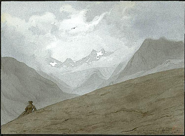
CIRQUE DE BARROSA SKETCHED BY FRANZ SCHRADER


FRANZ SCHRADER (1844-1924), The Cirque de Barrosa (1,745m - 5,725 ft) France- Spain border (Pyrénées)  In "Le Cirque de Barrosa", watercolor


FRANZ SCHRADER (1844-1924),
The Cirque de Barrosa (1,745m - 5,725 ft)
France- Spain border (Pyrénées)

In "Le Cirque de Barrosa", watercolor


The painter
Jean-Daniel-François Schrader, better known as Franz Schrader, was a French mountaineer, geographer, cartographer and landscape painter. He made an important contribution to the mapping of the Pyrenees and was highly considered among the pyreneists.
He is the son of Prussian Ferdinand Schrader from Magdeburg, who emigrated to Bordeaux, and of Marie-Louise Ducos, cousin of geographers Élisée and Onésime Reclus. He shows a talent for drawing from an early age. In 1866, while staying with his friend Léonce Lourde-Rocheblave in Pau, he has a sort of revelation at the "spectacle grandiose de la barrière montagneuse des Pyrenées ".
His vocation strengthens when reading stories by Ramond de Carbonnières (1755-1827) (Les Voyages au Mont-Perdu) and by Henry Russell (1834-1909) (Les Grandes Ascensions des Pyrénées, guide d'une mer à l'autre).
While devoting the main part of his leisure to long hikes in the mountains, during which he gathers thousands of observations for his topographical records, he still finds time to paint numerous panoramas of the Pyrenees as well as the Alps which he also studies, and to acquire a solid formation in topography.
To facilitate topographical work in rugged terrain, he develops the orograph in 1873. His first great cartographic work, in 1874, is the map of the massif of Gavarnie-Mont-Perdu at a scale of 1:40 000, for which he collects the measurements with the participation of Lourde-Rocheblave from nearby Pau. That map triggers such a sensation that it is included in the annual Mémoires of the Société des Sciences Physiques et Naturelles de Bordeaux with an explanatory text the following year. The Club alpin français directory follows with the publication of an enthusiastic review, describing Schrader as qualified for "first rank topographer in a glorious master stroke". In 1876 he takes part in the creation of the Bordeaux section of the Club Alpin Français, becoming its first president.
In 1877 he travels to Paris with a recommendation from his cousins Élisée and Onésime Reclus. There, having met Émile Templier, nephew and collaborator of Louis Hachette, and Adolphe Joanne, president of the Parisian section of the Club Alpin Français, he is employed as a geographer by Librairie Hachette and is now able to practice his passion in the scope of his profession. He also gives geography lessons at the School of Anthropology and also becomes editor of the French Alpine Club directory
In 1927, three years after his death, his remains are transferred to a tomb on a slope of the Circus of Gavarnie (French Pyrenees). 

The mountain
The Cirque de Barrosa (1745m - (Circo de Barrosa in Spanish) is a glacial cirque located in the center of the Pyrenees chain, in Spain, in the comarca of Sobrarbe (province of Huesca, autonomous community of Aragon). Part of its ridge line forms the border with France.
It is a beautiful mountain circus, attractive for mountaineers, but it is distinguished by its geological structure in two floors, the upper floor being part of an overlap, and by the remains of an old mule track which crosses it from side to side. However, these two singularities are intimately linked since this path has been laid out on a natural cornice which runs, in the cliffs, at the limit between the two floors, which gives its route a great interest from a geological point of view.
In addition, the Cirque de Barrosa provides the opportunity to take an interest in several stories: those of mining in the region of the cirque, to which this path is linked; that of human relations between France and the Bielsa valley, via this path or neighboring passes; that of an episode of the Spanish Civil War, of which the Bielsa Valley was the scene; and that of Pyreneism, whose pioneers discovered the circus at the end of the 19th century.

_______________________________

2022 - Wandering Vertexes...
by Francis Rousseau

Thursday, September 29, 2022

THE MONT BLANC PAINTED BY CESARE MAGGI

CESARE MAGGI (1881-1962) The Mont Blanc (4,808.73 m -15,777 ft) France - Italy   in "The Mont Blanc seen from italy", oil on canvas, 100 x 140 cm


CESARE MAGGI (1881-1962)
The Mont Blanc (4,808.73 m -15,777 ft)
France - Italy 

in "The Mont Blanc seen from italy", oil on canvas, 100 x 140 cm

 
The painter
The italian painter Cesare Maggi was born into a family of actors, Maggi embarked on classical studies at his father’s wish but also took up painting at a very early age His debut in Florence at the Esposizione Annuale della Società di Belle Arti di Firenze in 1898 was followed by a short trip to Paris to catch up with the latest developments.
The crucial turning point in Maggi’s art came in 1889 with the posthumous show of work by Giovanni Segantini held by the Milanese Society of Fine Arts, which prompted a definitive shift to landscape painting of a Divisionist character. After a short stay in the Engadin, he returned to Milan before finally settling in Turin. Commercial collaboration with Alberto Grubicy until 1913 enabled Maggi to establish himself quickly as one of the leading representatives of the second generation of Divisionist painters in Italy. He painted a repertoire of readily comprehensible mountain landscapes focusing primarily on aspects of the visual perception of the reflection of light and colour but lacking the deep spirituality of Segantini’s work. He took part in the major Italian and European exhibitions and the Venice Biennale devoted an entire room to his work at the Esposizione Internazionale d’Arte of Venice in 1912. After an interlude devoted to portrait painting in the same decade, the artist’s mature work focused on greater simplification of subject matter, mostly in landscapes.
Maggi obtained the chair in painting at the Albertina Academy, Turin, in 1936.


The mountain
The Mont-Blanc (in French) (4 ,808.73 m -15,777 ft) or Monte Bianco (in Italian), both meaning "White Mountain", is the highest mountain in the Alps and the highest in Europe after the Caucasus peaks. It is ranked 11th in the world in topographic prominence. The Mont Blanc is one of the Seven Summit, which includes the highest mountains of each of the seven continents. Summiting all of them is regarded as a mountaineering challenge, first achieved on April 30, 1985 by Richard Bass. The 7 highest summit, (which are obviously 8 with 2 in Europe !) are : Mount Everest (8,848m), Aconcagua (6,961m), Mt Denali or Mc Kinley (6,194m), Kilimandjaro (5,895m), Mt Elbrus (5,642m), Mount Vinson (4,892m) and Mount Kosciuszko (2,228m) in Australia.
The overcrowding threshold of Mont Blanc is reached, with 300 to 400 departures per day in summer.
At the summit of the National Mountain Council held in Sallanches at the end of August 2006, it was estimated that between 25,000 and 30,000 people set out in 2005 to conquer Mont Blanc. With the opening of new markets (Russia, China, India), 50,000 to 100,000 people could tomorrow try the adventure, the figure of 200,000 has even been advanced.
These prospects are nightmarish for the defenders of the site and for some political leaders of the valley, such as the mayor of Saint-Gervais-les-Bains, common on which Mont Blanc is located.

 - More about the Mont-Blanc


___________________________________________
2022 - Wandering Vertexes...
by Francis Rousseau

Tuesday, September 20, 2022

MONT CLAPIER & MERCANTOUR RANGE BY MARSDEN HARTLEY


MARSDEN HARTLEY (1877–1943) The Mont Clapier and Mercantour Range (3 ,045m - 9,990ft) France- Italy Border  In Purple Mountains, Vence, oil on canvas, Phoenix Art Museum


MARSDEN HARTLEY (1877–1943)
The Mont Clapier and Mercantour Range (3 ,045m - 9,990ft)
France- Italy Border

In Purple Mountains, Vence, oil on canvas, Phoenix Art Museum

The painter 
Marsden Hartley  was an American Modernist painter, poet, and essayist.
Hartley began his art training at the Cleveland Institute of Art after his family moved to Cleveland, Ohio, in 1892.  He won a scholarship to the Cleveland School of Art.
In 1898, at age 22, he moved to New York City to study painting at the New York School of Art under William Merritt Chase, and then attended the National Academy of Design. Hartley was a great admirer of Albert Pinkham Ryder and visited his studio in Greenwich Village as often as possible. His friendship with Ryder, in addition to the writings of Walt Whitman and American transcendentalists Henry David Thoreau and Ralph Waldo Emerson, inspired Hartley to view art as a spiritual quest.
Hartley first traveled to Europe in April 1912, and he became acquainted with Gertrude Stein's circle of Avant-garde writers and artists in Paris.  Stein, along with Hart Crane and Sherwood Anderson, encouraged Hartley to write as well as paint.
In 1913, Hartley moved to Berlin, where he continued to paint and befriended the painters Wassily Kandinsky and Franz Marc. He also collected Bavarian folk art.  His work during this period was a combination of abstraction and German Expressionism, fueled by his personal brand of mysticism.
In Berlin, Hartley developed a close relationship with a Prussian lieutenant, Karl von Freyburg. References to Freyburg were a recurring motif in Hartley's work, most notably in Portrait of a German Officer (1914). Freyburg's subsequent death during the war hit Hartley hard, and he afterward idealized their relationship. Many scholars believe Hartley to have been gay, and have interpreted his work regarding Freyburg as embodying his homosexual feelings for him.
Hartley finally returned to the U.S. in early 1916. He lived in Europe again from 1921 to 1930, when he moved back to the U.S. for good.  He painted throughout the country, in Massachusetts, New Mexico, California, and New York. He returned to Maine in 1937, after declaring that he wanted to become "the painter of Maine" and depict American life at a local level.  This aligned Hartley with the Regionalism movement, a group of artists active from the early- to-mid 20th century that attempted to represent a distinctly "American art." He continued to paint in Maine, primarily scenes around Lovell and the Corea coast, until his death in Ellsworth in 1943. His ashes were scattered on the Androscoggin River. Most of his mountains paintings of Maine are nowadays in the MET collections.


The mountain
The Mont Clapier (3 ,045m - 9,990ft) is one of the main peaks in the eastern part of the Mercantour-Argentera massif, on the border ridge between France (Alpes-Maritimes) and Italy (Piedmont),
The summit is easily accessible on foot from the Nice refuge, in the Gordolasque valley. In winter, it is also one of the main ski touring routes in the area. The Italian side of Le Clapier bears the southernmost glacier in the Alps, Le Glacier du Clapier, 40 kilometers as the crow flies from the sea. This glacier is normally visible from the Pas Est du Mont Clapier. 

_______________________________

2022 - Wandering Vertexes...
by Francis Rousseau


Saturday, September 17, 2022

THE MOUNT VALIER SKETCHED BY EUGÈNE VIOLLET-LE-DUC

 
EUGÈNE VIOLLET-LE-DUC (1814-1879)  Mont Valier (2,838m - 9,311ft)   France (Pyrénées)  In Vue du fond de la vallée d'Azun prise de la montagne de Pourges, Hautes-Pyrénées , watercolor, 1833


EUGÈNE VIOLLET-LE-DUC (1814-1879)
 Mont Valier (2,838m - 9,311ft) 
 France (Pyrénées)

In Vue du fond de la vallée d'Azun prise de la montagne de Pourges, Hautes-Pyrénées, watercolor, 1833


The mountain
Mont Valier (2,838m - 9,311ft) is summit located in the Ariège Pyrenees, emblematic of Couserans, dominating the Angouls valley and its torrent, a short distance from the Spanish border.
The name comes from Valerius (Saint Valier, around 452), mythical first bishop of Couserans who would have climbed it. The Mont Valier belongs to the axial Pyrenean chain. Visible from afar, you can clearly see it from the plains of the Garonne and from Toulouse. The summit is located within the perimeter of the regional natural park of the Ariège Pyrenees. It is shared between the municipalities of Seix and Bordes - Uchentein.
Several stone crosses have succeeded each other at the top. If the first would have been the work of the first bishop of Couserans Valerius in the 5th century, Bernard Coignet de Marmiesse, another bishop of Couserans, had a marble cross erected there in the 1670s. The last was inaugurated in September 2012 after the destruction by anticlerical vandalism in 2011 of the granite cross placed in 1987. During the Second World War, an escape route from Saint-Girons to Esterri d'Àneu in Catalonia crossed the Mont Valier massif to cross the border at the difficult Col de la Pale de la Clauère. This "Chemin de la Liberté" - the name given in 1994 to the long-distance footpath that follows its route - allowed the escape of 782 people between 1940 and 1944 and remained operational, despite the increased surveillance of the Germans from 1943 and the denunciations on the part of French collaborators, and it functioned until the end of the war.
In 2000, a via ferrata was created towards the Estagnous refuge (2,246 m). It connects the refuge to the Long pond. Overlooking the round pond, it allows you to discover verticality in safety and a quality point of view. A departure is possible from the refuge or the Long pond. The route totals a length of 1,200 m, including 620 m equipped, for a one-way duration of 2 h 30 and 150 m of elevation. She is rated D.
By ministerial decree of July 5, 2005, a vast territory located in the municipality of Seix, including the national reserve of Mont Valier — created in 1937 (it is one of the oldest in the Pyrenees) — as well as almost all of the national territory of the Fonta massif, has been classified as a site of the Natura 2000 network (special protection area of ​​the Mont Valier massif)
The access routes are only on foot and for experienced and well-equipped hikers. The main access is from the Riberot valley, in the commune of Bordes-Uchentein, from the Plat de la Lau car park and via the Estagnous refuge (guarded in the right season, reservation required).


The artist
Eugène Emmanuel Viollet-le-Duc (not to be confused with the french writer Violette Leduc!) was a French architect and theorist, famous for his "restorations" of medieval buildings. But he was, as well, an excellent but less famous watercolorist, sketching quite a number of mountains and volcanoes all over Europe.
Born in Paris, he was a major Gothic Revival architect. His works were largely restorative and few of his independent building designs were ever realised. Strongly contrary to the prevailing Beaux-Arts architectural trend of his time, much of his design work was largely derided by his contemporaries. He was the architect hired to design the internal structure of the Statue of Liberty, but died before the project was completed.
During the early 1830s, a popular sentiment for the restoration of medieval buildings developed in France. Viollet-le-Duc, returning during 1835 from study in Italy, was commissioned by Prosper Mérimée to restore the Romanesque abbey of Vézelay. This work was the first of a long series of restorations; Viollet-le-Duc's restorations at Notre Dame de Paris with Jean-Baptiste Lassus brought him national attention. His other main works include Mont Saint-Michel, Carcassonne, Roquetaillade castle and Pierrefonds.
Viollet-le-Duc's "restorations" frequently combined historical fact with creative modification. For example, under his supervision, Notre Dame was not only cleaned and restored but also "updated", gaining its distinctive third tower (a type of flèche) in addition to other smaller changes. Another of his most famous restorations, the medieval fortified town of Carcassonne, was similarly enhanced, gaining atop each of its many wall towers a set of pointed roofs that are actually more typical of northern France. Many of these reconstructions were controversial. Viollet-le-duc wanted what he called ‘a condition of completeness' which never actually existed at any given time. This approach to restoration was particularly problematic when buildings survived in a mixture of styles. For instance, Viollet-le-Duc eliminated eighteenth-century additions to Notre Dame. Both his theory and his practice were strongly criticized on the grounds that only what had once been in place should be reconstructed. At the same time, in the cultural atmosphere of the Second Empire theory necessarily became diluted in practice: Viollet-le-Duc provided a Gothic reliquary for the relic of the Crown of Thorns at Notre-Dame in 1862, and yet Napoleon III also commissioned designs for a luxuriously appointed railway carriage from Viollet-le-Duc, in 14th-century Gothic style.
Among his restorations were:
- Churches :
Notre-Dame in Paris, Abbey of the Mont Saint-Michel, Basilica of St. Mary Magdalene in Vézelay, St. Martin in Clamecy, Sainte-Chapelle in Paris, Basilica of St. Denis near Paris, St. Louis in Poissy, Notre-Dame in Semur-en-Auxois, Basilica of St. Nazarius and St. Celsus in Carcasonne, Basilica of St. Sernin in Toulouse, Notre-Dame in Lausanne (Switzerland).
Town halls:
- Saint-Antonin-Noble-Val, Narbonne
Castles:
- Château de Roquetaillade in Bordeaux, Château de Pierrefonds, Fortified city of Carcassonne, Château de Coucy, Antoing in Belgium, Château de Vincennes in Paris.
When monuments was to much damaged, he sometimes obtain from the emperor Napoleon III the permission to entirely rebuilt it, like he did in Avignon with the Popes ramparts all around the city.

_______________________________

2022 - Wandering Vertexes...
by Francis Rousseau

Sunday, August 7, 2022

LE PILON DU ROI - MASSIF DE L'ÉTOILE PAINTED BY PAUL CÉZANNE


PAUL CÉZANNE (1839-1906) The Pilon du Roi - Massif de l'Etoile (710 m - 2,200 ft) France                    La Chaine de l'Etoile avec le Pilon du Roi, 1885–1886,  Barnes Foundation


PAUL CÉZANNE (1839-1906)
The Pilon du Roi - Massif de l'Etoile (710 m - 2,200 ft)
France 

                     La Chaîne de l'Etoile avec le Pilon du Roi, 1885–1886,  Barnes Foundation


The mountain

The Massif de l'Etoile (Range of the Star) is a small mountain range located north of Marseille. Covering an area of ​​10,000 hectares, it culminates at 779 meters at Grand-Puech. Its other highest points are: to the west, the summit of Grande-Étoile (590 metres) and l'Étoile (652 metres, the highest point in the municipality of Marseilles), to the east, besides the Tête du Grand-Puech, the Mont Julien (647 meters), while the center of the massif is dominated by the Pilon du Roi (710 meters) whose name is a deformation of the Provençal Pieloun dóu Roure, or the “peak of the oak”.
With the Garlaban massif, it forms a chain of mountains in coastal limestone Lower Provence in the south of Bouches-du-Rhône. They constitute a vast natural space of approximately 20,000 hectares which emerge at the heart of an urban complex of more than one million inhabitants with the agglomerations of Marseille, Aix-en-Provence, Aubagne and Gardanne.
The massif crosses 18 communes of the Bouches-du-Rhône.
On the northern edge of the Marseille agglomeration, this massif offers a beautiful image of the non-coastal hills of limestone Basse-Provence with typical flora, including endemic and rare species, including one from Appendix II of the plant protection system. (Arenaria provincialis), a typical vegetation of coppice, scrubland, lawns and rock habitats belonging to the Meso-Mediterranean level with even, thanks to a clear shade, an outline of a supra-Mediterranean level (coppice - high oak forest pubescent holly and pine forests of Scots pine) and a Mediterranean fauna whose current studies show for the moment typicality and originality.


The Painter
If mount Sainte-Victoire appears to have been the subject of a true love story with the painter Paul Cezanne, it is not the only one mountain he painted.
Aix-en Provence (France) painter Paul Cezanne still remains closely linked to his hometown. His studio in Les Lauves remains a place to visit, as if the painter was coming back from one second to the other. But the eternal bond is undoubtedly the series of paintings he did of the Montagne Sainte-Victoire. A hobby, a passion, a thread in the painter's work that took place in the latter part of his life, between 1882 and 1906 when he died in Aix. History says that the painter had contracted a nasty pneumonia during a working session on the mountain. This is what can be called 'die on stage'.
Cézanne had a considerable influence on the art of the late nineteenth and the early twentieth century. Acknowledged master of his time, he attended during stays in Paris between 1862 and 1882, the Impressionist band: Camille Pissarro, Auguste Renoir (who also ended his life in the Provencal brightness), Claude Monet, Alfred Sisley and others. He participated in the Impressionist adventure while keeping his personality: it is the time of the shock of the en plein air, easels in the grass, looking for natural light and emotion.
The influence of the Aix painter is recognized in the history of art since it would be the cause of the Cubist movement embodied in 1906 by Pablo Picasso and Georges Braque. The first historically so called Cubist painting ' Les Demoiselles d'Avignon' would, a true artistic shock shown by Picasso in 1907 (one year after the death of Cézanne) is today one of the masterpieces of the MoMA in New York.
It is the search of volumes around which leads to the appearance of geometry in landscapes or still lifes of Cézanne.In 20 years, Cézanne pushes his style to express the emotion of the landscape, suggesting the wind, involving movement just like if we can breathe the air of the scene. In his first paintings pf the Sainte Victoire,(in the 1880’s) he expresses the giant aspect of the mountain that dominates the area with his characteristic e way of painting at the time, with a juxtaposition of linear brushstrokes and a range of soft, natural colors. In the last paintings of the Sainte Victoire, view from Les Lauves, between 1904 and 1906, he shows shots less accurate brushes allowing the shape of the mountain emerge from the canvas like an apparition. That is the whole intention of the artist, show nature as it is without fail to convey emotion.

_______________________________
2022 - Wandering Vertexes...
by Francis Rousseau

Thursday, August 4, 2022

LE MONT AGEL PAINTED BY CLAUDE MONET

CLAUDE MONET (1840-1926) Mont Agel (1,151m - 3,776 ft) France - Principauté de Monaco - Italy border  In "La Corniche near Monaco, Le Mont Agel", oil on canvas, 65 x 82cm, Private Collection


CLAUDE MONET (1840-1926)
Mont Agel (1,151m - 3,776 ft)
France - Principauté de Monaco - Italy border

In "La Corniche near Monaco, Le Mont Agel", oil on canvas, 65 x 82cm, Private Collection


About this painting
Claude  Monet  painted the Mont Agel quite a number of times, but in ecah painting colors and  general impression are totally different.  One can compare the different paintings of that mountain he done. this one is supposed to have been painted at 1the sunset.  Monet, like the japanese painters ,and particularly Hokusai who painted the 36 views of Mount Fuji, reproduced the same artistic behavior by painting series of the same mountains, in the same place, at different hours of the day or different seasons. At Cap Martin and Mont Agel, Monet painted about ten of them.

 The mountain
Mont Agel (1,151m - 3,776 ft) is a summit of the Alps located in the South of France, overlooking part of the French Riviera, Monaco, Beausoleil, Roquebrune-Cap-Martin... exactly as shwon in the Monet's painting above !
It has held a historic strategic position since Antiquity and still houses military aerial detection installations today. Mount Agel is precisely located in the French commune of Peille, ( Provence-Alpes-Côte d'Azur region). It rises in the Prealps of Nice and constitutes the highest point of the Monegasque watershed. The highest point of the principality, of Monaco, on the slopes of this mountain, can be reached by the Chemin des Révoires. A massive summit, Mount Agel is visible from a great distance: from certain districts of Nice as well as from a large part of the French Riviera between Cannes, Antibes, Nice, Antibes, and the Principality of Monaco and likewise from the Italian Riviera to around Vintimiglia and Bordighiera.
The history of Mount Agel begins with the Celto-Ligurian tribes who occupied the site and some of whose members were involved in the boarding and looting of boats engaged in cabotage. They are submitted from 23 to 13 BC. BC by the Romans who restored the old coastal route passing through the slopes of Mount Agel to link Ventimiglia to Narbonne Gaul and forming part of the Via Aurelia.
From 1931, new elements of fortification were built within the framework of the Maginot line.
Mount Agel now houses a large work of artillery equipped with turrets, linked together by deeply buried galleries. During the fighting of June 1940, his shots participated in the defense of Menton and supported the outpost of Pont-Saint-Louis and the work of Cap-Martin.
Until 2012, the 943 Capitaine Auber air base of the French Air Force was located there.
Today, only radars remain, which continue their watch in automatic mode, the information being transmitted and used by the Detection and Control Center at 942 Lyon-Mont Verdun air base.
Mount Agel also shelters on its slopes, the Monte-Carlo Golf Club, a very selective club. A little to the east of the golf course is the transmitter center of Fontbonne. Until its recent redevelopment, there were various protohistoric constructions.
Close to Mount Agel and the golf course is also the summer residence of Princes of Monaco (Rocagel site).


The painter
The painter Oscar-Claude Monet better known as Claude Monet was a founder of French Impressionist painting, and the most consistent and prolific practitioner of the movement's philosophy of expressing one's perceptions before nature, especially as applied to plein-air landscape painting. The term "Impressionism" is derived from the title of his painting « Impression, soleil levant » (Impression, Sunrise), which was exhibited in 1874 in the first of the independent exhibitions mounted by Monet and his associates as an alternative to the Salon de Paris.
Monet's ambition of documenting the French countryside led him to adopt a method of painting the same scene many times in order to capture the changing of light and the passing of the seasons exactly like the japanese artist Hokusai (1760-1849) did with his 36 views of Mount Fuji.
Monet repeated this kinf of "exercise de stylee with his series on Les Petites Dalles. and Kolsass mountain.
Monet has been described as "the driving force behind Impressionism". Crucial to the art of the Impressionist painters was the understanding of the effects of light on the local colour of objects, and the effects of the juxtaposition of colours with each other. Monet's long career as a painter was spent in the pursuit of this aim.
In 1856, his chance meeting with Eugene Boudin, a painter of small beach scenes, opened his eyes to the possibility of plein-air painting. From that time, with a short interruption for military service, he dedicated himself to searching for new and improved methods of painterly expression. To this end, as a young man, he visited the Paris Salon and familiarised himself with the works of older painters, and made friends with other young artists.[54] The five years that he spent at Argenteuil, spending much time on the River Seine in a little floating studio, were formative in his study of the effects of light and reflections. He began to think in terms of colours and shapes rather than scenes and objects. He used bright colours in dabs and dashes and squiggles of paint. Having rejected the academic teachings of Gleyre's studio, he freed himself from theory, saying "I like to paint as a bird sings."
In 1877 a series of paintings at Gare St-Lazare had Monet looking at smoke and steam and the way that they affected colour and visibility, being sometimes opaque and sometimes translucent. He was to further use this study in the painting of the effects of mist and rain on the landscape. The study of the effects of atmosphere were to evolve into a number of series of paintings in which Monet repeatedly painted the same subject in different lights, at different hours of the day, and through the changes of weather and season. This process began in the 1880s and continued until the end of his life in 1926.
His first series exhibited as such was of Haystacks, painted from different points of view and at different times of the day. Fifteen of the paintings were exhibited at the Galerie Durand-Ruel in 1891. In 1892 he produced what is probably his best-known series, Twenty-six views of Rouen Cathedral. In these paintings Monet broke with painterly traditions by cropping the subject so that only a portion of the facade is seen on the canvas. The paintings do not focus on the grand Medieval building, but on the play of light and shade across its surface, transforming the solid masonry.
Other series include Peupliers, Matins sur la Seine, and the Nenuphars that were painted on his property at Giverny. Between 1883 and 1908, Monet traveled to the Mediterranean, where he painted landmarks, landscapes, and seascapes, including a series of paintings in Antibes (above) and Venice. In London he painted four series: the Houses of Parliament, London ; Charing Cross Bridge ; Waterloo Bridge, and Views of Westminster Bridge. Helen Gardner writes: "Monet, with a scientific precision, has given us an unparalleled and unexcelled record of the passing of time as seen in the movement of light over identical forms."
___________________________________________

2022 - Wandering Vertexes...
by Francis Rousseau

Monday, August 1, 2022

LE SIGNAL DE LA SAUVETTE - MASSIF DES MAURES PAINTED BY DAVID HOCKNEY


DAVID HOCKNEY (bn. 1937), Le Signal de la Sauvette / Massif des Maures (776m - 2,546 ft) France (Var)

 
DAVID HOCKNEY (bn. 1937),
Le Signal de la Sauvette / Massif des Maures (776m - 2,546 ft)
France (Var)

In Portrait of an Artist (Pool with Two Figures), acrylic-on-canvas. 2.1 m × 3.0 m, 1972


About the painting
This very famous painting was done durin summer 1972, by the pool of Tony Richardson's house "Le Nid du Duc"  looking at the Massif des  Maures mountain range, near La Garde-Freinet close to Saint Tropez.

The mountain
The Signal de la Sauvette (776m - 2,546 ft) is the highest point of the Massif des Maures. It is located in the South-East of France, in the Var department, in the Provence-Alpes-Côte d'Azur region.
The Massif des Maures (in Provençal: lei Mauras or lei Mauro) is a small mountain range in the south of France, located i between Hyères and Fréjus. It is one of the natural regions of France.


The painter
David Hockney (born 9 July 1937) is an English painter, draughtsman, printmaker, stage designer and photographer. An important contributor to the pop art movement of the 1960s, he is considered one of the most influential British artists of the 20th century. At the Royal College of Art, Hockney featured in the exhibition Young Contemporaries—alongside Peter Blake—that announced the arrival of British Pop art. He was associated with the movement, but his early works display expressionist elements, similar to some works by Francis Bacon. When the RCA said it would not let him graduate in 1962, Hockney drew the sketch The Diploma in protest. He had refused to write an essay required for the final examination, saying he should be assessed solely on his artworks. Recognising his talent and growing reputation, the RCA changed its regulations and awarded the diploma. After leaving the RCA, he taught at Maidstone College of Art for a short time.  A visit to California, where he subsequently lived for many years, inspired him to make a series of paintings of swimming pools in the comparatively new acrylic medium rendered in a highly realistic style using vibrant colours. The artist moved to Los Angeles in 1964, returned to London in 1968, and from 1973 to 1975 lived in Paris. Hockney has a home and studio in Kensington, London and two residences in California, where he has lived on and off for over 30 years: one in Nichols Canyon, Los Angeles, and an office and archives on Santa Monica Boulevard in West Hollywood, California. 


_____________________________

2022 - Wandering Vertexes...
by Francis Rousseau


Thursday, July 14, 2022

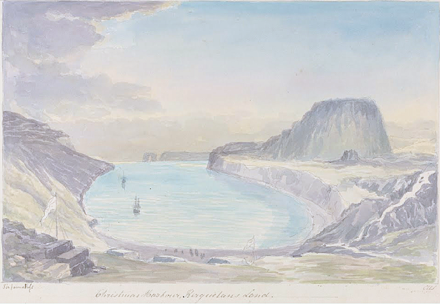
LA TABLE DE L'OISEAU SKETCHED BY CHARLES HAMILTON SMITH

CHARLES HAMILTON SMITH (1776-1859) La Table de l'Oiseau (403m - 1,322 ft) Antarctica - France   In Christmas Harbour,  Kerguelen's Land, watercolor,

CHARLES HAMILTON SMITH (1776-1859)
La Table de l'Oiseau (403m - 1,322 ft)
Antarctica - France

 In Christmas Harbour,  Kerguelen's Land, watercolor


The hill
The Table de l'Oiseau (403m - 1,322 ft) (Table ot the Bird) is a hill overlooking Port-Christmas by the north. Port-Christmas is one of the most isolated and difficult to reach points in the archipelagok.  Given the distance and especially the rugged topography, the site is almost never reached by land. However, it can be reached by sea after sailing for at least 100 nautical miles (190 km). The baie de l'Oiseau, at the bottom of which it is located, forms the first indentation at the northeast end of the Loranchet peninsula. The bay is closed to the north by Cap Français, to the south by Pointe de l'Arche (seen in the foreground).
While the shores of the bay are mostly rocky and often steep, the bottom is occupied by a strike, about 350 meters long, of black sand resulting from the erosion of the surrounding basaltic rocks. pours into the sea, after having collected runoff water from Mount Havergal on the one hand, and that from the outlet of Rochegude Lake on the other. This lake, located about 500 m from the shore and 40 m above sea level, marks the shoulder that separates Port-Christmas from Ducheyron Bay, to the west.
The anchorage at Port-Christmas allows you to anchor at a depth of 11 meters. It offers relatively safe shelter to sailors who frequent this particularly turbulent ocean sector of the Roaring Forties.

The artist
Lieutenant-Colonel Charles Hamilton Smith, was an English artist, naturalist, antiquary, illustrator, soldier, and... spy as well !. His military career began in 1787, when he studied at the Austrian academy for artillery and engineers at Mechelen and Leuven in Belgium (his native country). Although his military service, which ended in 1820 and included the Napoleonic Wars, saw him travel extensively (including the West Indies, Canada, United States, Southern and Northern Europe and ...Antarctica).
As a prolific self-taught illustrator (over 38,000 drawings!) He left quite an important number of books of beautifully watercolored landscapes taken all around the world. those nooks of watercolors are nowadays in the collections of the Yale Center From British Art. Among them :
- Views of France, Volume I (81 watercolors), Views of France, Volume II (93 watercolors),
- Views of England and Wales, Volume I (82 watercolors), Views of England and Wales, Volume II (74 watercolors),
- Views of Northern Europe, Volume I (68 watercolors), Views of Northern Europe, Volume II (78) watercolors),
- Views of Polar Regions (75 watercolors) (see above)
- Views of Spain, Volume I (69 watercolors), Views of Spain, Volume II (72 watercolors), But one of his noteworthy achievements was an 1800 experiment to determine which color should be used for military uniforms. He is also known in military history circles for Costume of the Army of the British Empire, produced towards the end of the Napoleonic Wars and an accurate depiction of contemporary British uniform.
As an antiquarian, he also produced, in collaboration with Samuel Rush Meyrick, Costume of the Original Inhabitants of the British Islands, 1815, and The Ancient Costume of England, with historical illustrations of medieval knights, ladies, shipsm and battles.
He also wrote on the history of the Seven Years' War and The Natural history of dogs.
Quite a productive fellow !
___________________________________________

2022 - Wandering Vertexes...
by Francis Rousseau

Thursday, June 9, 2022

THE PIC DU MIDI D'OSSAU BY THOMAS ALLOM

THOMAS ALLOM (1804-1872) Le Pic du Midi d'Ossau  (2, 848m-9,462 ft) France ( Pyrénées)  In "Les Eaux Bonnes dans les Pyréneées ",vers 1840, Lithographié par J. Kernot

THOMAS ALLOM (1804-1872)
Le Pic du Midi d'Ossau  (2, 848m-9,462 ft)
France ( Pyrénées)

In "Les Eaux Bonnes dans les Pyréneées ",vers 1840, Lithographed by J. Kernot


The mountain
The Pic du Midi d'Ossau (2, 848m-9,462 ft) not to be confused with the Pic du Midi de Bigorre is a mountain rising above the Ossau Valley in the French Pyrenees. Despite possessing neither a glacier nor, in the context of the range, a particularly high summit, its distinctive shape makes it a symbol of the French side of the Pyrenees. This familiar shape also makes it easily recognisable from afar, and it is particularly distinctive from the Boulevard des Pyrénées in Pau, some 55 km to the north.
The Pic du Midi d'Ossau lies within the commune of Laruns, in the département of Pyrénées Atlantiques and the Aquitaine region of France. It lies within the fully protected area of the Pyrenees National Park. As normally seen from the north, the mountain presents itself as having two distinct peaks, although from the south two other summits are also visible. It stands separate from any surrounding peaks, being largely surrounded by the valleys of the Gave de Bious, to the west, and the Gave du Brousset, to the east. These two mountain streams come together in the hamlet of Gabas at the foot of the mountain's northern slopes, to form the Gave d'Ossau.
The valley of Ossau is placed in the Béarnaises Pyrénées, between la vallée d'Aspe and the Vallée de Gavarnie, from Rébénacq to the French-Spanish frontier (Col du Portalet). The Col d'Aubisque closes the valley to the east. The villages (from N to S) of the high Ossau are: Bilhères, Bielle, Béon, Bélesten, Gère-Bélesten, Aste-Béon, Louvie-Soubiron, Béost, Assouste, Aas, Laruns, Eaux-Bonnes, Gourette, Eaux-Chaudes, Goust, Gabas, Arouste-Fabréges and Pont de Camps.
The Pic du Midi d'Ossau was reputedly first climbed in 1552 by an expedition led by François de Foix-Candale, later to become the Bishop of Aire. Although the success of this first climb is disputed, it is known that the mountain had been successfully climbed by 1787 when a military surveyor noted that a triangulation cairn had been built on the summit. The first fully recorded climb was by Guillaume Delfau accompanied by Mathieu (a shepherd from Eaux-Bonnes) on October 2, 1797.
The mountain offers many routes of ascent; the voie normale is a serious scramble and rock climb with a grading of PD, II+, 550 m. It approaches the summit via the Refuge de Pombie, a Club Alpin Français owned mountain hut situated at 2,031 m - 6,663 ft, and requires most of a day to execute.
Two others refuges : Cabane Pyrenea Sports belonging to Société Pyrénées Sports at Pau, 25 places located on the NE shore of Lac de Bious-Artigues, and Cabane de Peyreget (1.950 m)
non guarded, 4 places located near Lac de Peyreget and W of Peyreget' little peak ridge.

 The artist
Thomas Allom was an English architect, artist, and topographical illustrator. He was a founding member of what became the Royal Institute of British Architects (RIBA). He designed many buildings in London, including the Church of St Peter's and parts of the elegant Ladbroke Estate in Notting Hill. He also worked with Sir Charles Barry on numerous projects, most notably the Houses of Parliament, and is chiefly known for his numerous topographical works, which were used to illustrate books on travel. From the 1820s onwards, he travelled extensively through the UK and mainland Europe. In 1832 he published Westmorland, Durham and Northumberland Illustrated from Original Drawings (three volumes). In 1834 Allom arrived in Istanbul, Turkey, and produced hundreds of drawings during journeys through Anatolia, Syria and Palestine. The results of this expedition were published in 1838 in Constantinople and the Scenery of the Seven Churches of Asia Minor published in two volumes with text by Robert Walsh.  He is also remembered for numerous illustrations of China, published in China Illustrated in 1845. He also provided illustrations for "Family Secrets" by Mrs Ellis (1841) and E W Brayley's "A topographical history of Surrey" (1850).

___________________________
2022 - Wandering Vertexes
Un blog de Francis Rousseau


Sunday, May 22, 2022

LE GRAND VEYMONT SKETCHED BY JEAN-BAPTISTE NÉE


JEAN -BAPTISTE NÉE (b.1986) The  Grand Veymont (2,341m - 7,680 ft) France (Vercors)  In Vercors, hiver, paroi, gel (II), lavis, 2019, 16 x 25cm


JEAN -BAPTISTE NÉE (b.1986)
Le Grand Veymont (2,341m - 7,680 ft)
France (Vercors)

In Vercors, hiver, paroi, gel (II), lavis, 2019, 16 x 25cm


The artist
Jean-Baptiste Née, born in 1986. is a french painter, scenographer and visual artist, graduated from Arts-Décoratifs of Paris in 2012. Jean-Baptiste Née works in the mountains and high mountains, always in situ, in direct confrontation with the movements of the earth and water and wind. He gives a growing place for the action of the elements on the work in progress (rain, snow, frost, etc.). He established his "large workshop" in the Swiss Alps or in the Vercors massif - especially in winter -, as well as during long hikes in the Italian Alps. In the winter of 2018, he worked in the massifs of Wudangshan and Lushan, in China, and became interested in the Taoist notion of "Sky". Since 2016, Jean-Baptiste Née exhibits regularly in galleries in France and Switzerland. His workshop is in Montreuil, France. Exhibited in Galerie Camera
Obscura in Paris. A book was recently published about his work "Le monde nu" Éditions Hartpon.
Contact @jeanbaptiste.nee.
Jean Basptiste Née website

The mountain,
Le Grand Veymont (2,341m - 7,680 ft)( is  a mountain in the district of Gresse-en-Vercors, part of the department of Isère, France, is the highest point of the Massif du Vercors, but not the highest of the Vercors Regional Natural Park (which is the Rocher Rond at 2,453m).  It has a prominence of 1165 metres and an isolation of 26.88 kilometres. It is situated between le Pas de la Ville to the north and le Pas des Chattons to the south, and is part of the eastern edge of the high plateau of the Massif du Vercors.  It is preceded to the north by (north to south) "le Rocher de Séguret" (the Rock of Séguret, 2051 metres), "Roche Rousse" (Red Rock, 2105 metres), and "le Sommet de Pierre-Blanche" (the Summit of White Rock, 2106 metres)  and followed to the south (north to south) by Petit Veymont or Aiguillette (little Veymont or small needle, 2120 metres) and Mont Aiguille (Mount Needle, 2085 metres). Due to its location in the Parc du Vercors, it is far from any paved road. A moderately easy route to the summit involves walking about 10 km, hiking through the backcountry.
On 10 February 2007, a twin-engine light aircraft flying from London to Cannes disappeared in a snowstorm over le Grand Veymont, crashing into the mountainside and killing all three people aboard. The bodies and wreckage were recovered less than 24 hours later, at around 1960 metres above sea level, close to the Pas de la Ville, after a rescue operation involving more than one hundred policemen, firemen, mountain rescue specialists, and three helicopters equipped with infra-red cameras.

Saturday, April 23, 2022

THE MONT BLANC PAINTED BY CESARE MAGGI


CESARE MAGGI (1881-1962), The Mont Blanc (4,808.73 m -15,777 ft) France - Italy  In " Alla montagne, il Monte Biancho", fuile sur toile, détail.

CESARE MAGGI (1881-1962),
The Mont Blanc (4,808.73 m -15,777 ft)
France - Italy

In " Alla montagne, il Monte Biancho", oil on canvas 


The painter
The italian painter Cesare Maggi was born into a family of actors, Maggi embarked on classical studies at his father’s wish but also took up painting at a very early age His debut in Florence at the Esposizione Annuale della Società di Belle Arti di Firenze in 1898 was followed by a short trip to Paris to catch up with the latest developments.
The crucial turning point in Maggi’s art came in 1889 with the posthumous show of work by Giovanni Segantini held by the Milanese Society of Fine Arts, which prompted a definitive shift to landscape painting of a Divisionist character. After a short stay in the Engadin, he returned to Milan before finally settling in Turin. Commercial collaboration with Alberto Grubicy until 1913 enabled Maggi to establish himself quickly as one of the leading representatives of the second generation of Divisionist painters in Italy. He painted a repertoire of readily comprehensible mountain landscapes focusing primarily on aspects of the visual perception of the reflection of light and colour but lacking the deep spirituality of Segantini’s work. He took part in the major Italian and European exhibitions and the Venice Biennale devoted an entire room to his work at the Esposizione Internazionale d’Arte of Venice in 1912. After an interlude devoted to portrait painting in the same decade, the artist’s mature work focused on greater simplification of subject matter, mostly in landscapes.
Maggi obtained the chair in painting at the Albertina Academy, Turin, in 1936.


The mountain

The Mont-Blanc (in French) (4 ,808.73 m -15,777 ft) or Monte Bianco (in Italian), both meaning "White Mountain", is the highest mountain in the Alps and the highest in Europe after the Caucasus peaks. It is ranked 11th in the world in topographic prominence. The Mont Blanc is one of the Seven Summit, which includes the highest mountains of each of the seven continents. Summiting all of them is regarded as a mountaineering challenge, first achieved on April 30, 1985 by Richard Bass. The 7 highest summit, (which are obviously 8 with 2 in Europe !) are : Mount Everest (8,848m), Aconcagua (6,961m), Mt Denali or Mc Kinley (6,194m), Kilimandjaro (5,895m), Mt Elbrus (5,642m), Mount Vinson (4,892m) and Mount Kosciuszko (2,228m) in Australia.
The mountain lies in a range called the Graian Alps, between the regions of Aosta Valley, Italy, and Savoie and Haute-Savoie, France. The location of the summit is on the watershed line between the valleys of Ferret and Veny in Italy and the valleys of Montjoie, and Arve in France. The Mont Blanc massif is popular for mountaineering, hiking, skiing, and snowboarding.
The three towns and their communes which surround Mont Blanc are Courmayeur in Aosta Valley, Italy, and Saint-Gervais-les-Bains and Chamonix in Haute-Savoie, France. A cable car ascends and crosses the mountain range from Courmayeur to Chamonix, through the Col du Géant. Constructed beginning in 1957 and completed in 1965, the 11.6 km (7¼ mi) Mont Blanc Tunnel runs beneath the mountain between these two countries and is one of the major trans-Alpine transport routes.
Since the French Revolution, the issue of the ownership of the summit has been debated.
From 1416 to 1792, the entire mountain was within the Duchy of Savoy. In 1723 the Duke of Savoy, Victor Amadeus II, acquired the Kingdom of Sardinia. The resulting state of Sardinia was to become preeminent in the Italian unification.[ In September 1792, the French revolutionary Army of the Alps under Anne-Pierre de Montesquiou-Fézensac seized Savoy without much resistance and created a department of the Mont-Blanc. In a treaty of 15 May 1796, Victor Amadeus III of Sardinia was forced to cede Savoy and Nice to France. In article 4 of this treaty it says: "The border between the Sardinian kingdom and the departments of the French Republic will be established on a line determined by the most advanced points on the Piedmont side, of the summits, peaks of mountains and other locations subsequently mentioned, as well as the intermediary peaks, knowing: starting from the point where the borders of Faucigny, the Duchy of Aoust and the Valais, to the extremity of the glaciers or Monts-Maudits: first the peaks or plateaus of the Alps, to the rising edge of the Col-Mayor". This act further states that the border should be visible from the town of Chamonix and Courmayeur. However, neither the peak of the Mont Blanc is visible from Courmayeur nor the peak of the Mont Blanc de Courmayeur is visible from Chamonix because part of the mountains lower down obscure them. A Sardinian Atlas map of 1869 showing the summit lying two thirds in Italy and one third in France.
After the Napoleonic Wars, the Congress of Vienna restored the King of Sardinia in Savoy, Nice and Piedmont, his traditional territories, overruling the 1796 Treaty of Paris. Forty-five years later, after the Second Italian War of Independence, it was replaced by a new legal act. This act was signed in Turin on 24 March 1860 by Napoleon III and Victor Emmanuel II of Savoy, and deals with the annexation of Savoy (following the French neutrality for the plebiscites held in Tuscany and Emilia-Romagna to join the Kingdom of Sardinia, against the Pope's will). A demarcation agreement, signed on 7 March 1861, defines the new border. With the formation of Italy, for the first time Mont Blanc is located on the border of France and Italy.
The 1860 act and attached maps are still legally valid for both the French and Italian governments. One of the prints from the 1823 Sarde Atlas positions the border exactly on the summit edge of the mountain (and measures it to be 4,804 m (15,761 ft) high). The convention of 7 March 1861 recognises this through an attached map, taking into consideration the limits of the massif, and drawing the border on the icecap of Mont Blanc, making it both French and Italian.Watershed analysis of modern topographic mapping not only places the main summit on the border, but also suggests that the border should follow a line northwards from the main summit towards Mont Maudit, leaving the southeast ridge to Mont Blanc de Courmayeur wholly within Italy.
Although the Franco-Italian border was redefined in both 1947 and 1963, the commission made up of both Italians and French ignored the Mont Blanc issue. In the early 21st century, administration of the mountain is shared between the Italian town of Courmayeur and the French town of Saint-Gervais-les-Bains, although the larger part of the mountain lies within the commune of the latter.

___________________________________________
2022- Wandering Vertexes...
by Francis Rousseau

Wednesday, April 20, 2022

LE ROCHER DES DEUX TROUS PAINTED BY VINCENT VAN GOGH


VINCENT VAN GOGH (1853-1890) Le Rocher des Deux Trous (348m - France (Provence)


VINCENT VAN GOGH (1853-1890)
Le Rocher des Deux Trous (348m - 1,141 ft)
France (Provence)


The hill
The Rocher des Deux Trous (348m) in the Alpilles massif is one of the most popular hikes for walkers, satrting from Saint-Remy de Provence. It offers a 360° panorama over the two slopes of the Alpilles and over the entire surrounding region, from Mont Ventoux to the north and as far as the Mediterranean Sea to the south, on a clear day. This picturesque rock eroded and sculpted by the North wind (the Mistral) was painted by Van Gogh during his stay in Saint-Paul de Mausole from May 1889 to May 1890.

The painter
Vincent Willem van Gogh was a Dutch Post-Impressionist painter who is among the most famous and influential figures in the history of Western art. In just over a decade he created about 2100 artworks, including around 860 oil paintings, most of them in the last two years of his life. They include landscapes, still lifes, portraits and self-portraits, and are characterized by bold, symbolic colours, and dramatic, impulsive and expressive brushwork that contributed to the foundations of modern art. He died by suicide at 37, following years of mental illness and poverty.
Born into an upper-middle-class family, Van Gogh drew as a child and was serious, quiet and thoughtful. As a young man he worked as an art dealer, often travelling, but became depressed after he was transferred to London. He turned to religion, and spent time as a missionary in southern Belgium. Later he drifted in ill health and solitude. He took up painting in 1881 having moved back home with his parents. His younger brother Theo supported him financially, and the two kept up a long correspondence by letter.
More about Vincent Van Gogh

_______________________________

2022 - Wandering Vertexes...
by Francis Rousseau

Sunday, April 3, 2022

THE CAP D'ANTIBES PAINTED BY NICOLAS DE STAËL


NICOLAS DE STAËL (1914-1955) Cap d'Antibes (19 m - 62,3 ft) France (Var)  In  Marine au cap d'Antibes, 1954 oil on canvas, 88.3 x 129.5 cm, Private collection.

NICOLAS DE STAËL (1914-1955)
Cap d'Antibes (19 m - 62,3 ft)
France (Alpes Maritimes)

In  Marine au cap d'Antibes, 1954 oil on canvas, 88.3 x 129.5 cm, Private collection.


The Cap
Cap d'Antibes commonly refers to a peninsula located south of Antibes and east of Juan-les-Pins, on the Côte d'Azur in France. Geographical Cap d'Antibes is located to the south of this peninsula, near Argent Faux Cove and Villa Eilenroc, on the coastal path at the start of Golfe Juan. The history of Cap d'Antibes is linked to that of Antibes, whose exceptional site has been known since ancient times.
The coastal path known as “Tire-Poil” allows walkers to explore the cape in good weather, from the Garoupe beach car park to Villa Eilenroc. Walking as close as possible to the waves, this 2.7 km route makes its way through the steep rocks and along the imposing walls of the Garoupe and Croë castles. It offers an exceptional panorama, to the west on the Lérins islands, and to the east on the first summits of Mercantour. Built at the highest point of the cape and next to the ancient chapel of Notre Dame de Bon Port, the Garoupe lighthouse dominates the Gulf of Juan and the Bay of Angels. L'Abri de l'Olivette, a port-shelter where typical boats of the region anchor, is located on its west coast.The site benefits from the visit of personalities from the world of cinema, mainly during the Cannes Film Festival, which increases the notoriety of the place.  It was around the middle of the 19th century that the Cap d'Antibes really began to develop.  At that time, wealthy tourists from all over Europe, especially England and Russia, discovered the place and built luxurious homes there.  It was the Comte de Fersen, colonel and aide-de-camp to the Tsar, who opened up Cap d'Antibes in 1863 by tracing a road around the peninsula. Thus, the knight James Close, former banker of François II (king of the Two Sicilies), settled in 1864 in Antibes and bought 17,000 m2 of land there in Cap before dying in 1865. In 1880, the current location of Juan-les-Pins was discovered by the Duke of Albany, son of Queen Victoria. At that time, Juan-les-Pins was just a pine forest, bordered by idyllic sandy beaches. Juan-les-Pins was also called Albany-les-Bains until 1884. In 1893, Georges Gallice acquired land located at the start of the Cap road and a small port attached to his property would later become Port Gallice.

The painter
Nicolas de Staël was a French painter of Russian origin known for his use of a thick impasto and his highly abstract landscape painting. Nicolas de Staël was born Nikolai Vladimirovich Stael von Holstein (Николай Владимирович Шталь фон Гольштейн) in Saint Petersbourg (Russia), into the family of a Baron Vladimir Stael von Holstein, the last Commandant of the Peter and Paul Fortress. De Staël's family was forced to emigrate to Poland in 1919 because of the Russian Revolution ; both his father and stepmother died in Poland and the orphaned Nicolas de Staël was sent with his older sister Marina to Brussels to live with a Russian family (1922)...
- More about Nicolas de Stael biography
___________________________________________

2022 - Wandering Vertexes...
by Francis Rousseau


Tuesday, March 22, 2022

THE MER DE GLACE AND GRAND CHARMOZ PAINTED BY GABRIEL LOPPÉ


GABRIEL LOPPÉ (1825-1913), Les Aiguilles du Grand Charmoz (3,445m - 11,302ft) France  In La Mer de Glace et les Grands Charmoz, Chamonix, Huile sur toile, Courtesy JohnMitchell Fine Arts, London, Artcurial Paris,

GABRIEL LOPPÉ (1825-1913),
Les Aiguilles du Grand Charmoz (3,445m -11,302ft)
France

In La Mer de Glace et les Grands Charmoz, Chamonix, Huile sur toile, 

Courtesy John Mitchell Fine Arts, London, and Artcurial Paris,

 
The painter

Toussaint Gabriel Loppé was a French painter, photographer and mountaineer. He became the first foreigner to be made a member of the Alpine Club in London. His father was a captain in the French Engineers and Loppé's childhood was spent in many different towns in south-eastern France. Aged twenty-one Loppé climbed a small mountain in the Languedoc and found a group of painters sketching on the summit. He had found his calling and subsequently went off to Geneva where he met the reputed leading Swiss landscapist, Alexandre Calame (1810 -1864). Loppé took up mountaineering in Grindelwald in the 1850s and made friends easily with the many English climbers in France and Switzerland. Although he was frequently labelled as a pupil of Calame and his rival François Diday, Loppé was almost an entirely self-taught artist. He became the first painter to work at higher altitudes during climbing expeditions earning the right to be considered the founder of the peintres-alpinistes school, which became established in the Savoie at the turn of the nineteenth century.
Notable followers of Loppé include, Charles Henri Contencin (1875-1955) and Jacques Fourcy (1906-1990). Together with the first ascent of Mt Mallet in Chamonix’s Grandes Jorasses range, Loppé made over 40 ascents of Mont Blanc during his climbing career, which lasted until the late 1890s. He frequently made oil sketches from alpine summits, including a panorama of the view from the summit of Mont Blanc.
His paintings became celebrated for their atmosphere and spontaneity and he soon found himself taking part in many exhibitions in London and in Paris.
By 1896 Loppé had spent over fifty seasons climbing and painting in Chamonix. As the valley’s unrivalled ‘Court painter’ his work was in constant demand with the majority of his pictures going to English climbers and summer tourists.
In his later years, Loppé became fascinated with photography and was quite an innovator in this field too. His long exposure photograph of the Eiffel Tower struck by lightning, now in the Musée d'Orsay in Paris remains one of his iconic images. 

 
The mountain
The Aiguille des Grands Charmoz (3,445 m), is one of the Chamonix needles in the Mont Blanc massif. It is made up of a ridge bristling with " gendarmes", including La Carrée, and Bâton Wicks. The first ascent was done on August 9, 1885 by H. Dunod and P. Vignon with the guides J. Desailloux, F. Folliguet, F. and G. Simond, by the corridor Charmoz-Grépon. It is today the normal way of descent, the climb generally being made by the south-west slope and the northwestern edge (AD +), climbed 15 July 1880 by Albert F. Mummery with Alexandre Burgener and Benedikt Venetz, which stopped before the summit at point 3 435 m. The Aiguille des Grands Charmoz is linked with the Aiguille du Grépon for the crossing of Charmoz-Grépon (D), one of the great rocky classics of the Mont Blanc massif. The first crossing was done by Laurent Croux in 1904. The first ascent of the north face, via the needle of the Republic, and crossing the edges of the Charmoz was done by Raymond Leininger and G. Bicavelle in 1946. In 1974, Jean-Claude Droyer succeeded the solo climb of the western pillar of the Grand Charmoz (Cordier lane opened in 1970 by Patrick Cordier).
The Mt Blanc is one of the 7 highest summits in earth, (which are obviously 8 with 2 in Europe !):
Mount Everest (8,848m), Aconcagua (6,961m), Mt Denali or Mc Kinley (6,194m), Kilimandjaro (5,895m), Mt Elbrus (5,642m), Mount Vinson (4,892m) and Mount Kosciuszko (2,228m) in Australia.

The Glacier
The Mer de Glace (Sea of Ice) is an alpine valley glacier located on the northern slope of the Mont-Blanc massif. It is formed by the confluence of the Tacul glacier and the Leschaux glacier and flows into the Arve valley, on the territory of the municipality of Chamonix-Mont-Blanc, giving rise to the Arveyron. The glacier is seven kilometers long, its supply basin has a maximum length of twelve kilometers and an area of ​​40 km2, while its thickness reaches 300 meters. In the middle of the 20th century, an ice cave was pierced for the first time in the Mer de Glace. Due to the attraction's success, a cable car was put into service in 1961 to access it, then replaced by a cable car in 1988. Since 1973, an underground hydroelectric power station has been using the meltwater from the glacier.
Almost a million visitors go to Montenvers every year to contemplate the Mer de Glace. During peak periods, half of them visit the ice cave. Three museums are also located on the site. Skiing is possible from the Aiguille du Midi in winter. However, the retreat of the glacier, measured since 1860-1870, causes a loss of thickness of 120 meters in a century in its terminal part. It causes difficulties at the level of the ice cave, where more and more steps are necessary to reach the gondola, and requires considering its upstream movement, like the catchment of the hydroelectric power station in 2011.
_______________________________
2022 - Wandering Vertexes...
by Francis Rousseau