google.com, pub-0288379932320714, DIRECT, f08c47fec0942fa0 GRAVIR LES MONTAGNES... EN PEINTURE: Search results for Everest
Showing posts sorted by date for query Everest. Sort by relevance Show all posts

Wednesday, October 13, 2021

THE MONT BLANC & THE MER DE GLACE BY JOHN RUSKIN

JOHN RUSKIN (1819-1900), The Mont Blanc (4,808.13 m - 15,776.7 ft) France - Italy border  In Mer de Glace Chamonix, watercolor on paper, 1849, Ruskin Foundation


JOHN RUSKIN (1819-1900),
The Mont Blanc (4,808.13 m - 15,776.7 ft)
France - Italy border

In Mer de Glace Chamonix, watercolor on paper, 1849, Ruskin Foundation

The painter  
John Ruskin was the leading English art critic of the Victorian era, as well as an art patron, draughtsman, watercolourist, a prominent social thinker and philanthropist. He wrote on subjects as varied as geology, architecture, myth, ornithology, literature, education, botany and political economy. His writing styles and literary forms were equally varied. Ruskin also penned essays and treatises, poetry and lectures, travel guides and manuals, letters and even a fairy tale. The elaborate style that characterised his earliest writing on art was later superseded by a preference for plainer language designed to communicate his ideas more effectively. In all of his writing, he emphasised the connections between nature, art and society. He also made detailed sketches and paintings of rocks, plants, birds, landscapes, and architectural structures and ornamentation. He was hugely influential in the latter half of the 19th century, and up to the First World War. After a period of relative decline, his reputation has steadily improved since the 1960s with the publication of numerous academic studies of his work. Today, his ideas and concerns are widely recognised as having anticipated interest in environmentalism, sustainability and craft.
Ruskin first came to widespread attention with the first volume of Modern Painters (1843), an extended essay in defence of the work of J. M. W. Turner in which he argued that the principal role of the artist is "truth to nature". From the 1850s he championed the Pre-Raphaelites who were influenced by his ideas. His work increasingly focused on social and political issues. Unto This Last (1860, 1862) marked the shift in emphasis. In 1869, Ruskin became the first Slade Professor of Fine Art at the University of Oxford, where he established the Ruskin School of Drawing. In 1871, he began his monthly "letters to the workmen and labourers of Great Britain", published under the title Fors Clavigera (1871–1884). In the course of this complex and deeply personal work, he developed the principles underlying his ideal society. As a result, he founded the Guild of St George, an organisation that endures today.

The mountain
Mont Blanc (in French) or Monte Bianco (in Italian), both meaning "White Mountain", is the highest mountain in the Alps and the highest in Europe after the Caucasus peaks. It rises 4,808.73 m (15,777 ft) above sea level and is ranked 11th in the world in topographic prominence. The Mont Blanc is one of the Seven Summit, which includes the highest mountains of each of the seven continents. Summiting all of them is regarded as a mountaineering challenge, first achieved on April 30, 1985 by Richard Bass. The 7 highest summit, (which are obviously 8 with 2 in Europe !) are : Mount Everest (8,848m), Aconcagua (6,961m), Mt Denali or Mc Kinley (6,194m), Kilimandjaro (5,895m), Mt Elbrus (5,642m), Mount Vinson (4,892m) and Mount Kosciuszko (2,228m) in Australia.
The Glacier
The Mer de Glace  ( Sea of Ice) is an alpine valley glacier located on the northern slope of the Mont-Blanc massif, in the French department of Haute-Savoie. It is formed by the confluence of the Tacul glacier and the Leschaux glacier and flows into the Arve valley, on the territory of the municipality of Chamonix-Mont-Blanc, giving rise to the Arveyron. The glacier is seven kilometers long, its supply basin has a maximum length of twelve kilometers and an area of ​​40 km2, while its thickness reaches 300 meters.
In the seventeenth century, the glacier, which descends into the valley and threatens homes, is feared by the population, so that only its terminal tongue is known, under the name of Glacier des Bois. Then finished by a natural cave, it is the subject of numerous paintings. Its current name was given to it in 1741 by William Windham during the exploration he carried out with his British compatriot Richard Pococke. Two decades later, Horace-Bénédict de Saussure, the future instigator of the first ascent of Mont Blanc, made several observations of the glacier and asked Marc-Théodore Bourrit to promote it. It thus contributes to the development of alpine tourism and to the visit of numerous personalities of letters as well as of the aristocracy; scientists carried out experiments there in the 19th century. To shelter them, three increasingly large and comfortable shelters were successively built in Montenvers. At the beginning of the 20th century, the Montenvers railway, leaving from Chamonix, was created. In the middle of the century, an ice cave was pierced for the first time in the Mer de Glace. Due to the attraction's success, a cable car was put into service in 1961 to access it, then replaced by a cable car in 1988. Since 1973, an underground hydroelectric power station has been using the meltwater from the glacier.
Almost a million visitors go to Montenvers every year to contemplate the Mer de Glace. During peak periods, half of them visit the ice cave. Three museums are also located on the site. Skiing is possible from the Aiguille du Midi in winter. However, the retreat of the glacier, measured since 1860-1870, causes a loss of thickness of 120 meters in a century in its terminal part. It causes difficulties at the level of the ice cave, where more and more steps are necessary to reach the gondola, and requires considering its upstream movement, like the catchment of the hydroelectric power station in 2011.
_______________________________


2021 - Wandering Vertexes...
by Francis Rousseau

Wednesday, September 1, 2021

MOUNT SNOWDON PAINTED BY J.M.W. TURNER


J.M.W. Turner (1775-1851), Mount Snowdon (1, 085 m -3,560 ft), United Kingdom (Wales),  In  "Mount Snowdon, Afterglow ", oil on canvas, 1800, Tate 
 
J.M.W. Turner (1775-1851)
Mount Snowdon (1, 085 m -3,560 ft)
United Kingdom (Wales)

In Mount Snowdon, Afterglow, oil on canvas, 1800, Tate

The mountain
Mount Snowdon (1, 085 m -3,560 ft),Yr Wyddfa in welsh, is the highest mountain in Wales and the highest point in the British Isles south of the Scottish Highlands. A 1682 survey estimated that the summit of Snowdon was at a height of 1,130 m - 3,720 feet ; in 1773, Thomas Pennant quoted a later estimate of 1,088 m- 3,568 ft above sea level at Caernarfon. Recent surveys give the height of the summit as 1,085 m -3,560 ft. The name Snowdon is from the Old English for "snow hill", while the Welsh name – Yr Wyddfa – means "the tumulus" or "the barrow", which may refer to the cairn thrown over the legendary giant Rhitta Gawr after his defeat by King Arthur. As well as other figures from Arthurian legend, the mountain is linked to a legendary Afanc (water monster) and the Tylwyth Teg (fairies). Mount Snowdon is located in Snowdonia National Park (Parc Cenedlaethol Eryri) in Gwynedd. It has been described as "probably the busiest mountain in Britain", with approximately 444,000 people having walked up the mountain in 2016. It is designated as a national nature reserve for its rare flora and fauna. The rocks that form Snowdon were produced by volcanoes in the Ordovician period, and the massif has been extensively sculpted by glaciation, forming the pyramidal peak of Snowdon and the Arêtes of Crib Goch and Y Lliwedd. The cliff faces on Snowdon, including Clogwyn Du'r Arddu, are significant for rock climbing, and the mountain was used by Edmund Hillary in training for the 1953 ascent of Mount Everest.
The summit can be reached by a number of well-known paths, and by the Snowdon Mountain Railway, a rack and pinion railway opened in 1896 which carries passengers the 4.7 miles (7.6 km) from Llanberis to the summit station.

The painter
The english painter Joseph Mallord William Turner was considered a controversial figure in his day, but is now regarded as the artist who elevated landscape painting to an eminence in the history of painting. Although renowned for his oil paintings, Turner is also one of the greatest masters of British watercolour landscape painting.  He is commonly known as "the painter of light" and his work is regarded as a Romantic preface to Impressionism.
In his thirties, Turner travelled widely in Europe, starting with France and Switzerland in 1802 and studying in the Louvre in Paris in the same year. He made many visits to Venice.  Turner's talent was recognized early in his life. Financial independence allowed Turner to innovate freely; his mature work is characterized by a chromatic palette and broadly applied atmospheric washes of paint. According to David Piper's The Illustrated History of Art, his later pictures were called "fantastic puzzles:" Turner was recognized as an artistic genius: influential English art critic John Ruskin described him as the artist who could most "stirringly and truthfully measure the moods of Nature."
Turner's major venture into printmaking was the Liber Studiorum (Book of Studies), seventy prints that he worked on from 1806 to 1819. The Liber Studiorum was an expression of his intentions for landscape art. The idea was loosely based on Claude Lorrain's Liber Veritatis (Book of Truth), where Lorrain had recorded his completed paintings; a series of print copies of these drawings, by then at Devonshire House, had been a huge publishing success. Turner's plates were meant to be widely disseminated, and categorized the genre into six types: Marine, Mountainous, Pastoral, Historical, Architectural, and Elevated or Epic Pastoral. His printmaking was a major part of his output, and a museum is devoted to it, the Turner Museum in Sarasota, Florida, founded in 1974 by Douglass Montrose-Graem to house his collection of Turner prints.
Turner placed human beings in many of his paintings to indicate his affection for humanity on the one hand (note the frequent scenes of people drinking or working or walking in the foreground), but its vulnerability and vulgarity amid the 'sublime' nature of the world on the other. 'Sublime' here means awe-inspiring, savage grandeur, a natural world unmastered by man, evidence of the power of God – a theme that romanticist artists and poets were exploring in this period. Although these late paintings appear to be 'impressionistic' and therefore a forerunner of the French school, Turner was striving for expression of spirituality in the world, rather than responding primarily to optical phenomena.
Turner used pigments like carmine in his paintings, knowing that they were not long-lasting, despite the advice of contemporary experts to use more durable pigments. As a result, many of his colours have now faded greatly.
John Ruskin says in his "Notes" on Turner in March 1878 : "His true master was Dr Monro; to the practical teaching of that first patron and the wise simplicity of method of watercolour study, in which he was disciplined by him and companioned by Girtin, the healthy and constant development of the greater power is primarily to be attributed; the greatness of the power itself, it is impossible to over-estimate. "

_______________________________
2021 - Wandering Vertexes...
by Francis Rousseau

Wednesday, July 28, 2021

THE MONT BLANC PAINTED BY JEAN-ANTOINE LINCK


JEAN-ANTOINE LINCK (1766-1843)
The Mont Blanc (4,808.73 m -15,777 ft)
France-Italy border

In Vue du Mont blanc à partir du Col de Balme, Estampe, 50 x50cm, 
Musée Alpin de Chamonix-Mont-Blanc


About this picture
This print represents the Chamonix valley seen from the Col de Balme. This point of view allows the spectator to embrace the major part of the Mont-Blanc massif and the valley bottom by following the course of the Arve. Jean-Antoine Linck offers a relatively realistic panorama, sometimes exaggerating the bristling of summits and seracs. In the foreground, the artist has placed a few figures who seem to be tourists in awe of the landscape accompanied by a guide leaning against the border post with his two mules. Linck was trained in Geneva in his father's workshop in the context of the "Fabrique" which brings together watchmakers, jewelers and painters on enamel. It was in this dynamic artistic environment of the second half of the 18th century that the first engravers appeared who made the Chamonix valley known through their watercolor prints. A real industry of landscape engraving is then set up. Linck is one of the greatest representatives of this artistic movement linked to the rise of alpine tourism and a new craze for the landscape. He creates high-quality etched works, very popular with travelers, which he sells in his Geneva boutique. In his "Manual of the traveler in Switzerland" of 1818, Ebel moreover advises the latter in order to find the best artists. He quotes Linck in particular and specifies that this print was worth 18 pounds, a fairly large sum for the time. Despite everything, the print is reproducible and cheaper than a painting. It therefore lends itself perfectly to the request of visitors to take with them views of the regions visited.

The artist
Jean-Antoine Linck, is a swiss painter and draftsman who lived and worked at the end of the 18th century and beginning of 19th century, at the time nature and mountains were up to date in high society in Switzerland and France.He is the son of Jean-Conrad, an enameller and engraver from Geneva who initiates his apprenticeship. He was then trained by Carl Hackert with Wolfgang Adam Toepffer. In 1802, he opened his own studio in Geneva, in the district of Montbrillant. His works, depicting the surroundings of Geneva, Savoy, the Alps and the Mont Blanc, were inspired by those of the great master of that " genre" Johann Ludwig Aberli and were successful with Josephine de Beauharnais, the French Empress and Catherine II, the Russian Empress, meanwhile alpine tourism began to develop

The mountain
The Mont Blanc (4,808.73 m -15,777 ft) or Monte Bianco, both meaning "White Mountain", is the highest mountain in the Alps and the highest in Europe after the Caucasus peaks. It is ranked 11th in the world in topographic prominence. The Mont Blanc is one of the Seven Summit, which includes the highest mountains of each of the seven continents. Summiting all of them is regarded as a mountaineering challenge, first achieved on April 30, 1985 by Richard Bass. The 7 highest summits, (which are obviously 8 with 2 in Europe !) are :
Mount Everest (8,848m), Aconcagua (6,961m), Mt Denali or Mc Kinley (6,194m), Kilimandjaro (5,895m), Mt Elbrus (5,642m), Mount Vinson (4,892m) and Mount Kosciuszko (2,228m) in Australia.
The mountain lies in a range called the Graian Alps, between the regions of Aosta Valley, Italy, and Savoie and Haute-Savoie, France. The location of the summit is on the watershed line between the valleys of Ferret and Veny in Italy and the valleys of Montjoie, and Arve in France. The Mont Blanc massif is popular for mountaineering, hiking, skiing, and snowboarding.
The three towns and their communes which surround Mont Blanc are Courmayeur in Aosta Valley, Italy, and Saint-Gervais-les-Bains and Chamonix in Haute-Savoie, France. A cable car ascends and crosses the mountain range from Courmayeur to Chamonix, through the Col du Géant. Constructed beginning in 1957 and completed in 1965, the 11.6 km (7¼ mi) Mont Blanc Tunnel runs beneath the mountain between these two countries and is one of the major trans-Alpine transport routes.
Since the French Revolution, the issue of the ownership of the summit has been debated.
From 1416 to 1792, the entire mountain was within the Duchy of Savoy. In 1723 the Duke of Savoy, Victor Amadeus II, acquired the Kingdom of Sardinia. The resulting state of Sardinia was to become preeminent in the Italian unification.[ In September 1792, the French revolutionary Army of the Alps under Anne-Pierre de Montesquiou-Fézensac seized Savoy without much resistance and created a department of the Mont-Blanc. In a treaty of 15 May 1796, Victor Amadeus III of Sardinia was forced to cede Savoy and Nice to France. A Sardinian Atlas map of 1869 showing the summit lying two thirds in Italy and one third in France.
Although the Franco-Italian border was redefined in both 1947 and 1963, the commission made up of both Italians and French ignored the Mont Blanc issue. In the early 21st century, administration of the mountain is shared between the Italian town of Courmayeur and the French town of Saint-Gervais-les-Bains, although the larger part of the mountain lies within the commune of the latter.

_______________________________________


2021 - Wandering Vertexes...
by Francis Rousseau

Saturday, May 15, 2021

MONTE BIANCO PAINTED BY CESARE MAGGI


Cesare Maggi (1881–1962) The Mont Blanc (4,808.13 m - 15,776.7 ft) France - Italy border  In  A view of Mont Blanc from Entrèves, Oil on canvas ,70x100 cm,  Private collection
 
 CESARE MAGGI (1881-1962)
The Mont Blanc (4,808.13 m - 15,776.7 ft)
France - Italy border

In  A view of Monte Bianco from Entrèves, Oil on canvas, 70x100 cm,  Private collection 


The painter
The italian painter Cesare Maggi was born into a family of actors, Maggi embarked on classical studies at his father’s wish but also took up painting at a very early age His debut in Florence at the Esposizione Annuale della Società di Belle Arti di Firenze in 1898 was followed by a short trip to Paris to catch up with the latest developments.
The crucial turning point in Maggi’s art came in 1889 with the posthumous show of work by Giovanni Segantini held by the Milanese Society of Fine Arts, which prompted a definitive shift to landscape painting of a Divisionist character. After a short stay in the Engadin, he returned to Milan before finally settling in Turin. Commercial collaboration with Alberto Grubicy until 1913 enabled Maggi to establish himself quickly as one of the leading representatives of the second generation of Divisionist painters in Italy. He painted a repertoire of readily comprehensible mountain landscapes focusing primarily on aspects of the visual perception of the reflection of light and colour but lacking the deep spirituality of Segantini’s work. He took part in the major Italian and European exhibitions and the Venice Biennale devoted an entire room to his work at the Esposizione Internazionale d’Arte of Venice in 1912. After an interlude devoted to portrait painting in the same decade, the artist’s mature work focused on greater simplification of subject matter, mostly in landscapes.
Maggi obtained the chair in painting at the Albertina Academy, Turin, in 1936.


The mountain
Mont Blanc (in French) or Monte Bianco (in Italian), both meaning "White Mountain", is the highest mountain in the Alps and the highest in Europe after the Caucasus peaks. It rises 4,808.73 m (15,777 ft) above sea level and is ranked 11th in the world in topographic prominence. The Mont Blanc is one of the Seven Summit, which includes the highest mountains of each of the seven continents. Summiting all of them is regarded as a mountaineering challenge, first achieved on April 30, 1985 by Richard Bass. The 7 highest summit, (which are obviously 8 with 2 in Europe !) are : Mount Everest (8,848m), Aconcagua (6,961m), Mt Denali or Mc Kinley (6,194m), Kilimandjaro (5,895m), Mt Elbrus (5,642m), Mount Vinson (4,892m) and Mount Kosciuszko (2,228m) in Australia.
The mountain lies in a range called the Graian Alps, between the regions of Aosta Valley, Italy, and Savoie and Haute-Savoie, France. The location of the summit is on the watershed line between the valleys of Ferret and Veny in Italy and the valleys of Montjoie, and Arve in France. The Mont Blanc massif is popular for mountaineering, hiking, skiing, and snowboarding.
The three towns and their communes which surround Mont Blanc are Courmayeur in Aosta Valley, Italy, and Saint-Gervais-les-Bains and Chamonix in Haute-Savoie, France. A cable car ascends and crosses the mountain range from Courmayeur to Chamonix, through the Col du Géant. Constructed beginning in 1957 and completed in 1965, the 11.6 km (7¼ mi) Mont Blanc Tunnel runs beneath the mountain between these two countries and is one of the major trans-Alpine transport routes.
Since the French Revolution, the issue of the ownership of the summit has been debated.
From 1416 to 1792, the entire mountain was within the Duchy of Savoy. In 1723 the Duke of Savoy, Victor Amadeus II, acquired the Kingdom of Sardinia. The resulting state of Sardinia was to become preeminent in the Italian unification.[ In September 1792, the French revolutionary Army of the Alps under Anne-Pierre de Montesquiou-Fézensac seized Savoy without much resistance and created a department of the Mont-Blanc. In a treaty of 15 May 1796, Victor Amadeus III of Sardinia was forced to cede Savoy and Nice to France. In article 4 of this treaty it says: "The border between the Sardinian kingdom and the departments of the French Republic will be established on a line determined by the most advanced points on the Piedmont side, of the summits, peaks of mountains and other locations subsequently mentioned, as well as the intermediary peaks, knowing: starting from the point where the borders of Faucigny, the Duchy of Aoust and the Valais, to the extremity of the glaciers or Monts-Maudits: first the peaks or plateaus of the Alps, to the rising edge of the Col-Mayor". This act further states that the border should be visible from the town of Chamonix and Courmayeur. However, neither the peak of the Mont Blanc is visible from Courmayeur nor the peak of the Mont Blanc de Courmayeur is visible from Chamonix because part of the mountains lower down obscure them. A Sardinian Atlas map of 1869 showing the summit lying two thirds in Italy and one third in France.
After the Napoleonic Wars, the Congress of Vienna restored the King of Sardinia in Savoy, Nice and Piedmont, his traditional territories, overruling the 1796 Treaty of Paris. Forty-five years later, after the Second Italian War of Independence, it was replaced by a new legal act. This act was signed in Turin on 24 March 1860 by Napoleon III and Victor Emmanuel II of Savoy, and deals with the annexation of Savoy (following the French neutrality for the plebiscites held in Tuscany and Emilia-Romagna to join the Kingdom of Sardinia, against the Pope's will). A demarcation agreement, signed on 7 March 1861, defines the new border. With the formation of Italy, for the first time Mont Blanc is located on the border of France and Italy.
The 1860 act and attached maps are still legally valid for both the French and Italian governments. One of the prints from the 1823 Sarde Atlas positions the border exactly on the summit edge of the mountain (and measures it to be 4,804 m (15,761 ft) high). The convention of 7 March 1861 recognises this through an attached map, taking into consideration the limits of the massif, and drawing the border on the icecap of Mont Blanc, making it both French and Italian.Watershed analysis of modern topographic mapping not only places the main summit on the border, but also suggests that the border should follow a line northwards from the main summit towards Mont Maudit, leaving the southeast ridge to Mont Blanc de Courmayeur wholly within Italy.
Although the Franco-Italian border was redefined in both 1947 and 1963, the commission made up of both Italians and French ignored the Mont Blanc issue. In the early 21st century, administration of the mountain is shared between the Italian town of Courmayeur and the French town of Saint-Gervais-les-Bains, although the larger part of the mountain lies within the commune of the latter.
 
___________________________________________
2021- Wandering Vertexes...
by Francis Rousseau 


Saturday, April 24, 2021

ANAMUNDI & WESTERN GHATS BY HENRY SALT

HENRY SALT (1780-1827) Anamundi (2,479 m - 8,133 ft) India   In The Baramahal, Poonah,1809, hand colored aquatints, Western Ghats

HENRY SALT (1780-1827)
Anamundi (2,479 m - 8,133 ft)
India

In The Baramahal, Poonah,1809, hand colored aquatints, private collection


The mountain
Anamudi is a mountain located in the Indian state of Kerala. It is the highest peak in the Western Ghats and South India.  It lies on the border of Devikulam Taluk, Idukki district and Kothamangalam Taluk, Ernakulam district. The name Anamudi literally translates to "elephant's head" a reference to the resemblance of the mountain to an elephant's head. Anamudi Shola National Park (ASNP) was declared as National Park in December 2003. Anamudi is the highest mountain in peninsular India as well as the largest mountain in Kerala. 
The first recorded ascent of Anamudi was by General Douglas Hamilton of the Madras Army on 4 May 1862, but it is likely that there had been earlier ascents by local people. Anamudi peak is one of only three ultra prominent peaks in South India. It is also the peak with the greatest topographic isolation within India. It is the highest point in India south of Himalayas. Thus it is known as "Everest of South India".

 
The artist
Henry Salt was an English artist, traveller, collector of antiquities, diplomat, and Egyptologist.
After a time as a portrait painter, Salt was permitted to travel with the English nobleman George Annesley, Viscount Valentia as his secretary and draughtsman after being recommended by Thomas Simon Butt. They started on an eastern tour in June 1802, traveling on the British East India Company's extra (chartered) ship Minerva to India via the Cape Colony. In 1805, Valentia sent Salt on a journey into the Abyssinian area (now Ethiopia) to meet with the ras of Tigré to open up trade relations on behalf of the English. While visiting there, Salt gained the respect of the ras. He returned to England on 26 October 1806. His journey home took him through Egypt where he met the pasha Mehmet Ali. Salt's paintings from the trip were used in Valentia's Voyages and Travels to India, published in 1809. The originals of all the drawings were kept by Valentia, as also the copper plates after Salt's death. The format and style of the plates is similar to Thomas and William Daniell's work, "Oriental Scenery" (1795-1808).
Salt returned to Ethiopia in 1809 on a government mission to explore trade and diplomatic links with the Tigrayan warlord Ras Wolde Selassie. Upon arrival, he was unable to meet with the king due to unrest in the country, so instead he went to stay with his friend the ras of Tigré. During this venture, Salt took on the side mission of verifying and correcting the information about the region reported by the Scottish traveler, James Bruce many years earlier. Salt came back to England in 1811 with numerous specimens of both plants and animals.

___________________________________________
2021 - Wandering Vertexes...
by Francis Rousseau


Wednesday, February 10, 2021

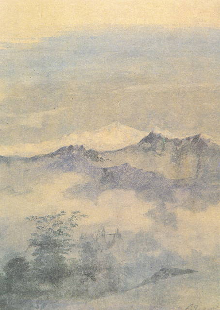
KANGCHENJUNGA PAINTED BY GAGANENDRANATH TAGORE


https://wanderingvertexes.blogspot.com/2021/02/kangchenjunga-painted-by-gaganendranath.html

GAGANENDRANATH  TAGORE  (1867-1938)
Kangchenjunga (8, 538m - 28,169 ft)
India, Népal

In Kangchenjunga, watercolor,  National Gallery of Modern Art, New Delhi


The painter
Gaganendranath Tagore was an Indian painter and cartoonist of the Bengal school. Along with his brother Abanindranath Tagore, he was counted as one of the earliest modern artists in India. Gaganendranath Tagore was born at Jorasanko into a family whose creativity defined Bengal's cultural life. Gaganendranath was the eldest son of Gunendranath Tagore, grandson of Girindranath Tagore and a great-grandson of Prince Dwarkanath Tagore. His brother Abanindranath was a pioneer and leading exponent of the Bengal School of Art. He was a nephew of the poet Rabindranath Tagore and the paternal great-grandfather of actress Sharmila Tagore. Gaganendranath received no formal education but trained under the watercolourist Harinarayan Bandopadhyay. In 1907, along with his brother Abanindranath, he founded the Indian Society of Oriental Art which later published the influential journal Rupam. Between 1906 and 1910, the artist studied and assimilated Japanese brush techniques and the influence of Far Eastern art into his own work, as demonstrated by his illustrations for Rabindranath Tagore's autobiography Jeevansmriti (1912). He went on to develop his own approach in his Chaitanya and Pilgrim series. Gaganendranath eventually abandoned the revivalism of the Bengal School and took up caricature. The Modern Review published many of his cartoons in 1917. From 1917 onwards, his satirical lithographs appeared in a series of books, including Play of Opposites, Realm of the Absurd and Reform Screams.
Between 1920 and 1925, Gaganendranath pioneered experiments in modernist painting.  Partha Mitter describes him as "the only Indian painter before the 1940s who made use of the language and syntax of Cubism in his painting". From 1925 onwards, the artist developed a complex post-cubist style.

The mountain
Kangchenjunga (8,586 m - 28,169 ft) is the third highest mountain in the world. It lies partly in Nepal and partly in Sikkim, India. Kangchenjunga is the second highest mountain of the Himalayas after Mount Everest. Three of the five peaks – Main, Central and South – are on the border between North Sikkim and Nepal. Two peaks are in the Taplejung District, Nepal.
Kangchenjunga Main is the highest mountain in India, and the easternmost of the mountains higher than 8,000 m (26,000 ft).
Until 1852, Kangchenjunga was assumed to be the highest mountain in the world, but calculations based on various readings and measurements made by the Great Trigonometrical Survey of India in 1849 came to the conclusion that Mount Everest., known as Peak XV at the time, was the highest.
It is listed int the Eight Thousanders and as Seven Third Summits
Kangchenjunga is the official spelling adopted by Douglas Freshfield, A. M. Kellas, and the Royal Geographical Society that gives the best indication of the Tibetan pronunciation. Freshfield referred to the spelling used by the Indian Government since the late 19th century. There are a number of alternative spellings including Kangchendzцnga, Khangchendzonga, and Kanchenjunga.
Local Lhopo people believe that the treasures are hidden but reveal to the devout when the world is in peril; the treasures comprise salt, gold, turquoise and precious stones, sacred scriptures, invincible armor or ammunition, grain and medicine. Kangchenjunga's name in the Limbu language is Senjelungma or Seseylungma, and is believed to be an abode of the omnipotent goddess Yuma Sammang.
It rises in a section of the Himalayas called Kangchenjunga Himal that is limited in the west by the Tamur River, in the north by the Lhonak Chu and Jongsang La, and in the east by the Teesta River. It lies about 128 km (80 mi) east of Mount Everest.
Allowing for further verification of all calculations, it was officially announced in 1856 that
Kangchenjunga was first climbed on 25 May 1955 by Joe Brown and George Band, who were part of a British expedition. They stopped short of the summit as per the promise given to the Chogyal that the top of the mountain would remain inviolate. Every climber or climbing group that has reached the summit has followed this tradition...

____________________________

2021 - Wandering Vertexes...
by Francis Rousseau
Sunday, January 10, 2021

MOUNT SNOWDON FROM LLYN Y DDINAS BY SIDNEY RICHARD PERCY


https://wanderingvertexes.blogspot.com/2021/01/mount-snowdon-from-llyn-y-ddinas-by.html

SIDNEY RICHARD PERCY (1821-1886)
Mount Snowdon (1, 085 m -3,560 ft)
United Kingdom (Wales)

In Llyn-y-Ddinas, North Wales, Mount Snowdon in the background (1873), Oil on canvas, 45.5 x 76 cm. Private Collection

 
The mountain
Mount Snowdon (1, 085 m -3,560 ft),Yr Wyddfa in welsh, is the highest mountain in Wales and the highest point in the British Isles south of the Scottish Highlands. A 1682 survey estimated that the summit of Snowdon was at a height of 1,130 m - 3,720 feet ; in 1773, Thomas Pennant quoted a later estimate of 1,088 m- 3,568 ft above sea level at Caernarfon. Recent surveys give the height of the summit as 1,085 m -3,560 ft. The name Snowdon is from the Old English for "snow hill", while the Welsh name – Yr Wyddfa – means "the tumulus" or "the barrow", which may refer to the cairn thrown over the legendary giant Rhitta Gawr after his defeat by King Arthur. As well as other figures from Arthurian legend, the mountain is linked to a legendary Afanc (water monster) and the Tylwyth Teg (fairies). Mount Snowdon is located in Snowdonia National Park (Parc Cenedlaethol Eryri) in Gwynedd. It has been described as "probably the busiest mountain in Britain", with approximately 444,000 people having walked up the mountain in 2016. It is designated as a national nature reserve for its rare flora and fauna. The rocks that form Snowdon were produced by volcanoes in the Ordovician period, and the massif has been extensively sculpted by glaciation, forming the pyramidal peak of Snowdon and the Arêtes of Crib Goch and Y Lliwedd. The cliff faces on Snowdon, including Clogwyn Du'r Arddu, are significant for rock climbing, and the mountain was used by Edmund Hillary in training for the 1953 ascent of Mount Everest.
The summit can be reached by a number of well-known paths, and by the Snowdon Mountain Railway, a rack and pinion railway opened in 1896 which carries passengers the 4.7 miles (7.6 km) from Llanberis to the summit station.

The painter
Sidney Richard Percy had his greatest success painting landscapes of grazing cattle, typically set against backgrounds of distant mountains and cloudy skies. The prevailing hues of his landscapes are earth tones and soft greens, accentuated by a variety of pastel hues. The detail in his work is part of its appeal, and "it was remarked that his rocks and stones were sufficiently accurate to have served as illustrations to the writings of Sir Roderick Murchison, the popular 19th-century geologist." Llyn-y-Ddinas, North Wales, (see above) one of his more popular works on the internet, displays these qualities. He also painted landscapes of farm fields, wheel-rutted country roads, and the occasional boat scene on a lake. Although he generally painted in oils, a number of small watercolors on cardboard exist, typically unsigned, that are his work. The family, and his son the painter Herbert Sidney Percy in particular, referred to these as "potboilers", meaning that they were quickly, and often crudely executed, yet easily and cheaply sold "to put food on the table" when working on larger, more time-consuming oils for exhibition, or commissions. Many of these watercolor "potboilers" were done in the field, and then brought back to the studio to refer to when executing a more formal oil on canvas.
Sidney Richard Percy was extremely popular during the early part of his career, which for a short time brought him a fair amount of income. Among his patrons during this time was Prince Albert the Royal consort who in 1854 gave Percy's landscape of A view of Llyn Dulyn, North Wales, which had just been exhibited at the Royal Academy, as a gift to his wife Queen Victoria. This painting still hangs today in the Royal Collection. Unfortunately Sidney Richard Percy outlived his popularity, and the art world was more excited about impressionism and other styles than landscapes when he died. Today though, his work is much sought after, and his better paintings bring much higher prices in auction than any of those of his brethren in the Williams family.
When the Athenaeum in 1886 (i. 592) ran an obituary for Sidney Richard Percy they called him, "the well-known and popular painter, founder of the so-called School of Barnes . . ." Although depending on the context of what is meant by the so-called Barnes School, this is a bit of an injustice to his father Edward Williams, whom it might be argued is the founder of the Barnes School of painters, but it illustrates the popularity that Sidney Richard Percy held with the art-buying public of his day.

__________________________________________

2021 - Wandering Vertexes / Mountain paintings
By Francis Rousseau

Monday, January 4, 2021

NANGA PARBAT PAINTED BY NICHOLAS ROERICH


https://wanderingvertexes.blogspot.com/2021/01/nanga-parbat-painted-by-nicholas-roerich.html
 
 
NICHOLAS ROERICH (1874-1947),
Nanga Parbat (8,126 m - 26,660 ft)
Pakistan

 In Nanga Parbat, oil on canvas, 1940, Nicolas Roerich  Museum, NYC


The mountain
Nanga Parbat (8,126 metres (26,660 ft) locally known as Diamer, is the ninth highest mountain in the world . Located in the Diamer District of Gilgit-Baltistan region, Pakistan, Nanga Parbat is the western anchor of the Himalayas. ] The name Nanga Parbat is derived from the Sanskrit words nagna and parvata which together mean "Naked Mountain".  The mountain is locally known by its Tibetan name Diamer or Deo Mir, meaning "huge mountain".
Nanga Parbat is one of the 14 eight-thousanders. An immense, dramatic peak rising far above its surrounding terrain, Nanga Parbat is known to be a difficult climb.   Nanga Parbat is one of only two peaks on Earth that rank in the top twenty of both the highest mountains in the world, and the most prominent peaks in the world, ranking ninth and fourteenth respectively. The other is Mount Everest, which is first on both lists.  Nanga Parbat along with Namcha Barwa on the Tibetan Plateau mark the west and east ends of the Himalayas.

The painter
Nicholas Roerich known also as Nikolai Konstantinovich Rerikh (Никола́й Константи́нович Ре́рих) is quite an important figure of mountain paintings in the early 20th century. He was a Russian painter, writer, archaeologist, theosophist, perceived by some in Russia as an enlightener, philosopher, and public figure. In his youth was he was quite influenced by a movement in Russian society around the occult and was interested in hypnosis and other spiritual practices. His paintings are said to have hypnotic expression.
More about the painter =>

__________________________________________

2021 - Wandering Vertexes / Mountain paintings
By F rancis Rousseau

_______________________________

2021 - Wandering Vertexes...
by Francis Rousseau

Wednesday, November 4, 2020

MOUNT ELBRUS/ EASTERN SUMMIT PAINTED BY ILYA NIKOLAEVICH ZANKOVSKY

https://wanderingvertexes.blogspot.com/2020/11/ilya-nikolaevich-zankovsky-1832-1919.html

ILYA NIKOLAEVICH ZANKOVSKY  (1832-1919)
Mount Elbrus / eastern summit (5,621 m-18,442 ft)
Russia

In  Frosty morning in Caucasus, oil on canvas, 1832, Private collection


The mountain 

Mount Elbrus (5,642 m -18,510 ft)should not be confused with the Alborz (also called Elburz) mountains in Iran, which also derive their name from the legendary mountain Harā Bərəzaitī in Persian mythology. A dormant volcano, Elbrus forms part of the Caucasus Mountains in Southern Russia, near the border with Georgia. Elbrus has two summits, both of which are dormant volcanic domes. With its slightly taller west summit, the mountain stands at 5,642 metres ; the east summit (see painting above) is 5,621 metres (18,442 ft). The lower east summit was first ascended on 10 July 1829 by Khillar Khachirov, a Karachayguide for an Imperial Russian army scientific expedition led by General Emmanuel, and the higher in 1874 by an British expedition led by F. Crauford Grove and including Frederick Gardner, Horace Walker, and the Swiss guide Peter Knubel of St. Niklaus in the canton Valais. While there are differing authorities on how the Caucasus are distributed between Europe and Asia, most relevant modern authorities define the continental boundary as the Caucasus watershed, placing Elbrus in Europe due to its position on the north side in Russia. Mount Elbrus was formed more than 2.5 million years ago. The volcano is currently considered inactive. Elbrus was active in the Holocene, and according to the Global Volcanism Program, the last eruption took place about AD 50. Mount Elbrus also called Karachay-Balkar is the highest mountain in Europe, and the seven highest summit in the world. The seven summit (which are obviously 8, with 2 in Europe !) are : Mount Everest (8,848m), Aconcagua (6,961m), Mt Denali or Mc Kinley (6,194m), Kilimandjaro (5,895m), Mt Elbrus (5,642m), Vinson Massif (4,892m), Mt Blanc (4,807m) and Mount Kosciuszko (2,228m) in Australia.

The painter
Ilya Zankovsky was a russian painter and graphic artist who studied as a noncredit student in the Imperial Academy of Arts (IAKh, 1862–1863) and who did not finish the course. Zankovsky lived in Tiflis, served in the Military topographic department of the Caucasus military region. He painted landscapes of the Caucasus (Mount Elbrus (above), Georgian military road, The Darial Gorge, From the main mountain range, Mount Ushba. Hunters halt). He worked a lot in watercolor. His works were shown at the exhibitions of the Caucasian Society for Encouragement of Fine Arts, the Society for mutual aid of Caucasian artists, the Society of Russian Watercolorists, and at the Autumn exhibitions in the halls of the IAKh. Zankovsky taught in the Drawing School under the Caucasian Society for Encouragement of Fine Arts in 1880s–1910s.
In 2009 an exhibition of Zankovsky’s works was held in Moscow. Works by Ilya Zankovsky are in many museum collections, including the State Russian Museum, Odessa Fine Arts Museum, Omsk Regional Museum of Fine Arts named after M. A. Vrubel, and Dagestan Museum of Local History.

_______________________________

2020 - Wandering Vertexes...
by Francis Rousseau


Sunday, August 23, 2020

MOUNT KOSCIUSZKO BY EUGENE VON GUERARD


EUGENE VON GUERARD (1811-1901)
Mount Kosciuszko (2, 228 m - 7,310 ft)
Australia

In North east view from the top of Mt Kosciusko, 1866, colour lithograph, 44.0 × 59.6 cm-
National Gallery of Victoria, Melbourne


The mountain 
On earth, there are two mountains named Mount Kosciuszko. One is located in Antartica continent and the other in Australia (Oceania continent). 
In Australia, Mount Kosciuszko (2,228 m - 7,310 ft) is a mountain located on the Main Range of the Snowy Mountains in Kosciuszko National Park, part of the Australian Alps National Parks and Reserves, in New South Wales  and is located west of Crackenback and close to Jindabyne.
Mount Kosciuszko is the highest mountain in Australia.
Mount Kosciuszko was named by the Polish explorer Paul Edmund Strzelecki in 1840, in honour of the Polish national hero and hero of the American Revolutionary War General Tadeusz Kościuszko, because of its perceived resemblance to the Kościuszko Mound in Kraków. The spelling "Mount Kosciuszko" was officially adopted in 1997 by the Geographical Names Board of New South Wales, Australia. Mount Everest (8,848m), Aconcagua (6,961m), Mt Denali or Mc Kinley (6,194m),  Kilimandjaro (5,895m), Mt Elbrus (5,642m), Mount Vinson (4,892m)  and Mt Blanc (4,808m)

The Painter 
Johann Joseph Eugene von Guerard was an Austrian-born artist, active in Australia from 1852 to 1882. Known for his finely detailed landscapes in the tradition of the Düsseldorf school of painting, he is represented in Australia's major public galleries, and is referred to in the country as Eugene von Guerard.
In 1852 von Guerard arrived in Victoria, Australia, determined to try his luck on the Victorian goldfields. As a gold-digger he was not very successful, but he did produce a large number of intimate studies of goldfields life, quite different from the deliberately awe-inspiring landscapes for which he was later to become famous. Realizing that there were opportunities for an artist in Australia, he abandoned the diggings and was soon undertaking commissions recording the dwellings and properties of wealthy pastoralists.

_______________________________

2020 - Wandering Vertexes...
by Francis Rousseau

Tuesday, June 16, 2020

THE MONT BLANC BY J.M.W. TURNER


J.M.W. TURNER (1775-1851)
Mont Blanc (4,808.13 m - 15,776.7 ft)
  France - Italy  border

 In  Bonneville, Savoy, with Mont Blanc, 1803, Oil on Canvas,  92 x 123.2 cm, 
The Dallas Museum of Art (Gift of Nancy Hamon) 


The mountain 
Mont Blanc (in French) or Monte Bianco (in Italian), both meaning "White Mountain", is the highest mountain in the Alps and the highest in Europe after the Caucasus peaks. It rises 4,808.73 m (15,777 ft) above sea level and is ranked 11th in the world in topographic prominence.  The Mont Blanc is one of the Seven Summit, which includes the highest mountains of each of the seven continents. Summiting all of them is regarded as a mountaineering challenge, first achieved on April 30, 1985 by Richard Bass.  The 7 highest summit, (which are obviously 8 with 2 in Europe !) are :  
Mount Everest (8,848m), Aconcagua (6,961m), Mt Denali or Mc Kinley (6,194m),  Kilimandjaro (5,895m), Mt Elbrus (5,642m), Mount Vinson (4,892m) and Mount Kosciuszko  (2,228m) in Australia.
The mountain lies in a range called the Graian Alps, between the regions of Aosta Valley, Italy, and Savoie and Haute-Savoie, France. The location of the summit is on the watershed line between the valleys of Ferret and Veny in Italy and the valleys of Montjoie, and Arve in France. The Mont Blanc massif is popular for mountaineering, hiking, skiing, and snowboarding.
Moreabout Mont Blanc

The painter 
The english painter Joseph Mallord William Turner was considered a controversial figure in his day, but is now regarded as the artist who elevated landscape painting to an eminence in the history of painting. Although renowned for his oil paintings, Turner is also one of the greatest masters of British watercolour landscape painting. He is commonly known as "the painter of light" and his work is regarded as a Romantic preface to Impressionism.
More about Turner 

___________________________________

2020 - Wandering Vertexes...
by Francis Rousseau

Monday, May 11, 2020

ELBRUS PAINTED BY VASILY VERESHCHAGIN


VASILY VERESHCHAGIN (1842-1904)
Mount Elbrus (5,642 m - 18,510 ft)
Russia

The mountain
Mount Elbrus (Эльбру́с) also called Karachay-Balkar (Минги таy) is the highest mountain in Europe, and the seven highest summit in the world. The seven summit (which are obviously 8, with 2 in Europe !) are : Mount Everest (8,848m), Aconcagua (6,961m), Mt Denali or Mc Kinley (6,194m), Kilimandjaro (5,895m), Mt Elbrus (5,642m), Vinson Massif (4,892m), Mt Blanc (4,807m) and Mount Kosciuszko (2,228m) in Australia.
Mount Elbrus should not be confused with the Alborz (also called Elburz) mountains in Iran, which also derive their name from the legendary mountain Harā Bərəzaitī in Persian mythology.
A dormant volcano, Elbrus forms part of the Caucasus Mountains in Southern Russia, near the border with Georgia. Elbrus has two summits, both of which are dormant volcanic domes. With its slightly taller west summit, the mountain stands at 5,642 metres (18,510 ft); the east summit is 5,621 metres (18,442 ft). The lower east summit was first ascended on 10 July 1829 by Khillar Khachirov, a Karachayguide for an Imperial Russian army scientific expedition led by General Emmanuel, and the higher in 1874 by an British expedition led by F. Crauford Grove and including Frederick Gardner, Horace Walker, and the Swiss guide Peter Knubel of St. Niklaus in the canton Valais.
While there are differing authorities on how the Caucasus are distributed between Europe and Asia, most relevant modern authorities define the continental boundary as the Caucasus watershed, placing Elbrus in Europe due to its position on the north side in Russia.
More about Mount Elbrus

The painter
Vasily Vasilyevich Vereshchagin (Васи́лий Васи́льевич Вереща́гин) transcribed in English as "Basil Verestchagin", was one of the most famous Russian war artists and one of the first Russian artists to be widely recognized abroad. The graphic nature of his realist scenes led many of them to never be printed or exhibited. In 1864 he proceeded to Paris, where he studied under Jean-Léon Gérôme, though he dissented widely from his master's methods. In the Paris Salon of 1866 he exhibited a drawing of Dukhobors chanting their Psalms. In the next year he was invited to accompany General Konstantin Kaufman's expedition to Turkestan. He was an indefatigable traveler, returning to St. Petersburg in late 1868, to Paris in 1869, back to St. Petersburg later in the year, and then back to Turkestan at the end 1869 via Siberia. In 1871, he established an atelier in Munich, and made a solo exhibition of his works at the Crystal Palace in London in 1873.
More about the painter 

____________________________________

Wandering Vertexes 2020
A blog by Francis Rousseau

Sunday, April 12, 2020

CERRO ACONCAGUA BY LEO WEHRLI


LEO WEHRLI (1870–1854)
Cerro Aconcagua (6, 961m - 22,838ft) 
Argentina
In Aconcagua, von der Cumbre de Uspallata, photo1897, hand colorized by Anna Wehrli-Frey 1918,
ETH Library, Zurich 

The mountain
Cerro Aconcagua (6,961 meters -22,838 ft) is the highest mountain outside of Asia and by extension the highest point in both the Western Hemisphere and the Southern Hemisphere.
Aconcagua is not a volcano.
The origin of the name is contested; it is either from the Mapuche "Aconca-Hue", which refers to the Aconcagua River, the Quechua "Ackon Cahuak", meaning "Sentinel of Stone", or Quechua "Anco Cahuac", meaning "White Sentinel" or the Aymara "Janq'u Q'awa" meaning "White Ravine", "White Brook".
Aconcagua is located in the Andes mountain range, in the Mendoza Province, Argentina, and lies 112 kilometers (70 mi) northwest of its capital, the city of Mendoza and 108 km (67 mi) from Santiago de Chile (the capital of Chile). The summit is in fact located about 5 kilometers from San Juan Province and 15 kilometers from the international border with Chile; its nearest higher neighbor is Tirich Mir in the Hindu Kush, 16,520 kilometers (10,270 mi) away.
Aconcagua is one of the Seven Summit, which includes the highest mountains of each of the seven continents. The 7 summits (which are obviously 8 !)... are :  Mt Everest (8,848m),  Mt Denali or Mc Kinley (6,194m), Kilimandjaro (5,895m), Mt Elbrus (5,642m), Vinson Massif (4,892m), Mt Blanc (4,807m) and Mount Kosciuszko (2,228m). Summiting all of them is regarded as a mountaineering challenge, first achieved on April 30, 1985 by Richard Bass.
The mountain and its surroundings are part of the Aconcagua Provincial Park. The mountain has a number of glaciers. The largest glacier is the Ventisquero Horcones Inferior at about 10 km long, which descends from the south face to about 3600 m altitude near the Confluencia camp. Two other large glacier systems are the Ventisquero de las Vacas Sur and Glaciar Este/Ventisquero Relinchos system at about 5 km.

The photographer
Leo Wehrli was a Swiss geologist, professor and explorer. After studying music, botany, chemistry, mineralogy, petrography and geology in Berlin and Zurich, Wehrli became assistant to Albert Heim. Immediately after completing his thesis, he left for Argentina with the famous Carl Emanuel Burckhardt in 1896. Accredited by the La Plata Museum and the government of Argentina, he explored the Andes he crossed at least five times during a stay of two years. His work was more particularly oriented on the delimitation of the border between Argentina and Chile after the agreement signedbetween these two countries in 1881 and on the determination of the property of mountain peaks, ridge lines and basins slopes.
After his return to Switzerland, he worked between 1900 and 1935 as a teacher and then lecturer for the Geol. Centralblatt in Berlin ; between 1901 and 1912, he wrote nearly 500 articles. He made other trips through Europe and North Africa (Egypt) before going back to Argentina again in 1938. He has summarized his research results in numerous articles, notably in the Geographic Lexicon of Switzerland. He participated in the founding of the Zurich Adult Education Center and gave lectures there from 1921 to 1953. From 1931 to 1951 he was a member of the Swiss Alpine Club SAC commission for the Central Library and has was president for 14 years.
Wehrli left a collection of 15,000 slides, some of which were hand-colored by his wife, born Anna Frey. A large part of the works is made available online by the photographic archives of the ETH-Bibliothek in Zurich.

___________________________________________ 


2020 - Wandering Vertexes...
by Francis Rousseau

Friday, March 13, 2020

THE MONT BLANC BY JULES-LOUIS-PHILIPPE COIGNET


JULES-LOUIS-PHILIPPE COIGNET (1798-1860)
 The Mont Blanc  (4,808m -15,777 ft)
 France Italy border

In Vue de Saint-Gervais,1843, Private collection 

The mountain 
Mont Blanc (in French) or Monte Bianco (in Italian), both meaning "White Mountain", is the highest mountain in the Alps and the highest in Europe after the Caucasus peaks. It rises 4,808.73 m (15,777 ft) above sea level and is ranked 11th in the world in topographic prominence.  The Mont Blanc is one of the Seven Summit, which includes the highest mountains of each of the seven continents. Summiting all of them is regarded as a mountaineering challenge, first achieved on April 30, 1985 by Richard Bass.  The 7 highest summit, (which are obviously 8 with 2 in Europe !) are :  
Mount Everest (8,848m), Aconcagua (6,961m), Mt Denali or Mc Kinley (6,194m),  Kilimandjaro (5,895m), Mt Elbrus (5,642m), Mount Vinson (4,892m) and Mount Kosciuszko  (2,228m) in Australia.

The painter  
Jules Louis Philippe Coignet was  was a noted french landscape painter who had studied under Jean-Victor Bertin. He travelled a good deal in his own country as well as elsewhere in Europe and the East, and produced a considerable number of views. A regular exhibitor at the Paris Salon exhibitions, he was awarded a gold medal there in 1824 and was given state recognition by being made a Chevalier of the Legion of Honour in 1836.
As a painter, Coignet holds a middle place between the Idealists and the Realists, and his work is remarkable for the combination of vigour and delicacy in the effects of light and shade, for poetical feeling, for a firm brush, and occasionally for grandeur of conception. This is particularly evident in "The Ruins of the Temple of Paestum", now in Munich's Neue Pinakothek. There are times too when his paintings have an atmospheric, almost Impressionist effect. One example is the coastal sunset in the Louvre;  another is the pastel "Grey weather over the sea" (1848) in the Dijon Fine Arts Museum.
Following the 1824 exhibition in Paris of John Constable's paintings, Coignet began painting outside in the forest of Fontainebleau and encouraged his students to do the same. One of his specialities was painting tree 'portraits', of which there are many examples, both as finished paintings and as sketches in oil paint. Two notable examples are the ancient oak, with a dolmen and meditating monk in the background, in the Quimper museum  and the dramatic "Oak tree and reeds" in the Musée Jean de La Fontaine at Château-Thierry.  As a pioneer of open air painting (la peinture de plein air), Coignet has been counted a member of the Barbizon school, the artists associated with the village of Barbizon, where he had painted long before they settled there. In fact one of the minor members of this school, the genre painter Ferdinand Chaigneau, was a pupil of Coignet's.
In addition to producing many water-colours, pastels and etchings, he wrote a book on landscape painting and published in 1825 a series of sixty Italian views.

______________________________

2020 - Wandering Vertexes...
by Francis Rousseau


Tuesday, March 10, 2020

KANGCHENJUNGA (3) PAINTED BY NICHOLAS ROERICH


NICHOLAS ROERICH (1874-1947),
Kangchenjunga (8, 538m - 28,169 ft)
India, Népal

In Kangchenjunga mountains lakes 1931, tempera on canvas, Private collection

The mountain
Kangchenjunga (8,586 m - 28,169 ft) is the third highest mountain in the world. It lies partly in Nepal and partly in Sikkim, India. Kangchenjunga is the second highest mountain of the Himalayas after Mount Everest. Three of the five peaks – Main, Central and South – are on the border between North Sikkim and Nepal. Two peaks are in the Taplejung District, Nepal.
Kangchenjunga Main is the highest mountain in India, and the easternmost of the mountains higher than 8,000 m (26,000 ft).
Until 1852, Kangchenjunga was assumed to be the highest mountain in the world, but calculations based on various readings and measurements made by the Great Trigonometrical Survey of India in 1849 came to the conclusion that Mount Everest., known as Peak XV at the time, was the highest.
It is listed int the Eight Thousanders and as Seven Third Summits
Kangchenjunga is the official spelling adopted by Douglas Freshfield, A. M. Kellas, and the Royal Geographical Society that gives the best indication of the Tibetan pronunciation. Freshfield referred to the spelling used by the Indian Government since the late 19th century. There are a number of alternative spellings including Kangchendzцnga, Khangchendzonga, and Kanchenjunga.
Local Lhopo people believe that the treasures are hidden but reveal to the devout when the world is in peril; the treasures comprise salt, gold, turquoise and precious stones, sacred scriptures, invincible armor or ammunition, grain and medicine. Kangchenjunga's name in the Limbu language is Senjelungma or Seseylungma, and is believed to be an abode of the omnipotent goddess Yuma Sammang.
It rises in a section of the Himalayas called Kangchenjunga Himal that is limited in the west by the Tamur River, in the north by the Lhonak Chu and Jongsang La, and in the east by the Teesta River. It lies about 128 km (80 mi) east of Mount Everest.
Allowing for further verification of all calculations, it was officially announced in 1856 that
Kangchenjunga was first climbed on 25 May 1955 by Joe Brown and George Band, who were part of a British expedition. They stopped short of the summit as per the promise given to the Chogyal that the top of the mountain would remain inviolate. Every climber or climbing group that has reached the summit has followed this tradition...

The painter
Nicholas Roerich known also as Nikolai Konstantinovich Rerikh (Никола́й Константи́нович Ре́рих) is quite an important figure of mountain paintings in the early 20th century. He was a Russian painter, writer, archaeologist, theosophist, perceived by some in Russia as an enlightener, philosopher, and public figure. In his youth was he was quite influenced by a movement in Russian society around the occult and was interested in hypnosis and other spiritual practices. His paintings are said to have hypnotic expression.
More about the painter = >

_______________________________ 

2020 - Wandering Vertexes...
by Francis Rousseau

Wednesday, January 29, 2020

THE MONT BLANC (2) BY GABRIEL LOPPÉ


GABRIEL LOPPÉ (1825-1913)
The Mont Blanc (4,808.13 m - 15,776.7 ft)
 France, Italy border

In Sur le col du Géant – Soleil levant sur le Mont Blanc,  oil on canvas, 51 x 35.5cm,   1890,   Courtesy William Mitchell Gallery, London

The painter 
Toussaint Gabriel Loppé was a French painter, photographer and mountaineer. He became the first foreigner to be made a member of the Alpine Club in London. His father was a captain in the French Engineers and Loppé's childhood was spent in many different towns in south-eastern France. Aged twenty-one Loppé climbed a small mountain in the Languedoc and found a group of painters sketching on the summit. He had found his calling and subsequently went off to Geneva where he met the reputed leading Swiss landscapist, Alexandre Calame (1810 -1864). Loppé took up mountaineering in Grindelwald in the 1850s and made friends easily with the many English climbers in France and Switzerland. Although he was frequently labelled as a pupil of Calame and his rival François Diday, Loppé was almost an entirely self-taught artist. He became the first painter to work at higher altitudes during climbing expeditions earning the right to be considered the founder of the peintres-alpinistes school, which became established in the Savoie at the turn of the nineteenth century.
Notable followers of Loppé include, Charles Henri Contencin (1875-1955) and Jacques Fourcy (1906-1990). Together with the first ascent of Mt Mallet in Chamonix’s Grandes Jorasses range, Loppé made over 40 ascents of Mont Blanc during his climbing career, which lasted until the late 1890s.  He frequently made oil sketches from alpine summits, including a panorama of the view from the summit of Mont Blanc.
His paintings became celebrated for their atmosphere and spontaneity and he soon found himself taking part in many exhibitions in London and in Paris.
By 1896 Loppé had spent over fifty seasons climbing and painting in Chamonix. As the valley’s unrivalled ‘Court painter’ his work was in constant demand with the majority of his pictures going to English climbers and summer tourists.
In his later years, Loppé became fascinated with photography and was quite an innovator in this field too. His long exposure photograph of the Eiffel Tower struck by lightning, now in the Musée d'Orsay in Paris remains one of his iconic images. 
The mountain 
Mont Blanc (in French) or Monte Bianco (in Italian), both meaning "White Mountain", is the highest mountain in the Alps and the highest in Europe after the Caucasus peaks. It rises 4,808.73 m (15,777 ft) above sea level and is ranked 11th in the world in topographic prominence.  The Mont Blanc is one of the Seven Summit, which includes the highest mountains of each of the seven continents. Summiting all of them is regarded as a mountaineering challenge, first achieved on April 30, 1985 by Richard Bass.  The 7 highest summit, (which are obviously 8 with 2 in Europe !) are :  
Mount Everest (8,848m), Aconcagua (6,961m), Mt Denali or Mc Kinley (6,194m),  Kilimandjaro (5,895m), Mt Elbrus (5,642m), Mount Vinson (4,892m) and Mount Kosciuszko  (2,228m) in Australia.
The mountain lies in a range called the Graian Alps, between the regions of Aosta Valley, Italy, and Savoie and Haute-Savoie, France. The location of the summit is on the watershed line between the valleys of Ferret and Veny in Italy and the valleys of Montjoie, and Arve in France. The Mont Blanc massif is popular for mountaineering, hiking, skiing, and snowboarding.
The three towns and their communes which surround Mont Blanc are Courmayeur in Aosta Valley, Italy, and Saint-Gervais-les-Bains and Chamonix in Haute-Savoie, France.  A cable car ascends and crosses the mountain range from Courmayeur to Chamonix, through the Col du Géant. Constructed beginning in 1957 and completed in 1965, the 11.6 km (7¼ mi) Mont Blanc Tunnel runs beneath the mountain between these two countries and is one of the major trans-Alpine transport routes.
Since the French Revolution, the issue of the ownership of the summit has been debated.


_____________________________

2020 - Wandering Vertexes...
by Francis Rousseau


Saturday, January 25, 2020

KANGCHENJUNGA (2) PAINTED BY NICHOLAS ROERICH


NICHOLAS ROERICH (1874-1947),
Kangchenjunga (8, 538m - 28,169 ft)
India, Népal

In Kangchenjunga at sunset  1944, tempera on canvas, Private collection

The mountain
Kangchenjunga (8,586 m - 28,169 ft) is the third highest mountain in the world. It lies partly in Nepal and partly in Sikkim, India. Kangchenjunga is the second highest mountain of the Himalayas after Mount Everest. Three of the five peaks – Main, Central and South – are on the border between North Sikkim and Nepal. Two peaks are in the Taplejung District, Nepal.
Kangchenjunga Main is the highest mountain in India, and the easternmost of the mountains higher than 8,000 m (26,000 ft).
Until 1852, Kangchenjunga was assumed to be the highest mountain in the world, but calculations based on various readings and measurements made by the Great Trigonometrical Survey of India in 1849 came to the conclusion that Mount Everest., known as Peak XV at the time, was the highest.
It is listed int the Eight Thousanders and as Seven Third Summits
Kangchenjunga is the official spelling adopted by Douglas Freshfield, A. M. Kellas, and the Royal Geographical Society that gives the best indication of the Tibetan pronunciation. Freshfield referred to the spelling used by the Indian Government since the late 19th century. There are a number of alternative spellings including Kangchendzцnga, Khangchendzonga, and Kanchenjunga.
Local Lhopo people believe that the treasures are hidden but reveal to the devout when the world is in peril; the treasures comprise salt, gold, turquoise and precious stones, sacred scriptures, invincible armor or ammunition, grain and medicine. Kangchenjunga's name in the Limbu language is Senjelungma or Seseylungma, and is believed to be an abode of the omnipotent goddess Yuma Sammang.
It rises in a section of the Himalayas called Kangchenjunga Himal that is limited in the west by the Tamur River, in the north by the Lhonak Chu and Jongsang La, and in the east by the Teesta River. It lies about 128 km (80 mi) east of Mount Everest.
Allowing for further verification of all calculations, it was officially announced in 1856 that
Kangchenjunga was first climbed on 25 May 1955 by Joe Brown and George Band, who were part of a British expedition. They stopped short of the summit as per the promise given to the Chogyal that the top of the mountain would remain inviolate. Every climber or climbing group that has reached the summit has followed this tradition...

The painter
Nicholas Roerich known also as Nikolai Konstantinovich Rerikh (Никола́й Константи́нович Ре́рих) is quite an important figure of mountain paintings in the early 20th century. He was a Russian painter, writer, archaeologist, theosophist, perceived by some in Russia as an enlightener, philosopher, and public figure. In his youth was he was quite influenced by a movement in Russian society around the occult and was interested in hypnosis and other spiritual practices. His paintings are said to have hypnotic expression.
More about the painter = >

_______________________________ 

2020 - Wandering Vertexes...
by Francis Rousseau