google.com, pub-0288379932320714, DIRECT, f08c47fec0942fa0 GRAVIR LES MONTAGNES... EN PEINTURE

Wednesday, November 20, 2019

THE MONTAGNE SAINTE VICTOIRE PAINTED BY PAUL CEZANNE


PAUL CÉZANNE (1839-1906) 
Montagne Sainte-Victoire (1, 011m - 2, 216 ft)
France (Provences-Alpes-Côte d'Azur)

In  Sainte-Victoire vue à travers l’allée des marronniers du Jas de Bouffan,  oil on canvas, 1885
 Minneapolis Museum of Fine Arts 

The mountain
Mont Sainte-Victoire (1,011 m-3,316ft) also called Mont Venturi is a limestone massif in the South of France, in the region Provence-Alpes-Côte d'Azur. Located east of Aix-en-Provence, it has experienced international fame, due to the more than 80 works Paul Cézanne did on it. It hosts many hikers, climbers and nature lovers, and is a major element of Aix landscape.
The range of the Sainte-Victoire is located on the Bouches-du-Rhône and Var, and in the towns of Puyloubier, Saint-Antonin-sur-Bayon, Rousset, Châteauneuf-le-Rouge, Beaurecueil, Le Tholonet Vauvenargues, Saint-Marc-Jaumegarde, Pourrières, Artigues and Rians. On the northern side, the D10 crosses the Col de Claps (530 m) and the Col des Portes (631 m). On the southern side, the D 17 walks on the Plateau de Cengle and crossed the Collet blanc de Subéroque (505 m).
The massif rises to the Pic des Mouches (Peak of the Flies) (1,011 m) near the eastern end of the chain, and not at the Croix de Provence (946 m) near the west end and visible from Aix. The Pic des Mouches is one of the highest peaks of the department of Bouches-du-Rhône, behind the peak Bertagne which reached an altitude of 1,042 mètres and which is located on the massif of Sainte-Baume.
Sainte-Victoire, as the range of the Sainte Baume, can be considered a special case among the Alpine ranges for the various stages of the formation of its relief associated geological history as well as that of the old Pyrenean-Provençal chain than that of the Western Alps (which have succeeded it).
Indeed, from the former Sainte-Victoire mountain, contemporary of the dinosaurs of the Cretaceous, appeared 15 million years BCE.
Sainte-Victoire, whose calcareous sediments date back to the Jurassic, thus consists of both a Pyrenean-Provencal vestige and of an alpine geology.
The massif is a ensemble of 6525 ha classified since 1983.
The massive hosts several world-famous dinosaur eggs deposits including the Roques-Hautes / Les Grands-Creux on the town Beaurecueil.

The painter
The mount Sainte-Victoire appears to have been the subject of a true love story with the painter (Paul Cézanne). He painted this subject more than 80 times, in oil paintings, watercolors and drawings !
Aix-en Provence (France) painter Paul Cezanne still remains closely linked to his hometown. His studio in Les Lauves remains a place to visit, as if the painter was coming back from one second to the other. But the eternal bond is undoubtedly the series of paintings he did of the Montagne Sainte-Victoire. A hobby, a passion, a thread in the painter's work that took place in the latter part of his life, between 1882 and 1906 when he died in Aix. History says that the painter had contracted a nasty pneumonia during a working session on the mountain. This is what can be called 'die on stage'.
Cézanne had a considerable influence on the art of the late nineteenth and the early twentieth century. Acknowledged master of his time, he attended during stays in Paris between 1862 and 1882, the Impressionist band: Camille Pissarro, Auguste Renoir (who also ended his life in the Provencal brightness), Claude Monet, Alfred Sisley and others. He participated in the Impressionist adventure while keeping his personality: it is the time of the shock of the en plein air, easels in the grass, looking for natural light and emotion.
The influence of the Aix painter is recognized in the history of art since it would be the cause of the Cubist movement embodied in 1906 by Pablo Picasso and Georges Braque. The first historically so called Cubist painting ' Les Demoiselles d'Avignon' would, a true artistic shock shown by Picasso in 1907 (one year after the death of Cézanne) is today one of the masterpieces of the MoMA in New York.
It is the search of volumes around which leads to the appearance of geometry in landscapes or still lifes of Cézanne.In 20 years, Cézanne pushes his style to express the emotion of the landscape, suggesting the wind, involving movement just like if we can breathe the air of the scene. In his first paintings pf the Sainte Victoire,(in the 1880’s) he expresses the giant aspect of the mountain that dominates the area with his characteristic e way of painting at the time, with a juxtaposition of linear brushstrokes and a range of soft, natural colors. IN the last paintings of the Sainte Victoire, view from Les Lauves, between 1904 and 1906, he shows shots less accurate brushes allowing the shape of the mountain emerge from the canvas like an apparition. That is the whole intention of the artist, show nature as it is without fail to convey emotion.
A true love story…

_____________________________________________
2019- Wandering Vertexes...
by Francis Rousseau


Tuesday, November 19, 2019

BAGUIO & TUBA MOUNTAINS PAINTED BY FERNANDO AMORSOLO


 FERNANDO AMORSOLO (1882-1972) 
Baguio and Tuba mountains (1, 540m- 5,050 ft)
 Philippines (Luzon) 

In Baguio and Mountains of Tuba  oil on canvas 

The mountains 
Baguio  mountains (1,540m- 5,050 ft) are located in the Cordillera Central mountain range in northern Luzon.  Baguio is also a city, officially is known as the Summer Capital of the Philippines, owing to its cool climate. Baguio was established as a hill station by the United States in 1900 at the site of an Ibaloi village known as Kafagway. It was the United States' only hill station in Asia.
Nowadays, Baguio is classified as a Highly Urbanized City (HUC). It is geographically located within Benguet, serving as the provincial capital from 1901 to 1916, but has since been administered independently from the province following its conversion into a chartered city.

The painter
Fernando Cueto Amorsolo was one of the most important artists in the history of painting in the Philippines.Amorsolo was a portraitist and painter of rural Philippine landscapes. He is popularly known for his craftsmanship and mastery in the use of light. After graduating from the Univeajor influences on his work. Amorsolo set up his own studio upon his return to Manila and painted prodigiously during the 1920s and the 1930s. His Rice Planting (1922), which appeared on posters and tourist brochures, became one of the most popular images of the Commonwealth of the Philippines. Beginning in the 1930s, Amorsolo's work was exhibited widely both in the Philippines and abroad. His bright,optimistic, pastoral images set the tone for Philippine painting before World War II . Except for his darker World War II-era paintings, Amorsolo painted quiet and peaceful scenes throughout his career.
Amorsolo was sought after by influential Filipinos including Luis Araneta, Antonio Araneta and Jorge B. Vargas. Amorsolo also became the favourite Philippine artist of United States officials and visitors to the country. Due to his popularity, Amorsolo had to resort to photographing his works and pasted and mounted them in an album. Prospective patrons could then choose from this catalog of his works. Amorsolo did not create exact replicas of his trademark themes; he recreated the paintings by varying some elements.
His works later appeared on the cover and pages of children textbooks, in novels, in commercial designs, in cartoons and illustrations for the Philippine publications such The Independent, Philippine Magazine, Telembang, El Renacimiento Filipino, and Excelsior. He was the director of the University of the Philippine's College of Fine Arts from 1938 to 1952.
During the 1950s until his death in 1972, Amorsolo averaged to finishing 10 paintings a month. However, during his later years, diabetes, cataracts, arthritis, headaches, dizziness and the death of two sons affected the execution of his works. Amorsolo underwent a cataract operation when he was 70 years old, a surgery that did not impede him from drawing and painting.
After being confined at the St. Luke's Hospital in Quezon City for two months, Amorsolo died at the age of 79 on April 24, 1972. The volume of paintings, sketches and studies of Amorsolo is believed to have reached more than 10,000 pieces. Amorsolo was an important influence on contemporary Filipino art and artists, even beyond the so-called "Amorsolo school." Amorsolo's influence can be seen in many landscape paintings by Filipino artists, including early landscape paintings by abstract painter Federico Aguilar Alcuaz.
In 2003, Amorsolo's children founded the Fernando C. Amorsolo Art Foundation, which is dedicated to preserving Fernando Amorsolo's legacy, promoting his style and vision, and preserving a national heritage through the conservation and promotion of his works.
_________________________________________-
2019 - Wandering Vertexes...
by Francis Rousseau

Monday, November 18, 2019

BLUE MOUNTAINS BY EUGENE VON GUERARD


EUGENE VON GUERARD  (1811-1901)
Blue Mountains  (1,189 m -3,901 ft) 
Australia  (New South Wales)

In Govett's Leap and Grose River Valley, Blue Mountains, New South Wales, oil on canvas, 1873

The mountains
The Blue Mountains  (1,189 m (3,901 ft) - not to be confused with Greater Blue Mountains Area, Blue Mountains National Park, City of Blue Mountains, Electoral district of Blue Mountains - are a mountainous region and a mountain range located in New South Wales, Australia. 
The region borders on Sydney's metropolitan area, its foothills starting about 50 kilometres (31 mi) west of centre of the state capital, close to the major suburb of Penrith. The public's understanding of the extent of the Blue Mountains is varied, as it forms only part of an extensive mountainous area associated with the Great Dividing Range. Officially the Blue Mountains region is bounded by the Nepean and Hawkesbury rivers in the east, the Coxs River and Lake Burragorang to the west and south, and the Wolgan and Colo rivers to the north.
Geologically, it is situated in the central parts of the Sydney Basin.
The Blue Mountains Range comprises a range of mountains, plateau escarpments extending off the Great Dividing Range about 4.8 kilometres (3.0 mi) northwest of Wolgan Gap in a generally southeasterly direction for about 96 kilometres (60 mi), terminating at Emu Plains. 
The Capertee Valley is a 2nd largest canyon (by width) in the world and largest valley in New South Wales, Australia, 135 km (84 mi) north-west of Sydney. The valley follows the Capertee River as it cuts through the Sydney Basin, a sedimentary basin consisting of Permian and Triassic sedimentary rock west of the Blue Mountains.

The painter
Johann Joseph Eugene von Guerard was an Austrian-born artist, active in Australia from 1852 to 1882. Known for his finely detailed landscapes in the tradition of the Düsseldorf school of painting, he is represented in Australia's major public galleries, and is referred to in the country as Eugene von Guerard. In 1852 von Guerard arrived in Victoria, Australia, determined to try his luck on the Victorian goldfields. As a gold-digger he was not very successful, but he did produce a large number of intimate studies of goldfields life, quite different from the deliberately awe-inspiring landscapes for which he was later to become famous. Realizing that there were opportunities for an artist in Australia, he abandoned the diggings and was soon undertaking commissions recording the dwellings and properties of wealthy pastoralists.
By the early 1860s, von Guerard was recognized as the foremost landscape artist in the colonies, touring Southeast Australia and New Zealand in pursuit of the sublime and the picturesque. He is most known for the wilderness paintings produced during this time, which are remarkable for their shadowy lighting and fastidious detail. Indeed, his View of Tower Hill in south-western Victoria was used as a botanical template over a century later when the land, which had been laid waste and polluted by agriculture, was systematically reclaimed, forested with native flora and made a state park. The scientific accuracy of such work has led to a reassessment of von Guerard's approach to wilderness painting, and some historians believe it likely that the landscapist was strongly influenced by the environmental theories of the leading scientist Alexander von Humboldt. Others attribute his 'truthful representation' of nature to the criterion for figure and landscape painting set by the Düsseldorf Academy.

_______________________________
2019 - Wandering Vertexes...
by Francis Rousseau

Sunday, November 17, 2019

BLUE MOUNTAINS BY JAMES A.C. WILLIS


JAMES A.C. WILLIS (1845- 1915?)
Blue Mountains  (1,189 m -3,901 ft) 
Australia  (New South Wales)

In Capertee Valley, New South Wales, 1892, watercolour, Art Gallery of New South Wales

The mountains
The Blue Mountains  (1,189 m (3,901 ft) - not to be confused with Greater Blue Mountains Area, Blue Mountains National Park, City of Blue Mountains, Electoral district of Blue Mountains - are a mountainous region and a mountain range located in New South Wales, Australia. 
The region borders on Sydney's metropolitan area, its foothills starting about 50 kilometres (31 mi) west of centre of the state capital, close to the major suburb of Penrith. The public's understanding of the extent of the Blue Mountains is varied, as it forms only part of an extensive mountainous area associated with the Great Dividing Range. Officially the Blue Mountains region is bounded by the Nepean and Hawkesbury rivers in the east, the Coxs River and Lake Burragorang to the west and south, and the Wolgan and Colo rivers to the north.
Geologically, it is situated in the central parts of the Sydney Basin.
The Blue Mountains Range comprises a range of mountains, plateau escarpments extending off the Great Dividing Range about 4.8 kilometres (3.0 mi) northwest of Wolgan Gap in a generally southeasterly direction for about 96 kilometres (60 mi), terminating at Emu Plains. 
The Capertee Valley is a 2nd largest canyon (by width) in the world and largest valley in New South Wales, Australia, 135 km (84 mi) north-west of Sydney. The valley follows the Capertee River as it cuts through the Sydney Basin, a sedimentary basin consisting of Permian and Triassic sedimentary rock west of the Blue Mountains.

The Painter 
Willis was born in Devon, England and arrived in Sydney in c.1845. His principal occupation was surveying and during his career he produced many maps for the NSW Government. In c.1848 he took art lessons with Conrad Martens (1801-1878), then the most talented artist active in the colony. Over the following years he painted many landscapes, often of remote areas of the State as in this Capertee painting. As well as his surveying duties, Willis was involved in the establishment of the Art Gallery of NSW in the 1870s. In 1892 he donated this work to the galleries permanent collection. Although rarely on show, this work can be privately viewed with a prearranged appointment with gallery staff.

_______________________________
2019 - Wandering Vertexes..
by Francis Rousseau

Saturday, November 16, 2019

MOUNT LANGI GHIRAN BY EUGENE VON GUERARD


EUGENE VON GUERARD (1811-1901) 
Mount Langi Ghiran (924m - 3,031ft) 
Australia (Victoria) 

In Mount Langi Ghiran, oil on canvas, 1890

The mountain 
Mount Langi Ghiran (924m - 3,031ft) is located in the west of Victoria  southeast of Australia. The nearest town to Mount Langi Ghiran is Ararat about 16.3 km away. 
The first European to climb Mount Langi Ghiran was Major Thomas Mitchell, on his 1836 'Australia Felix' expedition.  He first named it Mount Mistake ! 
There are two reservoirs in the park which were built from local granite blocks in the 1880s. The main reservoir forms part of Ararat's water supply and is worth a visit.
A "spot mill" for extracting timber was built on the northern slopes in 1940 but was short lived. Today little evidence remains to remind us of the mill's past operation.
Since 1970,  famous vineyards are situated in the valley of Mount Langi Ghiran.

The painter
Johann Joseph Eugene von Guerard was an Austrian-born artist, active in Australia from 1852 to 1882. Known for his finely detailed landscapes in the tradition of the Düsseldorf school of painting, he is represented in Australia's major public galleries, and is referred to in the country as Eugene von Guerard. In 1852 von Guerard arrived in Victoria, Australia, determined to try his luck on the Victorian goldfields. As a gold-digger he was not very successful, but he did produce a large number of intimate studies of goldfields life, quite different from the deliberately awe-inspiring landscapes for which he was later to become famous. Realizing that there were opportunities for an artist in Australia, he abandoned the diggings and was soon undertaking commissions recording the dwellings and properties of wealthy pastoralists.
By the early 1860s, von Guerard was recognized as the foremost landscape artist in the colonies, touring Southeast Australia and New Zealand in pursuit of the sublime and the picturesque. He is most known for the wilderness paintings produced during this time, which are remarkable for their shadowy lighting and fastidious detail. Indeed, his View of Tower Hill in south-western Victoria was used as a botanical template over a century later when the land, which had been laid waste and polluted by agriculture, was systematically reclaimed, forested with native flora and made a state park. The scientific accuracy of such work has led to a reassessment of von Guerard's approach to wilderness painting, and some historians believe it likely that the landscapist was strongly influenced by the environmental theories of the leading scientist Alexander von Humboldt. Others attribute his 'truthful representation' of nature to the criterion for figure and landscape painting set by the Düsseldorf Academy.

_______________________________
2019 - Wandering Vertexes...
by Francis Rousseau

Friday, November 15, 2019

THE HA LONG BAY BY JOSEPH INGIMBERTY


JOSEPH INGIMBERTY (1896-1971)  
The Ha long Bay (200 m - 656 ft)
Vietnam 

The Sste Hạ Long Bay is a UNESCO World Heritage Site and popular travel destination in Quảng Ninh Province, Vietnam. The name Hạ Long means "descending dragon". Administratively, the bay is a part of Vân Đồn District. The bay features thousands of limestone karsts and isles in various shapes and sizes. Ha Long Bay is a center of a larger zone which includes Bai Tu Long Bay to the northeast, and Cát Bà Island to the southwest. These larger zones share a similar geological, geographical, geomorphological, climate, and cultural characters.
Hạ Long Bay has an area of around 1,553 km2 (600 sq mi), including 1,960–2,000 islets, most of which are limestone. The core of the bay has an area of 334 km2 (129 sq mi) with a high density of 775 islets. The limestone in this bay has gone through 500 million years of formation in different conditions and environments. The evolution of the karst in this bay has taken 20 million years under the impact of the tropical wet climate. The geo-diversity of the environment in the area has created biodiversity, including a tropical evergreen biosystem, oceanic and sea shore biosystem.
 Hạ Long Bay is home to 14 endemic floral species and 60 endemic faunal species.
Historical research surveys have shown the presence of prehistoric human beings in this area tens of thousands years ago. The successive ancient cultures are the Soi Nhu culture around 18,000–7000 BC, the Cai Beo culture 7000–5000 BC and the Hạ Long culture 5,000–3,500 years ago.
Hạ Long Bay also marked important events in the history of Vietnam with many artifacts found in Bai Tho Mountain, Dau Go Cave, Bai Chay.
500 years ago, Nguyễn Trãi praised the beauty of Ha Long Bay in his verse Lộ nhập Vân Đồn, in which he called it "rock wonder in the sky". 
In 1962, the Ministry of Culture, Sports and Tourism of North Vietnam listed Ha Long Bay in the National Relics and Landscapes publication.
 In 1994, the core zone of Ha Long Bay was listed as a World Heritage Site according to Criterion VII, and listed for a second time according to Criterion VIII.

The  painter 
Joseph Inguimberty  is a french artist from Provence. He entered the Ecole des beaux-arts in Marseille in 1910 under the direction of the painter Alphonse Moutte. In 1913, he was admitted to the National School of Decorative Arts of Paris. The First World war interrupts his studies. Mobilized in the infantry, he was wounded in 1917 in Reims. After the Armistice he returned to the National School of Decorative Arts in the studio of Eugène Édouard Morand, father of the writer Paul Morand.  Then, he travels to Europe and especially Belgium, where he paints scenes related to the world of work. Between 1922, the date of his return to Marseille, and 1924, he painted three large paintings composing a triptych of the world of work at the port of Marseille.
In 1925, Joseph Inguimberty became director of the painting department of the School of Fine Arts of Vietnam in Hanoi, just founded by Victor Tardieu. He paints work in the rice fields and Indochinese women. Impressed by the decoration of the temples, he specializes in the study and teaching of lacquer. In 1929, the exhibition "Landscapes and Figures of the Tonkin Delta" made in Hanoi  presented  30 of his paintings. In 193, he participated in the Colonial Exhibition of Vincennes with three large paintings representing scenes of life in Tonkin. Seconded by Alix Aymé, he created in 1934 a lacquer workshop.
Joseph Inguimberty did not return to France until after the Second World war, in 1946. The Japanese asked him to teach lacquer, but he refused. He moved to Menton and painted Provençal landscapes: the creeks, Marseille, the Alpilles and the Menton hinterland.

_______________________________
2019 - Wandering Vertexes...
by Francis Rousseau 

Thursday, November 14, 2019

MOUNT ARAGATS PAINTED BY YEGHISHE TADEVOSYAN


YEGHISHE TADEVOSYAN (1870-1936)
Mount Aragats (4,090 m -13,420 ft)
Armenia

In Mount Aragats, 1917, Fabric, oil paint, 54 x 76cm, National Gallery of Armenia 


The mountain
Mount Aragats (4,090 m -13,420 ft) in Armenian: Արագած, is an isolated four-peaked volcano massif in Armenia. Its northern summit, above sea level, is the highest point of the Lesser Caucasus and Armenia. It is also one of the highest points in the Armenian Highlands. Situated 40 kilometers (25 mi) northwest of Armenian capital Yerevan, Aragats is a large volcano with numerous fissure vents and adventive cones. Numerous large lava flows descend from the volcano and are constrained in age between middle Pleistocene and 3,000 BCE. The summit crater is cut by a 13 kilometres (8.1 mi) long line of cones which generated possibly Holocene-age lahars and lava flows. The volcanic system covers an area of 5,000 km2 and is one of the largest in the region. The magmas feeding Aragats are unusually hot for arc-derived magmas, resulting in long and voluminous lava flows.
The Aragats massif is surrounded by Kasagh River on the east, Akhurian River on the west, Ararat plain on the south and Shirak plain on the north.
According to an ancient Armenian legend, Aragats and Mount Ararat were loving sisters who parted after a quarrel and separated permanently. Currently, the mountains are further separated politically, with Mount Ararat being located in Turkey.
Another legend tells that Gregory the Illuminator, who converted Armenia into Christianity in the early 4th century, "used to pray on the peak of the mountain. At nighttime an icon-lamp shone to give light for him, the lamp hanging from heaven using no rope. Some say that the icon-lamp is still there, but only the worthy ones can see it."
Mt. Aragats plays a special role in Armenian history and culture. Along with Ararat, it is considered a sacred mountain for the Armenians.
Aragats is a male first name in Armenia, used especially in areas surrounding the mountain.
Mt. Aragats is often associated with Gyumri, Armenia's second largest city. The mountain is depicted on the coat of arms of Gyumri. It is also depicted on the obverse side of the 10,000 Armenian dram banknote (in use since 2003) in the background of Avetik Isahakyan, a poet born in Gyumri.

The painter 
Yeghishe Martirosi Tadevosyan ( Եղիշե Թադևոսյան) was an Armenian painter associated with the Peredvizhniki and Mir Iskusstva movements. He was awarded the title of "Honored Artist" by the Armenian SSR in 1935. He studied at the Lazarian School, then entered the Moscow School of Painting, Sculpture and Architecture. Vasily Polenov was his teacher and friend. He graduated in 1894 and began participating in exhibitions by the Peredvizhniki shortly after.
In 1898, he travelled to Palestine with Polenov and would revisit the Middle East several times. In 1901, he moved from Moscow to Tbilisi and became an art teacher.
His early work had been influenced by Vardges Sureniants but, after this time, he began to employ impressionistic and pointillistic techniques. In 1916, he became the founder and head of the Union of Armenian Artists. Yeghishe Tadevosyan is buried at Komitas Pantheon which is located in the city center of Yerevan. A street in Yerevan and an Art school in Etchmiadzin are named after him.

_______________________________
2019 - Wandering Vertexes...
by Francis Rousseau 

Wednesday, November 13, 2019

MOUNT INDRASAN BY NICHOLAS ROERICH


NICHOLAS ROERICH (1874-1947)
Mount Indrasan  (6,221m - 20,410 ft)
India - Pakistan border 

In Ladakh,  oil on canvas, 1929

The mountain
Mount Indrasan  (6221m - 20,410 ft) is located  in Kullu district, Himachal Pradesh.  Mt. Indrasan is one of the difficult peaks in the Himalayas because of the challenges involved in scaling it. It is also believed that whenever Lord Indra arrives on earth he resides here. Indrasan (composed of two words: Indra and Aasana) i.e. the royal seat of the Lord Indra.  With Deo Tibba (6,001 m- 19,688 ft))  Indrasan is one of the  two important peaks at the eastern end of the Pir Panjal Range. They can be approached from both the Parvati-Beas Valley (Kulu District), Upper Belt of Chamba Himachal Pradesh and the Chandra (Upper Chenab) Valley (Lahaul and Spiti District) in Himachal Pradesh. The hill station of Gulmarg in Kashmir lies in this range.

The painter
Nicholas Roerich known also as Nikolai Konstantinovich Rerikh (Никола́й Константи́нович Ре́рих) is quite an important figure of mountain paintings in the early 20th century. He was a Russian painter, writer, archaeologist, theosophist, perceived by some in Russia as an enlightener, philosopher, and public figure. In his youth was he was quite influenced by a movement in Russian society around the occult and was interested in hypnosis and other spiritual practices. His paintings are said to have hypnotic expression.
More about the painter = >

___________________________

2019 - Wandering Vertexes...
by Francis Rousseau

Tuesday, November 12, 2019

EVEREST & LHOTSE BY ISABELLE SCHEIBLI


ISABELLE SCHEIBLI (bn.1949),
Mount Everest / Sagarmatha / Chomolunga (8,848 m - 29,029ft) 
Lhotse (8, 516m - 27, 940ft) 
China (Tibet) / Nepal

In Everest, and Lhotse, watercolor

The mountains 
Mount Everest (8,848 m - 29,029ft), also known in Nepal as Sagarmāthā and in Tibet as Chomolungma, is Earth's highest mountain. It is located in the Mahalangur mountain range in Nepal and Tibet. The international border between China (Tibet Autonomous Region) and Nepal runs across Everest's precise summit point. Its massif includes neighbouring peaks Lhotse (8,516 m -27,940 ft); Nuptse (7,855 m -25,771 ft) and Changtse (7,580 m -24,870 ft).
In 1856, the Great Trigonometrical Survey of India established the first published height of Everest, then known as Peak XV, at (8,840 m -29,002 ft). The current official height of (8,848 m -29,029 ft) as recognised by China and Nepal was established by a 1955 Indian survey and subsequently confirmed by a Chinese survey in 1975. In 1865, Everest was given its official English name by the Royal Geographical Society upon a recommendation by Andrew Waugh, the British Surveyor General of India. As there appeared to be several different local names, Waugh chose to name the mountain after his predecessor in the post, Sir George Everest, despite George Everest's objections.
Mount Everest attracts many climbers, some of them highly experienced mountaineers. There are two main climbing routes: one approaching the summit from the southeast in Nepal (known as the standard route) and the other from the north in Tibet. While not posing substantial technical climbing challenges on the standard route, Everest presents dangers such as altitude sickness, weather, wind as well as significant objective hazards from avalanches and the Khumbu Icefall. As of 2016, there are well over 200 corpses still on the mountain, with some of them even serving as landmarks.More informations on Everes

Lhotse (8, 516 m - 27, 940 ft), which means “South Peak” in Tibetan is the fourth highest mountain in the world after Mount Everest, K2, and Kangchenjunga. Part of the Everest massif, Lhotse is connected to the latter peak via the South Col.  In addition to the main summit, the mountain comprises the smaller peaks Lhotse Middle (8,414 m- 27,605 ft) and Lhotse Shar (8,383 m - 27,503 ft). The summit is on the border between Tibet and the Khumbu region of Nepal.
The main summit of Lhotse was first climbed on May 18, 1956, by the Swiss team of Ernst Reiss and Fritz Luchsinger from the Swiss Mount Everest/Lhotse Expedition. On May 12, 1970, Sepp Mayerl and Rolf Walter of Austria made the first ascent of Lhotse Shar. Lhotse Middle remained, for a long time, the highest unclimbed named point on Earth; on May 23, 2001, its first ascent was made by Eugeny Vinogradsky, Sergei Timofeev, Alexei Bolotov and Petr Kuznetsov of a Russian expedition.
By December 2008, 371 climbers had summitted Lhotse while 20 died during their attempt.
Lhotse was not summited in 2014, 2015, or 2016 due to a series of incidents, however, it was summited again in May 2017. 

The artist
Isabelle Scheibli (bn. 1949) is a french journalist, screenwriter, essayist and watercolorist, passionate about mountains. She is the author of the novel "Gaspard de la Meije" published in 1984. As a journalist she worked for several mountains magazines such as "Vertical" or "Montagne Magazine". She wrote several films scenarii related to the mountain such as "Le passe montagne" (1996), "Jours Blancs" (1990) or "Gaspard de la Meije" (1984) based on her novel, winner of a prize in the Festivals of Trent and of Les Diablerets, and also recompensed by the La Fondation de France. As a watercolorist, she illustrated three albums from the Carrés de France collection for Editions Equinox, about the Haute Savoie (2002), the Savoie (2003), the Drôme Provençale (2008).
Isabelle Scheibli made several voyages to Patagonia and Antarctica, which are her favorite places on earth. She doesn’t always paint in situ, due to the extreme conditions in these lands, especially speaking about watercolors! She often paints watertcolors in her studio from her drawings or photos, she realised herself in the Antarctic. About those voyages she wrote :
«Painting the glacial world is a long-term process. To accompany close alpinists and Himalayists in their expeditions, I have often been in the mountains, in the Alps, in Nepal and in Tibet. The peaks have become a privileged motive. In 2014, I had the opportunity to go to Patagonia, to follow the coast of the Beagle Channel on a sailboat and to go to the foot of the glaciers of Tierra del Fuego. It was a very violent aesthetic shock. Here the conditions did not always allow me to paint as I wished. When I returned I undertook a work in my atelier from the many drawings, watercolors and photos that I had brought back. The dimension of immensity quickly led me to paint in a large format, which I had never done before. In 2016, I set out on a sailboat to approach the absolute quintessence of the glacier, an entire continent of ice, Antarctica. I had somewhat underestimated the navigation part of this trip but the discovery of this icy pole was a glare. Once again I brought back watercolors stolen between two gusts, many drawings and photos. And I got to work on the way back, immersing myself completely »

__________________________________________
2019 - Wandering Vertexes...
by Francis Rousseau

Monday, November 11, 2019

MOUNT SABINE BY CHARLES HAMILTON SMITH


CHARLES HAMILTON SMITH (1776-1859)
Mount Sabine  (3,729m - 12, 205 ft) 
Antarctica (Victoria Land) 

In Mount Sabine and Possession Islands -  Watercolour from  Views of Polar region
Yale Center for British arts

The mountain
Mount Sabine (3,729m - 12, 205 ft)  is a prominent, relatively snow-free mountain rising between the heads of Murray Glacier and Burnette Glacier. Discovered on January 11, 1841, by Captain James Ross, Royal Navy, who named this feature for Lieutenant Colonel Edward Sabine of the Royal Artillery, Foreign Secretary of the Royal Society, one of the most active supporters of the expedition.
Mount Sabine is part of The Admiralty Mountains (alternatively Admiralty Range), a large group of high mountains and individually named ranges and ridges in northeastern Victoria Land, Antarctica. This mountain group is bounded by the Ross Sea, the Southern Ocean, and by the Dennistoun, Ebbe, and Tucker glaciers. The mountain range is situated on the Pennell Coast, a portion of Antarctica lying between Cape Williams and Cape Adare.
The Admiralty Mountains are divided into the Dunedin Range, Homerun Range, and Lyttelton Range and named them for the Lords Commissioners of the Admiralty under whose orders Captain James Ross served.

The artist 
Lieutenant-Colonel Charles Hamilton Smith,  was an English artist, naturalist, antiquary, illustrator, soldier, and... spy as well !. His military career began in 1787, when he studied at the Austrian academy for artillery and engineers at Mechelen and Leuven in Belgium (his native country). Although his military service, which ended in 1820 and included the Napoleonic Wars, saw him travel extensively (including the West Indies, Canada, United States, Southern and Northern Europe and ...Antarctica).
As a prolific self-taught illustrator (over 38,000 drawings!) He left quite an important number of books of  beautifully watercolored landscapes taken all around the world. those nooks of watercolors are nowadays in the collections of  the Yale Center From British Art. Among them  :
Views of France, Volume I (81 watercolors), Views of France, Volume II (93 watercolors), 
Views of England and Wales, Volume I (82  watercolors),  Views of England and Wales, Volume II (74  watercolors),
Views of Northern Europe, Volume I (68watercolors) , Views of Northern Europe, Volume II (78)  watercolors),  
Views of Polar Regions (75  watercolors) (see above) 
Views of Spain, Volume I (69 watercolors), Views of Spain, Volume II (72 watercolors), 
But one of his noteworthy achievements was an 1800 experiment to determine which color should be used for military uniforms.  He is also known in military history circles for Costume of the Army of the British Empire, produced towards the end of the Napoleonic Wars and an accurate depiction of contemporary British uniform.
As an antiquarian, he also produced, in collaboration with Samuel Rush Meyrick, Costume of the Original Inhabitants of the British Islands, 1815, and The Ancient Costume of England, with historical illustrations of medieval knights, ladies, shipsm and battles. 
He also wrote on the history of the Seven Years' War and TheNatural history of dogs.
Quite a productive fellow !

__________________________________________
2019 - Wandering Vertexes...
by Francis Rousseau

Sunday, November 10, 2019

KILIMANDJARO BY RUDOLF HELLGREWE


RUDOLF HELLGREWE (1860–1935) 
Kilimandjaro (5,885m - 19, 340ft)
Tanzania 

 In Kilimandjaro from Moschi, oil on board for a diorama, 1886

The mountain
Mount Kilimanjaro (5,885m - 19, 340ft) is a dormant volcano in Tanzania composed of three volcanic cones, "Kibo", "Mawenzi", and "Shira. The Kilimandjaro is the highest mountain in Africa. The first recorded ascent to the summit was by Hans Meyer and Ludwig Purtscheller in 1889.
The mountain is part of the Kilimanjaro National Park and is a major climbing destination. The mountain has been the subject of many scientific studies because of its shrinking glaciers, especially since 200.
The origin of the name "Kilimanjaro" is not precisely known, but a number of theories exist. European explorers had adopted the name by 1860 and reported that "Kilimanjaro" was the mountain's Kiswahili name. The 1907 edition of The Nuttall Encyclopædia also records the name of the mountain as "Kilima-Njaro", as well as the title of the watercolor above. Johann Ludwig Krapf wrote in 1860 that Swahilis along the coast called the mountain Kilimanjaro. Although he did not support his claim, he claimed that "Kilimanjaro" meant either "mountain of greatness" or "mountain of caravans". Under the latter meaning, "Kilima" meant "mountain" and "Jaro" possibly meant "caravans". Jim Thompson claimed in 1885, although he also did not support his claim, that the term Kilima-Njaro "has generally been understood to mean" the Mountain (Kilima) of Greatness (Njaro). Though not improbably it may mean the "White" mountain. "Njaro" is an ancient Kiswahili word for "shining". Others have assumed that "Kilima" is Kiswahili for "mountain".
In the 1880s, the mountain became a part of German East Africa and was called "Kilima-Ndscharo" in German following the Kiswahili name components.
On 6 October 1889, Hans Meyer reached the highest summit on the crater ridge of Kibo. He named it "Kaiser-Wilhelm-Spitze" ("Kaiser Wilhelm peak").
That name apparently was used until Tanzania was formed in 1964, when the summit was renamed "Uhuru", meaning "Freedom Peak" in Kiswahili.
- More informations about Kilimandjaro

The artist
The landscape painter and illustrator Rudolf Hellgrewe is the most famous painter of Germany's colonies. He taught for a long time at the Kunstgewerbemuseum (Museum of Decorative Arts) in Berlin. He attended the Königstädtische Realschule and later the Andreas Realschule in Berlin before studying under Eugen Bracht and Christian Wilberg at the Berliner Kunstakademie (Berlin Art Academy). He was drawn to landscape painting, and became known as the "painter of Brandenburg's lakes and sunsets".
In 1885–86, Hellgrewe travelled to East Africa, where he made numerous paintings. He later illustrated the books of the African explorers Carl Peters and Hermann von Wissmann, and produced dioramas of life in Germany's tropical colonies for use in schools. In 1888 at Berlin he published many of his works as a book, Aus Deutsch-Ostafrika. He took part in the colonial exhibitions of 1896 and 1907, and was one of the founding members of the Deutsches Kolonialmuseum (German Colonial Museum) in 1899. He also joined the Berlin Writers' Club.
In 1903 the German Colonial House was constructed based on the native architecture of the colonies. Hellgrewe provided the ceiling paintings.
Hellgrewe received Medal for Art and Science from the Grand Duchy of Mecklenburg-Schwerin and the Honorary Medal of the Geographical Society of Jena. He died at Berlin in 1935.

___________________________________________
2019 - Wandering Vertexes...
by Francis Rousseau

Saturday, November 9, 2019

SIMONSBERG & SOMERSET SNEEUKOP BY JACOBUS HENDRIK PIERNEEF


JACOBUS HENDRIK PIERNEEF (1886-1957) 
Somerset Sneeukop (1,590 m - 5,220 ft) 
Simonsberg (1,399m - 4,590ft))
South Africa 

In  A view in the Stellenbosch Valley with Simonsberg and the Hottentots Holland beyond
oil on canvas, Private collection  


The mountains
Somerset Sneeukop (1,590 m - 5,220 ft)  is the highest point of The Hottentots Holland Mountains are part of the Cape Fold Belt in the Western Cape, South Africa. The mountain range forms a barrier between the Cape Town metropolitan area and the southern Overberg coast. 
The range is primarily composed of Table Mountain Sandstone, and forms a large range between the Cape Town outlying suburbs of Somerset West and Gordon's Bay to the west, and the large Elgin valley to the east. Sir Lowry's Pass is the only crossing, in the form of the N2 motorway. The Steenbras Dam, one of Cape Town's main supply dams, is located in the southern section of the range. This is due to the abundant rainfall experienced in the uplands, located in the Elgin Valley around the town of Grabouw on the eastern slopes.
At the start of the Great Trek in 1835 when migrants decided to leave the Cape Town area, or Cape Colony as it was then known, the first mountain range they crossed was this range. 
The climate is typically Mediterranean, however it is generally much cooler and more verdant than other areas in the Western Cape, with annual precipitation exceeding 1500 mm and summertime maxima rarely exceeding 25 °C. The surrounding lowlands have rich alluvial soils supporting viticulture and other deciduous fruit farms.
Simonsberg (1399m - ) is part of the Cape Fold Belt in the Western Cape province of South Africa. It is located between the towns of Stellenbosch, Paarland Franschhoek. It is detached from the other ranges in the winelands region. Simonsberg is named after Simon van der Stel, first governor of the Cape and founder and namesake of Stellenbosch and Simon's Town.

The painter 
Jacobus Hendrik (Henk) Pierneef (usually referred to as Pierneef)  was a South African landscape artist, generally considered to be one of the best of the old South African masters. His distinctive style is widely recognized and his work was greatly influenced by the South African landscape.
Most of his landscapes were of the South African highveld, which provided a lifelong source of inspiration for him. Pierneef's style was to reduce and simplify the landscape to geometric structures, using flat planes, lines and colour to present the harmony and order in nature. This resulted in formalised, ordered and often-monumental view of the South African landscape, uninhabited and with dramatic light and colour.
Pierneef's work can be seen worldwide in many private, corporate and public collections, including the Africana Museum, Durban Art Gallery, Johannesburg Art Gallery, King George VI Art Gallery, Pierneef Museum and the Pretoria Art Gallery.

___________________________________________
2019 - Wandering Vertexes...
by Francis Rousseau 


Friday, November 8, 2019

JEBEL CHELIA PAINTED BY LÉON CARRÉ


LÉON CARRÉ (1878-1942)
Jebel Chelia (2,398m - 7,867ft)
Algeria 

In  Paysage Algérien, Oil on canvas, 1934,  Private collection 

The mountain 
Jebel Chelia (2,398m - 7,867ft)  is a mountain located in the east of Algeria. It constitutes the highest peak of the Aurés mountain range, on the border of the wilaya of Batna and the wilaya of Khenchela. Mount Chelia is the second highest mountain peak in Algeria after Mount Tahat in the Hoggar and the highest regularly snow-covered from late November to late February or early March.
Many specialists highlight the Aurès as to the potential for developing seasonal tourism in the region (skiing, hiking, trekking, climbing, etc.) especially as neighboring countries such as Tunisia or Libya do not do not have high mountains. However, the means have so far not been put in place to exploit these potentialities. The construction of the first Maghreb astronomical observatory is planned at the summit of Mount Chelia, taking advantage of its altitude.

The artist
The French orientalist painter and illustrator Léon Carré entered the École des Beaux-Arts in Rennes, then he joined the École des Beaux-Arts in Paris on 1896 thanks to Léon Bonnat. He was the double winner of the Chenavard prize. He exhibited at the Salon of French Artists in 1900 and, in 1905, at the Salon des Independants, and made a first trip to Algeria in 1907.
He exhibited at the Salon of the National Society of Fine Arts from 1911, and at the Autumn Fair.
Winner of the Villa Abd-el-Tif scholarship in 1909, he settled in Algiers. Orientalist painter, he practices oil, gouache and pastel. In 1927, Léon Carré helped decorate the Ile-de-France liner for the Transatlantic Company, and designed numerous posters for the PLM Company (including the centenary of Algeria in 1930).
He also drew the 50 franc banknote issued by the Bank of Algeria in 1942.
He was recently rediscovered as a great landscaper regarded to his numerous post impressionist paintings and watercolors of Atlas mountains and Kabylia landscapes (see above)

___________________________________________
2019 - Wandering Vertexes...
by Francis Rousseau

Thursday, November 7, 2019

EL COTOPAXI PAINTED BY RAFAEL SALAS


RAFAEL SALAS (1824-1906)
Cotopaxi (5,897 m - 19,347 ft)
Ecuador 

In Cotopaxi , oil on canvas, Museo de Arte del Banco de la Republica, Bogota.

The mountain
Cotopaxi (5,897 m - 19,347 ft) is an active stratovolcano in the Andes Mountains, located in the Latacunga canton of Cotopaxi Province, about 50 km (31 mi) south of Quito, and 33 km (21 mi) northeast of the city of Latacunga, Ecuador, in South America. It is the second highest summit in Ecuador, reaching a height of 5,897 m (19,347 ft). It is one of the world's highest volcanoes. Many sources claim that Cotopaxi means "Neck of the Moon" in an indigenous language, but this is unproven. The mountain was honored as a "Sacred Mountain" by local Andean people, even prior to the Inca invasion in the 15th century.
Most of the time, Cotopaxi is clearly visible on the skyline from Quito and is part of the chain of volcanoes around the Pacific plate known as the Pacific Ring of Fire. It has an almost symmetrical cone that rises from a highland plain of about 3,800 metres (12,500 ft), with a width at its base of about 23 kilometres (14 mi). It has one of the few equatorial glaciers in the world, which starts at the height of 5,000 metres (16,400 ft). At its summit, Cotopaxi has an 800 X 550 m wide crater which is 250 m deep. The crater consists of two concentric crater rims, the outer one being partly free of snow and irregular in shape. The crater interior is covered with ice cornices and rather flat. The highest point is on the outer rim of the crater on the north side.
The first recorded eruption of Cotopaxi was in 1534. With 87 known eruptions since then, Cotopaxi is one of Ecuador's most active volcanoes.

The painter
Rafael Salas was an important Ecuadorian landscape and genre painter of nineteenth century South America neoclassicism. He was the last son of the famous Salas artists dynasty among which his half brother Ramon Salas ( 1815-1880), the fist professor a t Academy of fine Arts of Quito and responsive for the taste of Costumbrismo; and above all their father Antonio Salas (1795-1860) a colonial artist specialized in religious themes like La Muerte de San José and La Negacion de San Pedro in the Cathedral of Quito.

_______________________________
2019 - Wandering Vertexes
Un blog de Francis Rousseau

Wednesday, November 6, 2019

EL PINCHACHA PAINTED BY RAFAEL TROYA


RAFAEL TROYA (1845-1920)
El Pinchicha (4,784 m -15,696 ft)
Ecuador

In El  Pichincha. Tomada de encima del Malchinguí, oil on canvas, 1913), 74 x 92 cm. Colección Sr. Rafael Troya Pinthus Fuente- A. Kennedy Troya

The mountain 
El Pichincha   (4,784 m -15,696 ft)  is an active stratovolcano situated in  Ecuador. The two highest peaks of the mountain are Wawa Pichincha (Hispanicized spelling Guagua Pichincha  meaning child, baby or small  and Ruku Pichincha (Hispanicized Rucu Pichincha meaning old person, in Kithwa rujku langage) (4,698 metres (15,413 ft)). The active caldera is in Wawa Pichincha on the western side of the mountain.
Both peaks are visible from the city of Quito and both are popular acclimatization climbs.
 In October 1999, the volcano erupted and covered the city with several inches of ash. Prior to that, the last major eruptions were in 1553 and during the Plinian eruption of 1660, when about 30 cm of ash fell on the city of Quito.
In 1737 several members of the French Geodesic Mission to the Equator, including Charles-Marie de La Condamine, Pierre Bouguer and Antonio de Ulloa, spent 23 days on the summit of Rucu Pichincha as part of their triangulation work to calculate the length of a degree of latitude.
On 17 June 1742, during the same mission, La Condamine and Bouguer made an ascent of Guagua Pichincha and looked down into the crater of the volcano, which had last erupted in 1660. La Condamine compared what he saw to the underworld.
On May 24, 1822, General Sucre's southern campaign, in the context of the Spanish-America war of independence, came to a climax when patriot forces defeated the Spanish colonial army on the south-east slopes of this volcano. The engagement, known as the Battle of Pichincha, secured the independence of the territories of present-day Ecuador.
The most recent significant eruption was in August 1998. On March 12, 2000, a phreatic eruption killed two volcanologists who were working on the lava dome.

The painter
Rafael Troya (1845-1920) was an Ecuadorian painter born, the son of the painter Vicente Troya. Being a teenager, he is taken to the Colegio de la Compañia de Jesus in Quito, but he soon abandons the clerical career to dedicate himself to what was his true vocation: painting. With the painter Luis Cadena, he learns the technique of colors. In 1872, he definitely choose the landscape and accompanied Reis and Stübel on their study trips in Ecuador on Nature and Archeology. Troya becomes the portraitist of nature, painting compositions full of color and life. In 1890 he came back in the capital of Imbabureña, and decided to be completely dedicated to his art. There he made several masterpieces, such as the paintings on the Apostles, which today are admired in the Ibarra Cathedral, the Ibarra Foundation, preserved in the Hall of the city of Ibarra; Allegory of love, panoramic view of Ibarra; The earthquake of Imbabura, and several religious canvases that are conserved in some churches of Quito, in the church of Caranqui and in the Museum of the Central Bank of Quito. In his paintings, green and bluish tones predominate, characteristic of his native land. He painted a lot of mountains of the Andes and the most famous volcanoes of the Cordillera.
_____________________________
2019 - Wandering Vertexes...
by Francis Rousseau

Tuesday, November 5, 2019

ALMIRANTAZGO FJORD PAINTED BY ROCKWELL KENT


ROCKWELL KENT (1882-1971),
Almirantazgo Fjord (no elevation data)
Chile ( Tierra del Fuego) 

 In  Admiralty Sound/ Tierra del Fuego, oil on canvas


The fjord
Almirantazgo Fjord (Fiordo Almirantazgo), also known as Almirantazgo Sound or Admiralty Sound, is a Chilean fjord located in the far south of the country at 54°19′S 69°30′W.
 The fjord cuts deeply into the west coast of the Isla Grande de Tierra del Fuego, extending southeastwards from the Whiteside Channel, which separates Isla Grande from Dawson Island. On its south side several smaller fjords and bays make significant indentations into the north coastline of the Cordillera Darwin. One of these, Ainsworth Bay, is home to a colony of elephant seals.[
 Azopardo River empties into the head of the fjord.
The sound was discovered in 1827 by the British Captain Phillip Parker King and named after the British Admiralty.
Ainsworth Bay, fed by the meltwater of Marinelli Glacier is a notable inlet along the Almirantazgo Fjord. The Marinelli Glacier has been in a state of retreat since at least 1960, and the retreat continues to the present time of 2008.

About the artist
Rockwell Kent spent much of his life in New York City, studying painting under influential artists including William Merritt Chase and Robert Henri before venturing in 1903 to New Hampshire to apprentice with Abbott Handerson Thayer. Kent’s personal stylistic formation was influenced by modernism, grounded in realism, and wedded to his mystical beliefs about the power of nature and man’s insignificance in face of it. In 1905 Kent moved to Monhegan Island in Maine, the first of a series of trips to remote locations that included Newfoundland, Alaska, Greenland, and Tierra del Fuego. Kent attended Socialist meetings in Pittsfield, MA in 1909, and his politics became increasingly controversial after WWII. By the 1930s he was associated with the Communist Party. During the Cold War, he was called before the House Un-American Activities Committee and was denied a passport in 1957. He eventually gave eighty works of art to the Soviet Union.
_____________________________________
2019 - Wandering Vertexes...
by Francis Rousseau

Monday, November 4, 2019

NORTH PALISADE PAINTED BY PAUL GRIMM


PAUL  GRIMM  (1891-1974)
North Palisade  (4,343 m - 14,248 ft)
United States Of America (California) 

In Palisade Glacier, oil on canvas,  1928

The mountain
North Palisade is the third highest mountain in the Sierra Nevada range of California. It is the highest peak of the Palisades group of peaks in the central part of the range. It sports a small glacier (the Palisade Glacier painted above in the 20's) and several highly prized rock climbing routes on its northeast side.
North Palisade has several named subsidiary peaks (nearby peaks which have less than 300 ft (91 m) of topographic prominence). These all lie on the main ridge crest, and are as follows:
- Polemonium Peak  (4,294 m -  14,080 ft). Prominence of 160 feet (49 m).  This lies between the "U-Notch" and "V-Notch" couloirs (popular snow/ice climbs), 0.15 mi (0.25 km) east-southeast of North Palisade. Named on the USGS topographic map. The peak is named for the Polemonium eximium skypilot (plant) found in the area.
- Starlight Peak (4,328 m - 14,200 ft). Prominence of 80 feet (24 m).  This is the northwest summit of North Palisade, less than 0.1 mi (0.15 km) from the main summit. Some climbing routes end atop this peak known for its famous "Milk Bottle", a 20 ft (6.1 m) pillar of rock with huge exposure (class 5.6).
- Thunderbolt Peak (4,268 m - 14,003 ft). Prominence of 203 feet (62 m). About 0.25 mi (0.4 km) northwest of North Palisade. Named on the USGS topographic map. The Sierra Club guidebook notes: "This was the last 14,000 foot (4,267 m) peak to be climbed in the Sierra. During a wild storm on the first ascent, a bolt of lightning left Jules Eichorn severely shaken; hence the name".

The painter
Paul Grimm was an artist born from German parents in South Africa. As a small child, he moved with his parents to the United States. He reportedly was seen as having artistic talent as a child and, as an adult, attended a university-level art school in New York. Between 1910 and 1920, he  went to South America for a few years before settling in southern California.
Grimm gained much of his fame by painting landscapes of southern California in the 1920s.
Many works depict alluvial fans and desert vegetation in the eastern half of Riverside County. The San Jacinto Mountains appear frequently in his work. Most of the works are oil on canvas. . A residence on Calle Palo Fierro in the Palm Springs Warm Sands Neighborhood was built for him in 1935. He had a studio on Palm Canyon Drive in Palm Springs from the 1950s until his death in 1974.

___________________________________________
2019 - Wandering Vertexes...
by Francis Rousseau

Sunday, November 3, 2019

EAGLE PEAK BY CHIURA OBATA


CHIURA OBATA (1885–1975)
Eagle Peak (2,372 m - 7,783ft) 
United States of America  

 In Eagle Peak Trail, 1930,  color woodcut on paper,  Smithsonian American Art Museum

The peak
Eagle Peak is the highest of the Three Brothers (Eagle Peak  the uppermost "brother"-,  Middle and Lower Brothers), a rock formation, above Yosemite Valley in California.
Eagle peak is an independent peak is located just east of El Capitan. John Muir considered the view from the summit to be "most comprehensive of all the views" available from the north wall.
Eagle Peak can be reached by following the Upper Yosemite Falls and Eagle Peak trails. The hike is 6.0 miles (9.7 km) one way with a climb of over 3,500 feet (1,100 m). The trailhead is at Camp 4 near Yosemite Village. It passes near Yosemite Falls and affords many views of the valley.
The peak can also be reached form the Tamarack Flat Campground located off the Tioga Pass Road. The hike, which follows the El Capitan trail most of the way, is 7.7 miles (12.4 km)  but the trailhead is at about 6,400 feet (2,000 m). Another route starts at Yosemite Creek Campground at an elevation of 7,200 feet (2,200 m). This trailhead is at the end of a very rough, single lane, 4-mile (6.4 km) road.

The artist 
Chiura Obata (小圃 千浦 ) was a well-known Japanese-American artist and popular art teacher. A self-described "roughneck", Obata went to the United States in 1903, at age 17. After initially working as an illustrator and commercial decorator, he had a successful career as a painter, following a 1927 summer spent in the Sierra Nevada, and was a faculty member in the Art Department at the University of California, Berkeley, from 1932 to 1954, interrupted by World War II, when he spent over a year in internment camps.
After his retirement, he continued to paint and to lead group tours to Japan to see gardens and art.
Posthumous exhibitions of Obata's works have been organized at the Oakland Museum, The Smithsonian Institution, and, in 2000, at the M. H. de Young Memorial Museum in San Francisco, a retrospective of 100 ink and brush paintings, large scrolls and color woodblock prints. In 2007 there was an exhibit in Yosemite National Park. The museum collection at Yosemite National Park contains several Obata prints of the park (see above). The Smithsonian American Art Museum organized an exhibition of Obata's Yosemite woodblock prints, which was shown at the American Art Museum in Washington, DC in early 2008 and then traveled to the Wichita Falls Museum, Wichita, TX (2008) and Federal Hall National Memorial, National Park Service, in New York, NY (2009).

___________________________________________
2019 - Wandering Vertexes...
by Francis Rousseau

Saturday, November 2, 2019

PICURIS MOUNTAINS (2) PAINTED BY AKSELI GALLEN-KALLELA


AKSELI GALLEN-KALLELA (1865-1931) 
Picuris Mountains (2,967 m - 9,734 ft) 
United States of America (New Mexico) 

In Taoskoti auringossa, oil on canvas

The mountains
Picuris Mountains (2,967 m - 9,734 feet) is one of the Ridge in Taos County, nearby Osha Canyon and Vallecitos. Named Pikuria – those who paint – by Spanish colonizer Juan de Oñate, Picuris is located 24 miles (38 km) southeast of Taos in the Sangre de Cristo Mountains via N.M. 68, 518, and 75. Picuris, once the largest, today is one of the smallest Tiwa pueblos, with some 1,801 inhabitants (Census 2000). Like Taos, it was influenced by Plains Indian culture, particularly the Apaches
If one like biking, the ride takes you into the scenic and historic part of Picuris Mountains. About 2 miles from the start of this ride you will cross the historic Camino Real, or “Royal Highway,” that served as the original highway to Taos for traders, settlers, and Native Americans traveling north and south for several hundred years.
In late spring through fall this ride is free of snow and dry. It can be pretty beastly pushing up this mountain in the middle of summer. Plan on riding early or late in the day to avoid the heat.

The painter
Akseli Gallen-Kallela was a Swedish-speaking Finnish painter who is best known for his illustrations of the Kalevala, the Finnish national epic. His work was considered very important for the Finnish national identity. He changed his name from Gallen to Gallen-Kallela in 1907. In 1884 he moved to Paris, to study at the Académie Julian and became friends with the Finnish painter Albert Edelfelt, the Norwegian painter Adam Dörnberger, and the Swedish writer August Strindberg. 
___________________________________________
2019 - Wandering Vertexes...
by Francis Rousseau


Friday, November 1, 2019

GORE MOUNTAIN PAINTED BY GEORGIA O' KEEFFE


GEORGIA O' KEEFFE  (1887–1986)
Gore Mountain (1,100 m - 3,600 ft)
United States of America (New York State) 

In  Lake George, Adirondacks, oil on canvas

The mountain 
Gore Mountain (1,100 m - 3,600 ft) consists of four peaks (Gore, Bear, Burnt Ridge, and Little Gore mountains). The three smaller peaks are below Gore, so the peaks are not separate.
The summit area (Gore Mountain) contains the Straightbrook and High Peaks areas, on either end of the summit ridge that the Cloud trail follows.
Bear Mountain's south, east, and north sides contain the Topridge, Northwoods, and North Side areas, respectively.
The Burnt Ridge Area is one of Gore's newest. It is served by a four-person chairlift, the Burnt Ridge Quad.The most recent development at Gore has been focused on the Ski Bowl.

The painter 

he painter
Georgia O’Keeffe is one of the most significant and intriguing artists of the twentieth century, known internationally for her boldly innovative art. Her distinct flowers, dramatic cityscapes, glowing landscapes, and images of bones against the stark desert sky are iconic and original contributions to American Modernism.
For more, see Georgia O'Keefe entry in this blog 

___________________________________________
2019 - Wandering Vertexes...
by Francis Rousseau 


Thursday, October 31, 2019

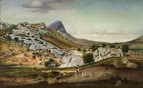
PIC SAINT LOUP PAINTED BY EUGÈNE CASTELNAU


https://wanderingvertexes.blogspot.com/2019/10/pic-saint-loup-painted-by-eugene.html


EUGÈNE CASTELNAU (1827–1894)
Pic Saint Loup (658 m - 2,159ft)
France (Occitanie)

In  Les Garrigues du Pic Saint Loup, oil on canvas, 1859- Musée Fabre, Montpellier, France 

The mountain
 Pic Saint Loup   (658 m - ) is a mountain in the Occitanie region of France located on the edge of the municipalities of Valflaunes and Cazevieille.Located about 20 km north of Montpellier, the peak is visible from a large part of the department of Hérault, the coast and the Gard, hence its profile evokes a point rushing to the sky. It is one of the most beautiful natural and hiking sites in the Garrigues region, the Cévennes outpost. The mountain is also considered the "Sainte-Victoire" of Languedoc. It forms, with the mountain of Hortus facing it to the north, a protected natural site and hosts a number of birds of prey..
From the top of its sharp ridge, the peak Saint-Loup stands against the elements. A large iron cross is erected, an observation post and the chapel of an old hermitage.

The painter
Eugene Castelnau belongs to a family of the Protestant bourgeoisie of Montpellier. and the cousin of the painter Frédéric Bazille. He followed Charles Matet's drawing classes at the Montpellier School of Fine Arts, and in 1841 he left his hometown for Switzerland.  He then studied in Paris, in the workshops of Alexandre Calame and Charles Gleyre.
In 1853, Eugene Castelnau stayed in Italy. In Rome, he attended the painter Ernest Hébert, he traveled for four months the campaign of Rome and the Bay of Naples. Édouard-Auguste Imer noted day after day the details of the trip. His first painting, Les Marais pontins, is presented at the 1855 World's Fair in Paris.
Eugene Castelnau participated in the political and artistic life of Montpellier. He was deputy mayor from September 1870 to April 1871. In 1873, he became president of the Artistic Society of Herault.

___________________________________________
2019 - Wandering Vertexes...
by Francis Rousseau

Wednesday, October 30, 2019

MONTE PERDIDO BY EUGÈNE DELACROIX


EUGÈNE  DELACROIX  (1798-1863)
 Monte Perdido / Mont Perdu  (3,355 m -11,007ft)
Spain

In Album Pyrénées 1845, watercolor,  Musée du Louvre, Paris

The mountain
Monte Perdido (3,355 m -11,007ft), Mont Perdu in French, located in Spain, near the French-Spanish border, is the highest summit above sea level on the ridge separating the canyons of Ordesa and Pineta in the Pyrénées. This is the central peak of Tres Hermanas (Spanish) consist of the cylinder Marboré, the Soum de Ramond, and Monte Perdido itself.
Observable from the peaks popular at the time (including the Pic du Midi de Bigorre), Mount Perdido is no longer visible from the French valleys, as located behind the watershed line between France and Spain.
The limestone, rich in fossils are marine sedimentary origin. These sediments occupying a shallow sea were raised during the formation of the Pyrenees there are 40 million years (see article Geology of the Pyrénées).The summit a form of typical pyramidal peak of erosion by glaciers time of glaciation, he is still on the northeast side of the mountain the Monte Perdido glacier.
Ramond Carbonnières, is the firstpersonn to have discover Mount Perdu. Since his first stay in Barèges, in 1787, he was fascinated by the "massive limestone" of Marboré. In 1796, convinced that the nature of the limestone Marboré is "ordinary" Ramond determines an access route to the summit: the Estaubé Valley.

The painter
Ferdinand Victor Eugène Delacroix was a French Romantic artist regarded from the outset of his career as the leader of the French Romantic school. As a painter and muralist, Delacroix's use of expressive brushstrokes and his study of the optical effects of colour profoundly shaped the work of the Impressionists, while his passion for the exotic inspired the artists of the Symbolist movement. A fine lithographer, Delacroix illustrated various works of William Shakespeare, the Scottish author Walter Scott and the German author Johann Wolfgang von Goethe.
In contrast to the Neoclassical perfectionism of his chief rival Ingres, Delacroix took for his inspiration the art of Rubens and painters of the Venetian Renaissance, with an attendant emphasis on colour and movement rather than clarity of outline and carefully modeled form. Dramatic and romantic content characterized the central themes of his maturity, and led him not to the classical models of Greek and Roman art, but to travel in North Africa, in search of the exotic. Friend and spiritual heir to Théodore Géricault, Delacroix was also inspired by Lord Byron, with whom he shared a strong identification with the "forces of the sublime", of nature in often violent action.
However, Delacroix was given to neither sentimentality nor bombast, and his Romanticism was that of an individualist. In the words of Baudelaire, "Delacroix was passionately in love with passion, but coldly determined to express passion as clearly as possible."
In 1832, Delacroix traveled to Spain and North Africa, as part of a diplomatic mission to Morocco shortly after the French conquered Algeria. He went not primarily to study art, but to escape from the civilization of Paris, in hopes of seeing a more primitive culture. He eventually produced over 100 paintings and drawings of scenes from or based on the life of the people of North Africa, and added a new and personal chapter to the interest in Orientalism. Delacroix was entranced by the people and the costumes, and the trip would inform the subject matter of a great many of his future paintings. He believed that the North Africans, in their attire and their attitudes, provided a visual equivalent to the people of Classical Rome and Greece: "The Greeks and Romans are here at my door, in the Arabs who wrap themselves in a white blanket and look like Cato or Brutus…"
He managed to sketch some women secretly in Algiers, as in the painting Women of Algiers in their Apartment (1834), but generally he encountered difficulty in finding Muslim women to pose for him because of Muslim rules requiring that women be covered. Less problematic was the painting of Jewish women in North Africa, as subjects for the Jewish Wedding in Morocco (1837–41).
While in Tangier, Delacroix made many sketches of the people and the city (see painting above), subjects to which he would return until the end of his life. Animals—the embodiment of romantic passion—were incorporated into paintings such as Arab Horses Fighting in a Stable (1860), The Lion Hunt (of which there exist many versions, painted between 1856 and 1861), and Arab Saddling his Horse (1855).

___________________________________________
2019 - Wandering Vertexes...
by Francis Rousseau