google.com, pub-0288379932320714, DIRECT, f08c47fec0942fa0 GRAVIR LES MONTAGNES... EN PEINTURE

Friday, September 28, 2018

SCHNEEKOPPE (3) PAINTED BY CASPAR DAVID FRIEDRICH

https://wanderingvertexes.blogspot.fr

CASPAR DAVID FRIEDRICH (1774-1840)
Schneekoppe or Sněћka or Śnieżka (1,603m - 2,259ft) 
Poland - Czech Republic border   

 In Ruine im Riesengebirge, oil on canvas, Pommersches Landesmuseum

The mountain 
Schneekoppe (1,603m  - 2,259ft) in German or Sněћka in Czech or Śnieżka in Polish, is a mountain on the border between the Czech Republic and Poland, the most prominent point of the Silesian Ridge in the Krkonoše mountains. Its summit is the highest point in the Czech Republic, in the Krkonoše and in the entire Sudetes range system.
The first historical account of an ascent to the peak is in 1456, by an unknown Venetian merchant searching for precious stones. The first settlements on the mountain soon appeared, being primarily mining communities, tapping into its deposits of copper, iron and arsenic. The mining shafts, totalling 1.5 kilometres (0.93 mi) in length, remain to this day.
The first recorded German name was Riseberg ("giant mountain"), mentioned by Georg Agricola in 1546. Fifteen years later the name Riesenberg appears on Martin Helwig's map of Silesia. The German name later changed to Riesenkoppe ("giant top") and finally to Schneekoppe ("snow top", "snowy head").
In Czech, the mountain was initially called Pahrbek Sněžný. Later Sněžka, with the eventual name Sněžovka, meaning "snowy" or "snow-covered", which was adopted in 1823. 
An older Polish name for the mountain was Góra Olbrzymia, meaning "giant mountain".
The first building on the mountaintop was the Chapel of Saint Lawrence (Laurentiuskapelle), built ca. 1665–1681 by the Silesian Schaffgotsch family to mark their dominion, serving also as an inn for a brief period of time. The territory including the mines were the property of the Schaffgotsch family until 1945. The so-called Prussian hut was built on the Silesian (now Polish) side in 1850, followed by the Bohemian hut on the Bohemian (now Czech) side in 1868, both built with the purpose of providing lodging. The Prussian hut was rebuilt twice after fires (1857 and 1862), and the (after 1945) "Polish hut" was finally demolished in 1967. The Bohemian hut fell into disrepair after 1990 and was demolished in 2004.


The painter 
Caspar David Friedrich was a 19th-century German Romantic landscape painter, considered as the most important German artist of his generation. He is best known for his mid-period allegorical landscapes which typically feature contemplative figures silhouetted against night skies, morning mists, barren trees or Gothic ruins. His primary interest as an artist was the contemplation of nature, and his often symbolic and anti-classical work seeks to convey a subjective, emotional response to the natural world. Friedrich's paintings characteristically set a human presence in diminished perspective amid expansive landscapes, reducing the figures to a scale that, according to the art historian Christopher John Murray, directs "the viewer's gaze towards their metaphysical dimension".
Friedrich was born in Pomerania, where he began to study art. He studied in Copenhagen until 1798, before settling in Dresden. A disillusionment with materialistic society was giving rise everywhere in Europe. This shift in ideals was often expressed through a reevaluation of the natural world, as artists such as Friedrich, J. M. W. Turner (1775–1851) and John Constable (1776–1837) sought to depict nature as a "divine creation, to be set against the artifice of human civilization".
Friedrich's work brought him renown early in his career, and contemporaries such as the French sculptor David d'Angers (1788–1856) spoke of him as a man who had discovered "the tragedy of landscape". Nevertheless, his work fell from favour during his later years, and he died in obscurity, and in the words of the art historian Philip B. Miller, "half mad". As Germany moved towards modernisation in the late 19th century, a new sense of urgency characterized its art, and Friedrich's contemplative depictions of stillness came to be seen as the products of a bygone age. The early 20th century brought a renewed appreciation of his work, beginning in 1906 with an exhibition of thirty-two of his paintings and sculptures in Berlin. By the 1920s his paintings had been discovered by the Expressionists, and in the 1930s and early 1940s Surrealists and Existentialists frequently drew ideas from his work. The rise of Nazism in the early 1930s again saw a resurgence in Friedrich's popularity, but this was followed by a sharp decline as his paintings were, by association with the Nazi movement, interpreted as having a nationalistic aspect.  It was not until the late 1970s that Friedrich regained his reputation as an icon of the German Romantic movement and a painter of international importance.
Friedrich was a prolific artist who produced more than 500 attributed works. In line with the Romantic ideals of his time, he intended his paintings to function as pure aesthetic statements, so he was cautious that the titles given to his work were not overly descriptive or evocative. It is likely that some of today's more literal titles, such as The Stages of Life, were not given by the artist himself, but were instead adopted during one of the revivals of interest in Friedrich. Complications arise when dating Friedrich's work, in part because he often did not directly name or date his canvases. He kept a carefully detailed notebook on his output, however, which has been used by scholars to tie paintings to their completion dates.

2018 - Wandering Vertexes...
Un blog de Francis Rousseau

Thursday, September 27, 2018

TAISHAN / 泰山 PAINTED BY JI CHENG / 计成


https://wanderingvertexes.blogspot.com/2018/09/taishan-painted-by-ji-cheng.html

JI CHENG /  计成  (1582-1642)
Taishan /泰山 (1,533m - 5,029ft)
China 

 In  Journey to Mount Tai,  Ming dynasty, 1368-1644, Harvard Art Museums /Arthur M. Sackler Museum

The artist
 Ji Cheng / 计成 was a Ming dynasty garden designer. Ji Cheng was born in the 10th year of the reign of the Wanli Emperor (1582) in Tongli, Wujiang County, Jiangsu province. As a youth, Ji Cheng made a name for himself as a landscape painter and private garden designer, he admired two Northern
During his lifetime, he designed numerous private gardens in Southern China.
 In his late years, he summarized his lifetime experience into a monograph on landscape design: Yuanye, The Craft of Gardens, 1631. Ji Cheng's Yuanye  is the first monograph dedicated to garden architecture in the world. His work has been translated into many languages.
Ji Cheng's thirty-five room former residence at Hueichuan Bridge, Tongli, is now a tourist attraction.
"The garden is created by the human hand, but should appear as if created by heaven."

The mountain 
Taishan /泰山  or Mount Tai  (1,533m - 5,029ft)  is a mountain of historical and cultural significance located north of the city of Tai'an, in Shandong province, China. The tallest peak is the Jade Emperor Peak (玉皇頂). Mount Tai is of key importance in Chinese religion, being the eastern one of the Sacred Mountains of China. It is associated with sunrise, birth, and renewal, and is often regarded the foremost of the five. According to historical records, Mount Tai became a sacred place haunted by emperors to offer sacrifices and meditate in the Zhou Dynasty before 1,000 BC. A total of 72 emperors were recorded as visiting it. Writers also came to acquire inspiration, to compose poems, write essays, paint and take pictures. Hence, a great many cultural relics were left on the mountain.
Mount Tai is a tilted fault-block mountain with height increasing from the north to the south. It is the oldest example of a paleo-metamorphic formation from the Cambrian Period in eastern China. Known as the Taishan Complex, this formation contains magnetized, metamorphic, and sedimentary rock as well as intrusions of other origins during the Archean Era. The uplift of the region started in the Proterozoic Era; by the end of the Proterozoic, it had become part of the continent. Besides the Jade Emperor Peak, other distinctive rock formations are the Heaven Candle Peak, the Fan Cliff, and the Rear Rock Basin.
Visitors can reach the peak of Mount Tai via a bus which terminates at the Midway Gate to Heaven, from there a cable car connects to the summit. Covering the same distance on foot takes from two and a half to six hours.
To climb up the mountain, one can take one of two routes. The more popular east route starts from Taishan Arch. On the way up the 7,200 stone steps, the climber first passes the Ten Thousand Immortals Tower (Wanxianlou), Arhat Cliff (Luohanya), and Palace to Goddess Dou Mu (Doumugong). The climbing from the First Gate to Heaven, the main entrance bordering on Tai'an town, up the entire mountain can take two and a half hours for the sprinting hiker to six hours for the leisure pace.


2018 - Wandering Vertexes...
Un blog de Francis Rousseau
Wednesday, September 26, 2018

THE ZUGSPITZE AND THE WAXENSTEIN BY EMIL NOLDE

https://wanderingvertexes.blogspot.com/2018/09/the-zugspitze-and-waxenstein-by-emil.html

EMIL NOLDE (1867-1956) 
Die Zugspitze (2,962m - 9,718 ft) 
Die Waxenstein (2,277m - 7,470ft)
 Germany (Bavaria)

  In  The Zugspitze and Waxenstein, postcard 

About this work 
The postcards series date from  pre-expressionist phase of Nolde’s career (though he was around 30 when he created them). After hiking in the Swiss Alps, Nolde did a painting, Mountain Giants, presenting the mountains in human form. Nolde wrote : “The picture went to the annual exhibition in Munich in 1896. Ferdinand Hodler’s picture “Night”  which established his fame, was also there. But my “Mountain Giants" was soon returned, rejected… In those days there was a general and stormy derision and ridicule about each of Hodler’s pictures. ‘And his colors are as ugly as can be possible!’ What help was my contradiction and my firm conviction that his sinuous, pushing, wry bodies are part of the character of the mountain folk, just as the firs on the mountain slopes are gnarled and grown oddly.” From then, he painted practically every Swiss Alps Summit in human form: the Zugspitze, the Waxenstein, the Eiger, the Monch, the Jungfrau, the Grand Saint- Gothard, Piz Bernina, the Morteratch, the Ortler, the Finsteraarhorn... they will be posted one after one in this blog, the Cervin / Matterhorn being the first one.

The mountain 
The Zugspitze (2,962m -9,718 ft) above sea level, is the highest peak of the Wetterstein Mountains as well as the highest mountain in Germany. It lies south of the town of Garmisch-Partenkirchen, and the border between Germany and Austria runs over its western summit. South of the mountain is the Zugspitzplatt, a high karst plateau with numerous caves. On the flanks of the Zugspitze are three glaciers, including the two largest in Germany: the Northern Schneeferner with an area of 30.7 hectares and the Höllentalferner with an area of 24.7 hectares. The third is the Southern Schneeferner which covers 8.4 hectares.
The Waxenstein (2,277m - 7,470ft) is an Alpine summit, at an altitude of 2,227 m, in the Wetterstein, Germany (Bavaria). It is composed of five points: the Großer Waxenstein ; the Vorderer Waxenstein  ; the Zwölferkopf ; the Mittagscharte and  the Männ.

The painter 
Emil Nolde (born Emil Hansen) was a German-Danish painter and printmaker. He was one of the first Expressionists, a member of Die Brücke (The Bridge) of Dresden in 1906, and was one of the first oil painting and watercolor painters of the early 20th century to explore color. He is known for his brushwork and expressive choice of colors. Golden yellows and deep reds appear frequently in his work, giving a luminous quality to otherwise somber tones. His watercolors include vivid, brooding storm-scapes and brilliant florals.

2018 - Wandering Vertexes...
Un blog de Francis Rousseau, #BlogWanderingVertexes, #mountainpaintings


Tuesday, September 25, 2018

MOUNT WHITNEY PAINTED BY PAUL LAURITZ

https://wanderingvertexes.blogspot.com/2018/09/mount-whitney-painted-by-paul-lauritz.html

    
                                                          PAUL LAURITZ (1889–1975)
Mount Whitney  (4,421 m - 14,505 ft)
United States of America (California) 

 In The High Sierras,  oil on canvas, circa 1929 , The  Crocker Art Museum 

The mountain 
Mount Whitney (4,421 m - 14,505 ft) is the tallest mountain in California, as well as the highest summit in the contiguous United States and the Sierra Nevada.  It is in Central California, on the boundary between California's Inyo and Tulare counties. The west slope of the mountain is in Sequoia National Park and the summit is the southern terminus of the John Muir Trail which runs 211.9 mi (341.0 km) from Happy Isles in Yosemite Valley. The east slope is in the Inyo National Forest in Inyo County.
The rise is caused by a normal fault system that runs along the eastern base of the Sierra, below Mount Whitney. Thus, the granite that forms Mount Whitney is the same as the granite that forms the Alabama Hills, thousands of feet lower down.  The raising of Whitney (and the downdrop of the Owens Valley) is due to the same geological forces that cause the Basin and Range Province: the crust of much of the intermontane west is slowly being stretched.
In July 1864, the members of the California Geological Survey named the peak after Josiah Whitney, the State Geologist of California and benefactor of the survey.

The painter 
Born in a small art colony of  Norway, Lauritz was exposed to art at an early age, studying with local and foreign artists in Larvik. At age 16 he moved to eastern Canada to live with his sister and found work as a hardrock driller in a mine. Working his way west, he worked as a commercial artist in Vancouver and Portland, OR where he began painting landscapes and portraits. The meager existence in artwork led him to Alaska with the Gold Rush. Unsuccessful as a miner, he again turned to painting and became a close friend of artist Sydney Laurence. The two artists held a joint exhibition before Lauritz left Alaska. In 1919 he settled in Los Angeles and established a studio-home in the Lyceum Theatre on Spring Street. When not teaching at the Chouinard and Otis Art Institutes
or in his studio, he made painting excursions to the Sierra, up the California coast as far north as Carmel, to Mexico (1921), the Columbia River (1924), and Norway (1925).
While in his native land, he was commissioned by the King of Norway to do a painting for the royal palace. Lauritz was an involved member of the Los Angeles art community and served for six years on the Los Angeles Municipal Art Commission. A versatile painter, his diverse subjects include desert scenes, portraits, snow scenes, marines and landscapes.

2018 - Wandering Vertexes...
Un blog de Francis Rousseau, #BlogWanderingVertexes, #mountainpaintings


Monday, September 24, 2018

THE JUNGFRAU, MÖNCH AND EIGER PAINTED BY AUGUST MACKE


https://wanderingvertexes.blogspot.com/2018/09/the-jungfrau-monch-and-eiger-painted-by.html


AUGUST MACKE (1887-1914)  
The Jungfrau (4,158 m - 13, 642 ft)  
 The Mönch (4,107 m - 13,474 ft)
The Eiger (3,970 m -13,020 ft)
Switzerland

 In Garten am Thuner See, oin on canvas  

The mountains 
The Jungfrau (4,158 m - 13,642 ft) ("The virgin" in german) is one of the main summits of the Bernese Alps, located between the northern canton of Bern and the southern canton of Valais, halfway between Interlaken and Fiesch. Together with the Eiger and Mönch, the Jungfrau forms a massive wall overlooking the Bernese Oberland and the Swiss Plateau, one of the most distinctive sights of the Swiss Alps. It is one of the most represented by artists summits with the  Matterhorn and the Mont Blanc.

The Mönch  (4,107 m - 13,474 ft) is a mountain in the Bernese Alps, in Switzerland.  The Mönch lies on the border between the cantons of Valais and Bern, and forms part of a mountain ridge between the Jungfrau and Jungfraujoch to the west, and the Eiger to the east. It is west of Mцnchsjoch, a pass at 3,650 metres (11,980 ft), Mцnchsjoch Hut, and north of the Jungfraufirn and Ewigschneefдld, two affluents of the Great Aletsch Glacier. The north side of the Mцnch forms a step wall above the Lauterbrunnen valley. The peak was first climbed 159 years ago in 1857 on August 15, ascended by Christian Almer, Christian Kaufmann, Ulrich Kaufmann and Sigismund Porges.


The Eiger (3,970 m- 13,020 ft) is located in the  Bernese Alps, overlooking Grindelwald and Lauterbrunnen in the Bernese Oberland, just north of the main watershed and border with Valais. It is the easternmost peak of a ridge crest that extends across the Mцnch to the Jungfrau, constituting one of the most emblematic sights of the Swiss Alps. While the northern side of the mountain rises more than 3,000m -10,000 ft above the two valleys of Grindelwald and Lauterbrunnen, the southern side faces the large glaciers of the Jungfrau-Aletsch area, the most glaciated region in the Alps. The most notable feature of the Eiger is its 1,800-metre-high - 5,900 ft north face of rock and ice, named Eigerwand or Nordwand, which is the biggest north face in the Alps. This huge face towers over the resort of Kleine Scheidegg at its base, on the homonymous pass connecting the two valleys.

The painter 
August Macke was a German Expressionist painter. He was one of the leading members of the German Expressionist group Der Blaue Reiter (The Blue Rider). He lived during a particularly innovative time for German art: he saw the development of the main German Expressionist movements as well as the arrival of the successive avant-garde movements which were forming in the rest of Europe. Like a true artist of his time, Macke knew how to integrate into his painting the elements of the avant-garde which most interested him.

Sunday, September 23, 2018

MOUNT WASHINGTON PAINTED BY AARON DRAPER SHATTUCK

https://wanderingvertexes.blogspot.com/2018/09/mount-washington-painted-by-aaron.html

AARON DRAPER SHATTUCK (1832-1928)
Mount Washington (1, 916m - 6, 286ft)
United States of America  (New Hampshire)

The mountain 
Mount Washington (1, 916m - 6, 286ft) is the highest point in the northeastern United States. It is located in the White Mountains in the county of Coos. Most of the mountain is located in the White Mountain National Forest and Mount Washington State Park.
The mountain is called Agiocochook, the "abode of the great spirit" by the Amerindians. A scientific expedition led by geologist Dr. Cutler named Mount Washington in 1784.
While the western slope, which climbs the Cog Railway, is regular from its base, the other slopes are more complex. To the north, Great Gulf, the largest glacial circus in the mountains, is surrounded by the Northern Presidentials, namely Clay, Jefferson, Adams and Madison Mountains. These peaks reach far beyond the alpine zone beyond the tree line. The imposing Chandler Ridge extends northeast from the top of Mount Washington to form the southern wall of the amphitheater. It is paced by a motorway to the summit.
The first European to mention the mountain is Giovanni da Verrazzano in 1524, who sees it from the Atlantic Ocean and describes it as a "high mountain of the interior". Irishman Darby Field says he made his first ascent in 1642.
The Crawford Path, the oldest hiking trail in the United States, was established in 1819 as a mule track from the Crawford Notch Gorge to the summit and has been in use since that time. Ethan Allen Crawford built a lodge at the summit in 1821 that resisted a storm five years later.  In the middle of the nineteenth century, the mountain became a major tourist destination of the country, with the construction of new trails and two hotels. The Summit House, a 20-meter-long stone building with a roof attached to four heavy chains, was opened in 1852. The following year, the Tip-Top House was erected to compete with it. Rebuilt in wood with 91 rooms in 1872-1873, the Summit House burned in 1908 and was replaced by a granite building in 1915. Only the Tip-Top House resists fire; it is now classified in the National Register of Historic Places and has recently been renovated to house exhibitions. Among the attractions of the Victorian era is also a coach road built in 1861, now the Mount Washington Auto Road, and the Mount Washington Cog Railway, a cog railway established in 1869, in service.

The artist 
Aaron Draper Shattuck was an American painter of the White Mountain School. He was born in Francestown, New Hampshire. A second-generation artist affiliated with the Hudson River School, Shattuck differed from most of his contemporaries in that he never studied abroad, and appears to have spent his entire life in New England.
Shattuck studied portrait painting with Alexander Ransom in Boston in 1851, and in 1852 was a student at the National Academy of Design in New York City. In 1854 he first painted in the White Mountains of New Hampshire.  The following year he exhibited for the first time at both the National Academy and the Boston Athenaeum. In 1856 he was elected an associate of the National Academy, and was made a full Academician in 1861.
From 1856 to 1870 Shattuck worked at the Tenth Street Studio Building in New York City.  In 1883 he invented a canvas stretcher bar key which was used by artists of the era, and which contributed to Shattuck's considerable wealth.
In 1888 Shattuck suffered the effects of a serious illness, after which he ceased to paint. After recovering he followed other agrarian and creative pursuits, raising sheep, experimenting with apple tree grafts, and making violins.  Prior to his death in 1928 at the age of 96 he was the oldest living member of the National Academy of Design.

2018 - Wandering Vertexes...
Un blog de Francis Rousseau,  #wandering-silent-vertexes


Saturday, September 22, 2018

FUJIYAMA / 富士山 BY NAGASAWA ROSETSU / 長沢芦雪

https://wanderingvertexes.blogspot.com/2018/09/fujiyama-by-nagasawa-rosetsu.html

NAGASAWA  ROSETSU / 長沢芦雪  (1754–1799)
Fujiyama / 富士山 (3, 776 m -12,389 ft)
Japan

 In  Cranes Flying Past Mount Fuji, 1794.  Hanging scroll; ink and light color on silk, 
Courtesy Museum Rietberg, Zurich  

The artist
Nagasawa Rosetsu / 長沢芦雪 was an 18th-century (Edo period) Japanese painter of the Maruyama School, known for his versatile style. He was born to the family of a low-ranking samurai. He studied with Maruyama Ōkyo in Kyoto.
 Upon establishing himself as an artist, he changed his name from Uesugi to Nagasawa. He moved to Kyoto in 1781, where he became a student of Maruyama Ōkyo.
Rosetsu's early period works are in the style of Maruyama Ōkyo, although critics agree that the pupil's skill quickly surpassed his master's. Finally, they had a falling out and Rosetsu left the school. After the break, he worked under the patronage of the feudal lord of Yodo and accepted commissions at several temples.
Rosetsu's paintings fall into two very clearly defined categories, with no halfway stage in between. On the one hand, there are those of studied finish, and on the other, those--the great majority--that were clearly the work of a very few minutes of intense activity, whatever the preliminary thought and calculation. We are inclined to think of the first type as early and even untypical, but in fact Rosetsu seems to have executed carefully finished paintings at all stages of his career.
He incorporated aspects of Western realism into Japanese themes. In his work, which is reminiscent of earlier Zen painting, while the moon is left white, the night sky, mountains, and pine trees are depicted with gradations of India ink.
His work was extensively forged in the Meiji period.

The mountain 
This is the legendary Mount Fuji or Fujiyama (富士山).
It is located on Honshu Island and is the highest mountain peak in Japan at 3,776.24 m (12,389 ft). Several names are attributed to it:  "Fuji-san", "Fujiyama" or, redundantly, "Mt. Fujiyama". Usually Japanese speakers refer to the mountain as "Fuji-san".  The other Japanese names for Mount Fuji,  have become obsolete or poetic like: Fuji-no-Yama (ふじの山 - The Mountain of Fuji), Fuji-no-Takane (ふじの高嶺- The High Peak of Fuji), Fuyō-hō (芙蓉峰 - The Lotus Peak), and Fugaku (富岳/富嶽), created by combining the first character of 富士, Fuji, and 岳, mountain.
Mount Fuji is an active stratovolcano that last erupted in 1707–08. Mount Fuji lies about 100 kilometres (60 mi) south-west of Tokyo, and can be seen from there on a clear day.
Mount Fuji's exceptionally symmetrical cone, which is snow-capped several months a year, is a well-known symbol of Japan and it is frequently depicted in art and photographs, as well as visited by sightseers and climbers.
Mount Fuji is one of Japan's Three Holy Mountains (三霊山) along with Mount Tate and Mount Haku. It is also a Special Place of Scenic Beauty and one of Japan's Historic Sites.
It was added to the World Heritage List as a Cultural Site on June 22, 2013. As per UNESCO, Mount Fuji has “inspired artists and poets and been the object of pilgrimage for centuries”. UNESCO recognizes 25 sites of cultural interest within the Mt. Fuji locality. These 25 locations include the mountain itself, Fujisan Hongū Sengen Shrine and six other Sengen shrines, two lodging houses, Lake Yamanaka, Lake Kawaguchi, the eight Oshino Hakkai hot springs, two lava tree molds, the remains of the Fuji-kō cult in the Hitoana cave, Shiraito Falls, and Miho no Matsubara pine tree grove; while on the low alps of Mount Fuji lies the Taisekiji temple complex, where the central base headquarters of Nichiren Shoshu Buddhism is located.


Friday, September 21, 2018

MONTE CAVO PAINTED BY SIMON DENIS

https://wanderingvertexes.blogspot.com/2018/09/monte-cavo-painted-by-simon-denis.html

SIMON DENIS (1755-1813) 
Monte Cavo (950 m - 3,120 ft)
Italy 

In Paysage avec les collines d'Alban et le Monte Cavo,  1790, oil on canvas, Private collection 

About this painting 
Monte Cavo is the sacred Mons Albanus of the Italic people of ancient Italy who lived in Alba Longa (the Albani), and other cities, and therefore a sacred mountain to the Romans; there they built the temple of Jove (Jupiter) Latiaris, one of the most important destinations of pilgrimage for all Latin people in the centuries of Roman domination. On the Mons Albanus, between January and March, the "Latin Festivals" were held. The newly chosen Consuls had to sacrifice to Jupiter Latiaris and to announce the Latin Holidays.
In 531 BC, King Tarquinius Superbus built here a temple shared with the Latins, the Hernici and the Volsci, where every year celebrations in honor of Jupiter Latiaris were held.
After being a temple, a monastery and an  hotel,  the structure became, in the post-war era, a telecommunications station. Nowadays, access is prohibited to unauthorized persons. A few blocks of the ancient temple are still visible behind the fenced area.
 
The mount 
Monte Cavo (950 m - 3,120 ft) or less occasionally, "Monte Albano," is the second highest mountain of the complex of the Alban Hills, near Rome, Italy. An old volcano extinguished around 10,000 years ago, it lies about 20 km (12 mi) from the sea, in the territory of the comune of Rocca di Papa. It is the dominant peak of the Alban Hills. The current name comes from Cabum, an Italic settlement existing on this mountain.Volcanic activity under king Tullus Hostilius on the site was reported by Livy in his book of Roman history: "...there had been a shower of stones on the Alban Mount..."

The painter 
Simon-Joseph-Alexandre-Clément Denis was a Belgian painter active primarily in Italy. Denis first studied in his native city of Antwerp, with the landscape and animal painter H.-J. Antonissen.
He moved to Paris in the 1780s, and soon gained the patronage of genre painter and art dealer Jean-Baptiste Lebrun, whose support allowed him to move to Rome in 1786. His paintings there attracted favorable attention, and in 1787 he married a local woman. He remained close to the Flemish community in Rome, and in 1789 was elected to head the Foundation St.-Julien-des-Flamands. He also developed ties within the French artistic community; Élisabeth-Louise Vigée-Le Brun stayed with him for some days in 1789 and that same year he and she traveled with François-Guillaume Ménageot to visit Tivoli. François Marius Granet sought his advice when he arrived in Rome in 1802.
In 1803, he was elected to the Accademia di San Luca; in 1806 he settled for good in Naples, becoming court painter to Joseph Bonaparte.   His wonderful Landscape near Rome during a Storm (1786–1806) an oil on paper probably representating Monte Cavo as well,  is now visible at The MET in New York city.


Thursday, September 20, 2018

HOHER DACHSTEIN BY RUDOLF SWOBODA THE ELDER

https://wanderingvertexes.blogspot.com/

RUDOLF SWOBODA THE ELDER  (1819-1859) 
Hoher Dachstein (2, 995 m - 9,826 ft)
Austria 

 In Festlicher Almabtrieb im Hochgebirge, oil on canvas, 1840,  Private collection

The mountain 
Hoher Dachstein (2, 995m - 9,826ft) is a strongly karstic Austrian mountain, and the second highest mountain in the Northern Limestone Alps. It is situated at the border of Upper Austria and Styria in central Austria, and is the highest point in each of those states. Parts of the massif also lie in the state of Salzburg, leading to the mountain being referred to as the Drei-Lander-Berg ("three-state mountain"). The Dachstein massif covers an area of around 20x30 km with dozens of peaks above 2,500 m, the highest of which are in the southern and south-western areas. Seen from the north, the Dachstein massif is dominated by the glaciers with the rocky summits rising beyond them. By contrast, to the south, the mountain drops almost vertically to the valley floor (see above).
The summit was first reached in 1832 by Peter Gappmayr, via the Gosau glacier, after an earlier attempt by Erzherzog Karl via the Hallstätter glacier had failed. Within two years of Gappmayr's success a wooden cross had been erected at the summit. The first person to reach the summit in winter was Friedrich Simony, on 14 January 1847. The sheer southern face was first climbed on 22 September 1909 by the brothers Irg and Franz Steiner.

The painter  
Rudolf Swoboda the elder or Senior (1819-1859) was a landscape and animal painter, coming from a Vienna family of artists  with his niece Josefine Swoboda (1861-1924) ans his nephew Rudolf Swoboda the younger or Junior (1859-1914) famous to have painted Indian portraits for Queen Victoria. Rudolf Swoboda the elder  received numerous orders from the Austrian imperial house and other noble houses in Vienna which made him one of the most active Vienna landscapists.  His landscapes often includes  scenes with farmers playing music and dancing or animals depictions in a gentle and naive atmosphere.

2018 - Wandering Vertexes...
Un blog de Francis Rousseau

Wednesday, September 19, 2018

MOUNT MARCY PAINTED BY REGIS-FRANÇOIS GIGNOUX

https://wanderingvertexes.blogspot.com/


RÉGIS-FRANÇOIS GIGNOUX (1816-1882)
Mount Marcy (1,629m - 5,343ft)
United States of America (Essex County) 

 In Winter in the Adirondacks,  Oil on canvas, 1853, Driscoll Babcock Galleries, New York

The mountain 
Mount Marcy (1,629m - 5,343ft)    in Mohawk  langage  Tewawe’estha is the highest point in New York State. It is located in the Town of Keene in Essex County. The mountain is in the heart of the Adirondack High Peaks Region of the High Peaks Wilderness Area. Its stature and expansive views make it a popular destination for hikers, who crowd its summit in the summer months.
Lake Tear of the Clouds, at the col between Mt. Marcy and Mt. Skylight, is often cited as the highest source of the Hudson River, via Feldspar Brook and the Opalescent River, even though the main stem of the Opalescent River has as its source a higher point two miles north of Lake of the Clouds, and that stem is a mile longer than Feldspar Brook.
The mountain is named after Gov. William L. Marcy, the 19th-century Governor of New York, who authorized the environmental survey that explored the area. Its first recorded ascent was on August 5, 1837, by a large party led by Ebenezer Emmons looking for the source of the East Fork of the Hudson River.[6] Today the summit may be reached by multiple trails; though long by any route, a round-trip may be made in a day.

The painter 
Régis François Gignoux  was a French painter who was active in the United States from 1840 to 1870, also known under aliases Marie-François-Régis Gignoux or Régis Gignoux. He was born in Lyon, France and studied at the École des Beaux-Arts under the French historical painter Hippolyte Delaroche, who inspired Gignoux to turn his talents toward landscape painting.  Gignoux arrived in the United States from France in 1840 and eventually opened a studio in Brooklyn, New York. He was a member of the National Academy of Design, and was the first president of the Brooklyn Art Academy. George Inness, John LaFarge (1835–1910), and Charles Dormon Robinson were his students.  By 1844, Gignoux had opened a studio in New York City and became one of the first artists to join the famous Tenth Street Studio, where other members included Albert Bierstadt, Frederic Church, Jasper Francis Cropsey, and John Frederick Kensett. He returned to France in 1870 and died in Paris in 1882. 
Gignoux is best known for his meticulous renderings of Northeast American landscapes, and was the only member of the Hudson River School to specialize in snow scenes. The fame of Gignoux is still quite considerable nowadays in the US and at least a dozen of the most important american museums are among the public collections holding work by Régis François Gignoux, which is often considered a precursor of the Luminist movement.

2018 - Wandering Vertexes...
Un blog de Francis Rousseau

Tuesday, September 18, 2018

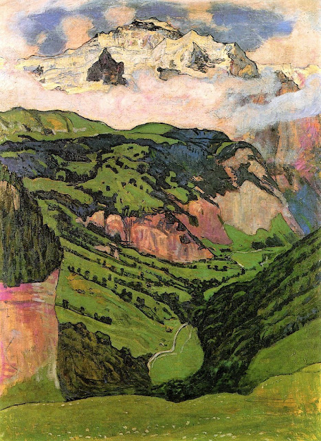
THE JUNGFRAU PAINTED BY FERDINAND HODLER

https://wanderingvertexes.blogspot.com/2018/09/the-jungfrau-painted-by-ferdinand-hodler.html

FERDINAND HODLER   (1853-1918) 
The Jungfrau (4,158 m - 13, 642 ft)  
Switzerland

In  The Jungfrau from Isenfluh, oil on canvas, 1902, Kunstmuseum Basel

The mountain 
The Jungfrau (4,158 m - 13,642 ft) ("The virgin" in german) is one of the main summits of the Bernese Alps, located between the northern canton of Bern and the southern canton of Valais, halfway between Interlaken and Fiesch. Together with the Eiger and Mönch, the Jungfrau forms a massive wall overlooking the Bernese Oberland and the Swiss Plateau, one of the most distinctive sights of the Swiss Alps. It is one of the most represented by artists summits with the Matterhorn and the Mont Blanc. The summit was first reached on August 3, 1811 by the Meyer brothers of Aarau and two chamois hunters from Valais. The ascent followed a long expedition over the glaciers and high passes of the Bernese Alps. It was not until 1865 that a more direct route on the northern side was opened. The construction of the Jungfrau railway in the early 20th century, which connects Kleine Scheidegg to the Jungfraujoch, the saddle between the Mönch and the Jungfrau, made the area one of the most-visited places in the Alps. Along with the Aletsch Glacier to the south, the Jungfrau is part of the Jungfrau-Aletsch area, which was declared a World Heritage Site in 2001.
Politically, the Jungfrau is split between the municipalities of Lauterbrunnen (Bern) and Fieschertal (Valais). It is the third-highest mountain of the Bernese Alps after the nearby Finsteraarhorn and Aletschhorn, respectively 12 and 8 km away. But from Lake Thun, and the greater part of the canton of Bern, it is the most conspicuous and the nearest of the Bernese Oberland peaks; with a height difference of 3,600 m between the summit and the town of Interlaken. This, and the extreme steepness of the north face, secured for it an early reputation for inaccessibility.
The landscapes around the Jungfrau are extremely contrasted. Instead of the vertiginous precipices of the north-west, the south-east side emerges from the upper snows of the Aletsch Glacier at around 3,500 metres. The 20 km long valley of Aletsch on the south-east is completely uninhabited and also surrounded by other similar glacier valleys. The whole area constitutes the largest glaciated area in
In 1811, the brothers Johann Rudolf  and Hieronymus Meyer, the head of a rich merchant family of Aarau, with several servants and a porter picked up at Guttannen,  reached the summit for the first time.

The painter 
Ferdinand Hodler was one of the best-known Swiss painters of the 19th century. His early works were portraits, landscapes, and genre paintings in a realistic style. Later, he adopted a personal form of symbolism he called Parallelism.
In the last decade of the nineteenth century his work evolved to combine influences from several genres including Symbolism and Art Nouveau. In 1890 he completed Night, a work that marked Hodler's turn toward symbolist imagery. It depicts several recumbent figures, all of them relaxed in sleep except for an agitated man who is menaced by a figure shrouded in black, which Hodler intended as a symbol of death. Hodler developed a style he called "Parallelism" that emphasized the symmetry and rhythm he believed formed the basis of human society. In paintings such as The Chosen One, groupings of figures are symmetrically arranged in poses suggestive of ritual or dance.
Hodler painted number of large-scale historical paintings, often with patriotic themes. In 1897 he accepted a commission to paint a series of large frescoes for the Weapons Room of the Schweizerisches Landesmuseum in Zurich. The compositions he proposed, including The Battle of Marignan which depicted a battle that the Swiss lost, were controversial for their imagery and style, and Hodler was not permitted to execute the frescoes until 1900.
Hodler's work in his final phase took on an expressionist aspect with strongly coloured and geometrical figures. Landscapes were pared down to essentials, sometimes consisting of a jagged wedge of land between water and sky.

2018 - Wandering Vertexes...

Un blog de Francis Rousseau

Monday, September 17, 2018

MOUNT RAZORBACK PAINTED BY ALBERT NAMATJIRA

https://wanderingvertexes.blogspot.com/2018/09/mount-razorback-painted-by-albert.html

ALBERT NAMATJIRA (1902-1959)
Mount Razorback (1, 258 m - 4,127 ft ) 
Australia (Northern Territory)

In Mount Razorback, watercolor

The mountain 
Mount Razorback (1,600m -  5,250ft )  - not to be confused with Razorback mountain (British Columbia) or Mount Razorback in Antarctica - is situated in Australia (NT), 57.71kms NorthWest of Hermannsburg. It is not the highest mountain in Australia !  It is not even the highest mountain in Northern Territory, actually it is the  6th highest in the MacDonnell Ranges,  behind Mount Zeil  (1,531 m 5,023 ft), Mount Liebig  (1,524 m- 5,000 ft), Mount Edward (1,423 m- 4,669 ft),  Mount Giles (1,389 m- 4,557 ft) and Mount Sonder (1,380 m-4,530 ft).
The MacDonnell Ranges is  a mountain range and an interim Australian bioregion.
The headwaters of the Todd, Finke and Sandover rivers form in the MacDonnell Ranges. The range is crossed by the Australian Overland Telegraph Line and the Stuart Highway.

The  painter 
Albert Namatjira  born Elea Namatjira, was a Western Arrernte-speaking Aboriginal artist from the MacDonnell Ranges in Central Australia. As a pioneer of contemporary Indigenous Australian art, he was the most famous Indigenous Australian of his generation.
Born and raised at the Hermannsburg Lutheran Mission outside Alice Springs, Namatjira showed interest in art from an early age, but it was not until 1934 (aged 32), under the tutelage of Rex Battarbee, that he began to paint seriously. Namatjira's richly detailed, Western art-influenced watercolours of the outback departed significantly from the abstract designs and symbols of traditional Aboriginal art, and inspired the Hermannsburg School of painting. He became a household name in Australia—indeed, reproductions of his works hung in many homes throughout the nation—and he was publicly regarded as a model Aborigine who had succeeded in mainstream society.
Although not the first Aboriginal artist to work in a European style, Albert Namatjira is certainly the most famous. Ghost gums with luminous white trunks, palm-filled gorges and red mountain ranges turning purple at dusk are the hallmarks of the Hermannsburg school. Hermannsburg Mission was established by Lutheran missionaries in 1877 on the banks of the Finke River, west of Mparntwe (Alice Springs). Namatjira learnt watercolour technique from the artist, Rex Battarbee.
Initially thought of as having succumbed to European pictorial idioms – and for that reason, to ideas of European privilege over the land – Namatjira’s landscapes have since been re-evaluated as coded expressions on traditional sites and sacred knowledge. Ownership of country is hereditary, but detailed knowledge of what it ‘contains’ is learnt in successive stages through ceremony, song, anecdote and contact. Namatjira’s father’s country lay towards Mount Sonder and Glen Helen Gorge, in the MacDonnell Ranges, and his mother’s country was in the region of Palm Valley in Central Australia. In Namatjira’s paintings, the totemic connections to his country are so indelible that, for example, Palm Valley the place and Palm Valley, c.1940s, the painting seem to intersect, detailing Namatjira’s artistic, cultural and proprietorial claim on the land.
 One of his first landscapes from 1936, Central Australian Landscape, shows a land of rolling green hills. Another early work, Ajantzi Waterhole (1937), shows a close up view of a small waterhole, with Namatjira capturing the reflection in the water. The landscape becomes one of contrasting colours, a device that is often used by Western painters, with red hills and green trees in Red Bluff (1938). Central Australian Gorge (1940) shows detailed rendering of rocks and reflections in the water. In Flowering Shrubs Namatjira contrasts the blossoming flowers in the foreground with the more barren desert and cliffs in the background. Namatjira's love of trees was often described so that his paintings of trees were more portraits than landscapes, which is shown in the portrait of the often depicted ghost gum in Ghost Gum Glen Helen (c.1945-49). Namatjira's skills at colouring trees can be clearly seen in this portrait. Namatjira was fully aware of his own talent, as was shown when he was describing another landscape painter to William Dargie: "He does not know how to make the side of a tree which is in the light look the same colour as the side of the tree in shadow...I know how to do better."
Namatjira's skills kept increasing with experience as is shown in the highly photographic quality of Mt Hermannsburg (1957), painted only two years before he died.
 In 1957, Namatjira became the first Aboriginal person to be granted conditional Australian citizenship. This entitled him to limited social freedoms and to live in Mparntwe, although he was prohibited from purchasing land. His relations, including his children, were not permitted the same privileges.
After an incident in 1958 that didn’t directly involve the artist, Namatjira was charged with supplying alcohol to members of the Aboriginal community – at the time, it was illegal for all Aboriginal people, except Namatjira, to possess and consume alcohol. Namatjira was sentenced to six months labour at Papunya and this, exacerbated by the authorities’ refusal to allow him to purchase the land of his ancestors, caused him profound despair. He served only two months, and died shortly after.
The more recent, dramatic success of the nearby Papunya Tula movement must be read against the history of its predecessor, the Hermannsburg school, which has endured for over half a century. In 2002, the centenary of Namatjira’s birth was celebrated with a major retrospective at the National Gallery of Australia, Canberra.

2018 - Wandering Vertexes...

Un blog de Francis Rousseau

Sunday, September 16, 2018

LE CANIGOU BY GEORGE-DANIEL DE MONFREID

https://wanderingvertexes.blogspot.com/2018/09/le-canigou-by-george-daniel-de-monfreid.html

GEORGE-DANIEL DE MONFREID (1856–1929)
 Le Canigou (2,784m - 9,137 ft) 
 France (Occitanie) 

In Le Canigou en Hiver, 1921, watercolour, Musée du Petit Palais Paris  

The mountain 
Le Canigou (2,784m - 9,137 ft) is a mountain located in the Pyrenées-Orientales (southern France), south of Prades and north of Prats-de-Mollo-la-Preste. Its summit is a quadripoint between the territories of Casteil, Taurinya, Valmanya and Vernet-les-Bains. Its location makes it visible from the plains of Roussillon and from Conflent in France, and as well from Empordà in Spain. Due to its sharp flanks and its dramatic location near the coast, until the 18th century the Canigou was believed to be the highest mountain in the Pyrenees.
Twice a year, in early February and at the end of October, with good weather, the Canigou can be seen at sunset from as far as Marseille, 250 km away, by refraction of light. This phenomenon was observed in 1808 by baron Franz Xaver von Zach from the Notre-Dame de la Garde basilica in Marseille. All year long, it can also be seen, with good weather, from Agde, Port-Camargue and the Montagne Noire.
The mountain has symbolical significance for Catalan people. On its summit stands a cross that is often decorated with the Catalan flag.  Every year on 23 June, the night before St. John's day (nuit de la Saint Jean), day of the summer solstice, there is a ceremony called Flama del Canigó (Canigou Flame), where a fire is lit at the mountaintop. People keep a vigil during the night and take torches lit on the fire in a spectacular torch relay to light bonfires elsewhere. Many bonfires are lit in this way all over the Pyrénées-Orientales, Catalonia, Valencian Community, and Balearic Islands theoretically.

The painter 
George-Daniel de Monfreid  was a French painter and art collector. Born at New York City, in the United States, he spent his childhood in the south of France. Early he decided on a career in art, and enrolled at the Académie Julian, and formed friendships with Paul Gauguin, Paul Verlaine and Aristide Maillol. Initially his work was Impressionist and Neo-Impressionist, but his close association Les Nabis group pushed his style in the direction of Gauguin.
He was also an art collector and a patron of the arts. Along with Gustave Fayet, he was one of the first collectors of the works of Gauguin at the time he was exiled in the Pacific. He was also one of the first biographers of Gauguin. He was also influenced by the cubism of Pablo Picasso late in his career.
 He wad the father of the  french writer Henry de Monfreid  (1879-1974).

2018 - Wandering Vertexes...
Un blog de Francis Rousseau

Saturday, September 15, 2018

DU TOITS PEAK PAINTED BY HUGO NAUDÉ

https://wanderingvertexes.blogspot.com/2018/09/du-toits-peak-painted-by-hugo-naude.html

HUGO NAUDÉ (1869-1938)
Du Toits Peak  (1,995 m - 6,545 ft) 
 South Africa


The mountain 
Du Toits Peak (1,995 m - 6,545 ft) is the highest seaward facing peak in the Cape Fold Belt ranges, i.e. the highest peak in the Western Cape within direct sight of the ocean. Located between Paarl and Worcester in the south-west of South Africa, 70 kilometres (43 mi) to the north-east of the provincial capital of Cape Town. The mountains form a formidable barrier between Cape Town and the rest of Africa on the N1 highway, also called the Cape to Cairo Road. This section is called the Du Toitskloof Pass. The old route culminates at 820 metres (2,690 ft), however, the new Huguenot Tunnel, of 4.4 kilometres (2.7 mi) in length, cuts out the old mountain pass.
The range mostly consists of Table Mountain sandstone, an erosion-resistant quatzitic sandstone. Vegetation is almost exclusively montane fynbos of the Cape floristic region. The rest of the mountains are barren rocks and steep cliffs. Precipitation occurs primarily in the winter months as rain on the lower slopes and as snow higher up, usually above 1000m. Climate varies dramatically, with the surrounding valleys being up to 10°C (18°F) warmer than the mountains. The climate falls within the Mediterranean type. The mountains form part of the Cape Syntaxis, a complex portion of the Cape Fold Belt where the north-south trending ranges meet in the east-west trending ranges in a complex series of folds, thrusts and fault-lines.

The painter
Hugo Naudé was South Africa’s pioneer impressionist painter. He received his professional art education at the Slade School of Fine Art in London (1889 -1890) and the Kunst Akademie in Munich (1890 -1894) and spent a year amongst the Barbizon painters in Fontainebleau near Paris.
Born and raised in the Boland town of Worcester, Naudé became South Africa’s first professional artist, establishing “Cape Impressionism”, an adaptation of European Impressionism, in conjunction with the artists Pieter Wenning, Nita Spilhaus, Ruth Prowse and Strat Caldecott. After his European training, Naudé had to adapt to the sunlit brilliance of the African landscape and as “plein-airste” gradually loosened the bonds of his formal training - pioneering a truly South African style which has been maintained by a second and third generation of artists.
When Hugo Naudé returned to South Africa in 1896, after 6 years of formal art training and study in Europe (1889-1895) he initially tried to establish himself as a portrait painter for which he had received expert training from the great Franz von Lenbach in Munich. The prevailing artistic climate proved this idea to have been too optimistic, and thus began a gradual transition in subject matter from portrait to landscape.

Friday, September 14, 2018

THE MONT VENTOUX BY ENGUERRAND QUARTON

https://wanderingvertexes.blogspot.com/2018/09/the-mont-ventoux-by-enguerrand-quarton.htmlhttps://wanderingvertexes.blogspot.com/2018/09/the-mont-ventoux-by-enguerrand-quarton.html

https://wanderingvertexes.blogspot.com/2018/09/the-mont-ventoux-by-enguerrand-quarton.html

 ENGUERRAND QUARTON (1410-15? - 1466)  
 Mont Ventoux (1, 911 m - 6, 270ft) 
 France (Provence)

1a.  The Coronation of the Virgin, 1453-54 (detail of the Mont Ventoux behind the Golgotha 
1b.  The Coronation of the Virgin, 1453-54, Tempera on panel, Pierre de Luxembourg Museum,  Villeneuve-lez-Avignon 
2.  Avignon Pieta or Villeneuve Pieta, 1455, Tempera and gold on walnut, Louvre Museum, Paris   

About the paintings 
Since the 15th century, Mont Ventoux, because of the vicinity of Avignon, the Popes city,  has been the subject of many paintings and engravings, either as a main subject or in the background landscape. 
Its oldest and very first representation can be found in The Coronation of the Virgin (1b above) painted circa 1453-54 by Enguerrand Quarton. This panel was formerly used to adorn the chapel of the Cartusian monastery of Villeneuve-lez-Avignon; it is currently preserved in the Musée Pierre-de-Luxembourg in that same  city. The Mont Ventoux appears at the bottom of the painting on the left of Golgotha ​​(see enlargement 1a) just behind the walls of the city of Villeneuve lez Avignon and its Collegiale church; in the middle, the Rhone river separating Villeneuve from a bigger city on the other bank, which is Avignon,  clearly  recognizable with its circular walls and its famous Pope's Palace (painted in red here like the religious monuments were at that time), exactly like everything is still geographically situated nowadays.
If we except the fact it is not  the good location, some experts said that the mountain represented could be the Sainte Victoire, the one Paul Cézanne painted such a lot of time a few centuries later) . Why not but after all ?  Enguerrand Quarton lived in Aix-en-Provence at theKing René's court and had enough times to observe this mountain under every angles and to paint it.  It could be the Sainte Victoire, and it ressembles to it by some aspects,  but it  is more likely the Mont Ventoux to which the shape of the mountain painted ressembles more.  It should be as well a mix of the both mountains, the geographical accuracy of landscape rendering being not a characteristic of this period.
But... the Sainte-Victoire is not situated near Avignon or behind Villeneuve les Avignon, while  the Ventoux is !  The Sainte Victoire is near Aix-en-Provence, 70 km off.  Actually, the Sainte Victoire is situated on the opposite bank of the Rhone River. that the one shown in that painting...
Another painting, The Avignon Pieta  (2) sometimes called The Villeneuve Pieta,  painted one year later, in 1455, attributed to the same Enguerrand Quarton and currently exhibited at the Louvre Museum in Paris, also clearly represents Mont Ventoux, visible on the extreme right side of the composition, next to the red coat of Maria Magdelena.

The painter 
Enguerrand Quarton (or Charonton) (c. 1410- 1415– 1466) was a French painter and manuscript illuminator very representative of the distinctive French style of that time. Quarton began to work in the Netherlands. Then he moved to Aix-en-Provence and  Arles in 1446, and then in Avignon, where he was based from 1447 until his death there in about 1466. In Avignon and Villeneuve les Avignon he pain ted The Coronation of the Virgin (1453-54)  and the Avignon Pieta (1455).  
Provence at this time had some of the most impressive painters in France, like Nicolas Froment or Barthélemy d'Eyck, who both appear to have collaborated with Quarton. The Popes and Anti-Popes were no longer living in Avignon, but it remained Papal territory, and the city contained many Italian merchants.
Except for some banners, no works by Quarton for René of Anjou,  the King René, ruler of most of Provence, are documented, although King René was a keen patron of the arts who employed d'Eyck for many years and patronised several other artists. Many of Quarton's clients were important figures in René's court and administration, like the Chancellor of Provence who commissioned the Missal of Jean des Martins.
Six paintings by Quarton are documented, of which only two survive.  His two documented works are the remarkable Coronation of the Virgin (1453–54) (above) and The Virgin of Mercy (1452, Musée Condé, Chantilly). Two smaller altarpieces are also attributed to him. The famous Avignon Pieta is given also by the Louvre Museum like "probably painted and attribuated to " Enguerrant Quarton.  A number of miniatures in illuminated manuscripts have been ascribed to Quarton, whose style has many distinctive features, in colouring, modelling and iconography.

The mountain 
Mont Ventoux (Ventor in Latin) is located in the French department of Vaucluse (Provence-Alpes-Côte d'Azur). Culminating at 1,911 meters - 6, 270 ft, it is about 25 kilometers long on an east-west for 15 kilometers wide on a north-south axis. Nicknamed the Giant of Provence, it is the culmination of the Monts du Vaucluse, the ultimate link of the Southern Alps and the highest peak of Vaucluse. Its geographical isolation makes it visible over great distances.
Mont Ventoux is as well the linguistic border between the north and south-Occitan.
Its mainly calcareous nature is responsible, in its top part, its deep white color in every season and intense karstification due to erosion by water, with the presence of numerous scree on the south face. Precipitation is particularly abundant in spring and fall. Rainwater seeps into galleries and reflects the level of the variable flow resurgences such as Fontaine de Vaucluse or Source du Groseau.
Mont Ventoux is subject to a Mediterranean dominant weather, sometimes causing scorching temperatures during summer, the altitude offering a wide variety of climates, to the top (continental influence of mountain type), through a temperate climate (mid-slopes). In addition, the north wind can be very violent and the Mistral blows almost half part of the year.
This particular geomorphology and climate make it a rich and fragile environmental site consisting of many levels of vegetation. It is s a biosphere reserve by UNESCO and Natura 2000 site.
If human settlements are found in the foothills in prehistoric times, the first ascent to the summit would work on 26 April 1336, the poet Petrarch from Malaucène on the northern slope. It opens the way later in numerous scientific studies.
Thereafter, for nearly six centuries, Mont Ventoux has been intensely deforested to provide the shipbuilding in Toulon, charcoal manufacturers and sheep farmers. During World War II, the mountain is home to the Ventoux maquis, the french Resistance against Nazis.
Since 1966, the summit is topped with an observation tower over forty meters high topped by a TV and satellite antenna.
While sheep farming has almost disappeared, beekeeping, gardening (especially cherries), viticulture, harvesting of mushrooms including truffles and, to a lesser extent,  lavender, are still practiced.
Mont Ventoux is an important symbolic figure of Provence that fed oral or literary works and artistic performances or pictorial map.


Thursday, September 13, 2018

KANGCHENJUNGA BY HIROSHI YOSHIDA / 吉田 博

https://wanderingvertexes.blogspot.com/2018/09/kangchenjunga-by-hiroshi-yoshida.html

HIROSHI YOSHIDA / 吉田 博 (1876-1950)
Kangchenjunga (8, 538m - 28,169 ft) 
India, Népal

 In Kangchenjunga, 1937- Woodblock Print.

The mountain 
 Kangchenjunga (8,586 m (28,169 ft) is the  third highest mountain in the world. It  lies partly in Nepal and partly in Sikkim, India.  Kangchenjunga is the second highest mountain of the Himalayas after Mount Everest. Three of the five peaks – Main, Central and South – are on the border between North Sikkim and Nepal. Two peaks are in the Taplejung District, Nepal.
Kangchenjunga Main is the highest mountain in India, and the easternmost of the mountains higher than 8,000 m (26,000 ft).  Until 1852, Kangchenjunga was assumed to be the highest mountain in the world, but calculations based on various readings and measurements made by the Great Trigonometrical Survey of India in 1849 came to the conclusion that Mount Everest, known as Peak XV at the time, was the highest.  It is listed int the  Eight Thousanders and as Seven Third Summits
Kangchenjunga is the official spelling adopted by Douglas Freshfield, A. M. Kellas, and the Royal Geographical Society that gives the best indication of the Tibetan pronunciation. Freshfield referred to the spelling used by the Indian Government since the late 19th century. There are a number of alternative spellings including Kangchendzцnga, Khangchendzonga, and Kanchenjunga.  Local Lhopo people believe that the treasures are hidden but reveal to the devout when the world is in peril; the treasures comprise salt, gold, turquoise and precious stones, sacred scriptures, invincible armor or ammunition, grain and medicine. Kangchenjunga's name in the Limbu language is Senjelungma or Seseylungma, and is believed to be an abode of the omnipotent goddess Yuma Sammang.
It rises in a section of the Himalayas called Kangchenjunga Himal that is limited in the west by the Tamur River, in the north by the Lhonak Chu and Jongsang La, and in the east by the Teesta River. It lies about 128 km (80 mi) east of Mount Everest.
Allowing for further verification of all calculations, it was officially announced in 1856 that
Kangchenjunga was first climbed on 25 May 1955 by Joe Brown and George Band, who were part of a British expedition. They stopped short of the summit as per the promise given to the Chogyal that the top of the mountain would remain inviolate. Every climber or climbing group that has reached the summit has followed this tradition...


The painter 
Hiroshi Yoshida  (not to be confused with Toshi Yoshida) was born in 1876. He began his artistic training with his adoptive father in Kurume, Fukuoka prefecture. Around the age of twenty, he left Kurume to study with Soritsu Tamura in Kyoto, subsequently moving to Tokyo and the tutelage of Shotaro Koyama. Yoshida studied Western-style painting, winning many exhibition prizes and making several trips to the United States, Europe and North Africa selling his watercolors and oil paintings. In 1902, he played a leading role in the organization of the Meiji Fine Arts Society into the Pacific Painting Association. His work was featured in the exhibitions of the state-sponsored Bunten and Teiten. While highly successful as an oil painter and watercolor artist, Yoshida turned to printmaking upon learning of the Western world’s infatuation with ukiyo-e.
Following the Great Kanto Earthquake of 1923, Yoshida embarked on a tour of the United States and Europe, painting and selling his work. When he returned to Japan in 1925, he started his own workshop, specializing in landscapes inspired both by his native country and his travels abroad. Yoshida often worked through the entire process himself: designing the print, carving his own blocks, and printing his work. His career was temporarily interrupted by his sojourn as a war correspondent in Manchuria during the Pacific War. Although he designed his last print in 1946, Yoshida continued to paint with oils and watercolors up until his death in 1950.
Yoshida was widely traveled and knowledgeable of Western aesthetics, yet maintained an allegiance to traditional Japanese techniques and traditions. Attracted by the calmer moments of nature, his prints breathe coolness, invite meditation, and set a soft, peaceful mood. All of his lifetime prints are signed “Hiroshi Yoshida” in pencil and marked with a jizuri (self-printed) seal outside of the margin. Within the image, most prints are signed “Yoshida” with brush and ink beside a red “Hiroshi” seal.

Wednesday, September 12, 2018

SASSOLUNGO PAINTED BY KONRAD PETRIDES

https://wanderingvertexes.blogspot.com/2018/09/sassolungo-painted-by-konrad-petrides.html

KONRAD PETRIDES  (1864-1944)
The Sassolungo  (3,181 m- 10,436ft)
Italy

  In The Langkofelgruppe- View of Saslonch-Langkofel in the Dolomites, watercolour,

The mountain 
The Sassolungo  (3,181 m- 10,436ft) (Langkofel in german)  which means Long stone is a mountain massif of the western Dolomites  (Trentino-Alto Adige). The summits of the Sassolungo group in their entirety form a circular arc, which opens only to the northwest and thus has a kind of inner courtyard. The area originated in the early Triassic period (about 230 million years ago) as a coral reef in the tropical shallow sea, where hard limestone could form on the outside of the reef, while the rock remained brittle inside and after the uplift of the mountains could be washed out quickly. 
The Sassolungo is a complex mountain with high slopes and many secondary summits :  Sasso Levante or Punta Grohmann (3,126 m -10,256 ft) ;  Punta delle Cinque Dita or Fünffingerspitze (2,998 m - 9,8360 ft) ; Sasso Piatto  or Plattkofel (2,958 m - 9,7080 ft) and Campanile Comici.
It was first First climbed by Paul Grohmann, Franz Innerkofler and Peter Salcher in 1869.

The artist 
Konrad Petrides  was a Viennese landscape and stage painter in the studio Hermann Burghart, where the painters Anton Brioschi, Josef Kautsky, Georg Jany and Leopold Rothaug also worked. He also painted many veduras, especially from Lower Austria and East Tyrol. Petrides was a member of the Dürer League, in whose exhibitions he participated and whose silver medal he received in 1919. In 1904 he also received the gold medal at the World's Fair in St. Louis, USA.

Tuesday, September 11, 2018

BLUE MOUNTAINS (AUSTRALIA) PAINTED BY ELIZA THURSTON

https://wanderingvertexes.blogspot.com/2018/09/blue-mountains-australia-painted-by.html

 ELIZA THURSTON (1807-1873) 
Blue Mountains  (1,189m -  3, 901ft)
Australia (New South Wales) 

 In Blue Mountain, Victoria Pass Australia, oil on canvas, 1861, National Museum of Australia.

The mountain 
The Blue Mountains of which the unnamed highest point culminate at 1,189m -  3, 901ft,  are a mountainous region and a mountain range located in New South Wales, Australia. The region borders on Sydney's metropolitan area, its foothills starting about 50 kilometres (31 mi) west of the state capital. The public's understanding of the extent of the Blue Mountains is varied, as it forms only part of an extensive mountainous area associated with the Great Dividing Range. Officially the Blue Mountains region is bounded by the Nepean and Hawkesbury rivers in the east, the Coxs River and Lake Burragorang to the west and south, and the Wolgan and Colo rivers to the north. Geologically, it is situated in the central parts of the Sydney Basin.
The Blue Mountains Range comprises a range of mountains, plateau escarpments extending off the Great Dividing Range about 4.8 kilometres (3.0 mi) northwest of Wolgan Gap in a generally southeasterly direction for about 96 kilometres (60 mi), terminating at Emu Plains. For about two-thirds of its length it is traversed by the Great Western Highway and the Main Western railway line. Several established towns are situated on its heights, including Katoomba, Blackheath, Mount Victoria, and Springwood. The range forms the watershed between Coxs River to the south and the Grose and Wolgan rivers to the north. The range contains the Explorer Range and the Bell Range.

The artist
Thurston painted a number of landscape views in the area during the 1860s. Her best known work in a public collection shows a panorama of the Capertee Valley taken from the Mudgee Road from the Crown Ridge (now known as Blackmans Crown).
The inclusion of human figures on the lower left corner of the picture was a compositional device popular with artists at the time. These sightseers give the viewer foreground interest as well as a sense of scale which helped emphasize the monumental power of the picturesque subject matter in the background. While not a highly realistic rendering of the scene, Thurston's Mitchell Library work has great charm and shows that the panorama seen from the Crown was as popular then as it is today.
Eliza came from an established family of artists from Bath in western England. Eliza became an art teacher after she came to Australia in 1853. She lived for a few years during the mid to late 1860s with her (Mudgee based) photographer son Horatio Thurston (1838-1881). While resident there she produced her Capertee Valley works. She died in Sydney a few years later. Her daughter, Eliza West Thurston, was an amateur artist who painted mostly floral subjects. She worked as a teacher in Rylstone and spent her later years living in Mudgee.