google.com, pub-0288379932320714, DIRECT, f08c47fec0942fa0 GRAVIR LES MONTAGNES... EN PEINTURE: Search results for Wilson
Showing posts sorted by date for query Wilson. Sort by relevance Show all posts

Thursday, September 19, 2024

LES DENTELLES DE MONTMIRAIL PAR JAMES DICKSON INNES

JAMES DICKSON INNES (1887-1914) Les Dentelles de Montmirail  France, (Vaucluse)   In  Les Dentelles de Montmirail Mountains, South of France, Watercolor, 1910


JAMES DICKSON INNES (1887-1914)
Les Dentelles de Montmirail 
France, (Vaucluse)
 
In  Les Dentelles de Montmirail Mountains, South of France, Watercolor, 1910 
 

Les montagnes
Les  Dentelles de Montmirail (722 m - 23,68ft) situées dans le département français de Vaucluse, sont une chaîne de montagne qui marque la limite occidentale des monts de Vaucluse. Elles sont situées au nord de Carpentras, au sud de Vaison-la-Romaine et à l'ouest du mont Ventoux. Leur point culminant est la crête de Saint-Amand à 722 mètres d'altitude. Le massif, qui fait environ huit kilomètres de long, est réputé mondialement pour ses parois d'escalade. Situé au cœur de l'appellation Côtes-du-Rhône, il s'est bâti une réputation pour la qualité de ses vins, ce qui a permis le développement de l'œnotourisme. Il est aussi réputé pour la production de son huile d'olive, protégée par une AOC, et pour la qualité de ses truffes. Son histoire s'étale sur plusieurs millénaires. Le site servit d'abord, par ses oppida, à contrôler les routes unissant le nord et le sud entre vallée du Rhône et Ventoux. Outre Vaison-la-Romaine, des découvertes archéologiques majeures y ont été faites (rare épée celte, inscription celto-grecque, statuaires gallo-romaines), Il abrita aussi deux lieux de culte paléochrétiens datés du 7e siècle, une abbaye de moniales aux sources du Trignon et la chapelle Saint-Hilaire. De plus, la présence pontificale à Avignon, au 14e siècle, permit de développer les muscadières qui fournissaient les celliers des papes en vin muscat. Son patrimoine est particulièrement riche.Elles ont été tres souvent peintes par le roi Charles III d'Angleterre qui y séjourna beaucoup lorsqu'il etait encore Prince de Galles.

Le peintre
James Dickson Innes était un peintre britannique, principalement de paysages de montagne, mais occasionnellement de personnages. Il a travaillé à la fois à l'huile et à l'aquarelle. L'historien de l'art David Fraser Jenkins a écrit à propos de son style : « Comme celui des fauves en France et des expressionnistes en Allemagne, le style de son œuvre est primitif : il est enfantin dans sa technique et est associé au paysage des lieux reculés. »  On a dit que son style inhabituel a ouvert la voie à des artistes britanniques tels que David Hockney. Il a étudié à la Carmarthen School of Art (1904-1905), d'où il a obtenu une bourse pour la Slade School of Art de Londres (1905-1908). Parmi ses professeurs à la Slade figurait P. Wilson Steer.
À partir de 1907, il expose avec le New English Art Club; et en 1911, il devient membre du Camden Town Group. Le Camden Town Group comprenait Walter Sickert qui a eu une influence importante sur l'art d'Innes, et Augustus John avec qui Innes se lia d'amitié.
La politicienne et philanthrope galloise Winifred Coombe Tennant (1874-1956) fut une mécène importante de son travail. En 1913, Innes exposa à l'influent Armory Show de New York, Chicago et Boston. En 1911 et 1912, il passa quelque temps à peindre avec Augustus John autour d'Arenig Fawr dans la vallée d'Arenig au nord du Pays de Galles ; mais une grande partie de son travail fut réalisée à l'étranger, principalement en France (1908-1913), notamment dans les Pyrénées, mais aussi en Espagne (1913) et au Maroc (1913) - des voyages à l'étranger lui ayant été prescrits après qu'on lui eut diagnostiqué une tuberculose. Finalement, le 22 août 1914, à l'âge de vingt-sept ans, il meurt de la maladie dans une maison de retraite à Swanley, dans le Kent.
En 2014, une exposition des œuvres d'Innes a été organisée au Musée national du Pays de Galles, à Cardiff.
 
______________________________________

2024 - Gravir les montagnes en peinture
Un blog de Francis Rousseau    

Monday, July 1, 2024

MITRE PEAK / RAHOTU  PEINT PAR   LAURENCE WILLIAM WILSON

LAURENCE WILLIAM WILSON (1851-1912) Mitre Peak/ Rahotu Nouvelle Zélande  In Aquarelle de Milford Sounds pour une série de Cartes postales d'art, New Zealand Posycard Society

LAURENCE WILLIAM WILSON (1851-1912)
Mitre Peak/ Rahotu (1,683m - 5,522 ft)
Nouvelle Zélande

In Aquarelle de Milford Sounds pour une série de Cartes postales d'art, New Zealand Posycard Society 

La montagne
Mitre Peak/ Rahotu (1,683m - 5,522 ft) est une montagne emblématique de l'île du Sud de la Nouvelle-Zélande, située sur les rives du Milford Sound. C'est l'un des sommets les plus photographiés du pays. La forme specifique du sommet du sud de la Nouvelle-Zélande donne son nom à la montagne, d'après la mitre des évêques chrétiens. Il a été nommé par le capitaine John Lort Stokes du HMS Achéron.
Une partie de la raison de son statut emblématique est son emplacement. Près des rives de Milford Sound, dans le parc national de Fiordland, au sud-ouest de l'île du Sud, c'est un spectacle époustouflant. La montagne s'élève presque verticalement depuis les eaux de Milford Sound, qui techniquement est un fjord.
Le pic est en fait un ensemble étroitement regroupé de cinq sommets, Mitre Peak n'étant même pas le plus haut, mais depuis les points de vue les plus facilement accessibles, Mitre Peak apparaît comme un seul point.
Milford Sound fait partie de Te Wahipounamu, un site du patrimoine mondial déclaré par l'UNESCO.
Le seul accès routier à Milford Sound se fait via la State Highway 94, en soi l'une des routes les plus pittoresques de Nouvelle-Zélande.

Le peintre
Laurence William Wilson émigre à Auckland en 1877, puis voyage beaucoup pour s'installer à Dunedin en 1884. Il peint à la fois à l'huile et à l'aquarelle. Il est le disciple de George O'Brien et devient enseignant. L'un de ses élèves était l'artiste de Dunedin Alfred O'Keefe. En 1895, LW Wilson avec Grace Joel, Alfred O'Keefe, Jane Wimperis et Girolami Nerli formèrent le Easel Club, une scission de l'établissement de Dunedin, qui proposait un programme de cours spéciaux et l'introduction d'un modèle professionnel pour le dessin d'après modèle.  En 1904, LW Wilson quitta Dunedin pour Melbourne où il passa 5 mois sur une peinture commandée par la ville avant de partir pour l'Angleterre, pour finalement retourner en Nouvelle-Zélande via l'Inde et l'Afrique. Il a exposé à la Canterbury Society of Arts en 1882 et à l'Otago Art Society entre 1994 et 1904. Son travail a été inclus à l'exposition NZ and South Seas de Dunedin 1889-90 et à l'exposition de St Louis en 1904. LW Wilson est présent dans les collections de toutes les principales galeries publiques de Nouvelle-Zélande.


_ ______________________________________

2024 - Gravir les montagnes en peinture
Un blog de Francis Rousseau   

Saturday, March 16, 2024

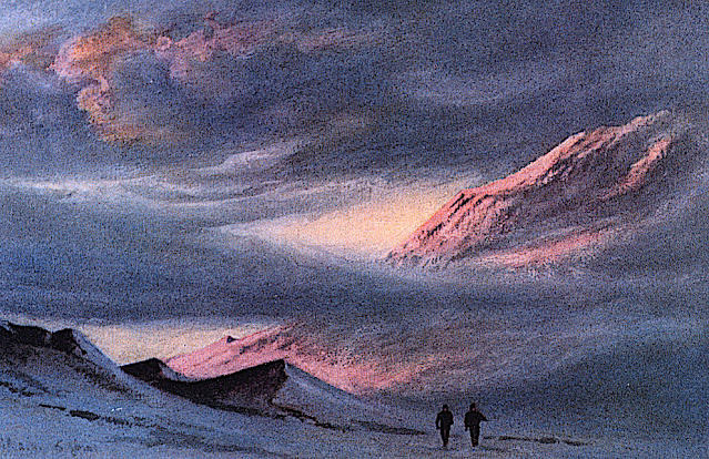
MONT KYFFIN  DÉSSINÉ PAR  EDWARD ADRIAN WILSON

EDWARD ADRIAN WILSON (1872-1912) Mont Kyffin (1, 670m -5, 480ft) Antarctique (Nouvelle-Zélande)

EDWARD ADRIAN WILSON (1872-1912)
Mont Kyffin (1, 670m -5, 480ft)
Antarctique (Nouvelle-Zélande)

L'artiste
Edward Adrian Wilson, surnommé « Oncle Bill » était un médecin anglais, explorateur polaire, historien naturel, peintre et ornithologue. Wilson a participé à deux expéditions britanniques en Antarctique, la Discovery Expedition (1901-1904) et la tragique expédition Terra Nova (1907-1912), toutes deux sous la direction de Scott.
Le Dr Edward A. Wilson est - considéré comme l’un des meilleurs artistes ayant jamais travaillé en Antarctique. Naviguant avec le capitaine Scott à bord du « Discovery » (1901-1904), il est devenu le dernier d'une longue tradition d'« artistes d'exploration » d'une époque où le crayon et l'aquarelle étaient les principales méthodes permettant de produire des enregistrements scientifiques précis de nouvelles terres et d'espèces animalières. Il a combiné des techniques scientifiques, topographiques et paysagères pour produire des images précises et magnifiques du dernier continent inconnu. La force de son œuvre fut telle qu’elle contribua également à fonder la tradition de la peinture animalière moderne. Wilson a notamment capturé sur papier l’essence du vol et du mouvement des oiseaux marins de l’océan Austral.
De retour avec le capitaine Scott à bord du « Terra Nova » (1910-1913) en tant que chef du personnel scientifique, il a continué à decrire le continent et sa faune avec une habileté extraordinaire. Choisi pour accompagner le capitaine Scott au pôle Sud, ses derniers dessins sont issus de l'un des voyages épiques les plus célèbres de l'histoire de l'exploration. Parallèlement à son travail scientifique, le crayon de Wilson a capturé la découverte de la tente de Roald Amundsen au pôle Sud par le capitaine Scott. Wilson mourut, avec les autres membres du British Pole Party, pendant le voyage de retour, en mars 1912. Les dessins et les peintures furent créés au prix d'un travail personnel considérable dans les conditions glaciales dans lesquelles Wilson travaillait. Il souffrait souvent gravement du froid lorsqu'il dessinait, ainsi que de la cécité des neiges ou de coups de soleil aux yeux. Ils constituent un remarquable témoignage de l’une des grandes figures de l’époque héroïque de l’exploration de l’Antarctique. Le livre a été produit en complément des « Carnets de la nature d'Edward Wilson » par deux des petits-neveux de Wilson, pour marquer le centenaire de sa mort.

 
La montagne

Le mont Kyffin (1, 670m -5, 480ft) est un relief brun rougeâtre avec un éperon en pente s'étendant sur4 milles marins au nord, à l'extrême nord de la chaîne du Commonwealth, se projetant du côté Est de Beardmore. Un glacier s'éleve précipitamment au-dessus de lui. Découvert par l'expédition antarctique britannique, 1907-1909 et nommé en l'honneur d'Evan Kyffin-Thomas, l'un des propriétaires du Register, compagnon de voyage de Shackleton lors du voyage depuis l'Angleterre. La chaîne du Commonwealth est une chaîne de montagnes escarpées orientées nord-sud, longue de 60 milles marins (110 km; 69 mi), située dans les montagnes Queen Maud sur la côte Dufek du continent Antarctique. 

 _______________________________________

2011-2024 - Gravir les montagnes en peinture
Un blog de Francis Rousseau  

Wednesday, August 16, 2023

LE MONT KIRKPATRICK PEINT PAR EDWARD ADRIAN WILSON


EDWARD ADRIAN WILSON (1872-1912), Mont Kirkpatrick  (4,528m) Antarctique  (Ile de Ross)   In "Sunset from Hut Point April 2nd 1911 ,watercolor


EDWARD ADRIAN WILSON (1872-1912)
Mont Kirkpatrick  (4,528m)
Antarctique  (Ile de Ross)

In "Sunset from Hut Point", April 2nd 1911, watercolor 


La montagne
Le mont Kirkpatrick est le point culminant du chaînon de la Reine-Alexandra, en Antarctique. Situé à 8 kilomètres à l'ouest du mont Dickerson, le mont Kirkpatrick est aussi le point culminant de la chaîne Transantarctique. Découvert et nommé par l'expédition Nimrod en 1908-1909, la montagne doit son nom à un homme d'affaires de Glasgow, qui était l'un des sponsors de l'expédition.
Sur les pentes du mont Kirkpatrick se trouve l'un des plus importants sites paléontologiques de l'Antarctique : la formation de Hanson, datée du Jurassique inférieur. À cette période, l'Antarctique était plus chaud et faisait partie due l'unique supercontinent qeu compteaut la planete et que l'on nomme Pangée. Ceci explique pourquoi les fossiles trouvés sur ce site peuvent l'être partout ailleurs dans le monde. À plus de 4 000 mètres d'altitude, des restes fossiles de vertébrés y ont été découverts, dont ceux du premier dinosaure trouvé sur le continent, Cryolophosaurus ellioti, nommé en 1994. Une autre espèce de dinosaures, Glacialisaurus hammeri, a été découverte durant une campagne de recherche en 2003-2004. Ce site a également livré les restes d'un cynodonte de la famille des tritylodontidés et un humérus de ptérosaure

 
Le peintre
Edward Adrian Wilson, surnommé « oncle Bill », est un explorateur polaire britannique, médecin, naturaliste, peintre et ornithologue.
Il fait partie des expéditions polaires Discovery et Terra Nova de Robert Falcon Scott. Il trouve la mort, lors de cette dernière, avec toute l'équipe de Scott composée de cinq hommes, en revenant du pôle Sud où ils avaient découvert qu'Amundsen et ses hommes les avaient précédés.

 ________________________________________

2023 - Gravir les montagnes en peinture
Un blog de Francis Rousseau


Wednesday, April 26, 2023

LE RIGI PEINT PAR J.M.W. TURNER


J.M.W. TURNER (1775-1851)
Rigi (1 797 m - 5 897 ft)
Suisse

In "Lake Lucerne, with the Rigi" , vers 1840 - 1849, Crayon et aquarelle rehaussé de touches de blanc, 24,8 x 36,2 cm, Collection Privée


La montagne
Le Rigi (1 797 m - 5 897 ft), également connu sous le nom de Reine des montagnes) est un massif montagneux des Alpes, situé en Suisse centrale. L'ensemble du massif est presque entièrement entouré par les eaux de trois plans d'eau différents : le lac des Quatre-Cantons, le lac de Zoug et le lac Lauerz. La chaîne se trouve dans les Alpes de Schwyz et est divisée entre les cantons de Schwyz et de Lucerne, bien que le sommet principal, nommé Rigi Kulm, à 1 798 mètres d'altitude, se trouve dans le canton de Schwyz. Techniquement, le Rigi ne fait pas partie des Alpes et appartient plutôt au plateau suisse. Il est principalement composé de molasse et d'autres conglomérats, par opposition au schiste grison et au flysch des Alpes.
Le Rigi Kulm et d'autres régions, telles que la station balnéaire de Rigi Kaltbad, sont desservies par les plus anciens chemins de fer de montagne d'Europe, les Rigi Railways. Les Chemins de fer suisses proposent une excursion spéciale aller-retour, le "Rigi-Rundfahrt", couvrant plusieurs segments en train, en train à crémaillère, en gondole (en option) et en bateau à vapeur. Toute la région offre de nombreuses activités telles que le ski ou la luge en hiver et la randonnée en été.
Le nom Rigi vient du vieux haut allemand « rîga » qui signifie « rangée, rayure, sillon », d'après la stratification bien visible sur le versant nord de la montagne. Le nom est enregistré pour la première fois en 1350 sous le nom de Riginun. Le nom a été interprété comme Regina montium "reine des montagnes" par Albrecht von Bonstetten (1479), qui donne cependant Rigena comme forme alternative.
Le mont Rigi a été présenté dans de nombreuses œuvres d'art, y compris des peintures et des publications littéraires. Les peintures les plus célèbres du Rigi étaient peut-être la série de J.M.W. Turner dont plusieurs sont dans la collection de la Tate Britain à Londres.


Le peintre
Joseph Mallord William Turner, plus connu sous le nom de William Turner ou de ses initiales J. M. W. Turnera, est un peintre, aquarelliste et graveur britannique,. Initialement de la veine romantique anglaise, son œuvre est marquée par une recherche novatrice audacieuse qui le fait considérer, avec son contemporain John Constable, comme un précurseur de l'impressionnisme, voir même d'une certaine abstraction. Renommé pour ses huiles, Turner est également un des plus grands maîtres anglais de paysages à l'aquarelle. Il y gagne le surnom de « peintre de la lumière ». La plus grande partie des œuvres de Turner est conservée à la Tate Britain. Il efut influencé par des artistes tels que Willem van de Velde le Jeune, Albert Cuyp, John Robert Cozens, Richard Wilson, Claude Gellée (« Claude le Lorrain ») ou encore Nicolas Poussin. Influencé par la Recherche philosophique sur l'origine de nos idées du Sublime et du Beau d'Edmund Burke datée de 1757, Turner intégra le concept du Sublime dans certaines de ses œuvres, à commencer par Bateaux hollandais dans la tempête, mettant en scène un spectacle terrifiant et à la fois délicieux. Il travailla d'abord la gravure avant l'aquarelle puis la peinture. D'après ses propres souvenirs, il fut marquépar une suite de 16 pièces gravées en clair-obscur d'Elisha Kirkall (1722) d'après Van de Velde le Jeune À partir de 1802, l'envie de voyager le conduit sur le continent européen, principalement en France et en Suisse, d'où il rapporte, évidemment, des aquarelles mais aussi le goût pour certains artistes, comme le Lorrain et ses représentations de la mythologie. Turner peint ainsi des fresques antiques comme Didon construisant Carthage en 1815. Il s'inspire aussi du Liber Veritatis du Lorrain en ce qui concerne son ouvrage, Liber Studiorum, établissant ainsi une classification des différents types de paysages : Marine, Montagne, Pastorale, Historique, Architecturale et Pastorale épique. Il n'hésite pas à tester des combinaisons étranges d'aquarelle et d'huile ainsi que de nouveaux produits dans ses toiles.  Parfois, il utilise même des matériaux inhabituels comme le jus de tabac et la bière vieillie, avec pour conséquence la nécessité des restaurations régulières de ses œuvres. Le peintre et critique d'art George Beaumont qualifie Turner et ses suiveurs comme Callcott de « peintres blancs » car ils mettent au point dès le début du 19e siècle l'utilisation d'un fond blanc pour donner à leurs tableaux la fraîcheur des couleurs et la luminosité, permettant le passage direct des effets de l'aquarelle dans la peinture à l'huile, 3 effets tout à fait différents de ceux obtenus avec les fonds rouges ou bruns traditionnels des anciens Maîtres ".
Son passage d'une représentation plus réaliste à des œuvres plus lumineuses, à la limite de l'imaginaire (Tempête de neige en mer), se fait après un voyage en Italie en 1819 (Campo Santo de Venise). Turner montre le pouvoir suggestif de la couleur, ainsi, son attirance pour la représentation des atmosphères le place pour des critiques d'art comme Clive Bell, comme un précurseur de la modernité en peinture et de l'impressionnisme jusqu'à devenir « le peintre des incendies ». Mais il peint rarement sur le motif contrairement aux impressionnistes, qui feront de cette pratique une règle. Il préfère en effet recomposer en atelier les nuances des paysages, aidé de sa grande mémoire des couleurs. D'autres critiques préfèrent pousser plus loin encore leur analyse en voyant dans l'absence de lignes et de points de fuite ou la dissolution de la forme dans la couleur, notamment dans les paysages marins de Turner, les prémices de l'abstraction lyrique, voire de l'action painting en gestation. 


_________________________________________

2023 - Wandering Vertexes ....
Errant au-dessus des Sommets Silencieux...
Un blog de Francis Rousseau


Sunday, April 2, 2023

MONT DENALI PEINT PAR JORGE RODRIGUEZ-GERADA


JORGE RODRIGUEZ-GERADA (bn.1 966)  Mount Denali (6, 190 m - 20, 310 ft) United States of America (Alaska)

JORGE RODRIGUEZ-GERADA (bn.1 966)
 Mount Denali (6, 190 m - 20, 310 ft)
United States of America (Alaska)


 La montagne
Denali (également connu sous le nom de mont McKinley,)) est le plus haut sommet de montagne en Amérique du Nord, avec une altitude au sommet de 6 190 m - 20 310 pieds au-dessus du niveau de la mer. Denali est le troisième sommet le plus important et le troisième le plus isolé après le mont Everest et l'Aconcagua. Denali est l'un des sept sommets, qui comprend les plus hautes montagnes de chacun des sept continents. Les atteindre tous est considéré comme un défi d'alpinisme, réalisé pour la première fois le 30 avril 1985 par Richard Bass.
Situé dans la chaîne de l'Alaska à l'intérieur de l'État américain de l'Alaska, Denali est la pièce maîtresse du parc national et de la réserve de Denali.
Denali a deux sommets importants: le sommet sud est le plus élevé, alors que le sommet nord a une altitude de 19 470 pieds (5 934 m). Le sommet nord est parfois compté comme un pic distinct et parfois non; il est rarement escaladé, sauf par ceux qui font des voies sur le versant nord du massif.
Cinq grands glaciers coulent des pentes de la montagne. Le glacier Peters se trouve sur le côté nord-ouest du massif, tandis que le glacier Muldrow tombe de ses pentes nord-est. Juste à l'est du Muldrow, et jouxtant le côté est du massif, se trouve le glacier Traleika. Le glacier Ruth se trouve au sud-est de la montagne et le glacier Kahiltna mène au côté sud-ouest de la montagne. Avec une longueur de 44 mi (71 km), le glacier Kahiltna est le plus long glacier de la chaîne de l'Alaska.
Les Koyukon Athabaskans qui habitent la région autour de la montagne ont pendant des siècles appelé le pic Dinale ou Denali. Il a été brièvement appelé Densmore's Mountain à la fin des années 1880 et au début des années 1890 en l'honneur de Frank Densmore, un prospecteur de l'Alaska qui fut le premier Européen à atteindre la base de la montagne.
En 1896, un chercheur d'or l'a nommé McKinley  en soutien au candidat à la présidence de l'époque, William McKinley, t devenu président l'année suivante. Les États-Unis ont officiellement reconnu le nom de Mount McKinley après que le président Wilson a signé le Mount McKinley National Park Act du 26 février 1917.
En 1965, Lyndon B. Johnson a déclaré les sommets nord et sud de la montagne les "Churchill Peaks", en l'honneur de l'homme d'État britannique Winston Churchill. Le Conseil des noms géographiques de l'Alaska a changé le nom de la montagne en Denali en 1975, comme on l'appelle localement.
Le 30 août 2015, juste avant une visite présidentielle en Alaska, l'administration de Barack Obama a annoncé que le nom Denali serait rétabli conformément à la désignation de l'Alaska Geographic Board.


L'artiste
Jorge Rodríguez-Gerada est un artiste contemporain cubano-américain. Né à Cuba le 5 février 1966 et élevé aux États-Unis. Il crée principalement des œuvres dans des espaces urbains à grande échelle. Il a été membre fondateur du mouvement de brouillage culturel new-yorkais du début des années 1990, travaillant d'abord avec le groupe "Artfux" et plus tard avec le "Cicada Corps of Artists". Au cours de cette période, il a également lancé des interventions sur les panneaux d'affichage et la publicité publique. En 1997, il a commencé à s'orienter vers le travail en solo. En 2002, Rodríguez-Gerada a déménagé à Barcelone où il s'est concentré sur les dessins au fusain éphémères à grande échelle, qui composent sa série Identity. Il a ensuite développé la Série Terrestre ; des terrassements éphémères si vastes qu'ils sont visibles de l'espace. D'autres projets en cours incluent la série Identity Composite et des œuvres d'art plus petites qu'il appelle Fragment Series, Urban Analogies et Memorylythics. Depuis 2009, il organise le festival annuel AvantGuard Urbano ; un petit festival d'art urbain avec de grands noms, qui s'est tenu à Tudela, en Navarre, dans le nord de l'Espagne. Il participe également à de nombreux salons et expositions.

 __________________________________________

2023 - Wandering Vertexes ....
Errant au-dessus des Sommets Silencieux...
Un blog de Francis Rousseau 


Saturday, January 28, 2023

MITRE PEAK ET MONT PEMBROKE PEINTS PAR LAURENCE WILLIAM WILSON


LAURENCE WILLIAM WILSON (1850-1912) Mitre Peak / Rahotu (1,683m - 5,522 ft) Mont Pembroke ( 2,015m) Nouvelle-Zélande   In Milford Sound with Mount Pembroke Peak and Mitre Peak/Rahotu 1901, watercolor on Bristol board- South Coast Antiques & Gallery


LAURENCE WILLIAM WILSON (1850-1912)
Mitre Peak / Rahotu (1,683m - 5,522 ft)
Mont Pembroke ( 2,015m)
Nouvelle-Zélande


In Milford Sound with Mount Pembroke Peak and Mitre Peak/Rahotu 1901, watercolor on Bristol board- South Coast Antiques & Gallery


Les montagnes
Mitre Peak/ Rahotu (1 683 m) est une montagne emblématique de Nouvelle-Zélande, située sur la rive du Milford Sound (South Island). C'est l'un des sommets les plus photographiés du pays. C'est la forme particulière évoquant un couvre chef d'évêque chrétien, la mitre, qui a donné son nom à ce sommet. Il a été nommé ainsi par le capitaine John Lort Stokes du HMS Acheron. Le sommet jaillit  du rivage de Milford Sound, dans le parc national de Fiordland, au sud-ouest de l'île du Sud, offrant un spectacle époustouflant. La montagne s'élève presque verticalement à partir de la surface de l'eau qui est en réalité un fjord. Le pic est un ensemble étroitement groupé de cinq pics, Mitre Peak n'étant même pas le plus haut. Selon le point de vue ou l'on se place, Mitre Peak  peut apparaître comme un seul pic. Milford Sound fait partie de Te Wahipounamu, un site inscrit du patrimoine mondial par l'UNESCO. Le seul accès routier à Milford Sound se fait par la State Highway 94,  l'une des routes les plus pittoresques de Nouvelle-Zélande. Mitre Peak est difficile à gravir et peu de gens le font. La première tentative a été faite en 1883, mais a été avortée en raison du mauvais temps. La tentative suivante eut lieu le 13 mars 1911 par JR Dennistoun de Peel Forest. Il y a six voies jusqu'à Mitre Peak, et la plupart des grimpeurs commencent par prendre un bateau pour Sinbad Bay. 

Le mont Pembroke, ou Mount Pembroke en anglais, est un sommet de Nouvelle-Zélande.  Il culmine à 2 015 mètres d'altitude au nord de Milford Sound, un fjord du parc national de Fiordland qui baigne sa base.

Le peintre
Laurence William Wilson émigre à Auckland en 1877 puis voyage beaucoup avant de s'installer à Dunedin en 1884. Il peint à la fois à l'huile et à l'aquarelle, devient compagnon de peinture de George O'Brien puis  professeur. L'un de ses élèves fut 'artiste Dunedin Alfred O'Keefe. En 1895, LW Wilson avec Grace Joel, Alfred O'Keefe, Jane Wimperis et Girolami Nerli formnt le Easel Club, émanation artistique de  l'établissement de Dunedin, qui offrait un programme de cours spéciaux et l'introduction d'une femme modèle professionnelle pour le nu.  En 1904, LW Wilson quitta Dunedin pour Melbourne où il passa 5 mois sur une peinture commandée de la ville avant de partir pour l'Angleterre, retournant finalement en Nouvelle-Zélande via l'Inde et l'Afrique. Il a exposé avec la Canterbury Society of Arts en 1882 et l'Otago Art Society entre 1994 et 1904. Son travail a été inclus dans l'exposition NZ and South Seas Dunedin 1889-90 et à l'exposition St Louis en 1904. LW Wilson est représenté dans le collections de toutes les grandes galeries publiques de Nouvelle-Zélande.

_________________________________________

2023 - Wandering Vertexes ....
            Errant au-dessus des Sommets Silencieux...
            Un blog de Francis Rousseau


Monday, September 5, 2022

PATON PEAK PAINTED BY EDWARD ADRIAN WILSON

EDWARD ADRIAN WILSON (1872-1912), Paton Peak (771 m -2530 ft) Antarctica (Beaufort Island)  In Beaufort Island, Ross Sea, watercolor, 1911

EDWARD ADRIAN WILSON (1872-1912),
Paton Peak (771 m -2530 ft)
Antarctica (Beaufort Island)

In Beaufort Island, watercolor, 1911, Royal Geographical Society Museum, London


The mountain
Paton Peak (771m-2,530 ft) is the highest point in Beaufort Island, an island in Antarctica's Ross Sea,  probably an  eroded basaltic stratovolcano of unknown age.  It is semi-circular in shape. It is the northernmost feature of the Ross Archipelago, lying 21 kilometres (13 miles) north of Cape Bird, Ross Island. It is approximately 18.4 km2 (7 square miles) in area. It was first charted by James Clark Ross in 1841. Ross named the island for Sir Francis Beaufort, hydrographer to the British Royal Navy. Much of the western side of the island is covered by moderately sloping ice fields with ice cliffs about 20 m (66 ft) high on the coast. The east and south sides of the island are mostly free of ice, with steep inaccessible cliffs that rise straight from the sea. Here the ice-free ground has a gentle slope and has ponds in summer and small meltwater streams that drain to the coast. The island has a small colony of breeding emperor penguins on nearshore sea ice at the northern end, a large Adélie penguin colony on a raised beach called Cadwalader Beach at the south-western end, and several breeding colonies of south polar skua.  It has been designated an Important Bird Area by BirdLife International.


The artist
Edward Adrian Wilson, nicknamed "Uncle Bill" was an English physician, polar explorer, natural historian, painter and ornithologist. Wilson took part in two British expeditions to Antarctica, the Discovery Expedition (1901-1904) and the tragic Terra Nova Expedition (1907-1912), both under the leadership of Scott.
Dr. Edward A. Wilson is widely regarded as one of the finest artists ever to have worked in the Antarctic. Sailing with Captain Scott aboard 'Discovery' (1901-1904), he became the last in a long tradition of 'exploration artists' from an age when pencil and water-colour were the main methods of producing accurate scientific records of new lands and animal species. He combined scientific, topographical and landscape techniques to produce accurate and beautiful images of the last unknown continent. Such was the strength of his work that it also helped to found the tradition of modern wildlife painting. In particular Wilson captured the essence of the flight and motion of Southern Ocean sea-birds on paper.
Returning with Captain Scott aboard 'Terra Nova' (1910-1913) as Chief of Scientific Staff, he continued to record the continent and its wildlife with extraordinary deftness. Chosen to accompany Captain Scott to the South Pole, his last drawings are from one of the most famous epic journeys in exploration history. Along with his scientific work, Wilson's pencil recorded the finding of Roald Amundsen's tent at the South Pole by Captain Scott. Wilson died, along with the other members of the British Pole Party, during the return journey, in March 1912. The drawings and paintings were created at considerable personal cost in the freezing conditions in which Wilson worked. He often suffered severely from the cold whilst sketching and also from snow-blindness, or sunburn of the eye. They provide a remarkable testament to one of the great figures of the heroic age of Antarctic exploration. The book has been produced as a companion volume to 'Edward Wilson's Nature Notebooks' by two of Wilson's great nephews, to mark the centenary of his death.

_______________________________
2022 - Wandering Vertexes..
Un blog de Francis Rousseau

Friday, September 2, 2022

MOUNT ASPIRING / TITETEA BY LAURENCE WILLIAM WILSON


LAURENCE WILLIAM WILSON (1851-1912) Mount Aspiring / Tititea (3, 033 m -9,951 ft) New Zealand  In Mount Aspiring, Matukituki River, watercolour, Christchurh Art Gallery- Te Puna o Waiwhetu.


LAURENCE WILLIAM WILSON (1851-1912)
Mount Aspiring / Tititea (3, 033 m -9,951 ft)
New Zealand

In Mount Aspiring, Matukituki River, watercolour,
Christchurh Art Gallery- Te Puna o Waiwhetu.


The mountain
Mount Aspiring / Tititea is New Zealand's highest mountain outside the Aoraki/Mount Cook region.
Set within Otago's Mount Aspiring National Park, it has a height of 3,033 metres (9,951 ft). Māori named it Tititea, which translates as Glistening Peak. It was named in December 1857 by the Chief Surveyor for the Otago Province, John Turnbull Thomson.[2] It is also often called 'the Matterhorn of the South,' for its pyramidal peak when seen from the Matukituki River. The first ascent was on 23 November 1909 by Major Bernard Head and guides Jack Clarke and Alec Graham.[3] Head's party climbed to the summit ridge by the west face from the Bonar Glacier, a route not repeated until 1965.
Mount Aspiring / Tititea sits slightly to the west of the main divide, 30 kilometres west of Lake Wanaka.[2] It lies at the junction of three major glacial systems — the Bonar Glacier, which drains into the Waipara River, and the Volta and Therma Glaciers, which both drain into the Waitoto River. The Waipara is a tributary of the Arawhata River, and both the Arawhata and Waitoto Rivers flow out to the west coast in between Haast and Jackson Bay.


The painter
Laurence William Wilson emigrated to Auckland in 1877 and then travelled extensively to settle in Dunedin in 1884. He painted in both oils and watercolours, became a painting companion of George O'Brien and a teacher. One of his pupils was the Dunedin artist Alfred O'Keefe. In 1895, LW Wilson together with Grace Joel, Alfred O'Keefe, Jane Wimperis and Girolami Nerli formed the Easel Club , a breakaway from the Dunedin Establishment, which offered a programme of special classes and the introduction of a professional lady model for life drawing. In 1904 LW Wilson left Dunedin for Melbourne where he spent 5 months on a commissioned painting of the city before he set out for England, eventually returning to New Zealand via India and Africa. He exhibited with the Canterbury Society of Arts in 1882 and the Otago Art Society between 1994 and 1904. His work was included in the NZ and South Seas Exhibition Dunedin 1889-90 and at the St Louis Exposition in 1904. LW Wilson is represented in the collections of all the major public galleries in New Zealand.

___________________________________________

2022 - Wandering Vertexes...
by Francis Rousseau

Wednesday, February 17, 2021

MOUNT EREBUS BY EDWARD ADRIAN WILSON


https://wanderingvertexes.blogspot.com/2021/02/mount-erebus-by-edward-adrian-wilson.html

EDWARD ADRIAN WILSON (1872-1912)
Mount Erebus (3, 794 m - 12, 448ft)
Antarctica (Ross Island)


In Mount Erebus, 1906, watercolour, Royal Geographical Society Museum, London


The mountain
Mount Erebus (3, 794 m - 12, 448ft), not to be confused with Mount Elbrus is the second-highest volcano in Antarctica (after Mount Sidley) and the southernmost active volcano on Earth. It is the sixth highest ultra mountain on an island, located on Ross Island, which is also home to three inactive volcanoes: Mount Terror, Mount Bird, and Mount Terra Nova.
The volcano has been active since c. 1.3 million years ago and is the site of the Mount Erebus Volcano Observatory run by the New Mexico Institute of Mining and Technology.
Mount Erebus was discovered on January 27, 1841 (and observed to be in eruption) by polar explorer Sir James Clark Ross who named it and its companion, Mount Terror, after his ships, Erebus and Terror (which were later used by Sir John Franklin on his disastrous Arctic expedition). Erebus is a dark region in Hades in Greek mythology. Present with Ross on the Erebus was the young Joseph Hooker, future president of the Royal Society and close friend of Charles Darwin. Erebus was an Ancient Greek primordial deity of darkness, the son of Chaos.
Mount Erebus is classified as a polygenetic stratovolcano. The bottom half of the volcano is a shield and the top half is a stratocone. The composition of the current eruptive products of Erebus is anorthoclase-porphyritic tephritic phonolite and phonolite, which are the bulk of exposed lava flow on the volcano. Erebus is the world's only presently erupting phonolite volcano.
Researchers spent more than three months during the 2007–08 field season installing an unusually dense array of seismometers around Mount Erebus to listen to waves of energy generated by small, controlled blasts from explosives they buried along its flanks and perimeter and to record scattered seismic signals generated by lava lake eruptions and local ice quakes. By studying the refracted and scattered seismic waves, the scientists produced an image of the uppermost (top few km) of the volcano to understand the geometry of its "plumbing" and how the magma rises to the lava lake. These results demonstrated a complex upper-volcano conduit system with appreciable upper-volcano magma storage to the northwest of the lava lake at depths hundreds of meters below the surface.


The artist
Edward Adrian Wilson, nicknamed "Uncle Bill" was an English physician, polar explorer, natural historian, painter and ornithologist. Wilson took part in two British expeditions to Antarctica, the Discovery Expedition (1901-1904) and the tragic Terra Nova Expedition (1907-1912), both under the leadership of Scott.
Dr. Edward A. Wilson is widely regarded as one of the finest artists ever to have worked in the Antarctic. Sailing with Captain Scott aboard 'Discovery' (1901-1904), he became the last in a long tradition of 'exploration artists' from an age when pencil and water-colour were the main methods of producing accurate scientific records of new lands and animal species. He combined scientific, topographical and landscape techniques to produce accurate and beautiful images of the last unknown continent. Such was the strength of his work that it also helped to found the tradition of modern wildlife painting. In particular Wilson captured the essence of the flight and motion of Southern Ocean sea-birds on paper.
Returning with Captain Scott aboard 'Terra Nova' (1910-1913) as Chief of Scientific Staff, he continued to record the continent and its wildlife with extraordinary deftness. Chosen to accompany Captain Scott to the South Pole, his last drawings are from one of the most famous epic journeys in exploration history. Along with his scientific work, Wilson's pencil recorded the finding of Roald Amundsen's tent at the South Pole by Captain Scott. Wilson died, along with the other members of the British Pole Party, during the return journey, in March 1912. The drawings and paintings were created at considerable personal cost in the freezing conditions in which Wilson worked. He often suffered severely from the cold whilst sketching and also from snow-blindness, or sunburn of the eye. They provide a remarkable testament to one of the great figures of the heroic age of Antarctic exploration. The book has been produced as a companion volume to 'Edward Wilson's Nature Notebooks' by two of Wilson's great nephews, to mark the centenary of his death.


_______________________________
2021 - Wandering Vertexes..
Un blog de Francis Rousseau

Tuesday, December 8, 2020

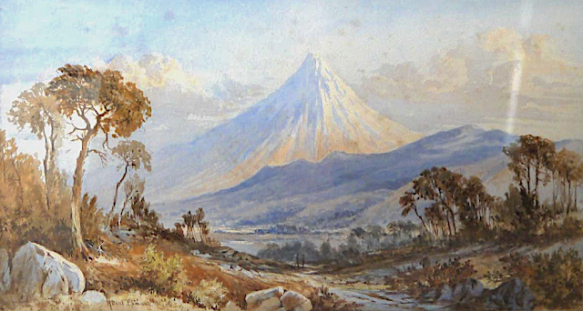
TARANAKI / MOUNT EGMONT PAINTED BY LAURENCE WILLIAM WILSON

https://wanderingvertexes.blogspot.com/2020/12/taranaki-mount-egmont-painted-by.html
 
 
LAURENCE WILLIAM WILSON (1851-1912)
Taranaki /Mount Egmont (2,518 m - 8,261 ft)
New Zealand (Northen Island)

The mountain
Taranaki or Mount Egmont (2,518 m - 8,261 ft) is an active but quiescent stratovolcano in the Taranaki region on the west coast of New Zealand's North Island. Although the mountain is more commonly referred to as Taranaki, it has two official names under the alternative names policy of the New Zealand Geographic Board. The mountain is one of the most symmetrical volcanic cones in the world. There is a secondary cone, Fanthams Peak or Panitahi in Māori (1,966 m - 6,450 ft), on the south side. Because of its resemblance to Mount Fuji, Taranaki provided the backdrop for the movie The Last Samurai.
For many centuries the mountain was called Taranaki by Māori. The Māori word tara means mountain peak, and naki is thought to come from ngaki, meaning "shining", a reference to the snow-clad winter nature of the upper slopes. It was also named Pukehaupapa and Pukeonaki by Iwi who live in the region in ancient times.
According to Māori mythology, Taranaki once resided in the middle of the North Island, with all the other New Zealand volcanoes. The beautiful Pihanga was coveted by all the mountains, and a great battle broke out between them. Tongariro eventually won the day, inflicted great wounds on the side of Taranaki, and causing him to flee. Taranaki headed westwards, following Te Toka a Rahotu and forming the deep gorges of the Whanganui River, paused for a while, creating the depression that formed the Te Ngaere swamp, then heading north. Further progress was blocked by the Pouakai ranges, and as the sun came up Taranaki became petrified in his current location. When Taranaki conceals himself with rainclouds, he is said to be crying for his lost love, and during spectacular sunsets, he is said to be displaying himself to her. In turn, Tongariro's eruptions are said to be a warning to Taranaki not to return.
Captain Cook named it Mount Egmont on 11 January 1770 after John Perceval, 2nd Earl of Egmont, a former First Lord of the Admiralty who had supported the concept of an oceanic search for Terra Australis Incognita. Cook described it as "of a prodigious height and its top cover'd with everlasting snow" surrounded by a "flat country ... which afforded a very good aspect, being clothed with wood and verdure".
When Marc-Joseph Marion du Fresne made landfall off Taranaki on 25 March 1772 he named the mountain Pic Mascarin. He was unaware of Cook's earlier visit. It appeared as Mount Egmont on maps until 29 May 1986, when the Minister of Lands ruled that "Mount Taranaki" would be an alternative and equal official name. The Egmont name still applies to the national park that surrounds the peak and geologists still refer to the peak as the Egmont Volcano.
Taranaki is geologically young, having commenced activity approximately 135,000 years ago. The most recent volcanic activity was the production of a lava dome in the crater and its collapse down the side of the mountain in the 1850s or 1860s. Between 1755 and 1800, an eruption sent a pyroclastic flow down the mountain's northeast flanks, and a moderate ash eruption occurred about 1755, of the size of Ruapehu's activity in 1995/1996. The last major eruption occurred around 1655. Recent research has shown that over the last 9,000 years minor eruptions have occurred roughly every 90 years on average, with major eruptions every 500 years.

The painter
Laurence William Wilson emigrated to Auckland in 1877 and then travelled extensively to settle in Dunedin in 1884. He painted in both oils and watercolours, became a painting companion of George O'Brien and a teacher. One of his pupils was the Dunedin artist Alfred O'Keefe. In 1895, LW Wilson together with Grace Joel, Alfred O'Keefe, Jane Wimperis and Girolami Nerli formed the Easel Club , a breakaway from the Dunedin Establishment, which offered a programme of special classes and the introduction of a professional lady model for life drawing. In 1904 LW Wilson left Dunedin for Melbourne where he spent 5 months on a commissioned painting of the city before he set out for England, eventually returning to New Zealand via India and Africa. He exhibited with the Canterbury Society of Arts in 1882 and the Otago Art Society between 1994 and 1904. His work was included in the NZ and South Seas Exhibition Dunedin 1889-90 and at the St Louis Exposition in 1904. LW Wilson is represented in the collections of all the major public galleries in New Zealand.

___________________________________________

2020 - Wandering Vertexes...
by Francis Rousseau

Saturday, November 28, 2020

WICK MOUNTAINS PAINTED BY LAURENCE WILLIAM WILSON

 https://wanderingvertexes.blogspot.com/2020/11/wick-mountains-painted-by-laurence.html

LAURENCE WILLIAM  WILSON  (1851-1912),
Wick Mountains (993 m - 3,259 ft)
New Zealand

In Wick Mountains upper Arthur River, watercolor,  TePapa Tongarewa Museum of New Zealand


The mountains
The Wick Mountains lie between the Arthur, Cleddau, and Clinton Valleys. This includes the peaks on the west of the Cleddau Valley, from Mt Moir to Sheerdown Peak. That is where they are provisionally placed on this site. The peaks near Homer Saddle – Mt Moir, Moir’s Mate, and the Mateʻs Little Brother – contain a wealth of classic rock routes on amazing diorite. The close proximity of this region to the road makes the routes accessible as day climbs from Homer Hut. Many routes lie on north to west faces, receiving their first rays of sun in the late morning.

The painter
Laurence William Wilson emigrated to Auckland in 1877 and then travelled extensively to settle in Dunedin in 1884. He painted in both oils and watercolours, became a painting companion of George O'Brien and a teacher. One of his pupils was the Dunedin artist Alfred O'Keefe. In 1895, LW Wilson together with Grace Joel, Alfred O'Keefe, Jane Wimperis and Girolami Nerli formed the Easel Club , a breakaway from the Dunedin Establishment, which offered a programme of special classes and the introduction of a professional lady model for life drawing. In 1904 LW Wilson left Dunedin for Melbourne where he spent 5 months on a commissioned painting of the city before he set out for England, eventually returning to New Zealand via India and Africa. He exhibited with the Canterbury Society of Arts in 1882 and the Otago Art Society between 1994 and 1904. His work was included in the NZ and South Seas Exhibition Dunedin 1889-90 and at the St Louis Exposition in 1904. LW Wilson is represented in the collections of all the major public galleries in New Zealand.

___________________________________________

2020 - Wandering Vertexes...
by Francis Rousseau

Wednesday, September 2, 2020

MITRE PEAK / RAHOTU PAINTED BY LAURENCE WILLIAM WILSON


LAURENCE WILLIAM  WILSON  (1851-1912)
Mitre Peak/ Rahotu (1,683m - 5,522 ft)
New Zealand 

In Mitre Peak, Milford Sound, oil on canvas,  Christchurch Art Gallery, New Zealand

The mountain
Mitre Peak/ Rahotu (1,683m - 5,522 ft) is an iconic mountain in the South Island of New Zealand, located on the shore of Milford Sound. It is one of the most photographed peaks in the country. The distinctive shape of the peak in southern New Zealand gives the mountain its name, after the mitre headwear of Christian bishops. It was named by Captain John Lort Stokes of the HMS Acheron.
Part of the reason for its iconic status is its location. Close to the shore of Milford Sound, in the Fiordland National Park in the southwestern South Island, it is a stunning sight. The mountain rises near vertically from the water of Milford Sound, which technically is a fjord.
The peak is actually a closely grouped set of five peaks, with Mitre Peak not even the tallest one, however from most easily accessible viewpoints, Mitre Peak appears as a single point.
Milford Sound is part of Te Wahipounamu, a World Heritage Site as declared by UNESCO.
The only road access to Milford Sound is via State Highway 94, in itself one of the most scenic roads in New Zealand

The painter
Laurence William Wilson emigrated to Auckland in 1877 and then travelled extensively to settle in Dunedin in 1884. He painted in both oils and watercolours, became a painting companion of George O'Brien and a teacher. One of his pupils was the Dunedin artist Alfred O'Keefe. In 1895, LW Wilson together with Grace Joel, Alfred O'Keefe, Jane Wimperis and Girolami Nerli formed the Easel Club , a breakaway from the Dunedin Establishment, which offered a programme of special classes and the introduction of a professional lady model for life drawing. In 1904 LW Wilson left Dunedin for Melbourne where he spent 5 months on a commissioned painting of the city before he set out for England, eventually returning to New Zealand via India and Africa. He exhibited with the Canterbury Society of Arts in 1882 and the Otago Art Society between 1994 and 1904. His work was included in the NZ and South Seas Exhibition Dunedin 1889-90 and at the St Louis Exposition in 1904. LW Wilson is represented in the collections of all the major public galleries in New Zealand.

___________________________________________

2020 - Wandering Vertexes...
by Francis Rousseau


Monday, July 20, 2020

MOUNT EARNSLAW / PIKIRAKATAHI BY LAURENCE WILLIAM WILSON


LAURENCE WILLIAM  WILSON  (1851-1912),
Mount Earnslaw / Pikirakatahi  (2,819m -9,249 ft)
New Zealand 

In  Mount Earnslaw, 1887,   oil on canvas., 84x120cm

The mountain 
Mount Earnslaw, (2,819m -9,249 ft) also named Pikirakatahi by Māori is located on New Zealand's South Island. It is named after Earnslaw (formerly Herneslawe) village in the parish of Eccles, Berwickshire, hometown of the surveyor John Turnbull Thomson's father.
Mount Earnslaw is within Mount Aspiring National Park at the southern end of the Forbes Range of New Zealand's Southern Alps. It is located 25 kilometres north of the settlement of Glenorchy, which lies at the northern end of Lake Wakatipu.

The painter
Laurence William Wilson emigrated to Auckland in 1877 and then travelled extensively to settle in Dunedin in 1884. He painted in both oils and watercolours, became a painting companion of George O'Brien and a teacher. One of his pupils was the Dunedin artist Alfred O'Keefe. In 1895, LW Wilson together with Grace Joel, Alfred O'Keefe, Jane Wimperis and Girolami Nerli formed the Easel Club , a breakaway from the Dunedin Establishment, which offered a programme of special classes and the introduction of a professional lady model for life drawing. In 1904 LW Wilson left Dunedin for Melbourne where he spent 5 months on a commissioned painting of the city before he set out for England, eventually returning to New Zealand via India and Africa. He exhibited with the Canterbury Society of Arts in 1882 and the Otago Art Society between 1994 and 1904. His work was included in the NZ and South Seas Exhibition Dunedin 1889-90 and at the St Louis Exposition in 1904. LW Wilson is represented in the collections of all the major public galleries in New Zealand.

___________________________________________

2020 - Wandering Vertexes...
by Francis Rousseau


Wednesday, June 10, 2020

BEN NEVIS PAINTED BY JAMES ALFRED AÏIKEN


JAMES ALFRED AITKEN (1846-1897)
Ben Nevis (1,344 m - 4, 118 ft)
United KIngdom  (Scotland)

In  Ben Nevis- The First Snow, Glasgow Museums Resource Centre


The mountain 
Ben Nevis  (1,344 m - 4, 118 ft)  in Scottish Gaelic: Beinn Nibheis is the highest mountain in the British Isles, located in Scotland, at the western end of the Grampian Mountains in the Lochaber area of the Scottish Highlands, close to the town of Fort William.
The mountain is a popular destination, attracting an estimated 100,000 ascents a year, around three-quarters of which use the Pony Track from Glen Nevis. The 700 metre - 2,300 ft cliffs of the north face are among the highest in Scotland, providing classic scrambles and rock climbs of all difficulties for climbers and mountaineers. They are also the principal locations in Scotland for ice climbing.
The summit, which is the collapsed dome of an ancient volcano, features the ruins of an observatory which was continuously staffed between 1883 and 1904. The meteorological data collected during this period are still important for understanding Scottish mountain weather. C. T. R. Wilson was inspired to invent the cloud chamber after a period spent working at the observatory.
More about Ben Nevis 

The painter
James Alfred Aitken was a Scottish landscape painter.
Aitken studied art with Horatio McCulloch, before moving to Dublin. There he attended the Royal Dublin Society's school, and had Henry MacManus as teacher.]
In 1872 Aitken moved to Glasgow. He exhibited at the Royal Academy, Glasgow Institute and Royal Hibernian Academy.


___________________________________

2020 - Wandering Vertexes...
by Francis Rousseau


Sunday, May 31, 2020

MOUNT TUTOKO PAINTED BY LAURENCE WILLIAM WILSON


LAURENCE WILLIAM  WILSON  (1851-1912)
Mount Tutoko  (2,723 m -8,934 ft) 
New Zealand (South Island)
 In  Mount Tutoko from Pykes River, Martins Bay Oil on canvas, 1900, Private collection 


The mountain
Mount Tutoko (2,723 m -8,934 ft)  is the highest peak in Fiordland National Park, in southwest New Zealand. It lies between the Hollyford Valley and Milford Sound, 15 kilometres due north of the Homer Tunnel at the northern end of the Darran Mountains. The glacier-covered mountain is visible from the Hollyford Track. Two slightly lower summits lie just to the south of the main peak. The first ascent of Tutoko was by Samuel Turner and Peter Graham in 1924, climbing by way of the northwest ridge. The mountain is thought to have been named after Tutoko, a Māori chief who lived at Martin's Bay, close to the mouth of the Hollyford River.

The painter

Laurence William Wilson emigrated to Auckland in 1877 and then travelled extensively to settle in Dunedin in 1884. He painted in both oils and watercolours, became a painting companion of George O'Brien and a teacher. One of his pupils was the Dunedin artist Alfred O'Keefe. In 1895, LW Wilson together with Grace Joel, Alfred O'Keefe, Jane Wimperis and Girolami Nerli formed the Easel Club , a breakaway from the Dunedin Establishment, which offered a programme of special classes and the introduction of a professional lady model for life drawing. In 1904 LW Wilson left Dunedin for Melbourne where he spent 5 months on a commissioned painting of the city before he set out for England, eventually returning to New Zealand via India and Africa. He exhibited with the Canterbury Society of Arts in 1882 and the Otago Art Society between 1994 and 1904. His work was included in the NZ and South Seas Exhibition Dunedin 1889-90 and at the St Louis Exposition in 1904. LW Wilson is represented in the collections of all the major public galleries in New Zealand.

___________________________________________
2020 - Wandering Vertexes...
by Francis Rousseau

Wednesday, March 11, 2020

MOUNT EREBUS (5) BY EDWARD ADRIAN WILSON


EDWARD ADRIAN WILSON (1872-1912)
Mount Erebus (3, 794 m - 12, 448ft)
Antarctica (Ross Island)

 In  Mountain range, McMurdo Strait, watercolor, 7.4 x 11.3 cm, Private collection 


The mountain
Mount Erebus (3, 794 m - 12, 448ft), not to be confused with Mount Elbrus is the second-highest volcano in Antarctica (after Mount Sidley) and the southernmost active volcano on Earth. It is the sixth highest ultra mountain on an island, located on Ross Island, which is also home to three inactive volcanoes: Mount Terror, Mount Bird, and Mount Terra Nova.
More about the mountain

The artist
Edward Adrian Wilson, nicknamed "Uncle Bill" was an English physician, polar explorer, natural historian, painter and ornithologist. Wilson took part in two British expeditions to Antarctica, the Discovery Expedition (1901-1904) and the tragic Terra Nova Expedition (1907-1912), both under the leadership of Scott.
More about the artist 

_______________________________ 

2020 - Wandering Vertexes...
by Francis Rousseau


Wednesday, February 12, 2020

MOUNT EREBUS (5) BY EDWARD ADRIAN WILSON


EDWARD ADRIAN WILSON (1872-1912)
Mount Erebus (3, 794 m - 12, 448ft)
Antarctica

In Slopes of Mount Erebus,  Watercolour on paper laid down on card Painting, 13.3 x 21.6 cm, 1911,  Royal Geographical Society Museum, London

The mountain 
Mount Erebus (3, 794 m - 12, 448ft), not to be confused with Mount Elbrus is the second-highest volcano in Antarctica (after Mount Sidley) and the southernmost active volcano on Earth. It is the sixth highest ultra mountain on an island, located on Ross Island, which is also home to three inactive volcanoes:  Mount Terror, Mount Bird, and Mount Terra Nova.
The volcano has been active since c. 1.3 million years ago and is the site of the Mount Erebus Volcano Observatory run by the New Mexico Institute of Mining and Technology.
Mount Erebus was discovered on January 27, 1841 (and observed to be in eruption) by polar explorer Sir James Clark Ross who named it and its companion, Mount Terror, after his ships, Erebus and Terror (which were later used by Sir John Franklin on his disastrous Arctic expedition). 
The artist
Edward Adrian Wilson,  nicknamed "Uncle Bill" was an English physician, polar explorer, natural historian, painter and ornithologist. Wilson took part in two British expeditions to Antarctica, the Discovery Expedition (1901-1904)  and the tragic Terra Nova Expedition (1907-1912), both under the leadership of Scott.
_______________________________ 

2020 - Wandering Vertexes..
Un blog de Francis Rousseau


Tuesday, January 14, 2020

MOUNT EREBUS (2) BY EDWARD ADRIAN WILSON


EDWARD ADRIAN WILSON (1872-1912)
Mount Erebus (3, 794 m - 12, 448ft)
Antarctica

 In  Mt Erebus - Aug. 17. 1911 - Noon.' on the mount,  Watercolour on paper, 13.1 x 21.1cm, 
Private collection (via Christie's)

About this watercolour
'The Summit of Mount Erebus' taken in August 1911, facing p.150.
Very similkar to  Mount Erebus 1911, watercolour,  Museum- Royal Geographical Society,
Notes :
"Thursday, August 17. - The weather has been extremely kind to us of late; we haven't a single grumble against it. Th temperature hovers pretty constantly at about -35°, there is very little wind and the sky is clear and bright. In such weather one sees well for more than three hours before and after noon, the landscape unfolds itself, and the sky colours are always delicate and beautiful. At noon today there was bright sunlight on the tops of the Western Peaks and on the summit and steam of Erebus -- of late the vapour cloud of Erebus has been exceptionally heavy and fantastic in form."

About Mount Erebus 

About the artist  


_______________________________

2020 - Wandering Vertexes.
Un blog de Francis Rousseau

Sunday, September 8, 2019

MOUNT TERROR AND CAPE CROZIER BY CHARLES HAMILTON SMITH


CHARLES HAMILTON SMITH (1776-1859)
Mount Terror (3, 262m - 10, 702 ft) 
Antarctica (Ross Island)

In Cap Crozier and Mount Terror - Watercolour from Views of Polar region, Connecticut Yale Center for British arts


The mountain 

Mount Terror (3, 262m - 10, 702 ft) is a large shield volcano that forms the eastern part of Ross Island, Antarctica. It has numerous cinder cones and domes on the flanks of the shield and is mostly under snow and ice. It is the second largest of the four volcanoes which make up Ross Island and is somewhat overshadowed by its neighbor, Mount Erebus, 30 km (19 mi) to the west. Mt. Terror was named in 1841 by Sir James Clark Ross for his second ship, HMS Terror. The captain of Terror was Captain Francis Crozier who was a close friend of Ross.
Those areas are from 0.82 to 1.75 million years old. Mount Terror showed no signs of volcanic activity more recent than that.
The first ascent of Mt. Terror was made by a New Zealand party in 1959.
Cape Crozier is the most easterly point on Ross Island in Antarctica. It was discovered in 1841 during the Erebus and Terror expedition of James Clark Ross, and was named after Francis Crozier, captain of HMS Terror. The Mount Terror volcano is located near the cape and the edge of the Ross barrier extends to the east.
This cape is a breeding area of the Adélie penguin and emperor penguin. It is a specially protected zone (zone n ° 6) by international agreement: any crossing of the zone, or overflight, is prohibited.
The message board erected on January 22, 1902 by Robert F. Scott during the Discovery Expedition and the remains of the hut built in July 1911 by the members of Edward Wilson's expedition are classified as a historic monument of the Antarctic.

The artist 
Lieutenant-Colonel Charles Hamilton Smith,  was an English artist, naturalist, antiquary, illustrator, soldier, and... spy as well !. His military career began in 1787, when he studied at the Austrian academy for artillery and engineers at Mechelen and Leuven in Belgium (his native country). Although his military service, which ended in 1820 and included the Napoleonic Wars, saw him travel extensively (including the West Indies, Canada, United States, Southern and Northern Europe and ...Antarctica).
As a prolific self-taught illustrator (over 38,000 drawings!) He left quite an important number of books of  beautifully watercolored landscapes taken all around the world. those nooks of watercolors are nowadays in the collections of  the Yale Center From British Art. Among them  :
Views of France, Volume I (81 watercolors), Views of France, Volume II (93 watercolors), 
Views of England and Wales, Volume I (82  watercolors),  Views of England and Wales, Volume II (74  watercolors),
Views of Northern Europe, Volume I (68watercolors) , Views of Northern Europe, Volume II (78)  watercolors),  
Views of Polar Regions (75  watercolors) (see above) 
Views of Spain, Volume I (69 watercolors), Views of Spain, Volume II (72 watercolors), 
But one of his noteworthy achievements was an 1800 experiment to determine which color should be used for military uniforms.  He is also known in military history circles for Costume of the Army of the British Empire, produced towards the end of the Napoleonic Wars and an accurate depiction of contemporary British uniform.
As an antiquarian, he also produced, in collaboration with Samuel Rush Meyrick, Costume of the Original Inhabitants of the British Islands, 1815, and The Ancient Costume of England, with historical illustrations of medieval knights, ladies, shipsm and battles. 
He also wrote on the history of the Seven Years' War and TheNatural history of dogs.
Quite a productive fellow ! 

___________________________________________
2019 - Wandering Vertexes...
by Francis Rousseau