google.com, pub-0288379932320714, DIRECT, f08c47fec0942fa0 GRAVIR LES MONTAGNES... EN PEINTURE: Search results for Peru
Showing posts sorted by date for query Peru. Sort by relevance Show all posts

Wednesday, August 31, 2022

CHIMBORAZO PAINTED BY FREDERIC EDWIN CHURCH

FREDERIC EDWIN CHURCH (1826-1900) El Chimborazo (6,263 m -20,548 ft) Ecuador  In Mount Chimborazo Shown From Riobamba, Ecuador, 1857, Brush and oil on thin board, 29.1 x 44.1 cm (11 7/16 x 17 3/8 in.) Smithsonian/ Cooper Hewitt, Smithsonian Design Museum

FREDERIC EDWIN CHURCH (1826-1900)
El Chimborazo (6,263 m -20,548 ft)
Ecuador

In Mount Chimborazo Shown From Riobamba, Ecuador, 1857, Brush and oil on thin board,
29.1 x 44.1 cm (11 7/16 x 17 3/8 in.) Smithsonian/ Cooper Hewitt, Smithsonian Design Museum

 
The mountain
Chimborazo (6,263 m -20,548 ft) is a currently inactive stratovolcano in the Cordillera Occidental range of the Andes ans the highest mountain in Ecuador and the Andes north of Peru ; it is higher than any more northerly summit in the Americas. Chimborazo is not the highest mountain by elevation above sea level, but its location along the equatorial bulge makes its summit the farthest point on the Earth's surface from the Earth's center. Chimborazo is at the main end of the Ecuadorian Volcanic Arc, north west of the town of Riobamba. Chimborazo is in la Avenida de los Volcanes (the Avenue of Volcanoes) west of the Sanancajas mountain chain. Carihuairazo, Tungurahua, Tulabug, and El Altar are all mountains that neighbor Chimborazo. The closest mountain peak, Carihuairazo, is 5.8 mi (9.3 km) from Chimborazo. There are many microclimates near Chimborazo, varying from desert in the Arenal to the humid mountains in the Abraspungo valley. Its last known eruption is believed to have occurred around A.D. 550. Until the beginning of the 19th century, it was thought that Chimborazo was the highest mountain on Earth (measured from sea level), and such reputation led to many attempts on its summit during the 17th and 18th centuries. In 1746, the volcano was explored by French academicians from the French Geodesic Mission. Their mission was to determine the sphericity of the Earth. Their work along with another team in Lapland established that the Earth was an oblate spheroid rather than a true sphere. They did not reach the summit of Chimborazo. In 1802, during his expedition to South America, Baron Alexander von Humboldt, accompanied by Aimé Bonpland and the Ecuadorian Carlos Montufar, tried to reach the summit. From his description of the mountain, it seems that before he and his companions had to return suffering from altitude sickness they reached a point at 5,875 m, higher than previously attained by any European in recorded history. (Incans had reached much higher altitudes previously; see Llullaillaco). In 1831, Jean-Baptiste Boussingault and Colonel Hall reached a new "highest point", estimated to be 6,006 m. On 4 January 1880, the English climber Edward Whymper reached the summit of Chimborazo. The route that Whymper took up Chimborazo is now known as the Whymper route. Edward Whymper, and his Italian guides Louis Carrel and Jean-Antoine Carrel, were the first Europeans to summit a mountain higher than 20,000 feet. As there were many critics who doubted that Whymper had reached the summit, later in the same year he climbed to the summit again, choosing a different route (Pogyos) with the Ecuadorians David Beltrбn and Francisco Campaсa.


The painter
Frederic Edwin Church was an American landscape painter born in Hartford, Connecticut. He was a central figure in the Hudson River School of American landscape painters, perhaps best known for painting large panoramic landscapes, often depicting mountains, waterfalls, and sunsets, but also sometimes depicting dramatic natural phenomena that he saw during his travels to the Arctic and Central and South America. Church's paintings put an emphasis on light and a romantic respect for natural detail. In his later years, Church painted classical Mediterranean and Middle Eastern scenes and cityscapes. Church was the product of the second generation of the Hudson River School and the pupil of Thomas Cole, the school’s founder. The Hudson River School was established by the British Thomas Cole when he moved to America and started painting landscapes, mostly of mountains and other traditional American scenes. Both Cole and Church were devout Protestants and the latter's beliefs played a role in his paintings especially his early canvases. Church did differ from Cole in the topics of his paintings: he preferred natural and often majestic scenes over Cole's propensity towards allegory.
Church, like most second generation Hudson River School painters, used extraordinary detail, romanticism, and luminism in his paintings. Romanticism was prominent in Britain and France in the early 1800s as a counter-movement to the Enlightenment virtues of order and logic. Artists of the Romantic period often depicted nature in idealized scenes that depicted the richness and beauty of nature, sometimes also with emphasis on the grand scale of nature.
This tradition carries on in the works of Frederic Church, who idealizes an uninterrupted nature, highlighted by creating excruciatingly detailed art. The emphasis on nature is encouraged by the low horizontal lines, and preponderance of sky to enhance the wilderness; humanity, if it is represented, is depicted as small in comparison with the greater natural reality. The technical skill comes in the form of Luminism, a Hudson River School innovation particularly present in Church's works. Luminism is also cited as encompassing several technical aspects, which can be seen in Church’s works. One example is the attempt to “hide brushstrokes” which makes the scene seem more realistic and lessen the artist’s presence in the work. Most importantly is the emphasis on light (hence luminism) in these scenes. The several sources of light create contrast in the pictures that highlights the beauty and detailed imagery in the painting.
_________________________________________

2022 - Wandering Vertexes...
by Francis Rousseau


Tuesday, July 5, 2022

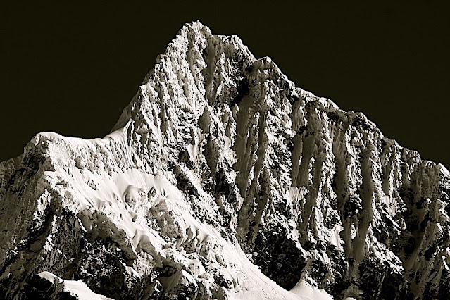
ALPAMAYO SUMMIT PHOTOGRAPHED IN 1936 BY ERWIN SCHNEIDER


ERWIN SCHNEIDER (1906-1987) Alpamayo ( 5,947m - 19,511 ft) Peru  In  "Alpamayo summit", argentic photo 1936 
 
 
ERWIN SCHNEIDER (1906-1987) 
Alpamayo ( 5,947m - 19,511 ft) 
Peru

In  "Alpamayo summit", argentic photo 1936


The mountain

Alpamayo ( 5,947m - 19,511 ft) possibly named from Quechua words is one of the most conspicuous peaks in the Cordillera Blanca of the Peruvian Andes. Alpamayo Creek originates northwest of it. The Alpamayo lies next to the slightly higher Quitaraju. n July 1966, the German magazine "Alpinismus", published a photo of Alpamayo taken by American photographer Leigh Ortenburger accompanied by an article on a survey among mountaineering experts, who chose Alpamayo as "The Most Beautiful Mountain in the World". Not defined by a single summit Alpamayo has two sharp summits, the North and south, which are separated by a narrow corniced ridge.
The first attempt on Alpamayo's summit was in 1948 by a Swiss expedition. Climbing by way of the heavily corniced North Ridge, the three climbers came within sight of the virgin summit when a large cornice broke under them and they were carried down the precipitous Northwest Face. By some amazing piece of good fortune, the three were neither buried nor injured by the 650 foot fall and they were able to make an 'orderly retreat' from the mountain. In 1951, a Franco-Belgian expedition including George and Claude Kogan claimed to have made the first ascent via the North Ridge. After studying the photos in George Kogan's book The Ascent of Alpamayo, the German team of Günter Hauser, Frieder Knauss, Bernhard Huhn and Horst Wiedmann came to the conclusion that the 1951 team did not reach the actual summit, thereby making their ascent via the South Ridge in 1957 the first. Although the South Ridge is no less steep or dangerous than the North Ridge, it has the advantage of leading directly to the higher south summit. This was written up in Hauser's book White Mountain and Tawny Plain. Although there are several climbing routes on the Southwest Face the most common is known as the Ferrari or Italian Route. It was opened in 1975 by a group of Italian alpinists led by Casimiro Ferrari. It begins at the top of the highest point of the snow slope where the bergshrund separates the upper face on the left and then ascends a steep runnel to the summit ridge. Because of its esthetic beauty, Alpamayo is one of the most climbed mountains in the Andes and the base camp can be a hodge-podge of nationalities. Each year the route is made easy by the first party to ascend the route as they usually leave snow-stakes in place at the belay stations. Then it is just a matter of finding out what length of rope they used so that your rope is long enough to reach each station. In the summer of 1988, they had used 50m ropes.

The photographer
Erwin Hermann Manfred Schneider was an Austrian mountaineer. On July 25, 1928, he was part of the German-Soviet expedition for the first ascent of Lenin Peak. They reach the top with Karl Wien and Eugen Allwein. In 1930, he participated in an expedition in the Himalayas led by Günter Dyhrenfurth to Kangchenjunga. On June 21, 1931, he made the first ascent of Jongsong Peak at 7,462 meters1,2. They climb the Ramthang Chang at 6,802 meters. In 1932 and 1936, he took part in two expeditions organized by the German-Austrian Alpine Club (DuOeAV). During these expeditions, Schneider and his companions made about ten first ascents.

___________________________________________
2022 - Wandering Vertexes...
by Francis Rousseau

Thursday, June 30, 2022

PICO DEL TEIDE SKETCHED BY ALEXANDER VON HUMBOLDT


ALEXANDER VON HUMBOLDT (1769-1859), Pico del Teide (3, 718 m -12, 198 ft) Tenerife - Canari Islands - Spain   In  "Intérieur du Cratère du Pic de Teneriffe " Dessin, Alexander von Humboldt


ALEXANDER VON HUMBOLDT (1769-1859)
Pico del Teide (3, 718 m -12, 198 ft)
Tenerife - Canari Islands - Spain

 In  "Intérieur du Cratère du Pic de Teneriffe " Dessin, Alexander von Humboldt


The mountain
Pico del Teide (3,718m - 12,198 ft) (« Teide Peak") is a volcano on Tenerife in the Canary Islands, Spain. Before the 1495 Spanish colonization of Tenerife, the native Guanches called the volcano Echeyde, which in their legends referred to a powerful figure leaving the volcano, which could turn into hell. El Pico del Teide is the modern Spanish name.
Its summit is the highest point in Spain and the highest point above sea level in the islands of the Atlantic. If measured from its base on the ocean floor, it is at 7,500 m-24,600 ft the third highest volcano on a volcanic ocean island in the world after Mauna Kea and Mauna Loa in Hawaii. Its elevation makes Tenerife the tenth highest island in the world. It remains active: its most recent eruption occurred in 1909 from the El Chinyero vent on the northwestern Santiago rift.
Historical volcanic activity on the island is associated with vents on the Santiago or northwest rift (Boca Cangrejo in 1492, Montañas Negras in 1706, Narices del Teide or Chahorra in 1798 and El Chinyero in 1909) and the Cordillera Dorsal or northeast rift (Fasnia in 1704, Siete Fuentes and Arafo in 1705). The 1706 Montañas Negras eruption destroyed the town and principal port of Garachico, as well as several smaller villages.
In 1492, Christopher Columbus reported seeing "a great fire in the Orotava Valley" as he sailed past Tenerife on his voyage to discover the New World. This was interpreted as indicating that he had witnessed an eruption there. Radiometric dating of possible lavas indicates that in 1492 no eruption occurred in the Orotava Valley, but one did occur from the Boca Cangrejo vent.
The last summit eruption from Teide occurred about the year 850 CE, and this eruption produced the "Lavas Negras" that cover much of the flanks of the volcano.
About 150,000 years ago, a much larger explosive eruption occurred, probably of Volcanic Explosivity Index 5.
The United Nations Committee for Disaster Mitigation designated Teide a Decade Volcano because of its history of destructive eruptions and its proximity to several large towns, of which the closest are Garachico, Icod de los Vinos and Puerto de la Cruz. Teide, Pico Viejo and Montaсa Blanca form the Central Volcanic Complex of Tenerife.
In a publication of 1626, Sir Edmund Scory, who probably stayed on the island in the first decades of the 17th century, gives a description of Teide, in which he notes the suitable paths to the top and the effects the considerable height causes to the travellers, indicating that the volcano had been accessed via different routes before the 17th century. In 1715 the English traveler J. Edens and his party made the ascent and reported their observations in the journal of the Royal Society in London.
After the Enlightenment, most of the expeditions that went to East Africa and the Pacific had Teide as one of the most rewarding targets. The expedition of Lord George Macartney, George Staunton and John Barrow in 1792 almost ended in tragedy, as a major snowstorm and rain swept over them and they failed to reach the peak of Teide, just barely getting past Montaña Blanca.
During an expedition to Kilimanjaro, the German adventurer Hans Heinrich Joseph Meyer visited Teide in 1894 to observe ice conditions on the volcano. He described the two mountains as "two kings, one rising in the ocean and the other in the desert and steppes"
The volcano and its surroundings comprise Teide National Park, which has an area of 18,900 hectares (47,000 acres) and was named a World Heritage Site by UNESCO on June 28, 2007. Teide is the most visited natural wonder of Spain, the most visited national park in Spain and Europe and – by 2015 – the eighth most visited in the world, with some 3 million visitors yearly. A major international astronomical observatory is located on the slopes of the mountain.

The cartographer
Friedrich Wilhelm Heinrich Alexander von Humboldt was a Prussian geographer, naturalist, explorer, and influential proponent of Romantic philosophy and science. He was the younger brother of the Prussian minister, philosopher, and linguist Wilhelm von Humboldt (1767–1835). Humboldt's quantitative work on botanical geography laid the foundation for the field of biogeography. Humboldt's advocacy of long-term systematic geophysical measurement laid the foundation for modern geomagnetic and meteorological monitoring.
Between 1799 and 1804, Humboldt travelled extensively in Latin America, exploring and describing it for the first time from a modern scientific point of view. His description of the journey was written up and published in an enormous set of volumes over 21 years. Humboldt was one of the first people to propose that the lands bordering the Atlantic Ocean were once joined (South America and Africa in particular). Humboldt resurrected the use of the word cosmos from the ancient Greek and assigned it to his multi-volume treatise, Kosmos, in which he sought to unify diverse branches of scientific knowledge and culture. This important work also motivated a holistic perception of the universe as one interacting entity.
On their way back to Europe from Mexico on their way to the United States, Humboldt and his fellow scientist Aimé Bonpland stopped in Cuba for a While. After their first stay in Cuba of three months they returned the mainland at Cartagena de Indias (now in Colombia), a major center of trade in northern South America. Ascending the swollen stream of the Magdalena River to Honda and arrived in Bogotá on July 6, 1801 where they met Spanish botanist José Celestino Mutis, the head of the Royal Botanical Expedition to New Granada, staying there until September 8, 1801. Mutis was generous with his time and gave Humboldt access to the huge pictorial record he had compiled since 1783. Humboldt had hopes of connecting with the French sailing expedition of Baudin, now finally underway, so Bonpland and Humboldt hurried to Ecuador. They crossed the frozen ridges of the Cordillera Real, they reached Quito on 6 January 1802, after a tedious and difficult journey.
Their stay in Ecuador was marked by the ascent of Pichincha and their climb of Chimborazo, where Humboldt and his party reached an altitude of 19,286 feet (5,878 m). This was a world record at the time, but a thousand feet short of the summit. Humboldt's journey concluded with an expedition to the sources of the Amazon en route for Lima, Peru.
At Callao, the main port for Peru, Humboldt observed the transit of Mercury. On 9 November and studied the fertilizing properties of guano, rich in nitrogen, the subsequent introduction of which into Europe was due mainly to his writings.

___________________________________________
2022 - Wandering Vertexes...
by Francis Rousseau

Saturday, February 5, 2022

LOS FRAILES OR THE ORGANS OF ACTOPAN BY ALEXANDER VON HUMBOLDT


ALEXANDER VON HUMBOLDT (1769-1859) WILHELM FRIEDRICH ( 1760-1820), engraver The Organs of Actopan or Los Frailes (1,140 m - 3,740 ft) Mexico (Hidalgo) In Vues des Cordillères, et monumens des peuples indigènes de l'Amérique from the book  Voyage aux régions équinoxiales du nouveau continent, 1813

ALEXANDER VON HUMBOLDT (1769-1859)
WILHELM FRIEDRICH ( 1760-1820), engraver
The Organs of Actopan or Los Frailes (1,140 m - 3,740 ft)
Mexico (Hidalgo)

In Vues des Cordillères, et monumens des peuples indigènes de l'Amérique from the book  Voyage aux régions équinoxiales du nouveau continent, 1813


About this engraving and the mountain

On May 23 and 24, Humboldt would tour the Actopan Valley, and then leave on May 25 for Mexico City. During the visit, Humboldt drew and studied the Organs of Actopan, also known as Los Frailes,located 17 km southeast of Actopan in the municipality of El Arenal. Humboldt determines their height trigonometrically.In Actopan. The slender part of the rock is a hundred meters high; but the absolute elevation of the summit of the mountain, where the Organos begin to stand out, is 585 toises (1,140 m - 3,740 ft) .  It is on the way from Mexico to the mines of Guanaxuatotjuon distinguishes from very far away, and standing out on Thoiizon, the rock of Mamanchota: it rises in the middle of a forest of oaks, and oflers a very picturesque aspect. 

The artist and explorer
Friedrich Wilhelm Heinrich Alexander von Humboldt was a Prussian geographer, naturalist, explorer, and influential proponent of Romantic philosophy and science. He was the younger brother of the Prussian minister, philosopher, and linguist Wilhelm von Humboldt (1767–1835). Humboldt's quantitative work on botanical geography laid the foundation for the field of biogeography. Humboldt's advocacy of long-term systematic geophysical measurement laid the foundation for modern geomagnetic and meteorological monitoring.
Between 1799 and 1804, Humboldt travelled extensively in Latin America, exploring and describing it for the first time from a modern scientific point of view. His description of the journey was written up and published in an enormous set of volumes over 21 years. Humboldt was one of the first people to propose that the lands bordering the Atlantic Ocean were once joined (South America and Africa in particular). Humboldt resurrected the use of the word cosmos from the ancient Greek and assigned it to his multi-volume treatise, Kosmos, in which he sought to unify diverse branches of scientific knowledge and culture. This important work also motivated a holistic perception of the universe as one interacting entity.
On their way back to Europe from Mexico on their way to the United States, Humboldt and his fellow scientist Aimé Bonpland stopped in Cuba for a while. After their first stay in Cuba of three months they returned the mainland at Cartagena de Indias (now in Colombia), a major center of trade in northern South America. Ascending the swollen stream of the Magdalena River to Honda and arrived in Bogotá on July 6, 1801 where they met Spanish botanist José Celestino Mutis, the head of the Royal Botanical Expedition to New Granada, staying there until September 8, 1801. Mutis was generous with his time and gave Humboldt access to the huge pictorial record he had compiled since 1783. Humboldt had hopes of connecting with the French sailing expedition of Baudin, now finally underway, so Bonpland and Humboldt hurried to Ecuador. They crossed the frozen ridges of the Cordillera Real, they reached Quito on 6 January 1802, after a tedious and difficult journey.
Their stay in Ecuador was marked by the ascent of Pichincha and their climb of Chimborazo, where Humboldt and his party reached an altitude of 19,286 feet (5,878 m). This was a world record at the time, but a thousand feet short of the summit. Humboldt's journey concluded with an expedition to the sources of the Amazon en route for Lima, Peru.
At Callao, the main port for Peru, Humboldt observed the transit of Mercury. On 9 November and studied the fertilizing properties of guano, rich in nitrogen, the subsequent introduction of which into Europe was due mainly to his writings.
___________________________________________
2022 - Wandering Vertexes...
by Francis Rousseau


Monday, November 1, 2021

COFRE DE PEROTE / NAUPA-TECVUTÉPTL SKETCHED BY ALEXANDER VON HUMBOLDT


ALEXANDER VON HUMBOLDT  (1769-1859), Cofre de Perote/ Naupa-Tecutépetl (4,282 m (14,049 ft) Mexico


ALEXANDER VON HUMBOLDT (1769-1859),
Cofre de Perote/ Naupa-Tecutépetl (4,282 m (14,049 ft)
Mexico

 The mountain
Cofre de Perote, also known by its Nahuatl names Naupa-Tecutépetl ,  meaning something like "Place of Four Mountain" or "Mountain of the Lord of Four Places", is an inactive volcano located in the Mexican state of Veracruz, at the point where the Trans-Mexican Volcanic Belt, home to all of Mexico's highest peaks, joins the Sierra Madre Oriental. Cofre de Perote is Mexico's eighth highest mountain summit.
Cofre de Perote is a shield volcano, shaped very differently from the stratovolcanic Pico de Orizaba, which lies about 50 km (31 mi) to the southeast. A cofre is a coffer, and the name alludes to a volcanic outcropping on the shield which constitutes the peak of the mountain. To the north is the town of Perote, Veracruz, after which the mountain is named. The area surrounding the volcano was protected by the Mexican government as a national park, known as Cofre de Perote National Park (Parque Nacional Cofre de Perote), in 1937.

The artist
Friedrich Wilhelm Heinrich Alexander von Humboldt was a Prussian geographer, naturalist, explorer, and influential proponent of Romantic philosophy and science. He was the younger brother of the Prussian minister, philosopher, and linguist Wilhelm von Humboldt (1767–1835). Humboldt's quantitative work on botanical geography laid the foundation for the field of biogeography. Humboldt's advocacy of long-term systematic geophysical measurement laid the foundation for modern geomagnetic and meteorological monitoring.
Between 1799 and 1804, Humboldt travelled extensively in Latin America, exploring and describing it for the first time from a modern scientific point of view. His description of the journey was written up and published in an enormous set of volumes over 21 years. Humboldt was one of the first people to propose that the lands bordering the Atlantic Ocean were once joined (South America and Africa in particular). Humboldt resurrected the use of the word cosmos from the ancient Greek and assigned it to his multi-volume treatise, Kosmos, in which he sought to unify diverse branches of scientific knowledge and culture. This important work also motivated a holistic perception of the universe as one interacting entity.
On their way back to Europe from Mexico on their way to the United States, Humboldt and his fellow scientist Aimé Bonpland stopped in Cuba for a while. After their first stay in Cuba of three months they returned the mainland at Cartagena de Indias (now in Colombia), a major center of trade in northern South America. Ascending the swollen stream of the Magdalena River to Honda and arrived in Bogotá on July 6, 1801 where they met Spanish botanist José Celestino Mutis, the head of the Royal Botanical Expedition to New Granada, staying there until September 8, 1801. Mutis was generous with his time and gave Humboldt access to the huge pictorial record he had compiled since 1783. Humboldt had hopes of connecting with the French sailing expedition of Baudin, now finally underway, so Bonpland and Humboldt hurried to Ecuador. They crossed the frozen ridges of the Cordillera Real, they reached Quito on 6 January 1802, after a tedious and difficult journey.
Their stay in Ecuador was marked by the ascent of Pichincha and their climb of Chimborazo, where Humboldt and his party reached an altitude of 19,286 feet (5,878 m). This was a world record at the time, but a thousand feet short of the summit. Humboldt's journey concluded with an expedition to the sources of the Amazon en route for Lima, Peru.
At Callao, the main port for Peru, Humboldt observed the transit of Mercury. On 9 November and studied the fertilizing properties of guano, rich in nitrogen, the subsequent introduction of which into Europe was due mainly to his writings.
___________________________________________
2021 - Wandering Vertexes...
by Francis Rousseau

Saturday, October 30, 2021

SOUTHERN ANDES (2) PAINTED BY RHOD WULFARS


RHOD WULFARS (bn. 1979), Southern Andes (6,991 m - 22, 838ft) Argentina  In Somewhere in Andes , acrylic on hardboard, 2018, Private collection @rhodwulfars

 
RHOD WULFARS (bn. 1979)
Southern Andes (6,991 m - 22, 838ft)
Argentina

In Somewhere in Andes, acrylic on hardboard, 2018, Private collection @rhodwulfars


About this painting
The painter wrote: “It is not a real mountain. Most of my paintings are born from the combination of the imagination and the hours spent looking, walking and smelling them. I call them "Twins" because they are similar to those reliefs of the Argentinian Andean Coridilla called "acarreos", which are long slopes of very popular loose rock that can be easily viewed. very frequently observed. This painting is therefore that of an unknown mountain, dreamt up which sums up several, and which came out of my unconscious one afternoon when the brush gave it life in a mysterious way without my being able to explain it. "
And indeed this mountain that looks a lot like the Alpamayo in Peru is not the Alpamayo (even if it could be the most famous South West face to be published very soon in this blog) !), any more than it is not the Cerro Poincenot, the Fitz Roy, the Cerro Torre or the Aconcagua, the highest peak in the Andes. These Twins imagined, encompassed, summarized and illustrated all these mountains at the same time. The most amazing being that they do it with a single stroke of the brushes as powerful and definitive as the rocky uplift itself.

The artist
Rhod Wulfars is a contemporary mountain painter using mainly acrylic technique for his paintings.
He was born in 1979 in Mendoza (Argentina). In his website he wrote: "I have spent my whole life by the mountains. On day I started to paint them". Using, in the manner of Nicolas de Staël, a style always beetween abstract and figurative, his very strong and very moving paintings described perfectly the majesty and the spectacular contents of the peaks he paints. Rhod Wulfars makes a surprising use of acrylic medium, in thick paste as one could do with oil paint. He used to named his works only bu numbers, and series letters, but sometime he writes the name of the peaks ans makes it more easy to identify. Other works by this artist on his website : rhodwulfars.wixsite.com/rhodwulfars/

The mountains
The Andes, Andes Mountains or Andean Mountains (Cordillera de los Andes in Spanish ) are the longest continental mountain range in the world, forming a continuous highland along the western edge of South America. The range is 7,000 km (4,350 mi) long, 200 to 700 km (124 to 435 mi) wide (widest between 18°S - 20°S latitude), and has an average height of about 4,000 m (13,123 ft). The Andes extend from north to south through seven South American countries: Venezuela, Colombia, Ecuador, Peru, Bolivia, Chile, and Argentina.
The Andes Mountains are the highest mountain range outside Asia. The highest mountain outside Asia, Argentina's Mount Aconcagua, rises to an elevation of about 6,961 m (22,838 ft) above sea level. The peak of Chimborazo in the Ecuadorian Andes is farther from the Earth's center than any other location on the Earth's surface, due to the equatorial bulge resulting from the Earth's rotation. The world's highest volcanoes are in the Andes, including Ojos del Salado on the Chile-Argentina border, which rises to 6,893 m (22,615 ft).
The Andes are also part of the American Cordillera, a chain of mountain ranges (cordillera) that consists of an almost continuous sequence of mountain ranges that form the western "backbone" of North America, Central America, South America and Antarctica.

 ___________________________________________

2021 - Wandering Vertexes...
by Francis Rousseau

Thursday, September 30, 2021

BLACK MESA (3) PAINTED BY GEORGIA O' KEEFFE


GEORGIA O' KEEFFE (1887–1986) Black Mesa (1,739 m - 5,705 feet) United States of America (Colorado, New Mexico, and Oklahoma)  In Near Abiquiu, New Mexico, 1931 Oil on canvas, 0.6 x 91.4 cm, Georgia O' Keeffe Museum

GEORGIA O' KEEFFE (1887–1986)
Black Mesa (1,739 m - 5,705 feet)
United States of America (Colorado, New Mexico, and Oklahoma)

In Near Abiquiu, New Mexico, 1931 Oil on canvas, 0.6 x 91.4 cm, Georgia O' Keeffe Museum


The painter

Georgia O’Keeffe is one of the most significant and intriguing artists of the twentieth century, known internationally for her boldly innovative art. Her distinct flowers, dramatic cityscapes, glowing landscapes, and images of bones against the stark desert sky are iconic and original contributions to American Modernism.
Born on November 15, 1887, the second of seven children, Georgia Totto O’Keeffe grew up on a farm near Sun Prairie, Wisconsin. She studied at the Art Institute of Chicago in 1905-1906 and the Art Students League in New York in 1907-1908. Under the direction of William Merritt Chase, F. Luis Mora, and Kenyon Cox she learned the techniques of traditional realist painting. The direction of her artistic practice shifted dramatically in 1912 when she studied the revolutionary ideas of Arthur Wesley Dow. Dow’s emphasis on composition and design offered O’Keeffe an alternative to realism. She experimented for two years, while she taught art in South Carolina and west Texas. Seeking to find a personal visual language through which she could express her feelings and ideas, she began a series of abstract charcoal drawings in 1915 that represented a radical break with tradition and made O’Keeffe one of the very first American artists to practice pure abstraction. O’Keeffe mailed some of these highly abstract drawings to a friend in New York City, who showed them to Alfred Stieglitz. An art dealer and internationally known photographer, he was the first to exhibit her work in 1916. He would eventually become O’Keeffe’s husband.
In the summer of 1929, O’Keeffe made the first of many trips to northern New Mexico. The stark landscape, distinct indigenous art, and unique regional style of adobe architecture inspired a new direction in O’Keeffe’s artwork. For the next two decades she spent part of most years living and working in New Mexico . She made the state her permanent home in 1949, three years after Stieglitz’s death. O’Keeffe’s New Mexico paintings coincided with a growing interest in regional scenes by American Modernists seeking a distinctive view of America. Her simplified and refined representations of this region express a deep personal response to the high desert terrain.
In the 1950s, O’Keeffe began to travel internationally. She created paintings that evoked a sense of the spectacular places she visited, including the mountain peaks of Peru and Japan’s Mount Fuji. At the age of seventy-three she embarked on a new series focused on the clouds in the sky and the rivers below.
Suffering from macular degeneration and discouraged by her failing eyesight, O’Keeffe painted her last unassisted oil painting in 1972. But O’Keeffe’s will to create did not diminish with her eyesight. In 1977, at age ninety, she observed, “I can see what I want to paint. The thing that makes you want to create is still there.”
Late in life, and almost blind, she enlisted the help of several assistants to enable her to again create art. In these works she returned to favorite visual motifs from her memory and vivid imagination.
Georgia O’Keeffe died in Santa Fe, on March 6, 1986, at the age of 98.

The mountain 
Black Mesa  (1,739 m - 5,705 feet) is a mesa in the U.S. states of Colorado, New Mexico, and Oklahoma. It extends from Mesa de Maya, Colorado southeasterly 28 miles (45 km) along the north bank of the Cimarron River, crossing the northeast corner of New Mexico to end at the confluence of the Cimarron River and Carrizo Creek near Kenton in the Oklahoma panhandle. Its highest elevation is  in Colorado. The highest point of Black Mesa within New Mexico is 1,597 m -  5,239 feet.  The plateau that formed at the top of the mesa has been known as a "geological wonder" of North America. There is abundant wildlife in this shortgrass prairie environment, including mountain lions, butterflies, and the Texas horned lizard.
The plateau has been home to Plains Indians.
In the late-nineteenth and early twentieth century the area was a hideout for outlaws such as William Coe and Black Jack Ketchum. The outlaws built a fort known as the Robbers' Roost. The stone fort housed a blacksmith shop, gun ports, and a piano. The present-day Oklahoma Panhandle area, which was then considered a no man's land, lacked law enforcement agencies and hence the outlaws found it safe to hide in the region. However, as new settlers arrived in the area for copper and coal mining and also for cattle ranching activities by grazing cattle in the mesa region, law enforcement became more effective, and the outlaws were brought under control.
___________________________________________
2021 - Wandering Vertexes...
by Francis Rousseau

Monday, August 16, 2021

ALPAMAYO PHOTOGRAPHED BY LEIGH ORTENBURGER

LEIGH ORTENBURGER (1929- 1991), Alpamayo ( 5,947m - 19,511 ft),  Peru,   In  "Cordillera Blanca - Alpamayo - Peru, South West face" , 1959 et 1960 , blanc and white photos published in 1966,  Courtsesy Stanford University Archives

LEIGH ORTENBURGER (1929- 1991), Alpamayo ( 5,947m - 19,511 ft),  Peru,   In  "Cordillera Blanca - Alpamayo - Peru, South West face" , 1959 et 1960 , blanc and white photos published in 1966,  Courtsesy Stanford University Archives
 

LEIGH ORTENBURGER (1929-1991)
Alpamayo (5,947m - 19,511 ft)
Peru

In Cordillera Blanca - Alpamayo - Peru, South West face, 1959 et 1960, black and white photos published in 1966, Courtsesy Stanford University Archives and collections


About the photo
In the July 1966 issue of the German magazine Alpinismus, a photo taken by American photographer Leigh Ortenburger, accompanied by an article resulting from an international survey among climbers and photographers, chose Alpamayo as "The Most Beautiful Mountain in the World." The photo (above) was of its Southwest Face which is a steep, almost perfect pyramid of ice? Although slightly smaller than many of its neighboring peaks, it is distinguished by its unusual ice runnels and overwhelming beauty especially when seen in the evening alpenglow. Günter Hauser, who made the first ascent, wrote: "As we pitched our tents the sun went down and Alpamayo became a kaleidoscope of swiftly-changing colour altogether becoming suffused with the pale lunar radiance of the evening before against the background of the dark blue sky with its diadem of stars."
This mountain was first photographed in 1936 by Erwin Schneider.

The photographer
Leigh Ortenburger (1929-1991) climbed and photographed for more than forty years in the world's greatest mountain ranges. He graduated from the University of Oklahoma in 1952 with a degree in mathematics, and earned a master’s degree in mathematics from the University of California at Berkeley in 1953 and a second in statistics from Stanford in 1963, where he did additional work toward a Ph.D. He worked several years as a Teton mountain guide and served a two-year stint in the Army before settling into a career as a mathematician with Sylvania. His classic guidebook, A Climber’s Guide to the Teton Range, is now in its third edition. Ortenburger’s extensive knowledge of the terrain equipped him to play a key role in the rescue of two climbers trapped on the North Face of the Grand Teton in 1967. Together with fellow climber Irene Beardsley, whom he met through the student-run Stanford Alpine Club in the 1950s, he raised a family in Palo Alto, California. He died October 20, 1991, in the firestorm that swept the Oakland, California hills.
No less impressive than the photographs of Alpamayo themselves is the process of making them, said Glen Denny, also a mountaineering photographer:  “Few realize the difficulty of creating images like Ortenburger's. During hard climbs, while others rested, he performed a painstaking ritual countless times: Plunge the tripod legs into soft snow until they are solid, mount and level the camera, select and attach the lens, huddle under the head cloth while composing the dim, upside-down image on the ground glass, with the wind snatching at the cloth and shaking the camera. Then take off your gloves and spin the delicate dials on the light meter, calibrate the exposure, set the aperture, and cock the shutter, while your fingers still have feeling left. Insert the film holder, pull out the slide, squeeze the cable release--very gently--and replace the slide. There! One shot taken.”

The mountain
Alpamayo ( 5,947m - 19,511 ft) possibly named from Quechua words is one of the most conspicuous peaks in the Cordillera Blanca of the Peruvian Andes. Alpamayo Creek originates northwest of it. The Alpamayo lies next to the slightly higher Quitaraju. n July 1966, the German magazine "Alpinismus", published a photo of Alpamayo taken by American photographer Leigh Ortenburger accompanied by an article on a survey among mountaineering experts, who chose Alpamayo as "The Most Beautiful Mountain in the World". Not defined by a single summit Alpamayo has two sharp summits, the North and south, which are separated by a narrow corniced ridge.
The first attempt on Alpamayo's summit was in 1948 by a Swiss expedition. Climbing by way of the heavily corniced North Ridge, the three climbers came within sight of the virgin summit when a large cornice broke under them and they were carried down the precipitous Northwest Face. By some amazing piece of good fortune, the three were neither buried nor injured by the 650 foot fall and they were able to make an 'orderly retreat' from the mountain. In 1951, a Franco-Belgian expedition including George and Claude Kogan claimed to have made the first ascent via the North Ridge. After studying the photos in George Kogan's book The Ascent of Alpamayo, the German team of Günter Hauser, Frieder Knauss, Bernhard Huhn and Horst Wiedmann came to the conclusion that the 1951 team did not reach the actual summit, thereby making their ascent via the South Ridge in 1957 the first. Although the South Ridge is no less steep or dangerous than the North Ridge, it has the advantage of leading directly to the higher south summit. This was written up in Hauser's book White Mountain and Tawny Plain. Although there are several climbing routes on the Southwest Face the most common is known as the Ferrari or Italian Route. It was opened in 1975 by a group of Italian alpinists led by Casimiro Ferrari. It begins at the top of the highest point of the snow slope where the bergshrund separates the upper face on the left and then ascends a steep runnel to the summit ridge. Because of its esthetic beauty, Alpamayo is one of the most climbed mountains in the Andes and the base camp can be a hodge-podge of nationalities. Each year the route is made easy by the first party to ascend the route as they usually leave snow-stakes in place at the belay stations. Then it is just a matter of finding out what length of rope they used so that your rope is long enough to reach each station. In the summer of 1988, they had used 50m ropes.
___________________________________________

2021 - Wandering Vertexes...
by Francis Rousseau


Saturday, August 14, 2021

SOUTHERN ANDES SUMMIT PAINTED BY RHOD WULFARS (bn 1979)

RHOD WULFARS (bn. 1979), Southern Andes (6,991 m - 22, 838ft), Argentina,  In "Twin", acrylic on hardboard, 2018, Private collection @rhodwulfars
 
 
RHOD WULFARS (bn. 1979)
Southern Andes (6,991 m - 22, 838ft)
Argentina

In Twin, acrylic on hardboard, 2018, Private collection @rhodwulfars


About this painting
The painter wrote: “It is not a real mountain. Most of my paintings are born from the combination of the imagination and the hours spent looking, walking and smelling them. I call them "Twins" because they are similar to those reliefs of the Argentinian Andean Coridilla called "acarreos", which are long slopes of very popular loose rock that can be easily viewed. very frequently observed. This painting is therefore that of an unknown mountain, dreamt up which sums up several, and which came out of my unconscious one afternoon when the brush gave it life in a mysterious way without my being able to explain it. "
And indeed this mountain that looks a lot like the Alpamayo in Peru is not the Alpamayo (even if it could  be the most famous South West face to be published very soon in this blog) !), any more than it is not the Cerro Poincenot, the Fitz Roy, the Cerro Torre or the Aconcagua, the highest peak in the Andes. These Twins imagined, encompassed, summarized and illustrated all these mountains at the same time. The most amazing being that they do it with a single stroke of the brushes as powerful and definitive as the rocky uplift itself.


The artist
Rhod Wulfars is a contemporary mountain painter using mainly acrylic technique for his paintings.
He was born in 1979 in Mendoza (Argentina). In his website he wrote: "I have spent my whole life by the mountains. On day I started to paint them". Using, in the manner of Nicolas de Staël, a style always beetween abstract and figurative, his very strong and very moving paintings described perfectly the majesty and the spectacular contents of the peaks he paints. Rhod Wulfars makes a surprising use of acrylic medium, in thick paste as one could do with oil paint. He used to named his works only bu numbers, and series letters, but sometime he writes the name of the peaks ans makes it more easy to identify. Other works by this artist on his website : rhodwulfars.wixsite.com/rhodwulfars/

The mountains
The Andes, Andes Mountains or Andean Mountains (Cordillera de los Andes in Spanish ) are the longest continental mountain range in the world, forming a continuous highland along the western edge of South America. The range is 7,000 km (4,350 mi) long, 200 to 700 km (124 to 435 mi) wide (widest between 18°S - 20°S latitude), and has an average height of about 4,000 m (13,123 ft). The Andes extend from north to south through seven South American countries: Venezuela, Colombia, Ecuador, Peru, Bolivia, Chile, and Argentina.
The Andes Mountains are the highest mountain range outside Asia. The highest mountain outside Asia, Argentina's Mount Aconcagua, rises to an elevation of about 6,961 m (22,838 ft) above sea level. The peak of Chimborazo in the Ecuadorian Andes is farther from the Earth's center than any other location on the Earth's surface, due to the equatorial bulge resulting from the Earth's rotation. The world's highest volcanoes are in the Andes, including Ojos del Salado on the Chile-Argentina border, which rises to 6,893 m (22,615 ft).
The Andes are also part of the American Cordillera, a chain of mountain ranges (cordillera) that consists of an almost continuous sequence of mountain ranges that form the western "backbone" of North America, Central America, South America and Antarctica.

___________________________________________

2021 - Wandering Vertexes...
by Francis Rousseau

Wednesday, July 21, 2021

EL CHIMBORAZO SKETCHED BY ALEXANDER VON HUMBOLDT


ALEXANDER VON HUMBOLDT (1769-1859) Chimborazo (6,263 m-20,549 ft) Ecuador  In,  El Chimborazo vu de la plaine de Tapia, 1810


ALEXANDER VON HUMBOLDT (1769-1859)
Chimborazo (6,263 m-20,549 ft)
Ecuador

In  El Chimborazo vu de la plaine de Tapia, 1810


The mountain
El Chimborazo (6,263 m -20,548 ft) is a currently inactive stratovolcano in the Cordillera Occidental range of the Andes ans the highest mountain in Ecuador and the Andes north of Peru ; it is higher than any more northerly summit in the Americas. Chimborazo is not the highest mountain by elevation above sea level, but its location along the equatorial bulge makes its summit the farthest point on the Earth's surface from the Earth's center.
Chimborazo is at the main end of the Ecuadorian Volcanic Arc, north west of the town of Riobamba. Chimborazo is in la Avenida de los Volcanes (the Avenue of Volcanoes) west of the Sanancajas mountain chain. Carihuairazo, Tungurahua, Tulabug, and El Altar are all mountains that neighbor Chimborazo. The closest mountain peak, Carihuairazo, is 5.8 mi (9.3 km) from Chimborazo. There are many microclimates near Chimborazo, varying from desert in the Arenal to the humid mountains in the Abraspungo valley.
Its last known eruption is believed to have occurred around A.D. 550.
Until the beginning of the 19th century, it was thought that Chimborazo was the highest mountain on Earth (measured from sea level), and such reputation led to many attempts on its summit during the 17th and 18th centuries.
In 1746, the volcano was explored by French academicians from the French Geodesic Mission. Their mission was to determine the sphericity of the Earth. Their work along with another team in Lapland established that the Earth was an oblate spheroid rather than a true sphere. They did not reach the summit of Chimborazo.
In 1802, during his expedition to South America, Baron Alexander von Humboldt, accompanied by Aimé Bonpland and the Ecuadorian Carlos Montufar, tried to reach the summit. From his description of the mountain, it seems that before he and his companions had to return suffering from altitude sickness they reached a point at 5,875 m, higher than previously attained by any European in recorded history. (Incans had reached much higher altitudes previously). In 1831, Jean-Baptiste Boussingault and Colonel Hall reached a new "highest point", estimated to be 6,006 m.
On 4 January 1880, the English climber Edward Whymper reached the summit of Chimborazo. The route that Whymper took up Chimborazo is now known as the Whymper route. Edward Whymper, and his Italian guides Louis Carrel and Jean-Antoine Carrel, were the first Europeans to summit a mountain higher than 20,000 feet. As there were many critics who doubted that Whymper had reached the summit, later in the same year he climbed to the summit again, choosing a different route (Pogyos) with the Ecuadorians David Beltrбn and Francisco Campaсa.


The cartographer and artist
Friedrich Wilhelm Heinrich Alexander von Humboldt was a Prussian geographer, naturalist, explorer, and influential proponent of Romantic philosophy and science. He was the younger brother of the Prussian minister, philosopher, and linguist Wilhelm von Humboldt (1767–1835). Humboldt's quantitative work on botanical geography laid the foundation for the field of biogeography. Humboldt's advocacy of long-term systematic geophysical measurement laid the foundation for modern geomagnetic and meteorological monitoring.
Between 1799 and 1804, Humboldt travelled extensively in Latin America, exploring and describing it for the first time from a modern scientific point of view. His description of the journey was written up and published in an enormous set of volumes over 21 years. Humboldt was one of the first people to propose that the lands bordering the Atlantic Ocean were once joined (South America and Africa in particular). Humboldt resurrected the use of the word cosmos from the ancient Greek and assigned it to his multi-volume treatise, Kosmos, in which he sought to unify diverse branches of scientific knowledge and culture. This important work also motivated a holistic perception of the universe as one interacting entity.
On their way back to Europe from Mexico on their way to the United States, Humboldt and his fellow scientist Aimé Bonpland stopped in Cuba for a While. After their first stay in Cuba of three months they returned the mainland at Cartagena de Indias (now in Colombia), a major center of trade in northern South America. Ascending the swollen stream of the Magdalena River to Honda and arrived in Bogotá on July 6, 1801 where they met Spanish botanist José Celestino Mutis, the head of the Royal Botanical Expedition to New Granada, staying there until September 8, 1801. Mutis was generous with his time and gave Humboldt access to the huge pictorial record he had compiled since 1783. Humboldt had hopes of connecting with the French sailing expedition of Baudin, now finally underway, so Bonpland and Humboldt hurried to Ecuador. They crossed the frozen ridges of the Cordillera Real, they reached Quito on 6 January 1802, after a tedious and difficult journey.
Their stay in Ecuador was marked by the ascent of Pichincha and their climb of Chimborazo, where Humboldt and his party reached an altitude of 19,286 feet (5,878 m). This was a world record at the time, but a thousand feet short of the summit. Humboldt's journey concluded with an expedition to the sources of the Amazon en route for Lima, Peru.
At Callao, the main port for Peru, Humboldt observed the transit of Mercury. On 9 November and studied the fertilizing properties of guano, rich in nitrogen, the subsequent introduction of which into Europe was due mainly to his writings.

___________________________________________ 


2021 - Wandering Vertexes...
by Francis Rousseau

Wednesday, July 14, 2021

MOUNT WELLINGTON / KUNANYI PAINTED BY AUGUSTUS EARLE


AUGUSTUS EARLE (1793-1838) Mount Wellington - Kunanyi or Unghbanyahletta or Poorawetter (1,269m - 4,163ft) Australia (Tasmania)  In Tasmania - Van Dieman's Islands, waterolor, Pirivate collection


AUGUSTUS EARLE (1793-1838)
Mount Wellington - Kunanyi or Unghbanyahletta or Poorawetter (1,269m - 4,163ft)
Australia (Tasmania)

In Tasmania - Van Dieman's Islands, waterolor,1820,  Private collection,


The mountain
Mount Wellington (1,269m - 4,163ft) also known as Unghbanyahletta or Poorawetter or Kunanyi in Aboriginal langage, is located in the southeast coastal region of Tasmania, Australia. The Palawa, the surviving descendants of the original indigenous Tasmanians, tend to prefer the latter name. In 2013, a Tasmanian dual naming policy was announced and "Kunanyi - Mount Wellington" was named as one of the inaugural dual named geographic features.
The mountain is the summit of the Wellington Range on whose foothills is built much of the city of Hobart. Mount Wellington is frequently covered by snow, sometimes even in summer, and the lower slopes are thickly forested, but criss-crossed by many walking tracks and a few fire trails. There is also a sealed narrow road to the summit, about 22 kilometres (14 mi) from Hobart central business district. An enclosed lookout near the summit provides spectacular views of the city below and to the east, the Derwent estuary, and also glimpses of the World Heritage Area nearly 100 kilometres (62 mi) west. From Hobart, the most distinctive feature of Mount Wellington is the cliff of dolerite columns known as the Organ Pipes.
The first recorded European in the area Abel Tasman probably did not see the mountain in 1642, as his ship was quite a distance out to sea as he sailed up the South East coast of the island - coming closer in near present-day North and Marion Bays. No other Europeans visited Tasmania until the late eighteenth century, when several visited southern Tasmania (then referred to as Van Diemens Land) including Frenchman Marion du Fresne (1772), Englishmen Tobias Furneaux (1773), James Cook (1777) and William Bligh (1788 and 1792), and Frenchman Bruni d'Entrecasteaux (1792–93).
In February 1836, Charles Darwin visited Hobart Town and climbed Mount Wellington.


The artist
Augustus Earle was a London-born travel artist. Unlike earlier artists who worked outside Europe and were employed on voyages of exploration or worked abroad for wealthy, often aristocratic patrons, Earle was able to operate quite independently - able to combine his lust for travel with an ability to earn a living through art. The body of work he produced during his travels comprises a significant documentary record of the effects of European contact and colonisation during the early nineteenth century. From 1817 to 1832, Earle travelled trough Sicily, Malta, Gibraltar, North Africa, North Americas (New York Philadelphia), South America (Brazil, Peru, Chile), Tristan da Cunha (Antartica) the Pacific, Asia, India, Mauritius, St Helena (where he met the french emperor Napoleon in exil), New South Wales, New Zealand, Tasmania... he came back in England in 1832 ans died in London in 1838.

_____________________________

2021 - Wandering Vertexes...
by Francis Rousseau

Wednesday, June 16, 2021

EL JORULLO SKETCHED BY ALEXANDER VON HUMBOLDT


ALEXANDER VON HUMBOLDT (1769-1859) El Jorullo (1,329m- 4,360ft) Mexico   In Volcan de Jorullo,  Vue des Coridllères et monumens des peuples indigènes de l'Amérique, 1816, Paris chez F. Schoell.

 ALEXANDER VON HUMBOLDT (1769-1859)
El Jorullo (1,329m- 4,360ft)
Mexico

 In Volcan de Jorullo,  Vue des Coridllères et monumens des peuples indigènes de l'Amérique, 1816, Paris chez F. Schoell.


About this drawing
Alexander von Humboldt climbed El Jorullo during the Mexican portion of his scientific expedition to Spanish America. When he visited on 19 September 1803, its multiple cones were still smoldering and the air was extremely hot and filled with volcanic gases. He wrote a detailed description of the climb, noting that his face and those of his travel companions were burned. The volcano enriched the local soil and there was considerable vegetation. Humboldt sketched the volcano in the distance (see above), showing multiple smoking cones. Humboldt undertook the climb with his scientific travel partner Aimé Bonpland, as well as a local Basque settler Ramón Epelde, and two local indigenous servants, whose names have not been recorded. Humboldt noted their assistance on site. Humboldt also notes that he consulted a 1782 publication Rusticatio Mexicana, by Rafael Landívar, who calculated the height of the volcano and the temperature of the thermal waters.


The volcano
El Jorullo  (1,329m- 4,360ft) is a cinder cone volcano in Michoacán, central Mexico, on the southwest slope of the central plateau, 33 miles (53 kilometers) southeast of Uruapan in an area known as the Michoacán-Guanajuato volcanic field.  It is about 6 miles (10 km) east-northeast of La Huacana.  El Jorullo has four smaller cinder cones which have grown from its flanks.  El Jorullo's crater is about 1,300 by 1,640 feet (400 by 500 m) wide and 490 feet (150 m) deep.   El Jorullo is one of two known volcanoes to have developed in Mexico in recent history. The second, born about 183 years later, was named Parícutin after a nearby village that it eventually destroyed. Parícutin is about 50 miles (80 km) northwest of El Jorullo. El Jorullo was first erupted on 29 September 1759. Earthquakes occurred prior to this first day of eruption. Once the volcano started erupting, it continued for 15 years, eventually ending in 1774.
El Jorullo did not develop on a corn field like Parícutin did, but it did destroy what had been a rich agricultural area. It grew approximately 820 feet (250 meters) from the ground in the first six weeks. The eruptions from El Jorullo were primarily phreatic and phreatomagmatic. This 15 year eruption was the longest one El Jorullo has had, and was the longest cinder cone eruption known. Lava flows can still be seen to the north and west of the volcano.  Parícutin and El Jorullo both rose in an area known for its volcanoes. Called the Trans-Mexican Volcanic Belt, the region stretches about 700 miles (1,120 km) from east to west across southern Mexico. The eruptive activity deposited a layer of volcanic rock some 6,000 feet thick, creating a high and fertile plateau. During summer months, the heights snag moisture-laden breezes from the Pacific Ocean; rich farmland, in turn, has made this belt the most populous region in Mexico. Though the region already boasted three of the country's four largest cities: Mexico City, Puebla, and Guadalajara (the area around Parícutin, some 200 miles west of the capital), it was still a peaceful backwater inhabited by Purépecha in the early 1940s. The crater and lake can now be reached by car.


The artist
Friedrich Wilhelm Heinrich Alexander von Humboldt was a Prussian geographer, naturalist, explorer, and influential proponent of Romantic philosophy and science. He was the younger brother of the Prussian minister, philosopher, and linguist Wilhelm von Humboldt (1767–1835). Humboldt's quantitative work on botanical geography laid the foundation for the field of biogeography. Humboldt's advocacy of long-term systematic geophysical measurement laid the foundation for modern geomagnetic and meteorological monitoring.
Between 1799 and 1804, Humboldt travelled extensively in Latin America, exploring and describing it for the first time from a modern scientific point of view. His description of the journey was written up and published in an enormous set of volumes over 21 years. Humboldt was one of the first people to propose that the lands bordering the Atlantic Ocean were once joined (South America and Africa in particular). Humboldt resurrected the use of the word cosmos from the ancient Greek and assigned it to his multi-volume treatise, Kosmos, in which he sought to unify diverse branches of scientific knowledge and culture. This important work also motivated a holistic perception of the universe as one interacting entity.
On their way back to Europe from Mexico on their way to the United States, Humboldt and his fellow scientist Aimé Bonpland stopped in Cuba for a while. After their first stay in Cuba of three months they returned the mainland at Cartagena de Indias (now in Colombia), a major center of trade in northern South America. Ascending the swollen stream of the Magdalena River to Honda and arrived in Bogotá on July 6, 1801 where they met Spanish botanist José Celestino Mutis, the head of the Royal Botanical Expedition to New Granada, staying there until September 8, 1801. Mutis was generous with his time and gave Humboldt access to the huge pictorial record he had compiled since 1783. Humboldt had hopes of connecting with the French sailing expedition of Baudin, now finally underway, so Bonpland and Humboldt hurried to Ecuador. They crossed the frozen ridges of the Cordillera Real, they reached Quito on 6 January 1802, after a tedious and difficult journey.
Their stay in Ecuador was marked by the ascent of Pichincha and their climb of Chimborazo, where Humboldt and his party reached an altitude of 19,286 feet (5,878 m). This was a world record at the time, but a thousand feet short of the summit. Humboldt's journey concluded with an expedition to the sources of the Amazon en route for Lima, Peru.
At Callao, the main port for Peru, Humboldt observed the transit of Mercury. On 9 November and studied the fertilizing properties of guano, rich in nitrogen, the subsequent introduction of which into Europe was due mainly to his writings.

___________________________________________ 


2021 - Wandering Vertexes and Mountain paintings 
by Francis Rousseau

Wednesday, March 24, 2021

BLACK MESA ( 2) PAINTED BY GEORGIA O'KEEFFE

 
GEORGIA O' KEEFFE (1887-1986)
Black Mesa (1,739 m - 5,705 ft)
United States of America (Colorado, New Mexico, and Oklahoma)

In Mesa and Road East, oil on canvas, 1952, Private collection


The mountain
Black Mesa (1,739 m - 5,705 feet) is a mesa in the U.S. states of Colorado, New Mexico, and Oklahoma. It extends from Mesa de Maya, Colorado southeasterly 28 miles (45 km) along the north bank of the Cimarron River, crossing the northeast corner of New Mexico to end at the confluence of the Cimarron River and Carrizo Creek near Kenton in the Oklahoma panhandle. Its highest elevation is in Colorado. The highest point of Black Mesa within New Mexico is 1,597 m - 5,239 feet. The plateau that formed at the top of the mesa has been known as a "geological wonder" of North America. There is abundant wildlife in this shortgrass prairie environment, including mountain lions, butterflies, and the Texas horned lizard. The plateau has been home to Plains Indians. In the late-nineteenth and early twentieth century the area was a hideout for outlaws such as William Coe and Black Jack Ketchum. The outlaws built a fort known as the Robbers' Roost. The stone fort housed a blacksmith shop, gun ports, and a piano. The present-day Oklahoma Panhandle area, which was then considered a no man's land, lacked law enforcement agencies and hence the outlaws found it safe to hide in the region. However, as new settlers arrived in the area for copper and coal mining and also for cattle ranching activities by grazing cattle in the mesa region, law enforcement became more effective, and the outlaws were brought under control.


The painter
Georgia O’Keeffe is one of the most significant and intriguing artists of the twentieth century, known internationally for her boldly innovative art. Her distinct flowers, dramatic cityscapes, glowing landscapes, and images of bones against the stark desert sky are iconic and original contributions to American Modernism.
Born on November 15, 1887, the second of seven children, Georgia Totto O’Keeffe grew up on a farm near Sun Prairie, Wisconsin. She studied at the Art Institute of Chicago in 1905-1906 and the Art Students League in New York in 1907-1908. Under the direction of William Merritt Chase, F. Luis Mora, and Kenyon Cox she learned the techniques of traditional realist painting. The direction of her artistic practice shifted dramatically in 1912 when she studied the revolutionary ideas of Arthur Wesley Dow. Dow’s emphasis on composition and design offered O’Keeffe an alternative to realism. She experimented for two years, while she taught art in South Carolina and west Texas. Seeking to find a personal visual language through which she could express her feelings and ideas, she began a series of abstract charcoal drawings in 1915 that represented a radical break with tradition and made O’Keeffe one of the very first American artists to practice pure abstraction.
O’Keeffe mailed some of these highly abstract drawings to a friend in New York City, who showed them to Alfred Stieglitz. An art dealer and internationally known photographer, he was the first to exhibit her work in 1916. He would eventually become O’Keeffe’s husband.
In the summer of 1929, O’Keeffe made the first of many trips to northern New Mexico. The stark landscape, distinct indigenous art, and unique regional style of adobe architecture inspired a new direction in O’Keeffe’s artwork. For the next two decades she spent part of most years living and working in New Mexico . She made the state her permanent home in 1949, three years after Stieglitz’s death. O’Keeffe’s New Mexico paintings coincided with a growing interest in regional scenes by American Modernists seeking a distinctive view of America. Her simplified and refined representations of this region express a deep personal response to the high desert terrain.
In the 1950s, O’Keeffe began to travel internationally. She created paintings that evoked a sense of the spectacular places she visited, including the mountain peaks of Peru and Japan’s Mount Fuji. At the age of seventy-three she embarked on a new series focused on the clouds in the sky and the rivers below.
Suffering from macular degeneration and discouraged by her failing eyesight, O’Keeffe painted her last unassisted oil painting in 1972. But O’Keeffe’s will to create did not diminish with her eyesight. In 1977, at age ninety, she observed, “I can see what I want to paint. The thing that makes you want to create is still there.”
Late in life, and almost blind, she enlisted the help of several assistants to enable her to again create art. In these works she returned to favorite visual motifs from her memory and vivid imagination.
Georgia O’Keeffe died in Santa Fe, on March 6, 1986, at the age of 98.

___________________________________________
2021 - Wandering Vertexes...
by Francis Rousseau 


Friday, January 1, 2021

VICTORIA PEAK PAINTED BY ERNEST CHARTON DE TREVILLE


ERNEST CHARTON DE TREVILLE (1816-1877)
Victoria Peak  (552 m -1,811 ft)
China (Hong Kong)
 
In Victoria Peak vu de la Baie de Hong Kong, Oil on canvas, Private collection 

The mountain
Victoria Peak (552 m -1,811 ft) or 太平山 (in Chinese) also locally called The Peak or Mount Austin an sa few others cantonese and Hong Kong Hakka names such as Taai Pen Saa or Deng or Saan Deng or Ce Kei Saan or Lou Fung... is a mountain in the western half of Hong Kong Island. It is the highest mountain on Hong Kong island, ranked 31 in terms of elevation in the Hong Kong Special Administrative Region ; Tai Mo Shan (957m) being the highest point in the Hong Kong Special Administrative Region.The summit is occupied by a radio telecommunications facility and is closed to the public. However, the surrounding areaf public parks and high-value residential land is the area that is normally meant by the name The Peak. During the19th century, the Peak attracted prominent European residents because of its panoramic view over the city and its relatively temperate climate compared to the sub-tropical climate in the rest of Hong Kong. The sixth Governor of Hong Kong, Sir Richard MacDonnell had a summer residence built on the Peak circa 1868. Those that built houses named them whimsically, such as The Eyrie, and the Austin Arm. These original residents reached their homes by sedan chairs, which were carried up and down the steep slope of Victoria Peak.

The painter
Ernest-Marc-Jules Charton Thiessen of Treville better known as Ernest Charton or Ernesto Charton was a French painter, famous for his pastel portraits and realistic- style customary paintings. He made most of his artistic career in South America - particularly in Argentina Chile and Ecuador -, a continent where his first name, as was customary at the time, was Castilianized, which is why he was known as Ernesto Charton.
He was initially established in Valparaíso (Chile), but in 1848 he moved to Santiago where he opened a studio neighboring that of Raymond Monvoisin, another French pioneer of Chilean painting and also belonging to traveling artists as was also at that time the watercolorist Carlos Wood.
Brother of Edouard Charton, director of the Parisian magazine Le Tour du Monde Ernesto was a typical adventurous artist of the nineteenth century in search of the most exotic expressions of unexplored nature, following in this aspect the motivation of numerous European painters of the time.  Many of his American experiences were reflected in the L'llustration, a magazine also directed by his brother and of which he was a correspondent, sending not only chronicles but also drawings, such as those he sent from the streets of Valparaíso before the bombing. He also sent a drawing of the bombing of Callao, which was recorded by Louis Le Breton and published on June 23.
Tempted by the gold rush in California he embarked on October 25, 1848 on the schooner Rosa Segunda, who arrived in the Galapagos Islands within two weeks to get water; when most of the passengers were ashore, the ship abandoned them to their fate. The painter, like his companions, lost everything, including his works.
Charton, who in 1862 would return to Ecuador, managed to settle in Quito with the help of the French consul. He taught drawing and painting at the University of that city; in addition, he directed the Miguel de Santiago Liceo of Painting, a direct antecedent of the School of Fine Arts of that country. As a result of his stay in Ecuador, he left a 48-watercolors album (cf. above)
He returned to France, but in 1855 he returned to Chile with his family; he gained fame as a portraitist, landscaper and teacher. In this last quality he had a famous controversy with the first director of the Academy of Painting of Santiago. ]
In 1870 he left Chile to Argentina, crossing the Andes. From that experience, his large oil painting was born the following year View of the Andes mountain range (115x197cm) that is today in the National Museum of Fine Arts of that country, in Buenos Aires, city where he settled until his death.
In addition to the countries mentioned, he travelled in Italy, Panama (when it was still part of Colombia) Peru and China (Hong Kong, Macao) (see above). 
As a Photographer, he used snapshots as a base for his paintings, portraying typical clothes, customs and parties that he then tracked to the web.
Charton's works are characterized by their vibrant color and the realistic expression of popular customs and motifs. He left among his students from Chile, Ecuador and Argentina this cultural vision of pictorial realism applied to the theme of each country, leaving aside religious, mythological or literally copied motifs of European models.
His paintings can be seen in museums in Argentina, Chile and Ecuador.

__________________________________________

2021 - Wandering Vertexes / Mountain paintings
By F rancis Rousseau


___________________________________

2021 - Wandering Vertexes
A blog by Francis Rousseau

Monday, March 23, 2020

CERRO RICO PAINTED BY GASPAR MIGUEL DE BERRIO


GASPAR MIGUEL DE BERRIO  (1706-1762)
Cerro Rico (4,782 m - 15,689 ft)
Bolivia

  In Vista panoracmica de Potosi, oil on canvas,  Museo de Charcas, Sucre, Bolivia

The mountain
Cerro Rico  (4,782 m - 15,689 ft) "rich mountain" in spanish or  Cerro Potosí or Sumaq Urqu,  "beautiful, good, pleasant mountain" in Quechua, is a mountain in the Andes near the Bolivian city of Potosí. Cerro Rico, which is popularly conceived of as being "made of" silver ore, was famous for providing vast quantities of silver for Spain during the period of the New World Spanish Empire. It is estimated that 85%percent of the silver produced in the central Andes during this time came from Cerro Rico. As a result of mining  operations in the mountain, the city of Potosí became one of the largest cities in the New World.
Cerro Rico de Potosí was accidentally discovered in 1545 by Diego de Huallpa, a Quechua silver miner for Spanish invaders, while he was searching the mountain for an Inca shrine or traditional burial offering.  The red mountain, now known as Cerro Rico, sits nestled between the Porco and Sucre mines, which had previously been discovered, being at lower altitudes and therefore easier to mine. However, once Cerro Rico was found to carry predominantly silver ores, mining focus shifted to the harvesting of the more costly ore over ores like tin, zinc, and lead found in Porco and Sucre. Now one of the largest silver mines in Bolivia, and in the world, the Cerro Rico de Potosí mine has estimated reserves of 1.76 billion ounces of silver and 540 million tons of ore grading 0.17% tin. After centuries of brutal Spanish extraction and forced labor, decades of foreign control and private investment in the late 20th century, and the failure of the state-run mining company COMIBOL led to the displacement of 25,000 miners following plummeting mineral prices in the 1990s, "informal, self-managed associations" began selling "unrefined product to private operators".Bolivia's cooperative mining sector, whose center is in Potosí, has been given many privileges included favorable tax treatment and exemption from labor and environmental regulations since the election of socialist president Evo Morales in 2006. National Federation of Mining Cooperatives in Bolivia (FENCOMIN)  was a vital player in insuring the successful popular election of Evo Morales and also functioned as one of the leaders in drafting Bolivia's new constitution establishing a plural mining economy (state, private, and cooperative). However, over the last ten years much conflict has arisen between cooperative miners and state miners. In 2006, state miners and cooperatives clashed at Huanuni leaving 16 dead leading to the firing of Morales' first Mining Minister, a member of FENCOMIN. Most recently in 2016, Bolivia's Deputy Interior Minister Rodolfo Illanes was tortured and killed, allegedly by a Bolivian mining cooperative. This outburst of violence has led to clashes between cooperative miners and the police leaving five miners dead and severing a decade of strong ties between cooperative mining and the Morales government

The painter 
Gaspar Miguel de Berrío was a painter, representative of the South American baroque who worked in Potosí, then viceroyalty of Peru in Upper Peru but nowadays located in present-day Bolivia.
He is listed as one of the main representatives of the Potosí school, after Melchor Pérez de Holguín, of which he is said to have been a disciple. His work combines religious themes, echoes of  "spanish darkness", the use of gold leaf and   landscapes of his pwn city,  the very rich Potosy town.
It is credited today with about thirty paintings, generally of good quality, such as : The panoramic view of Potosí, (above) today at the Museum of Charcas in Sucre the Adorations of the Shepherds and Kings, at the National Museum of La Paz, the Patronage of San José and others at the National Currency Museum.

_______________________________

2020 - Wandering Vertexes...
by Francis Rousseau