google.com, pub-0288379932320714, DIRECT, f08c47fec0942fa0 GRAVIR LES MONTAGNES... EN PEINTURE: Search results for Mount Robson
Showing posts sorted by date for query Mount Robson. Sort by relevance Show all posts

Saturday, May 28, 2022

MOUNT COLEMAN PAINTED BY ARTHUR P. COLEMAN

ARTHUR P. COLEMAN (1852-1939) Mount Coleman (3,135 m-10,285 ft) Canada (Alberta)
 

ARTHUR P. COLEMAN (1852-1939)
Mount Coleman (3,135 m-10,285 ft)
Canada (Alberta) 

 In  "Mountain un the Canadian rockies"

The mountain
Mount Coleman (3,135 m-10,285 ft) mountain summit located in the upper North Saskatchewan River valley in Banff National Park, in the Canadian Rockies of Alberta, Canada. Its nearest higher peak is Cirrus Mountain, 4.46 km (2.77 mi) to the north.  Mount Coleman is situated along the east side the Icefields Parkway midway between Saskatchewan Crossing and Sunwapta Pass.
Mount Coleman was named in 1898 after Arthur Philemon Coleman (1852-1939), a Canadian geologist and among the first white men to explore the area that is now Jasper National Park.(see below). Like other mountains in Banff Park, Mount Coleman is composed of sedimentary rock laid down from the Precambrian to Jurassic periods. Formed in shallow seas, this sedimentary rock was pushed east and over the top of younger rock during the Laramide orogeny.  Based on the Köppen climate classification, Mount Coleman is located in a subarctic climate with cold, snowy winters, and mild summers.  Temperatures can drop below -20 °C with wind chill factors below -30 °C. Precipitation runoff from Mount Coleman drains into tributaries of the North Saskatchewan River.

The painter
Arthur Philemon Coleman was a Canadian a geologist, professor, minerals prospector, artist, Rockies explorer, backwoods canoeist, world traveller, scientist, popular lecturer, museum administrator, memoirist and... one of Canada’s most beloved scientist.
Arthur Coleman is a fine example of that rare bird, a polished amateur artist whose drawings and paintings stand comfortably beside those of many professionals. He was active during the time when sketching and painting was ceding to photography the task of recording the visible world. Although he was also a photographer, painting was, for him, both a poetic and a descriptive pursuit, a way of wrapping an artistic expression around a phenomenon he was interested in or moved by. Thus motivated, Coleman's paintings give much joy and command a good deal of respect. The more surprising, perhaps given that he used to introduced himself more as a geologist than a painter.
Coleman travelled throughout the United States for professional conferences as well as geological field work. He visited many of the major American mountain ranges including: the American Cordillera Mountains (Washington, Oregon and California); the Sierra Nevada Mountains (California and Nevada); Yellowstone National Park (Wyoming, Montana and Idaho); and the Appalachian Mountains (eastern United States). Pleistocene glaciation had extended in Northern Europe as far south as Berlin and London and covered an area of two million square miles. Coleman also visited such countries as India, Australia, Brazil, Argentina, Scandinavia, Bolivia, New Zealand, South Africa and Uruguay. In his final years he made two expeditions to the Andes in Colombia, to mountains in Southern Mexico and to two mountains in Central America. He achieved the first ascent of Castle Mountain in 1884, and in 1907, he was the first white man to attempt to climb Mount Robson. He made a total of eight exploratory trips to the Canadian Rockies, wholly four of them looking for the mythical giants of Hooker and Brown.
From 1901 to 1922, he was a Professor of Geology at the University of Toronto and was Dean of the Faculty of Arts from 1919 to 1922. From 1931 to 1934, he was a geologist with the Department of Mines of the Government of Ontario. He was elected a Fellow of the Royal Society of Canada in 1900 and was its President in 1921. In 1929, he was appointed Honorary Vice-President of the Royal Canadian Geographical Society.
"Mount Coleman" and "Coleman Glacier" in Banff National Park is named in his honor. He was awarded the Penrose Medal in 1936.
He planned to climb "his" mountain, "Mount Coleman"'in the Albertan Rockies, and had also prepared a trip to British Guiana, but death intervened.
He was author of:
- Reports on the Economic Geology of Ontario (1903)
- Lake Ojibway; Last of the Great Glacial Lakes (1909)
- The Canadian Rockies: New and Old Trails (1911)
- Ice Ages, Recent and Ancient (1926), and was co-author of Elementary Geology (1922).
- The Last Million Years (1941) edited by George F. Kay

__________________________________________
2022 - Wandering Vertexes...
by Francis Rousseau

Monday, September 27, 2021

CLYDE PEAK PAINTED BY ARTHUR P. COLEMAN


ARTHUR P. COLEMAN (1852-1939), Clyde Peak (2,624 m - 8,610 f) United States of America (Montana)  In Mountain South Clide, watercolor on paper, 1895 A.P Coleman Funds.


ARTHUR P. COLEMAN (1852-1939)
Clyde Peak (2,624 m - 8,610 ft)
United States of America (Montana)

In Mountain South Clide, watercolor on paper, 1895 A.P Coleman Funds.


The mountain
Clyde Peak 2,624 m- is an 8,610 ft) is  located in Glacier National Park in the U.S. state of Montana. The mountain straddles the border shared by Flathead County and Glacier County. It is situated on the Continental Divide so precipitation runoff from the west side of the mountain drains into Thompson Creek which is part of the Middle Fork Flathead Riverwatershed, and the east side drains into headwaters of Red Eagle Creek, which flows to Red Eagle Lake, thence Saint Mary Lake. It is set in the Lewis Range, and the nearest higher neighbor is Mount Logan 1.44 mile to the northwest. Topographic relief is significant as the southwest aspect rises approximately 4,000 feet (1,220 meters) in one mile.
The mountain's name commemorates Norman Clyde (1885–1972), who made the first ascent of this peak on July 23, 1923.  Clyde is credited with 130 first ascents, most of which were in the Sierra Nevada of California.[ In 1923 he spent 36 days in Glacier National Park, Montana, where he climbed 36 mountains, including 11 first ascents.


The painter
Arthur Philemon Coleman was a Canadian a geologist, professor, minerals prospector, artist, Rockies explorer, backwoods canoeist, world traveller, scientist, popular lecturer, museum administrator, memoirist and... one of Canada’s most beloved scientist.
Arthur Coleman is a fine example of that rare bird, a polished amateur artist whose drawings and paintings stand comfortably beside those of many professionals. He was active during the time when sketching and painting was ceding to photography the task of recording the visible world. Although he was also a photographer, painting was, for him, both a poetic and a descriptive pursuit, a way of wrapping an artistic expression around a phenomenon he was interested in or moved by. Thus motivated, Coleman's paintings give much joy and command a good deal of respect. The more surprising, perhaps given that he used to introduced himself more as a geologist than a painter.
Coleman travelled throughout the United States for professional conferences as well as geological field work. He visited many of the major American mountain ranges including: the American Cordillera Mountains (Washington, Oregon and California); the Sierra Nevada Mountains (California and Nevada); Yellowstone National Park (Wyoming, Montana and Idaho); and the Appalachian Mountains (eastern United States). Pleistocene glaciation had extended in Northern Europe as far south as Berlin and London and covered an area of two million square miles. Coleman also visited such countries as India, Australia, Brazil, Argentina, Scandinavia, Bolivia, New Zealand, South Africa and Uruguay. In his final years he made two expeditions to the Andes in Colombia, to mountains in Southern Mexico and to two mountains in Central America. He achieved the first ascent of Castle Mountain in 1884, and in 1907, he was the first white man to attempt to climb Mount Robson. He made a total of eight exploratory trips to the Canadian Rockies, wholly four of them looking for the mythical giants of Hooker and Brown.
From 1901 to 1922, he was a Professor of Geology at the University of Toronto and was Dean of the Faculty of Arts from 1919 to 1922. From 1931 to 1934, he was a geologist with the Department of Mines of the Government of Ontario. He was elected a Fellow of the Royal Society of Canada in 1900 and was its President in 1921. In 1929, he was appointed Honorary Vice-President of the Royal Canadian Geographical Society.
"Mount Coleman" and "Coleman Glacier" in Banff National Park is named in his honor. He was awarded the Penrose Medal in 1936.
He planned to climb "his" mountain, "Mount Coleman"'in the Albertan Rockies, and had also prepared a trip to British Guiana, but death intervened.
He was author of:
- Reports on the Economic Geology of Ontario (1903)
- Lake Ojibway; Last of the Great Glacial Lakes (1909)
- The Canadian Rockies: New and Old Trails (1911)
- Ice Ages, Recent and Ancient (1926), and was co-author of Elementary Geology (1922).
- The Last Million Years (1941) edited by George F. Kay

 
___________________________________________
2021 - Wandering Vertexes...
by Francis Rousseau
Sunday, January 12, 2020

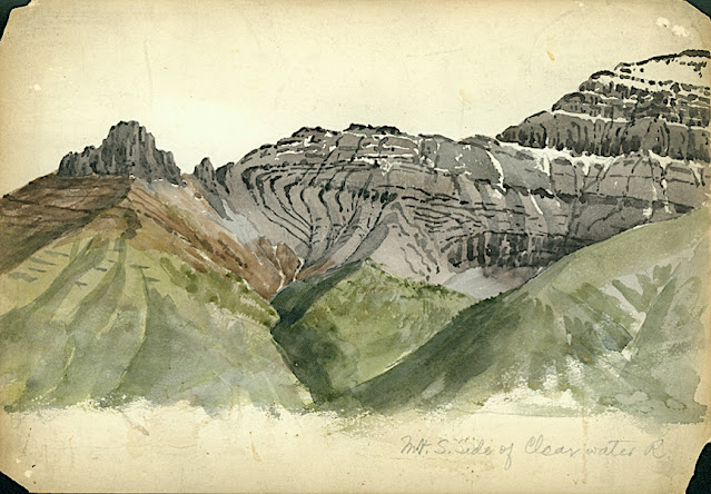
MOUNT CAUBVICK/ MONT D'IBERVILLE PAINTED BY ARTHUR P. COLEMAN


ARTHUR P. COLEMAN (1852-1939)
Mount Caubvick / Mont D'Iberville (1,652 m -5,420 ft) 
Canada (Labrador /Quebec border) 

In Mountains South of Nakvak, Labrador; oil on canvas, 1910, Private collection

The mountain 
Mount Caubvick / Mont D'Iberville (1,652 m -5,420 ft)  is a mountain located in Canada on the border between Labrador and Quebec in the Selamiut Range of the Torngat Mountains. Mount Caubvick is the highest point in mainland Canada east of the Rockies. The mountain contains a massive peak that rises sharply from nearby sea level. Craggy ridges, steep cirques and glaciers are prominent features of the peak.
The alp was named Mont d'Iberville by the Quebec government in 1971. It remained nameless on the Labrador side for several years; it became known unofficially as L1, L for Labrador and 1 for highest. In 1981, at the suggestion of Dr. Peter Neary, the provincial government named the mountain after Caubvick, one of the five Inuit who accompanied George Cartwright to England in 1772.
Mount Caubvick also hosts the highest point in both the province of Newfoundland and Labrador and Quebec, although the summit itself lies about 10 metres (33 ft) northeast of the Quebec provincial border and is entirely within Labrador.

The painter
Arthur Philemon Coleman was a Canadian a geologist, professor, minerals prospector, artist, Rockies explorer, backwoods canoeist, world traveller, scientist, popular lecturer, museum administrator, memoirist and... one of Canada’s most beloved scientist.
Arthur Coleman is a fine example of that rare bird, a polished amateur artist whose drawings and paintings stand comfortably beside those of many professionals. He was active during the time when sketching and painting was ceding to photography the task of recording the visible world. Although he was also a photographer, painting was, for him, both a poetic and a descriptive pursuit, a way of wrapping an artistic expression around a phenomenon he was interested in or moved by. Thus motivated, Coleman's paintings give much joy and command a good deal of respect. The more surprising, perhaps given that he used to introduced himself more as a geologist than a painter.
Coleman travelled throughout the United States for professional conferences as well as geological field work. He visited many of the major American mountain ranges including: the American Cordillera Mountains (Washington, Oregon and California); the Sierra Nevada Mountains (California and Nevada); Yellowstone National Park (Wyoming, Montana and Idaho); and the Appalachian Mountains (eastern United States). Pleistocene glaciation had extended in Northern Europe as far south as Berlin and London and covered an area of two million square miles. Coleman also visited such countries as India, Australia, Brazil, Argentina, Scandinavia, Bolivia, New Zealand, South Africa and Uruguay. In his final years he made two expeditions to the Andes in Colombia, to mountains in Southern Mexico and to two mountains in Central America. He achieved the first ascent of Castle Mountain in 1884, and in 1907, he was the first white man to attempt to climb Mount Robson. He made a total of eight exploratory trips to the Canadian Rockies, wholly four of them looking for the mythical giants of Hooker and Brown.
"Mount Coleman" and "Coleman Glacier" in Banff National Park are named in his honor.
He was awarded the Penrose Medal in 1936.

_______________________________

2020 - Wandering Vertexes...
by Francis Rousseau

Tuesday, November 26, 2019

MOUNT ROBSON BY ARTHUR P. COLEMAN


ARTHUR P. COLEMAN (1852-1939)
Mount Robson (3,954 m - 12, 972 ft) 
Canada (British Columbia)

  In Mount Robson glacier -cutting steps, oil on canvas


The mountain 
Mount Robson (3,954 m - 12, 972 ft) is the most prominent mountain in North America's Rocky Mountain range; it is also the highest point in the Canadian Rockies. The mountain is located entirely within Mount Robson Provincial Park of British Columbia, and is part of the Rainbow Range. Mount Robson is the second highest peak entirely in British Columbia, behind Mount Waddington in the Coast Range. The south face of Mount Robson is clearly visible from the Yellowhead Highway (Highway 16), and is commonly photographed along this route.
Mount Robson was likely named after Colin Robertson, who worked for both the North West Company and the Hudson’s Bay Company at various times in the early 19th century, though there was confusion over the name as many assumed it to have been named for John Robson, an early premier of British Columbia. The Texqakallt, a Secwepemc people and the earliest inhabitants of the area, call it Yuh-hai-has-kun (The Mountain of the Spiral Road). Other unofficial names include Cloud Cap Mountain.
In 1893, five years after the expedition of A.P. Coleman to Athabasca Pass and the final settling of the mistaken elevations of Mt. Hooker and Mt. Brown, Mt. Robson was first surveyed by James McEvoy and determined to be the highest peak in the Canadian Rockies. The first documented ascent of Mount Robson, led by the young guide Conrad Kain, at its time the hardest ice face to be climbed on the continent, was achieved during the 1913 annual expedition organized by a large party of Alpine Club of Canada members who made use of the newly completed Grand Trunk Pacific railway to access the area. Prior to 1913, it had been necessary to approach the mountain by pack train from Edmonton or Laggan via Jasper and Lucerne, so only few intrepid explorers had made previous attempts at exploring the mountain. The most famous early ascensionist was the Reverend George Kinney, a founding member of the Alpine Club, who on his twelfth attempt in August 1909 claimed to have reached the summit with local outfitter Donald "Curly" Phillips. A major controversy over this claim and over the implausible nature of his unlikely and dangerous route dominated the discourse within the Alpine Club elite, and he is now generally presumed to have reached the high summit ridge before being turned back at the final ice dome of the peak. Kinney Lake, below the south face, is named in his honour.
The north face of Mount Robson is heavily glaciated and 800 m (2,600 ft) of ice extends from the summit to Berg Glacier. The Berg glacier calves directly into the lake. The Robson Glacier, which fills the cirque and valley between Mount Robson and Mount Resplendent, in the early 1900s fed directly into both Berg lake and Adolphus lake, straddling the Continental Divide and draining thus to both the Arctic and Pacific oceans via the Smoky and Robson Rivers, respectively. It since has receded more than 2 kilometres and is the source of the Robson River only.

The painter 
Arthur Philemon Coleman was a Canadian a geologist, professor, minerals prospector, artist, Rockies explorer, backwoods canoeist, world traveller, scientist, popular lecturer, museum administrator, memoirist and...  one of Canada’s most beloved scientist.
Arthur Coleman is a fine example of that rare bird, a polished amateur artist whose drawings and paintings stand comfortably beside those of many professionals. He was active during the time when sketching and painting was ceding to photography the task of recording the visible world. Although he was also a photographer, painting was, for him, both a poetic and a descriptive pursuit, a way of wrapping an artistic expression around a phenomenon he was interested in or moved by. Thus motivated, Coleman's paintings give much joy and command a good deal of respect. The more surprising, perhaps given that he used to introduced himself more as a geologist than a painter.
Coleman travelled throughout the United States for professional conferences as well as geological field work.  He visited many of the major American mountain ranges including: the American Cordillera Mountains (Washington, Oregon and California); the Sierra Nevada Mountains (California and Nevada); Yellowstone National Park (Wyoming, Montana and Idaho); and the Appalachian Mountains (eastern United States). Pleistocene glaciation had extended in Northern Europe as far south as Berlin and London and covered an area of two million square miles. Coleman also visited such countries as India, Australia, Brazil, Argentina, Scandinavia, Bolivia, New Zealand, South Africa and Uruguay. In his final years he made two expeditions to the Andes in Colombia, to mountains in Southern Mexico and to two mountains in Central America.  He achieved the first ascent of Castle Mountain in 1884, and in 1907, he was the first white man to attempt to climb Mount Robson. He made a total of eight exploratory trips to the Canadian Rockies, wholly four of them looking for the mythical giants of Hooker and Brown.
 "Mount Coleman" and "Coleman Glacier" in Banff National Park are named in his honor.
He was awarded the Penrose Medal in 1936.

_______________________________
2019 - Wandering Vertexes...
by Francis Rousseau 


Monday, August 5, 2019

PIC ISLAND PAINTED BY LAWREN S. HARRIS


LAWREN S. HARRIS (1885-1970) 
Pic Island (312 m- 1024 ft)
Canada (Ontario) 

 In Pic Island, lake Ontario, oil on beaverboard, 1924, National Gallery of Canada.


The hill 
Pic island ((312 m- 1024 ft) is part of the Neys Provincial Park is a Natural Environment Class provincial park on the north shore of Lake Superior, just west of Marathon, Ontario, Canada. The ghost village of Coldwell, which lies just outside the east boundary of the park, was home to an old railway and fishing community until the 1960s. All that remains of the village now are a few foundations, shipwrecks in the harbour and a cemetery. Within park boundaries is also the muse for Group of Seven member Lawren Harris (see above), who in 1924 painted the now famous image of Pic Island. Only the hardy survive here, including subarctic plants and a rare herd of woodland caribou.

The painter
Lawren Stewart Harris was a leading landscape canadian painter, imbuing his paintings with a spiritual dimension. An inspirer of other artists, he was a key figure in the Group of Seven and gave new vision to representations of the northern Canadian landscape. During the 1920s, Harris's works became more abstract and simplified, especially his stark landscapes of the Canadian north and Arctic. He also stopped signing and dating his works so that people would judge his works on their own merit and not by the artist or when they were painted.
In 1924, a sketching trip with A.Y. Jackson to Jasper National Park in the Canadian Rockies marked the beginning of Harris' mountain subjects, which he continued to explore with annual sketching trips until 1929, exploring areas around Banff National Park, Yoho National Park and Mount Robson Provincial Park. In 1930, Harris went on his last extended sketching trip, travelling to the Arctic aboard the supply ship SS. Beothic for two months, during which time he completed over 50 sketches. "We are on the fringe of the great North and its living whiteness, its loneliness and replenishment, its resignations and release, tis call and answer, its cleansing rhythms. It seems that the top of the continent is a source of spiritual flow that will ever shed clarity into the growing race of America."(Lawren S. Harris, 1926)
For Harris, art was to express spiritual values as well as to represent the visible world. North Shore, Lake Superior (1926), an image of a solitary weathered tree stump surrounded by an expanse of dramatically lit sky, effectively evokes the tension between the terrestrial and spiritual.
The resulting Arctic canvases that he developed from the oil panels marked the end of his landscape period, and from 1935 on, Harris enthusiastically embraced abstract painting. Several members of the Group of Seven later became members of the Canadian Group of Painters including Harris, A. J. Casson, Arthur Lismer, A. Y. Jackson, and Franklin Carmichael.
From 1934 to 1937, Harris lived in Hanover, New Hampshire, where he painted his first abstract works, a direction he would continue for the rest of his life. In 1938 he moved to Sante Fe, New Mexico, and helped found the Transcendental Painting Group, an organization of artists who advocated a spiritual form of abstraction.
In 1969, he was made a Companion of the Order of Canada.
Harris died in Vancouver in 1970, at the age of 84, as a well-known artist. He was buried on the grounds of the McMichael Canadian Art Collection, where his work is now held.
On November 26, 2015 his painting Mountain and Glacier was auctioned for $3.9 million at a Heffel Fine Art Auction House auction in Toronto, breaking the previous record for the sale of one of Harris's works.
In 2016 a film about Harris's life, Where the Universe Sings, was produced by TV Ontario. It was created by filmmaker Peter Raymont and directed by Nancy Lang.
___________________________________________
2019 - Wandering Vertexes...
by Francis Rousseau 


Sunday, July 7, 2019

PORCUPINE MOUNTAINS PAINTED BY LAWREN HARRIS


 LAWREN S. HARRIS (1885-1970), 
Porcupine mountains or Porkies  (441 m-1,447 ft)
Canada 

In Above Lake Superior, c. 1922, oil on canvas 121.9 x 152.4 cm, 
Art Gallery of Ontario, Toronto. 


The mountain
The Porcupine Mountains or Porkies (441 m -1,447 ft) are a group of small mountains spanning the northwestern Upper Peninsula of Michigan in Ontonagon and Gogebic counties, near the shore of Lake Superior. The Porcupine Mountains were named by the native Ojibwa people, supposedly because their silhouette had the shape of a crouching porcupine.  They are home to the most extensive stand of old growth northern hardwood forest in North America west of the Adirondack Mountains, spanning at least 31,000 acres (13,000 ha). In these virgin forests, sugar maple, American basswood, eastern hemlock, and yellow birch are the most abundant tree species.  The area is part of the Porcupine Mountains Wilderness State Park established since 1972.  This act gave the park the new designation of the Porcupine Mountains Wilderness State Park.

The painter 
Lawren Stewart Harris was a leading landscape canadian painter, imbuing his paintings with a spiritual dimension. An inspirer of other artists, he was a key figure in the Group of Seven and gave new vision to representations of the northern Canadian landscape. During the 1920s, Harris's works became more abstract and simplified, especially his stark landscapes of the Canadian north and Arctic.  He also stopped signing and dating his works so that people would judge his works on their own merit and not by the artist or when they were painted.
In 1924, a sketching trip with A.Y. Jackson to Jasper National Park in the Canadian Rockies marked the beginning of Harris' mountain subjects, which he continued to explore with annual sketching trips until 1929, exploring areas around Banff National Park, Yoho National Park and Mount Robson Provincial Park. In 1930, Harris went on his last extended sketching trip, travelling to the Arctic aboard the supply ship SS. Beothic for two months, during which time he completed over 50 sketches.  "We are on the fringe of the great North and its living whiteness, its loneliness and replenishment, its resignations and release, tis call and answer, its cleansing rhythms. It seems that the top of the continent is a source of spiritual flow that will ever shed clarity into the growing race of America."(Lawren S. Harris, 1926)
In 1969, he was made a Companion of the Order of Canada.
Harris died in Vancouver in 1970, at the age of 84, as a well-known artist.

_______________________________
2019 - Wandering Vertexes...
by Francis Rousseau 


Sunday, March 31, 2019

SURPRISE MOUNTAIN BY ARTHUR. P. COLEMAN


ARTHUR P. COLEMAN (1852-1939)
Surprise Mountain  (1,929m - 63,30ft) 
United States of America (Washington State) 

In Surprize Mountain, Showing Thalkessel, left side in shade, watercolor 

The mountain 
Surprise Mountain  (1,929m - 63,30ft) is an alpine peak nestled in the middle of the Alpine Lakes Wilderness of Washington State. Perhaps appropriately, several alpine lakes are found near the mountain. The Deception Lakes are located at the south end of the mountain, and Glacier Lake and Surprise Lake are located northeast of the mountain. Views of surrounding peaks and valleys from the mountain are also far-reaching, including Mount Daniel and Glacier Peak. Surprise Mountain is located southeast of Spark Plug Mountain and southwest of Thunder Mountain.
In 1932, the U.S. Forest Service built a L-4 cab fire lookout on the summit of Surprise Mountain, due to its wide views of the Central Cascade Mountains. The U.S. Forest Service then decommissioned and destroyed the fire lookout during the 1950s. The only remnant of the lookout that remains today is a tall metallic pole at the mountain summit.

The painter 
Arthur Philemon Coleman was a Canadian a geologist, professor, minerals prospector, artist, Rockies explorer, backwoods canoeist, world traveller, scientist, popular lecturer, museum administrator, memoirist and...  one of Canada’s most beloved scientist.
Arthur Coleman is a fine example of that rare bird, a polished amateur artist whose drawings and paintings stand comfortably beside those of many professionals. He was active during the time when sketching and painting was ceding to photography the task of recording the visible world. Although he was also a photographer, painting was, for him, both a poetic and a descriptive pursuit, a way of wrapping an artistic expression around a phenomenon he was interested in or moved by. Thus motivated, Coleman's paintings give much joy and command a good deal of respect. The more surprising, perhaps given that he used to introduced himself more as a geologist than a painter.
Coleman travelled throughout the United States for professional conferences as well as geological field work.  He visited many of the major American mountain ranges including: the American Cordillera Mountains (Washington, Oregon and California); the Sierra Nevada Mountains (California and Nevada); Yellowstone National Park (Wyoming, Montana and Idaho); and the Appalachian Mountains (eastern United States). Pleistocene glaciation had extended in Northern Europe as far south as Berlin and London and covered an area of two million square miles. Coleman also visited such countries as India, Australia, Brazil, Argentina, Scandinavia, Bolivia, New Zealand, South Africa and Uruguay. In his final years he made two expeditions to the Andes in Colombia, to mountains in Southern Mexico and to two mountains in Central America.  He achieved the first ascent of Castle Mountain in 1884, and in 1907, he was the first white man to attempt to climb Mount Robson. He made a total of eight exploratory trips to the Canadian Rockies, wholly four of them looking for the mythical giants of Hooker and Brown.
 "Mount Coleman" and "Coleman Glacier" in Banff National Park are named in his honor.
He was awarded the Penrose Medal in 1936.

_______________________________
2019 - Wandering Vertexes...
by Francis Rousseau 


Wednesday, March 13, 2019

MALIGNE MOUNTAIN BY LAWREN S. HARRIS


LAWREN S. HARRIS (1885-1970)
Maligne Mountain  (3,200m -10,500-ft)  
Canada (Alberta)

 In Mountains East of Maligne Lake, Maligne Mountain,  oil on canvas, 1925

The mountain 
Maligne Mountain  (3,200m -10,500-ft)  is multi-peak massif located east of Maligne Lake in Jasper National Park, in the Canadian Rockies of Alberta, Canada. Maligne Mountain is surrounded by glaciers, and its nearest higher peak is Monkhead, 7.83 kilometres (4.87 miles) to the south.
The peak was first named by Mary Schäffer in 1911 because she thought one peak should bear the name of Maligne Lake. Mary "discovered" Maligne Lake and she named many of the mountains around it, including Mount Charlton, Mount Unwin, and Mount Warren. The mountain's name was officially adopted in 1946 by the Geographical Names Board of Canada.
The first ascent of Maligne Mountain was made in 1930 by W.R. Hainsworth, J.F. Lehmann, M.M. Strumia, and N.D. Waffl.
Based on the Köppen climate classification, Maligne Mountain is located in a subarctic climate with cold, snowy winters, and mild summers.Temperatures can drop below −20 degrees Celsius (−4 degrees Fahrenheit) with wind chill factors below −30 °C (−22 °F).

The painter 
Lawren Stewart Harris  was a leading landscape canadian painter, imbuing his paintings with a spiritual dimension. An inspirer of other artists, he was a key figure in the Group of Seven and gave new vision to representations of the northern Canadian landscape. During the 1920s, Harris's works became more abstract and simplified, especially his stark landscapes of the Canadian north and Arctic.  He also stopped signing and dating his works so that people would judge his works on their own merit and not by the artist or when they were painted.
In 1924, a sketching trip with A.Y. Jackson to Jasper National Park in the Canadian Rockies marked the beginning of Harris' mountain subjects, which he continued to explore with annual sketching trips until 1929, exploring areas around Banff National Park, Yoho National Park and Mount Robson Provincial Park. In 1930, Harris went on his last extended sketching trip, travelling to the Arctic aboard the supply ship SS. Beothic for two months, during which time he completed over 50 sketches.  "We are on the fringe of the great North and its living whiteness, its loneliness and replenishment, its resignations and release, tis call and answer, its cleansing rhythms. It seems that the top of the continent is a source of spiritual flow that will ever shed clarity into the growing race of America."(Lawren S. Harris, 1926)
In 1969, he was made a Companion of the Order of Canada.
Harris died in Vancouver in 1970, at the age of 84, as a well-known artist.

_______________________________
2019 - Wandering Vertexes...
by Francis Rousseau 


Wednesday, December 19, 2018

MOUNT SAMPSON PAINTED BY LAWREN S. HARRIS


LAWREN S. HARRIS (1885-1970) 
Mount Sampson  or Samson (2,811 m, 9,222 ft) 
Canada (British Columbia)  

In Mount Sampson, from Maligne Lake, oil on board, 1924, (27,3cm x 35,6cm)  Private owner

The mountain 
 Mount Sampson also named Mount Samson (2,811 m, 9,222 ft)  - not to be confused with Mount Samson in Australia - is a rocky summit, highest of the summits south of the head of the Hurley River and East of North Creek, British Columbia, Canada.
The provincial government names website gives "Sampson" as the gazetted spelling, and notes that "Samson" was formerly official but has been rescinded in favour of the new spelling. The name of the closest neighbouring peak is Delilah, the wife of the biblical Samson. However, Delilah was not named at the same time as Samson was, but later.  Fairley's guide spells it Samson, as that was the official spelling at the time - as do Alpine Select and the Culbert guides.
The Sampson family of Nequatque (near D'Arcy) may be the source of the family name. Ironically, it is probable that if you go back in history far enough, the family name "Sampson" was itself based on the biblical character. As in Samson Narrows at Maligne lake.
The mountain has seen at least two ski descents. The west face, although not a direct line from the summit, was skied solo from the top of the ridgeline. It was approached from Boomerang Glacier and is the closest line from that direction. Since then, at least one BCMC party has skied the south side, approaching from Glacier Pass. The west face is a steep, rewarding descent linking snow patches through rock outcrops.

The painter 
Lawren Stewart Harris  was a leading landscape canadian painter, imbuing his paintings with a spiritual dimension. An inspirer of other artists, he was a key figure in the Group of Seven and gave new vision to representations of the northern Canadian landscape. During the 1920s, Harris's works became more abstract and simplified, especially his stark landscapes of the Canadian north and Arctic.  He also stopped signing and dating his works so that people would judge his works on their own merit and not by the artist or when they were painted.
In 1924, a sketching trip with A.Y. Jackson to Jasper National Park in the Canadian Rockies marked the beginning of Harris' mountain subjects, which he continued to explore with annual sketching trips until 1929, exploring areas around Banff National Park, Yoho National Park and Mount Robson Provincial Park. In 1930, Harris went on his last extended sketching trip, travelling to the Arctic aboard the supply ship SS. Beothic for two months, during which time he completed over 50 sketches.  "We are on the fringe of the great North and its living whiteness, its loneliness and replenishment, its resignations and release, tis call and answer, its cleansing rhythms. It seems that the top of the continent is a source of spiritual flow that will ever shed clarity into the growing race of America."(Lawren S. Harris, 1926)
In 1969, he was made a Companion of the Order of Canada.
Harris died in Vancouver in 1970, at the age of 84, as a well-known artist.
_______________________________
2018 - Wandering Vertexes...
by Francis Rousseau 

Tuesday, December 4, 2018

MOUNT BALL PAINTED BY ARTHUR P. COLEMAN


ARTHUR P. COLEMAN (1852-1939)
Mount Ball  (3,311 m - 10,863 ft) 
Canada (Alberta)

The mountain 
Mount Ball is a mountain located on the Continental Divide, on the borders of Banff and Kootenay national parks in Canada. Mt. Ball is the highest peak of the Ball Range in the Canadian Rockies.
The mountain was named in 1858 by James Hector after John Ball, a politician who helped secure funding for the Palliser Expedition.  Mount Ball was first climbed in 1904 by J.D. Patterson, guided by Christian & Hans Kaufmann. The name was officially adopted in 1924 based on Palliser's 1863 map of British North America. Mt. Ball can be ascended from a scrambling route by late summer but involves remote bushwhacking, which limits the number of attempts per year. The trailhead is located at the Marble Canyon Campground in Kootenay National Park.

The painter 
Arthur Philemon Coleman was a Canadian a geologist, professor, minerals prospector, artist, Rockies explorer, backwoods canoeist, world traveller, scientist, popular lecturer, museum administrator, memoirist and...  one of Canada’s most beloved scientist.
Arthur Coleman is a fine example of that rare bird, a polished amateur artist whose drawings and paintings stand comfortably beside those of many professionals. He was active during the time when sketching and painting was ceding to photography the task of recording the visible world. Although he was also a photographer, painting was, for him, both a poetic and a descriptive pursuit, a way of wrapping an artistic expression around a phenomenon he was interested in or moved by. Thus motivated, Coleman's paintings give much joy and command a good deal of respect. The more surprising, perhaps given that he used to introduced himself more as a geologist than a painter.
Coleman travelled throughout the United States for professional conferences as well as geological field work.  He visited many of the major American mountain ranges including: the American Cordillera Mountains (Washington, Oregon and California); the Sierra Nevada Mountains (California and Nevada); Yellowstone National Park (Wyoming, Montana and Idaho); and the Appalachian Mountains (eastern United States). Pleistocene glaciation had extended in Northern Europe as far south as Berlin and London and covered an area of two million square miles. Coleman also visited such countries as India, Australia, Brazil, Argentina, Scandinavia, Bolivia, New Zealand, South Africa and Uruguay. In his final years he made two expeditions to the Andes in Colombia, to mountains in Southern Mexico and to two mountains in Central America.  He achieved the first ascent of Castle Mountain in 1884, and in 1907, he was the first white man to attempt to climb Mount Robson. He made a total of eight exploratory trips to the Canadian Rockies, wholly four of them looking for the mythical giants of Hooker and Brown.
 "Mount Coleman" and "Coleman Glacier" in Banff National Park are named in his honor. 
He was awarded the Penrose Medal in 1936.

_______________________________
 
2018 - Wandering Vertexes...
by Francis Rousseau 

Thursday, November 22, 2018

MOUNT LEFROY BY LAWREN S. HARRIS


LAWREN S. HARRIS (1885-1970),
Mount Lefroy (3,423 m -11,230 ft) 
 Canada (Alberta)

 1. In Snow Rocky Mountain Paintings VII, oil on canvas,1929, Thomson Col.
2.  In Mount Lefroy oil on canvas, 1929,  National Gallery of Canada 

The mountain 
Mont Lefroy (3,423 m -11,230 ft)  is a mountain on the Continental Divide, at the border of Alberta and British Columbia in western Canada. The mountain is located on the eastern side of Abbot Pass which separates Lake Louise in Banff National Park from Lake O'Hara in Yoho National Park. Mount Victoria lies immediately on the western side of the pass.
The mountain was named by George M. Dawson in 1894 for Sir John Henry Lefroy (1817-1890), an astronomer who had traveled over 8,800 kilometres (5,470 mi) in Canada's north between 1842-44 making meteorological and magnetic observations.
The mountain is the site of the first fatal climbing accident in Canada. In 1896 during a failed summit bid, Philip Stanley Abbot slipped on rocks after just coming off an icy section and plummeted down the rock face to his death.
A prominent painting by Canadian Group of 7 artist Lawren Harris, was painted at this site. It is the second one in this page. 

The painter 
Lawren Stewart Harris  was a leading landscape canadian painter, imbuing his paintings with a spiritual dimension. An inspirer of other artists, he was a key figure in the Group of Seven and gave new vision to representations of the northern Canadian landscape. During the 1920s, Harris's works became more abstract and simplified, especially his stark landscapes of the Canadian north and Arctic.  He also stopped signing and dating his works so that people would judge his works on their own merit and not by the artist or when they were painted.
In 1924, a sketching trip with A.Y. Jackson to Jasper National Park in the Canadian Rockies marked the beginning of Harris' mountain subjects, which he continued to explore with annual sketching trips until 1929, exploring areas around Banff National Park, Yoho National Park and Mount Robson Provincial Park. In 1930, Harris went on his last extended sketching trip, travelling to the Arctic aboard the supply ship SS. Beothic for two months, during which time he completed over 50 sketches.  "We are on the fringe of the great North and its living whiteness, its loneliness and replenishment, its resignations and release, tis call and answer, its cleansing rhythms. It seems that the top of the continent is a source of spiritual flow that will ever shed clarity into the growing race of America."(Lawren S. Harris, 1926)
In 1969, he was made a Companion of the Order of Canada.
Harris died in Vancouver in 1970, at the age of 84, as a well-known artist.
_______________________________
2018 - Wandering Vertexes...
by Francis Rousseau 

Tuesday, August 21, 2018

MOUNT GOODSIR PAINTED BY LAWREN HARRIS


LAWREN S. HARRIS (1885-1970)
Mount Goodsir  (3,525 m -11,565 ft)
Canada (British Columbia) 

The mountain 
Mount Goodsir  (2,567m - 11,703ft)  or the Goodsir Towers is the highest mountain in the Ottertail Range, a subrange of the Canadian Rockies in British Columbia. It is located in Yoho National Park, near its border with Kootenay National Park. The mountain has two major summits, the South Tower (the higher summit) and the North Tower, 3,525 metres (11,565 ft).
The mountain was named by James Hector in 1859 after two brothers, John Goodsir, a professor of anatomy at the University of Edinburgh, and Harry Goodsir, a surgeon on the ship HMS Erebus.
The standard route on the South Tower is the southwest ridge, a straightforward but long climb (Grade III), which consists primarily of non-technical terrain, but includes short sections of narrow ridge graded YDS 5.4. Access to any route on either Tower requires a long hike.

The painter 
Lawren Stewart Harris  was a leading landscape canadian painter, imbuing his paintings with a spiritual dimension. An inspirer of other artists, he was a key figure in the Group of Seven and gave new vision to representations of the northern Canadian landscape. During the 1920s, Harris's works became more abstract and simplified, especially his stark landscapes of the Canadian north and Arctic.  He also stopped signing and dating his works so that people would judge his works on their own merit and not by the artist or when they were painted.
In 1924, a sketching trip with A.Y. Jackson to Jasper National Park in the Canadian Rockies marked the beginning of Harris' mountain subjects, which he continued to explore with annual sketching trips until 1929, exploring areas around Banff National Park, Yoho National Park and Mount Robson Provincial Park. In 1930, Harris went on his last extended sketching trip, travelling to the Arctic aboard the supply ship SS. Beothic for two months, during which time he completed over 50 sketches.  "We are on the fringe of the great North and its living whiteness, its loneliness and replenishment, its resignations and release, tis call and answer, its cleansing rhythms. It seems that the top of the continent is a source of spiritual flow that will ever shed clarity into the growing race of America."(Lawren S. Harris, 1926)
In 1969, he was made a Companion of the Order of Canada.
Harris died in Vancouver in 1970, at the age of 84, as a well-known artist.


Friday, June 29, 2018

MOUNT THULE (2) BY LAWREN S. HARRIS


LAWREN S. HARRIS  (1885-1970)
Mount Thule (1, 711m- 5, 614ft)
Canada - Nunavut 
 
In Mont Thule on Bylot Island, oil on canvas, McMichael Canadian Art Collection

The mountain 
Mount Thule (1,711m-  5, 614ft )  is a mountain on Bylot Island, Nunavut, Canada. It is located 38 km (24 mi) north of Pond Inlet on Baffin Island. It is associated with the Baffin Mountains which in turn form part of the Arctic Cordillera mountain system.
The Baffin Mountains have some of the a highest peaks of eastern North America, reaching a height of 1,525–2,146 m (5,003–7,041 ft) above sea level. While they could be considered a single mountain range as they are separated by bodies of water to make Baffin Island, this is not true, as they are closely related to the other mountain ranges that make the much larger Arctic Cordillera mountain range.

The painter 
Lawren Stewart Harris (1885–1970) was a leading landscape canadian painter, imbuing his paintings with a spiritual dimension. An inspirer of other artists, he was a key figure in the Group of Seven and gave new vision to representations of the northern Canadian landscape. During the 1920s, Harris's works became more abstract and simplified, especially his stark landscapes of the Canadian north and Arctic.  He also stopped signing and dating his works so that people would judge his works on their own merit and not by the artist or when they were painted.
In 1924, a sketching trip with A.Y. Jackson to Jasper National Park in the Canadian Rockies marked the beginning of Harris' mountain subjects, which he continued to explore with annual sketching trips until 1929, exploring areas around Banff National Park, Yoho National Park and Mount Robson Provincial Park. In 1930, Harris went on his last extended sketching trip, travelling to the Arctic aboard the supply ship SS. Beothic for two months, during which time he completed over 50 sketches.  "We are on the fringe of the great North and its living whiteness, its loneliness and replenishment, its resignations and release, tis call and answer, its cleansing rhythms. It seems that the top of the continent is a source of spiritual flow that will ever shed clarity into the growing race of America."(Lawren S. Harris, 1926)
In 1969, he was made a Companion of the Order of Canada.
Harris died in Vancouver in 1970, at the age of 84, as a well-known artist. He was buried on the grounds of the McMichael Canadian Art Collection, where his work is now held.

Sunday, March 18, 2018

MOUNT SCHAFFER PAINTED BY LAWREN HARRIS


LAWREN S. HARRIS (1885-1970)
Mount Schaffer (2,962 m - 9,711 ft)
 Canada

In Mount Schaffer, Yoho national park, oil on canvas, 1926


The mountain 
Mount Schaffer (2,962 m- 9,711ft) was named in 1909 after Mary Schaffer.
Schaffer, a native of Pennsylvania, accompanied the Philadelphia Academy of Natural Sciences on a trip to the Canadian Rockies with Mary Vaux in 1889. The Rockies made an obvious impression on Mary, who was an accomplished artist, writer and photographer and she returned annually to explore until finally moving to Banff in 1912. Although Mount Schaffer overlooks one of Yoho National Park’s scenic gems: Lake O’Hara, Mary Schaffer is more well-known for her exploration of Maligne Lake in Jasper National Park. In addition to being the first tourist in Jasper National Park, in 1908, she was likely the first non-native person to see Maligne Lake since it was discovered 32 years earlier. Mount Schaffer was first climbed in 1909 by M. Goddard and W. S. Richardson.

The painter 
Lawren Stewart Harris was a leading landscape canadian painter. An inspirer of other artists, he was a key figure in the Group of Seven and gave new vision to representations of the northern Canadian landscape. During the 1920s, Harris's works became more abstract and simplified, especially his stark landscapes of the Canadian north and Arctic.  He also stopped signing and dating his works so that people would judge his works on their own merit and not by the artist or when they were painted.
In 1924, a sketching trip with A.Y. Jackson to Jasper National Park in the Canadian Rockies marked the beginning of Harris' mountain subjects, which he continued to explore with annual sketching trips until 1929, exploring areas around Banff National Park, Yoho National Park and Mount Robson Provincial Park. In 1930, Harris went on his last extended sketching trip, travelling to the Arctic aboard the supply ship SS. Beothic for two months, during which time he completed over 50 sketches.  "We are on the fringe of the great North and its living whiteness, its loneliness and replenishment, its resignations and release, tis call and answer, its cleansing rhythms. It seems that the top of the continent is a source of spiritual flow that will ever shed clarity into the growing race of America."
(Lawren S. Harris, 1926)
For Harris, art was to express spiritual values as well as to represent the visible world. North Shore, Lake Superior (1926), an image of a solitary weathered tree stump surrounded by an expanse of dramatically lit sky, effectively evokes the tension between the terrestrial and spiritual.
The resulting Arctic canvases that he developed from the oil panels marked the end of his landscape period, and from 1935 on, Harris enthusiastically embraced abstract painting. Several members of the Group of Seven later became members of the Canadian Group of Painters including Harris, A. J. Casson, Arthur Lismer, A. Y. Jackson, and Franklin Carmichael.
From 1934 to 1937, Harris lived in Hanover, New Hampshire, where he painted his first abstract works, a direction he would continue for the rest of his life. In 1938 he moved to Sante Fe, New Mexico, and helped found the Transcendental Painting Group, an organization of artists who advocated a spiritual form of abstraction.
In 1969, he was made a Companion of the Order of Canada.
Harris died in Vancouver in 1970, at the age of 84, as a well-known artist. He was buried on the grounds of the McMichael Canadian Art Collection, where his work is now held.
On November 26, 2015 his painting Mountain and Glacier was auctioned for $3.9 million at a Heffel Fine Art Auction House auction in Toronto, breaking the previous record for the sale of one of Harris's works.
In 2016 a film about Harris's life, Where the Universe Sings, was produced by TV Ontario. It was created by filmmaker Peter Raymont and directed by Nancy Lang.

Wednesday, December 13, 2017

THE RAMPARTS PAINTED BY LAWREN S. HARRIS


 LAWREN S. HARRIS (1885-1970)
Dungeon Peak - The Ramparts (3, 219 m - 10, 266 ft)  
Canada

 In The Ramparts Tonquin Valley, oil on canvas,  no dating

The mountain 
Dungeon Peak (3, 219 m - 10, 266 ft) is located on the border of Alberta and British Columbia. Named in 1916, Dungeon peak is one of the 10 named peaks by the Alpine Club of Canada part of The Ramparts, such as Bastion, Parapet etc.. They form a western boundary for the Tonquin Valley. Amethyst Lake lies to the east, while the headwaters of the Fraser River bound it to the west.
The Ramparts are a mountain range in the Canadian Rockies; part of the Park Ranges, they straddle the Continental Divide and lie partly within Jasper National Park in Alberta and Mount Robson Provincial Park in British Columbia.
The first ascent of Dungeon peak was made  in 1933 by  Rex GibsonR.C. HindE.L. Woolf
The most famous cliimbing route is East Face IV 5.7, another of the prominent east-facing rib routes. Not quite as aesthetic as the E Face of Oubliette (2 days climbing route) but still a very worthwhile outing. Mostly a rock route but take ice gear for both the ascent and descent.


The painter 

Lawren Stewart Harris was a leading landscape canadian painter. An inspirer of other artists, he was a key figure in the Group of Seven and gave new vision to representations of the northern Canadian landscape. During the 1920s, Harris's works became more abstract and simplified, especially his stark landscapes of the Canadian north and Arctic.  He also stopped signing and dating his works so that people would judge his works on their own merit and not by the artist or when they were painted.
In 1924, a sketching trip with A.Y. Jackson to Jasper National Park in the Canadian Rockies marked the beginning of Harris' mountain subjects, which he continued to explore with annual sketching trips until 1929, exploring areas around Banff National Park, Yoho National Park and Mount Robson Provincial Park. In 1930, Harris went on his last extended sketching trip, travelling to the Arctic aboard the supply ship SS. Beothic for two months, during which time he completed over 50 sketches.  "We are on the fringe of the great North and its living whiteness, its loneliness and replenishment, its resignations and release, tis call and answer, its cleansing rhythms. It seems that the top of the continent is a source of spiritual flow that will ever shed clarity into the growing race of America."
(Lawren S. Harris, 1926)
For Harris, art was to express spiritual values as well as to represent the visible world. North Shore, Lake Superior (1926), an image of a solitary weathered tree stump surrounded by an expanse of dramatically lit sky, effectively evokes the tension between the terrestrial and spiritual.
The resulting Arctic canvases that he developed from the oil panels marked the end of his landscape period, and from 1935 on, Harris enthusiastically embraced abstract painting. Several members of the Group of Seven later became members of the Canadian Group of Painters including Harris, A. J. Casson, Arthur Lismer, A. Y. Jackson, and Franklin Carmichael.
From 1934 to 1937, Harris lived in Hanover, New Hampshire, where he painted his first abstract works, a direction he would continue for the rest of his life. In 1938 he moved to Sante Fe, New Mexico, and helped found the Transcendental Painting Group, an organization of artists who advocated a spiritual form of abstraction.
In 1969, he was made a Companion of the Order of Canada.
Harris died in Vancouver in 1970, at the age of 84, as a well-known artist. He was buried on the grounds of the McMichael Canadian Art Collection, where his work is now held.
On November 26, 2015 his painting Mountain and Glacier was auctioned for $3.9 million at a Heffel Fine Art Auction House auction in Toronto, breaking the previous record for the sale of one of Harris's works.
In 2016 a film about Harris's life, Where the Universe Sings, was produced by TV Ontario. It was created by filmmaker Peter Raymont and directed by Nancy Lang.

Wednesday, November 29, 2017

THE HALF DOME PAINTED BY ARTHUR P. COLEMAN


ARTHUR P. COLEMAN (1852-1939)
Half Dome (2, 695 m - 8,844 ft)  
United States of America (California) 

The mountain
Half Dome (2, 695 m - 8,844 ft)   is a granite dome at the eastern end of Yosemite Valley in Yosemite National Park, California, part of the Sierra Nevada Range. It is a well-known rock formation in the park, named for its distinct shape; One side is a sheer face while the other three sides are smooth and round, making it appear like a dome cut in half. The granite crest rises more than 4,737 ft (1,444 m) above the valley floor. The impression from the valley floor that this is a round dome that has lost its northwest half is an illusion. From Washburn Point, Half Dome can be seen as a thin ridge of rock, an arête, that is oriented northeast-southwest, with its southeast side almost as steep as its northwest side except for the very top. Although the trend of this ridge, as well as that of Tenaya Canyon, is probably controlled by master joints, 80 percent of the northwest "half" of the original dome may well still be there.
As late as the 1870s, Half Dome was described as "perfectly inaccessible" by Josiah Whitney of the California Geological Survey. The summit was finally conquered by George G. Anderson in October 1875, via a route constructed by drilling and placing iron eyebolts into the smooth granite.
Today, Half Dome may now be ascended in several different ways. Thousands of hikers reach the top each year by following an 8.5 mi (13.7 km) trail from the valley floor. After a rigorous 2 mi (3.2 km) approach, including several hundred feet of granite stairs, the final pitch up the peak's steep but somewhat rounded east face is ascended with the aid of a pair of post-mounted braided steel cables originally constructed close to the Anderson route in 1919.
Alternatively, over a dozen rock climbing routes lead from the valley up Half Dome's vertical northwest face. The first technical ascent was in 1957 via a route pioneered by Royal Robbins, Mike Sherrick, and Jerry Gallwas, today known as the Regular Northwest Face. Their five-day epic was the first Grade VI climb in the United States. Their route has now been free soloed several times in a few hours' time. Other technical routes ascend the south face and the west shoulder.

The artist 
Arthur Philemon Coleman was a Canadian a geologist, professor, minerals prospector, artist, Rockies explorer, backwoods canoeist, world traveller, scientist, popular lecturer, museum administrator, memoirist and...  one of Canada’s most beloved scientist. 
Arthur Coleman is a fine example of that rare bird, a polished amateur artist whose drawings and paintings stand comfortably beside those of many professionals. He was active during the time when sketching and painting was ceding to photography the task of recording the visible world. Although he was also a photographer, painting was, for him, both a poetic and a descriptive pursuit, a way of wrapping an artistic expression around a phenomenon he was interested in or moved by. Thus motivated, Coleman's paintings give much joy and command a good deal of respect. The more surprising, perhaps given that he used to introduced himself more as a geologist than a painter.
Coleman travelled throughout the United States for professional conferences as well as geological field work.  He visited many of the major American mountain ranges including: the American Cordillera Mountains (Washington, Oregon and California); the Sierra Nevada Mountains (California and Nevada); Yellowstone National Park (Wyoming, Montana and Idaho); and the Appalachian Mountains (eastern United States). Pleistocene glaciation had extended in Northern Europe as far south as Berlin and London and covered an area of two million square miles. Coleman also visited such countries as India, Australia, Brazil, Argentina, Scandinavia, Bolivia, New Zealand, South Africa and Uruguay. In his final years he made two expeditions to the Andes in Colombia, to mountains in Southern Mexico and to two mountains in Central America.  He achieved the first ascent of Castle Mountain in 1884, and in 1907, he was the first white man to attempt to climb Mount Robson. He made a total of eight exploratory trips to the Canadian Rockies, wholly four of them looking for the mythical giants of Hooker and Brown. 
From 1901 to 1922, he was a Professor of Geology at the University of Toronto and was Dean of the Faculty of Arts from 1919 to 1922. From 1931 to 1934, he was a geologist with the Department of Mines of the Government of Ontario. He was elected a Fellow of the Royal Society of Canada in 1900 and was its President in 1921. In 1929, he was appointed Honorary Vice-President of the Royal Canadian Geographical Society.
 "Mount Coleman" and "Coleman Glacier" in Banff National Park are named in his honor. 
 He was awarded the Penrose Medal in 1936.
He planned to climb "hi" mountain, "Mount Coleman"'in the Albertan Rockies, and had also prepared a trip to British Guiana, but death intervened.

Tuesday, September 19, 2017

MOUNT BRAZEAU BY ARTHUR. P. COLEMAN


ARTHUR P. COLEMAN (1852-1939)
Mount Brazeau (3, 500 m - 11, 483 ft) 
Canada (Alberta) 

 In The Brazeau from camp 17, 1892 watercolor 

The mountain 
Mount Brazeau  (3, 470m - 11, 380ft)  is a mountain in  Canada (Alberta),  located in the upper Coronet Creek Valley of Jasper National Park. It stands west of the Coronet Glacier and south of Maligne Lake. The mountain was named in 1902 by Arthur P. Coleman (who painted the mountain as well) after Joseph Edward Brazeau, who had provided his translation skills to the Palliser Expedition. The name Brazeau was originally applied to the Brazeau River by Sir James Hector ( the most important members of the Palliser Expedition, becoming the first to travel through much of the Canadian Rockies.) 
Mount Brazeau is an impressive mountain with several striking and formidable faces falling down to Maligne Lake and Coronet Creek in southern Jasper National Park. The West Face is massive and near vertical, rising nearly 1,000 metres (3,280 ft.) from Coronet Creek to the summit plateau, which is draped in the glacial mass of the Brazeau Icefield. The south and southwest slopes, topped with the Brazeau Icefield, are low angle and gentle, but are riddled with a minefield of hidden crevasses. 
Mount Brazeau is high on the list of Canadian Rockies 11,000 footers, depending on your perspective, either the thirteenth, seventeenth or twenty first highest mountain in the Canadian Rockies; 21 th on the generally accepted list of 54 summits. 
Jasper National Park  (11,228 square kilometres -4,335 square miles) is the largest of Canada's Rocky Mountain Parks and part of a UNESCO World Heritage Site. 

The painter 
Arthur Philemon Coleman was a Canadian a geologist, professor, minerals prospector, artist, Rockies explorer, backwoods canoeist, world traveller, scientist, popular lecturer, museum administrator, memoirist and...  one of Canada’s most beloved scientist.
Arthur Coleman is a fine example of that rare bird, a polished amateur artist whose drawings and paintings stand comfortably beside those of many professionals. He was active during the time when sketching and painting was ceding to photography the task of recording the visible world. Although he was also a photographer, painting was, for him, both a poetic and a descriptive pursuit, a way of wrapping an artistic expression around a phenomenon he was interested in or moved by. Thus motivated, Coleman's paintings give much joy and command a good deal of respect. The more surprising, perhaps given that he used to introduced himself more as a geologist than a painter.
Coleman travelled throughout the United States for professional conferences as well as geological field work.  He visited many of the major American mountain ranges including: the American Cordillera Mountains (Washington, Oregon and California); the Sierra Nevada Mountains (California and Nevada); Yellowstone National Park (Wyoming, Montana and Idaho); and the Appalachian Mountains (eastern United States). Pleistocene glaciation had extended in Northern Europe as far south as Berlin and London and covered an area of two million square miles. Coleman also visited such countries as India, Australia, Brazil, Argentina, Scandinavia, Bolivia, New Zealand, South Africa and Uruguay. In his final years he made two expeditions to the Andes in Colombia, to mountains in Southern Mexico and to two mountains in Central America.  He achieved the first ascent of Castle Mountain in 1884, and in 1907, he was the first white man to attempt to climb Mount Robson. He made a total of eight exploratory trips to the Canadian Rockies, wholly four of them looking for the mythical giants of Hooker and Brown.
From 1901 to 1922, he was a Professor of Geology at the University of Toronto and was Dean of the Faculty of Arts from 1919 to 1922. From 1931 to 1934, he was a geologist with the Department of Mines of the Government of Ontario. He was elected a Fellow of the Royal Society of Canada in 1900 and was its President in 1921. In 1929, he was appointed Honorary Vice-President of the Royal Canadian Geographical Society.
 "Mount Coleman" and "Coleman Glacier" in Banff National Park is named in his honor.  He was awarded the Penrose Medal in 1936.
He planned to climb "hi" mountain, "Mount Coleman"'in the Albertan Rockies, and had also prepared a trip to British Guiana, but death intervened.
He was author of:
- Reports on the Economic Geology of Ontario (1903)
- Lake Ojibway; Last of the Great Glacial Lakes (1909)
- The Canadian Rockies: New and Old Trails (1911)
- Ice Ages, Recent and Ancient (1926), and was co-author of Elementary Geology (1922).
- The Last Million Years (1941) edited by George F. Kay

Monday, September 4, 2017

MOUNT ROBSON BY LAWREN S. HARRIS


LAWREN S. HARRIS (1885-1970) 
Mount Robson (3,954 m - 12, 972 ft) 
Canada  (British Columbia)

The Mountain 
Mount Robson (3,954 m - 12, 972 ft) is the most prominent mountain in North America's Rocky Mountain range; it is also the highest point in the Canadian Rockies. The mountain is located entirely within Mount Robson Provincial Park of British Columbia, and is part of the Rainbow Range. Mount Robson is the second highest peak entirely in British Columbia, behind Mount Waddington in the Coast Range. The south face of Mount Robson is clearly visible from the Yellowhead Highway (Highway 16), and is commonly photographed along this route.
Mount Robson was likely named after Colin Robertson, who worked for both the North West Company and the Hudson’s Bay Company at various times in the early 19th century, though there was confusion over the name as many assumed it to have been named for John Robson, an early premier of British Columbia. The Texqakallt, a Secwepemc people and the earliest inhabitants of the area, call it Yuh-hai-has-kun (The Mountain of the Spiral Road). Other unofficial names include Cloud Cap Mountain.
In 1893, five years after the expedition of A.P. Coleman to Athabasca Pass and the final settling of the mistaken elevations of Mt. Hooker and Mt. Brown, Mt. Robson was first surveyed by James McEvoy and determined to be the highest peak in the Canadian Rockies.  The first documented ascent of Mount Robson, led by the young guide Conrad Kain, at its time the hardest ice face to be climbed on the continent, was achieved during the 1913 annual expedition organized by a large party of Alpine Club of Canada members who made use of the newly completed Grand Trunk Pacific railway to access the area. Prior to 1913, it had been necessary to approach the mountain by pack train from Edmonton or Laggan via Jasper and Lucerne, so only few intrepid explorers had made previous attempts at exploring the mountain. The most famous early ascensionist was the Reverend George Kinney, a founding member of the Alpine Club, who on his twelfth attempt in August 1909 claimed to have reached the summit with local outfitter Donald "Curly" Phillips. A major controversy over this claim and over the implausible nature of his unlikely and dangerous route dominated the discourse within the Alpine Club elite, and he is now generally presumed to have reached the high summit ridge before being turned back at the final ice dome of the peak. Kinney Lake, below the south face, is named in his honour.
The north face of Mount Robson is heavily glaciated and 800 m (2,600 ft) of ice extends from the summit to Berg Glacier.  The Berg glacier calves directly into the lake. The Robson Glacier, which fills the cirque and valley between Mount Robson and Mount Resplendent, in the early 1900s fed directly into both Berg lake and Adolphus lake, straddling the Continental Divide and draining thus to both the Arctic and Pacific oceans via the Smoky and Robson Rivers, respectively. It since has receded more than 2 kilometres and is the source of the Robson River only.


The painter 
Lawren Stewart Harris, (1885–1970) was a leading landscape canadian painter, imbuing his paintings with a spiritual dimension. An inspirer of other artists, he was a key figure in the Group of Seven and gave new vision to representations of the northern Canadian landscape. During the 1920s, Harris's works became more abstract and simplified, especially his stark landscapes of the Canadian north and Arctic.  He also stopped signing and dating his works so that people would judge his works on their own merit and not by the artist or when they were painted.
In 1924, a sketching trip with A.Y. Jackson to Jasper National Park in the Canadian Rockies marked the beginning of Harris' mountain subjects, which he continued to explore with annual sketching trips until 1929, exploring areas around Banff National Park, Yoho National Park and Mount Robson Provincial Park. In 1930, Harris went on his last extended sketching trip, travelling to the Arctic aboard the supply ship SS. Beothic for two months, during which time he completed over 50 sketches.  "We are on the fringe of the great North and its living whiteness, its loneliness and replenishment, its resignations and release, tis call and answer, its cleansing rhythms. It seems that the top of the continent is a source of spiritual flow that will ever shed clarity into the growing race of America."(Lawren S. Harris, 1926)
For Harris, art was to express spiritual values as well as to represent the visible world. North Shore, Lake Superior (1926), an image of a solitary weathered tree stump surrounded by an expanse of dramatically lit sky, effectively evokes the tension between the terrestrial and spiritual.
The resulting Arctic canvases that he developed from the oil panels marked the end of his landscape period, and from 1935 on, Harris enthusiastically embraced abstract painting. Several members of the Group of Seven later became members of the Canadian Group of Painters including Harris, A. J. Casson, Arthur Lismer, A. Y. Jackson, and Franklin Carmichael.
From 1934 to 1937, Harris lived in Hanover, New Hampshire, where he painted his first abstract works, a direction he would continue for the rest of his life. In 1938 he moved to Sante Fe, New Mexico, and helped found the Transcendental Painting Group, an organization of artists who advocated a spiritual form of abstraction.
In 1969, he was made a Companion of the Order of Canada.
Harris died in Vancouver in 1970, at the age of 84, as a well-known artist. He was buried on the grounds of the McMichael Canadian Art Collection, where his work is now held.
On November 26, 2015 his painting Mountain and Glacier was auctioned for $3.9 million at a Heffel Fine Art Auction House auction in Toronto, breaking the previous record for the sale of one of Harris's works.
In 2016 a film about Harris's life, Where the Universe Sings, was produced by TV Ontario. It was created by filmmaker Peter Raymont and directed by Nancy Lang.

Wednesday, February 15, 2017

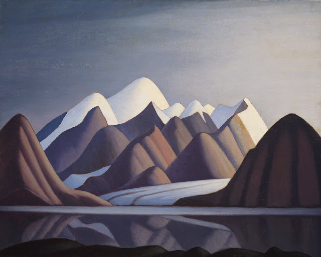
MOUNT THULE PAINTED BY LAWREN HARRIS

http://wanderingvertexes.blogspot.com

LAWREN HARRIS (1885-1970)
Mount Thule  (1,711m- 5,614 ft)
Canada - Nunavut

About Nunavut
Nunavut is the newest, largest, and northernmost territory of Canada. It was separated officially from the Northwest Territories on April 1, 1999, via the Nunavut Act and the Nunavut Land Claims Agreement Act, though the boundaries had been contemplatively drawn in 1993. The creation of Nunavut resulted in the first major change to Canada's political map since the incorporation of the province of Newfoundland and Labrador in 1949.

The mountain 
Mount Thule (1,711m- 5,614 ft) is a mountain on Bylot Island, Nunavut, Canada. It is located 38 km (24 mi) north of Pond Inlet on Baffin Island. It is associated with the Baffin Mountains which in turn form part of the Arctic Cordillera mountain system. The Baffin Mountains are ice-capped mountains in which some of the highest peaks of eastern North America.  While they could be considered a single mountain range as they are separated by bodies of water to make Baffin Island, this is not true, as they are closely related to the other mountain ranges that make the much larger Arctic Cordillera mountain range. The highest point is Mount Odin at (2,147 m -7,044 ft) while Mount Asgard (2,015 m - 6,611 ft) is perhaps the most famous. The highest point in the northern Baffin Mountains is Qiajivik Mountain at (1,963 m -6,440 ft). Mount Tule is the fourth highest point (1,711m- 5,614 ft).  Being situated north of the Arctic tree line, there are no trees in the Baffin Mountains but only rocks which are primarily deeply dissected granitic rocks. It was covered with ice until about 1500 years ago, and vast parts of it are still ice-covered.  The dominant vegetation in the Baffin Mountains is a discontinuous cover of mosses, lichens and cold-hardy vascular plants such as sedge and cottongrass.
Geologically, the Baffin Mountains form the eastern edge of the Canadian Shield, which covers much of Canada's landscape. 
One of the first mountaineering expeditions in the Baffin Mountains was in 1934 by J.M Wordie, in which two peaks called Pioneer Peak and Longstaff Tower were climbed. The Auyuittuq National Park was established in 1976. It features many of Arctic wilderness, such as fjords, glaciers and ice fields. In Inuktitut - the language of Nunavut's Aboriginal people, Inuit - Auyuittuq means "the land that never melts". Although Auyuittuq was established in 1976 as a national park reserve, it was upgraded to a full national park in 2000.
There were Inuit settlements in the Baffin Mountains before European contact. The first European contact is believed to have been by Norse explorers in the 11th century, but the first recorded sighting of Baffin Island was Martin Frobisher during his search for the Northwest Passage in 1576.

The painter 
Lawren Stewart Harris, (1885–1970) was a leading landscape canadian painter, imbuing his paintings with a spiritual dimension. An inspirer of other artists, he was a key figure in the Group of Seven and gave new vision to representations of the northern Canadian landscape. During the 1920s, Harris's works became more abstract and simplified, especially his stark landscapes of the Canadian north and Arctic.  He also stopped signing and dating his works so that people would judge his works on their own merit and not by the artist or when they were painted.
In 1924, a sketching trip with A.Y. Jackson to Jasper National Park in the Canadian Rockies marked the beginning of Harris' mountain subjects, which he continued to explore with annual sketching trips until 1929, exploring areas around Banff National Park, Yoho National Park and Mount Robson Provincial Park. In 1930, Harris went on his last extended sketching trip, travelling to the Arctic aboard the supply ship SS. Beothic for two months, during which time he completed over 50 sketches.  "We are on the fringe of the great North and its living whiteness, its loneliness and replenishment, its resignations and release, tis call and answer, its cleansing rhythms. It seems that the top of the continent is a source of spiritual flow that will ever shed clarity into the growing race of America."(Lawren S. Harris, 1926)
For Harris, art was to express spiritual values as well as to represent the visible world. North Shore, Lake Superior (1926), an image of a solitary weathered tree stump surrounded by an expanse of dramatically lit sky, effectively evokes the tension between the terrestrial and spiritual.
The resulting Arctic canvases that he developed from the oil panels marked the end of his landscape period, and from 1935 on, Harris enthusiastically embraced abstract painting. Several members of the Group of Seven later became members of the Canadian Group of Painters including Harris, A. J. Casson, Arthur Lismer, A. Y. Jackson, and Franklin Carmichael.
From 1934 to 1937, Harris lived in Hanover, New Hampshire, where he painted his first abstract works, a direction he would continue for the rest of his life. In 1938 he moved to Sante Fe, New Mexico, and helped found the Transcendental Painting Group, an organization of artists who advocated a spiritual form of abstraction.
In 1969, he was made a Companion of the Order of Canada.
Harris died in Vancouver in 1970, at the age of 84, as a well-known artist. He was buried on the grounds of the McMichael Canadian Art Collection, where his work is now held.
On November 26, 2015 his painting Mountain and Glacier was auctioned for $3.9 million at a Heffel Fine Art Auction House auction in Toronto, breaking the previous record for the sale of one of Harris's works.
In 2016 a film about Harris's life, Where the Universe Sings, was produced by TV Ontario. It was created by filmmaker Peter Raymont and directed by Nancy Lang.

_______________________________
2017 - Wandering Vertexes...
by Francis Rousseau