google.com, pub-0288379932320714, DIRECT, f08c47fec0942fa0 GRAVIR LES MONTAGNES... EN PEINTURE

Wednesday, February 10, 2021

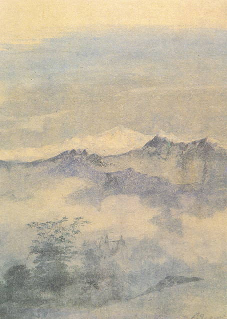
KANGCHENJUNGA PAINTED BY GAGANENDRANATH TAGORE


https://wanderingvertexes.blogspot.com/2021/02/kangchenjunga-painted-by-gaganendranath.html

GAGANENDRANATH  TAGORE  (1867-1938)
Kangchenjunga (8, 538m - 28,169 ft)
India, Népal

In Kangchenjunga, watercolor,  National Gallery of Modern Art, New Delhi


The painter
Gaganendranath Tagore was an Indian painter and cartoonist of the Bengal school. Along with his brother Abanindranath Tagore, he was counted as one of the earliest modern artists in India. Gaganendranath Tagore was born at Jorasanko into a family whose creativity defined Bengal's cultural life. Gaganendranath was the eldest son of Gunendranath Tagore, grandson of Girindranath Tagore and a great-grandson of Prince Dwarkanath Tagore. His brother Abanindranath was a pioneer and leading exponent of the Bengal School of Art. He was a nephew of the poet Rabindranath Tagore and the paternal great-grandfather of actress Sharmila Tagore. Gaganendranath received no formal education but trained under the watercolourist Harinarayan Bandopadhyay. In 1907, along with his brother Abanindranath, he founded the Indian Society of Oriental Art which later published the influential journal Rupam. Between 1906 and 1910, the artist studied and assimilated Japanese brush techniques and the influence of Far Eastern art into his own work, as demonstrated by his illustrations for Rabindranath Tagore's autobiography Jeevansmriti (1912). He went on to develop his own approach in his Chaitanya and Pilgrim series. Gaganendranath eventually abandoned the revivalism of the Bengal School and took up caricature. The Modern Review published many of his cartoons in 1917. From 1917 onwards, his satirical lithographs appeared in a series of books, including Play of Opposites, Realm of the Absurd and Reform Screams.
Between 1920 and 1925, Gaganendranath pioneered experiments in modernist painting.  Partha Mitter describes him as "the only Indian painter before the 1940s who made use of the language and syntax of Cubism in his painting". From 1925 onwards, the artist developed a complex post-cubist style.

The mountain
Kangchenjunga (8,586 m - 28,169 ft) is the third highest mountain in the world. It lies partly in Nepal and partly in Sikkim, India. Kangchenjunga is the second highest mountain of the Himalayas after Mount Everest. Three of the five peaks – Main, Central and South – are on the border between North Sikkim and Nepal. Two peaks are in the Taplejung District, Nepal.
Kangchenjunga Main is the highest mountain in India, and the easternmost of the mountains higher than 8,000 m (26,000 ft).
Until 1852, Kangchenjunga was assumed to be the highest mountain in the world, but calculations based on various readings and measurements made by the Great Trigonometrical Survey of India in 1849 came to the conclusion that Mount Everest., known as Peak XV at the time, was the highest.
It is listed int the Eight Thousanders and as Seven Third Summits
Kangchenjunga is the official spelling adopted by Douglas Freshfield, A. M. Kellas, and the Royal Geographical Society that gives the best indication of the Tibetan pronunciation. Freshfield referred to the spelling used by the Indian Government since the late 19th century. There are a number of alternative spellings including Kangchendzцnga, Khangchendzonga, and Kanchenjunga.
Local Lhopo people believe that the treasures are hidden but reveal to the devout when the world is in peril; the treasures comprise salt, gold, turquoise and precious stones, sacred scriptures, invincible armor or ammunition, grain and medicine. Kangchenjunga's name in the Limbu language is Senjelungma or Seseylungma, and is believed to be an abode of the omnipotent goddess Yuma Sammang.
It rises in a section of the Himalayas called Kangchenjunga Himal that is limited in the west by the Tamur River, in the north by the Lhonak Chu and Jongsang La, and in the east by the Teesta River. It lies about 128 km (80 mi) east of Mount Everest.
Allowing for further verification of all calculations, it was officially announced in 1856 that
Kangchenjunga was first climbed on 25 May 1955 by Joe Brown and George Band, who were part of a British expedition. They stopped short of the summit as per the promise given to the Chogyal that the top of the mountain would remain inviolate. Every climber or climbing group that has reached the summit has followed this tradition...

____________________________

2021 - Wandering Vertexes...
by Francis Rousseau
Sunday, February 7, 2021

ELYSIUM MONS BY NASA VIKING PROGRAM (1975-1982)


NASA VIKING PROGRAM (1975-1982)
Elysium Mons (13, 900m / 13, 9km - 46,000 ft / 8,6 mi)
MARS

Image from camera B (541A44, 541A46). Red filter used . Resolution is about 144 m/pixel. 
Approximate north is at top. taken on 10 December 1977, USGS Astrogeology Science Center 


The Mountain
Elysium Mons (13,900m / 13, 9km - 46,000 ft / 8,6 mi) is a volcano on Mars located in the volcanic province Elysium, at 25.02°N 147.21°E, in the Martian eastern hemisphere. It stands about above the surrounding lava plains, and about 16 km (52,000 ft) above the Martian datum. Its diameter is about 240 km (150 mi), with a summit caldera about 14 km (8.7 mi) across. It is flanked by the smaller volcanoes Hecates Tholus to the northeast, and Albor Tholus to the southeast.
A 6.5 km diameter crater at 29.674 N, 130.799 E, in the volcanic plains to the northwest of Elysium Mons has been identified as a possible source for the nakhlite meteorites, a family of similar basaltic Martian meteorites with cosmogenic ages of about 10.7 Ma, suggesting ejection from Mars by a single impact event. This implies that Martian volcanism had slowed greatly by that point in history.


The Mission
NASA Viking Orbiter 1 was the first of two spacecraft (along with Viking 2) sent to Mars as part of NASA's Viking program. On July 20, 1976, it became the second spacecraft to soft-land on Mars, and the first to successfully perform its mission. (The first spacecraft to soft-land on Mars was the Soviet Union's Mars 3 on December 2, 1971, which stopped transmitting after 14.5 seconds.) Viking 1 held the record for the longest Mars surface mission of 2307 days (over 6​1⁄4 years) or 2245 Martian solar days, until that record was broken by the Opportunity rover on May 19, 2010. Following launch using a Titan/Centaur launch vehicle on August 20, 1975, and an 11-month cruise to Mars, the orbiter began returning global images of Mars about 5 days before orbit insertion. The Viking 1 Orbiter was inserted into Mars orbit on June 19, 1976, and trimmed to a 1513 x 33,000 km, 24.66 h site certification orbit on June 21. Landing on Mars was planned for July 4, 1976, the United States Bicentennial, but imaging of the primary landing site showed it was too rough for a safe landing. The landing was delayed until a safer site was found, and took place instead on July 20, the seventh anniversary of the Apollo 11 Moon landing. The lander separated from the orbiter at 08:51 UTC and landed at Chryse Planitia at 11:53:06 UTC. It was the first attempt by the United States at landing on Mars.
The instruments of the orbiter consisted of two vidicon cameras for imaging (VIS), an infrared spectrometer for water vapor mapping (MAWD) and infrared radiometers for thermal mapping (IRTM). The orbiter primary mission ended at the beginning of solar conjunction on November 5, 1976.
The extended mission commenced on December 14, 1976, after solar conjunction. Operations included close approaches to Phobos in February 1977. The periapsis was reduced to 300 km on March 11, 1977. Minor orbit adjustments were done occasionally over the course of the mission, primarily to change the walk rate — the rate at which the areocentric longitude changed with each orbit, and the periapsis was raised to 357 km on July 20, 1979. On August 7, 1980, Viking 1 Orbiter was running low on attitude control gas and its orbit was raised from 357 × 33943 km to 320 × 56000 km to prevent impact with Mars and possible contamination until the year 2019. Operations were terminated on August 17, 1980, after 1485 orbits. A 2009 analysis concluded that, while the possibility that Viking 1 had impacted Mars could not be ruled out, it was most likely still in orbit. More than 57,000 images were sent back to Earth. 

 _____________________________

2021 - Wandering Vertexes...
by Francis Rousseau

Wednesday, February 3, 2021

FUJIYAMA / 富士山 (n°13) BY KATSUSHIKA HOKUSAÏ


KATSUSHIKA HOKUSAÏ (1760-1849)
Fujiyama / 富士山 (3,776.24 m -12,389 ft)
Japan

In Fujiyama from the Village of Sekiya at Sumida river,
n °13 from the series 36 Views of Mt. Fuji, 1830-32,
Edo Tokyo Museum, Japan


About the 36 Views of Mt Fuji

Thirty-six Views of Mount Fuji (富嶽三十六景 Fugaku Sanjūrokkei) is a series of landscape prints created by the Japanese ukiyo-e artist Hokusai (1760?1849). The series depicts Mount Fuji from different locations and in various seasons and weather conditions. The original thirty-six prints were so popular that Hokusai expanded the series by ten.
The earliest impressions appear faded when compared to the versions usually seen, but are closer to Hokusai's original conception. The original prints have a deliberately uneven blue sky, which increases the sky's brightness and gives movement to the clouds. The peak is brought forward with a halo of Prussian blue. Subsequent prints have a strong, even blue tone and the printer added a new block, overprinting the white clouds on the horizon with light blue. Later prints also typically employ a strong benigara (Bengal red) pigment, which lent the painting its common name of Red Fuji. The green block colour was recut, lowering the meeting point between forest and mountain slope.

The artist
Katsushika Hokusai (葛飾 北斎) was a Japanese artist, ukiyo-e painter and printmaker of the Edo period. He was influenced by such painters as Sesshu, and other styles of Chinese painting. Born in Edo (now Tokyo), Hokusai is best known as author of the woodblock print series Thirty-six Views of Mount Fuji (富嶽三十六景 c. 1831) which includes the internationally recognized print, The Great Wave off Kanagawa, created during the 1820s.
Hokusai created the "Thirty-Six Views of Mt Fuji " both as a response to a domestic travel boom and as part of a personal obsession with Mount Fuji. In this series, Mt Fuji is painted on different meteorological conditions, in different hours of the days, in different seasons and from different places.

The mountain
This is the legendary Mount Fuji or Fujiyama (富士山).
It is located on Honshu Island and is the highest mountain peak in Japan at 3,776.24 m (12,389 ft). Several names are attributed to it: "Fuji-san", "Fujiyama" or, redundantly, "Mt. Fujiyama". Usually Japanese speakers refer to the mountain as "Fuji-san". The other Japanese names for Mount Fuji, have become obsolete or poetic like: Fuji-no-Yama (ふじの山 - The Mountain of Fuji), Fuji-no-Takane (ふじの高嶺- The High Peak of Fuji), Fuyō-hō (芙蓉峰 - The Lotus Peak), and Fugaku (富岳/富嶽), created by combining the first character of 富士, Fuji, and 岳, mountain.
Mount Fuji is an active stratovolcano that last erupted in 1707–08. Mount Fuji lies about 100 kilometres (60 mi) south-west of Tokyo, and can be seen from there on a clear day.
Mount Fuji's exceptionally symmetrical cone, which is snow-capped several months a year, is a well-known symbol of Japan and it is frequently depicted in art and photographs, as well as visited by sightseers and climbers.
Mount Fuji is one of Japan's Three Holy Mountains (三霊山) along with Mount Tate and Mount Haku. It is also a Special Place of Scenic Beauty and one of Japan's Historic Sites.
It was added to the World Heritage List as a Cultural Site on June 22, 2013. As per UNESCO, Mount Fuji has “inspired artists and poets and been the object of pilgrimage for centuries”. UNESCO recognizes 25 sites of cultural interest within the Mt. Fuji locality. These 25 locations include the mountain itself, Fujisan Hongū Sengen Shrine and six other Sengen shrines, two lodging houses, Lake Yamanaka, Lake Kawaguchi, the eight Oshino Hakkai hot springs, two lava tree molds, the remains of the Fuji-kō cult in the Hitoana cave, Shiraito Falls, and Miho no Matsubara pine tree grove; while on the low alps of Mount Fuji lies the Taisekiji temple complex, where the central base headquarters of Nichiren Shoshu Buddhism is located.


______________________________

2021 - Wandering Vertexes...
by Francis Rousseau


Sunday, January 31, 2021

THE DENTELLES DE MONTMIRAIL PAINTED BY A. G. CARRICK / H.M KING CHARLES III


https://wanderingvertexes.blogspot.com


A. G. CARRICK / H.M KING CHARLES III former PRINCE OF WALES (bn.1948)
Les Dentelles de Montmirail (734m - 2,400 ft)
France (Vaucluse)

In Les Dentelles de Montmirail from Le Barroux, watercolor, Priaate coillection


The mountains
The Dentelles de Montmirail (734 m - are a small chain of mountains in Provence in France, in the département of Vaucluse, located just to the south of the village of Vaison-la-Romaine. They are foothills of the highest peak in Provence, Mont Ventoux, which is situated just to the east. The dramatically jagged shape of their peaks was formed by horizontal strata of Jurassic limestone being folded and forced into a nearly upright position and subsequently eroded into sharp-edged ridges and spikes. The highest peak of the Dentelles is St-Amand, at 734 m (2,400 ft). The range, which is about 8 km wide, offers over 600 trails for walking, rock climbing, and mountain biking.]The foot of the Dentelles is surrounded by vineyards of the Rhône Valley. Their name Dentelles, the French word for "lace," refers to their shape obtained by erosion, while Montmirail is derived from the Latin mons mirabilis meaning 'admirable mountain'.
Located on the territory of the communes of Beaumes-de-Venise, Crestet, Gigondas, La Roque-Alric, Lafare, Le Barroux, Malaucène, Suzette, and Vacqueyras; the Dentelles de Montmirail were an important natural frontier during Antiquity between the tribes of the Memini in the south, and the Voconces in the north. 

The painter
Arthur George Carrick is actually H.M. the King Charles III, former Prince of Wales.
When he began showing his paintings, he was too nervous to display his name so displayed under a pseudonym. Arthur George are two of his names (Charles Phillip Arthur George) and one of his titles is Earl of Carrick. King Charles III is an experienced watercolourist.  He has been painting for most of his adult life, during holidays or when his official diary allows. King Charles' interest began during the 1970s and 1980s when he was inspired by Robert Waddell, who had been his art master at Gordonstoun in Scotland. In time, King Charles met leading artists such as Edward Seago, with whom he discussed watercolour technique, and received further tuition from John Ward, Bryan Organ and Derek Hill.
The Royal Family has a tradition of drawing and painting, and King Charles’ work first came to public notice at a 1977 exhibition at Windsor Castle at which other Royal artists included Queen Victoria, The Duke of Edinburgh and The Duke of York.
King Charles paints in the open air, often finishing a picture in one go and his favourite locations include The Queen's estate at Balmoral in Scotland and Sandringham House in Norfolk, England. Sometimes King Charles  III paints during his skiing holidays, and during overseas tours when possible.
The copyright of King Charles' watercolours belongs to A. G. Carrick Ltd, a trading arm of The King's Charities Foundation. Over the years King Charles III has agreed to exhibitions of his watercolours and of lithographs made from them, on the understanding that any income they generate goes to The Prince of Wales's Charitable Foundation.
Money from the sale of the lithographs also goes to the Foundation but the paintings themselves are never for sale.
In the 1980s King Charles III, then Prince of Wales,  began inviting young British artists to accompany him on official tours overseas and record their impressions, a tradition that has continued to this day.
Reference :
- The prince of Wales paintings 

______________________________

2021 - Wandering Vertexes...
by Francis Rousseau


Wednesday, January 27, 2021

THE SWARTBERG PAINTED BY TINUS DE JONGH

https://wanderingvertexes.blogspot.com/2021/01/the-swartberg-painted-by-tinus-de-jongh.html

 
TINUS DE JONGH (1855-1942)
The Swartberg (2,325m-7,628 ft)
South Africa (Western Cape)

In Meiringspoort, oil on canvas, 1935, Private collection


The mountains and pass
The Swartberg mountains (2,325m-7,628 ft), meaning black mountain in Afrikaans, are a mountain range in the Western Cape province of South Africa. It is composed of two main mountain chains running roughly east–west along the northern edge of the semi-arid Little Karoo. To the north of the range lies the other large semi-arid area in South Africa, the Great Karoo. Most of the Swartberg Mountains are above 2000 m high, making them the tallest mountains in the Western Cape. It is also one of the longest, spanning some 230 km from south of Laingsburg in the west to between Willowmore and Uniondale in the east. Geologically, these mountains are part of the Cape Fold Belt.
Meiringspoort (750m-2,460 ft) is a pass trough the Swartberg range of mountains, Until the first pass was cut, these mountains were virtually insurmountable, The pass was cut in 1858 and the route completed in only 223 working days, comprising one of the era's most extraordinary feats of engineering. It was also a huge economic step for the interior of the Cape Colony. For example, by 1870, an eighth of the country's wool exports passed through the Meiringspoort.
The Meiringspoort provides paved road transit through the Swartberg range, using the route largely carved by a river. The poort connects the town of De Rust in the south, with the town of Klaarstroom in the north. It also offers a spectacular drive through incredible rock formations, (as depicted in the painting above) and is the setting for an annual half marathon that ends in the town of De Rust. Modern additions mean several different passes now cut different routes through the range.


The artist
Martinus Johannes "Tinus" de Jongh was one of South Africa's most popular painters.
Self-taught, he began his career as a decorator in the Netherlands where he was born, and then pursued painting full-time. He achieved some note when the Stedelijk Museum in Amsterdam purchased one of his early pictures. He arrived in South Africa in 1921, practicing a sober style within the Dutch tradition, typified there by Still Life with Birds and Hare. The light and landscape of South Africa soon caused him to abandon his muted palette in favour of more saturated colours (as seen above). His formulaic approach to painting Cape landscapes with gabled farmhouses created such a demand that he abandoned his considered brushwork in favour of a broader palette knife technique. His etchings sold in the hundreds through his dealer Louis Woolf. 

_______________________________

2021 - Wandering Vertexes...
by Francis Rousseau

Saturday, January 23, 2021

DEDO DE DEUS PAINTED BY ELISEU VISCONTI

https://wanderingvertexes.blogspot.com/2021/01/dedo-de-deus-painted-by-eliseu-visconti.html

ELISEU VISCONTI (1866-1944)
Dedo de Deus (1,682m - 5,551ft)
Brazil

The mountain
Dedo de Deus (The Finger of God) (1,682m - 5,551ft) is a peck whose outline resembles a hand pointing the index finger to the sky. It is one of the several geological monuments of Serra dos Órgãos which is located in Serra do Mar, between the cities of Petrópolis, Guapimirim and Teresópolis, in the state of Rio de Janeiro, in Brazil. The mountaineering in Brazil is closely linked to the achievement of the Dedo de deus. The peak is a state symbol Rio de Janeiro, appearing on its flag and coat of arms. As for the coat of arms of the State of Rio de Janeiro, the first section, occupying the upper half, is blue, representing the sky and symbolizing justice, truth and loyalty, with the silhouette of the Serra dos Órgãos, highlighting the Dedo de Deus.  The symbol was created by the 1892 State Constitution and made official under the government of José Tomás da Porciúncula, with small differences over time.  In 1912, José Guimarães Teixeira, Raul Carneiro and the brothers Américo, Alexandre and Acácio de Oliveira, all from Teresópolis, were the first to step on top of the rock formation.


The artist
Eliseu Visconti, born Eliseo d'Angelo Visconti was an Italian-born Brazilian painter, cartoonist, and teacher. He is considered one of the very few impressionist painters of Brazil. He is considered the initiator of the art nouveau in Brazil.
Thanks to a prize received in 1892, Visconti travelled to Paris, where he attended the École des Beaux Arts the following year. He also took classes at the Académie Julian and the École nationale supérieure des arts décoratifs, where he was a pupil of art nouveau master Eugène Grasset. He was accepted at the Salon de la Nationale des Beaux Arts and at the Salon of the Société of des Artistes Français. As one of the Brazilian representatives to the Exposition Universelle 1900 he exhibited the paintings Gioventú and Oréadas, for which he received a silver medal. Back in Brazil, Visconti exhibited in Rio de Janeiro and São Paulo, and obtained the first place in a contest for the drawing of postal stamps for the Brazilian Casa da Moeda.  He traveled again to Europe, where he exhibited at the Paris Salon of 1905 the portrait of the artist Nicolina Vaz de Assis now at the Museu Nacional de Belas Artes. In this same year, he was invited to paint the stage curtain for the Teatro Municipal of Rio de Janeiro which he completed in his studio in Paris.
Decorative schemes executed for the National Library or Biblioteca Nacional in (Rio de Janeiro) date from this period as does another gold medal he received at the International Exhibition of Saint-Louis (Louisiana Purchase Exposition), in 1904, for the painting Recompensa de São Sebastião (see external links). The museum of Santiago of the Chile acquired his Sonho Místico (Mystical Dream) in 1912.  In 1913, Visconti returned to Europe in order to paint large scale panels for the "foyer" of the Theatro Municipal do Rio de Janeiro. His plans to return were interrupted by the First World War so he stayed in France until 1920. The resulting paintings for the "foyer" were sent to Brazil during the war, in 1915.  In 1922 his triptych "Lar" gained him the Medal of Honor in a large exhibition created in Rio de Janeiro to commemorate the first centennial of Brazilian Independence, the Exposição do Centenário.  The following year Visconti painted the mural decoration of Rio de Janeiro's municipal council hall. In 1924, he painted the panel depicting the signature of the first Republican Constitution, for the old federal court, also in Rio de Janeiro.


_______________________________

2021 - Wandering Vertexes...
by Francis Rousseau


Tuesday, January 19, 2021

THE RYSY - TATRAS MOUNTAINS PAINTED BY STANISLAW WITKIEWICZ

https://wanderingvertexes.blogspot.com/2021/01/the-rysy-tatras-mountains-painted-by.html


STANISLAW WITKIEWICZ (1851-1915)
The Rysy (2,503 m -8,212 ft)
Poland - Slovakia border

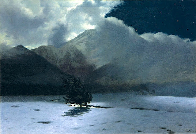
In  Halny Wind in Tatra Mountains, 1885, oil on canvas


About this painting
Halny is a foehn wind that blows in southern Poland and in Slovakia in the Tatra Mountains of the Carpathians. The most turbulent halny blows in Podhale region of southern Poland, coming from the south, down the slopes of the Tatra Mountains; in Slovakia, on the other side of the mountains, it comes from the north. Halny is a warm windstorm that blows through the valleys. It is often disastrous; ripping off roofs, causing avalanches and, according to some people, can have some influence on mental states. Most halny occur in October and November, sometimes in February and March, rarely in other months. In May 1968 a destructive halny known as Wind of the Century where winds reportedly reached 288 km/h, destroyed large areas of forestry in southern Poland.

The mountain
The Rysy (2,503 m -8,212 ft), the the highest point in Poland. named Meeraugspitze in German and Tengerszem-csúcs in Hungarian is a mountain in the crest of the High Tatras, lying on the border between Poland and Slovakia. Rysy has three summits: the middle at 2,503 m (8,212 ft); the north-western at 2,499 m (8,199 ft); and the south-eastern at 2,473 m (8,114 ft). The north-western summit is the highest point of Poland ; the other two summits are on the Slovak side of the border, in the Prezov Region. A folk explanation on the Slovak side says that the name comes from the plural word rysy meaning "lynxes", although the habitat of the lynx does not extend above the timberline.
The Hungarian name Tengerszem-csúcs and the German name Meeraugspitze mean "eye-of-the-sea peak", from the glacial lake at the northern foot of the mountain, called "eye of the sea" (Morskie Oko in Polish). Morskie Oko (literally Eye of the Sea") is the largest and fourth-deepest lake (50, 8 m - 166 ft) in the Tatra Mountains. It is located deep within the Tatra National Park, in the Rybi Potok Valley, of the High Tatras mountain range at a n altitude of 1,395m - 4,577ft.
Many Swiss Pines also grow around the lake as shown in this painting.


The artist
Stanisław Witkiewicz was a Polish painter, art theoretician, and amateur architect, known for his creation of "Zakopane Style". He studied at the Academy of Fine Arts in Saint Petersburg (1868–1871) and furthered his studies in Munich (1872–1875). In 1875, he moved to Warsaw and set up a painting workshop in the laundry at the Hotel Europejski. In 1884–1887, Witkiewicz worked as the artistic director of "Wędrowiec" weekly, for which he wrote a series of articles concerning the values of a work of art and the role of art critics (published in book form under the title "Painting and criticism among us", in 1891 and 1899). In 1887, he held the same position in "Kłosy" magazine.
In 1886, he visited Zakopane for the first time. He developed a fascination with the mountains, the Podhale highlanders and their vernacular traditions. His ambition became to create a Polish national style through extraction of all-Polish forms from the architectural and decorative art of the highlanders. He formulated the Zakopane Style (styl zakopiański) (also known as Witkiewicz Style in architecture, in which he designed homes and interiors for well-off, artistically inclined Poles. He was strongly associated with Zakopane and promoted it in the art community. Witkiewicz had strong views against formal education: "school is completely at odds with the psychological make-up of human beings". He applied this principle in his son's upbringing and was disappointed when the 20-year-old Witkacy chose to enroll at the Academy of Fine Arts in Kraków. In 1908, suffering from tuberculosis, the elder Witkiewicz left his family in Zakopane and relocated to Lovran, a fashionable resort in what was then Austria-Hungary, which today is in Croatia. He died there in 1915.

_______________________________

2021 - Wandering Vertexes...
by Francis Rousseau
Saturday, January 16, 2021

POPOCATEPETL AND IZTACCHIHUATL (6) PAINTED BY JOSÉ MARIRA VELASCO


JOSE MARIA VELASCO (1840-1912)
Popocatépetl (5, 426 m -17, 802 ft) on left)
Iztaccíhuatl (5,230 m - 17,160 ft) (on right)
Mexico

In Popocatepetl and Iztacchihuatl , 1895, watercolor, The José María Velasco Museum, Mexico


The volcanoes
Popocatépetl (5,426 m - 17,802 ft), on right in this painting, is an active volcano, located in the states of Puebla, Mexico, and Morelos, in Central Mexico, and lies in the eastern half of the Trans-Mexican volcanic belt. The name Popocatépetl comes from the Nahuatl words Popōca (It smokes) and Tepētl (mountain), meaning Smoking Mountain. It is the second highest peak in Mexico, after Citlaltépetl (Pico de Orizaba) at 5,636 m (18,491 ft).
It is linked to the Iztaccihuatl volcano to the north by the high saddle known as the Paso de Cortés.
Popocatépetl is 70 km (43 mi) southeast of Mexico City, from where it can be seen regularly, depending on atmospheric conditions. Until recently, the volcano was one of three tall peaks in Mexico to contain glaciers, the others being Iztaccihuatl and Pico de Orizaba.
Iztaccíhuatl (5,230 m - 17,160 ft) is dormant volcanic mountain in Mexico located on the border between the State of Mexico and Puebla. It is the nation's third highest, after Pico de Orizaba 5,636 m (18,491 ft) and Popocatépetl 5,426 m (17,802 ft). The name "Iztaccíhuatl" is Nahuatl for "White woman", reflecting the four individual snow-capped peaks which depict the head, chest, knees and feet of a sleeping female when seen from east or west.The peak is sometimes nicknamed La Mujer Dormida (The Sleeping Woman.) Iztaccíhuatl is to the north of Popocatépetl, to which it is connected by the high altitude Paso de Cortés. Depending on atmospheric conditions Iztaccíhuatl is also visible much of the year from Mexico City some 70 km (43 mi) to the northwest.
The first recorded ascent was made in 1889, though archaeological evidence suggests the Aztecs and previous cultures climbed it previously. It is the lowest peak containing permanent snow and glaciers in Mexico.
In Aztec mythology : Iztaccíhuatl was a princess who fell in love with one of her father's warriors, Popocatépetl. The emperor sent Popocatépetl to war in Oaxaca, promising him Iztaccíhuatl as his wife when he returned (which Iztaccíhuatl's father presumed he would not). Iztaccíhuatl was falsely told that Popocatépetl had died in battle, and believing the news, she died of grief. When Popocatépetl returned to find his love dead, he took her body to a spot outside Tenochtitlan and kneeled by her grave. The gods covered them with snow and changed them into mountains.
Popocatépetl became an active volcano, raining fire on Earth in blind rage at the loss of his beloved.

The painter

José Maria Tranquilino Francisco de Jesus Velasco Gomez Obregуn, generally known as José Maria Velasco, was a 19th-century Mexican polymath, most famous as a painter who made Mexican geography a symbol of national identity through his paintings. He was both one of the most popular artists of the time and internationally renowned. He received many distinctions such as the gold medal of the Mexican National Expositions of Bellas Artes in 1874 and 1876; the gold medal of the Philadelphia International Exposition in 1876, on the centenary of U.S. independence; and the medal of the Paris Universal Exposition in 1889, on the centenary of the outbreak of the French Revolution. His painting El valle de Mexico is considered Velasco's masterpiece, of which he created seven different renditions. Of all the nineteenth-century painters, Velasco was the "first to be elevated in the post-Revolutionary period as an exemplar of nationalism."
Velasco's long career elevated Mexican landscape painting to international standing. One of his landscapes of the Valley of Mexico is in the Vatican Museum, a gift to Pope Leo XIII. His scenes of the Mexican landscape are a visual source for environmental historians, since they show the Valley of Mexico before its degradation in the twentieth century, with air pollution and urban sprawl. His landscape art has a wide appeal, since it is more accessible than history paintings that require the viewer to understand a particular event.
Today the Government of the State of Mexico, where Velasco was from, presents an award for artistic merit in his name to painters born in that state. Among the most outstanding winners are Luis Nishizawa, Leopoldo Flores, Ignacio Barrios and Héctor Cruz.
The José María Velasco Museum was opened in 1992 in Toluca City with the task of preserving and promoting his paintings.

_______________________________

2021 - Wandering Vertexes...
by Francis Rousseau

Wednesday, January 13, 2021

CRISTO MOUNTAINS PAINTED BY WILLIAM VICTOR HIGGINS


https://wanderingvertexes.blogspot.com/2021/01/cristo-mountains-painted-by-william.html

WILLIAM VICTOR HIGGINS (1884-1949)
Cristo mountains (4,374m-14, 351ft)
United States of America (Colorado and New Mexico)

In  Taos mountains New Mexico, 1921, oil on canvas

The mountains
Cristo mountains (culminating at Bianca Peak 4,374m-14, 351ft ), origanally The Sangre de Cristo Mountains (Spanish for "Blood of Christ") are the southernmost subrange of the Rocky Mountains. They are located in southern Colorado and northern New Mexico in the United States. The mountains run from Poncha Pass in South-Central Colorado, trending southeast and south, ending at Glorieta Pass, southeast of Santa Fe, New Mexico. The mountains contain a number of fourteen thousand foot peaks in the Colorado portion, as well as all the peaks in New Mexico which are over thirteen thousand feet.
The name of the mountains may refer to the occasional reddish hues observed during sunrise and sunset, and when alpenglow occurs, especially when the mountains are covered with snow. Although the particular origin of the name is unclear, it has been in use since the early 19th century. Before that time the terms "La Sierra Nevada", "La Sierra Madre", "La Sierra", and "The Snowies" (used by English speakers) were used. According to tradition, "sangre de Cristo" were the last words of a Catholic priest who was killed by Indians.

The artist
William Victor Higgins was an American painter and teacher, born at Shelbyville, Indiana. He studied at the Art Institute in Chicago and at the Chicago Academy of Fine Arts.
In Paris he was a pupil of Robert Henri, René Menard and Lucien Simon, and when he was in Munich he studied with Hans von Hayek. He was an associate of the National Academy of Design. Higgins moved to Taos, New Mexico in 1913 and joined in 1917 the Taos Society of Artists founded two years before by Joseph Henry Sharp, W. Herbert Dunton, Eanger Irving Couse et Oscar Edmund Berninghaus.
In 1923 he founded The Hartwood Foundation with Louise Harwood and Bert Phillips. He then painted a lot of works representing the mountains range surrounding the city of Taos and especially the Pueblo Mountains.
During the Depression, he was commissioned to paint a mural inside the Taos County Courthouse financed by the PWAP, titled Moises, El Legislador. 

_______________________________

2021 - Wandering Vertexes / Mountain paintings
By Francis Rousseau

Sunday, January 10, 2021

MOUNT SNOWDON FROM LLYN Y DDINAS BY SIDNEY RICHARD PERCY


https://wanderingvertexes.blogspot.com/2021/01/mount-snowdon-from-llyn-y-ddinas-by.html

SIDNEY RICHARD PERCY (1821-1886)
Mount Snowdon (1, 085 m -3,560 ft)
United Kingdom (Wales)

In Llyn-y-Ddinas, North Wales, Mount Snowdon in the background (1873), Oil on canvas, 45.5 x 76 cm. Private Collection

 
The mountain
Mount Snowdon (1, 085 m -3,560 ft),Yr Wyddfa in welsh, is the highest mountain in Wales and the highest point in the British Isles south of the Scottish Highlands. A 1682 survey estimated that the summit of Snowdon was at a height of 1,130 m - 3,720 feet ; in 1773, Thomas Pennant quoted a later estimate of 1,088 m- 3,568 ft above sea level at Caernarfon. Recent surveys give the height of the summit as 1,085 m -3,560 ft. The name Snowdon is from the Old English for "snow hill", while the Welsh name – Yr Wyddfa – means "the tumulus" or "the barrow", which may refer to the cairn thrown over the legendary giant Rhitta Gawr after his defeat by King Arthur. As well as other figures from Arthurian legend, the mountain is linked to a legendary Afanc (water monster) and the Tylwyth Teg (fairies). Mount Snowdon is located in Snowdonia National Park (Parc Cenedlaethol Eryri) in Gwynedd. It has been described as "probably the busiest mountain in Britain", with approximately 444,000 people having walked up the mountain in 2016. It is designated as a national nature reserve for its rare flora and fauna. The rocks that form Snowdon were produced by volcanoes in the Ordovician period, and the massif has been extensively sculpted by glaciation, forming the pyramidal peak of Snowdon and the Arêtes of Crib Goch and Y Lliwedd. The cliff faces on Snowdon, including Clogwyn Du'r Arddu, are significant for rock climbing, and the mountain was used by Edmund Hillary in training for the 1953 ascent of Mount Everest.
The summit can be reached by a number of well-known paths, and by the Snowdon Mountain Railway, a rack and pinion railway opened in 1896 which carries passengers the 4.7 miles (7.6 km) from Llanberis to the summit station.

The painter
Sidney Richard Percy had his greatest success painting landscapes of grazing cattle, typically set against backgrounds of distant mountains and cloudy skies. The prevailing hues of his landscapes are earth tones and soft greens, accentuated by a variety of pastel hues. The detail in his work is part of its appeal, and "it was remarked that his rocks and stones were sufficiently accurate to have served as illustrations to the writings of Sir Roderick Murchison, the popular 19th-century geologist." Llyn-y-Ddinas, North Wales, (see above) one of his more popular works on the internet, displays these qualities. He also painted landscapes of farm fields, wheel-rutted country roads, and the occasional boat scene on a lake. Although he generally painted in oils, a number of small watercolors on cardboard exist, typically unsigned, that are his work. The family, and his son the painter Herbert Sidney Percy in particular, referred to these as "potboilers", meaning that they were quickly, and often crudely executed, yet easily and cheaply sold "to put food on the table" when working on larger, more time-consuming oils for exhibition, or commissions. Many of these watercolor "potboilers" were done in the field, and then brought back to the studio to refer to when executing a more formal oil on canvas.
Sidney Richard Percy was extremely popular during the early part of his career, which for a short time brought him a fair amount of income. Among his patrons during this time was Prince Albert the Royal consort who in 1854 gave Percy's landscape of A view of Llyn Dulyn, North Wales, which had just been exhibited at the Royal Academy, as a gift to his wife Queen Victoria. This painting still hangs today in the Royal Collection. Unfortunately Sidney Richard Percy outlived his popularity, and the art world was more excited about impressionism and other styles than landscapes when he died. Today though, his work is much sought after, and his better paintings bring much higher prices in auction than any of those of his brethren in the Williams family.
When the Athenaeum in 1886 (i. 592) ran an obituary for Sidney Richard Percy they called him, "the well-known and popular painter, founder of the so-called School of Barnes . . ." Although depending on the context of what is meant by the so-called Barnes School, this is a bit of an injustice to his father Edward Williams, whom it might be argued is the founder of the Barnes School of painters, but it illustrates the popularity that Sidney Richard Percy held with the art-buying public of his day.

__________________________________________

2021 - Wandering Vertexes / Mountain paintings
By Francis Rousseau

Thursday, January 7, 2021

MOUNT BURKE & BAY OF ISLANDS PAINTED BY FRANKLIN CARMICHAEL

https://wanderingvertexes.blogspot.com/2021/01/mount-burke-bay-of-islands-painted-by.html


FRANKLIN CARMICHAEL (1890–1945)
Mount Burke (1,270 m  - 4,167 ft)
Canada (British Columbia)

In Bay of Islands from Mt. Burke, 1931, oil on canvas, 101.6 x 122.0 cm, 

McMichael Canadian Art Collection


The mountain

Mount Burke (1,270 m (4,167 ft), is a mountain located in northeast Coquitlam, British Columbia, north of Port Coquitlam on the ridge system leading to Coquitlam Mountain. Most of the mountain is part of Pinecone Burke Provincial Park.   Mount Burke was named for Edmund Burke by Captain George Henry Richards of HMS Plumper while surveying Burrard Inlet in 1859.
The mountain was placed in Pinecone Burke Provincial Park on the park's creation in 1995.
Many people confuse Mount Burke, with the much higher and larger Burke Ridge, which is more commonly known as Burke Mountain, and in the 1920s Burke Ridge was more commonly known as Dollar Mountain, after the Canadian Robert Dollar Company, who logged the lower portions of the mountain.

The artist
Franklin Carmichael was a Canadian artist and member of the Group of Seven. Though he was primarily famous for his use of watercolours, he also used oil paints, charcoal and other media to capture the Ontario landscapes of which he was fond. Besides his work as a painter, he worked as a designer and illustrator, creating promotional brochures, advertisements in newspapers and magazines, and stylizing books. Near the end of his life, Carmichael taught in the Graphic Design and Commercial Art Department at the Ontario College of Art (today the Ontario College of Art and Design). The youngest original member of the Group of Seven, Carmichael often found himself socially on the outside of the group. Despite this, the art he produced was of equal measure in terms of style and approach to the other members' contributions, vividly expressing his spiritual views through his art.  Carmichael was a passionate landscape painter. Many of his paintings depict the trees, rocks, hills, and mountains of Ontario. His earlier works had flat juxtapositions of colour, but as he matured through the 1920s he emphasized depth and three dimensional space. Beyond simple representation of picturesque views, Carmichael attempted to capture contrast.  Contemporary Emily Carr wrote that Carmichael's work was, "A little pretty and too soft, but pleasant."Carmichael was a member of the Royal Canadian Academy of Arts.  In 1952, Dr. Ann Curtin and Carmichael's widow founded the Franklin Carmichael Art Group, now located at 34 Riverdale Drive in Toronto.


__________________________________________

2021 - Wandering Vertexes / Mountain paintings
By F rancis Rousseau


Monday, January 4, 2021

NANGA PARBAT PAINTED BY NICHOLAS ROERICH


https://wanderingvertexes.blogspot.com/2021/01/nanga-parbat-painted-by-nicholas-roerich.html
 
 
NICHOLAS ROERICH (1874-1947),
Nanga Parbat (8,126 m - 26,660 ft)
Pakistan

 In Nanga Parbat, oil on canvas, 1940, Nicolas Roerich  Museum, NYC


The mountain
Nanga Parbat (8,126 metres (26,660 ft) locally known as Diamer, is the ninth highest mountain in the world . Located in the Diamer District of Gilgit-Baltistan region, Pakistan, Nanga Parbat is the western anchor of the Himalayas. ] The name Nanga Parbat is derived from the Sanskrit words nagna and parvata which together mean "Naked Mountain".  The mountain is locally known by its Tibetan name Diamer or Deo Mir, meaning "huge mountain".
Nanga Parbat is one of the 14 eight-thousanders. An immense, dramatic peak rising far above its surrounding terrain, Nanga Parbat is known to be a difficult climb.   Nanga Parbat is one of only two peaks on Earth that rank in the top twenty of both the highest mountains in the world, and the most prominent peaks in the world, ranking ninth and fourteenth respectively. The other is Mount Everest, which is first on both lists.  Nanga Parbat along with Namcha Barwa on the Tibetan Plateau mark the west and east ends of the Himalayas.

The painter
Nicholas Roerich known also as Nikolai Konstantinovich Rerikh (Никола́й Константи́нович Ре́рих) is quite an important figure of mountain paintings in the early 20th century. He was a Russian painter, writer, archaeologist, theosophist, perceived by some in Russia as an enlightener, philosopher, and public figure. In his youth was he was quite influenced by a movement in Russian society around the occult and was interested in hypnosis and other spiritual practices. His paintings are said to have hypnotic expression.
More about the painter =>

__________________________________________

2021 - Wandering Vertexes / Mountain paintings
By F rancis Rousseau

_______________________________

2021 - Wandering Vertexes...
by Francis Rousseau

Friday, January 1, 2021

VICTORIA PEAK PAINTED BY ERNEST CHARTON DE TREVILLE


ERNEST CHARTON DE TREVILLE (1816-1877)
Victoria Peak  (552 m -1,811 ft)
China (Hong Kong)
 
In Victoria Peak vu de la Baie de Hong Kong, Oil on canvas, Private collection 

The mountain
Victoria Peak (552 m -1,811 ft) or 太平山 (in Chinese) also locally called The Peak or Mount Austin an sa few others cantonese and Hong Kong Hakka names such as Taai Pen Saa or Deng or Saan Deng or Ce Kei Saan or Lou Fung... is a mountain in the western half of Hong Kong Island. It is the highest mountain on Hong Kong island, ranked 31 in terms of elevation in the Hong Kong Special Administrative Region ; Tai Mo Shan (957m) being the highest point in the Hong Kong Special Administrative Region.The summit is occupied by a radio telecommunications facility and is closed to the public. However, the surrounding areaf public parks and high-value residential land is the area that is normally meant by the name The Peak. During the19th century, the Peak attracted prominent European residents because of its panoramic view over the city and its relatively temperate climate compared to the sub-tropical climate in the rest of Hong Kong. The sixth Governor of Hong Kong, Sir Richard MacDonnell had a summer residence built on the Peak circa 1868. Those that built houses named them whimsically, such as The Eyrie, and the Austin Arm. These original residents reached their homes by sedan chairs, which were carried up and down the steep slope of Victoria Peak.

The painter
Ernest-Marc-Jules Charton Thiessen of Treville better known as Ernest Charton or Ernesto Charton was a French painter, famous for his pastel portraits and realistic- style customary paintings. He made most of his artistic career in South America - particularly in Argentina Chile and Ecuador -, a continent where his first name, as was customary at the time, was Castilianized, which is why he was known as Ernesto Charton.
He was initially established in Valparaíso (Chile), but in 1848 he moved to Santiago where he opened a studio neighboring that of Raymond Monvoisin, another French pioneer of Chilean painting and also belonging to traveling artists as was also at that time the watercolorist Carlos Wood.
Brother of Edouard Charton, director of the Parisian magazine Le Tour du Monde Ernesto was a typical adventurous artist of the nineteenth century in search of the most exotic expressions of unexplored nature, following in this aspect the motivation of numerous European painters of the time.  Many of his American experiences were reflected in the L'llustration, a magazine also directed by his brother and of which he was a correspondent, sending not only chronicles but also drawings, such as those he sent from the streets of Valparaíso before the bombing. He also sent a drawing of the bombing of Callao, which was recorded by Louis Le Breton and published on June 23.
Tempted by the gold rush in California he embarked on October 25, 1848 on the schooner Rosa Segunda, who arrived in the Galapagos Islands within two weeks to get water; when most of the passengers were ashore, the ship abandoned them to their fate. The painter, like his companions, lost everything, including his works.
Charton, who in 1862 would return to Ecuador, managed to settle in Quito with the help of the French consul. He taught drawing and painting at the University of that city; in addition, he directed the Miguel de Santiago Liceo of Painting, a direct antecedent of the School of Fine Arts of that country. As a result of his stay in Ecuador, he left a 48-watercolors album (cf. above)
He returned to France, but in 1855 he returned to Chile with his family; he gained fame as a portraitist, landscaper and teacher. In this last quality he had a famous controversy with the first director of the Academy of Painting of Santiago. ]
In 1870 he left Chile to Argentina, crossing the Andes. From that experience, his large oil painting was born the following year View of the Andes mountain range (115x197cm) that is today in the National Museum of Fine Arts of that country, in Buenos Aires, city where he settled until his death.
In addition to the countries mentioned, he travelled in Italy, Panama (when it was still part of Colombia) Peru and China (Hong Kong, Macao) (see above). 
As a Photographer, he used snapshots as a base for his paintings, portraying typical clothes, customs and parties that he then tracked to the web.
Charton's works are characterized by their vibrant color and the realistic expression of popular customs and motifs. He left among his students from Chile, Ecuador and Argentina this cultural vision of pictorial realism applied to the theme of each country, leaving aside religious, mythological or literally copied motifs of European models.
His paintings can be seen in museums in Argentina, Chile and Ecuador.

__________________________________________

2021 - Wandering Vertexes / Mountain paintings
By F rancis Rousseau


___________________________________

2021 - Wandering Vertexes
A blog by Francis Rousseau

Monday, December 28, 2020

HIGH ATLAS PAINTED BY JACQUES MAJORELLE

https://wanderingvertexes.blogspot.com/2020/12/high-atlas-painted-by-jacques-majorelle.html


JACQUES MAJORELLE (1886-1962)
High Atlas (4,167 m - 2.589 mi - 13,678 ft)
Morocco  
 
In La kasbah d'Ammeniter et la Vallée d'Ounila, Oil on canvas, 1925,  Private collection


The mountain
High Atlas, also called the Grand Atlas is a mountain range in central Morocco, North Africa, the highest part of the Atlas Mountains. The High Atlas rises in the west at the Atlantic Ocean and stretches in an eastern direction to the Moroccan-Algerian border. At the Atlantic and to the southwest the range drops abruptly and makes an impressive transition to the coast and the Anti-Atlas range. To the north, in the direction of Marrakech, the range descends less abruptly. The range includes Jbel Toubkal, which at 4,167 m (2.589 mi; 13,671 ft) is the highest in the range and lies in Toubkal National Park. The range serves as a weather system barrier in Morocco running east–west and separating the Sahara from the Mediterranean and continental zones to the north and west. In the higher elevations of the massif, snow falls regularly, allowing winter sports. Snow lasts well into last spring in the High Atlas, mostly on the northern faces of the range. On the Western High Atlas, there is Oukaïmeden, one of three main ski stations in Morocco.
The High Atlas forms the basins for a multiplicity of river systems. The majority of the year-round rivers flow to the north, providing the basis for the settlements there. A number of wadis and seasonal rivers terminate in the deserts to the south and plateaux to the east of the mountains. The High-Atlas Mountains are inhabited by Berbers, who live from agriculture and pastoralism in the valleys. In the steppe zone of the High-Atlas, where precipitations are low, the locals created a smart technique in managing the low precipitations and the weak soil. They turn the rather semi-arid lands into fertile valleys called locally by Agdal (garden in Berber). This technique has intrigued many Western agriculturalists, in which they were impressed by the high efficiency of this agricultural system. Many scientists, particularly French scientists, make yearly expeditions to observe the community and their living system.
 
The painter  
Jacques Majorelle son of the celebrated Art Nouveau furniture designer Louis Majorelle, was a French painter. He studied at the École des Beaux-Arts in Nancy in 1901 and later at the Académie Julian in Paris with Schommer and Royer. Majorelle became a noted Orientalist painter, but is most remembered for constructing the villa and gardens that now carry his name, Les Jardins Majorelle in Marrakech.
In around 1917 he travelled to Morocco to recover from heart problems and after short period spent in Casablanca, he visited Marrakech, where he fell in love with the vibrant colours and quality of light he found there. Initially, he used Marrakech as a base for trips to Spain, Italy and other parts of North Africa, including Egypt. Eventually, however, he settled in Marrakech permanently.
He drew inspiration for his paintings from his trips and from Marrakesch itself. His paintings include many street scenes, souks and kasbahs as well as portraits of local inhabitants. He opened a handicrafts workshop in Marrakech and also designed posters to promote travel to Morocco.  His work was profoundly affected by his voyages around the Mediterannean and North Africa. He introduced a more coloured vision, bathed in light where the drawing disappears and the image emerges from large spots of colour laid flat. It seemed as if he had discoved the sun in these countries. His style exhibited more freedom and spontaneity.
In 1919, he married Andrée Longueville and the pair lived in an apartment near the Jemâa el-Fna Square (then at the palace of Pasha Ben Daoud). In 1923, Jacques Majorelle bought a four acre plot, situated on the border of a palm grove in Marrakech and in 1931, he commissioned the architect, Paul Sinoir, to design a Cubist villa for him. He gradually purchased additional land, extending his holding by almost 10 acres. In the grounds around the residence, Majorelle began planting a luxuriant garden which would become known as the Jardins Majorelle or Majorelle Garden. He continued to work on the garden for almost forty years. The garden is often said to be the his finest work.  Majorelle developed a special shade of the colour blue, which was inspired by the blue tiles prevalent in southern Morocco. This colour was used extensively in Majorelle's house and garden, and now carries his name; Majorelle Blue.
The garden proved costly to run and in 1947, Majorelle opened the garden to the public with an admission fee designed to defray the cost of maintenance.  He sold the house and land in the 1950s, after which it fell into disrepair.
Majorelle was sent to France for medical treatment in 1962 following a car accident, and died in Paris, later that year of complications from his injuries. He is buried in Nancy, the place of his birth.
During his lifetime, many of Majorelle's paintings were sold to private buyers and remain in private collections. Some of his early works can be found in Museums around his birthplace such as the Musée de l'Ecole de Nancy. Examples of his later work can be seen in the Mamounia Hotel, Marrakesch, the French Consulate of Marrakech and in the Villa at the Majorelle Gardens. 
 
__________________________________________

2020 - Wandering Vertexes...
by Francis Rousseau


Thursday, December 24, 2020

MOUNT SINAÏ PAINTED BY JEAN-LÉON GERÔME


https://wanderingvertexes.blogspot.com/2020/12/mount-sinai-painted-by-jean-leon-gerome.html

JEAN-LÉON GERÔME (1824-1904)
Mount Sinaï / Jabal Musa (2,285 m - 7,496ft)
Egypt

In La fuite en Egypte , oil and tempera on panel, 1897, Musée Georges Garret, Vesoul (France)


About the painting
Jean Leon Gérome painted Mount Sinai on several occasions and often for its historical religious content as on the canvas above or in his Moses at Mount Sinai. Each time the painter added details of miraculous appearances! Here, it is an white angel who guides in a halo of light Mary and Joseph on the way of the Flight into Egypt. The description of Mount Sinai (on the bacjground) and its surroundings, seen from above (from the point of view of the Angel) adds an additional element to the strangeness of this painting.


The painter
Jean-Léon Gérôme was a French painter and sculptor in the style now known as academicism. The range of his oeuvre included historical painting, Greek mythology, Orientalism, portraits, and other subjects, bringing the academic painting tradition to an artistic climax. He is considered one of the most important painters from this academic period. He was also a teacher with a long list of students.
In 1856, he visited Egypt for the first time. Gérômes recurrent itinerary followed the classic grand tour of most occidental visitors to the Orient; up the nile to Cairo, across to Fayoum, then further up the Nile to Abu Simbel, then back to Cairo, across the Sinai Peninsula through Sinai and up the Wadi el-Araba to the Holy land, Jerusalem and finally Damascus. This would herald the start of many orientalist paintings depicting Arab religion, genre scenes and North African landscapes. In an autobiographical essay of 1878, Gérôme described how important oil sketches made on the spot were for him: "even when worn out after long marched under the bright sun, as soon as our camping spot was reached I got down to work with concentration. But Oh! How many things were left behind of which I carried only the memory away! And I prefer three touches of colour on a piece of canvas to the most vivid memory, but one had to continue on with some regret.
He did not only gather themes, artefacts and costumes for his oriental scenes, but also made oil studies from nature for their backgrounds. Several of these quick sketches are filled with details that exceed his wished for three touches of colour.
Gérôme's reputation was greatly enhanced at the Salon of 1857 by a collection of works of a more popular kind : The Duel ; After the Masked Ball (Musée Condé, Chantilly); Egyptian Recruits crossing the Desert; Memnon and Sesostris and Camels Watering.

The mountain
Mount Sinaï (2,285 m - 7,496 ft) or Jabal Mūsā or Gabal Mūsā (in arab : "Moses' Mountain" or "Mount Moses"), also known as Mount Horeb or Jebel Musa (a similarly named mountain in Morocco), is a mountain in the Sinai Peninsula of Egypt that is a possible location of the biblical Mount Sinai. The latter is mentioned many times in the Book of Exodus (and other books of the Bible) and the Quran. According to Jewish, Christian, and Islamic tradition, the biblical Mount Sinai was the place where Moses received the Ten Commandments.
Mount Sinai is a moderately high mountain near the city of Saint Katherine in the Sinai region.
It is next to Mount Katherine (2,629 m - 8,625 ft), the highest peak in Egypt.
Mount Sinai's rocks were formed in the late stage of the Arabian-Nubian Shield's (ANS) evolution. Mount Sinai displays a ring complex that consists of alkaline granites intruded into diverse rock types, including volcanics. The granites range in composition from syenogranite to alkali feldspar granite. The volcanic rocks are alkaline to peralkaline and they are represented by subaerial flows and eruptions and subvolcanic porphyry. Generally, the nature of the exposed rocks in Mount Sinai indicates that they originated from differing depths.
There are two principal routes to the summit. The longer and shallower route, Siket El Bashait, takes about 2.5 hours on foot, though camels can be used. The steeper, more direct route (Siket Sayidna Musa) is up the 3,750 "steps of penitence" in the ravine behind the monastery.
The summit of the mountain has a mosque that is still used by Muslims. It also has a Greek Orthodox chapel, constructed in 1934 on the ruins of a 16th-century church, that is not open to the public. The chapel encloses the rock which is considered to be the source for the biblical Tablets of Stone. At the summit also is "Moses' cave", where Moses was said to have waited to receive the Ten Commandments.

__________________________________________


2020 - Wandering Vertexes...
by Francis Rousseau


Sunday, December 20, 2020

KLOOF CORNER/TABLE MOUNTAIN PAINTED BY NITA SPILHAUS


https://wanderingvertexes.blogspot.com/2020/12/kloof-cornertable-mountain-painted-by.html

NITA SPILHAUS (1878-1967)
Kloof Corner in Table mountain / Hoerikwaggo (1,085 m - 3,558 ft) 
South Africa


In Klooof Corner, oil on canvas, 1920, Private collection

The mountain
Kloof Corner follows a prominent ridge the forms the right skyline of Table Mountain (1,085 m - 3,558 ft)   when viewed from the north – the iconic and best-known view of Table Mountain. The ridge terminates about 150 meters below the summit at the foot of sheer cliffs, from where you latch onto the India Venster route to gain the summit via a lengthy traverse to the back of the Table. As far as Table Mountain hiking goes, Kloof Corner is one of the more challenging routes. The route contains 3 chains to assist hikers up tricky rock bands; these should not be underestimated. A variation exists along the middle section, known as Kloof Corner Pinnacle and strictly adhering to the crest of the ridge to rejoin the original line further up. Great to do if you have time and want more scrambling and adventure.  A unique feature of the route is that it offers views towards the north (over the city) and the west (Camps Bay / Atlantic coast) at the same time at several points along the way. The ridge, known as Kloof Corner Ridge (a route name consisting of 3 nouns!) forms the great northwestern corner of the mountain, where the north and west sides meet. It’s one of the most conspicuous features on Table Mountain.
Table Mountain (1,085 m - 3,558 ft)  also called Hoerikwaggo is a flat-topped mountain forming a prominent landmark overlooking the city of Cape Town in South Africa and forming part of the Table Mountain National Park. The main feature of Table Mountain is the level plateau approximately 3 kilometres (2 mi) from side to side, edged by impressive cliffs. The plateau, flanked by Devil's Peak to the east and by Lion's Head to the west, forms a dramatic backdrop to Cape Town. This broad sweep of mountainous heights, together with Signal Hill, forms the natural amphitheatre of the City Bowl and Table Bay harbour. The highest point on Table Mountain is towards the eastern end of the plateau and is marked by Maclear's Beacon, a stone cairn built in 1865 by Sir Thomas Maclear for trigonometrical survey. It is 1,086 metres (3,563 ft) above sea level, about 19 metres (62 ft) higher than the cable station at the western end of the plateau.

 The painter
Nita Spilhaus born Pauline Augusta Wilhelmina Spilhaus was a Portuguese-born South African painter, working in oil, watercolour and pastel. She is best known for her landscapes, paintings and etchings of trees, her portrayals of the Cape mountains, and depictions of the Malay Quarter.
Nita was raised by her grandfather in Lübeck, and her first training in drawing and etching took place at the Lübeck School of Art, then in Munich, where she attended a private art school run by Friedrich Fehr, the Dachau art colony just outside Munich under Adolf Hölzel, and copper engraving under Heinrich Wolff.
She moved to South Africa in 1907 because of the death of her grandfather in 1906, joining her brother Karl, and the family of her uncle Arnold Wilhelm Spilhaus.
She joined the 'South African Society of Artists' soon after her arrival. The Cape Times acknowledged her talent as a graphic artist by publishing a modest booklet of 12 etchings portraying scenes in and around Cape Town.
Working from a studio in Keerom Street in Cape Town she gradually became a leading member of Cape Town's art community. When Hugo Naudé visited Munich in 1913 she took over his art classes in Worcester.
Her oil paintings were Impressionist in style, her landscapes rich in atmosphere, while her flower studies are notable for their vivid colours. She had a particular affinity with trees and her striking images of the Stone Pines around Cape Town are a recurring theme in her work.

___________________________________________

2020 - Wandering Vertexes...
by Francis Rousseau

Wednesday, December 16, 2020

MONT GAUSSIER (4) AND THE ALPILLES BY VINCENT VAN GOGH


VINCENT VAN GOGH (1853-1890) Mont Gaussier (306 m -1,004 ft) France  In Mas au milieu des oliviers dans les Alpilles, St Rémy de Provence, oil on canvas, 1889,  Private collection


VINCENT VAN GOGH (1853-1890)
Mont Gaussier (306 m -1,004 ft)
France

In Mas au milieu des oliviers dans les Alpilles, St Rémy de Provence, oil on canvas, 1889, 
Private collection


About the painting
During his internment in the Saint-Paul-de-Mausole asylum in Saint-Rémy-de-Provence, Van Gogh seized the surroundings to nourish his artistic geography. He tirelessly paints and draws new Provencal motifs: cypress trees, olive groves and hills. With the Alpilles chain and the Mont Gaussier rising behind the asylum buildings, the painter has the opportunity to represent this mountain range as well as the farms (Mas in french) nearby.  I this one the Mont Gaussier is in the background of the farm, probably situated on theVia Aurelia, the antique roman road going from St Rémy de Provence to Arles...  

The mountain
The Mont Gaussier (306 m -1,004 ft) is a summit of the Alpilles located south of the city of Saint-Rémy-de-Provence, France. Today, the place of passage of many hikers who cross it by the GR6, Mount Gaussier was very early used as habitat by protohistoric populations, before having at its summit a medieval castle, nowadays disappeared. Mount Gaussier is made of crystalline limestone, white and hard. One finds in the soil the trace of many fossils. This type of summit is characteristic of the Alpilles range of mountains, especially on the north face.
The first traces of habitation on Mount Gaussier are ancient. In 1996, three sites dating from Protohistory were discovered at the summit and on the slopes. This is what emerges from the study of stones, tiles, ceramics and shards of amphora found on the premises. Moreover, the foundation of a wall was identified at the top during the same prospecting.
Most of the human activity of antiquity at Mount Gaussier nevertheless concentrated at the foot of it, since it was there that was built the Salyan city of Glanum (today Saint-Remy de Provence). Research carried out in 1996 and 1997 revealed that the well-preserved remains of a protohistoric rampart with towers have been cleared in several places, particularly on the ridges which dominate to the north-east and south-west the Saint-Clerg and at the foot of Mount Gaussier. The system of rampart which encircled the city in the 1st and 2nd centuries BC. J.-C. leaned on the cliffs of the mount Gaussier which border it on a hundred meters. It is also believed that Mount Gaussier, by its situation, could be used as an acropolis because of its plateau surrounded by cliffs and that its access from Glanum was made possible by a narrow corridor.
If, according to the archaeologist Henri Rolland, some families occupied the Alpilles range, on the slopes of Mount Gaussier, between the first Iron Age and the end of Antiquity, but also in the High Middle Ages, only the foot and the summit of the mountain were occupied in the following centuries, especially in the 5th and 6th centuries. It was here that a part of the inhabitants of Glanum took up residence after the ruin of the ancient city in the alluvial deposits of the mountain.
Mount Gaussier, like Glanum, then in ruins, and Saint-Remy-de-Provence, became property of the church of Avignon at the end of the 9th century in a county of Provence powered by Count Thibert.
It is possible to reach the Mount Gaussier from the ruins of Glanum or from La Caume by the GR6 climbing previously metal ladders.

The painter
Vincent Willem van Gogh was a Dutch Post-Impressionist painter who is among the most famous and influential figures in the history of Western art. In just over a decade he created about 2100 artworks, including around 860 oil paintings, most of them in the last two years of his life. They include landscapes, still lifes, portraits and self-portraits, and are characterized by bold, symbolic colours, and dramatic, impulsive and expressive brushwork that contributed to the foundations of modern art. He died by suicide at 37, following years of mental illness and poverty.
Born into an upper-middle-class family, Van Gogh drew as a child and was serious, quiet and thoughtful. As a young man he worked as an art dealer, often travelling, but became depressed after he was transferred to London. He turned to religion, and spent time as a missionary in southern Belgium. Later he drifted in ill health and solitude. He took up painting in 1881 having moved back home with his parents. His younger brother Theo supported him financially, and the two kept up a long correspondence by letter.
More about Vincent Van Gogh

_______________________________

2020 - Wandering Vertexes...
by Francis Rousseau

Saturday, December 12, 2020

LA DENT DU GÉANT PAINTED BY MARCEL WIBAULT


https://wanderingvertexes.blogspot.com/2020/12/la-dent-du-geant-painted-by-marcel.html


MARCEL WIBAULT (1904-1998)
La dent du Géant (4,013 m -13,166 ft)
France - Italy


The mountain
The Dent du Géant (4,013 m -13,166 ft) (« Giant's tooth") is a mountain in the Mont Blanc massif in France and Italy. The Dent du Géant remained unclimbed during the golden age of alpinism, and was a much-coveted peak in the 1870s, repelling many parties who attempted it mostly from the Rochefort ridge. In 1880 the strong team of Albert F. Mummery and Alexander Burgener tried to force a passage via the south-west face but were repelled by a band of slabs, causing Mummery to exclaim 'Absolutely inaccessible by fair means!'
The mountain has two summits, (27m-88 ft) apart and separated by a small col :
- Pointe Sella (4,009 m), first ascent via the south-west face by Jean Joseph Maquignaz with son Baptiste Maquignaz and nephew, Daniel Maquignaz on 28 July 1882.
- Pointe Graham (4,013 m), first ascent by W. W. Graham with guides Auguste Cupelin and Alphonse Payot on 20 August 1882.


The artist
Marcel Wibault is a french painter known especially for his numerous paintings of mountains representing Mont-Blanc, Chamonix, the great peaks of the Alps and their "chalets". He made his débuts in art by ketching soldiers of the 60th Infantry Regiment of Besançon. Later he discovered, as a Member of the French Alpine Club, the Alps and its grandiose landscapes. At the start of the 1930s, he settled in Chamonix-Mont-Blanc and discovered, in these troubled times, the departments of Savoie and Haute-Savoie. Encouraged by his wife, Marcel Wibault painted the mountain and its surroundings. Living in Chamonix, he travels the surroundings with his painting equipment. He could produce works in one sitting. Commissioned by the Museum of Natural History and the city of Geneva in Switzerland, as a true knowledgeable geologist, he painted numerous rocks. In the 1960s, he also testified, through his painting, of the construction of the Mont-Blanc Tunnel. Marcel Wibault received many commissions from art lovers and was able to live in part from his art. He was also a teacher for his son Lionel Wibault who, too, is a painter. In his Chamonix chalet, Alpenrose, he made some of his furniture and sculpted many characters. 


Tuesday, December 8, 2020

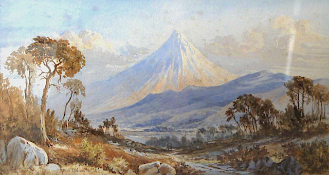
TARANAKI / MOUNT EGMONT PAINTED BY LAURENCE WILLIAM WILSON

https://wanderingvertexes.blogspot.com/2020/12/taranaki-mount-egmont-painted-by.html
 
 
LAURENCE WILLIAM WILSON (1851-1912)
Taranaki /Mount Egmont (2,518 m - 8,261 ft)
New Zealand (Northen Island)

The mountain
Taranaki or Mount Egmont (2,518 m - 8,261 ft) is an active but quiescent stratovolcano in the Taranaki region on the west coast of New Zealand's North Island. Although the mountain is more commonly referred to as Taranaki, it has two official names under the alternative names policy of the New Zealand Geographic Board. The mountain is one of the most symmetrical volcanic cones in the world. There is a secondary cone, Fanthams Peak or Panitahi in Māori (1,966 m - 6,450 ft), on the south side. Because of its resemblance to Mount Fuji, Taranaki provided the backdrop for the movie The Last Samurai.
For many centuries the mountain was called Taranaki by Māori. The Māori word tara means mountain peak, and naki is thought to come from ngaki, meaning "shining", a reference to the snow-clad winter nature of the upper slopes. It was also named Pukehaupapa and Pukeonaki by Iwi who live in the region in ancient times.
According to Māori mythology, Taranaki once resided in the middle of the North Island, with all the other New Zealand volcanoes. The beautiful Pihanga was coveted by all the mountains, and a great battle broke out between them. Tongariro eventually won the day, inflicted great wounds on the side of Taranaki, and causing him to flee. Taranaki headed westwards, following Te Toka a Rahotu and forming the deep gorges of the Whanganui River, paused for a while, creating the depression that formed the Te Ngaere swamp, then heading north. Further progress was blocked by the Pouakai ranges, and as the sun came up Taranaki became petrified in his current location. When Taranaki conceals himself with rainclouds, he is said to be crying for his lost love, and during spectacular sunsets, he is said to be displaying himself to her. In turn, Tongariro's eruptions are said to be a warning to Taranaki not to return.
Captain Cook named it Mount Egmont on 11 January 1770 after John Perceval, 2nd Earl of Egmont, a former First Lord of the Admiralty who had supported the concept of an oceanic search for Terra Australis Incognita. Cook described it as "of a prodigious height and its top cover'd with everlasting snow" surrounded by a "flat country ... which afforded a very good aspect, being clothed with wood and verdure".
When Marc-Joseph Marion du Fresne made landfall off Taranaki on 25 March 1772 he named the mountain Pic Mascarin. He was unaware of Cook's earlier visit. It appeared as Mount Egmont on maps until 29 May 1986, when the Minister of Lands ruled that "Mount Taranaki" would be an alternative and equal official name. The Egmont name still applies to the national park that surrounds the peak and geologists still refer to the peak as the Egmont Volcano.
Taranaki is geologically young, having commenced activity approximately 135,000 years ago. The most recent volcanic activity was the production of a lava dome in the crater and its collapse down the side of the mountain in the 1850s or 1860s. Between 1755 and 1800, an eruption sent a pyroclastic flow down the mountain's northeast flanks, and a moderate ash eruption occurred about 1755, of the size of Ruapehu's activity in 1995/1996. The last major eruption occurred around 1655. Recent research has shown that over the last 9,000 years minor eruptions have occurred roughly every 90 years on average, with major eruptions every 500 years.

The painter
Laurence William Wilson emigrated to Auckland in 1877 and then travelled extensively to settle in Dunedin in 1884. He painted in both oils and watercolours, became a painting companion of George O'Brien and a teacher. One of his pupils was the Dunedin artist Alfred O'Keefe. In 1895, LW Wilson together with Grace Joel, Alfred O'Keefe, Jane Wimperis and Girolami Nerli formed the Easel Club , a breakaway from the Dunedin Establishment, which offered a programme of special classes and the introduction of a professional lady model for life drawing. In 1904 LW Wilson left Dunedin for Melbourne where he spent 5 months on a commissioned painting of the city before he set out for England, eventually returning to New Zealand via India and Africa. He exhibited with the Canterbury Society of Arts in 1882 and the Otago Art Society between 1994 and 1904. His work was included in the NZ and South Seas Exhibition Dunedin 1889-90 and at the St Louis Exposition in 1904. LW Wilson is represented in the collections of all the major public galleries in New Zealand.

___________________________________________

2020 - Wandering Vertexes...
by Francis Rousseau