google.com, pub-0288379932320714, DIRECT, f08c47fec0942fa0 GRAVIR LES MONTAGNES... EN PEINTURE

Wednesday, April 19, 2017

MOUNT WILLIAM (DUWIL) BY EUGENE VON GUERARD


EUGENE VON GUERARD (1811-1901)
 Mount William or Mount Duwil (1,167 m - 3,829 ft)
Australia (Victoria)

1. In Mount William and part of the Grampian in West Victoria, 1865, National Gallery of Victoria
2. In  Mount William from Mount Dryden, 1857 , oil on canvas, Art Gallery of Western Australia

The mountain 
Mount William also called Mount Duwil ( (1,167 m - 3,829 ft) is a mountain of the Grampians Mountain Range, located within the Grampians National Park (which is he highest point), in the Australian state of Victoria. The mountain is situated approximately 250 kilometres (160 mi) west-north-west of Melbourne on the eastern edge of the national park, approximately 22 kilometres (14 mi) drive from Halls Gap.
Sir Thomas Mitchell reached the summit with a group of explorers in 1836. The first settler in the area was Horatio Wills, who established a sheep run at Mount William in 1840, and named nearby Mount Ararat, after which the town is named. His son, cricketer and Australian rules football pioneer Tom Wills, grew up as a lone white child among the Djab wurrung Aboriginal tribes of Mount William.
A sealed service road continues to the summit, but is not accessible by vehicle to the general public.
It will take a person approximately 45 mins to walk. No permit is required to climb the mountain.
 Source: 
 - Grampians National Park

The painter 
Johann Joseph Eugene von Guerard was an Austrian-born artist, active in Australia from 1852 to 1882. Known for his finely detailed landscapes in the tradition of the Düsseldorf school of painting, he is represented in Australia's major public galleries, and is referred to in the country as Eugene von Guerard. In 1852 von Guerard arrived in Victoria, Australia, determined to try his luck on the Victorian goldfields. As a gold-digger he was not very successful, but he did produce a large number of intimate studies of goldfields life, quite different from the deliberately awe-inspiring landscapes for which he was later to become famous. Realizing that there were opportunities for an artist in Australia, he abandoned the diggings and was soon undertaking commissions recording the dwellings and properties of wealthy pastoralists...
- More about Eugene Von Gerard life and works

Tuesday, April 18, 2017

THE MONT VENTOUX BY CAMILLE COROT


CAMILLE COROT (1796-1875) 
 Mont Ventoux (1, 911m - 6, 270ft) 
France (Vaucluse) 

In Villeneuve-les-Avignon, 1836,  oil on academy board mounted on canvas  
Indianapolis Museum of Art, Indianapolis, USA 

The mountain  
Mont Ventoux  (1, 911m - 6, 270ft), Ventor in Latin, is located in the French department of Vaucluse (Provence-Alpes-Côte d'Azur). It is about 25 kilometers long on an east-west for 15 kilometers wide on a north-south axis. Nicknamed the Giant of Provence, it is the culmination of the Monts du Vaucluse, the ultimate link of the Southern Alps and the highest peak of Vaucluse. Its geographical isolation makes it visible over great distances.
Mont Ventoux is as well the linguistic border between the north and south-Occitan.
Its mainly calcareous nature is responsible, in its top part, its deep white color in every season and intense karstification due to erosion by water, with the presence of numerous scree on the south face. Precipitation is particularly abundant in spring and fall. Rainwater seeps into galleries and reflects the level of the variable flow resurgences such as Fontain-de-Vaucluse or Source du Groseau.
Mont Ventoux is subject to a Mediterranean dominant weather, sometimes causing scorching temperatures during summer, the altitude offering a wide variety of climates, to the top (continental influence of mountain type), through a temperate climate (mid-slopes). In addition, the north wind can be very violent and the Mistral blows almost half part of the year.
This particular geomorphology and climate make it a rich and fragile environmental site consisting of many levels of vegetation. It is s a biosphere reserve by UNESCO and Natura 2000 site.
If human settlements are found in the foothills in prehistoric times, the first ascent to the summit would work on 26 April 1336, the poet Petrarch from Malaucène on the northern slope. It opens the way later in numerous scientific studies.
Thereafter, for nearly six centuries, Mont Ventoux has been intensely deforested to provide the shipbuilding in Toulon, charcoal manufacturers and sheep farmers. During World War II, the mountain is home to the Ventoux maquis, the french Resistance against Nazis.
Since 1966, the summit is topped with an observation tower over forty meters high topped by a TV and satellite antenna.
While sheep farming has almost disappeared, beekeeping, gardening (especially cherries), viticulture, harvesting of mushrooms including truffles and, to a lesser extent,  lavender, are still practiced.
Mont Ventoux is an important symbolic figure of Provence that fed oral or literary works and artistic performances or pictorial map. It is represented since 1445 in the famous Pieta d'Avignon  by Engurerant Quarton (Musée du Louvre Paris), where one can see it painted on the right, behind Mary Magdalene weeping at the feet of Christ.
Before being covered by three main roads, which enabled the development of green tourism and outdoor sports both in summer and winter in particular with the organization of major cycling races, motor cars and other challenges, mountain was crisscrossed by sheep tracks traced by shepherds as a result of the growth of sheep between the fourteenth century and the mid-nineteenth century. These roads have now been turned into hiking trails, like the GR 4 and GR 9.

 The painter 
Jean-Baptiste-Camille Corot, French landscape and portrait painter as well as a printmaker in etching,  is a pivotal figure in landscape painting.  His vast output simultaneously refers the Neo-Classical tradition and anticipates the plein-air innovations of Impressionism.
Camille Corot, no doubt attracted by the mythical aspect of Monte Soratte, painted it several times during his first stay in Italy between 1825 and 1830. They were painted at different times of the year ant different hours of the day as Hokusai used to do with the Fujiyama. 
Indeed, with his parents' support, Corot followed the well-established pattern of French painters who went to Italy to study the masters of the Italian Renaissance and to draw the crumbling monuments of Roman antiquity.  A condition by his parents before leaving was that he paint a self-portrait for them, his first.  During  his stay in Italy, Corot completed over 200 drawings and 150 paintings !
- More about Camille Corot's life and works 

Notice about this painting   
Corot spent the summer of 1836 in Provence, where he and his fellow painters rose early each day to sketch directly from nature. This view of Villeneuve-les-Avignon with its luminous atmosphere and sense of rapid execution reflects his study in Italy. On the right is the medieval tower Tour Philippe Le Bel, the village of Villeneuve les Avignon near Avignon, the Rhone River on right and, in the background, the Mont Ventoux. 

Monday, April 17, 2017

MONTE GENEROSO BY GIOVANNI GIACOMETTI


GIOVANNI GIACOMETTI  (1868-1933) 
 Monte Generoso or Calvagione (1,701m - 5,581ft)
Italy - Switzerland border 

In Vue de Capolago vers 1907, oil on canvas, Musée d'Orsay, Paris, France

The mountain 
Monte Generoso  (1,701m - 5,581ft) also known as Calvagione is a mountain of the Lugano Prealps, located on the border between Switzerland and Italy and between Lake Lugano and Lake Como. The western and southern flanks of the mountain lie in the Swiss canton of Ticino, whilst the north-eastern flanks are in the Italian region of Lombardy.[
The view from the summit of the mountain - one of the most outstanding panorama summits in Alps-  encompasses the lakes of Lugano, Como, Varese and Maggiore. To the north are the Alps, stretching from the Matterhorn via the Jungfrau and the Saint-Gotthard Massif to the Bernina Range. To the south are the Lombardy Plains and the Po Valley, with the city of Milan and the Apennine Mountains visible on a clear day.
The summit can be approached by the Monte Generoso Railway, a rack railway that starts from Capolago in Switzerland, and climbs via the western flank of the mountain. The summit station includes a panoramic terrace and buffet, a restaurant and a hotel. A paved path links the railway's summit station to the summit proper, a distance of approximately 350 metres (1,150 ft) and a difference in altitude of about 100 metres (330 ft).
There is road access from Mendrisio in Switzerland to Bellavista, some 3 kilometres (1.9 mi) from the summit and an intermediate station on the railway. Hiking trails reach the summit from different starting points, including Bellavista, Capolago and Mendrisio.
The Monte Generoso Observatory is located adjacent to the railway's summit station, and is operated by the Monte Generoso Insubrica Astronomy Group.
The summit can be reached in any time of the season. In winter the ascent is quite long, everything depends of the snow conditions on the road. The train starts to operate when the snow is cleared. It is highly recommended to climb Monte Generoso when the visibility is best. You can hike or climb up there for fun any time.
The mountain slopes are home to a herd of between 300 and 350 chamois.
The artist and author Edward Lear spent summers from 1878 to 1883 on the mountain. His oil  The Plains of Lombardy from Monte Generoso (Ashmolean Museum, Oxford) painted at the summit gives a good idea of the view but doesn't show the mountain itself.

The artist
Giovanni Giacometti was a Swiss painter, the father of  the famous painter and sculptor Alberto Giacometti, and of Diego Giacometti, the furniture designer as well as the father of the architect Bruno Giacometti ! In 1886, he studied painting at the School of Decorative Arts in Munich, where he met Cuno Amiet the following year. Both decide to pursue their studies in Paris, in October stood at the Académie Julian, where Giacometti remains until 1891.
In 1893, shortly after his return to Switzerland, to Bergell, he became friends with Giovanni Segantini, his eldest ten years, which has great influence on his work by opening it to the beauty of the mountain scenery and the rules of divisionism. After his sudden death in 1899, Giacometti met Ferdinand Hodler, who teaches him to create a rigorous and ornamental composition by appropriate use of shapes and colors...

______________________________

2017 - Wandering Vertexes...
by Francis Rousseau


Sunday, April 16, 2017

CAP DE CREUS PAINTED BY SALVADOR DALI


SALVADOR DALI (1904-1989) 
Cap de Creus (672 m  - 2, 205ft)

 Spain 

1. In The Persistence of Memory, 1931, oil on canvas, MOMA, New York
                            2. In The Disintegration of the Persistence of Memory, 1952-54, oil on canvas, 

The mountain 
Cap de Creus (672 m  - 2, 205ft) is a peninsula and a headland located at the far northeast of Catalonia (Spain), some 25 kilometres (16 mi) south from the French border. The cape lies in the municipal area of Cadaquès, and the nearest large town is Figueres, capital of the Alt Empordа and birthplace of Salvador Dali.  Cadaquès is the most well known village, home of artists and writers, with sophisticated atmosphere, near Port Lligat where Dali built his home in a paradise small bay. (Dalн depicted Cap de Creus in four of his most famous paintings : The Persistence of Memory  in 1931 (above)  and the The Disintegration of the Persistence of Memory, 1952-54 (above) 
Cap de Creus is the easternmost point of Catalonia and therefore of mainland Spain and the Iberian Peninsula.  Mountains are the eastern foothills of the Pyrenees, the natural border between France and Spain.  The peninsula has an area of 190 square kilometres (73 sq mi) of an extraordinary landscape value; a windbeaten very rocky dry region, with almost no trees, in contrast with a seaside rich in minuscule creeks of deep blue sea to anchor.The region is frequently swept by awful north wind "tramontana" (beyond mountains) which has caused many naval disasters.
Sant Pere de Rodes stands out at 500 metres (1,600 ft) of altitude, with views of the Cap and the Pyrenees. It is an 11th-century monastery whose first structures date from about 750 AD.
One legend tells that the Cap de Creus was hewn by Hercules.


 The painter 
Salvador Domingo Felipe Jacinto Dalí i Domènech, Marqués de Dalí de Púbol, known professionally as Salvador Dalí, was a prominent Spanish surrealist painter born in Figueres, Catalonia, Spain.
Dalí was a skilled draftsman, best known for the striking and bizarre images in his surrealist work. His painterly skills are often attributed to the influence of Renaissance masters. His best-known work,  The Persistence of Memory (above) was completed in August 1931. Dalí's expansive artistic repertoire included film, sculpture, and photography, in collaboration with a range of artists in a variety of media. Dalí attributed his "love of everything that is gilded and excessive, my passion for luxury and my love of oriental clothes" to an "Arab lineage", claiming that his ancestors were descended from the Moors. Dalí was highly imaginative, and also enjoyed indulging in unusual and grandiose behavior. His eccentric manner and attention-grabbing public actions sometimes drew more attention than his artwork, to the dismay of those who held his work in high esteem, and to the irritation of his critics.


Saturday, April 15, 2017

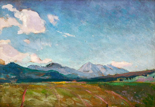
OSOBITA PAINTED BY JAN STANISLAWSKI

http://wanderingvertexes.blogspot.com

JAN STANISLAWSKI (1860-1907) 
Mount Osobita  (1,687m- 5,535ft)
Slovakia - Poland border 

 In Osobita - Tatras Mountains, 1901, oil on canvas, Muzeum Narodowe w Krakowie 

The mountain
Osobitá  (1,687m- 5,535ft)  as its name tells ("the lonely one") is a lonely top in the northern part of the Western Slovak Tatra Mountains, about 17 km from Zakopane (Poland). It is not very high, but very distinct and far from the main Tatra ridge. Osobitá constitutes a distinct geomorphological unit which represents just by itself 12% of the surface of the Slovak Western Tatras. This moutain was mentioned as early as 1615 when Polish highlanders described the Polish Tatras (wider during this time) as extending "From Osobita to Hawran".
There are the three distinct but close tops with heights of 1,617, 1,521 and 1,587 m (the last two are separated by the pass "sedlo pod Osobitou". There many caves in this karst zone, not all yet been investigated. In 1997, the most famous are Bezdenna and Okolik. Here also, as in many other places in the Tatra Mountains, was a mining activity for iron. Now, from these times remain only few tunnels reaching dozens of meters deep. 
In the past, the mountain was an important pastoral center, with five wide meadows. In the seventeenth century it could host up to 1500 head of sheep and cows. Later it decreased. 
Osobitá separates 3 valleys: Zuberska Dolina, Blatna Dolina and Oravicka Sucha Dolina. No other summit of the Orava region is as clearly visible, and very early the mountain attracted a lot of visitors. The first recorded visit was made by Titus Chałubiński in 1870, the first recorded winter one by Mariusz Zaruski with companions in 1906. 
At the beginning of the twentieth century, there was even a mountain hut at Mala Osobitá (1,583 m). Since 1989, the top is no longer available for tourists, since this one is included in the nature reserve (458 hectares).  There are two ways to reach Osobitá, from Slovakia and from Poland. Both are very easy and without difficulty, but the first one is as short as the second is very long.
Nowadays, it is impossible the reach the real top of Osobitá, which is located in the Natura 2000 zone, in order to protect fragile fauna such as eagles. Hence, strictly forbidden as mentionned previously. Including with a guide, or holding an UIAA licence !

The painter 
Jan Stanisławski was a Polish modernist painter, art educator, founder and member of various innovative art groups and literary societies. He began to learn painting at the art studio in Warsaw which later gave rise to the School of Fine Arts, under Wojciech Gerson.  In 1885, he continued his studies in Paris under Charles Emile Auguste Durand. While based in Paris, he travelled much, visiting Italy, Spain, Switzerland, Germany, Austria and eastern Galicia.
His early works were exhibited at the inauguration of the Salon du Champ-de-Mars in Paris in 1890 and at the Kraków Society of Friends of Fine Arts in 1892. In the 1890s, he travelled extensively and his sketchbooks filled up with drawings from Berlin, Dresden, Prague, Kraków, and various places in Ukraine.  In 1897, he initiated and helped organise the Separate Exhibition of Painting and Sculpture at Kraków’s Cloth Hall. That year, he became a teacher of landscape painting at the School of Fine Arts in Kraków, and in 1906 – after the school was upgraded to an academy in 1900 – was granted full professorship and also taught at Teodor Axentowicz’s Private School of Painting and Drawing for Women and at Teofila Certowicz’s Art School for Women in Kraków.
He co-founded the Society of Polish Artists "Sztuka" ("Art") in Kraków in 1897.  In 1898, he became a member of the Viennese Secession, and his works were exhibited among theirs in 1901, 1902 and 1905. In 1901, he became a founding member of the Polish Applied Arts Society. He worked in the Wawel Castle Reconstruction Committee and was involved in the activities of the Green Balloon (Zielony Balonik) Cabaret. After his death, two exhibitions were opened at the Palace of Art by the Kraków Society of Friends of Fine Arts in November 1907, one to show 154 of his oil paintings, as well as drawings and watercolours, and the other to present the works of his numerous outstanding students.
_______________________________
2017 - Wandering Vertexes...
by Francis Rousseau 

Friday, April 14, 2017

CAPE CARBON BY FREDERIC GADMER


FREDERIC GADMER  (1878-1954), 
Cape Carbon (220 m - 722 ft)
Algeria

In  Le Cap Carbon, Bougie, 1929Autochrome Lumiere - Albert Kahn museum 

The mountain
Cape Carbon (220 m - 722 ft) is  cape located in the Wilaya of Béjaïa, north of the port of Béjaïa, Algeria. A tourist path, traced on the crest, frequented by the monkey magot, allows access. Cape carbon is situated in the Gouraya National Park. It seems that before colonization only a few rudimentary lanterns were placed near the shelters which served as a refuge for the Barbary ship, such as the ordinary lantern on the high tower of the Penon of Algiers. From 1834, the French installed on the rocky spur at the end of the Cape Carbon, a fixed light surmounted by a rotating crown bearing 8 lamps with reflectors arranged in a way to realize an eclipse fire of 30 seconds In 30 seconds.  The lantern was periodically modified between 1860 and 1900, until 1924 when the electrification of main fires and port fires was actively pursued. The Cape Carbon lighthouse is known to be the highest natural lighthouse in the Mediterranean Sea and one of the highest in the world. It is a "landing" lighthouse which indicates the proximity of the port of Béjaïa.

The photographer
Frédéric Georges Gadmer was born in 1878 in France into a Protestant family; his father, Leon, son of Swiss émigré, was confectioner. Before World War II, he follows his family in Paris and works as a photographer for the house Vitry, located Quai de la Rapée. As an heliogravure company, it performs work for the sciences and the arts, travel and education. In 1898 Gadmer completed his military service as a secretary to the staff then recalled in 1914 at the time of mobilization. In 1915, he joined the newly created  "Photographic Section of the Army" and carried pictures on the front, in the Dardanelles, with General Gouraud, then in Cameroon. In 1919, at age 41, he was hired as a photographer by Albert Khan for his project called "Archives of the Planet". He finds there his comrades of  "the film and photographic section of the army" Paul Castelnau and Fernand Cuville. Soon as he arrived, he made reports in Syria, Lebanon, Turkey and Palestine. It was the first to make a color portrait of Mustafa Kemal, leader of the Young Turks. In 1921, he returned to the Levant with Jean Brunhes, the scientific director of the Archives of the Planet. The same year, he attended General Gouraud, appointed High Commissioner in Syria. Operator and prolific photographer, specializing in distant lands and landscapes, it covers Iraq, Persia, Afghanistan, Algeria and Tunisia. In 1930, he accompanied Father Francis Aupiais in Dahomey. He also works in Europe. In 1931, at the request of Marechal Lyautey, he photographies the Colonial Exhibition. It is one of the last person to leave the "Archives of the Planet" threatened by the Albert Kahn's bankruptcy in 1932. He then worked at the famous french newspaper L'Illustration and carries postcards for Yvon. He died in Paris, unmarried, in 1954.
Source: 
- Frédéric Gadmer 

About the  "Autochrome Lumière" Photos
The autochrome is a photographic reproduction of process colors patented December 17, 1903 by Auguste and Louis Lumière french brothers. This is the first industrial technique of photography colors, it produces positive images on glass plates. It was used between 1907 and 1932 approximately an particularly in many pictures of the World War I. A important number of photographs of mountains and landscapes around the world was made with this technique, particularly in the for  the Project "The archives of the planet" by Albert Kahn.
Source:
- Musée Départemental Albert Kahn on line

Thursday, April 13, 2017

KILIMANDJARO BY AKSELI GALLEN-KALLELA


AKSELI GALLEN-KALLELA  (1865-1931)
Kilimandjaro or Uhuru (5,885m - 19, 340ft) 
Tanzania

 In  Kilima'ndjaro from Uakamba, June 1909 - Watercolor on paper 

The mountain 
Mount Kilimanjaro   (5,885m - 19, 340ft)  is a dormant volcano in Tanzania composed of three volcanic cones, "Kibo", "Mawenzi", and "Shira.  The Kilimandjaro is the highest mountain in Africa. The first recorded ascent to the summit  was by Hans Meyer and Ludwig Purtscheller in 1889.
The mountain is part of the Kilimanjaro National Park and is a major climbing destination. The mountain has been the subject of many scientific studies because of its shrinking glaciers, especially since 200.
The origin of the name "Kilimanjaro" is not precisely known, but a number of theories exist. European explorers had adopted the name by 1860 and reported that "Kilimanjaro" was the mountain's Kiswahili name. The 1907 edition of The Nuttall Encyclopædia also records the name of the mountain as "Kilima-Njaro", as well as the title of the watercolor above. Johann Ludwig Krapf wrote in 1860 that Swahilis along the coast called the mountain Kilimanjaro. Although he did not support his claim, he claimed that "Kilimanjaro" meant either "mountain of greatness" or "mountain of caravans". Under the latter meaning, "Kilima" meant "mountain" and "Jaro" possibly meant "caravans". Jim Thompson claimed in 1885, although he also did not support his claim, that the term Kilima-Njaro "has generally been understood to mean" the Mountain (Kilima) of Greatness (Njaro). Though not improbably it may mean the "White" mountain. "Njaro" is an ancient Kiswahili word for "shining". Others have assumed that "Kilima" is Kiswahili for "mountain".
In the 1880s, the mountain became a part of German East Africa and was called "Kilima-Ndscharo" in German following the Kiswahili name components.
On 6 October 1889, Hans Meyer reached the highest summit on the crater ridge of Kibo. He named it "Kaiser-Wilhelm-Spitze" ("Kaiser Wilhelm peak").
That name apparently was used until Tanzania was formed in 1964, when the summit was renamed "Uhuru", meaning "Freedom Peak" in Kiswahili.
- More informations about Kilimandjaro 

The painter 
Akseli Gallen-Kallela was a Swedish-speaking Finnish painter who is best known for his illustrations of the Kalevala, the Finnish national epic. His work was considered very important for the Finnish national identity. He changed his name from Gallen to Gallen-Kallela in 1907. In 1884 he moved to Paris, to study at the Académie Julian and became friends with the Finnish painter Albert Edelfelt, the Norwegian painter Adam Dörnberger, and the Swedish writer August Strindberg.
In December 1894, Gallen-Kallela moved to Berlin to oversee the joint exhibition of his works with the works of Norwegian painter Edvard Munch. Here he became acquainted with the Symbolists.
On his return from Germany, Gallen studied print-making and visited London to deepen his knowledge, and in 1898 studied fresco-painting in Italy.
For the Paris World Fair in 1900, Gallen-Kallela painted frescoes for the Finnish Pavilion. In these frescoes, his political ideas became most apparent. Gallen-Kallela officially finnicized his name to the more Finnish-sounding Akseli Gallen-Kallela in 1907.
In 1909, Gallen-Kallela moved to Nairobi in Kenya with his family, and there he painted over 150 expressionist oil paintings and bought many east African artefacts (watercolor above). But he returned to Finland after a couple of years, realizing Finland was his main inspiration. Between 1911 and 1913 he designed and built a studio and house at Tarvaspää, about 10 km northwest of the centre of Helsinki.
From December 1923 to May 1926, Gallen-Kallela lived in the United States, where an exhibition of his work toured several cities, and where he visited the Taos art-colony in New Mexico to study indigenous American art. In 1925 he began the illustrations for his "Great Kalevala". This was still unfinished when he died of pneumonia in Stockholm on 7 March 1931, while returning from a lecture in Copenhagen, Denmark His studio and house at Tarvaspää was opened as the Gallen-Kallela Museum in 1961

Wednesday, April 12, 2017

GUNUNG MERAPI BY BASOEKI ABDULLAH


BASOEKI ABDULLAH (1915 -1993)
Gunung Merapi  (2,914m - 9,500 ft) 
Indonesia (Java)

1. In Gunung Merapi, oil on canvas, 1960 - Basoeki Abdullah Museum, Jakarta
2. In Gunung Merapi, oil on canvas,1971, Private collection 

The mountain 
Gunung Merapi  or Mount Merapi (2,914m - 9,500 ft)  is an active stratovolcano located on the border between Central Java and Yogyakarta, Indonesia. It is the most active volcano in Indonesia and has erupted regularly since 1548. It is located approximately 28 kilometres (17 mi) north of Yogyakarta city which has a population of 2.4 million, and thousands of people live on the flanks of the volcano, with villages as high as 1,700 metres (5,600 ft) above sea level.
Smoke can often be seen emerging from the mountaintop, and several eruptions have caused fatalities. Pyroclastic flow from a large explosion killed 27 people on 22 November 1994, mostly in the town of Muntilan, west of the volcano.Another large eruption occurred in 2006, shortly before the Yogyakarta earthquake. In light of the hazards that Merapi poses to populated areas, it has been designated as one of the Decade Volcanoes....
More  informations about Gunung Merapi volcano 


The painter 
Basoeki  (or Basuki) Abdullah is one of a the modern master painters of Indonesia, known as a realist and naturalist painter. He has been appointed as the official painter of Merdeka Palace in Jakarta and works adorn palaces and presidential countries Indonesia, in addition to have been collectibles from around the world. His father, Abdullah Suriosubroto, was a famous painter and dancer, while his grandfather,  Doctor Wahidin Sudirohusodo, was a prominent Indonesian National Awakening Movement in the early 1900's. Since the age of 4 years, Basoeki Abdullah began to paint  famous personalities such as Mahatma Gandhi, Rabindranath Tagore and even Jesus Christ and Krishnamurti. His acquired a formal education in the Basoeki Abdullah Catholic and Catholic Mulo in Solo. In 1933,  BasoekiAbdullah obtained a scholarship to study at the Academic Arts in The Hague, Netherlands, and completed his studies within 3 years with awarded Certificate of Royal International of Art (RIA). On 6 September 1948,  during the revolutionary period,  Basoeki Abdullah is housed in Amsterdam (Netherlands) during the coronation of Queen Juliana which held a contest to paint, Basoeki Abdullah defeated 87 European painters and managed to come out as winners.
Since then, the world began to recognize BasoekiAbdullah, during his frequent visits around Europe (Italy and France) and was well known by many resident artists with a worldwide reputation.
BasoekiAbdullah is famous as a portrait painter, especially painting  the royal family and heads of state that tends to beautify or embellish  persons. Aside from being an accomplished portrait painter, he too painted landscapes, mountains, fauna, flora, the themes of struggle, construction and so on.
Basoeki Abdullah held many solo exhibitions both domestically and abroad, among others, his work was exhibited in Bangkok (Thailand), Malaysia, Japan, the Netherlands, England, Portugal... Approximately 22 countries have Basoeki Abdullah paintings in their official collections. Most of his life was spent abroad including several years living in Thailand.
Source:
- Museum Basoeki Abdullah 

Tuesday, April 11, 2017

CHACHANI BY MARTIN CHAMBI


MARTIN CHAMBI (1891–1973)
Chachani (6, 057m- 19, 872ft) 
 Peru  

1.  In Mount Chachani, 1915,  autochrome 
2.  In Mount Chachani, 1917 autochrome
3.  In Mount Chacani and The Misti seen from Arequipa, 1920,  autochrome  

The mountain 
Chachani  (6, 057m- 19, 872ft) is  the highest of the mountains near the city of Arequipa in southern Peru and the eighty-four highest summit of the Andes. Between six and eight separate craters form the massif of Chachani. Erosion has only left one recognizable crater in the western part of the complex. This structure has an arcuate shape. A shield 1 kilometre (0.62 mi) thick with a diametre of 8 kilometres (5.0 mi) is formed from coalescent lava flows on Chachani's southern side and is known as Pampa de Palacio or Las Cortaderas. An escarpment on the eastern side of Chachani may be part of a "Chachani" caldera, the source of several ignimbrites in the Arequipa area. Vegetation cover above 4,500 metres (14,800 ft) altitude is scarce. 
A Inca temple was constructed on Chachani's summit area, and archeological relics date back to pre-Hispanic times. This sanctuary was looted as early as the end of the 19th century. During one of these lootings, a skeleton of a woman, wooden vessels and ceramics. An archeological study in 2013 did suggest that Chachani's summit was the site of Capacocha sacrifices. Rock material from Chachani has been used to construct churches in Arequipa and sulfur was mined on the mountain. Oral tradition attributes to Chachani the ability to choose the gender of newborn children.
Climbing 
Chachani is often touted as the easiest 6000 meter mountain in the world, and for good reason.  There are three main routes up Chachani but the mountain is normally climbed from its northern side. The start of the trek is at a drop-off point which is reached in 2.5 hours by four-wheel drive vehicle, driving west around Chachani and turning off from the main highway near Pampa Cañahuas, or heading north from Arequipa between Misti and Chachani. Base camp is at approximately 5,200 metres (17,100 ft). There is another higher camp called Camp Azulfrera situated at about 5,400 metres (17,700 ft). The route starts with the ascent to the Angel Col before traversing the El Angel mountain itself. Then climbers ascend the face of Fatima mountain in a zig-zag pattern before making another traverse on the Fatima mountain. Only then the summit of Chachani can be seen. From there, climbers need to make the final ascent on the face of Chachani all the way to the top of the mountain.
The standard route requires crampons and an ice axe, but does not require roping up, as there are no large crevasses on Chachani. Two traverses over relatively steep terrain constitute the main challenges on the way to the summit. The final push to the summit is a very steep[clarification needed] scree slope, which provides for a fast descent back to the first traverse.
In recent years, the amount of snow on Chachani has decreased dramatically, so for many months of the year there may be little snow on the mountain. For example, in October and November 2010, there was no snow at all, and the ascent could be made without crampons or ice axes. Climbers need to check on the snow conditions beforehand.
The average total climb time from base camp ranges from six to nine hours, with a two-to four-hour descent.
 Source: 
- Summitpost. org 

The photographer
Martín Chambi Jiménez or Martín Chambi de Coaza, known as Martin Chambi was a photographer, originally from southern Peru. He was one of the first major indigenous Latin American photographers. Recognized for the profound historic and ethnic documentary value of his photographs, he was a prolific portrait photographer in the towns and countryside of the Peruvian Andes. As well as being the leading portrait photographer in Cuzco, Chambi made many landscape photographs, which he sold mainly in the form of postcards, a format he pioneered in Peru.
In 1979, New York's MOMA held a Chambi retrospective, which later traveled to various locations and inspired other international expositions of his work.
Martín Chambi was born into a Quechua-speaking peasant family in one of the poorest regions of Peru, at the end of the nineteenth century. When his father went to work in a Carabaya Province gold mine on a small tributary of the River Inambari, Martin went along. There he had his first contact with photography, learning the rudiments from the photographer of the Santo Domingo Mine near Coaza (owned by the Inca Mining Company of Bradford, Pa). This chance encounter planted the spark that made him seek to support himself as a professional photographer. With that idea in mind, he headed in 1908 to the city of Arequipa, where photography was more developed and where there were established photographers who had taken the time to develop individual photographic styles and impeccable technique.
Chambi initially served as an apprentice in the studio of Max T. Vargas, but after nine years set up his own studio in Sicuani in 1917, publishing his first postcards in November of that year. In 1923 he moved to Cuzco and opened a studio there, photographing both society figures and his indigenous compatriots. During his career, Chambi also travelled the Andes extensively, photographing the landscapes, Inca ruins, and local people.
The archives of Martin Chambi's works are kept in Cuzco in his own  house and by the care of his family. Everything is preserved in boxes, left by the photographer, classified and numbered by his own hand. A recent inventory has enumerated about 30,000 photographic plates and more than 12,000 to 15,000 photograph (rolls). Scanning work is in progress to retrieve photographic plates and photos.
"It is wrong to focus too much on the testimonial value of his photos. They have that, indeed, but, in equal measure they express the milieu in which he lived and they show (...) that when he got behind a camera, he became a giant, a true inventor, a veritable force of invention, a recreator of life."
 (Mario Vargas Llosa)
 Source:
- Martin Chambi official Website


Monday, April 10, 2017

TRE CIME DI LAVERADO BY EDWARD H. COMPTON


EDWARD HARRISON COMPTON (1881-1960)
Tre Cime di Laverado  (2,999 m -  9,839 ft)
Italy 

 In Die drei zinnen in Südtirol, oil on canvas

The mountain 
Tre Cime di Lavaredo (2,999 m -  9,839 ft)   (The three peaks of Lavaredo)  also called Drei Zinnen by Germans, are three distinctive battlement-like peaks, in the Sexten Dolomites of northeastern Italy. They are probably one of the best-known mountain groups in the Alps, and one of the most photographed in Italy. The three peaks are named, from east to west, "little peak" (Cima Piccola), "big peak" (Cima Grande) and "western peak" (Cima Ovest). The Cima Grande has an elevation of 2,999 metres (9,839 ft). It stands between the Cima Piccola, at 2,857 metres (9,373 ft), and the Cima Ouest, at 2,973 metres (9,754 ft).
Until 1919 the peaks formed part of the border between Italy and Austria. Now they lie on the border between the Italian provinces of South Tyrol and Belluno and still are a part of the linguistic boundary between German-speaking and Italian-speaking majorities. Both communities still battle today about the exact border line.
The surrounding around Tre Cime di Lavaredo and the path leading to the Three Peaks is popular among hikers. There are numerous routes leading from the surrounding communities to and around the peaks. The road that leads to the southern side of the Three Peaks was built during World War I as a transport road by pioneers to support the front troops in that war. Because of this there are a number of fortifications, man-made caves, and commemorative plaques in the area.
The peaks are also great for climbing. The first ascent of the Cima Grande was made in the early 1869 by Paul Grohmann, Franz Innerkofler and Peter Salcher. The Cima Ovest was first climbed exactly ten years later, in 1879. The Cima Piccola was conquered two years later on 1881. The partly overhanging northern face of the Cima Grande is considered by climbers to be one of the great north faces of the Alps, and was first climbed in 1933 after an ascent time of 3 days and 2 nights.

The painter 
Edward Harrison Compton (1881–1960) not to be confused with his father Edward Theodore Compton (1849-1921) was a German landscape painter and illustrator of English descent. Compton was born in Feldafing in Upper Bavaria, Germany, the second son of notable landscape painter Edward Theodore Compton. He received his early art training from his father, and after a period of study in London at the Central School of Arts and Crafts settled back in Bavaria. Like his father he was inspired by the Alps to become a mountain painter ("bergmaller") working in both oils and watercolour. However, an attack of Polio at the age of 28 meant that he had to find more accessible landscapes to paint in Germany, England northern Italy and Sicily. He also provided illustrations for several travel books published by A & C Black. Compton exhibited at galleries in Munich and Berlin, and also in England at the Royal Academy in London and in Bradford. He died in Feldafing in 1960.
He had two sisters, both of whom were artists: Marion Compton, the flowers and still-life painter, and Dora Keel-Compton, flower and mountain painter

Sunday, April 9, 2017

DER NIESEN PAINTED BY PAUL KLEE


PAUL KLEE (1879-1940) 
 Der Niesen  (2, 362m - 7,749ft)
Switzerland

1.  In Der Niesen, Egyptian Night, 1915, oil on canvas (see note)  
2. In The Niesen, Ad Parnassum, 1932, oil on canvas, Kunst Museum, Bern

Note about the first painting
Mount Niesen - Egyptian Night was exposed in Kunstmuseum Bern. In 1976, it was stolen from there, being deemed as lost since then.  It was only in the spring of 2001 that it reappeared in Basel.

 The mountain 
The Niesen (2, 362m - 7,749ft)  is a mountain of the Bernese Alps in Switzerland. It overlooks Lake Thun, in the Bernese Oberland region, and forms the northern end of a ridge that stretches north from the Albristhorn and Mannliflue, separating the Simmental and Kandertal valleys. The literal translation of the German word "Niesen" is  "sneeze", but the Niesen because of its shape, is often called The Swiss Pyramid. Administratively, the summit is shared between the municipalities of Reichenbach im Kandertal, to the south-east, and Wimmis, to the west and north. Both municipalities are in the canton of Bern. The summit of the mountain can be reached easily by using the Niesenbahn funicular from Mülenen (near Reichenbach). The construction of the funicular was completed in 1910. Alongside the path of the Niesenbahn is the longest stairway in the world with 11,674 steps. It is open only once a year to the public for a stair run.
The literal translation of the German word Niesen is sneeze. Because of its shape, the Niesen is often called the Swiss Pyramid.  Since the 18th century, the Niesen was the subject of a number of paintings which will all be published in this blog, one by one. The Ferdinand Holder's paintings are the two first ones to have been published. The Niesen was also the subject of a number of paintings by Paul Klee, in which it was represented as a quasi-pyramid (above)

The painter 
Paul Klee was a Swiss-German artist. His highly individual style was influenced by movements in art that included Expressionism, Cubism, and Surrealism. Klee was a natural draftsman who experimented with and eventually deeply explored color theory, writing about it extensively; his lectures Writings on Form and Design Theory (Schriften zur Form und Gestaltungslehre), published in English as the Paul Klee Notebooks, are held to be as important for modern art as Leonardo da Vinci's A Treatise on Painting for the Renaissance. He and his colleague, Russian painter Wassily Kandinsky, both taught at the Bauhaus school of art, design and architecture. His works reflect his dry humor and his sometimes childlike perspective, his personal moods and beliefs, and his musicality.
Klee has been variously associated with Expressionism, Cubism, Futurism, Surrealism, and Abstraction, but his pictures are difficult to classify. He generally interpreted new art trends in his own way. He was inventive in his methods and technique. Klee worked in many different media—oil paint, watercolor, ink, pastel, etching, and others. He often combined them into one work. He used canvas, burlap, muslin, linen, gauze, cardboard, metal foils, fabric, wallpaper, and newsprint. Klee employed spray paint, knife application, stamping, glazing, and impasto, and mixed media such as oil with watercolor, watercolor with pen and India ink, and oil with tempera.
He was a natural draftsman, and through long experimentation developed a mastery of color and tonality. Many of his works combine these skills. He uses a great variety of color palettes from nearly monochromatic to highly polychromatic. His works often have a fragile childlike quality to them and are usually on a small scale. He often used geometric forms as well as letters, numbers, and arrows, and combined them with figures of animals and people. Some works were completely abstract. Many of his works and their titles reflect his dry humor and varying moods; some express political convictions. They frequently allude to poetry, music and dreams and sometimes include words or musical notation. The later works are distinguished by spidery hieroglyph-like symbols. Rainer Maria Rilke wrote about Klee in 1921, "Even if you hadn’t told me he plays the violin, I would have guessed that on many occasions his drawings were transcriptions of music."

Saturday, April 8, 2017

MONTE ROTONDO PAINTED BY AGNES MARTIN


AGNES MARTIN (1912-2004) 
 Monte Rotondo (2, 622m - 8, 602ft)
 France (Corse) 

1.  In  Monte Rotondo et la vallée de la Restonica, huile sur toile
 2. In Le  torrent bleu de Restonica, pastel

The mountain 
The Monte Rotondo (2, 622m - 8, 602ft) is the highest point of the second highest Corsican massif, after that of Monte Cinto in the island of Corsica (France). It is located in the center of the island between the microregions of Talcini, Venaco, Rogna in La and Sorro in Su. The summit overlooks Lake Bettaniella (south face), Lake Oriente and Lake Galeria (north face).
The  main peak of the Monte Rotondo range are :  Monte Rotondo, Maniccia, Monte Cardo, Monte d'Oro, Punta Artica and Punta alle Porte.
It has long been considered as the highest point of the island and was then assigned an altitude of 2,746 meters above sea level.  It has been dethroned on the shelves by Monte Cinto only for about a century. In 1802, André François Miot, State Councilor appointed in Corsica by Bonaparte was the first to make the "tourist" climb of the summit. With two other Corsican peaks, Monte Cinto and Monte Stello, the Monte Rotondo served at the geodesic junction between Corsica and mainland France carried out by Paul Helbronner in 1925. The installation of facilities such as the shelter allowed the summit to be occupied for 14 days.

The Painter
Agnes Bernice Martin, born in Canada, was an American abstract painter. Her work has been defined as an "essay in discretion on inward-ness and silence".  Although she is often considered or referred to as a minimalist, Martin considered herself an abstract expressionist.
Her work is most closely associated with Taos, with some of her early work visibly inspired by the desert environment of New Mexico. She moved to New York City after being discovered by the artist/gallery owner Betty Parsons in 1957.
In addition to a couple of self-portraits and a few watercolor landscapes, Martin's early works included biomorphic paintings in subdued colors made when the artist had a grant to work in Taos between 1955 and 1957. However, she did her best to seek out and destroy paintings from the years when she was taking her first steps into abstraction.
Martin praised Mark Rothko for having "reached zero so that nothing could stand in the way of truth". Following his example Martin also pared down to the most reductive elements to encourage a perception of perfection and to emphasize transcendent reality. Her signature style was defined by an emphasis upon line, grids, and fields of extremely subtle color. Particularly in her breakthrough years of the early 1960s, she created 6 × 6 foot square canvases that were covered in dense, minute and softly delineated graphite grids. Because of her work's added spiritual dimension, which became more and more dominant after 1967, she preferred to be classified as an abstract expressionist.
She was awarded a National Medal of Arts from the National Endowment for the Arts in 1998.
The Agnes Martin estate is represented by Pace Gallery, New York
Source:

Friday, April 7, 2017

FUJIYAMA / 富士山 (n°33 g) BY HOKUSAI


KATSUSHIKA HOKUSAÏ (1760-1849) 
Fujiyama / 富士山 (3, 776 m -12,389 ft)
Japan

South Wind clear sky, 1830-32,  n°33 from the series 36 Views of Mt. Fuji, early print,
The Library of Congress, Washington


About the 36 Views of Mt Fuji 
Thirty-six Views of Mount Fuji (富嶽三十六景 Fugaku Sanjūrokkei) is a series of landscape prints created by the Japanese ukiyo-e artist Hokusai (1760?1849). The series depicts Mount Fuji from different locations and in various seasons and weather conditions. The original thirty-six prints were so popular that Hokusai expanded the series by ten.
The earliest impressions (whose the one below is) appear faded when compared to the versions usually seen, but are closer to Hokusai's original conception. The original prints have a deliberately uneven blue sky, which increases the sky's brightness and gives movement to the clouds. The peak is brought forward with a halo of Prussian blue. Subsequent prints have a strong, even blue tone and the printer added a new block, overprinting the white clouds on the horizon with light blue. Later prints also typically employ a strong benigara (Bengal red) pigment, which lent the painting its common name of Red Fuji. The green block colour was recut, lowering the meeting point between forest and mountain slope.

The artist
Katsushika Hokusai (葛飾 北斎)  was a Japanese artist, ukiyo-e painter and printmaker of the Edo period. He was influenced by such painters as Sesshu, and other styles of Chinese painting. Born in Edo (now Tokyo), Hokusai is best known as author of the woodblock print series Thirty-six Views of Mount Fuji (富嶽三十六景 c. 1831) which includes the internationally recognized print, The Great Wave off Kanagawa, created during the 1820s.
Hokusai created the "Thirty-Six Views of Mt Fuji " both as a response to a domestic travel boom and as part of a personal obsession with Mount Fuji. In this series, Mt Fuji is painted on different meteorological conditions, in different hours of the days and in different seasons.  None of the 36 view is the same, even if sometimes they appears closely similar. The 36 views are nowadays in different great international museums around the world.  It was this series, specifically The Great Wave print and Fine Wind, Clear Morning, that secured Hokusai’s fame both in Japan and overseas. While Hokusai's work prior to this series is certainly important, it was not until this series that he gained broad recognition.
The earliest impressions appear faded when compared to the versions usually seen, but are closer to Hokusai's original conception. The original prints have a deliberately uneven blue sky, which increases the sky's brightness and gives movement to the clouds. The peak is brought forward with a halo of Prussian blue. Subsequent prints have a strong, even blue tone and the printer added a new block, overprinting the white clouds on the horizon with light blue. Later prints also typically employ a strong benigara (Bengal red) pigment, which lent the painting its common name of Red Fuji. The green block colour was recut, lowering the meeting point between forest and mountain slope.


The mountain 
This is the legendary Mount Fuji or Fujiyama (富士山).
It is located on Honshu Island and is the highest mountain peak in Japan at 3,776.24 m (12,389 ft). Several names are attributed to it:  "Fuji-san", "Fujiyama" or, redundantly, "Mt. Fujiyama". Usually Japanese speakers refer to the mountain as "Fuji-san".  The other Japanese names for Mount Fuji,  have become obsolete or poetic like: Fuji-no-Yama (ふじの山 - The Mountain of Fuji), Fuji-no-Takane (ふじの高嶺- The High Peak of Fuji), Fuyō-hō (芙蓉峰 - The Lotus Peak), and Fugaku (富岳/富嶽), created by combining the first character of 富士, Fuji, and 岳, mountain.
Mount Fuji is an active stratovolcano that last erupted in 1707–08. Mount Fuji lies about 100 kilometres (60 mi) south-west of Tokyo, and can be seen from there on a clear day.
Mount Fuji's exceptionally symmetrical cone, which is snow-capped several months a year, is a well-known symbol of Japan and it is frequently depicted in art and photographs, as well as visited by sightseers and climbers.
Mount Fuji is one of Japan's Three Holy Mountains (三霊山) along with Mount Tate and Mount Haku. It is also a Special Place of Scenic Beauty and one of Japan's Historic Sites.
It was added to the World Heritage List as a Cultural Site on June 22, 2013. As per UNESCO, Mount Fuji has “inspired artists and poets and been the object of pilgrimage for centuries”. UNESCO recognizes 25 sites of cultural interest within the Mt. Fuji locality. These 25 locations include the mountain itself, Fujisan Hongū Sengen Shrine and six other Sengen shrines, two lodging houses, Lake Yamanaka, Lake Kawaguchi, the eight Oshino Hakkai hot springs, two lava tree molds, the remains of the Fuji-kō cult in the Hitoana cave, Shiraito Falls, and Miho no Matsubara pine tree grove; while on the low alps of Mount Fuji lies the Taisekiji temple complex, where the central base headquarters of Nichiren Shoshu Buddhism is located.

Thursday, April 6, 2017

QUEEN'S MARY PEAK BY AUGUSTUS EARLE


AUGUSTUS EARLE (1793-1838)
Queen's Mary Peak  (2, 062m -  6,765ft)
Antarctica - British Overseas Territory (Tristan Da Cunha) 

1.  In Queen's Mary Peak in Tristan d 'Acunha, A Man killing an albatros, 1824 - Watercolour,
2.  In A north easter at Tristan d'Acunha Island, 1824, Watercolour, 

The mountain 
Queen Mary's Peak   (2, 062m -  6,765ft) is the summit of the island of Tristan da Cunha, in the South Atlantic Ocean.  It is named after Mary of Teck, the Queen consort of King George V. It is the highest point of the British overseas territory of Saint Helena, Ascension and Tristan da Cunha (also written d'Acunha). The mountain is the peak of the massive shield volcano which forms the island. A 300 m (1,000 ft) wide summit crater caps the peak, and it contains a heart-shaped crater lake. This lake is normally frozen during the winter, and the upper slopes of the volcano are covered in snow.
The only recorded eruption began on 10 October 1961 from a vent on the north shore of the island, and continued into March 1962. The entire population of the island had to be evacuated and did not return until 1963. Queen Mary's Peak was used by sailors on the route from Europe to the Indian Ocean and beyond as a navigational aid. In the 17th century the East India Company instructed captains to sail via Tristan. In 2004, Ellen MacArthur sighted the Peak on her record-breaking circumnavigation of the world.

The artist 
Augustus Earle was a London-born travel artist...
- Augustus Earle (short biography
- Augistus Earle (complete biography)

Wednesday, April 5, 2017

GERLACHOVSKY STIT BY ADRIAN STOKES


ADRIAN STOKES (1902-1972) 
Gerlach Peak or Gerlachovsky stit (2,654m - 8,709ft) 
Slovakia 

 In Lake of Csorba, High Tatras, Peak of Gerlach, Hungary - oil on canvas - Tate Britain

The mountain 
Gerlachovský štít (2,654m - 8,709ft), Gerlach Peak in english, is the highest peak in the High Tatras, in Slovakia, and in the whole 1,500 km (930 mi) long Carpathian mountain chain. The pyramidal shape of the massif is marked by a huge cirque. Despite its relatively low elevation, the about 2,000 m vertical rise from the valley floor makes Gerlachovský štít  soar. Mistaken for an average mountain in the rugged High Tatras range in the more distant past, it has since played a symbolic role in the eyes of the rulers and populations of several Central European nations, to the point that between the 19th and mid-20th century, it had four different names with six name reversals. It managed to be the highest mountain of the Kingdom of Hungary, and of the countries of Czechoslovakia and Slovakia within the span of only about two decades of the 20th century.
Gerlachovský štít  shares its geology and ecology with the rest of the High Tatras, but provides a worthwhile environment for biologists as the highest ground anywhere in Europe north of the parallel linking approximately Munich, Salzburg, and Vienna. With the travel restrictions imposed by the Eastern Bloc, the mountain was particularly treasured as the loftiest point available to climb to by Czechs, East Germans, Hungarians, Poles, and Slovaks. It continues to attract its share of visitors although the local authorities have been continually adding new restrictions on access.
Climbing 
The High Tatras is truly an alpine rock climber’s paradise since there are no nasty glaciers about and the snow is mostly gone by June, though it may linger in some of the shaded valleys until late August. There are literally hundreds of alpine rock and face climbs here and most of them have never been done by westerners even 10 years after the fall of the wall. Most importantly the rock quality is on a par with Yosemite and the routes are well established and protected. Only members of a national UIAA club are allowed to climb the peak on their own. Other visitors have to take a certified mountain guide. The two easiest routes, usually up the Velická próba and down the Batizovská próba named after their respective valleys, are protected by chains.Technically only a grade II to III climb when not snow covered it benefits greatly from a very well maintained mountain trail that leads to the summit along a standard route.
Source: 
- Summit post.org

The painter 
Adrian Stokes was a British writer and painter, known principally as an influential art critic. He was also a published poet. Stokes’s first major achievements began after he met modernist poet, Ezra Pound in November 1926, and after he started analysis with Melanie Klein, in January 1930. Stokes evolved an innovative aesthetic in the first two of his major books of the 1930s - The Quattro Cento (1932) and Stones of Rimini (1934).
In The Quattro Cento he characterized the intense Early Renaissance feeling for material and space as 'mass-effect' and 'stone-blossom'. The stone—deeply respected as a medium – is, he said, 'carved to flower' thereby bringing to the surface the fantasies the artist reads in its depths.
Stones of Rimini (1934) tightens and focuses these organicist themes, further psychologises the artistic process, and establishes thereby one of Stokes’s most central themes: the duality of 'carving-modelling'.  In the contemporary art of the 1930s Stokes found these 'carving' qualities in the work of Ben Nicholson, Barbara Hepworth, and Henry Moore, whose Modernism he championed in articles in The Spectator. As a lover of ballet and a ballet-critic Stokes also promoted the avant-garde creations of the Ballets Russes in two further books: To-Night the Ballet (1934) and Russian Ballets (1935). Following the end of his analysis in 1935 he learnt to paint, joined the Euston Road school of art, and extended his carving-modelling aesthetic to painting in his seventh book, Colour and Form (1937).
In the following years he drew on the work of Klein and other psychoanalysts in reformulating his previous carving-modelling aesthetic in terms of ‘depressive’ and ‘paranoid-schizoid’ states of mind. This featured in his book, Smooth and Rough (1951),which was the last Faber publication and was much more developed in his next book, Michelangelo (1955) now published by Tavistock. At the same time Stokes helped & contributed papers to the 'Imago Group' which met regularly for nearly eighteen years to discuss applications of psychoanalysis to philosophy, politics, ethics, and aesthetics. A year after his death in 1972 these papers were published by Carcanet in the book, A Game That Must Be Lost (1973) which remains one of the most fitting tributes to his life's work.
Source: 
- Tate Britain + Wikipedia

Tuesday, April 4, 2017

HAWKS MOUNTAIN PAINTED BY WILLARD METCALF


WILLARD METCALF (1858-1925)
Hawks mountain  (638 m - 2, 092 ft)
United States of America (Vermont)  

In The North Country, 1923 - oil on canvas,  The MET

The mountain
Hawks mountain  (638 m - 2, 092 ft) painted by Willard Metcalf is situated in Cavendish, Vermont and should not be confused with  Hawks mountain  (2,205 - 7,234ft) located in Oregon or with Hawk Mountain (464 m - 1,521 ft), Pennsylvania (like we did previouly ! sorry about that!)
Hawks Mountain, in Vermont, is named for Colonel John Hawks, a “Hero of Fort Massachusetts,” and one of the builders of the historic Crown Point Road. He and his men encamped on the side of the mountain that now bears his name. Hawks Mountain Wildlife Management Area (WMA) is located in the Southern Green Mountains biophysical region and is 2,183 acres in size. The previous owners retain the timber rights. The Black River flows along part of the western boundary and a portion of the northern boundary. Cavendish Gulf Road parallels a portion of the southwest boundary. The terrain on the WMA is very steep and rugged, ranging in elevation from approximately 700 feet along the Black River to 1,940 feet on the slopes of Hawks Mountain. Ledge outcrops are common throughout the property and are home to porcupines and bobcats. The WMA is completely forested with red and sugar maple, yellow birch and beech. Patches of red spruce and red oak are scattered throughout. The entire WMA is considered seasonal bear habitat.
Hunting is the primary recreational opportunity. From the south, the property can be accessed from the Cavendish Gulf Road by parking on the shoulder of the road and walking up and over a steep, rocky ridge. From the north, access may be gained by parking at the end of Ina Butler road or off woods roads originating off Carlton Road.
Source: 

The painter 
Willard Leroy Metcalf  was an American artist born in Lowell, Massachusetts. He studied at the School of the Museum of Fine Arts, Boston, and later attended Académie Julian, Paris. After early figure-painting and illustration, he became prominent as a landscape painter. He was one of the Ten American Painters who in 1897 seceded from the Society of American Artists. For some years he was an instructor in the Women's Art School, Cooper Union, New York, and in the Art Students League, New York. In 1893 he became a member of the American Watercolor Society, New York. Generally associated with American Impressionism, he is also remembered for his New England landscapes and involvement with the Old Lyme Art Colony at Old Lyme, Connecticut and his influential years at the Cornish Art Colony.
Notice about the painting  above:
After about 1900, Metcalf devoted himself to painting the woodlands and mountains of Connecticut, New Hampshire, and Vermont. "The North Country," the sort of seasonal landscape for which he received national acclaim, reveals his skill in capturing subtle color and light. The broad view, rendered in a rapid, sketchy manner in a palette suited to a late autumn or a winter day, portrays the village of Perkinsville, Vermont, nestled in the sloping countryside below Hawks Mountain. The Black River flows through pasture in the foreground, its smooth waters echoing the overall tranquility of the scene.
Source: 

Monday, April 3, 2017

THE NIEDERHORN PAINTED BY BALTHUS


BALTHUS (1908- 2001) 
Der Niederhorn (1,963m - 6,640ft)
Switzerland 

In The mountain, Suisse 1936-1937, oil on canvas, The MET

The mountain 
The Niederhorn (1,963m - 6,640ft) is a peak of the Emmental Alps in the Bernese Oberland near Beatenberg. It is the peak farthest west in the Güggis ridge. From its summit one can see Lake Thun and the entire Bernese Alps. An aerial cable car to the summit was completed in 1946 with a restaurant and children's playground at the top. Today the summit can be reached by the Seilbahnen Beatenberg-Niederhorn, a more modern gondola lift that runs from the village of Beatenberg, where it connects with the Thunersee–Beatenberg Bahn, a funicular with connections to the shipping services on Lake Thun.
Source:

The painter 
Balthusz Klossowski de Rola, known as Balthus, was born 29 February 1908 in Paris. He is the second son of painter and art historian, Erich Klossowski (1875-1946), and Elizabeth Dorothea Spiro (1886-1969), called Baladine. His older brother is the writer and artist Pierre Klossowski (1905-2001). Involved in the artistic circles of Montparnasse at the beginning of the century, Erich and Dorothea associated with Pierre Bonnard, Julius Meier-Graefe, Wilhelm Uhde, and Rainer Maria Rilke.
Throughout his career, Balthus rejected the usual conventions of the art world. He insisted that his paintings should be seen and not read about, and he resisted any attempts made to build a biographical profile. A telegram sent to the Tate Gallery as it prepared for its 1968 retrospective of his works read: "NO BIOGRAPHICAL DETAILS. BEGIN: BALTHUS IS A PAINTER OF WHOM NOTHING IS KNOWN. NOW LET US LOOK AT THE PICTURES. REGARDS. B."
Source:
- Fonds Balthus

The MET notice about the painting
Painting in his austere Paris studio, Balthus imagined and depicted in this monumental canvas an escape from the congested city to the open landscape of Niederhorn Mountain, near Beatenberg, Switzerland. A hiking party of seven explores the mountainous terrain together, yet the figures are strangely isolated from one another, a persistent characteristic of Balthus’s work. The figure’s disparate poses and activities—walking, stretching, kneeling, and sleeping—heighten their detachment and enhance the scale and remoteness of the landscape. Invoking life in summer, The Mountain is one in an abandoned series of four canvases meant to symbolize the seasons.
Source: 
The MET, New York