google.com, pub-0288379932320714, DIRECT, f08c47fec0942fa0 GRAVIR LES MONTAGNES... EN PEINTURE: China
Showing posts with label China. Show all posts

Wednesday, January 16, 2019

GAURISHANKAR BY KURT BOECK


KURT BOECK (1855–1933)
Gaurishankar (7,134m- 23,406ft) 
Nepal - China 

 In  Sikkim Himalaya Everest, Gaurishankar,  gelatine photo 1906 


The Mountain 
Gaurishankar (7,134m- 23,406ft)  also  called Gauri Sankar or Gauri Shankar is a mountain in the Himalayas, the second highest peak of the Rolwaling Himal, behind Melungtse (7,181m). 
The name comes from the Hindu goddess Gauri, a manifestation of Durga, and her Consort Shankar, denoting the sacred regard to which it is afforded it by the peoples of Tibet and Nepal. 
The Buddhist Sherpas call the mountain Jomo Tseringma. 
The mountain has two summits, the northern (higher) summit being called Shankar and the southern summit being called Gauri.  It rises dramatically above the Bhote Kosi only 5 km away, and is protected on all sides by steep faces and long, corniced ridges.
The first attempts to climb Gauri Sankar were made in the 1950s and 1960s but weather, avalanches and difficult ice faces defeated all parties.  From 1965 until 1979, the mountain was officially closed for climbing. When permission was finally granted in 1979, an American-Nepalese expedition finally managed to gain the top, via the West Face. This was a route of extreme technical difficulty. The permit from the Nepalese Ministry of Tourism stipulated that the summit could only be reached if an equal number of climbers from both nations were on the summit team. John Roskelley and Dorje Sherpa fulfilled that obligation.
In the fall of 2013, the complete south face was finally climbed by a four-man team of French climbers. After reaching the top of the south face at 4 pm on October 21, they decided not to continue to the 7,010 m south summit. It took them 11 hours to descend to the bottom of the face.

The artist 
Kurt Karl Alexander Oskar Boeck was a German theater actor, climber, travel writer  ans eventually early photographer. He began as an actor but in 1887when  he had the opportunity to accompany a research expedition to Asia, especially to Persia and the Caucasus, he could not resist the temptation.
Researching and traveling in lesser-known, far-off lands told him so much that when he returned home from Asia he did not find a commitment that suited his wishes, he turned completely to this interesting profession. First, Boeck undertook in 1890 at his own expense an expedition to the Himalayas, where he took the glacier leader Hans Kerner from Tyrol and drove in the years 1893, 1895 and 1898-1899 again to India to thoroughly get to know the country in all parts. Boeck's lectures in numerous national and international associations on these and his other travels in Burma, China, America, Japan, Siberia, etc., have made him, as well as his articles in magazines, known to the general public.

_______________________________
2019 - Wandering Vertexes...
by Francis Rousseau 

Sunday, January 6, 2019

SHISHAPANGMA / GOSAINTHAN PHOTOGRAPHED BY KURT BOECK


KURT BOECK (1855–1933) 
Shishapangma / Gosainthān  (8,027 m - 26,335 ft) 
China (Autonomous region of Tibet)

 In Das Gosainthangebirge (Shishapangma), Photo, 1898

The mountain 
Shishapangma / Gosainthān  (8,027 m - 26,335 ft)  is the 14th highest mountain in the world. It was the last 8,000 m peak to be climbed, due to its location entirely within Tibet Autonomous Region.  It is the only eight-thousander entirely within Chinese territory, located in south-central Tibet, five kilometres from the border with Nepal.
Shishapangma / Gosainthān was first climbed via the Northern Route on 2 May 1964 by a Chinese expedition led by Xu Jing. In addition to Xǔ Jìng, the summit team consisted of Zhāng Jùnyán, Wang Fuzhou, Wū Zōngyuè, Chén Sān, Soinam Dorjê, Chéng Tiānliàng, Migmar Zhaxi, Dorjê, and Yún Dēng.
Shishapangma / Gosainthān  is also the highest peak in the Jugal Himal which is contiguous with and often considered part of Langtang Himal. The Jugal/Langtang Himal straddles the Tibet/Nepal border.
 Tibetologist Guntram Hazod records a local story that explains the mountain's name in terms of its literal meaning in the Standard Tibetan language: shisha, which means "meat of an animal that died of natural causes" and sbangma which means "malt dregs left over from brewing beer".
According to the story, one year a heavy snowfall killed most of the animals at pasture. All that the people living near the mountain had to eat was the meat of the dead animals and the malt dregs left over from brewing beer, and so the mountain was named Shisha Pangma (shisha sbangma), signifiying "meat of dead animals and malty dregs".
The Sanskrit name of the mountain, Gosainthan, means "place of the saint" or "Abode of God".
Still, its most common name is Shishapangma.

The artist  
Kurt Karl Alexander Oskar Boeck was a German theater actor, climber, travel writer  ans eventually early photographer. He began as an actor but in 1887when  he had the opportunity to accompany a research expedition to Asia, especially to Persia and the Caucasus, he could not resist the temptation.
Researching and traveling in lesser-known, far-off lands told him so much that when he returned home from Asia he did not find a commitment that suited his wishes, he turned completely to this interesting profession. First, Boeck undertook in 1890 at his own expense an expedition to the Himalayas, where he took the glacier leader Hans Kerner from Tyrol and drove in the years 1893, 1895 and 1898-1899 again to India to thoroughly get to know the country in all parts. Boeck's lectures in numerous national and international associations on these and his other travels in Burma, China, America, Japan, Siberia, etc., have made him, as well as his articles in magazines, known to the general public.

_____________________________
2019 - Wandering Vertexes...
by Francis Rousseau 

Sunday, December 30, 2018

KAILASH / GANG RINPOCHÉ PAINTED BY NICHOLAS ROERICH


https://wanderingvertexes.blogspot.com/2018/12/kailash-gang-rinpoche-painted-by.html


NICHOLAS ROERICH (1874-1947)
 Kailash  or Gang Rinpoché  (6,638 m - 21,778ft) 
China  (Tibet autonomous region) 

The mountain 
Mount Kailash (6,638 m - 21,778ft)  also  called Kangrinboqê or Gang Rinpoche  or Tisé Mountain  is situated in  the Kailash Range (Gangdisê Mountains), which forms part of the Transhimalaya in the Tibet Autonomous Region of China.
The mountain is located near Lake Manasarovar and Lake Rakshastal, close to the source of some of the longest Asian rivers: the Indus, Sutlej, Brahmaputra, and Karnali also known as Ghaghara (a tributary of the Ganges) in India.
Mount Kailash is considered to be sacred in four religions: Bön, Buddhism, Hinduism and Jainism.
Tibetan Buddhists call it Kangri Rinpoche (Precious Snow Mountain).
For Böns, a religion native to Tibet,  it makes no doubt  that the entire mystical region and Kailash, which they call the "nine-story Swastika Mountain", is the axis mundi (Tagzig Olmo Lung Ring).
For Hindus, it is the home of the wild mountain god Shiva and a symbol of his penis.
For Jains it is where their first leader was enlightened.
For Buddhists, the navel of the universe; and for adherents of Bon, the abode of the sky goddess Sipaimen.
Every year, thousands make a pilgrimage to Kailash, following a tradition going back thousands of years. Pilgrims of several religions believe that circumambulating Mount Kailash on foot is a holy ritual that will bring good fortune. The peregrination is made in a clockwise direction by Hindus and Buddhists, while Jains and Bönpos circumambulate the mountain in a counterclockwise direction.  Kailash is still an unclimbed summit.
Herbert Tichy was in the area in 1936, attempting to climb Gurla Mandhata. When he asked one of the Garpons of Ngari whether Kailash was climbable, the Garpon replied, "Only a man entirely free of sin could climb Kailash. And he wouldn't have to actually scale the sheer walls of ice to do it – he'd just turn himself into a bird and fly to the summit."
 Reinhold Messner was given the opportunity by the Chinese government to climb in the mid-1980s but he declined.
In 2001, reports emerged that the Chinese had given permission for a Spanish team to climb the peak, which caused an international backlash. Chinese authorities disputed the reports, and stated that any climbing activities on Mt Kailash were strictly prohibited.
 Reinhold Messner, who condemned the reported Spanish plans, said:
" If we conquer this mountain, then we conquer something in people's souls. I would suggest they go and climb something a little harder. Kailash is not so high and not so hard. "  

The painter 
Nicholas Roerich known also as Nikolai Konstantinovich Rerikh (Никола́й Константи́нович Ре́рих) is quite an important figure of mountain paintings in the early 20th century.  He was a Russian painter, writer, archaeologist, theosophist, perceived by some in Russia as an enlightener, philosopher, and public figure. In his youth was he was quite influenced by a movement in Russian society around the occult and was interested in hypnosis and other spiritual practices. His paintings are said to have hypnotic expression.
Born in Saint Petersburg, Russia, he lived in various places around the world until his death in Naggar, Himachal Pradesh, India. Trained as an artist and a lawyer, his main interests were literature, philosophy, archaeology, and especially art. After the February Revolution of 1917 and the end of the czarist regime, Roerich, a political moderate who valued Russia's cultural heritage more than ideology and party politics, had an active part in artistic politics. With Maxim Gorky and Aleksandr Benois, he participated with the so-called "Gorky Commission" and its successor organization, the Arts Union (SDI).
After the October Revolution and the acquisition of power of Lenin's Bolshevik Party, Roerich became increasingly discouraged about Russia's political future. During early 1918, he, Helena, and their two sons George and Sviatoslav emigrated to Finland. After some months in Finland and Scandinavia, the Roerichs relocated to London, arriving in mid-1919. Later, a successful exhibition resulted in an invitation from a director at the Art Institute of Chicago, offering to arrange for Roerich's art to tour the United States. During the autumn of 1920, the Roerichs traveled to America by sea.  The Roerichs remained in the United States from October 1920 until May 1923.
After leaving New York, the Roerichs – together with their son George and six friends – began the five-year-long 'Roerich Asian Expedition' that, in Roerich's own words: "started from Sikkim through Punjab, Kashmir, Ladakh, the Karakoram Mountains, Khotan, Kashgar, Qara Shar, Urumchi, Irtysh, the Altai Mountains, the Oyrot region of Mongolia, the Central Gobi, Kansu, Tsaidam, and Tibet" with a detour through Siberia to Moscow in 1926.
In 1929 Nicholas Roerich was nominated for the Nobel Peace Prize by the University of Paris. He received two more nominations in 1932 and 1935. His concern for peace resulted in his creation of the Pax Cultura, the "Red Cross" of art and culture. His work for this cause also resulted in the United States and the twenty other nations of the Pan-American Union signing the Roerich Pact on April 15, 1935 at the White House. The Roerich Pact is an early international instrument protecting cultural property.
In 1934–1935, the U.S. Department of Agriculture (then headed by Roerich admirer Henry A. Wallace) sponsored an expedition by Roerich and USDA scientists H. G. MacMillan and James F. Stephens to Inner Mongolia, Manchuria, and China.
Roerich was in India during the Second World War, where he painted Russian epic heroic and saintly themes, including: Alexander Nevsky, The Fight of Mstislav...
In 1942, Roerich received Jawaharlal Nehru at his house in Kullu. Together they discussed the fate of the new world: "We spoke about Indian-Russian cultural association, it is time to think about useful and creative cooperation ...”.
Gandhi would later recall about several days spent together with Roerich's family: "That was a memorable visit to a surprising and gifted family where each member was a remarkable figure in himself, with a well-defined range of interests." ..."Roerich himself stays in my memory. He was a man with extensive knowledge and enormous experience, a man with a big heart, deeply influenced by all that he observed". During the visit, "ideas and thoughts about closer cooperation between India and USSR were expressed. Now, after India wins independence, they have got its own real implementation[clarification needed]. And as you know, there are friendly and mutually-understanding relationships today between both our countries".
In 1942, the American-Russian cultural Association (ARCA) was created in New York.
Its active participants were Ernest Hemingway, Rockwell Kent, Charlie Chaplin, Emil Cooper, Serge Koussevitzky, and Valeriy Ivanovich Tereshchenko. The Association's activity was welcomed by scientists like Robert Millikan and Arthur Compton.
Roerich died on December 13, 1947.
Presently, the Nicholas Roerich Museum in New York City is a major institution for Roerich's artistic work. Numerous Roerich societies continue to promote his theosophical teachings worldwide. His paintings can be seen in several museums including the Roerich Department of the State Museum of Oriental Arts in Moscow; the Roerich Museum at the International Centre of the Roerichs in Moscow; the Russian State Museum in Saint Petersburg, Russia; a collection in the Tretyakov Gallery in Moscow; a collection in the Art Museum in Novosibirsk, Russia; an important collection in the National Gallery for Foreign Art in Sofia, Bulgaria; a collection in the Art Museum in Nizhny Novgorod Russia; National Museum of Serbia ; the Roerich Hall Estate in Nagar village in Kullu Valley, India; the Sree Chitra Art Gallery, Thiruvananthapuram, India;[17] in various art museums in India; and a selection featuring several of his larger works in The Latvian National Museum of Art.

_______________________________
2018 - Wandering Vertexes...
by Francis Rousseau 

Thursday, September 27, 2018

TAISHAN / 泰山 PAINTED BY JI CHENG / 计成


https://wanderingvertexes.blogspot.com/2018/09/taishan-painted-by-ji-cheng.html

JI CHENG /  计成  (1582-1642)
Taishan /泰山 (1,533m - 5,029ft)
China 

 In  Journey to Mount Tai,  Ming dynasty, 1368-1644, Harvard Art Museums /Arthur M. Sackler Museum

The artist
 Ji Cheng / 计成 was a Ming dynasty garden designer. Ji Cheng was born in the 10th year of the reign of the Wanli Emperor (1582) in Tongli, Wujiang County, Jiangsu province. As a youth, Ji Cheng made a name for himself as a landscape painter and private garden designer, he admired two Northern
During his lifetime, he designed numerous private gardens in Southern China.
 In his late years, he summarized his lifetime experience into a monograph on landscape design: Yuanye, The Craft of Gardens, 1631. Ji Cheng's Yuanye  is the first monograph dedicated to garden architecture in the world. His work has been translated into many languages.
Ji Cheng's thirty-five room former residence at Hueichuan Bridge, Tongli, is now a tourist attraction.
"The garden is created by the human hand, but should appear as if created by heaven."

The mountain 
Taishan /泰山  or Mount Tai  (1,533m - 5,029ft)  is a mountain of historical and cultural significance located north of the city of Tai'an, in Shandong province, China. The tallest peak is the Jade Emperor Peak (玉皇頂). Mount Tai is of key importance in Chinese religion, being the eastern one of the Sacred Mountains of China. It is associated with sunrise, birth, and renewal, and is often regarded the foremost of the five. According to historical records, Mount Tai became a sacred place haunted by emperors to offer sacrifices and meditate in the Zhou Dynasty before 1,000 BC. A total of 72 emperors were recorded as visiting it. Writers also came to acquire inspiration, to compose poems, write essays, paint and take pictures. Hence, a great many cultural relics were left on the mountain.
Mount Tai is a tilted fault-block mountain with height increasing from the north to the south. It is the oldest example of a paleo-metamorphic formation from the Cambrian Period in eastern China. Known as the Taishan Complex, this formation contains magnetized, metamorphic, and sedimentary rock as well as intrusions of other origins during the Archean Era. The uplift of the region started in the Proterozoic Era; by the end of the Proterozoic, it had become part of the continent. Besides the Jade Emperor Peak, other distinctive rock formations are the Heaven Candle Peak, the Fan Cliff, and the Rear Rock Basin.
Visitors can reach the peak of Mount Tai via a bus which terminates at the Midway Gate to Heaven, from there a cable car connects to the summit. Covering the same distance on foot takes from two and a half to six hours.
To climb up the mountain, one can take one of two routes. The more popular east route starts from Taishan Arch. On the way up the 7,200 stone steps, the climber first passes the Ten Thousand Immortals Tower (Wanxianlou), Arhat Cliff (Luohanya), and Palace to Goddess Dou Mu (Doumugong). The climbing from the First Gate to Heaven, the main entrance bordering on Tai'an town, up the entire mountain can take two and a half hours for the sprinting hiker to six hours for the leisure pace.


2018 - Wandering Vertexes...
Un blog de Francis Rousseau

Wednesday, August 22, 2018

MOUNT EVEREST / CHOMOLUNGA AND THE HIMALAYAS BY NICHOLAS ROERICH

http://wanderingvertexes.blogspot.com

NICHOLAS ROERICH (1874-1947)
Mount Everest / Chomolunga  (8,848 m - 29,029ft)
China-Nepal border 

In  Kuluta. 1937. Tempera on canvas.  
The Museum of Latvian and Russian Art of Latvia, Riga, Latvia. 

The mountain 
Mount Everest (8,848 m - 29,029ft), also known in Nepal as Sagarmāthā and in Tibet as Chomolungma, is Earth's highest mountain. It is located in the Mahalangur mountain range in Nepal and Tibet. The international border between China (Tibet Autonomous Region) and Nepal runs across Everest's precise summit point. Its massif includes neighbouring peaks Lhotse (8,516 m -27,940 ft); Nuptse (7,855 m -25,771 ft) and Changtse (7,580 m -24,870 ft).
In 1856, the Great Trigonometrical Survey of India established the first published height of Everest, then known as Peak XV, at (8,840 m -29,002 ft). The current official height of (8,848 m -29,029 ft) as recognised by China and Nepal was established by a 1955 Indian survey and subsequently confirmed by a Chinese survey in 1975. In 1865, Everest was given its official English name by the Royal Geographical Society upon a recommendation by Andrew Waugh, the British Surveyor General of India. As there appeared to be several different local names, Waugh chose to name the mountain after his predecessor in the post, Sir George Everest, despite George Everest's objections.
Mount Everest attracts many climbers, some of them highly experienced mountaineers. There are two main climbing routes: one approaching the summit from the southeast in Nepal (known as the standard route) and the other from the north in Tibet. While not posing substantial technical climbing challenges on the standard route, Everest presents dangers such as altitude sickness, weather, wind as well as significant objective hazards from avalanches and the Khumbu Icefall. As of 2016, there are well over 200 corpses still on the mountain, with some of them even serving as landmarks.
Tenzing Norgay and Edmund Hillary made the first official ascent of Everest in 1953 using the southeast ridge route. Tenzing had reached 8,595 m - 28,199 ft) the previous year as a member of the 1952 Swiss expedition. The Chinese mountaineering team of Wang Fuzhou, Gonpo and Qu Yinhua made the first reported ascent of the peak from the North Ridge on 25 May 1960.
Mount Everest is one of the Seven Summits, which includes the highest mountains of each of the seven  continents. Summiting all of them is regarded as a mountaineering challenge, first achieved on April 30, 1985 by Richard Bass. 
The 7 summits (which are obviously 8 !)... are :  
Mount Everest (8,848 m), Aconcagua (6,961m), Mt Denali or Mc Kinley (6,194 m), Kilimandjaro (5,895 m), Mt Elbrus (5,642 m), Vinson  Massif (4,892 m), Mt Blanc (4,807 m) and Mount Kosciuszko  (2,228 m) in Australia.

The painter 
Nicholas Roerich known also as Nikolai Konstantinovich Rerikh (Никола́й Константи́нович Ре́рих) is quite an important figure of mountain paintings in the early 20th century.  He was a Russian painter, writer, archaeologist, theosophist, perceived by some in Russia as an enlightener, philosopher, and public figure. In his youth was he was quite influenced by a movement in Russian society around the occult and was interested in hypnosis and other spiritual practices. His paintings are said to have hypnotic expression.
After the October Revolution and the acquisition of power of Lenin's Bolshevik Party, Roerich became increasingly discouraged about Russia's political future. During early 1918, he, Helena, and their two sons George and Sviatoslav emigrated to Finland. After some months in Finland and Scandinavia, the Roerichs relocated to London, arriving in mid-1919. Later, a successful exhibition resulted in an invitation from a director at the Art Institute of Chicago, offering to arrange for Roerich's art to tour the United States. During the autumn of 1920, the Roerichs traveled to America by sea.  The Roerichs remained in the United States from October 1920 until May 1923.
In 1929 Nicholas Roerich was nominated for the Nobel Peace Prize by the University of Paris. He received two more nominations in 1932 and 1935. His concern for peace resulted in his creation of the Pax Cultura, the "Red Cross" of art and culture. His work for this cause also resulted in the United States and the twenty other nations of the Pan-American Union signing the Roerich Pact on April 15, 1935 at the White House. The Roerich Pact is an early international instrument protecting cultural property.
In 1934–1935, the U.S. Department of Agriculture (then headed by Roerich admirer Henry A. Wallace) sponsored an expedition by Roerich and USDA scientists H. G. MacMillan and James F. Stephens to Inner Mongolia, Manchuria, and China.
Roerich was in India during the Second World War, where he painted Russian epic heroic and saintly themes, including: Alexander Nevsky, The Fight of Mstislav...
In 1942, Roerich received Jawaharlal Nehru at his house in Kullu. Together they discussed the fate of the new world: "We spoke about Indian-Russian cultural association, it is time to think about useful and creative cooperation ...”.
Gandhi would later recall about several days spent together with Roerich's family: "That was a memorable visit to a surprising and gifted family where each member was a remarkable figure in himself, with a well-defined range of interests." ..."Roerich himself stays in my memory. He was a man with extensive knowledge and enormous experience, a man with a big heart, deeply influenced by all that he observed". During the visit, "ideas and thoughts about closer cooperation between India and USSR were expressed. Now, after India wins independence, they have got its own real implementation[clarification needed]. And as you know, there are friendly and mutually-understanding relationships today between both our countries".

_______________________________
2018 - Wandering Vertexes...
by Francis Rousseau 

Wednesday, August 1, 2018

TIANMUSHAN / 天目山 BY DONG QICHANG / 董其昌


DONG QICHANG  /  董其昌 (1555-1636)
Tianmushan / 天目山  (1,506 m -4,941 ft) 
China 

In  The Qingbian Mountains, 1617,  ink on paper, hanging scroll, Cleveland Museum of art

About this painting
Dong Qichang radically transforms the landscape composition into a purely abstract design. He organizes the mountain forms to achieve an overall sense of structure, activating the flow of energy (qi) and the momentum of force (shi) throughout the pictorial design. In his art, brush and ink assume life independent of the depicted forms, so that the painting can be appreciated for “the sheer marvels of brush and ink.”


The artist
Dong Qichang / 董其昌  was a Chinese painter, scholar, calligrapher, and art theorist of the later period of the Ming Dynasty. His work favored expression over formal likeness. He also avoided anything he deemed to be slick or sentimental. This led him to create landscapes with intentionally distorted spatial features. Still his work was in no way abstract as it took elements from earlier Yuan masters. His views on expression had importance to later "individualist" painters.
He considered there to be a Northern school, represented by Zhe, and a Southern school represented by literati painters. These names are misleading as they refer to Northern and Southern schools of Chan Buddhism thought rather than geographic areas. Hence a Northern painter could be geographically from the south and a Southern painter geographically from the north. In any event he strongly favored the Southern school and dismissed the Northern school as superficial or merely decorative.
His ideal of Southern school painting was one where the artist forms a new style of individualistic painting by building on and transforming the style of traditional masters. This was to correspond with sudden enlightenment, as favored by Southern Chan Buddhism. By relating to the ancient masters' style, artists are to create a place for themselves within the tradition, not by mere imitation, but by extending and even surpassing the art of the past. Dong's theories, combining veneration of past masters with a creative forward looking spark, would be very influential on Qing Dynasty artist as well as collectors, "especially some of the newly rich collectors of Sungchiang, Huichou in Southern Anhui, Yangchou, and other places where wealth was concentrated in this period". He, together with other early self-appointed arbiters of taste, helped determine which painters were to be considered collectible (or not). As Cahill points out, such men were the forerunners of today's art historians.

 The mountains 
Tianmushan / 天目山  (1,506 m -4,941 ft)  meaning "Heavenly Eyes Mountain" is a mountain in Lin'an County 83.2 kilometers (51.7 mi) west of Hangzhou, Zhejiang, in eastern China. It is made up of two peaks: West Tianmu (1,506 m -  4,941 ft) and East Tianmu (1,480 m -  4,860 ft). Twin ponds near the top of the peaks led to the name of the mountain.
China's Tianmu Mountain National Nature Reserve lies on the northwest portion of the mountain. It is a UNESCO Biosphere Reserve as part of UNESCO's Man and the Biosphere Program. The mountain has a lush sub-tropical climate with an annual rainfall of 1,767 millimeters (69.6 in) and an annual temperature of 17.3 °C (63 °F).
Tianmu is known for giant Japanese cedars, waterfalls, Tianmu tea, peaks surrounded by clouds, bamboo shoots, temples and nunneries, and odd-shaped rocks. More than 2,000 species of plants grow on the mountain, including (on West Tianmu) the last surviving truly wild population of Ginkgo trees. Prominent among the Japanese cedars is the "Giant Tree King", named by the Qianlong Emperor of the Qing. The mountain is also home to hundreds of species of birds and animals, including 39 endangered or protected species. These include the clouded leopard and the black muntjac.
In Chinese, the name Tianmushan can also refer to the adjacent range of mountains, including Mount Mogan or ancient Quingbian mountains

Sunday, June 24, 2018

TIANTAI SHAN / 天台山 BY DAI BENXIAO / 戴本晓


DAI BENXIAO / 戴本晓  (1621–1693)
Tiantai Shan /天台山 (1,138m- 3,784ft)
Cbina (Zhejiang)

  In The Strange Pines of Mount Tiantai, 1687, Hanging scroll, ink on paper,  The MET
In the collection of Marie-Hélène and Guy A. Weill until 1991.  

Notice of the MET about this work   
A refuge since its discovery in the fourth century, Mount Tiantai is a legendary dwelling place of Buddhist holy men; its natural stone bridge is a fabled point of connection between this world and the paradise of the immortals. Dai Benxiao, whose Ming-loyalist father committed suicide after being injured in a battle against Qing forces, focuses here on the mountain's pines. Symbolic of survival in times of adversity, the pines, having been suddenly threatened, reflect the artist's uncertainty about his ability to find spiritual sanctuary in a world from which he feels alienated :  " The strangely shaped pine trees of Mount Tiantai have been depicted by artists of previous periods.  I have decided to portray this theme, drawing upon my own imagination. I have heard recently that most of these strange pines have met the sad fate of extinction. It seems that once the natural wonders of the sky, earth, mountains, and rivers are exposed to the intimate scrutiny of the dusty world, they do not last long. This is indeed cause for lamentation."

The mountain 
Tiantai Shan / 天台山 (1138m- 3784ft)  which means “Heavenly Terrace” also called  Mount Tiantai  is a mountain in Tiantai County near the city of Taizhou, Zhejiang, China. The mountain comprises a series of peaks - Tongbai, Foulong, Chicheng, whose the highest is Huading.
From a very early period the Tiantai mountain chain was considered holy, and in ancient times it was associated with Daoism. Many well-known Daoist adepts and masters lived there until the 11th and 12th centuries. Its fame, however, is associated not with Daoism but with Buddhism. According to tradition, the first Buddhist community was founded there in 238-251, but the renown of Tiantai began when the monk Zhiyi settled there in 576. When the Sui dynasty (581–618) unified China in 589, Zhiyi played an important role in giving religious sanction to the new regime and was greatly honoured by the Sui emperor. After Zhiyi’s death in 597, his disciples, under imperial patronage, made Tiantai a major cult centre. The best-known temples established there were the Guoqing, Dazi, Dianfeng, Huoguo, Wannian Bo’er, and Gaoming. Eventually there were 72 major temples as well as a great number of cloisters and shrines on the mountain, and it became a major centre of pilgrimage for both Chinese and Japanese Buddhists. It also gave its name to one of the major schools of Buddhist teaching, Tiantai, perhaps better known under its Japanese name of Tendai.
Many of the temples still remain, although the influence of the Tiantai school in Chinese Buddhism did not survive the 13th century. A good deal of building continued in the 17th and 18th centuries, and in the 17th century in particular the Tiantai area produced a number of prominent Buddhist scholars.
The mountain was made a national park on 1 August 1988.

The painter 
Dai Benxiao  / 戴本晓  (1621- 1693)   was a  landscapes painter of the Qing dynasty. His father, Dai Zhong (1602–46), a late Ming-dynasty (1368–1644) loyalist, moved his family to Nanjing in 1632. Political unrest forced them to move in 1637 and several times thereafter, always poor and often hungry. In 1645, having heard of the Manchu conquest of Nanjing, Dai Zhong helped organize resistance to the invading army but was later wounded in battle. Dai Benxiao was able to take his father back to Hezhou, but he died the following year. Thirty years later, Dai Benxiao built a commemorative shrine to his father and to Huilan, a Chan Buddhist martyr of the Southern Song period.
Dai Benxiao was a second-ranking painter of the Anhui school. Like Hong ren, he liked to endow his works with a monumental aspect with great economy of means. He was particularly gifted in the use of the dry brush and blurred wash painting for depicting distances. He seems to have been influenced by the fantastic landscapes dating from the end of the Ming dynasty.


Wednesday, May 9, 2018

HUANGSHAN / 黄山 PAINTED BY FAN KUAN / 范寬


FAN KUAN / 范寬 (950- 1032)
Huangshan / 黄山 (1,864m - 6,115ft)
China

In Traveler Among Mountains and Streams,  National Palace Museum, Taipe

About this painting 
This 206.3 cm (about 6.75 feet)  landscape known as the Travelers among Mountains and Streams, painted by Fan Kuan is considered one of the finest monumental landscape paintings by a Chinese artist. It also became a model for later Chinese painters. Fan Kuan based the painting on the Daoist principle of becoming one with nature. When looking at the painting, the viewer realizes how small he or she is compared to the big picture of nature.
The mountain 
Huangshan / 黄山, sometimes called Yellow Mountains, is a mountain range in southern Anhui province in eastern China. Vegetation on the range is thickest below 1,100 meters -3,600 ft), with trees growing up to the treeline at 1,800 meters -5,900 ft). The Huangshan mountain range has many peaks, some more than 1,000 meters (3,250 feet) high. The three tallest and best-known peaks are Lotus Peak (Lian Hua Feng, 1,864 m), Bright Summit Peak (Guang Ming Ding, 1,840 m), and Celestial Peak (Tian Du Feng, literally Capital of Heaven Peak, 1,829 m).
The area is well known for its scenery, sunsets, peculiarly-shaped granite peaks, Huangshan pine trees, hot springs, winter snow, and views of the clouds from above. Much of Huangshan's reputation derives from its significance in Chinese arts and literature. In addition to inspiring poets such as Li Bai, Huangshan and the scenery therein has been the frequent subject of poetry and artwork, especially Chinese ink painting and, more recently, photography. Overall, from the Tang Dynasty to the end of the Qing Dynasty, more than 20,000 poems were written about Huangshan, and a school of painting named after it. The mountains also have appeared in modern works. James Cameron, director of the 2009 film Avatar, cited Huangshan as one of his influences in designing the fictional world of that film.  The area also has been a location for scientific research because of its diversity of flora and wildlife. In the early part of the twentieth century, the geology and vegetation of Huangshan were the subjects of multiple studies by both Chinese and foreign scientists. The mountain is still a subject of research. For example, in the late twentieth century a team of researchers used the area for a field study of Tibetan macaques, a local species of monkey.
Huangshan is a UNESCO World Heritage Site, and one of China's major tourist destinations.  The World Heritage Site covers a core area of 154 square kilometres and a buffer zone of 142 square kilometres. In 2002, Huangshan was named the "sister mountain" of Jungfrau in the Swiss Alps.
 The artist 
 Fan Kuan (范寬, ca.950–1032) was a Chinese landscape painter during the Song Dynasty (960–1279). A native of Huayuan (華原, modern Yaoxian 耀縣) in Shaanxi (陜西) Province, Fan Kuan often traveled the area between the capital and Luoyang (洛陽). Although he was known for his magnanimous character, straightforward personality, and fondness of drink and Daoism, Fan Kuan is famous now for his landscape painting.
In his early study of painting, he followed the style of the Shandong (山東) artist Li Cheng (李成, 919–967). Later, however, Fan Kuan came to realize that if he really wanted to portray the land, he had to take Nature as his teacher rather than other artists or their works. After all, a personal landscape exists in nature and in the mind. Fan Kuan thereupon went to the Cuihua Mountain (翠華山) and secluded himself among the forests and mountains, devoting himself to observing the effects of atmospheric, weather, and seasonal changes on the scenery. Contemporaries thereupon praised him for being able to commune with the mountains.
Little else is known of his life, except the admiration and love he had for viewing the mountains of northern China. Fan Kuan was listed as the 59th of the 100 most important people of the last millennium by LIFE magazine.

Monday, April 30, 2018

LUSHAN / 庐山 PAINTED BY SOAMI / 相阿弥


SOAMI  相阿弥 (1472 ?-1525) 
Lushan / 庐山 (1,474m- 4,834ft) 
China

In Li Bai viewing the waterfall at Mt  Lu, hanging scroll, ink on paper,
Japan, Muromachi period, approx. 1500-1525, 
Asian Art Museum of San Francisco 

The mountain 
Lushan / 庐山 (1,474m- 4,834ft) is situated in the northern part of Jiangxi province in southeastern China, and is one of the most renowned mountains in the country. Mount Lushan is one of the spiritual centres of Chinese civilization. Buddhist and Taoist temples, along with landmarks of Confucianism, where the most eminent masters taught, blend effortlessly into a strikingly beautiful landscape which has inspired countless artists who developed the aesthetic approach to nature found in Chinese culture.
The oval-shaped mountains are about 25 km long and 10 km wide, and neighbors Jiujiang city and the Yangtze River to the north, Nanchang city to the south, and Poyang Lake to the east. Its highest point is Dahanyang Peak (1,474m- 4,834ft) and is one of the hundreds of steep peaks that towers above a sea of clouds that encompass the mountains for almost 200 days out of the year. Mount Lu is known for its grandeur, steepness, and beauty, and is part of Lushan National Park, a UNESCO World Heritage Site since 1996, and a prominent tourist attraction, especially during the summer months when the weather is cooler.
Lushan was a summer resort for Western missionaries in China. Absalom Sydenstricker, the father of Pearl Buck was one of the first five missionaries to acquire property in the Kuling Estate on the mountain.
Mount Lu was once dubbed the xiadu ("summer capital") of the Republic of China. Chiang Kai-Shek, China's leader at the time, would frequently spend his summers here. In June 1937, Zhou Enlai, then a major leader in the Communist Party, met with Chiang on the mountain to discuss a united front against the Japanese invasion. In July 1937, Chiang Kai-shek announced his intention for a full mobilization for war against Japan from Mount Lu. In 1946, following the war, the U.S. special diplomatic mission led by General George C. Marshall met with Chiang Kai-Shek to discuss the role of post-WWII China.
Mao Zedong convened three large conferences of senior party officials at Mount Lu, in 1959, 1961, and 1970. The 1959 conference became known as the Lushan Conference. The meeting saw the purge of decorated Chinese Civil War and Korean War general Peng Dehuai, who was critical of Mao's Great Leap Forward policies. The 1970 Lushan Conference took place during the Cultural Revolution, and marked the increasing antagonism between those loyal to Mao and those loyal to his chosen successor Lin Biao.
Mount Lushan has rich cultural and natural heritage, which authentically preserve the unique elements and characteristics of Mount Lushan’s creation, development and inheritance, including cultural, historical and natural elements such as ancient monuments and sites, villas, ancient stone inscriptions, paintings and poems dating to different historic periods, and streams and waterfalls, peaks and valleys. Temporary or partial damage of the ecological environment can be quickly and effectively restored. Restoration and intervention have followed principle of retaining the historic condition of the heritage in terms of design, materials, methods, and techniques. Thus, the property retains its historical authenticity, which permanently preserves the value of this “famous cultural mountain”.
In 1982, Mount Lushan became one of the first National Scenic Areas and one of the First Class National Nature Reserves, with the property area and buffer zone delimited. All attributes of Mount Lushan are effectively protected by the laws and regulations pertaining to the management of national scenic areas, and to the protection of cultural heritage and its setting. Any measures and projects that may significantly impact the heritage value must be authorized by the relevant national authorities.

The artist
Sōami  / 相阿弥 (1472 ?- 1525)  also called Shinsō, was a Japanese painter, art critic, poet, landscape gardener, and master of the tea ceremony, incense ceremony, and flower arrangement who is an outstanding figure in the history of Japanese aesthetics.
Sōami was the grandson and son of the painters and art connoisseurs Nōami and Geiami, respectively, and like them was in charge of the art collection of the Ashikaga shoguns (military dictators of the Ashikaga clan that ruled Japan from 1338 to 1573.
Sōami’s work was strongly influenced by the philosophy of Zen, the meditative sect of Buddhism that taught that secular art forms can serve as a means of attaining spiritual enlightenment. As a painter, he preferred the soft ink-wash style of Mu-ch’i Fa-ch’ang, a 13th-century Chinese Zen painter greatly admired in Japan, and he painted a fine set of landscape fusuma-e (paintings done on sliding doors) in the Daisen-in, a monastery within the Zen Buddhist Daitoku Temple in Kyōto. As a critic, in 1511 he revised Nōami’s famous catalog of Chinese paintings, the Kundaikan sayū chōki (compiled in 1476). As a landscape gardener, he designed two of the most celebrated Zen temple gardens in Japan: the Ryōan Temple garden, in Kyōto, an outstanding example of kare sansui, a dry landscape technique in which combinations of stones and sand are used to suggest mountains and water; and the Daisei-in garden, a miniature reproduction of a natural landscape, also in the kare sansui style. It is believed that he also planned the garden of the famed Silver Pavilion (Ginkaku Temple) in Kyōto, the villa built by his major patron, Ashikaga Yoshimasa.

Wednesday, March 28, 2018

XIAO MOUNTAINS / 崤山 PAINTED BY XIA GUI / 夏圭


XIA GUI / 夏圭  (active ca. 1195-1230),
Xiao mountains  / 崤山 (1, 903m - 6, 243ft) 
China

 In  Mountain Market, Clearing Mist, Album leaf, ink on silk, The MET  

About the painting
According to the MET notice : 
 "This album leaf presents a poetic evocation of one of the Eight Views of the Xiao and Xiang Rivers. The Eight Views became a popular subject for painters beginning in the late eleventh century after the Chan (Japanese: Zen) Buddhist monk Huihong (1071–1128) composed eight poems on these themes. His poem Mountain Market, Clear with Rising Mist offers vivid images for painters to interpret:
Last night's rain is letting up, mountain air is heavy,
Steam rising, sun and shadow, shifting light
amid trees;
The silkworm market comes to a close, the crowd
thins out,
Roadside willows by the market bridge: golden
threads play;
Whose house with flower-filled plot is across
the valley?
A smooth-tongued yellow bird calls in spring breeze;
Wine flag in hazy distance-look and you can see:
It's the one west of the road to Zhe Tree Reidge
Valley.
(Alfreda Murck, trans., in Images of the Mind - Princeton: The Art Museum, Princeton University, 1984, p. 226)
In Xia Gui's interpretation, boldly executed brushstrokes and ink dots create an abstract language of visual signs rather than merely descriptive forms: the kinesthetic brushstrokes, which change effortlessly from outlines and foliage dots to wedge-shaped modeling strokes and ink wash, at once simplify and unify the landscape and human forms, breathing life into the moisture-drenched landscape. It was this brilliantly simplified idiom of ink wash and ax-cut brush that infused gesture with meaning, preparing the way for the expressive calligraphic revolution of the ensuing Yuan dynasty."

The painter 
Xia Gui (Chinese: 夏圭 or 夏珪), courtesy name Yuyu (禹玉), was a Chinese landscape painter of the Song dynasty. Very little is known about his life, and only a few of his works survive, but he is generally considered one of China's greatest artists. He continued the tradition of Li Tang, further simplifying the earlier Song style to achieve a more immediate, striking effect. Together with Ma Yuan, he founded the so-called Ma-Xia (馬夏) school, one of the most important of the period.
Although Xia was popular during his lifetime, his reputation suffered after his death, together with that of all Southern Song academy painters. Nevertheless, a few artists, including the Japanese master Sesshū, continued Xia's tradition for hundreds of years, until the early 17th century.
Contemporary accounts describe Xia as a painter who worked very fast, and with great ease. Pure and Remote View of Streams and Mountains is a work on paper, which absorbs ink quickly, and so must be an example of such spontaneous creation. Xia was also praised for his technical skill in drawing architecture and similar objects freehand, rather than using a ruler. Some sources mention the painter's preference for brushes with worn tips, used to avoid excessive smoothness, and "split" brushes, which allowed making two or more strokes at the same time.

The mountain 
Mount Xiao or Mount Yao (崤山) is a range of mountains in western Henan, China north of the Luo River and south of Sanmenxia. Major peaks include Qīnggǎngfēng (1, 903m - 6, 243ft)  and Guānyúnshān (1,666 m - 5,465 ft). The range is part of the Xiáo  historical region on the border of Hénán and Shānxī provinces in China. The area between Yáo and the strategic Hángǔ Pass was called Xiáohán.


Friday, February 9, 2018

MOUNT EVEREST (CHOMOLUNGA) SEEN FROM NASA ISS


NASA INTERNATIONAL SPACE STATION (since1998)
Mount Everest or Sagarmatha or Chomolunga (8,848 m - 29,029ft) 
China (Tibet) / Nepal  

 In  Himalaya from the International Space Station

The mountain 
Mount Everest (8,848 m - 29,029ft), also known in Nepal as Sagarmāthā and in Tibet as Chomolungma, is Earth's highest mountain. It is located in the Mahalangur mountain range in Nepal and Tibet. The international border between China (Tibet Autonomous Region) and Nepal runs across Everest's precise summit point. Its massif includes neighbouring peaks Lhotse (8,516 m -27,940 ft); Nuptse (7,855 m -25,771 ft) and Changtse (7,580 m -24,870 ft).
In 1856, the Great Trigonometrical Survey of India established the first published height of Everest, then known as Peak XV, at (8,840 m -29,002 ft). The current official height of (8,848 m -29,029 ft) as recognised by China and Nepal was established by a 1955 Indian survey and subsequently confirmed by a Chinese survey in 1975. In 1865, Everest was given its official English name by the Royal Geographical Society upon a recommendation by Andrew Waugh, the British Surveyor General of India. As there appeared to be several different local names, Waugh chose to name the mountain after his predecessor in the post, Sir George Everest, despite George Everest's objections.
Mount Everest attracts many climbers, some of them highly experienced mountaineers. There are two main climbing routes: one approaching the summit from the southeast in Nepal (known as the standard route) and the other from the north in Tibet. While not posing substantial technical climbing challenges on the standard route, Everest presents dangers such as altitude sickness, weather, wind as well as significant objective hazards from avalanches and the Khumbu Icefall. As of 2016, there are well over 200 corpses still on the mountain, with some of them even serving as landmarks.
The first recorded efforts to reach Everest's summit were made by British mountaineers. With Nepal not allowing foreigners into the country at the time, the British made several attempts on the north ridge route from the Tibetan side. After the first reconnaissance expedition by the British in 1921 reached 7,000 m - 22,970 ft) on the North Col, the 1922 expedition pushed the North ridge route up to 8,320 m - 27,300 ft) marking the first time a human had climbed above 8,000 m - 26,247 ft). Tragedy struck on the descent from the North col when seven porters were killed in an avalanche. The 1924 expedition resulted in the greatest mystery on Everest to this day: George Mallory and Andrew Irvine made a final summit attempt on 8 June but never returned, sparking debate as to whether they were the first to reach the top. They had been spotted high on the mountain that day but disappeared in the clouds, never to be seen again, until Mallory's body was found in 1999 at 8,155 m (26,755 ft) on the North face. Tenzing Norgay and Edmund Hillary made the first official ascent of Everest in 1953 using the southeast ridge route. Tenzing had reached 8,595 m - 28,199 ft) the previous year as a member of the 1952 Swiss expedition. The Chinese mountaineering team of Wang Fuzhou, Gonpo and Qu Yinhua made the first reported ascent of the peak from the North Ridge on 25 May 1960.
Mount Everest is one of the Seven Summit, which includes the highest mountains of each of the seven  continents. Summiting all of them is regarded as a mountaineering  challenge, first achieved on April 30, 1985 by Richard Bass. 
The 7 summits (which are obviously 8 !)... are :  
Mount Everest (8,848 m), Aconcagua (6,961m), Mt Denali or Mc Kinley (6,194 m), Kilimandjaro (5,895 m), Mt Elbrus (5,642 m), Vinson  Massif (4,892 m), Mt Blanc (4,807 m) and Mount Kosciuszko  (2,228 m) in Australia.

Imager
In addition to looking heavenward, NASA helps the world see the Earth in ways no one else can. Astronauts on board the International Space Station recently took advantage of their unique vantage point to photograph the Himalayas, looking south from over the Tibetan Plateau. The perspective is illustrated by the summits of Makalu on left (8,462 m - 27,765 ft)], Everest in the middle (8,848 m- 29,035 ft) Lhotse  in the middle (8,516 m-  27,939 ft) and Cho Oyu on right (8,201 m- 26,906 ft)  at the heights typically flown by commercial aircraft.

Thursday, February 1, 2018

LUNGHU SHAN / 龙虎山 BY FANG CONGYI / 方從義


FANG CONGYI / 方從義  (ca. 1301 - after 1378) 
 Lunghu shan / 龙虎山  (150m - 290ft) 
China 

 In Cloudy Mountains (元 方從義 雲山圖 卷) ,  Handscroll, ink and color on paper, 1360, The MET 

About this painting  (from the MET)
According to Daoist geomantic beliefs, a powerful life energy pulsates through mountain ranges and watercourses in patterns known as longmo (dragon veins). In Cloudy Mountains, the painter's kinetic brushwork, wound up as if in a whirlwind, charges the mountains with an expressive liveliness that defies their physical structure. The great mountain range, weightless and dematerialized, resembles a dragon ascending into the clouds.

The mountain 
 Lunghu shan / 龙虎山  (150m - 290ft)  meaning Dragon Tiger Mountain, is located in Jiangxi, China. It is famous for being one of the birthplaces of Taoism, with many Taoist temples built upon the mountainside. It is particularly important to the Zhengyi Dao as it the Shangqing Temple and the Mansion of the Taoist Master are located here.  It is known as one of the Four Sacred Mountains of Taoism. Two of them are the temples of Immortal City  and Zheng Yi , all founded by Zhang Daoling, the Han Dynasty founder of the religion. There are more Taoist temples in nearby Shangqing Town.
Mount Longhu also has cultural significance has a historical burial site of the Guyue people, who placed their dead in hanging coffins on the mountains cliff faces.
In August 2010 UNESCO inscribed Mount Longhu on the World Heritage List as part of the complex of six sites that make up the China Danxia.
Mount Longhu can be reached from the nearby city of Yingtan.

The painter 
Fang Congyi /方從義  (1302-1393), courtesy name Wuyu (無隅), sobriquets Fanghu (方壺), Bumang Daoren (不芒道人), Jinmen Yuke (金門羽客) and Guigu Shanren (鬼谷山人), was a famed Chinese painter during the Yuan Dynasty. Fang was a native of Guixi, Jiangxi Province. In his youth he studied and became a Daoist priest, joining the Zhengyi Dao sect at his local temple. After the death of his principal instructor in the early 1340s, Fang traveled along the Yangtze River to the capital Khanbaliq, now Beijing. It was there that he began painting. He obtained a patron, and produced a number of works based on his travels. He traveled extensively in the north before settling down at the seat of the Orthodox Unity Daoist church, the Shangqing Temple on Mount Longhu (Dragon Tiger Mountain), Jiangxi province. Imbued with Daoist mysticism, he painted landscapes that "turned the shapeless into shapes and returned things that have shapes to the shapeless."

Saturday, December 16, 2017

HUANGSHAN / 黄山 BY HONG REN / 弘仁


HONG REN / 弘仁  (1610-1663)
Huangshan / 黄山  (1,864m - 6,115ft)
China 

In Pine on the Huang mountain,  ink on paper,  The MET


The mountain 
Huangshan  /  黄山, sometimes called Yellow Mountains, is a mountain range in southern Anhui province in eastern China. Vegetation on the range is thickest below 1,100 meters -3,600 ft), with trees growing up to the treeline at 1,800 meters -5,900 ft). The Huangshan mountain range has many peaks, some more than 1,000 meters (3,250 feet) high. The three tallest and best-known peaks are Lotus Peak (Lian Hua Feng, 1,864 m), Bright Summit Peak (Guang Ming Ding, 1,840 m), and Celestial Peak (Tian Du Feng, literally Capital of Heaven Peak, 1,829 m).
The area is well known for its scenery, sunsets, peculiarly-shaped granite peaks, Huangshan pine trees, hot springs, winter snow, and views of the clouds from above. Much of Huangshan's reputation derives from its significance in Chinese arts and literature. In addition to inspiring poets such as Li Bai, Huangshan and the scenery therein has been the frequent subject of poetry and artwork, especially Chinese ink painting and, more recently, photography. Overall, from the Tang Dynasty to the end of the Qing Dynasty, more than 20,000 poems were written about Huangshan, and a school of painting named after it. The mountains also have appeared in modern works. James Cameron, director of the 2009 film Avatar, cited Huangshan as one of his influences in designing the fictional world of that film.  The area also has been a location for scientific research because of its diversity of flora and wildlife. In the early part of the twentieth century, the geology and vegetation of Huangshan were the subjects of multiple studies by both Chinese and foreign scientists. The mountain is still a subject of research. For example, in the late twentieth century a team of researchers used the area for a field study of Tibetan macaques, a local species of monkey.
Huangshan is a UNESCO World Heritage Site, and one of China's major tourist destinations.  The World Heritage Site covers a core area of 154 square kilometres and a buffer zone of 142 square kilometres. In 2002, Huangshan was named the "sister mountain" of Jungfrau in the Swiss Alps.

The painter 
Hong Ren  / 弘仁 who is also known as Hongren, was an early Qing dynasty painter and a member of the Anhui (or Xin'an) school of painting. His birth name was Jiang Fang. After the fall of the Ming dynasty he became a monk, as did Zhu Da, Shitao, and Kun Can. They protested the fall of the Ming dynasty by becoming monks. Hong Ren's style has been said to "represent the world in a dematerialized, cleansed version ... revealing his personal peace through the liberating form of geometric abstraction."

Thursday, November 9, 2017

KARAKORAM RANGE PAINTED BY NICHOLAS ROERICH

 http://wanderingvertexes.blogspot.com

NICHOLAS ROERICH (1874-1947),
Karakoram at K2 (8,611m - 28,251ft) 
Pakistan - India - China- Afghanistan- Tajikistan 

 In Karakoram from Pakistan, 1925-26, Nicolas Roerich  Museum NY

The mountain range 
The Karakoram is home to the four most closely located peaks over 8000m in height on earth: K2 (8,611 m  -28,251 ft), the second highest peak in the world, Gasherbrum I, Broad Peak and Gasherbrum II. The Karakoram, or Karakorum is a large mountain range spanning the borders of Pakistan, India, and China, with the northwest extremity of the range extending to Afghanistan and Tajikistan. It is located in the regions of Gilgit–Baltistan (Pakistan), Ladakh (India), and southern Xinjiang (China), and reaches the Wakhan Corridor (Afghanistan). A part of the complex of ranges from the Hindu Kush to the Himalayan Range, it is one of the Greater Ranges of Asia.
The range is about 500 km (311 mi) in length, and is the most heavily glaciated part of the world outside the polar regions. The Siachen Glacier at 76 kilometres (47 mi) and the Biafo Glacier at 63 kilometres (39 mi) rank as the world's second and third longest glaciers outside the polar regions.
The Karakoram is bounded on the northeast by the edge of the Tibetan Plateau, and on the north by the Pamir Mountains. The southern boundary of the Karakoram is formed, west to east, by the Gilgit, Indus, and Shyok Rivers, which separate the range from the northwestern end of the Himalaya range proper as these rivers converge southwestward towards the plains of Pakistan.
The Tashkurghan National Nature Reserve and the Pamir Wetlands National Nature Reserve in the Karalorun and Pamir mountains have been nominated for inclusion in UNESCO in 2010 by the National Commission of the People's Republic of China for UNESCO and has tentatively been added to the list.

The painter 
Nicholas Roerich known also as Nikolai Konstantinovich Rerikh (Никола́й Константи́нович Ре́рих) is quite an important figure of mountain paintings in the early 20th century.  He was a Russian painter, writer, archaeologist, theosophist, perceived by some in Russia as an enlightener, philosopher, and public figure. In his youth was he was quite influenced by a movement in Russian society around the occult and was interested in hypnosis and other spiritual practices. His paintings are said to have hypnotic expression.
_______________________________
2017 - Wandering Vertexes...
by Francis Rousseau 

Monday, September 11, 2017

LHOTSE PAINTED BY NICHOLAS ROERICH

http://wanderingvertexes.blogspot.com

NICHOLAS ROERICH (1874-1947)
Lhotse  (8, 516m - 27, 940ft) 
China (Tibet Autonomous Region)
Nepal (Khumbu)  

In Pink  Peak Himalayas,  Lhotse from Goralshep,1940, tempera on cardboard (30,5 cm x 47,5 cm)   


The mountain 
Lhotse (8, 516 m - 27, 940 ft), which means South Peak” in Tibetan is the fourth highest mountain in the world  after Mount Everest, K2, and Kangchenjunga. Part of the Everest massif, Lhotse is connected to the latter peak via the South Col. 
 In addition to the main summit, the mountain comprises the smaller peaks Lhotse Middle (8,414 m- 27,605 ft) and Lhotse Shar (8,383 m - 27,503 ft). The summit is on the border between Tibet and the Khumbu region of Nepal.
The main summit of Lhotse was first climbed on May 18, 1956, by the Swiss team of Ernst Reiss and Fritz Luchsinger from the Swiss Mount Everest/Lhotse Expedition. On May 12, 1970, Sepp Mayerl and Rolf Walter of Austria made the first ascent of Lhotse Shar.  Lhotse Middle remained, for a long time, the highest unclimbed named point on Earth; on May 23, 2001, its first ascent was made by Eugeny Vinogradsky, Sergei Timofeev, Alexei Bolotov and Petr Kuznetsov of a Russian expedition.
By December 2008, 371 climbers had summitted Lhotse while 20 died during their attempt. 
Lhotse was not summited in 2014, 2015, or 2016 due to a series of incidents, however, it was summited again in May 2017. 

The painter 
Nicholas Roerich known also as Nikolai Konstantinovich Rerikh (Никола́й Константи́нович Ре́рих) is quite an important figure of mountain paintings in the early 20th century.  He was a Russian painter, writer, archaeologist, theosophist, perceived by some in Russia as an enlightener, philosopher, and public figure. In his youth was he was quite influenced by a movement in Russian society around the occult and was interested in hypnosis and other spiritual practices. His paintings are said to have hypnotic expression.
Born in Saint Petersburg, Russia, he lived in various places around the world until his death in Naggar, Himachal Pradesh, India. Trained as an artist and a lawyer, his main interests were literature, philosophy, archaeology, and especially art. After the February Revolution of 1917 and the end of the czarist regime, Roerich, a political moderate who valued Russia's cultural heritage more than ideology and party politics, had an active part in artistic politics. With Maxim Gorky and Aleksandr Benois, he participated with the so-called "Gorky Commission" and its successor organization, the Arts Union (SDI).
After the October Revolution and the acquisition of power of Lenin's Bolshevik Party, Roerich became increasingly discouraged about Russia's political future. During early 1918, he, Helena, and their two sons George and Sviatoslav emigrated to Finland. After some months in Finland and Scandinavia, the Roerichs relocated to London, arriving in mid-1919. Later, a successful exhibition resulted in an invitation from a director at the Art Institute of Chicago, offering to arrange for Roerich's art to tour the United States. During the autumn of 1920, the Roerichs traveled to America by sea.  The Roerichs remained in the United States from October 1920 until May 1923.
After leaving New York, the Roerichs – together with their son George and six friends – began the five-year-long 'Roerich Asian Expedition' that, in Roerich's own words: "started from Sikkim through Punjab, Kashmir, Ladakh, the Karakoram Mountains, Khotan, Kashgar, Qara Shar, Urumchi, Irtysh, the Altai Mountains, the Oyrot region of Mongolia, the Central Gobi, Kansu, Tsaidam, and Tibet" with a detour through Siberia to Moscow in 1926.
In 1929 Nicholas Roerich was nominated for the Nobel Peace Prize by the University of Paris. He received two more nominations in 1932 and 1935. His concern for peace resulted in his creation of the Pax Cultura, the "Red Cross" of art and culture. His work for this cause also resulted in the United States and the twenty other nations of the Pan-American Union signing the Roerich Pact on April 15, 1935 at the White House. The Roerich Pact is an early international instrument protecting cultural property.
In 1934–1935, the U.S. Department of Agriculture (then headed by Roerich admirer Henry A. Wallace) sponsored an expedition by Roerich and USDA scientists H. G. MacMillan and James F. Stephens to Inner Mongolia, Manchuria, and China.
Roerich was in India during the Second World War, where he painted Russian epic heroic and saintly themes, including: Alexander Nevsky, The Fight of Mstislav...
In 1942, Roerich received Jawaharlal Nehru at his house in Kullu. Together they discussed the fate of the new world: "We spoke about Indian-Russian cultural association, it is time to think about useful and creative cooperation ...”.
Gandhi would later recall about several days spent together with Roerich's family: "That was a memorable visit to a surprising and gifted family where each member was a remarkable figure in himself, with a well-defined range of interests." ..."Roerich himself stays in my memory. He was a man with extensive knowledge and enormous experience, a man with a big heart, deeply influenced by all that he observed". During the visit, "ideas and thoughts about closer cooperation between India and USSR were expressed. Now, after India wins independence, they have got its own real implementation[clarification needed]. And as you know, there are friendly and mutually-understanding relationships today between both our countries".
In 1942, the American-Russian cultural Association (ARCA) was created in New York.
Its active participants were Ernest Hemingway, Rockwell Kent, Charlie Chaplin, Emil Cooper, Serge Koussevitzky, and Valeriy Ivanovich Tereshchenko. The Association's activity was welcomed by scientists like Robert Millikan and Arthur Compton.  Roerich died on December 13, 1947.
Presently, the Nicholas Roerich Museum in New York City is a major institution for Roerich's artistic work. Numerous Roerich societies continue to promote his theosophical teachings worldwide. His paintings can be seen in several museums including the Roerich Department of the State Museum of Oriental Arts in Moscow; the Roerich Museum at the International Centre of the Roerichs in Moscow; the Russian State Museum in Saint Petersburg, Russia; a collection in the Tretyakov Gallery in Moscow; a collection in the Art Museum in Novosibirsk, Russia; an important collection in the National Gallery for Foreign Art in Sofia, Bulgaria; a collection in the Art Museum in Nizhny Novgorod Russia; National Museum of Serbia ; the Roerich Hall Estate in Nagar village in Kullu Valley, India; the Sree Chitra Art Gallery, Thiruvananthapuram, India; in various art museums in India; and a selection featuring several of his larger works in The Latvian National Museum of Art.
_______________________________
2017 - Wandering Vertexes...
by Francis Rousseau 
Tuesday, August 29, 2017

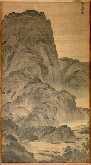
ZHANGYE DANXIA / RAINBOW MOUNTAINS IN VINTAGE POSTCARD 1970


VINTAGE POSTCARD 1970
Zhangye Danxia / Rainbow Mountains (1,500 to 2,500 m - 4,921 to 8202 ft)
 China 

The mountains 
Zhangye Danxia (1,500 to 2,500 m - 4,921 to 8202 ft) is known for the unusual colours of the rocks, which are smooth and sharp. Like in alt the others parts of the world where this kind of so called rainbow Mountain can be found, they are the result of deposits of sandstone and other minerals that occurred over 24 million years.  In the case of the Zhangye Danxia, the result, similar to a layer cake, is connected to the action of the same tectonic plates responsible for creating parts of the Himalayan mountains. Wind, rain, and time then sculpted extraordinary shapes, including towers, pillars, and ravines, with varying colours, patterns, and sizes.
Zhangye Danxia is located inside The Gansu Zhangye National Geopark (甘肃张掖国家地质公园), in Sunan and Linze counties within the prefecture-level city of Zhangye,in the northern foothills of the Qilian Mountains (祁连山). It covers an area of 322 square kilometres (124 sq mi). The site became a quasi-national geopark on April 23, 2012 . It was formally designated as ″Gansu Zhangye National Geopark″ by the Ministry of Land and Resources on June 16, 2016 after it has passed the on-site acceptance test. Known for its colorful rock formations, it has been voted by Chinese media outlets as one of the most beautiful landforms in China.
The core area of the park, Linze Danxia Scenic Area, is located 30 kilometres (19 mi) west of downtown Zhangye and 20 kilometres (12 mi) south of the seat of Linze County. It is the most developed and most visited part of the park. A second scenic area, Binggou (冰沟), located on the north bank of Liyuan River (梨园河), was officially inaugurated on 3 August 2014. 
In 2005, Zhangye Danxia was voted by a panel of reporters from 34 major media outlets as one of the most beautiful Danxia landform areas in China. In 2009, Chinese National Geography magazine chose Zhangye Danxia as one of the "six most beautiful landforms" in China.  The area has become a top tourist attraction for Zhangye. A series of boardwalks and access roads have been built to help visitors to explore the rock formations.  In 2014, 100 million yuan was invested to improve the facilities in the Binggou area.

Wednesday, June 28, 2017

XIANGIU PEAK / 翔宇峰 BY WU DACHENG / 吳大成


WU DACHENG / 吳大成 (1835–1902)
Xiangiu Peak / 翔宇峰 in Fragrant Hills (557m - 1,827ft)
China

In  Fragrant Mountains (清吳大澂山水扇面), Qing Dynasty (1644-1911), 
Folding fan mounted as an album leaf; ink on alum paper, The MET 

The Hill 
Xiangiu Peak / 翔宇峰 (557m - 1,827ft) is the highest point of the landscape complex known as The Fragrant Hills (Xiangshan / 象山)  located 25 km north west of Beijing. The park is a cool and appreciated place in summer for those wishing to escape the high temperatures of the capital.  The hills were occupied for the first time under the Jin Dynasty in 1186 and the Xiangshan Temple was built to house the Emperor during his hunting parties. But it is to the Emperor Qianlong that we owe the construction in 1745 of the largest part of the buildings. One can admire the Temple of the Clouds of Azure, the Fountain of Jade, the lake and the Summer Palace… to the skyscrapers of Beijing. Below, the botanical garden crosses the road leading to the Temple of the Lying Buddha (Wofosi). Famous for its five meter bronze lacquered coated Buddha, this temple was built under the Tang Dynasty. The best time to visit this 160 hectare park seems to be the late autumn when the leaves of the trees are dyed yellow and red. In this park, there are also pines, cypresses, maples, ginkos, fragrant orchards (apricots, pears, peaches) and many lilacs, all of which have subtle perfumes and explain the origin of the name of these hills.

The artist
The round, weighty brush strokes borrowed from the study of archaic scripts by late 19th century scholar artists are clearly seen in this fine ink landscape by Wu Dacheng.
As a Qing official, Wu Dacheng was a participant in several important events in 19th century history. When the Qing intervened in Annam in 1884 on behalf of the king against the French, Wu was sent to Tientsin to defend the city against the French attack. As governor of Guangdong, he negotiated customs duties on opium that continued to flow into the country through Canton and Macao, and without success recommended against ceding Macao to the Portuguese. As governor of Henan, he raised the standards of production in the lucrative silk and tea industries. When the Sino-Japanese War broke out in 1894, Wu took troops to defend a strategic northern mountain pass. His troops were defeated and he was dismissed from his post, after which he devoted his leisure to cultivating his talents as poet, calligrapher, seal cutter, connoisseur, collector, epigrapher and painter.