google.com, pub-0288379932320714, DIRECT, f08c47fec0942fa0 GRAVIR LES MONTAGNES... EN PEINTURE: July 2021

Wednesday, July 28, 2021

THE MONT BLANC PAINTED BY JEAN-ANTOINE LINCK


JEAN-ANTOINE LINCK (1766-1843)
The Mont Blanc (4,808.73 m -15,777 ft)
France-Italy border

In Vue du Mont blanc à partir du Col de Balme, Estampe, 50 x50cm, 
Musée Alpin de Chamonix-Mont-Blanc


About this picture
This print represents the Chamonix valley seen from the Col de Balme. This point of view allows the spectator to embrace the major part of the Mont-Blanc massif and the valley bottom by following the course of the Arve. Jean-Antoine Linck offers a relatively realistic panorama, sometimes exaggerating the bristling of summits and seracs. In the foreground, the artist has placed a few figures who seem to be tourists in awe of the landscape accompanied by a guide leaning against the border post with his two mules. Linck was trained in Geneva in his father's workshop in the context of the "Fabrique" which brings together watchmakers, jewelers and painters on enamel. It was in this dynamic artistic environment of the second half of the 18th century that the first engravers appeared who made the Chamonix valley known through their watercolor prints. A real industry of landscape engraving is then set up. Linck is one of the greatest representatives of this artistic movement linked to the rise of alpine tourism and a new craze for the landscape. He creates high-quality etched works, very popular with travelers, which he sells in his Geneva boutique. In his "Manual of the traveler in Switzerland" of 1818, Ebel moreover advises the latter in order to find the best artists. He quotes Linck in particular and specifies that this print was worth 18 pounds, a fairly large sum for the time. Despite everything, the print is reproducible and cheaper than a painting. It therefore lends itself perfectly to the request of visitors to take with them views of the regions visited.

The artist
Jean-Antoine Linck, is a swiss painter and draftsman who lived and worked at the end of the 18th century and beginning of 19th century, at the time nature and mountains were up to date in high society in Switzerland and France.He is the son of Jean-Conrad, an enameller and engraver from Geneva who initiates his apprenticeship. He was then trained by Carl Hackert with Wolfgang Adam Toepffer. In 1802, he opened his own studio in Geneva, in the district of Montbrillant. His works, depicting the surroundings of Geneva, Savoy, the Alps and the Mont Blanc, were inspired by those of the great master of that " genre" Johann Ludwig Aberli and were successful with Josephine de Beauharnais, the French Empress and Catherine II, the Russian Empress, meanwhile alpine tourism began to develop

The mountain
The Mont Blanc (4,808.73 m -15,777 ft) or Monte Bianco, both meaning "White Mountain", is the highest mountain in the Alps and the highest in Europe after the Caucasus peaks. It is ranked 11th in the world in topographic prominence. The Mont Blanc is one of the Seven Summit, which includes the highest mountains of each of the seven continents. Summiting all of them is regarded as a mountaineering challenge, first achieved on April 30, 1985 by Richard Bass. The 7 highest summits, (which are obviously 8 with 2 in Europe !) are :
Mount Everest (8,848m), Aconcagua (6,961m), Mt Denali or Mc Kinley (6,194m), Kilimandjaro (5,895m), Mt Elbrus (5,642m), Mount Vinson (4,892m) and Mount Kosciuszko (2,228m) in Australia.
The mountain lies in a range called the Graian Alps, between the regions of Aosta Valley, Italy, and Savoie and Haute-Savoie, France. The location of the summit is on the watershed line between the valleys of Ferret and Veny in Italy and the valleys of Montjoie, and Arve in France. The Mont Blanc massif is popular for mountaineering, hiking, skiing, and snowboarding.
The three towns and their communes which surround Mont Blanc are Courmayeur in Aosta Valley, Italy, and Saint-Gervais-les-Bains and Chamonix in Haute-Savoie, France. A cable car ascends and crosses the mountain range from Courmayeur to Chamonix, through the Col du Géant. Constructed beginning in 1957 and completed in 1965, the 11.6 km (7¼ mi) Mont Blanc Tunnel runs beneath the mountain between these two countries and is one of the major trans-Alpine transport routes.
Since the French Revolution, the issue of the ownership of the summit has been debated.
From 1416 to 1792, the entire mountain was within the Duchy of Savoy. In 1723 the Duke of Savoy, Victor Amadeus II, acquired the Kingdom of Sardinia. The resulting state of Sardinia was to become preeminent in the Italian unification.[ In September 1792, the French revolutionary Army of the Alps under Anne-Pierre de Montesquiou-Fézensac seized Savoy without much resistance and created a department of the Mont-Blanc. In a treaty of 15 May 1796, Victor Amadeus III of Sardinia was forced to cede Savoy and Nice to France. A Sardinian Atlas map of 1869 showing the summit lying two thirds in Italy and one third in France.
Although the Franco-Italian border was redefined in both 1947 and 1963, the commission made up of both Italians and French ignored the Mont Blanc issue. In the early 21st century, administration of the mountain is shared between the Italian town of Courmayeur and the French town of Saint-Gervais-les-Bains, although the larger part of the mountain lies within the commune of the latter.

_______________________________________


2021 - Wandering Vertexes...
by Francis Rousseau

Saturday, July 24, 2021

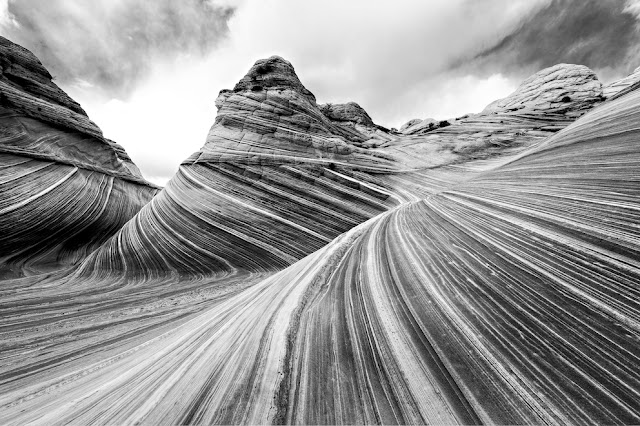
VERMILION CLIFFS PHOTOGRAPHED BY ANSEL ADAMS

ANSEL ADAMS (1902-1984) Vermilion Cliffs (944 m to 2164m - 3,100 to 7,100 feet.) United States of America (Arizona-Utah)


ANSEL ADAMS (1902-1984)
Vermilion Cliffs (944 m to 2164m - 3,100 to 7,100 feet.)
United States of America ( Arizona-Utah)


The site
The Vermilion Cliffs are the second "step" up in the five-step Grand Staircase of the Colorado Plateau, in northern Arizona and southern Utah. They extend west from near Page, Arizona, for a considerable distance, in both Arizona and Utah.  112,500 acres (45,500 ha) of the region were designated as the Paria Canyon-Vermilion Cliffs Wilderness in 1984. An even greater area was protected within Vermilion Cliffs National Monument in 2000. The Vermilion Cliffs are composed of the resistant red sandstone beds of the Lower Jurassic Moenave and Kayenta Formations.  They are made up of deposited silt and desert dunes, cemented by infiltrated carbonates and intensely colored by red iron oxide and other minerals, particularly bluish manganese. They are in the physiographic High Plateaus Section and Canyon Lands Section of the Colorado Plateau Province.  The Vermillion Cliffs were on an important route from Utah to Arizona used by settlers during the 19th Century. Present day U.S. Highway 89A basically follows the old wagon route past the cliffs through House Rock Valley and up the Kaibab Plateau to Jacob Lake.
Famous locations in the cliff area include Lee's Ferry, Glen Canyon and the Glen Canyon National Recreation Area, The Wave, Coyote Buttes, and others. Reddish or vermilion-colored cliffs are found along U.S. Highway 89A near Navajo Bridge, and may be seen from U.S. Highway 89 close to Bitter Springs. Highway 89A runs alongside the Vermilion Cliffs for most of its route between Jacob Lake and Marble Canyon, and offers a great view of the cliffs.

The photographer
Ansel Easton Adams was an American photographer and environmentalist.
His black-and-white landscape photographs of the American West, especially Yosemite National Park, have been widely reproduced on calendars, posters, books, and the internet. Adams and Fred Archer developed the Zone System as a way to determine proper exposure and adjust the contrast of the final print. The resulting clarity and depth characterized his photographs. He primarily used large-format cameras because their high resolution helped ensure sharpness in his images. Adams founded the photography group known as Group f/64, along with fellow photographers Willard Van Dyke and Edward Weston and Imogen Cunningham.
In September 1941, Adams contracted with the Department of the Interior to make photographs of National Parks, Indian reservations, and other locations for use as mural-sized prints for decoration of the Department's new building. Part of his understanding with the Department was that he might also make photographs for his own use, using his own film and processing... 

Full entry

___________________________________________


2021 - Wandering Vertexes...
by Francis Rousseau
Wednesday, July 21, 2021

EL CHIMBORAZO SKETCHED BY ALEXANDER VON HUMBOLDT


ALEXANDER VON HUMBOLDT (1769-1859) Chimborazo (6,263 m-20,549 ft) Ecuador  In,  El Chimborazo vu de la plaine de Tapia, 1810


ALEXANDER VON HUMBOLDT (1769-1859)
Chimborazo (6,263 m-20,549 ft)
Ecuador

In  El Chimborazo vu de la plaine de Tapia, 1810


The mountain
El Chimborazo (6,263 m -20,548 ft) is a currently inactive stratovolcano in the Cordillera Occidental range of the Andes ans the highest mountain in Ecuador and the Andes north of Peru ; it is higher than any more northerly summit in the Americas. Chimborazo is not the highest mountain by elevation above sea level, but its location along the equatorial bulge makes its summit the farthest point on the Earth's surface from the Earth's center.
Chimborazo is at the main end of the Ecuadorian Volcanic Arc, north west of the town of Riobamba. Chimborazo is in la Avenida de los Volcanes (the Avenue of Volcanoes) west of the Sanancajas mountain chain. Carihuairazo, Tungurahua, Tulabug, and El Altar are all mountains that neighbor Chimborazo. The closest mountain peak, Carihuairazo, is 5.8 mi (9.3 km) from Chimborazo. There are many microclimates near Chimborazo, varying from desert in the Arenal to the humid mountains in the Abraspungo valley.
Its last known eruption is believed to have occurred around A.D. 550.
Until the beginning of the 19th century, it was thought that Chimborazo was the highest mountain on Earth (measured from sea level), and such reputation led to many attempts on its summit during the 17th and 18th centuries.
In 1746, the volcano was explored by French academicians from the French Geodesic Mission. Their mission was to determine the sphericity of the Earth. Their work along with another team in Lapland established that the Earth was an oblate spheroid rather than a true sphere. They did not reach the summit of Chimborazo.
In 1802, during his expedition to South America, Baron Alexander von Humboldt, accompanied by Aimé Bonpland and the Ecuadorian Carlos Montufar, tried to reach the summit. From his description of the mountain, it seems that before he and his companions had to return suffering from altitude sickness they reached a point at 5,875 m, higher than previously attained by any European in recorded history. (Incans had reached much higher altitudes previously). In 1831, Jean-Baptiste Boussingault and Colonel Hall reached a new "highest point", estimated to be 6,006 m.
On 4 January 1880, the English climber Edward Whymper reached the summit of Chimborazo. The route that Whymper took up Chimborazo is now known as the Whymper route. Edward Whymper, and his Italian guides Louis Carrel and Jean-Antoine Carrel, were the first Europeans to summit a mountain higher than 20,000 feet. As there were many critics who doubted that Whymper had reached the summit, later in the same year he climbed to the summit again, choosing a different route (Pogyos) with the Ecuadorians David Beltrбn and Francisco Campaсa.


The cartographer and artist
Friedrich Wilhelm Heinrich Alexander von Humboldt was a Prussian geographer, naturalist, explorer, and influential proponent of Romantic philosophy and science. He was the younger brother of the Prussian minister, philosopher, and linguist Wilhelm von Humboldt (1767–1835). Humboldt's quantitative work on botanical geography laid the foundation for the field of biogeography. Humboldt's advocacy of long-term systematic geophysical measurement laid the foundation for modern geomagnetic and meteorological monitoring.
Between 1799 and 1804, Humboldt travelled extensively in Latin America, exploring and describing it for the first time from a modern scientific point of view. His description of the journey was written up and published in an enormous set of volumes over 21 years. Humboldt was one of the first people to propose that the lands bordering the Atlantic Ocean were once joined (South America and Africa in particular). Humboldt resurrected the use of the word cosmos from the ancient Greek and assigned it to his multi-volume treatise, Kosmos, in which he sought to unify diverse branches of scientific knowledge and culture. This important work also motivated a holistic perception of the universe as one interacting entity.
On their way back to Europe from Mexico on their way to the United States, Humboldt and his fellow scientist Aimé Bonpland stopped in Cuba for a While. After their first stay in Cuba of three months they returned the mainland at Cartagena de Indias (now in Colombia), a major center of trade in northern South America. Ascending the swollen stream of the Magdalena River to Honda and arrived in Bogotá on July 6, 1801 where they met Spanish botanist José Celestino Mutis, the head of the Royal Botanical Expedition to New Granada, staying there until September 8, 1801. Mutis was generous with his time and gave Humboldt access to the huge pictorial record he had compiled since 1783. Humboldt had hopes of connecting with the French sailing expedition of Baudin, now finally underway, so Bonpland and Humboldt hurried to Ecuador. They crossed the frozen ridges of the Cordillera Real, they reached Quito on 6 January 1802, after a tedious and difficult journey.
Their stay in Ecuador was marked by the ascent of Pichincha and their climb of Chimborazo, where Humboldt and his party reached an altitude of 19,286 feet (5,878 m). This was a world record at the time, but a thousand feet short of the summit. Humboldt's journey concluded with an expedition to the sources of the Amazon en route for Lima, Peru.
At Callao, the main port for Peru, Humboldt observed the transit of Mercury. On 9 November and studied the fertilizing properties of guano, rich in nitrogen, the subsequent introduction of which into Europe was due mainly to his writings.

___________________________________________ 


2021 - Wandering Vertexes...
by Francis Rousseau

Sunday, July 18, 2021

HUANGSHAN / 黄山 PAINTED BY CHEN RUYAN / 陳汝言

CHEN RUYAN / 陳汝言 ( c. 1331-bef 1380) Huangshan / 黄山 (1,864m - 6,115ft) China   In Mountains of the Immortals Handscroll, ink and color on silk, 33X97 cm.  The Cleveland Museum of Art

CHEN RUYAN / 陳汝言 ( c. 1331-bef 1380) Huangshan / 黄山 (1,864m - 6,115ft) China   In Mountains of the Immortals Handscroll, ink and color on silk, 33X97 cm.  The Cleveland Museum of Art


CHEN RUYAN / 陳汝言 ( c. 1331-bef 1380)
Huangshan / 黄山 (1,864m - 6,115ft)
China

In Mountains of the Immortals, Handscroll, ink and color on silk, 33X97 cm. 
(Detail and full scroll )
The Cleveland Museum of Art

About the painting
This extraordinary painting reveals the intense desire by Yuan artists to capture and renew the flavor of past generations. The fantastic landscape is painted in the "blue and green" style associated with the Tang dynasty (618–907), a period of superb cultural achievement in China. Athough the intense mineral pigments have faded with the passage of time, the artist's vision of an imaginary land remains intact for the modern viewer.


The artist
There is no detailed biography that can define the dates of Chen Ruyan's birth and death. Only his works allow us to locate his period of activity which begins around 1340, and ends in 1380, possible date of its execution. The latter is in perfect contradiction with the inscription of Ni Zan situating his death in 1371.
Poet and painter, friend of the artist Wang Meng (painter), he held a post of provincial secretary in Shandong province at the beginning of the Ming dynasty. He makes landscapes in the style of Zhao Mengfu and characters in that of Ma Hozhi.
Chen Ruyan is part of the same circle of literate amateurs with his friends Ni Zan and Wang Meng and he also holds office in the short-lived government of Zhang Shicheng. He accepts a provincial post under the new Ming regime and suffers the same fate as the others, execution, for certain unspecified transgression. His Kingdoms of Immortals portable scroll probably dates from the time he was in the service of Zhang Shicheng; according to an inscription written by Ni Zan in 1371, in which he notes that by then the artist is already dead, the scroll is a birthday present for Mr. Pan, Zhang Shicheng's brother-in-law2.


The mountains
Huangshan - 黄山 is a mountain range in southern Anhui province in eastern China. Vegetation on the range is thickest below 1,100 meters -3,600 ft), with trees growing up to the treeline at 1,800 meters -5,900 ft). The Huangshan mountain range has many peaks, some more than 1,000 meters (3,250 feet) high. The three tallest and best-known peaks are Lotus Peak (Lian Hua Feng, 1,864 m), Bright Summit Peak (Guang Ming Ding, 1,840 m), and Celestial Peak (Tian Du Feng, literally Capital of Heaven Peak, 1,829 m).
The area is well known for its scenery, sunsets, peculiarly-shaped granite peaks, Huangshan pine trees, hot springs, winter snow, and views of the clouds from above. Much of Huangshan's reputation derives from its significance in Chinese arts and literature. In addition to inspiring poets such as Li Bai, Huangshan and the scenery therein has been the frequent subject of poetry and artwork, especially Chinese ink painting and, more recently, photography. Overall, from the Tang Dynasty to the end of the Qing Dynasty, more than 20,000 poems were written about Huangshan, and a school of painting named after it. The mountains also have appeared in modern works. James Cameron, director of the 2009 film Avatar, cited Huangshan as one of his influences in designing the fictional world of that film. The area also has been a location for scientific research because of its diversity of flora and wildlife. In the early part of the twentieth century, the geology and vegetation of Huangshan were the subjects of multiple studies by both Chinese and foreign scientists. The mountain is still a subject of research. For example, in the late twentieth century a team of researchers used the area for a field study of Tibetan macaques, a local species of monkey.
Huangshan is a UNESCO World Heritage Site, and one of China's major tourist destinations. The World Heritage Site covers a core area of 154 square kilometres and a buffer zone of 142 square kilometres. In 2002, Huangshan was named the "sister mountain" of Jungfrau in the Swiss Alps.

_______________________________

2021 - Wandering Vertexes...
by Francis Rousseau

Wednesday, July 14, 2021

MOUNT WELLINGTON / KUNANYI PAINTED BY AUGUSTUS EARLE


AUGUSTUS EARLE (1793-1838) Mount Wellington - Kunanyi or Unghbanyahletta or Poorawetter (1,269m - 4,163ft) Australia (Tasmania)  In Tasmania - Van Dieman's Islands, waterolor, Pirivate collection


AUGUSTUS EARLE (1793-1838)
Mount Wellington - Kunanyi or Unghbanyahletta or Poorawetter (1,269m - 4,163ft)
Australia (Tasmania)

In Tasmania - Van Dieman's Islands, waterolor,1820,  Private collection,


The mountain
Mount Wellington (1,269m - 4,163ft) also known as Unghbanyahletta or Poorawetter or Kunanyi in Aboriginal langage, is located in the southeast coastal region of Tasmania, Australia. The Palawa, the surviving descendants of the original indigenous Tasmanians, tend to prefer the latter name. In 2013, a Tasmanian dual naming policy was announced and "Kunanyi - Mount Wellington" was named as one of the inaugural dual named geographic features.
The mountain is the summit of the Wellington Range on whose foothills is built much of the city of Hobart. Mount Wellington is frequently covered by snow, sometimes even in summer, and the lower slopes are thickly forested, but criss-crossed by many walking tracks and a few fire trails. There is also a sealed narrow road to the summit, about 22 kilometres (14 mi) from Hobart central business district. An enclosed lookout near the summit provides spectacular views of the city below and to the east, the Derwent estuary, and also glimpses of the World Heritage Area nearly 100 kilometres (62 mi) west. From Hobart, the most distinctive feature of Mount Wellington is the cliff of dolerite columns known as the Organ Pipes.
The first recorded European in the area Abel Tasman probably did not see the mountain in 1642, as his ship was quite a distance out to sea as he sailed up the South East coast of the island - coming closer in near present-day North and Marion Bays. No other Europeans visited Tasmania until the late eighteenth century, when several visited southern Tasmania (then referred to as Van Diemens Land) including Frenchman Marion du Fresne (1772), Englishmen Tobias Furneaux (1773), James Cook (1777) and William Bligh (1788 and 1792), and Frenchman Bruni d'Entrecasteaux (1792–93).
In February 1836, Charles Darwin visited Hobart Town and climbed Mount Wellington.


The artist
Augustus Earle was a London-born travel artist. Unlike earlier artists who worked outside Europe and were employed on voyages of exploration or worked abroad for wealthy, often aristocratic patrons, Earle was able to operate quite independently - able to combine his lust for travel with an ability to earn a living through art. The body of work he produced during his travels comprises a significant documentary record of the effects of European contact and colonisation during the early nineteenth century. From 1817 to 1832, Earle travelled trough Sicily, Malta, Gibraltar, North Africa, North Americas (New York Philadelphia), South America (Brazil, Peru, Chile), Tristan da Cunha (Antartica) the Pacific, Asia, India, Mauritius, St Helena (where he met the french emperor Napoleon in exil), New South Wales, New Zealand, Tasmania... he came back in England in 1832 ans died in London in 1838.

_____________________________

2021 - Wandering Vertexes...
by Francis Rousseau

Sunday, July 11, 2021

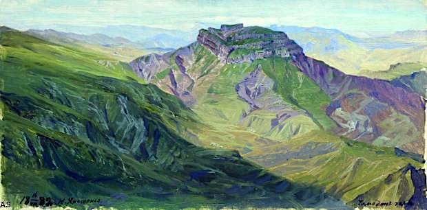
GUNIBMOUNTAIN PAINTED BY NIKOLAI YAROSHENKO


NIKOLAI YAROSHENKO (1846-1898), Gunib Mountain (1, 500m - 4,921ft) Russia (Republic of Dagestan)  In Hora Dagestan, oil on can vas, 1888, Private collection
 
NIKOLAI YAROSHENKO (1846-1898),
Gunib Mountain (1, 500m - 4,921ft)
Russia (Republic of Dagestan)

In Hora Dagestan, oil on can vas, 1888, Private collection

The mountain
Gunib Mountain (1, 500m - 4,921ft) dominates the village of Gunib (Гуниб) in Daghestan, chief town of the district of the same name. Its population, of stingy ethnicity, was 2 271 inhabitants in 2010. Gounib is situated in the middle of the Gounib Plateau, 172 kilometers southwest of Makhachkala at an altitude of 1,500 meters.
This area was taken by the Russian army against Shamil on August 25, 1859 who surrendered to General Prince Alexander Bariatinski. The village was formed in 1862 as a dwelling place for workers building a Russian fortress. It took the name of an aul higher on the plateau destroyed in 1859. Gounib was the chief town of Okrug Gounib belonging to the oblast of Dagestan (until 1921). The barracks of the Samur Regiment and the Artillery Regiment of the Dagestan Fortress and Terek were built there in 1895. At that time there were twenty-nine homes of employees, merchants, retired soldiers, a small Orthodox church and a post office.


The painter

Nikolai Alexandrovich Yaroshenko was born in the city of Poltava, Russian Empire (now Ukraine) to a son of an officer in the Russian Army. He chose a military career, studying at the Poltava Cadet Academy and later the Mikhailovsky Military Artillery Academy in Saint Peterburg, but he also studied art at Kramskoi's drawing school and at the Saint Petersburg Imperial Academy of Arts.
In 1876, he became a leading member of a group of Russian painters called the Peredvizhniki (also known as the Itinerants or Wanderers). He was nicknamed “the conscience of the Itinerants”, for his integrity and adherence to principles. Yaroshenko retired as a Major General in 1892. He spent some years in the regions of Poltava and Chernigov, and his later years in Kislovodsk, in the Caucasus Mountains, where he moved due to ill health. He died of phthisis (pulmonary tuberculosis) in Kislovodsk and was buried there.
Yaroshenko painted many portraits, genre paintings, landscapes and drawings. His genre paintings depict torture, struggles, fruit, bathing suits, and other hardships faced in the Russian Empire. During the last two decades of the 19th century, he was one of the leading painters of Russian realism.
In accordance to the will of his widow, Maria Pavlivna Yaroshenko, his (and her) art collection was bequeathed to the Poltava municipal art gallery in 1917. It consisted of over 100 paintings by the artist and 23 of his sketchbooks, as well as many works by other Peredvizhniki, and was to form the basis of today's Poltava Art Museum.

_______________________________

2021 - Wandering Vertexes...
by Francis Rousseau

Wednesday, July 7, 2021

MONTAGNE SAINTE VICTOIRE BY JEAN-BAPTISTE NÉE


JEAN-BAPTISTE NÉE (b.1986)
The Montagne Sainte Victoire (1, 011m - 2, 216 ft)
France (Provence Alpes Côte d'azur)

 In  La  Sainte Victoire  Fusain, 29,  x 42cm,  2008.


The artist
Jean-Baptiste Née, born in 1986. is a french painter, scenographer and visual artist, graduated from Arts-Décoratifs of Paris in 2012.  Jean-Baptiste Née works in the mountains and high mountains, always in situ, in direct confrontation with the movements of the earth and water and wind.  He gives a growing place for the action of the elements on the work in progress (rain, snow, frost, etc.).  He established his "large workshop" in the Swiss Alps or in the Vercors massif - especially in winter -, as well as during long hikes in the Italian Alps. In the winter of 2018, he worked in the massifs of Wudangshan and Lushan, in China, and became interested in the Taoist notion of "Sky".  Since 2016, Jean-Baptiste Née exhibits regularly in galleries in France and Switzerland. His workshop is in Montreuil, France. Exhibited  in Galerie Camera Obscura in Paris. A book was recently published about his work "Le monde nu" Éditions Hartpon. Contact @jeanbaptiste.nee. His new website

The mountain
Mont Sainte-Victoire (1,011 m-3,316ft) also called Mont Venturi is a limestone massif in the South of France, in the region Provence-Alpes-Côte d'Azur. Located east of Aix-en-Provence, it has experienced international fame, due to the more than 80 works Paul Cézanne did on it. It hosts many hikers, climbers and nature lovers, and is a major element of Aix landscape.
The range of the Sainte-Victoire is 18 kilometers long and 5 kilometers from large, following a strict east-west orientation. It is located on the Bouches-du-Rhône and Var, and in the towns of Puyloubier, Saint-Antonin-sur-Bayon, Rousset, Châteauneuf-le-Rouge, Beaurecueil, Le Tholonet Vauvenargues, Saint-Marc-Jaumegarde, Pourrières, Artigues and Rians.
D 10 and D 17 (Route Cézanne) are the main roads to skirt the mountains. On the northern side, the D10 crosses the Col de Claps (530 m) and the Col des Portes (631 m). On the southern side, the D 17 walks on the Plateau de Cengle and crossed the Collet blanc de Subéroque (505 m).
The southern side is characterized by the presence of significant high limestone cliffs 500 to 700 m with the white appearance added to the sun gives the appearance of a high muraille. At the foot of the cliffs, there is more massive brush, oak, kermes oak, Aleppo pine (population greatly reduced after the fire of 1989) but also cultures (olive trees).
On the northern side among the many species present, the Crocus is fairly well represented in the hills and the wild iris and daffodil. One can also see various varieties and boxwood shrubs.
The massif rises to the Pic des Mouches (Peak of the Flies) (1011 m) near the eastern end of the chain, and not at the Croix de Provence (946 m) near the west end and visible from Aix. The Pic des Mouches is one of the highest peaks of the department of Bouches-du-Rhône, behind the peak Bertagne which reached an altitude of 1042 mètres and which is located on the massif of Sainte-Baume.
Sainte-Victoire, as the range of the Sainte Baume, can be considered a special case among the Alpine ranges for the various stages of the formation of its relief associated geological history as well as that of the old Pyrenean-Provençal chain than that of the Western Alps (which have succeeded it).
Indeed, from the former Sainte-Victoire mountain, contemporary of the dinosaurs of the Cretaceous, it remains today only the fold Bimont, said Chaînon des Costes Chaudes, the last vestige resulting from tectonic movements and characteristics of the stacks of Pyreneo-Provençal phase during the Eocene. Later during the Oligocene, breaking of the anticlinal fold of Sainte-Victoire, which resulted from the uplift of the first great Alpine reliefs, is causing a surge that help explain the current form of the mountain, which appeared 15 million years BCE.
Sainte-Victoire, whose calcareous sediments date back to the Jurassic, thus consists of both a Pyrenean-Provencal vestige and of an alpine geology. This singularity and this ambivalence help explain why, although a massive western Alps, the problem of this connection remains complexe.
According to a recent study, the Sainte-Victoire is still growing ! The company ME2i has indeed conducted a satellite survey between 1993 and 2003 providing evidence that during this period the western end of the Sainte-Victoire was uplift of 7 mm per year.
The massif is a ensemble of 6525 ha classified since 1983.
The massive hosts several world-famous dinosaur eggs deposits including the Roques-Hautes / Les Grands-Creux on the town Beaurecueil.

_______________________________


2021 - Wandering Vertexes...
by Francis Rousseau
Saturday, July 3, 2021

THE DENTS DU MIDI PAINTED BY JEAN-ANTOINE LINCK

JEAN-ANTOINE LINCK (1766 - 1843) Les Dents du Midi (3,114 m to 3,257 m -10,216 ft to10,685 ft) Switzerland  In Vue la Dent du Midi et du Château de Lanex prise près d'Aigle, Original coloured etching, 36 x 48 cm

JEAN-ANTOINE LINCK (1766 - 1843)
Les Dents du Midi (3,114 m to 3,257 m -10,216 ft to10,685 ft)
Switzerland

In Vue la Dent du Midi et du Château de Lanex prise près d'Aigle, Original coloured etching, 36 x 48 cm


The mountain
The Dents du Midi (Teeth of the south) (3,114 m to 3,257 m -10,216 ft to 10,685 ft) are a mountain range, 3 kilometers long, located in the Chablais Alps in the canton of Valais in Switzerland. Overlooking the valley of Illiez and Rhône Valley on south, they face the lake Salanfe, an artificial reservoir, and are part of the geological whole massif Giffre.
The name "Dents du Midi" is recent. The people formerly called them "Dents Tsallen". It was only towards the end of the19e century that the name "Dents du Midi" came officially.
Each « tooth » had several names over the centuries and according to its geological evolution.
- The "Cime de l'Est" (3,178 meters) called "Mont Novierre" before the mid-17th century, and "Mont Saint-Michel "after landslides in 1635 and 1636 and finally "Dent Noire" (until the 19th century).
- The "Dent Jaune" (3,186 m) was called the "Dent Rouge" until 1879.
- The "Doigt de Champéry" (in 1882) and then the Doigt Salanfe (in 1886) turned just into "Les Doigts" (Fingers) (3,205 m and 3210 m).
- The "Haute Cime" (3,257 m) also had many names : "Dent de l’Ouest" (until 1784) and then "Dent du Midi", "Dent de Tsallen" and "Dent de Challent."
- As for l’Eperon (3,114 m) (The Spur), it is assumed that there were two peaks but a landslide in the Middle Ages significantly changed its crest.
- The Forteresse (3,164 m) and the Cathedral (3,160 m) have not changed names.
The evolution of this massif continues nowadays. So on the morning of 30 October 2006, a volume of 1 million m3 of rock broke away from the edge of the Haute Cime and slid down the slope to an altitude of about 3,000 m. The event did not present danger to the nearby village of Val-d'Illiez but roads and trails were closed for security reasons. According to the cantonal geologist, the landslide was caused by the thawing of rocks, helped by warm summers of recent years.


The artist
Jean-Antoine Linck, is a swiss painter and draftsman who lived and worked at the end of the 18th century and beginning of 19th century, at the time nature and mountains were up to date in high society in Switzerland and France.He is the son of Jean-Conrad, an enameller and engraver from Geneva who initiates his apprenticeship. He was then trained by Carl Hackert with Wolfgang Adam Toepffer. In 1802, he opened his own studio in Geneva, in the district of Montbrillant. His works, depicting the surroundings of Geneva, Savoy, the Alps and the Mont Blanc, were inspired by those of the great master of that " genre" Johann Ludwig Aberli and were successful with Josephine de Beauharnais, the French Empress and Catherine II, the Russian Empress, meanwhile alpine tourism began to develop.

__________________________________
2021 - Wandering Vertexes...
by Francis Rousseau