google.com, pub-0288379932320714, DIRECT, f08c47fec0942fa0 GRAVIR LES MONTAGNES... EN PEINTURE

Friday, April 28, 2017

DIE LORELEI BY NIKOLAÏ ASTUDIN


NIKOLAÏ ASTUDIN (1847-1925) 
Die Loreley (132m - 433ft)
Germany 

Engraving from an oil on canvas, 1910

The mountain 
Die Loreley  (132m- 433 ft) high  is a slate cliff in the Upper Middle Rhine Valley World Heritage near the town of St. Goarshausen. The view of St. Goarshausen, from the Loreley outlook point, with Castle Katz and the view of the town St. Goar and its Fortress Rheinfels, leaves a wonderful impression on all Loreley tourists. The Rhine, at the Loreley, is up to 82 feet deep and only 371 feet wide. Because this area is so deep and narrow, it is one of the most dangerous places in the World Heritage Upper Middle Rhine Valley. Ships, crossing each other here and all along the section between Oberwesel and St. Goarshausen, are directed by light signals, called “Wahrschau”.
The name comes from the old German words lureln, Rhine dialect for "murmuring", and the Celtic term ley ("rock"). The translation of the name would therefore be: "murmur rock" or "murmuring rock". The heavy currents, and a small waterfall in the area (still visible in the early 19th century) created a murmuring sound, and this combined with the special echo the rock produces to act as a sort of amplifier, giving the rock its name. The murmuring is hard to hear today owing to the urbanization of the area. Other theories attribute the name to the many accidents, by combining the German verb "lauern" (to lurk, lie in wait) with the same "ley" ending, with the translation "lurking rock".
In the German language orthographic reform of 1903, in almost all German terms the letter "y" was changed to the letter "i".
The rock and the murmur it creates have inspired various tales. An old legend envisioned dwarfs living in caves in the rock. The Lorelei have inspired as well quite a lot of artists, musicians and painters and poets, the most famous of them being Heinrich Heine (link  to the full poem here)

 The painter 
Nikolai Lvovoch Astudin ( Николай Львович Астудин)  was a Russian landscape painter.
Astudin was the son of an officer and completed his school education in Saint Petersburg. He then became a student of the landscape painter Armand-Théophile Cassagne (1823-1907) in Paris. Study trips lead him to Finland, to the Alpine countries and to Italy. As early as 1876 and 1877 Astudin had exhibitions in Berlin,  and in 1885 in Zurich.  Among his Bonner motifs are the Rhine Bridge (1898) and the Godesburg. In 1912, he moved to Oberlahnstein, where he lived until his death. In this late phase, he mainly painted the Rhine motifs and repeatedly painted Lahneck Castle and The Lorelei (above).  Astudin was widely known for his Rhine paintings and the numerous reproductions of his Rhine views. His work is an expression of the Rhine and Eifelromantik of the early 20th century.

_______________________________
2017 - Wandering Vertexes...
by Francis Rousseau 

Thursday, April 27, 2017

MILESOVKA PAINTED BY CASPAR DAVID FRIEDRICH


CASPAR DAVID FRIEDRICH (1774-1840)
Milešovka (837m - 2, 746ft)
Czech Republic

1. In Bohemian Landscape with Mount Milešovka, oil on canvas,1807, 
2. In Bohemian landscape, 1808, oil on canvas, Private collection

The mountain 
Milešovka (837m - 2, 746 ft), an isolated phonolite cone, is the highest mountain of České Středohoří (Czech Central Mountains Range), a picturesque mountain range in northwest Bohemia, in Czech Republic. Situated right in the middle of the European Continent, it has a volcanic origin. The range covers an area of  more than 1000 km2 with many hills typically volcano shaped. Their unique appearance were attracting numbers of naturalists, painters, poets and nature-lovers.
Mount Milešovka is located over the village of Milesov about 10km northwestward of Lovosice. The peak is ranked among the most windy mountains in Czech Republic. The very first chalet had been built up in 1825, other buildings soon followed as well as the outlook tower in 1850. The famous traveler Alexander von Humboldt is responsible for their construction, he labeled the view from Milesovka as "the third most beautiful in the world", making it really worth visiting. From there, one can see the scenery view of Ceske Stredohori, the Polabska nizina lowlands and the ridge of the Krusne hory mountains. Milesovka adjoins with a peak called Paskapole which is crossed by the road connecting Prague with Teplice.

 Source:  
Czech Republic Geographic Institute

The painter 
Caspar David Friedrich was a 19th-century German Romantic landscape painter, considered as the most important German artist of his generation. He is best known for his mid-period allegorical landscapes which typically feature contemplative figures silhouetted against night skies, morning mists, barren trees or Gothic ruins. His primary interest as an artist was the contemplation of nature, and his often symbolic and anti-classical work seeks to convey a subjective, emotional response to the natural world. Friedrich's paintings characteristically set a human presence in diminished perspective amid expansive landscapes, reducing the figures to a scale that, according to the art historian Christopher John Murray, directs "the viewer's gaze towards their metaphysical dimension".
Friedrich was born in Pomerania, where he began to study art. He studied in Copenhagen until 1798, before settling in Dresden. A disillusionment with materialistic society was giving rise everywhere in Europe. This shift in ideals was often expressed through a reevaluation of the natural world, as artists such as  J. M. W. Turner (1775–1851) and John Constable (1776–1837) sought to depict nature as a "divine creation, to be set against the artifice of human civilization"....
More informations about Caspar David  Friedrich life and work 

Wednesday, April 26, 2017

PENYCADAIR PAINTED BY RICHARD WILSON


RICHARD WILSON (1714-1782)
Penygadair - Cader Idris (892m-2,927ft)
United Kingdom (Wales)

1.   In Llyn-y-Cau, Cader Idris, oil on canvas, Tate Britain 
2. In The Mawddach Valley and Cader Idris, 1774, oil on canvas, Walker Art Gallery 

The mountain 
 Penygadair or Pen-y-Gader (892m-2,927 ft ) which means Top of the Chair, is the summit of Cader  Idris mountain and offers a superb panorama of mountain scenery.  Cader Idris  (or Cadair Idris) means 'Chair of Idris', the giant warrior poet of Welsh legend.  The mountain consists of a long ridge (11km), the 19th highest mountain in Wales and the second most popular mountain in the country after Mount Snowdon.  Pen-y-Gader northern face is craggy and precipitous, in contrast to the south face which slopes more gently into the broad expanse of the Dyfi estuary. There are a number of paths which lead to the summit, the Fox's Path leads directly up the mountains north face. To the north of the summit lies the very steep and craggy north face, where the cliffs drop around 200 metres (656ft).  The other peaks of the ridge are Mynyyd Moel (855m- 2805ft) and Mynydd Pencoed (798m-2618ft). North of Cadair Idris lies the town of Dolgellau, a convenient base, which offers cafes, restaurants and shops. The mountain is notorious for its low cloud but on a clear day it is possible to see the mountains of the Snowdon massif and the Rhinog mountain range as well as the Lleyn Peninsula and the hills of Shropshire, the Long Mynd, the Wrekin and occasionally Ireland.
There are numerous legends about Cader Idris. Some nearby lakes are supposed to be bottomless, and anyone who sleeps on its slopes alone will supposedly awaken either a madman or a poet. The tradition of sleeping on the summit of the Mountain apparently stems from bardic traditions, where bards would sleep on the mountain in hope of inspiration.
 Source:
 -Snowdonia official  Guide 

The painter
Richard Wilson was an influential Welsh landscape painter, who worked in Britain and Italy. With George Lambert he is recognized as a pioneer in British art of landscape for its own sake and was described in the Welsh Academy Encyclopedia of Wales as the "most distinguished painter Wales has ever produced and the first to appreciate the aesthetic possibilities of his country".  From 1750 to 1757 Wilson was in Italy, and became a landscape painter on the advice of Francesco Zuccarelli. Painting in Italy and afterwards in Britain, he was the first major British painter to concentrate on landscape. He composed well, but saw and rendered only the general effects of nature, thereby creating a personal, ideal style influenced by Claude Lorrain and the Dutch landscape tradition. John Ruskin wrote that Wilson "paints in a manly way, and occasionally reaches exquisite tones of colour". Among Wilson's pupils was the painter Thomas Jones. His landscapes were acknowledged as an influence by Constable, John Crome and Turner.
In December 1768 Wilson became one of the founder-members of the Royal Academy. A catalogue raisonné of the artist's work is published by the Paul Mellon Centre for Studies in British Art.
Source: 
- Tate Britain 

Tuesday, April 25, 2017

MONT PUGET - LES CALANQUES BY LUCIEN LEVY DHURMER


LUCIEN LEVY-DHURMER (1865-1953)
Mont Puget (563m - 1,847ft)
France (Provence-Alpes-Côte-d'Azur) 

1. In Mont Puget, Calanques (6 heures du soir),1930-36, oil on canvas, Musée d'Orsay, Paris 
2. In Mont Puget, Les Calanques (midi) , 1930-36, oil on canvas,  Musée d'Orsay, Paris  
3. In Les Calanques (lever de soleil), pastel, Musée d'Orsay, Paris 

The mountain
Mount Puget (563m - 1,847ft) is the highest point of the Massif des Calanques, between Marseille (northwest) and Cassis (east). It lies to the east of the massif Marseilleveyre. Overlooking the city, which spreads at its feet, it offers a unique view on the harbors North and South of Marseille. Puget is the diminutive of the Provencal word "puech" which comes from the Latin "podium" and designates an eminence, a high place.
Mount Puget can provide interesting climbing and walking routes. The most common starting point is the Luminy faculty site at the bus terminal. A very good track, which has been set up for the firemen, leads to the summit in about two hours. One can also climb directly through several "ways". One of these is actually a scree, with a slope of 45 degrees. From the summit, you have a panorama of the Grande Candelle, the Calanques, Cap Canaille, the city of Marseille, the Garlaban massif, and even the Sainte-Baume Massif.
The Massif of the Calanques (also know as Calanques of Marseille), are a massive coastline, extending over twenty kilometers of coast on the Mediterranean Sea between the village of La Madrague (district of the south-west of the city of Marseille) to Cassis, via Les Goudes and Callelongue. It is one of the most remarkable natural sites in France, and a major natural resource area for its one million annual visitors. The word calanque (Provencal Calanco) refers to a valley dug by a river and then recovered by the sea. The Calanques benefit from the protection of the National Park of the Calanques created in April 2012 and which is the first national peri-urban park in Europe. In order to repopulate the waters, certain areas of the future park are forbidden to fish to serve as natural nurseries.

The Painter 
Lucien Lévy-Dhurmer  was a French Symbolist/Art Nouveau artist whose works include paintings, drawings, ceramics, furniture and interior design.
He was born Lucien Lévy to a Jewish family in Algiers, Algeria in those days a French colony. In 1879 he began studying drawing and sculpture in Paris. He first exhibited at the Paris Salon of 1882 where he showed a small ceramic plaque. In 1887 Lévy began making his living near Cannes in southern France, overseeing the decoration of ceramics. From 1886 to 1895 he worked as a ceramic decorator and then as artistic director of the studio of Clément Massier. Around 1892 he signed his first pieces of ceramics, which were influenced by Islamic Art.  In 1895 he left for Paris to begin a career in painting; around this time he visited Italy and was further influenced by art of the Renaissance. In 1896 he exhibited his first pastels and paintings under the name Lucien Lévy-Dhurmer; he'd added the last two syllables of his mother's maiden name (Goldhurmer), likely to differentiate himself from other people named Lévy. His paintings soon became popular with the public and among fellow artists as well. He earned high praise for the academic attention to detail with which he captured figures lost in a Pre-Raphaelite haze of melancholy, contrasted with bright Impressionist colouration. His portrait of writer Georges Rodenbach is perhaps the most striking example of this strange and extraordinary synergy.
After 1901 Lévy-Dhurmer moved away from expressly Symbolist content, incorporating more landscapes into his work because of his travels in Europe and North Africa. He continued to draw inspiration from music and attempted to capture works of great composers such as Beethoven in painted form.

Monday, April 24, 2017

MOUNT ADAMS / PAHTO PAINTED BY ALBERT BIERSTADT


ALBERT BIERSTADT  (1830-1902) 
Mount Adams or Patho or Klikitat (3, 473m - 12, 281ft) 
United States of America (Washington State) 

In Mount Adams , 1875, oil on canvas, Princeton University Art Museum, USA

The mountain
Mount Adams or Patho or Klikitat (3, 473m - 12, 281ft)  is a potentially active stratovolcano in the Cascade Range, USA. Although Adams has not erupted in more than 1,000 years, it is not considered extinct. It is the second-highest mountain in the U.S. state of Washington, after Mount Rainier/Tacoma. Mount Adams is a member of the Cascade Volcanic Arc, and is one of the arc's largest volcanoes, located in a remote wilderness approximately 34 miles (55 km) east of Mount St. Helens. The Mount Adams Wilderness consists of the upper and western part of the volcano's cone. The eastern side of the mountain is designated as part of the territory of the Yakama Nation.
Adams' asymmetrical and broad body rises 1.5 miles (2.4 km) above the Cascade crest. Its nearly flat summit was formed as a result of cone-building eruptions from separated vents. A false summit, Pikers Peak, rises 11,657 feet (3,553 m) on the south side of the nearly half-mile (800 m) wide summit area. The true summit is about 600 feet (180 m) higher on the gently sloping north side. A small lava and scoria cone marks the highest point. Suksdorf Ridge is a long buttress descending from the false summit down to an elevation of 8,000 feet (2,000 m). This structure was built by repeated lava flows in the late Pleistocene. 
Air travelers flying the busy routes above the area sometimes confuse Mount Adams with nearby Mount Rainier/Tacoma, which has a similar flat-topped shape.
The Pacific Crest Trail traverses the western flank of the mountain.
In the early 21st century, glaciers cover a total of 2.5% of Adams' surface. During the last ice age about 90% of the mountain was glaciated. Mount Adams has 209 perennial snow and ice features and 12 officially named glaciers : Adams Glacier, Pinnacle Glacier, White Salmon Glacier,  Avalanche Glacier, Mazama Glacier, Klickitat Glacier, Rusk Glacier, Wilson Glacier, Gotchen Glacier, Crescent Glacier and Lava Glacier.

 The Painter 
Albert Bierstadt was a German-born American painter.At an early age Bierstadt developed a taste for art and made clever crayon sketches in his youth. In 1851, he began to paint in oils. He became part of the Hudson River School in New York, an informal group of like-minded painters who started painting along this scenic river. Their style was based on carefully detailed paintings with romantic, almost glowing lighting, sometimes called Luminism. An important interpreter of the western landscape, Bierstadt, along with Thomas Moran, is also grouped with the Rocky Mountain School.
In 1858 he exhibited a large painting of a Swiss landscape at the National Academy of Design, which gained him positive critical reception and honorary membership in the Academy.  At this time Bierstadt began painting scenes in New England and upstate New York, including in the Hudson River valley. A group of artists known as the Hudson River School portrayed its majestic landscapes and craggy areas, as well as the light affected by the changing waters.
In 1859, Bierstadt traveled westward in the company of Frederick W. Lander, a land surveyor for the U.S. government, to see those landscapes.  He continued to visit the American West throughout his career....
 - More on Albert Bierstadt 's life and works

Sunday, April 23, 2017

LES PETITES DALLES PAINTED BY CLAUDE MONET


CLAUDE MONET (1840-1926)
 Les Petites Dalles (30 to 50m - 98 to164ft)
 France 

1. In  Marée basse aux Petites Dalles, 1884, oil on canvas, Private collection 
 2.  In La falaise des petites dalles en 1884,  oil en canvas, Kreeger Museum, Washington DC
3. In La falaise d'Amont, 1881, oil on canvas, Private collection 
 4.  In Falaise près de Dieppe, 1882, oil on canvas, Private collection 
5.  In Falaises des Petites Dalles, 1880, oil on canvas,  Museum of Fine Arts, Boston 


Claude Monet and Les Petites  Dalles 
Claude Monet first came to Les Petites-Dalles for a fortnight in September 1880. He then returned regularly for seven years, from 1881 to 1886. He went down to his brother Léon who lived in one of the villas Saint-Jean. Léon (Léon Pascal Monet domiciled in Rouen) bought this villa, or rather the land, on Aug. 9, 1875. At least 10 paintings (oil on canvas) were painted at Les Petites-Dalles by Claude Monet:  2 in 1880, 4 in 1881 and 4 in 1884. All but one of 1884 represent the cliffs.

The mountain 
Les Petites Dalles (30 to 50m - 98 to 164ft) (the Small Slabs) are cliffs located in a hamlet between Sassetot-le-Mauconduit and Saint-Martin-aux-Buneaux, in Haute-Normandie,  France.
Seaside resort south of Dieppe in Normandy, on the coast of the Channel and the country of Caux, the Petites Dalles cliffs are famous mainly because they inspired the impressionist painters like Claude Monet and Berthe Morisot. it is also famous for its numerous seaside villas built at the end of the nineteenth century and preserved (Les Catelets, Les Lampottes, Les Mouettes...)
The old name for Les Petites Dalles appears in the Latinized form Daletis in a charter of 1252.  It is the diminutive of Dalis which appears in the same charter.  Dalis became Les Grandes-Dalles and Daletis, Les Petites Dalles.
The place became definitely up to date in 187,5 when  the Empress of Austria,  Elisabeth, known as Sissi, spent the months of August and September at the castle of Sassetot-le-Mauconduit and regularly bathes on the beach of  Les Petites Dalles. The painter Paul Valantin realizes a painting of the scene. On August 25, 2016, a landslide over a hundred meters of the cliff felt down. Nearly 50,000 m3 of rocks collapsed on the beach in  Saint-Martin-aux-Buneaux at the place known as Les Petites Dalles, according to the Seine-Maritime Fire and Rescue Service.
 Source: 
lespetitesdalles official website  (in French)

 The painter 
Oscar-Claude Monet better known as Claude Monet  was a founder of French Impressionist painting, and the most consistent and prolific practitioner of the movement's philosophy of expressing one's perceptions before nature, especially as applied to plein-air landscape painting. The term "Impressionism" is derived from the title of his painting « Impression, soleil levant » (Impression, Sunrise), which was exhibited in 1874 in the first of the independent exhibitions mounted by Monet and his associates as an alternative to the Salon de Paris.
Monet's ambition of documenting the French countryside led him to adopt a method of painting the same scene many times in order to capture the changing of light and the passing of the seasons exactly like the japanese artist  Hokusai (1760-1849) did with his 36 views of Mount Fuji.
Monet has been described as "the driving force behind Impressionism". Crucial to the art of the Impressionist painters was the understanding of the effects of light on the local colour of objects, and the effects of the juxtaposition of colours with each other. Monet's long career as a painter was spent in the pursuit of this aim....
More about Claude Monet's Life and works 
 
___________________________________________

2017 - Wandering Vertexes...
by Francis Rousseau


Saturday, April 22, 2017

SAINTE-VICTOIRE BY NICOLAS DE STAËL

http://wanderingvertexes.blogspot.com

NICOLAS DE STAËL (1914-1955)
The mount Sainte-Victoire  (1, 011m - 3, 316ft) 
France (Provence-Alpes-Côte -d'Azur)

 In La montagne Sainte-Victoire (Paysage de Sicile), en hommage à Cézanne,1954,  oil on canvas


The mountain 
Mont Sainte-Victoire (1,011 m-3,316ft)  also called Mont Venturi is a limestone massif in the South of France, in the region Provence-Alpes-Côte d'Azur. Located east of Aix-en-Provence, it has experienced international fame, due to the more than 80 works Paul Cézanne did on it. It hosts many hikers, climbers and nature lovers, and is a major element of Aix landscape.
The range of the Sainte-Victoire is 18 kilometers long and 5 kilometers from large, following a strict east-west orientation. It is located on the Bouches-du-Rhône and Var, and in the towns of Puyloubier, Saint-Antonin-sur-Bayon, Rousset, Châteauneuf-le-Rouge, Beaurecueil, Le Tholonet Vauvenargues, Saint-Marc-Jaumegarde, Pourrières, Artigues and Rians.
D 10 and D 17 (Route Cézanne) are the main roads to skirt the mountains. On the northern side, the D10 crosses the Col de Claps (530 m) and the Col des Portes (631 m). On the southern side, the D 17 walks on the Plateau de Cengle and crossed the Collet blanc de Subéroque (505 m)...

 The Painter 
Nicolas de Staël was a French painter of Russian origin known for his use of a thick impasto and his highly abstract landscape painting. Nicolas de Staël was born Nikolai Vladimirovich Stael von Holstein (Николай Владимирович Шталь фон Гольштейн) in Saint Petersbourg (Russia), into the family of a Baron Vladimir Stael von Holstein, the last Commandant of the Peter and Paul Fortress. De Staël's family was forced to emigrate to Poland in 1919 because of the Russian Revolution ; both his father and stepmother died in Poland and the orphaned Nicolas de Staël was sent with his older sister Marina to Brussels to live with a Russian family (1922).
De Staël's painting career spans roughly 15 years (from 1940) and produced more than a thousand paintings. His work shows the influence of Gustave Courbet, Paul Cézanne, Henri Matisse, Pablo Picasso, Georges Braque, Fernand Léger and Chaim Soutine, as well as of the Dutch masters Rembrandt, Vermeer and Hercules Seghers. During the 1940s and beginning in representation, de Staël moved further and further toward abstraction. Evolving his own highly distinctive and abstract style, which bears comparison with the near-contemporary American Abstract Expressionist movement, and French Tachisme, but which he developed independently of them. Typically his paintings contained block-like slabs of colour, emerging as if struggling against one another across the surface of the image. According to de Staël himself, he turned to his "abstracting" because he "found it awkward to paint an object as a likeness because of the awkwardness I felt when faced ! with the infinite multitude of coexisting objects in any single object".
De Staël's work was quickly recognized within the post-war art world, and he became one of the most influential artists of the 1950s. However, he moved away from abstraction in his later paintings, seeking a more "French" lyrical style, returning to representation (seascapes, footballers, jazz musicians, seagulls) at the end of his life.  His most well-known late paintings of beaches and landscapes are dominated by the sky and effects of light. 
Much of de Staël's late work—in particular his thinned and diluted oil on canvas abstract landscapes of the mid-1950s—predicts Color field painting and Lyrical Abstraction of the 1960s and 1970s. Nicolas de Staël's bold and intensely vivid color in his last paintings predict the direction of much of contemporary painting that came after him including Pop Art of the 1960s.
 Source : 
- Applicat Prazan

2017 - Wandering Vertexes...
by Francis Rousseau 

Friday, April 21, 2017

THE GRAMMONT PAINTED BY FERDINAND HODLER


 FERDINAND HODLER (1853-1918) 
The Grammont (2, 172 m - 7,126 ft) 
Switzerland (Valais) 

1. In The Grammont 1905 in the dark, oil on canvas, Private collection
2. In  The Grammont 1906, oil on canvas, Private collection 
3. In The Grammont in the morning sun, 1917, oil on canvas, Private Collection 
4.  In The Grammont after the rain,1917, oil on canvas, Private Collection

The mountain 
The Grammont (2, 172 m- 7,126 ft)   is a mountain located in the Valais Chablais, in the Canton of Valais, Savoy Alps, Switzerland.  Its northern flank falls steeply to the French-Swiss border towns of Saint-Gingolph on the shores of Lake Geneva. To the south-east lies Lac de Tanay, a lake located in  the municipality of Vouvry.
In 1906, a concession was filed at Federal Authorities for the construction of a cogwheel railway from the Swiss Saint-Gingolph to the Grammont. Stations were provided on the slopes of Vignoles, in Fritaz and at 2,080 meters (6,824ft) at the top of the Grammont. An extension to the neighboring Cornettes de Bise was conceived. The deadline for submission of technical and financial documents was last extended in 1913. Because of the World War I, the train was never built.
During the Second World War, on July 13, 1943, an aircraft of the British Royal Air Force crashed on the northeast slope above Le Bouveret at an altitude of 900 meters on the slopes of the Grammont. Seven people were killed.  The Swiss army announced that their air defense had fired the aircraft. The dead were buried in the English cemetery in Vevey.
The mountain has inspired the swiss painter Ferdinand Hodler quite a number of times. He painted the summit at every hour of the days and in every season...

The painter
Ferdinand Hodler was one of the best-known Swiss painters of the 19th century. His early works were portraits, landscapes, and genre paintings in a realistic style. Later, he adopted a personal form of symbolism he called Parallelism.
- More about Ferdinand Hodler's life and works

Thursday, April 20, 2017

BAINSKLOOF PAINTED BY HUGO NAUDE


HUGO NAUDE (1869-1938) 
Bainskloof Pass (594 m - 1,949ft)
South Africa

In Bainskloof, Worcester,  oil on board

The mountain 
Bainskloof Pass (594 m - 1,949ft) is a mountain pass on the R301 regional road between Wellington and Ceres in the Western Cape province of South Africa, reaching at the highest point of the mountain.  The 18 kilometres (11 mi) pass, opened in 1854, was constructed by road engineer Andrew Geddes Bain with the use of convict labour. Originally built for horse-drawn traffic, the pass was later tarred. Here, the road joins the Witte River, which descends the northern side of the mountains through a precipitous cleft to a stretch of rapids, waterfalls and natural pools. Bainskloof Pass is now a national monument.

The painter 
Hugo Naudé was South Africa’s pioneer impressionist painter. He received his professional art education at the Slade School of Fine Art in London (1889 -1890) and the Kunst Akademie in Munich (1890 -1894) and spent a year amongst the Barbizon painters in Fontainebleau near Paris.
Born and raised in the Boland town of Worcester, Naudé became South Africa’s first professional artist, establishing “Cape Impressionism”, an adaptation of European Impressionism, in conjunction with the artists Pieter Wenning, Nita Spilhaus, Ruth Prowse and Strat Caldecott. After his European training, Naudé had to adapt to the sunlit brilliance of the African landscape and as “plein-airste” gradually loosened the bonds of his formal training - pioneering a truly South African style which has been maintained by a second and third generation of artists.
When Hugo Naudé returned to South Africa in 1896, after 6 years of formal art training and study in Europe (1889-1895) he initially tried to establish himself as a portrait painter for which he had received expert training from the great Franz von Lenbach in Munich. The prevailing artistic climate proved this idea to have been too optimistic, and thus began a gradual transition in subject matter from portrait to landscape.
Naudé’s total sincerity as a man and his integrity as an artist is evident in his oeuvre of work reflecting his submission to the attraction of nature and the landscape which evidently also suited his temperament. Applying his technical skills acquired from his formal art training, he tried to reflect the soul of the African landscape by capturing the dramatic tensions of nature in light and atmosphere by means of strong contrasts. This proved to be a lonely struggle as he had to adapt his palette and technique to suit the brilliant sunshine and colours the local landscape confronted him with. His determination and perseverance resulted in a unique style of landscape painting where the open-air freshness of the work, the confident brushstrokes of individually mixed colours and the underlying sense of composition always captured the atmosphere and brilliance of the scene.


Wednesday, April 19, 2017

MOUNT WILLIAM (DUWIL) BY EUGENE VON GUERARD


EUGENE VON GUERARD (1811-1901)
 Mount William or Mount Duwil (1,167 m - 3,829 ft)
Australia (Victoria)

1. In Mount William and part of the Grampian in West Victoria, 1865, National Gallery of Victoria
2. In  Mount William from Mount Dryden, 1857 , oil on canvas, Art Gallery of Western Australia

The mountain 
Mount William also called Mount Duwil ( (1,167 m - 3,829 ft) is a mountain of the Grampians Mountain Range, located within the Grampians National Park (which is he highest point), in the Australian state of Victoria. The mountain is situated approximately 250 kilometres (160 mi) west-north-west of Melbourne on the eastern edge of the national park, approximately 22 kilometres (14 mi) drive from Halls Gap.
Sir Thomas Mitchell reached the summit with a group of explorers in 1836. The first settler in the area was Horatio Wills, who established a sheep run at Mount William in 1840, and named nearby Mount Ararat, after which the town is named. His son, cricketer and Australian rules football pioneer Tom Wills, grew up as a lone white child among the Djab wurrung Aboriginal tribes of Mount William.
A sealed service road continues to the summit, but is not accessible by vehicle to the general public.
It will take a person approximately 45 mins to walk. No permit is required to climb the mountain.
 Source: 
 - Grampians National Park

The painter 
Johann Joseph Eugene von Guerard was an Austrian-born artist, active in Australia from 1852 to 1882. Known for his finely detailed landscapes in the tradition of the Düsseldorf school of painting, he is represented in Australia's major public galleries, and is referred to in the country as Eugene von Guerard. In 1852 von Guerard arrived in Victoria, Australia, determined to try his luck on the Victorian goldfields. As a gold-digger he was not very successful, but he did produce a large number of intimate studies of goldfields life, quite different from the deliberately awe-inspiring landscapes for which he was later to become famous. Realizing that there were opportunities for an artist in Australia, he abandoned the diggings and was soon undertaking commissions recording the dwellings and properties of wealthy pastoralists...
- More about Eugene Von Gerard life and works

Tuesday, April 18, 2017

THE MONT VENTOUX BY CAMILLE COROT


CAMILLE COROT (1796-1875) 
 Mont Ventoux (1, 911m - 6, 270ft) 
France (Vaucluse) 

In Villeneuve-les-Avignon, 1836,  oil on academy board mounted on canvas  
Indianapolis Museum of Art, Indianapolis, USA 

The mountain  
Mont Ventoux  (1, 911m - 6, 270ft), Ventor in Latin, is located in the French department of Vaucluse (Provence-Alpes-Côte d'Azur). It is about 25 kilometers long on an east-west for 15 kilometers wide on a north-south axis. Nicknamed the Giant of Provence, it is the culmination of the Monts du Vaucluse, the ultimate link of the Southern Alps and the highest peak of Vaucluse. Its geographical isolation makes it visible over great distances.
Mont Ventoux is as well the linguistic border between the north and south-Occitan.
Its mainly calcareous nature is responsible, in its top part, its deep white color in every season and intense karstification due to erosion by water, with the presence of numerous scree on the south face. Precipitation is particularly abundant in spring and fall. Rainwater seeps into galleries and reflects the level of the variable flow resurgences such as Fontain-de-Vaucluse or Source du Groseau.
Mont Ventoux is subject to a Mediterranean dominant weather, sometimes causing scorching temperatures during summer, the altitude offering a wide variety of climates, to the top (continental influence of mountain type), through a temperate climate (mid-slopes). In addition, the north wind can be very violent and the Mistral blows almost half part of the year.
This particular geomorphology and climate make it a rich and fragile environmental site consisting of many levels of vegetation. It is s a biosphere reserve by UNESCO and Natura 2000 site.
If human settlements are found in the foothills in prehistoric times, the first ascent to the summit would work on 26 April 1336, the poet Petrarch from Malaucène on the northern slope. It opens the way later in numerous scientific studies.
Thereafter, for nearly six centuries, Mont Ventoux has been intensely deforested to provide the shipbuilding in Toulon, charcoal manufacturers and sheep farmers. During World War II, the mountain is home to the Ventoux maquis, the french Resistance against Nazis.
Since 1966, the summit is topped with an observation tower over forty meters high topped by a TV and satellite antenna.
While sheep farming has almost disappeared, beekeeping, gardening (especially cherries), viticulture, harvesting of mushrooms including truffles and, to a lesser extent,  lavender, are still practiced.
Mont Ventoux is an important symbolic figure of Provence that fed oral or literary works and artistic performances or pictorial map. It is represented since 1445 in the famous Pieta d'Avignon  by Engurerant Quarton (Musée du Louvre Paris), where one can see it painted on the right, behind Mary Magdalene weeping at the feet of Christ.
Before being covered by three main roads, which enabled the development of green tourism and outdoor sports both in summer and winter in particular with the organization of major cycling races, motor cars and other challenges, mountain was crisscrossed by sheep tracks traced by shepherds as a result of the growth of sheep between the fourteenth century and the mid-nineteenth century. These roads have now been turned into hiking trails, like the GR 4 and GR 9.

 The painter 
Jean-Baptiste-Camille Corot, French landscape and portrait painter as well as a printmaker in etching,  is a pivotal figure in landscape painting.  His vast output simultaneously refers the Neo-Classical tradition and anticipates the plein-air innovations of Impressionism.
Camille Corot, no doubt attracted by the mythical aspect of Monte Soratte, painted it several times during his first stay in Italy between 1825 and 1830. They were painted at different times of the year ant different hours of the day as Hokusai used to do with the Fujiyama. 
Indeed, with his parents' support, Corot followed the well-established pattern of French painters who went to Italy to study the masters of the Italian Renaissance and to draw the crumbling monuments of Roman antiquity.  A condition by his parents before leaving was that he paint a self-portrait for them, his first.  During  his stay in Italy, Corot completed over 200 drawings and 150 paintings !
- More about Camille Corot's life and works 

Notice about this painting   
Corot spent the summer of 1836 in Provence, where he and his fellow painters rose early each day to sketch directly from nature. This view of Villeneuve-les-Avignon with its luminous atmosphere and sense of rapid execution reflects his study in Italy. On the right is the medieval tower Tour Philippe Le Bel, the village of Villeneuve les Avignon near Avignon, the Rhone River on right and, in the background, the Mont Ventoux. 

Monday, April 17, 2017

MONTE GENEROSO BY GIOVANNI GIACOMETTI


GIOVANNI GIACOMETTI  (1868-1933) 
 Monte Generoso or Calvagione (1,701m - 5,581ft)
Italy - Switzerland border 

In Vue de Capolago vers 1907, oil on canvas, Musée d'Orsay, Paris, France

The mountain 
Monte Generoso  (1,701m - 5,581ft) also known as Calvagione is a mountain of the Lugano Prealps, located on the border between Switzerland and Italy and between Lake Lugano and Lake Como. The western and southern flanks of the mountain lie in the Swiss canton of Ticino, whilst the north-eastern flanks are in the Italian region of Lombardy.[
The view from the summit of the mountain - one of the most outstanding panorama summits in Alps-  encompasses the lakes of Lugano, Como, Varese and Maggiore. To the north are the Alps, stretching from the Matterhorn via the Jungfrau and the Saint-Gotthard Massif to the Bernina Range. To the south are the Lombardy Plains and the Po Valley, with the city of Milan and the Apennine Mountains visible on a clear day.
The summit can be approached by the Monte Generoso Railway, a rack railway that starts from Capolago in Switzerland, and climbs via the western flank of the mountain. The summit station includes a panoramic terrace and buffet, a restaurant and a hotel. A paved path links the railway's summit station to the summit proper, a distance of approximately 350 metres (1,150 ft) and a difference in altitude of about 100 metres (330 ft).
There is road access from Mendrisio in Switzerland to Bellavista, some 3 kilometres (1.9 mi) from the summit and an intermediate station on the railway. Hiking trails reach the summit from different starting points, including Bellavista, Capolago and Mendrisio.
The Monte Generoso Observatory is located adjacent to the railway's summit station, and is operated by the Monte Generoso Insubrica Astronomy Group.
The summit can be reached in any time of the season. In winter the ascent is quite long, everything depends of the snow conditions on the road. The train starts to operate when the snow is cleared. It is highly recommended to climb Monte Generoso when the visibility is best. You can hike or climb up there for fun any time.
The mountain slopes are home to a herd of between 300 and 350 chamois.
The artist and author Edward Lear spent summers from 1878 to 1883 on the mountain. His oil  The Plains of Lombardy from Monte Generoso (Ashmolean Museum, Oxford) painted at the summit gives a good idea of the view but doesn't show the mountain itself.

The artist
Giovanni Giacometti was a Swiss painter, the father of  the famous painter and sculptor Alberto Giacometti, and of Diego Giacometti, the furniture designer as well as the father of the architect Bruno Giacometti ! In 1886, he studied painting at the School of Decorative Arts in Munich, where he met Cuno Amiet the following year. Both decide to pursue their studies in Paris, in October stood at the Académie Julian, where Giacometti remains until 1891.
In 1893, shortly after his return to Switzerland, to Bergell, he became friends with Giovanni Segantini, his eldest ten years, which has great influence on his work by opening it to the beauty of the mountain scenery and the rules of divisionism. After his sudden death in 1899, Giacometti met Ferdinand Hodler, who teaches him to create a rigorous and ornamental composition by appropriate use of shapes and colors...

______________________________

2017 - Wandering Vertexes...
by Francis Rousseau


Sunday, April 16, 2017

CAP DE CREUS PAINTED BY SALVADOR DALI


SALVADOR DALI (1904-1989) 
Cap de Creus (672 m  - 2, 205ft)

 Spain 

1. In The Persistence of Memory, 1931, oil on canvas, MOMA, New York
2. In Untitled Persistence of Fair Weather, oil on canvas, Salvador Dali Museum,  St Pertersburg FL 
3. In Le Spectre du Sex Appeal, 1934, oil on canvas, Fundació Gala-Salvador Dalí, Figueres, Spain
4. In The Disintegration of the Persistence of Memory, 1952-54, oil on canvas, 

The mountain 
Cap de Creus (672 m  - 2, 205ft) is a peninsula and a headland located at the far northeast of Catalonia (Spain), some 25 kilometres (16 mi) south from the French border. The cape lies in the municipal area of Cadaquès, and the nearest large town is Figueres, capital of the Alt Empordа and birthplace of Salvador Dali.  Cadaquès is the most well known village, home of artists and writers, with sophisticated atmosphere, near Port Lligat where Dali built his home in a paradise small bay. (Dalн depicted Cap de Creus in four of his most famous paintings : The Persistence of Memory  in 1931 (above), Untitled (Persistence of Fair Weather) 1932-34 (above),  Le Spectre du sex appeal in 1934 (above) and the The Disintegration of the Persistence of Memory, 1952-54 (above) 
Cap de Creus is the easternmost point of Catalonia and therefore of mainland Spain and the Iberian Peninsula.  Mountains are the eastern foothills of the Pyrenees, the natural border between France and Spain.  The peninsula has an area of 190 square kilometres (73 sq mi) of an extraordinary landscape value; a windbeaten very rocky dry region, with almost no trees, in contrast with a seaside rich in minuscule creeks of deep blue sea to anchor.The region is frequently swept by awful north wind "tramontana" (beyond mountains) which has caused many naval disasters.
Sant Pere de Rodes stands out at 500 metres (1,600 ft) of altitude, with views of the Cap and the Pyrenees. It is an 11th-century monastery whose first structures date from about 750 AD.
One legend tells that the Cap de Creus was hewn by Hercules.
Source: 

 The painter 
Salvador Domingo Felipe Jacinto Dalí i Domènech, Marqués de Dalí de Púbol, known professionally as Salvador Dalí, was a prominent Spanish surrealist painter born in Figueres, Catalonia, Spain.
Dalí was a skilled draftsman, best known for the striking and bizarre images in his surrealist work. His painterly skills are often attributed to the influence of Renaissance masters. His best-known work,  The Persistence of Memory (above) was completed in August 1931. Dalí's expansive artistic repertoire included film, sculpture, and photography, in collaboration with a range of artists in a variety of media. Dalí attributed his "love of everything that is gilded and excessive, my passion for luxury and my love of oriental clothes" to an "Arab lineage", claiming that his ancestors were descended from the Moors. Dalí was highly imaginative, and also enjoyed indulging in unusual and grandiose behavior. His eccentric manner and attention-grabbing public actions sometimes drew more attention than his artwork, to the dismay of those who held his work in high esteem, and to the irritation of his critics.
Sources :
- MOMA, New York 
- Series of video portraits and interviews

Saturday, April 15, 2017

OSOBITA PAINTED BY JAN STANISLAWSKI

http://wanderingvertexes.blogspot.com

JAN STANISLAWSKI (1860-1907) 
Mount Osobita  (1,687m- 5,535ft)
Slovakia - Poland border 

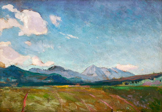
 In Osobita - Tatras Mountains, 1901, oil on canvas, Muzeum Narodowe w Krakowie 

The mountain
Osobitá  (1,687m- 5,535ft)  as its name tells ("the lonely one") is a lonely top in the northern part of the Western Slovak Tatra Mountains, about 17 km from Zakopane (Poland). It is not very high, but very distinct and far from the main Tatra ridge. Osobitá constitutes a distinct geomorphological unit which represents just by itself 12% of the surface of the Slovak Western Tatras. This moutain was mentioned as early as 1615 when Polish highlanders described the Polish Tatras (wider during this time) as extending "From Osobita to Hawran".
There are the three distinct but close tops with heights of 1,617, 1,521 and 1,587 m (the last two are separated by the pass "sedlo pod Osobitou". There many caves in this karst zone, not all yet been investigated. In 1997, the most famous are Bezdenna and Okolik. Here also, as in many other places in the Tatra Mountains, was a mining activity for iron. Now, from these times remain only few tunnels reaching dozens of meters deep. 
In the past, the mountain was an important pastoral center, with five wide meadows. In the seventeenth century it could host up to 1500 head of sheep and cows. Later it decreased. 
Osobitá separates 3 valleys: Zuberska Dolina, Blatna Dolina and Oravicka Sucha Dolina. No other summit of the Orava region is as clearly visible, and very early the mountain attracted a lot of visitors. The first recorded visit was made by Titus Chałubiński in 1870, the first recorded winter one by Mariusz Zaruski with companions in 1906. 
At the beginning of the twentieth century, there was even a mountain hut at Mala Osobitá (1,583 m). Since 1989, the top is no longer available for tourists, since this one is included in the nature reserve (458 hectares).  There are two ways to reach Osobitá, from Slovakia and from Poland. Both are very easy and without difficulty, but the first one is as short as the second is very long.
Nowadays, it is impossible the reach the real top of Osobitá, which is located in the Natura 2000 zone, in order to protect fragile fauna such as eagles. Hence, strictly forbidden as mentionned previously. Including with a guide, or holding an UIAA licence !

The painter 
Jan Stanisławski was a Polish modernist painter, art educator, founder and member of various innovative art groups and literary societies. He began to learn painting at the art studio in Warsaw which later gave rise to the School of Fine Arts, under Wojciech Gerson.  In 1885, he continued his studies in Paris under Charles Emile Auguste Durand. While based in Paris, he travelled much, visiting Italy, Spain, Switzerland, Germany, Austria and eastern Galicia.
His early works were exhibited at the inauguration of the Salon du Champ-de-Mars in Paris in 1890 and at the Kraków Society of Friends of Fine Arts in 1892. In the 1890s, he travelled extensively and his sketchbooks filled up with drawings from Berlin, Dresden, Prague, Kraków, and various places in Ukraine.  In 1897, he initiated and helped organise the Separate Exhibition of Painting and Sculpture at Kraków’s Cloth Hall. That year, he became a teacher of landscape painting at the School of Fine Arts in Kraków, and in 1906 – after the school was upgraded to an academy in 1900 – was granted full professorship and also taught at Teodor Axentowicz’s Private School of Painting and Drawing for Women and at Teofila Certowicz’s Art School for Women in Kraków.
He co-founded the Society of Polish Artists "Sztuka" ("Art") in Kraków in 1897.  In 1898, he became a member of the Viennese Secession, and his works were exhibited among theirs in 1901, 1902 and 1905. In 1901, he became a founding member of the Polish Applied Arts Society. He worked in the Wawel Castle Reconstruction Committee and was involved in the activities of the Green Balloon (Zielony Balonik) Cabaret. After his death, two exhibitions were opened at the Palace of Art by the Kraków Society of Friends of Fine Arts in November 1907, one to show 154 of his oil paintings, as well as drawings and watercolours, and the other to present the works of his numerous outstanding students.
_______________________________
2017 - Wandering Vertexes...
by Francis Rousseau 

Friday, April 14, 2017

CAPE CARBON BY FREDERIC GADMER


FREDERIC GADMER  (1878-1954), 
Cape Carbon (220 m - 722 ft)
Algeria

In  Le Cap Carbon, Bougie, 1929Autochrome Lumiere - Albert Kahn museum 

The mountain
Cape Carbon (220 m - 722 ft) is  cape located in the Wilaya of Béjaïa, north of the port of Béjaïa, Algeria. A tourist path, traced on the crest, frequented by the monkey magot, allows access. Cape carbon is situated in the Gouraya National Park. It seems that before colonization only a few rudimentary lanterns were placed near the shelters which served as a refuge for the Barbary ship, such as the ordinary lantern on the high tower of the Penon of Algiers. From 1834, the French installed on the rocky spur at the end of the Cape Carbon, a fixed light surmounted by a rotating crown bearing 8 lamps with reflectors arranged in a way to realize an eclipse fire of 30 seconds In 30 seconds.  The lantern was periodically modified between 1860 and 1900, until 1924 when the electrification of main fires and port fires was actively pursued. The Cape Carbon lighthouse is known to be the highest natural lighthouse in the Mediterranean Sea and one of the highest in the world. It is a "landing" lighthouse which indicates the proximity of the port of Béjaïa.

The photographer
Frédéric Georges Gadmer was born in 1878 in France into a Protestant family; his father, Leon, son of Swiss émigré, was confectioner. Before World War II, he follows his family in Paris and works as a photographer for the house Vitry, located Quai de la Rapée. As an heliogravure company, it performs work for the sciences and the arts, travel and education. In 1898 Gadmer completed his military service as a secretary to the staff then recalled in 1914 at the time of mobilization. In 1915, he joined the newly created  "Photographic Section of the Army" and carried pictures on the front, in the Dardanelles, with General Gouraud, then in Cameroon. In 1919, at age 41, he was hired as a photographer by Albert Khan for his project called "Archives of the Planet". He finds there his comrades of  "the film and photographic section of the army" Paul Castelnau and Fernand Cuville. Soon as he arrived, he made reports in Syria, Lebanon, Turkey and Palestine. It was the first to make a color portrait of Mustafa Kemal, leader of the Young Turks. In 1921, he returned to the Levant with Jean Brunhes, the scientific director of the Archives of the Planet. The same year, he attended General Gouraud, appointed High Commissioner in Syria. Operator and prolific photographer, specializing in distant lands and landscapes, it covers Iraq, Persia, Afghanistan, Algeria and Tunisia. In 1930, he accompanied Father Francis Aupiais in Dahomey. He also works in Europe. In 1931, at the request of Marechal Lyautey, he photographies the Colonial Exhibition. It is one of the last person to leave the "Archives of the Planet" threatened by the Albert Kahn's bankruptcy in 1932. He then worked at the famous french newspaper L'Illustration and carries postcards for Yvon. He died in Paris, unmarried, in 1954.
Source: 
- Frédéric Gadmer 

About the  "Autochrome Lumière" Photos
The autochrome is a photographic reproduction of process colors patented December 17, 1903 by Auguste and Louis Lumière french brothers. This is the first industrial technique of photography colors, it produces positive images on glass plates. It was used between 1907 and 1932 approximately an particularly in many pictures of the World War I. A important number of photographs of mountains and landscapes around the world was made with this technique, particularly in the for  the Project "The archives of the planet" by Albert Kahn.
Source:
- Musée Départemental Albert Kahn on line

Thursday, April 13, 2017

KILIMANDJARO BY AKSELI GALLEN-KALLELA


AKSELI GALLEN-KALLELA  (1865-1931)
Kilimandjaro or Uhuru (5,885m - 19, 340ft) 
Tanzania

 In  Kilima'ndjaro from Uakamba, June 1909 - Watercolor on paper 

The mountain 
Mount Kilimanjaro   (5,885m - 19, 340ft)  is a dormant volcano in Tanzania composed of three volcanic cones, "Kibo", "Mawenzi", and "Shira.  The Kilimandjaro is the highest mountain in Africa. The first recorded ascent to the summit  was by Hans Meyer and Ludwig Purtscheller in 1889.
The mountain is part of the Kilimanjaro National Park and is a major climbing destination. The mountain has been the subject of many scientific studies because of its shrinking glaciers, especially since 200.
The origin of the name "Kilimanjaro" is not precisely known, but a number of theories exist. European explorers had adopted the name by 1860 and reported that "Kilimanjaro" was the mountain's Kiswahili name. The 1907 edition of The Nuttall Encyclopædia also records the name of the mountain as "Kilima-Njaro", as well as the title of the watercolor above. Johann Ludwig Krapf wrote in 1860 that Swahilis along the coast called the mountain Kilimanjaro. Although he did not support his claim, he claimed that "Kilimanjaro" meant either "mountain of greatness" or "mountain of caravans". Under the latter meaning, "Kilima" meant "mountain" and "Jaro" possibly meant "caravans". Jim Thompson claimed in 1885, although he also did not support his claim, that the term Kilima-Njaro "has generally been understood to mean" the Mountain (Kilima) of Greatness (Njaro). Though not improbably it may mean the "White" mountain. "Njaro" is an ancient Kiswahili word for "shining". Others have assumed that "Kilima" is Kiswahili for "mountain".
In the 1880s, the mountain became a part of German East Africa and was called "Kilima-Ndscharo" in German following the Kiswahili name components.
On 6 October 1889, Hans Meyer reached the highest summit on the crater ridge of Kibo. He named it "Kaiser-Wilhelm-Spitze" ("Kaiser Wilhelm peak").
That name apparently was used until Tanzania was formed in 1964, when the summit was renamed "Uhuru", meaning "Freedom Peak" in Kiswahili.
- More informations about Kilimandjaro 

The painter 
Akseli Gallen-Kallela was a Swedish-speaking Finnish painter who is best known for his illustrations of the Kalevala, the Finnish national epic. His work was considered very important for the Finnish national identity. He changed his name from Gallen to Gallen-Kallela in 1907. In 1884 he moved to Paris, to study at the Académie Julian and became friends with the Finnish painter Albert Edelfelt, the Norwegian painter Adam Dörnberger, and the Swedish writer August Strindberg.
In December 1894, Gallen-Kallela moved to Berlin to oversee the joint exhibition of his works with the works of Norwegian painter Edvard Munch. Here he became acquainted with the Symbolists.
On his return from Germany, Gallen studied print-making and visited London to deepen his knowledge, and in 1898 studied fresco-painting in Italy.
For the Paris World Fair in 1900, Gallen-Kallela painted frescoes for the Finnish Pavilion. In these frescoes, his political ideas became most apparent. Gallen-Kallela officially finnicized his name to the more Finnish-sounding Akseli Gallen-Kallela in 1907.
In 1909, Gallen-Kallela moved to Nairobi in Kenya with his family, and there he painted over 150 expressionist oil paintings and bought many east African artefacts (watercolor above). But he returned to Finland after a couple of years, realizing Finland was his main inspiration. Between 1911 and 1913 he designed and built a studio and house at Tarvaspää, about 10 km northwest of the centre of Helsinki.
From December 1923 to May 1926, Gallen-Kallela lived in the United States, where an exhibition of his work toured several cities, and where he visited the Taos art-colony in New Mexico to study indigenous American art. In 1925 he began the illustrations for his "Great Kalevala". This was still unfinished when he died of pneumonia in Stockholm on 7 March 1931, while returning from a lecture in Copenhagen, Denmark His studio and house at Tarvaspää was opened as the Gallen-Kallela Museum in 1961

Wednesday, April 12, 2017

GUNUNG MERAPI BY BASOEKI ABDULLAH


BASOEKI ABDULLAH (1915 -1993)
Gunung Merapi  (2,914m - 9,500 ft) 
Indonesia (Java)

1. In Gunung Merapi, oil on canvas, 1960 - Basoeki Abdullah Museum, Jakarta
2. In Gunung Merapi, oil on canvas,1971, Private collection 

The mountain 
Gunung Merapi  or Mount Merapi (2,914m - 9,500 ft)  is an active stratovolcano located on the border between Central Java and Yogyakarta, Indonesia. It is the most active volcano in Indonesia and has erupted regularly since 1548. It is located approximately 28 kilometres (17 mi) north of Yogyakarta city which has a population of 2.4 million, and thousands of people live on the flanks of the volcano, with villages as high as 1,700 metres (5,600 ft) above sea level.
Smoke can often be seen emerging from the mountaintop, and several eruptions have caused fatalities. Pyroclastic flow from a large explosion killed 27 people on 22 November 1994, mostly in the town of Muntilan, west of the volcano.Another large eruption occurred in 2006, shortly before the Yogyakarta earthquake. In light of the hazards that Merapi poses to populated areas, it has been designated as one of the Decade Volcanoes....
More  informations about Gunung Merapi volcano 


The painter 
Basoeki  (or Basuki) Abdullah is one of a the modern master painters of Indonesia, known as a realist and naturalist painter. He has been appointed as the official painter of Merdeka Palace in Jakarta and works adorn palaces and presidential countries Indonesia, in addition to have been collectibles from around the world. His father, Abdullah Suriosubroto, was a famous painter and dancer, while his grandfather,  Doctor Wahidin Sudirohusodo, was a prominent Indonesian National Awakening Movement in the early 1900's. Since the age of 4 years, Basoeki Abdullah began to paint  famous personalities such as Mahatma Gandhi, Rabindranath Tagore and even Jesus Christ and Krishnamurti. His acquired a formal education in the Basoeki Abdullah Catholic and Catholic Mulo in Solo. In 1933,  BasoekiAbdullah obtained a scholarship to study at the Academic Arts in The Hague, Netherlands, and completed his studies within 3 years with awarded Certificate of Royal International of Art (RIA). On 6 September 1948,  during the revolutionary period,  Basoeki Abdullah is housed in Amsterdam (Netherlands) during the coronation of Queen Juliana which held a contest to paint, Basoeki Abdullah defeated 87 European painters and managed to come out as winners.
Since then, the world began to recognize BasoekiAbdullah, during his frequent visits around Europe (Italy and France) and was well known by many resident artists with a worldwide reputation.
BasoekiAbdullah is famous as a portrait painter, especially painting  the royal family and heads of state that tends to beautify or embellish  persons. Aside from being an accomplished portrait painter, he too painted landscapes, mountains, fauna, flora, the themes of struggle, construction and so on.
Basoeki Abdullah held many solo exhibitions both domestically and abroad, among others, his work was exhibited in Bangkok (Thailand), Malaysia, Japan, the Netherlands, England, Portugal... Approximately 22 countries have Basoeki Abdullah paintings in their official collections. Most of his life was spent abroad including several years living in Thailand.
Source:
- Museum Basoeki Abdullah