google.com, pub-0288379932320714, DIRECT, f08c47fec0942fa0 GRAVIR LES MONTAGNES... EN PEINTURE

Thursday, June 15, 2017

NORTH PALISADE PAINTED BY FRANZ BISHOFF


FRANZ BISHOFF (1864-1929) 
North Palisade (4,341 m - 14, 242 ft)
United States of America (California) 

In Palisade Glacier, 1925, oil on canvas, Courtesy The Irvine Museum  

The mountain 
North Palisade (4,341 m - 14, 242 ft) is the third highest mountain in the Sierra Nevada range of California. It is the highest peak of the Palisades group of peaks in the central part of the range. It supports a small glacier (the Palisade Glacier) and several highly prized rock climbing routes on its northeast side.
North Palisade has a collection of names from the 19th century. The Wheeler Survey referred to it as Northwest Palisade in 1878. The following year, Lil Winchell called it Dusy's Peak after local rancher Frank Dusy. In 1895, Bolton Brown advocated yet another name, after David Starr Jordan. U.S. Senator Dianne Feinstein, supported by U.S. Senator Barbara Boxer, has introduced legislation to rename the peak as Brower Palisade, in honor of environmentalist David Brower.
The North Palisade' first ascent was made on July 25, 1903 by James S. Hutchinson, Joseph Nisbet LeConte and James K. Moffitt.
North Palisade has several named subsidiary peaks. These all lie on the main ridge crest, and are as follows:
Starlight Peak (4,328 m -14,200 feet ). This is the northwest summit of North Palisade, less than 0.1 mi (0.15 km) from the main summit. Some climbing routes end atop this peak known for its famous "Milk Bottle", a 20 ft (6.1 m) pillar of rock with huge exposure (class 5.6).
- Polemonium Peak (4,294+ m - 14,080+ ft) This lies between the "U-Notch" and "V-Notch" couloirs, 0.15 mi (0.25 km) east-southeast of North Palisade. Named on the USGS topographic map. The peak is named for the Polemonium eximium skypilot (plant) found in the area.
Thunderbolt Peak (4,268 m- 14,003 feet ).  About 0.25 mi (0.4 km) northwest of North Palisade. Named on the USGS topographic map. The Sierra Club guidebook notes: "This was the last 14,000 foot (4,267 m) peak to be climbed in the Sierra. During a wild storm on the first ascent, a bolt of lightning left Jules Eichorn severely shaken; hence the name".
The Palisade Glacier is located on the northeast side of the Palisades within the John Muir Wilderness in the central Sierra Nevada of California.  The glacier descends from the flanks of four mountain peaks over 4,300 m (14,000 ft)  in elevation of which North Palisade is third highest peak in the Sierra Nevada Range. The cirque containing the Palisade Glacier has a history of thousands of years of glaciation. The modern glacier attained its last maximum extent during the Little Ice Age, between 250 and 170 years ago (a period also known as the Matthes glaciation in the Sierra Nevada).
 It currently has an area of .31 sq mi (0.80 km2) and the glacier is .81 mi (1.30 km) long and .50 mi (0.80 km) wide. It is located between 13,400 and 12,000 ft (4,100 and 3,700 m) and moves at a rate of 20 ft (6.1 m) per year, although it is also retreating. 
Source: 

The painter 
 Franz Albert Bischoff  was an American artist known primarily for his China painting, floral paintings and California landscapes. He was born in Steinschцnau, Austria (now in Czech Republic).He immigrated to the United States as a teenager where he became a naturalized citizen. While in Europe, his early training was focused upon applied design, watercolor and ceramic decorations. After arriving in the United States, Bischoff worked in New York, Fostoria, Ohio, Detroit, Michigan and Dearborn, Michigan. While in Detroit and Dearborn, he gained success as a porcelain painter, and as a teacher of the techniques, as well as a manufacturer of ceramic glazes as well as a teacher of watercolor painting.
Franz Bischoff decided to visit California in 1900 and ultimately chose to settle in the Los Angeles area in 1906. Shortly after arriving, he started making arrangements to design and build a large Italian Renaissance style home in Pasadena that also became his studio. This landmark home was completed in 1908. Bischoff was one of the earliest members of the California Art Club, and the group's second meeting was held at his studio on February 5, 1910. Also present at that meeting were Carl Oscar Borg and William Wendt.
Inspired by the California countryside, Bischoff attempted to capture the area's brilliant light and diverse landscapes. Spending less time with ceramic painting following the start of World War I, Bischoff took up canvas painting. He painted local farms, fishing wharfs, coastal landscapes and scenes of the Sierra Nevada and the mountains of Utah, including Zion National Park.  Recognized during his career for use of color and vivid composition, his paintings always displayed reverence for nature. One critic commented that some of his later works flirted with Expressionism and his use of colors were reminiscent of Fauvism. Franz Bischoff died of heart failure at home in his adopted city of South Pasadena, California on February 5, 1929.
Source: 

Wednesday, June 14, 2017

EARNSLAW / PIKIRAKATAHI BY JOHN TURNBULL THOMSON


JOHN TURNBULL THOMSON (1821-1884)
  Mount Earnslaw or Pikirakatahi  (2,819m -9,249 ft)
 New Zealand  

In Earnslaw, 1883, watercolor on paper, Museum of New Zealand - Te Papa Tongarewa 


The Mountain 
Mount Earnslaw, (2,819m -9,249 ft) also named Pikirakatahi by Māori is located on New Zealand's South Island. It is named after Earnslaw (formerly Herneslawe) village in the parish of EcclesBerwickshire, hometown of the surveyor John Turnbull Thomson's father.
Mount Earnslaw is within Mount Aspiring National Park at the southern end of the Forbes Range of New Zealand's Southern Alps. It is located 25 kilometres north of the settlement of Glenorchy, which lies at the northern end of Lake Wakatipu.
Climbing
Reverend W.S. Green had come to New Zealand to try to climb Mount Cook. In March 1882, with guides Emil Boss and Ulrich Kaufmann, he attempted Earnslaw, but transport and weather problems forced them to turn back after climbing 1, 500m (5,000 ft).  After several attempts over a period of years, Glenorchy guide Harry Birley climbed the eastern peak of Earnslaw in 1890. He left a bent shilling in an Irish Moss bottle within a stone cairn, to prove he had reached the top.
The 10 m lower, but much more challenging West Peak, 2.5 km to the west-south-west and separated by a 200 m deep pass, was climbed in 1914 by H.F. Wright and J. Robertson.
Mt Earnslaw (Pikirakatahi) has variety of routes available for a moderate to technical challenge and provide and excellent platform to begin your alpine practice.  The peak(s) west and east, dominate over the northern arm of Lake Wakatipu and the small hamlet of Glenorchy (315 m) is the last frontier before the lush river valley leads the way to the eastern slopes and the access to climb Mt. Earnslaw.  Although the easiest route is not technically demanding, Mt. Earnslaw will physically challenge any mountaineer with a variety of routes on Earnslaw await the climber who wants a technical challenge.   An excellent campsite is located on the old moraine bench at the foot of the ascent track beyond the Rees crossing point 
There are two huts available on the ascent:
1) Earnslaw Hut (at about 1000m - still below the tree line) It is owned by the DOC. Some describe its condition as "derelict" but you should prefer to like it for its historic feel and rustic construction! This is where Frank Wright commenced his FA of West Peak back in 1914. 
2). Esquilant Bivvy at Wright Col (Just beyond it actually) at 2150m owned by N.Z ALPINE CLUB - for more details click here.
The best season to climb is from December to the end of February.  The nearest city is Queenstown.


The painter 
John Turnbull Thomson was a British civil engineer and artist who played an instrumental role in the development of the early infrastructure of nineteenth-century Singapore and New Zealand.
After his father was killed in a hunting accident in 1830, the young Thomson and his mother went to live in Abbey St. Bathans, Berwickshire. He was educated at Wooler and Duns Academy, later spending some time attached to Marischal College, Aberdeen, and Edinburgh University before studying engineering at Peter Nicholson's School of Engineering at Newcastle-on-Tyne.
Thomson arrived in the Malay Straits in 1838 and was employed by the East India Survey. In 1841 he was appointed Government Surveyor at Singapore and in 1844 became Superintendent of Roads and Public Works. He was responsible for the design and construction of a number of notable engineering works including bridges, roads, and hospitals. His outstanding achievement was the erection of the Horsburgh Lighthouse on Pedra Branca. In 1853 his health failed and he returned to England where he studied modern engineering techniques, and travelled widely through Britain and the Continent inspecting engineering works. Early in 1856 he emigrated to New Zealand, where he worked as Chief Surveyor of the Otago Province until 1873. From 1876 until 1879 he was Surveyor-General of New Zealand. He was also the original surveyor of the city of Invercargill.
From 1856 until 1858 Thomson surveyed and explored large sections of the interior of the South Island, covering most of the southern half of the island.
He was also a amateur painter of landscapes, working mostly in oils, almost known for the interesting historical topographical viewpoint of his paintings.

Tuesday, June 13, 2017

THE VIGNEMALE PAINTED BY FRANZ SCHRADER


FRANZ SCHRADER  (1844-1924)
Pique-Longue Vignemale (3,928m - 10, 820ft)
France - Spain border 

In Le Pic de Vignemale, 1900, oil on canvas. Private collection. 

The mountain 
The  Pic de Vignemale (3,928m - 10, 820ft)  also called in Occitan  Vinhamala and in Aragonese Comachibosa is the highest of the French Pyrenean summits, on the border with Spain (the highest in the whole of the range is Pic Aneto).
The Vignemale is the name given to the mountain massif, which also straddles into Spain. It consists of several distinct summits, the predominant ones being Grand Vignemale or Pique-Longue (3,298 m), Pointe Chausenque (3,204 m) and Petit Vignemale (3,032 m). The Vignemale is also the site of the second largest of the Pyrenean glaciers (after Aneto's one), the Ossoue (with around 0.6 kmІ), across which the "voie normale", or standard route to the summit travels.
One of its most dramatic aspects is the North Face upon which lie a number of serious ascent routes requiring skill and commitment. Below the North Face is the impressively situated mountain refuge - the Refuge des Oulettes de Gaube. The approach from the north entails a delightful walk up to and around the picturesque Lac de Gaube giving increasingly dramatic views of the mountain.
Almost synonymous with the Vignemale is the name of Count Henry Russell, an eccentric of the Victorian era who developed a lifelong passion for the mountain.

The painter 
Jean-Daniel-François Schrader, better known as Franz Schrader, was a French mountaineer, geographer, cartographer and landscape painter. He made an important contribution to the mapping of the Pyrenees and was highly considered among the pyreneists.
He is the son of Prussian Ferdinand Schrader from Magdeburg, who emigrated to Bordeaux, and of Marie-Louise Ducos, cousin of geographers Élisée and Onésime Reclus. He shows a talent for drawing from an early age.  In 1866, while staying with his friend Léonce Lourde-Rocheblave in Pau, he has a sort of revelation at the "spectacle grandiose de la barrière montagneuse des Pyrenées ".
His vocation strengthens when reading stories by Ramond de Carbonnières (1755-1827) (Les Voyages au Mont-Perdu) and by Henry Russell (1834-1909) (Les Grandes Ascensions des Pyrénées, guide d'une mer à l'autre).
While devoting the main part of his leisure to long hikes in the mountains, during which he gathers thousands of observations for his topographical records, he still finds time to paint numerous panoramas of the Pyrenees as well as the Alps which he also studies, and to acquire a solid formation in topography.
To facilitate topographical work in rugged terrain, he develops the orograph in 1873. His first great cartographic work, in 1874, is the map of the massif of Gavarnie-Mont-Perdu at a scale of 1:40 000, for which he collects the measurements with the participation of Lourde-Rocheblave from nearby Pau. That map triggers such a sensation that it is included in the annual Mémoires of the Société des Sciences Physiques et Naturelles de Bordeaux with an explanatory text the following year. The Club alpin français directory follows with the publication of an enthusiastic review, describing Schrader as qualified for "first rank topographer in a glorious master stroke". In 1876 he takes part in the creation of the Bordeaux section of the Club Alpin Français, becoming its first president.
In 1877 he travels to Paris with a recommendation from his cousins Élisée and Onésime Reclus. There, having met Émile Templier, nephew and collaborator of Louis Hachette, and Adolphe Joanne, president of the Parisian section of the Club Alpin Français, he is employed as a geographer by Librairie Hachette and is now able to practice his passion in the scope of his profession. He also gives geography lessons at the School of Anthropology and also becomes editor of the French Alpine Club directory.
On August 11, 1878, accompanied by high-mountain guide Henri Passet, he carries out the first known ascension of the Grand Batchimale (3,176 m), consequently renamed Pic Schrader.
In 1880, he is promoted director of cartography for Hachette and aims at surpassing in quality the Stieler Atlas, by German Adolf Stieler. On November 25, 1897, as vice-president of the C.A.F. he holds a conference at the Club Alpin which constitutes his true esthetic credo of the mountain and in which he announces the imminent foundation of a French school of mountain painting. The conference text title is : À quoi tient la beauté des montagnes (What makes the beauty of mountains); this speech is considered as the birth bulletin of La Société des peintres de montagne (Paris) and its text is reproduced in 1898 in the Club Alpin Français directory.
From 1901 to 1904, he  actively contributes to the Guides Joanne of the Librairie Hachette, which in 1919 became the  famous Guides bleus.
The scientific commission created by Franz Schrader in the Club Alpin Français still exists today, as well as the Société des Peintres de Montagne.
In 1927, three years after his death, his remains are transferred to a tomb on a slope of the Circus of Gavarnie (French Pyrenees).

Monday, June 12, 2017

THE GRAND CANYON OF COLORADO IN VINTAGE POSTCARD 1950


VINTAGE POSTCARD 1950
The Grand Canyon of Colorado  (1,857m -  6,093ft)
United States of America (Arizona)

 In Grand-Canyon, View from the South Rim, postcard 1950, The Detroit Publishing Co.  

The canyon 
The Grand Canyon (1,857m -  6,093ft deep) also called in Hopi Ongtupqa, in Yavapai Wi:kaʼi:la, in Navajo Tsékooh Hatsoh and in Spanish  Gran Caсуn is a steep-sided canyon carved by the Colorado River in the U.S. state of Arizona in North America. It is contained within and managed by Grand Canyon National Park, the Kaibab National Forest, Grand Canyon-Parashant National Monument, the Hualapai Tribal Nation, the Havasupai people and the Navajo Nation. President Theodore Roosevelt was a major proponent of preservation of the Grand Canyon area, and visited it on numerous occasions to hunt and enjoy the scenery.
The Grand Canyon is 277 miles (446 km) long, up to 18 miles (29 km) wide. Nearly two billion years of Earth's geological history have been exposed as the Colorado River and its tributaries cut their channels through layer after layer of rock while the Colorado Plateau was uplifted. While some aspects about the history of incision of the canyon are debated by geologists, several recent studies support the hypothesis that the Colorado River established its course through the area about 5 to 6 million years ago. Since that time, the Colorado River has driven the down-cutting of the tributaries and retreat of the cliffs, simultaneously deepening and widening the canyon.
For thousands of years, the area has been continuously inhabited by Native Americans, who built settlements within the canyon and its many caves. The Pueblo people considered the Grand Canyon a holy site, and made pilgrimages to it. 
The first European known to have viewed the Grand Canyon was Garcia Lopez de Cбrdenas from Spain, who arrived in 1540. 
The Grand Canyon area has some of the cleanest air in the United States. However at times the air quality can be considerably affected by events such as forest fires and dust storms in the Southwest.
There are approximately 1,737 known species of vascular plants, 167 species of fungi, 64 species of moss and 195 species of lichen found in Grand Canyon National Park. 90 mammal species are found along the Colorado River corridor, of which 18 are rodents and 22 are bats.   

Vintage postcards
Postcards became popular at the turn of the 20th century, especially for sending short messages to friends and relatives. They were collected right from the start, and are still sought after today by collectors of pop culture, photography, advertising, wartime memorabilia, local history, and many other categories.
Postcards were an international craze, published all over the world. The Detroit Publishing Co. and Teich & Co. were two of the major publishers in the U.S, and sometimes individuals printed their own postcards as well. Yvon were the most famous in France. Many individual or anonymous publishers did exist around the world and especially in Africa and  Asia (Japan, Thailand, Nepal, China, Java) between 1920 and 1955. These photographer were mostly local notables, soldiers, official guides belonging to the colonial armies (british french, belgium...) who sometimes had rather sophisticated equipment and readily produced colored photograms or explorers, navigators, climbers (Vittorio Sella and the Archiduke of Abruzzi future king of Italy remains the most famous of them).
There are many types of collectible vintage postcards.
Hold-to-light postcards were made with tissue paper surrounded by two pieces of regular paper, so light would shine through. Fold-out postcards, popular in the 1950s, had multiple postcards attached in a long strip. Real photograph postcards (RPPCs) are photographs with a postcard backing.
Novelty postcards were made using wood, aluminum, copper, and cork. Silk postcards–often embroidered over a printed image–were wrapped around cardboard and sent in see-through glassine paper envelopes; they were especially popular during World War I.
In the 1930s and 1940s, postcards were printed on brightly colored paper designed to look like linen.
Most vintage postcard collectors focus on themes, like Christmas, Halloween, portraits of movie stars, European royalty and U.S. presidents, wartime imagery, and photos of natural disasters or natural wonders. Not to mention cards featuring colorful pictures by famous artists like Alphonse Mucha, Harrison Fisher, Ellen Clapsaddle, and Frances Brundage.
For vintage postcards, subject matter, condition, and rarity, plus general desirability and demand, determine value.


Sunday, June 11, 2017

LE SALEVE PAINTED BY ALEXANDRE PERRIER


ALEXANDRE PERRIER (1862-1936)
  Mont Salève (1, 379m - 4,524ft)
France  (Haute-Savoie) 

1. In Le Salève au printemps, 1900, oil on pencil on textile, Private Collection, France 
2. Le Salève en hiver,  1919, oil on pencil on textile,Private Collection, France
2.  In Coucher de soleil sur le Salève, 1898, oil on pencil on textile, Private Collection, France

The Mountain 
Le Salève (1,379m - 4,524ft) is a mountain of the French Prealps located in the departement of Haute-Savoie (France). It is also called the "Balcony of Geneva". Geographically, the Salève is a mountain of the French Prealps but geologically a part of the Jura chain, as the Vuache is.
Below the Salève is the Geneva urban area where more than 700,000 people live. The Salève consists of the Pitons, the Grand and the Petit Salève, and culminates at 1379 meters at the Grand Piton. It is accessible by a cable car since 1932 (rebuilt in 1983), the Salève stretches between Étrembières in the north and the suspension bridge de la Caille in the south. Between 1892 and 1935, the Salève was served by the first electric rack railway in the world.
The eastern side of the Salève dives under the molasse of the Bornes Massif while the abrupt mountain slope facing Geneva is subject to erosion. The vegetation - or its absence - enhances the limestone's layers. This side of the mountain is slit by several narrow and deep gorges, among which the Grande Varappe, which at the end of the 19th century gave its name to the activity of rock climbing in French. This discipline developed intensely there, at a time when it was only beginning.
The Monnetier valley, separating the Petit and the Grand Salève, is due to glaciary erosion. Modern geologists now think that this valley was dug by the subglaciary currents in a fissured region between the Petit and the Grand Salève, and not by the Arve as was assumed earlier.
The Salève occurs on one of the first European paintings depicting a realistic landscape, La Pêche Miraculeuse by Konrad Witz created in 1444 already posted on this blog.
In Frankenstein by Mary Shelley, the creature after having fled climbs up the Salève (Chapter 7).
“ It was echoed from Saleve, the Juras, and the Alps of Savoy; vivid flashes of lightning dazzled my eyes, illuminating the lake, making it appear like a vast sheet of fire; then for an instant everything seemed of a pitchy darkness, until the eye recovered itself from the preceding flash (...) I thought of pursuing the devil; but it would have been in vain, for another flash discovered him to me hanging among the rocks of the nearly perpendicular ascent of Mont Salève, a hill that bounds Plainpalais on the south. Who could arrest a creature capable of scaling the overhanging sides of Mont Saleve? "
The Dedicace to the Last song of Harold's Pilgrimage, proposed by Lamartine in 1825 as the conclusion of his friend Lord Byron's uncompleted poem, is located on the Salève. Byron died in 1824. 

The painter 
Alexandre Perrier  is one of the most prominent Swiss artists of the turn of the century, but he is perhaps the one whose work remains today the least studied. He counted among his friends and acquaintances Cuno Amiet, Albert Trachsel and Ferdinand Hodler and exhibited at the side of the latter at the Secession of Vienna in 1901, as well as at the Exposition Universelle in Paris the previous year. A landscape painter by vocation, he devoted his whole life to the pictorial transposition of a limited choice of sites, such as  Mont Salève, Lake Geneva, The Mont-Blanc and The Grammont, whose light and atmosphere he sought to bring back. Influenced by Neo-Impressionist tendencies, he uses a technique decomposing his touch into small dots and lines, situating it stylistically between pointillism and divisionism. In the second part of his career his style evolved towards a freer painting, dissociating color and drawing, an artistic approach that confirms its originality and its modernity.
At his debut, he worked for a short period in a bank before going to Mulhouse in 1881, for training as a signatory of textile printing. In 1891, he moved to Paris where he worked as a fashion illustrator; He discovered new artistic movements such as neo-impressionism, symbolism and Art Nouveau. Shortly before the turn of the century, he returned to Geneva, where he remained until his death. He received a bronze medal at the Universal Exhibition of Paris in 1900. In 1902, he exhibited at the Secession of Vienna.
Source: 

Saturday, June 10, 2017

ALPSPITZE BY WASSILY KANDINSKY


WASSILY KANDINSKY  (1866-1944)
"Der Blue Berge" - Alpspitze (2,628 m - 8,622ft)
Germany (Bavaria)

 1. In Der Blaue Berge (The Blue Mountain). 1908/09, oil on canvas,
The Solomon R. Guggenheim Museum, New York


The mountain 
The Alpspitze (2,628 m - 8,622ft) is a mountain in Bavaria, Germany. Its pyramidal peak is the symbol of Garmisch-Partenkirchen and is one of the best known and most attractive mountains of the Northern Limestone Alps. It is made predominantly of Wetterstein limestone from the Upper Triassic.
Several klettersteigs run up the Alpspitze. The shortest ascent starts at the valley station of Osterfelderkopf (2,033 m) on the Alpspitze Cable Car from Garmisch-Partenkirchen. From the Osterfelderkopf the Alpspitze may be climbed either directly along the Alpspitz-Ferrata, an easy, mostly protected and much frequented klettersteig (ca. 2 hours from the Osterfelderkopf) or the summit may be reached on the North Face Climb (Nordwandsteig), which runs in a curve to the east into the Oberkar cirque and from there along the left-hand edge of the cirque to the top.
Another ascent runs from the col of Grießkarscharte (2,460 m), which is reached either from the Höllentalanger Hut in the Höllental valley via the cirque of Mathaisenkar (involving a klettersteig) or from the lake of Stuibensee via the Grießkar cirque.
The popular route from the Alpspitze via the arete of Jubiläumsgrat to the Zugspitze is a long and difficult climbing tour, which involves UIAA grade III sections.
Why should Der Blaue Berge by Kandinsky should represent the Alpspitze in Garmisch-Partenkirchen ? No one could certify it of course, but there are strong presumptions for it...  The triangular shape, characteristic of this Bavarian summit, is exactly reflected in Kandinsky's work. There is also the fact that this painting was made at the time Kandinsky was living in Bavaria, very close to this peak... But these are only hypotheses

The painter 
Wassily Wassilyevich Kandinsky (Васи́лий Васи́льевич Канди́нский) was a Russian-French  painter and art theorist.  He is credited with painting one of the first recognised purely abstract works. Born in Moscow, Kandinsky spent his childhood in Odessa, where he graduated at Grekov Odessa Art school. He enrolled at the University of Moscow, studying law and economics. Successful in his profession—he was offered a professorship (chair of Roman Law) at the University of Dorpat—Kandinsky began painting studies (life-drawing, sketching and anatomy) at the age of 30.
In 1896, Kandinsky settled in Munich, studying first at Anton Ažbe's private school and then at the Academy of Fine Arts.
From 1906 to 1908 Kandinsky spent a great deal of time travelling across Europe (he was an associate of the Blue Rose symbolist group of Moscow), until he settled in the small Bavarian town of Murnau. In 1908 he bought a copy of Thought-Forms by Annie Besant and Charles Webster Leadbeater. In 1909 he joined the Theosophical Society.
The Blue Mountain (1908–1909) was painted at this time, demonstrating his trend toward abstraction. A mountain of blue is flanked by two broad trees, one yellow and one red. A procession, with three riders symbolizing his crusade against conventional aesthetic values and his dream of a better, more spiritual future through the transformative powers of art. The faces, clothing, and saddles of the riders are each a single colour, and neither they nor the walking figures display any real detail. The flat planes and the contours also are indicative of Fauvist influence. The broad use of colour in The Blue Mountain illustrates Kandinsky's inclination toward an art in which colour is presented independently of form, and which each colour is given equal attention. The composition is more planar; the painting is divided into four sections: the sky, the red tree, the yellow tree and the blue mountain with the three riders.
After the outbreak of World War I, Kandinsky left Germany for Moscow.  He was unsympathetic to the official theories on art in Communist Russia, and he soon returned to Germany in 1920, a few years after the Revolution. There, he taught at the Bauhaus school of art and architecture from 1922 until the Nazis closed it in 1933. He then moved to France, where he lived for the rest of his life, becoming a French citizen in 1939 and producing some of his most prominent art. He died at Neuilly-sur-Seine in 1944.

Friday, June 9, 2017

FUJIYAMA / 富士山(n°19) BY HOKUSAI


KATSUSHIKA HOKUSAI (1760–1849) 
Fujiyama / 富士山 (3, 776 m -12,389 ft)
Japan

Ushibori in  Hitachi province, woodblock print from n°19 from the series '36 Views of Mt. Fuji'
  Ashmolean Museum - University of Oxford

About the 36 Views of Mt Fuji 
Thirty-six Views of Mount Fuji (富嶽三十六景 Fugaku Sanjūrokkei) is a series of landscape prints created by the Japanese ukiyo-e artist Hokusai (1760?1849). The series depicts Mount Fuji from different locations and in various seasons and weather conditions. The original thirty-six prints were so popular that Hokusai expanded the series by ten.

The artist
Katsushika Hokusai (葛飾 北斎)  was a Japanese artist, ukiyo-e painter and printmaker of the Edo period. He was influenced by such painters as Sesshu, and other styles of Chinese painting. Born in Edo (now Tokyo), Hokusai is best known as author of the woodblock print series Thirty-six Views of Mount Fuji (富嶽三十六景 c. 1831) which includes the internationally recognized print, The Great Wave off Kanagawa, created during the 1820s.
Hokusai created the "Thirty-Six Views of Mt Fuji " both as a response to a domestic travel boom and as part of a personal obsession with Mount Fuji. In this series, Mt Fuji is painted on different meteorological conditions, in different hours of the days, in different seasons and from different places.

The mountain 
This is the legendary Mount Fuji or Fujiyama (富士山).
It is located on Honshu Island and is the highest mountain peak in Japan at 3,776.24 m (12,389 ft). Several names are attributed to it:  "Fuji-san", "Fujiyama" or, redundantly, "Mt. Fujiyama". Usually Japanese speakers refer to the mountain as "Fuji-san".  The other Japanese names for Mount Fuji,  have become obsolete or poetic like: Fuji-no-Yama (ふじの山 - The Mountain of Fuji), Fuji-no-Takane (ふじの高嶺- The High Peak of Fuji), Fuyō-hō (芙蓉峰 - The Lotus Peak), and Fugaku (富岳/富嶽), created by combining the first character of 富士, Fuji, and 岳, mountain.
Mount Fuji is an active stratovolcano that last erupted in 1707–08. Mount Fuji lies about 100 kilometres (60 mi) south-west of Tokyo, and can be seen from there on a clear day.
Mount Fuji's exceptionally symmetrical cone, which is snow-capped several months a year, is a well-known symbol of Japan and it is frequently depicted in art and photographs, as well as visited by sightseers and climbers.
Mount Fuji is one of Japan's Three Holy Mountains (三霊山) along with Mount Tate and Mount Haku. It is also a Special Place of Scenic Beauty and one of Japan's Historic Sites.
It was added to the World Heritage List as a Cultural Site on June 22, 2013. As per UNESCO, Mount Fuji has “inspired artists and poets and been the object of pilgrimage for centuries”. UNESCO recognizes 25 sites of cultural interest within the Mt. Fuji locality. These 25 locations include the mountain itself, Fujisan Hongū Sengen Shrine and six other Sengen shrines, two lodging houses, Lake Yamanaka, Lake Kawaguchi, the eight Oshino Hakkai hot springs, two lava tree molds, the remains of the Fuji-kō cult in the Hitoana cave, Shiraito Falls, and Miho no Matsubara pine tree grove; while on the low alps of Mount Fuji lies the Taisekiji temple complex, where the central base headquarters of Nichiren Shoshu Buddhism is located.


MONT VENTOUX PHOTOGRAPHED BY FRANCIS ROUSSEAU


©Francis Rousseau, all right reserved. Mont Ventoux (1, 911 m - 6, 270ft) France (Provence) In Mont Ventoux, photo by FR ©2017 Original HD photo on sale on https://www.revelles.fr/photographe/francis-rousseau

©Francis Rousseau, all rights reserved.
Mont Ventoux (1, 911 m - 6, 270ft)
France (Provence)
In Mont Ventoux, photo by FR ©2017
Original HD photo on sale on
https://www.revelles.fr/photographe/francis-rousseau

#revelles


The mountain 
Mont Ventoux (Ventor in Latin) is located in the French department of Vaucluse (Provence-Alpes-Côte d'Azur). Culminating at 1,911 meters - 6, 270 ft, it is about 25 kilometers long on an east-west for 15 kilometers wide on a north-south axis. Nicknamed the Giant of Provence, it is the culmination of the Monts du Vaucluse, the ultimate link of the Southern Alps and the highest peak of Vaucluse. Its geographical isolation makes it visible over great distances.
Mont Ventoux is as well the linguistic border between the north and south-Occitan.
Its mainly calcareous nature is responsible, in its top part, its deep white color in every season and intense karstification due to erosion by water, with the presence of numerous scree on the south face. Precipitation is particularly abundant in spring and fall. Rainwater seeps into galleries and reflects the level of the variable flow resurgences such as Fontaine de Vaucluse or Source du Groseau.
Mont Ventoux is subject to a Mediterranean dominant weather, sometimes causing scorching temperatures during summer, the altitude offering a wide variety of climates, to the top (continental influence of mountain type), through a temperate climate (mid-slopes). In addition, the north wind can be very violent and the Mistral blows almost half part of the year.
This particular geomorphology and climate make it a rich and fragile environmental site consisting of many levels of vegetation. It is s a biosphere reserve by UNESCO and Natura 2000 site.
If human settlements are found in the foothills in prehistoric times, the first ascent to the summit would work on 26 April 1336, the poet Petrarch from Malaucène on the northern slope. It opens the way later in numerous scientific studies.
Thereafter, for nearly six centuries, Mont Ventoux has been intensely deforested to provide the shipbuilding in Toulon, charcoal manufacturers and sheep farmers. During World War II, the mountain is home to the Ventoux maquis, the french Resistance against Nazis.
Since 1966, the summit is topped with an observation tower over forty meters high topped by a TV and satellite antenna.
While sheep farming has almost disappeared, beekeeping, gardening (especially cherries), viticulture, harvesting of mushrooms including truffles and, to a lesser extent,  lavender, are still practiced.
Mont Ventoux is an important symbolic figure of Provence that fed oral or literary works and artistic performances or pictorial map.

Thursday, June 8, 2017

LES DENTS DU MIDI BY FELIX VALOTTON

http://wanderingvertexes.blogspot.com

FELIX VALOTTON  (1865-1925)  
Les Dents du Midi (3,114 m to 3,257 m -10,216 ft to10,685 ft) 
Switzerland

 In Les Dents du Midi, 1919, Oil on canvas, Private collection 

The mountain 
The Dents du Midi (Teeth of the south) (3,114 m to 3,257 m -10,216 ft to10,685 ft) are a mountain range, 3 kilometers long, located in the Chablais Alps in the canton of Valais in Switzerland. Overlooking the valley of Illiez and Rhône Valley on south, they face the lake Salanfe, an artificial reservoir, and are part of the geological whole massif Giffre.
The name "Dents du Midi" is recent. The people formerly called them "Dents Tsallen". It was only towards the end of the19e century that the name "Dents du Midi" came officially.
Each « tooth » had several names over the centuries and according to its geological evolution.
- The "Cime de l'Est" (3178 meters) called "Mont Novierre" before the mid-17th century, and "Mont Saint-Michel "after landslides in 1635 and 1636 and finally "Dent Noire" (until the 19th century).
- The "Dent Jaune" (3186 m) was called the "Dent Rouge" until 1879.
- The "Doigt de Champéry" (in 1882) and then the Doigt Salanfe (in 1886) turned just into "Les Doigts" (Fingers) (3205 m and 3210 m).
- The  "Haute Cime" (3257 m) also had many names : "Dent de l’Ouest" (until 1784)an then "Dent du Midi", "Dent de Tsallen" and "Dent de Challent."
- As for l’Eperon (3114 m) (The Spur), it is assumed that there were two peaks but a landslide in the Middle Ages significantly changed its crest.
- The Forteresse (3164 m) and the Cathedral (3160 m) have not changed names.
The evolution of this massif continues nowadays. So on the morning of 30 October 2006, a volume of 1 million m3 of rock broke away from the edge of the Haute Cime and slid down the slope to an altitude of about 3000 m. The event did not present danger to the nearby village of Val-d'Illiez but roads and trails were closed for security reasons. According to the cantonal geologist, the landslide was caused by the thawing of rocks, helped by warm summers of recent years.
More about Les Dents du Midi 

The painter 
Félix Edouard Vallotton (December 28, 1865 – December 29, 1925) was a Swiss/French painter and printmaker associated (from 1892) with Les Nabis, a group of young artists that included Pierre Bonnard, Ker-Xavier Roussel, Maurice Denis, and Edouard Vuillard, with whom Vallotton was to form a lifelong friendship. During the 1890s, when Vallotton was closely allied with the avant-garde, his paintings reflected the style of his woodcuts, with flat areas of color, hard edges, and simplification of detail. His subjects included genre scenes, portraits and nudes. Examples of his Nabi style are the deliberately awkward Bathers on a Summer Evening (1892–93), now in the Kunsthaus Zurich, and the symbolist Moonlight (1895), in the Musée d'Orsay, Paris.
In 1899 Vallotton married Gabrielle Rodrigues-Henriques, a wealthy young widow with three children, and in 1900 he attained French citizenship. Around 1899, his printmaking activity diminished as he concentrated on painting, developing a sober, often bitter realism independently of the artistic mainstream. His Portrait of Gertrude Stein (1907) was painted as an apparent response to Picasso's portrait of the previous year, and in The Autobiography of Alice B. Toklas Stein described the very methodical way in which Vallotton painted it, working from top to bottom as if lowering a curtain across the canvas.
Vallotton's paintings of the post-Nabi period found admirers, and were generally respected for their truthfulness and their technical qualities, but the severity of his style was frequently criticized. Typical is the reaction of the critic who, writing in the March 23, 1910 issue of Neue Zurcher Zeitung, complained that Vallotton "paints like a policeman, like someone whose job it is to catch forms and colors. Everything creaks with an intolerable dryness ... the colors lack all joyfulness."
In its uncompromising character his art prefigured the New Objectivity that flourished in Germany during the 1920s, and has a further parallel in the work of Edward Hopper.
Vallotton responded in 1914 to the coming of the First World War by volunteering for the French army, but he was rejected because of his age.  In 1915–16 he returned to the medium of woodcut for the first time since 1901 to express his feelings for his adopted country in the series, This is War, his last prints. He subsequently spent three weeks on a tour of the Champagne front in 1917, on a commission from the Ministry of Fine Arts. The sketches he produced became the basis for a group of paintings, The Church of Souain in Silhouette among them, in which he recorded with cool detachment the ruined landscape.  In his last years Félix Vallotton concentrated especially on still lifes and on "composite landscapes", landscapes composed in the studio from memory and imagination. Always a prolific artist, by the end of his life he had completed over 1700 paintings and about 200 prints, in addition to hundreds of drawings and several sculptures.  He died on the day after his 60th birthday, following cancer surgery in Paris in 1925.

2017 - Wandering Vertexes...
by Francis Rousseau 

Wednesday, June 7, 2017

THE JUNGRAU PAINTED BY KARL MILLNER


KARL MILLNER (1825-1895)
The Jungfrau  (4,158m- 13, 642ft)
Switzerland

In Die Junfrau, 1867, oil on canvas, private collection 

The mountain 
The Jungfrau (4,158 m- 13,642 ft) ("The virgin" in german) is one of the main summits of the Bernese Alps, located between the northern canton of Bern and the southern canton of Valais, halfway between Interlaken and Fiesch. Together with The Eiger and  the Mönch, the Jungfrau forms a massive wall overlooking the Bernese Oberland and the Swiss Plateau, one of the most distinctive sights of the Swiss Alps. It is one of the most represented by artists summits with the Matterhorn and the Mont Blanc.

The painter  
Karl Millner was a German landscape painter. In 1850, Millner moved from Mindelheim (Allgäu) to Munich, Germany's cultural capital, in order to perfect his artistic abilities and to receive new stimuli. Influenced by Carl Rottmann (1797-1850) and Eduard Schleich (the older 1812-1874), Millner quickly made a name for himself as a good painter especially for alpine landscapes. From 1858 Millner also studied painting with Julius Lange. Characteristic of his style were the dramatic appearance of the high Alps. He painted with great meticulous mountain panoramas, which were characterized by fine details and skillfully used light and shadow contrasts. The connection to the art dealer Daniel Loffel in 1857 opened the possibility for Millner to work in a financially secure framework. It also created the prerequisite for letting many young artists of this time work in his studio.

Tuesday, June 6, 2017

SOGNEFJORD PAINTED BY THERESE FUCHS


THERESE FUCHS  (1849-1898)
Sognefjord (1, 306m - 4, 291ft)
 Norway 

In Sommertag im Sognefjord, 1898, oil on canvas,  Private collection 

The mountains 
The Sognefjord or Sognefjorden (1,308 metres -4,291 ft deep) is the largest and best known fjord in Norway and  the deepest in its  central parts near Haeyanger. Located in Sogn og Fjordane county in Western Norway, it stretches 205 kilometres (127 mi) inland from the ocean to the small village of Skjolden in the municipality of Luster. The fjord takes its name from the traditional district of Sogn, which covers the southern part of the county.
The fjord runs through many municipalities: Solund, Gulen, Hyllestad, Hшyanger, Vik, Balestrand, Leikanger, Sogndal, Laerdal, Aurland, Еrdal, and Luster.   Near its mouth, the bottom rises abruptly to a sill about 100 metres (330 ft) below sea level. The seabed in Sognefjord is covered by some 200 metres (660 ft) thick sediments such that the bedrock is some 1,500 metres (4,900 ft) below sea level. The fjord is up to 6 km wide. Cliffs surrounding the fjord rise almost sheer from the water to heights of 1,000 metres (3,300 ft) and more.
The inner end of the Sognefjord is localized southeast of a mountain range rising to about 2,000 metres (6,600 ft) above sea level and covered by the Jostedalsbreen, continental Europe's largest glacier.  Hurrungane range at the eastern end of the fjord reaches 2400 m. The greatest elevation from sea bed to summit is at Sogndal. Several rivers pour fresh water into the fjord with an annual "spring" flood in June.The mouth of the fjord is surrounded by many islands including Sula, Losna, and Hiserшyna.
Boats connect settlements along the fjord and its sidearms. Larger villages on the fjord and its branches include Leirvik, Ytre Oppedal, Vadheim, Hшyanger, Vikшyri, Balestrand, Hermansverk, Sogndalsfjшra, Gudvangen, Flеm, Aurlandsvangen, Laerdalsшyri, Еrdalstangen, Gaupne, and Solvorn. Gudvangen is situated by the Naerшyfjord, a branch of the Sognefjord particularly noted for its unspoiled nature and dramatic scenery, and only 300 metres (980 ft) across at its narrowest point. The Naerшyfjord is a UNESCO World Heritage Site. From the village of Flеm, the Flеm Railway climbs 864 m (2,835 ft) up to Myrdal Station in a distance of only 20 kilometres (12 mi)—the steepest unassisted railway climb in the world.
Around the inner end of the fjord, three of Norway's famous stave churches have survived: Kaupanger and Urnes (along the shoreline) and Borgund (30 kilometres or 19 miles into the Laerdal valley). The Sognefjord Span (power lines) crosses the fjord with a span of 4,597 metres (15,082 ft). This is the second largest span of power lines in the world. The fjord has become a tourist attraction with summer tourists being an important part of the local economy.

The painter 
Therese Fuchs was a German artist of the Dusseldorf School of Painting  who is known to have lived in Norway for a considerable time.  A prolific painter, she created atmospheric works depicting Alpine scenes, fiords, lakes and snowy landscapes, signing her work 'Th. Fuchs'. Many sources give her date of death as 1898 but this may be the year of her last dated painting as other sites state 'after 1898'. ​In the Getty Library Repository there is a letter from Therese Fuchs, dated 1901, sent to the German artist Melchior Lechter which might prove she was still alive in 1901...
Between 1819 and 1918, some 4000 artists belonged to the Düsseldorf school of painting, a school which  had a significant influence on the Hudson River School in the United States.  Albert Bierstadt applied but was not accepted.  His American friend Worthington Whittredge became his teacher while attending Düsseldorf.

Monday, June 5, 2017

VINICUNCA - MONTANA DE SIETE COLORES IN VINTAGE POSTCARDS 1930-1940


VINTAGE  POSTCARDS 1930- 1940
Vinicunca or Montaña de Siete Colores  (5,200m- 17, 100ft)  
 Peru (Cuzco)

1. In Vinicunca at noon, 1940, Vintage Peruvian postcard 
2. In Vinicunca at dawn, covered with snow, 1930, Vintage American postcard

The mountain 
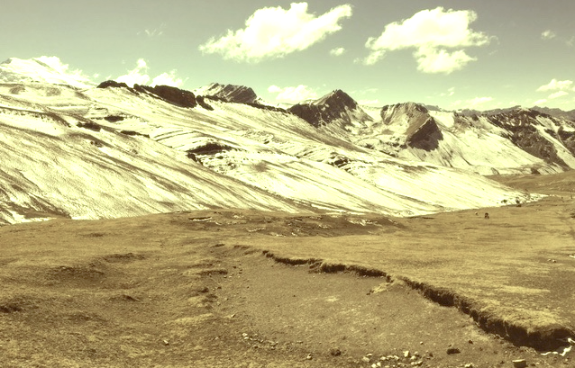
Vinicunca (5,200m- 17, 100ft)  also called Montaña de Siete Colores (The Mountain of Seven Colors) or Montaña de Colores  (Mountain of colors), sometimes known as Rainbow mountains, is a mountain in Peru, located in the Andes of Peru, in the . The Mountain of Seven Colors is a spectacular place, as if it were taken from another planet. It is found in the mountain range of Vilcanota and its striking natural coloration is due to the presence of sedimentary stones and minerals thanks to the erosion of wind and water. Ocres, reds, whites, yellows, greens and purples form a chromatic range that make Vinicunca a unique place in the world.
According to what some people of the area, this part of the mountain range was covered by glaciers for millennia. It seems that the disappearance of perpetual snow since the 1920's, made this colorful show. One of the peculiarities of this mountain for tourists (and they actually are too many!) who arrive there at dawn, is to discover Vinicunca covered with frost and entirely white (second photo above), without any of the colors that the brochures had promised! Then, as the sun warms up the atmosphere, the frost melts and reveals a land of multiple colors, a true rainbow mountain. One can imagine the reaction of the Incas to this phenomenon and why they immediately declared it sacred mountain.
There are two others Rainbow mountains or so called Colored Mountains on planet Earth : one in Canada, one in China.

Vintage postcards
Postcards became popular at the turn of the 20th century, especially for sending short messages to friends and relatives. They were collected right from the start, and are still sought after today by collectors of pop culture, photography, advertising, wartime memorabilia, local history, and many other categories. Postcards were an international craze, published all over the world. The Detroit Publishing Co. and Teich & Co. were two of the major publishers in the U.S, and sometimes individuals printed their own postcards as well. Yvon were the most famous in France. Many individual or anonymous publishers did exist around the world and especially in Africa and  Asia (Japan, Thailand, Nepal, China, Java) between 1920 and 1955. These photographer were mostly local notables, soldiers, official guides belonging to the colonial armies (british french, belgium...) who sometimes had rather sophisticated equipment and readily produced colored photograms or explorers, navigators, climbers (Vittorio Sella and the Archiduke of Abruzzi future king of Italy remains the most famous of them).
There are many types of collectible vintage postcards.
Hold-to-light postcards were made with tissue paper surrounded by two pieces of regular paper, so light would shine through. Fold-out postcards, popular in the 1950s, had multiple postcards attached in a long strip. Real photograph postcards (RPPCs) are photographs with a postcard backing.
Novelty postcards were made using wood, aluminum, copper, and cork. Silk postcards–often embroidered over a printed image–were wrapped around cardboard and sent in see-through glassine paper envelopes; they were especially popular during World War I.
In the 1930s and 1940s, postcards were printed on brightly colored paper designed to look like linen.
Most vintage postcard collectors focus on themes, like Christmas, Halloween, portraits of movie stars, European royalty and U.S. presidents, wartime imagery, and photos of natural disasters or natural wonders. Not to mention cards featuring colorful pictures by famous artists like Alphonse Mucha, Harrison Fisher, Ellen Clapsaddle, and Frances Brundage.

Sunday, June 4, 2017

GRINDELWALD VALLEY PANORAMA BY CASPAR WOLF


CASPAR WOLF (1735-1783) 
The Eiger (3,970 m - 13, 020ft)
The Mettenberg (3,104m -10,184ft)
The Wetterhorn (3,692m - 12, 133ft) 
Grindelwald Valley (1,034 m (3,392 ft) 
Switzerland

 In Panorama of the Grindelwald valley with  the Eiger, the Mettenberg, the Wetterhorn, 
oil on canvas, Private collection 

The mountains 
The Eiger (3,970 m - 13,020 ft)  is a mountain of the Bernese Alps, overlooking Grindelwald and Lauterbrunnen in the Bernese Oberland of Switzerland, just north of the main watershed and border with Valais. It is the easternmost peak of a ridge crest that extends across the Mönch to the Jungfrau (4,158 m -13,642 ft), constituting one of the most emblematic sights of the Swiss Alps.
The Mettenberg  (3,104m -10,184ft) also spelled Mättenberg, is a mountain of the Bernese Alps, overlooking Grindelwald in the Bernese Oberland. It lies north of the Schreckhorn.
The Wetterhorn (3,692m - 12, 133ft)  is a mountain in the Swiss Alps towering above the village of Grindelwald. Formerly known as Hasle Jungfrau, it is one of three summits of a mountain named Wetterhorn sensu lato, or the "Wetterhцrner", the highest summit of which is the Mittelhorn (3,704 m) and the most distant the Rosenhorn (3,689 m). The Mittelhorn and Rosenhorn are mostly hidden from view from Grindelwald. The Grosse Scheidegg Pass crosses the col to the north, between the Wetterhorn and the Schwarzhorn.
Grindelwald (1,034 m 3,392 ft) designates a valley, a village and a municipality in the Interlaken-Oberhasli administrative district in the canton of Berne in Switzerland. In addition to the village of Grindelwald, the municipality also includes the settlements of Alpiglen, Burglauenen, Grund, Itramen, Mühlebach, Schwendi, Tschingelberg and Wargistal.

The Painter 
Caspar Wolf was a Swiss painter, known mostly for his dramatic paintings of Alps. He was strongly influenced by Albrecht von Hallers poem on the Alps, and the Sturm und Drang movement. After 1773 Wolf mostly painted glaciers, caves, waterfalls and gorges.
Wolf was trained in Konstanz, between 1753 and 1759 he worked in Augsburg, Munich, Passau as a decoration painter. Not being able to sell his work he went disappointed back to his home town. For Horben Castle he painted by hand the wallpaper on the first floor. In 1768 Wolf lived in Basel. From 1769 till 1771 he stayed in Paris and worked with Philip James de Loutherbourg. In 1774 he moved to Bern. Wolf made a deal with the local publisher Abraham Wagner who had a geological interest, to deliver 200 paintings. He travelled with Wagner or a minister Jakob Samuel Wyttenbach in Berner Oberland and Wallis. From 1780-1781 he was working in Spa, Cologne, Aix-la-Chapelle and Düsseldorf. He died in poor circumstances in a hospital.
In 1779 his prints were exhibited in Bern but the book failed to sell. Wagner received help from a Swiss army officer in Dutch service and in 1785 thirty aquatints were published in Amsterdam. Till 1948 ninety of these aquatints were exhibited in Keukenhof Castle, but sold. Today these works can be seen in the Kunsthaus in Aarau. His son Theodor Wolf (1770–1818) was a still life painter.

Saturday, June 3, 2017

MONTE DARWIN BY ISABELLE SCHEIBLI


ISABELLE SCHEIBLI (bn.1949) 
Monte Darwin (2,438m - 7,999ft) 
Chile (Tierra del Fuego) 

In Mont Darwin, Antarctica, watercolor, 2016, Private collection 

The Mountain 
Monte Darwin (2,438m - 7,999ft) is a peak in Tierra del Fuego, Chile, forming part of the Cordillera Darwin, the southernmost range of the Andes, just to the north of the Beagle Channel. It is formed of crystalline schists and has massive glaciers down its steep southern slopes. Monte Darwin was for a long time considered as the highest peak in Tierra del Fuego, but that distinction corresponds to a mountain unofficially named Monte Shipton, which is about 2,580 m (8,460 ft) high and is located at 54°39′33″S 69°35′54″W.
Both peaks are best climbed in late December, January, February and March. Monte Shipton was first climbed in 1962 by Eric Shipton, E. Garcia, F. Vivanco and C. Marangunic.
Mount Darwin was given its name during the voyage of the Beagle by HMS Beagle's captain Robert FitzRoy to celebrate Charles Darwin's 25th birthday on 12 February 1834. A year earlier FitzRoy had named an expanse of water to the southwest of the mountain the Darwin Sound to commemorate Darwin's quick wit and courage in saving them from being marooned when waves from a mass of ice splitting off a glacier threatened their boats.
The mountain is part of Alberto de Agostini National Park.

The artist 
Isabelle Scheibli (bn. 1949) is a french journalist, screenwriter, essayist and watercolorist, passionate about mountains. She is the author of the novel "Gaspard de la Meije" published in 1984. As a journalist she worked for several mountains magazines such as "Vertical" or "Montagne Magazine". She wrote several films scenarii related to the mountain such as "Le passe montagne" (1996), "Jours Blancs" (1990) or "Gaspard de la Meije" (1984) based on her novel, winner of a prize in the Festivals of Trent and of Les Diablerets, and also recompensed by the La Fondation de France. As a watercolorist, she illustrated three albums from the Carrés de France collection for Editions Equinox, about the Haute Savoie (2002), the Savoie (2003), the Drôme Provençale (2008).
Isabelle Scheibli made several voyages to Patagonia and Antarctica, which are her favorite places on earth. She doesn’t always paint in situ, due to the extreme conditions in these lands, especially speaking about watercolors! She often paints watertcolors in her studio from her drawings or photos, she realised herself in the Antarctic.  About those voyages she wrote :
 «Painting the glacial world is a long-term process. To accompany close alpinists and Himalayists in their expeditions, I have often been in the mountains, in the Alps, in Nepal and in Tibet. The peaks have become a privileged motive. In 2014, I had the opportunity to go to Patagonia, to follow the coast of the Beagle Channel on a sailboat and to go to the foot of the glaciers of Tierra del Fuego. It was a very violent aesthetic shock.  Here the conditions did not always allow me  to paint as I wished. When I returned I undertook a work in my atelier from the many drawings, watercolors and photos that I had brought back. The dimension of immensity quickly led me to paint in a large format, which I had never done before. In 2016, I set out on a sailboat to approach the absolute quintessence of the glacier, an entire continent of ice, Antarctica. I had somewhat underestimated the navigation part of this trip but the discovery of this icy pole was a glare. Once again I brought back watercolors stolen between two gusts, many drawings and photos. And I got to work on the way back, immersing myself completely »

Friday, June 2, 2017

THE MONT BLANC BY ADOLPHE BRAUN


ADOLPHE BRAUN (1812-1877)  
The Mont Blanc (4,808 m - 15,776 ft)
  France - Italy border

In La pierre de Béranger et le massif du Mont-Blanc, 1875, photograph on paper. 


The mountain 
Mont Blanc (in French) or Monte Bianco (in Italian), both meaning "White Mountain", is the highest mountain in the Alps and the highest in Europe after the Caucasus peaks. It rises 4,808.73 m (15,777 ft) above sea level and is ranked 11th in the world in topographic prominence.  The Mont Blanc is one of the Seven Summit, which includes the highest mountains of each of the seven continents. Summiting all of them is regarded as a mountaineering challenge, first achieved on April 30, 1985 by Richard Bass.  The 7 highest summit, (which are obviously 8 with 2 in Europe !) are :  
Mount Everest (8,848m), Aconcagua (6,961m), Mt Denali or Mc Kinley (6,194m),  Kilimandjaro (5,895m), Mt Elbrus (5,642m), Mount Vinson (4,892m) and Mount Kosciuszko  (2,228m) in Australia.

The photographer
Adolphe Braun was a French photographer, best known for his floral still lifes, Parisian street scenes, and grand Alpine landscapes. One of the most influential French photographers of the 19th century, he used contemporary innovations in photographic reproduction to market his photographs worldwide. In his later years, he used photographic techniques to reproduce famous works of art, which helped advance the field of art history.
Photography historian Naomi Rosenblum described Braun's work as representative of the relationship between art and commercialism in the mid-19th century. His self-sustaining Mulhouse studio helped elevate photography from a craft to a full-scale business enterprise, producing thousands of unique images which were reproduced and marketed throughout Europe and North America.  Rosenblum also suggests that Braun's detailed reproductions of works of art in European museums brought these works to art students in North America, providing a major catalyst for the field of art history in the United States. Subsequent photographs focused on Alpine landscapes, especially lake scenes, and glacier scenes. Unlike many landscape photographers during this period, Braun liked to include people in his scenes. Photography historian Helmut Gernsheim suggested that Braun was one of the most skillful photographers of his era in rendering composition.  While not known as a portraitist, he did take portraits of several notable individuals, including Pope Pius IX, Franz Liszt, and the Countess of Castiglione, mistress of Napoleon III. Braun's work has been exhibited at the Metropolitan Museum of Art, the J. Paul Getty Museum, the George Eastman House, and the Musйe d'Orsay.
His photographs of Parisian street scenes and Alpine landscapes are frequently reproduced in works on the history of photography.


Thursday, June 1, 2017

SAPAS MONS BY NASA MAGELLAN MISSION


Sapas Mons (1,500m or 1, 5km -   4,921ft or 0.93mi)
Venus (Alta Regio) 

The mountain 
Sapas Mons 1.5 kilometers (0.93 mi) is a large volcano with twin summit, located in the Atla Regio region of planet Venus. Sapas is named after the Canaanite sun goddess. It measures about 400 kilometers (250 mi) across. Its flanks show numerous overlapping lava flows. The dark flows on the lower right of the radar image are thought to be smoother than the brighter ones near the central part of the volcano. Many of the flows appear to have been erupted along the flanks of the volcano rather than from the double summit. This type of flank eruption is common on large volcanoes on Earth, such as the Hawaiian volcanoes. The summit area has two flat-topped mesas, whose smooth tops give a relatively dark appearance in the radar image. Also seen near the summit are groups of pits, some as large as one kilometer (0.6 mile) across. These are thought to have formed when underground chambers of magma were drained through other subsurface tubes and lead to a collapse at the surface. A 20-kilometer-diameter (12 mi) impact crater northeast of the volcano is partially buried by the lava flows. Little was known about Atla Regio prior to the Magellan probe. The new data, acquired in February 1991, show the region to be composed of at least five large volcanoes such as Sapas Mons, which are commonly linked by complex systems of fractures or rift zones. If comparable to similar features on Earth Atla Regio probably formed when large volumes of molten rock upwelled from areas within the interior of Venus known as 'hot spots.'
Source:
- NASA

The photographer 
Soviet Venera 13 and 14 spacecraft observed in the 1970s have first photographed the twin summit. The Nasa Magellan Mission photographed the region in a more acute way.
More about NASA Magellan Mission 
- Nasa Magellan Mission to Venus

Wednesday, May 31, 2017

CERRO MACA BY RAMOS CATALAN


RAMOS CATALAN (1888-1961)
Cerro Macá  (2, 300m - 7, 500ft)    
Chile

In Mountains landscapes of Andes, oil on canvas,Valparaiso Art Museum / Palazzo Barburizza

The mountain 
Cerro Macá  (2, 300m - 7, 500ft) - not to be be confused with Mount Maca in Mozambique, Africa -  is a stratovolcano located to the north of the Aisen Fjord and to the east of the Moraleda Channel, in the Aysen del General Carlos Ibanez del Campo Region of Chile.  Part of the Andes, this glacier-covered volcano lies along the regional Liquiсe-Ofqui Fault Zone. It has erupted basalt.
This peak has no ascents officially registered by  professional climbers.
 Source: 

The painter 
Benito Ramos Catalán (1888-1961) was a chilean  painter who used to sign "Ramos Catalan". Known for his marines and landscapes of the Andes and Chile, and most particularly for his mountains paintings. Most of them have the same title: "Mountains of Chile" or  "Mountains landscapes of Andes", making quite difficult to know which mountain was exactly depicted, in a country which has quite a lot of summits ! To add to the difficulty, he used to paint the most famous mountains of his country under very unusual angles or with proportions that do not correspond exactly to their real size... making even more difficult to recognize and identify them for experts ! That is why today, 55 years after his death, some of these mountains paintings are not clearly identified and presented, in the public sales, as 'possibly' a particular summit of Chile or Andes...
His works are in many Chilean institutions like Viña del Mar Fine Art Museum, O'Higginiano Fine Art Museum in Talca, Valparaiso Fine Art Museum, and Navy  Schools in Valparaiso and Talcahuano, Ranos.

Tuesday, May 30, 2017

MONT VENTOUX PAINTED BY PAUL SURTEL


PAUL SURTEL (1893-1985)
 The mont Ventoux (1, 911m - 6, 270ft)
 France (Provence-Alpe-Côte-d'Azur)  


1. The mont Ventoux from north, oil on cardboard, Private collection, France
2.  The mont Ventoux from south-west, oil on cardboard, Private collection, France
 3. The mont Ventoux from west , oil on cardboard, (not signed), Private collection, France
 4. The mont Ventoux from south, oil on cardboard, Private collection, France
 5. The mont Ventoux from Les Alpilles,  oil on cardboard, Private collection, Switzerland

One can notice that there is not a single tree on those paintings of the Mont Ventoux, which is no longer the case today. This is the result of an intensive reforestation policy carried out by the French State services on this mountain which had been devastated by the forestry exploitation in the late 19th and the early 20th century.

The mountain 
Mont Ventoux  (1, 911m - 6, 270ft), Ventor in Latin, is located in the French department of Vaucluse (Provence-Alpes-Côte d'Azur). It is about 25 kilometers long on an east-west for 15 kilometers wide on a north-south axis. Nicknamed the Giant of Provence, it is the culmination of the Monts du Vaucluse, the ultimate link of the Southern Alps and the highest peak of Vaucluse. Its geographical isolation makes it visible over great distances.

The painter 
Paul Surtel is a French painter and epistolier, the son of a family of coffee makers and restaurateurs living in the Paris region. Fernand Maillaud, the "good master",  a landscape painter, very good friend of Paul's father, introduced him very early to painting. In1904, Paul Surtel went up to Paris,at the Lycée Charlemagne and the Arts Décoratifs, but especially at the "l'école buissonnière", visiting  museums and exhibitions in the galleries of Paris instead to go to school ! He then became passionate for Rembrandt and especially Corot (who greatly influenced him).
At the end of the First World War, he was enlisted as an artilleryman (at the beginning of 1917). From Seine and Marne in Lorraine, Belgium, Somme, he went from offensive to cantonments. Then he allows himself to be taken back by nature, draws, leaves emotion to guide his hand, the craft acquiring itself by dint of attention and work.
Demobilized in Hyères, Paul found a forestry foreman occupation in the Var, and discovered the Provençal nature that would become the source of his work and would make him known as a "regionalist painter", a rather pejorative label to carry in France until very recently.  In 1937, during one of his first exhibitions in Oran (Algeria, at that time French department) Paul Surtel meets Elia Duc, a young teacher in a small the algerian city. They married in 1939. After that follows 48 years of passionate creation and happiness, especially in Peipin, a tiny village in the Alpes of Haute Provence where the couple settled. His paintings radiate tenderness, lightness, effusion, through impalpable matter. After two years in Quercy, then three in Orange, the family settles in Carpentras (Vaucluse), in 1951, where Elia is named professor.
From the 60s, Paul Surtel added landscapes, still-lifes and portraits.