google.com, pub-0288379932320714, DIRECT, f08c47fec0942fa0 GRAVIR LES MONTAGNES... EN PEINTURE: - NORTH AMERICA
Showing posts with label - NORTH AMERICA. Show all posts

Friday, December 30, 2022

MONT DIABLO PEINT PAR WILLIAM KEITH


WILLIAM KEITH (1838-1911) Mont Diablo (1 ,173m - 3,648 ft) Etats-Unis (Californie)  In Sunset on Mount Diablo, 1877 ,Huile sur toile,  100.7 cm x 151.5 cm. Cantor Arts Center, Stanford University, Palo Alto CA


WILLIAM KEITH (1838-1911)
Mont Diablo (1 ,173m - 3,648 ft)
Etats-Unis (Californie)

In Sunset on Mount Diablo, 1877 Huile sur toile, 100.7 cm x 151.5 cm.
Cantor Arts Center, Stanford University, Palo Alto CA


Le peintre
William Keith était un peintre américano- écossais célèbre pour ses paysages californiens. Il est associé au tonalisme et à l'Ecole de Barbizon. Bien que la majeure partie de sa carrière se soit déroulée en Californie, il a c effectué deux longs voyages d'études en Europe et a eu un studio à Boston en 1871-72 et un à New York en 1880.
Dans les années 1870, Keith est arrivé en Californie, dans la vallée de Yosemite, avec une lettre de recommandation auprès de John Muir. Les deux hommes sont devenus de grands amis et cette amitié a perduré les 38 années du reste de leur vie . Tous deux étaient nés en Écosse la même année et partageaient un amour pour les montagnes de Californie. James Mitchell Clarke a décrit leur amitié comme une amitié "dans laquelle une affection et une admiration profondes s'exprimaient à travers une sorte de joute verbale, permanente ".
Au cours des années 1870, Keith a peint un certain nombre de grandes œuvres panoramiques dont Kings River Canyon (Oakland Museum) et California Alps (Mission Inn, Riverside). Ces oeuvre voulaient directement rivaliser avec celles de sujet similaires peint par Albert Bierstadt ou Thomas Hill.
"Mes images sont celles qui viennent de l'intérieur.de moi. Je ressens une émotion et je peins immédiatement une image qui l'exprime. Le sentiment est la valeur réelle dans mes images, et seules quelques personnes comprennent cela. Quiconque sait utiliser de la peinture et des pinceaux peut peindre une vraie scène de la nature - c'est une image objective. Mais pour un artiste digne de ce nom, tout doit cela doit venir de l'intérieur de lui même " .

La montagne
Le mont Diablo (1 ,173m - 3,648 ft) est une montagne située dans le comté de Contra Costa dans la région urbaine de San Francisco, au sud de la ville de Clayton et au nord-ouest de Danville. Ce sommet isolé est visible de l'ensemble de la baie de San Francisco et de nombreux endroits de la Californie du Nord. Le mont Diablo ressemble à une double pyramide sous de nombreux angles, et inclut plusieurs sommets secondaires, le plus important et le plus proche étant celui de l'autre moitié de ladite double pyramide, North Peak. Le sommet du mont Diablo est accessible aux véhicules motorisés, randonneurs ou cyclistes. Par temps clair, il est possible du sommet d'apercevoir le massif montagneux de la Sierra Nevada et la montagne de l'extrémité sud de la chaîne des Cascades, le volcan du pic Lassen, à environ 290 kilomètres. Le mont Shasta reste invisible du fait de la courbure terrestre, mais le Half Dome du parc national de Yosemite est lui visible par temps exceptionnellement clair grâce à un télescope.

 _________________________________________

2022 - Wandering Vertexes ....
            Errant au-dessus des Sommets Silencieux...
            Un blog de Francis Rousseau

Tuesday, December 27, 2022

LE CANYON DE CHELLY PEINT PAR EDGAR ALWIN PAYNE


EDGAR ALWIN PAYNE (1883-1947) Canyon de Chelly / Spyder Rock  (300 m - 984ft) Etats -Unis (Arizona)  In Sunset, Canyon de Chelly (1916), huile sur toile 71.1 x 81.3 cm, Collection privée

EDGAR ALWIN PAYNE (1883-1947)
Canyon de Chelly / Spyder Rock  (300 m - 984ft)
Etats -Unis (Arizona)

In Sunset, Canyon de Chelly (1916), huile sur toile 71.1 x 81.3 cm, Collection privée


Le canyon
Le Monument national du Canyon de Chelly (300 m - 984ft)  est  situé dans l'État de l'Arizona, au sud-ouest des États-Unis. Le mot « Chelly » est une déformation anglaise du mot navajo « tseqi », qui signifie « canyon rocheux ». Il est au milieu d'une grande réserve Navajo. Il a la forme d'un Y, creusé verticalement dans les lits de grès par deux arroyos : Tsaile Creek et Whiskey Creek qui se joignent pour former le Rio de Chelly. Il s'étend sur 40 kilomètres. Depuis le nord-est, le canyon del Muerto, long de 50 kilomètres, le rejoint à Chinle. Ce canyon encore habité présente de belles formations rocheuses et abrite des habitats troglodytes d'anciens Indiens Pueblos. Quelques familles de fermiers Navajos s'y sont réinstallées, cultivant maïs et haricots et élevant des moutons. Parmi les formations rocheuses les plus spectaculaires, Spider Rock, aiguille de 244 m de haut surplombant le canyon.


Le peintre
Edgar Alwin Payne est sans conteste l'un des peintres de plein air californiens les plus doués de son temps. Alors que ses contemporains privilégiaient une représentation calme et idyllique des paysages naturels, Payne leur préférait leur beauté sauvage. Largement autodidacte, il a trouvé son inspiration et a fait son éducation artistique  dans la nature elle-même. Ses paysages majestueux  inspirés par son respect de la  nature, sont imprégnés d'une force intérieure et d'un dynamisme qui parlent à toutes les générations. Ayant décidé, jeune homme, de devenir peintre, Edgar Payne part pour l' Europe de 1922 à 1924 où, sous l’influence de l’impressionnisme français, il peint et expose. Il peint des bateaux de pêche en Bretagne, des villages et les Alpes en Suisse, les bateaux de pêche de Chioggia, à Venise.  De retour aux Etats unis, il  a été parmi les premiers peintres à capturer la force de la Sierra Nevada. Ses voyages à travers le grand ouest  américain ont produit  des représentations tout aussi magnifiques du désert. Sa quête sans fin pour transmettre "l'indiciblement sublime" de ses paysages lui a valu une large reconnaissance - un critique éminent l'a qualifié de ""poète qui chante en couleurs". Edgar Payne a eu une longue carrière réussie aux États-Unis où il a peint des Indiens à cheval en Arizona, des lacs de montagne en Californie et des paysages côtiers en Californie du sud. Il a vécu de nombreuses années à Laguna Beach avant sa mort.

 _________________________________________

2022 - Wandering Vertexes ....
            Errant au-dessus des Sommets Silencieux...
            Un blog de Francis Rousseau

Friday, December 9, 2022

PUEBLO PEAK PEINT PAR WILLIAM VICTOR HIGGINS


WILLIAM VICTOR HIGGINS (1884-1949) Pueblo Peak  (2,631m - 8,632ft) United States of America (Oregon / Nevada)   In Taos mountains under Rain 1921,watercolor, RISD Museum

WILLIAM VICTOR HIGGINS (1884-1949)
Pueblo Peak  (2,631m - 8,632ft)
United States of America (Oregon / Nevada) 

In Taos mountains under Rain 1921, oil on canvas, RISD Museum


La montagne
Pueblo Peak (2 631 m - 8 632 pieds) est le point culminant du massif des Pueblo, une chaîne de montagnes des États-Unis située principalement dans le sud-est de l'Oregon et partiellement dans le nord-ouest du Nevada. La plupart des montagnes Pueblo sont gérées par le Federal Bureau of Land Management, Bien qu'il n'y ait pas de zone sauvage désignée comme telle dans ces montagne,  y voyager peut être très difficile. Le Desert Trail  qui traverse les montagnes n'est pas un sentier de randonnée aménagé. Le parcours est simplement balisé par des cairns rocheux qui servent de repères. Les cairns ont été construits dans le cadre d'une coopération entre le Bureau of Land Management, le Département des parcs et des loisirs de l'Oregon et la Desert Trail Association (une organisation privée). La Desert Trail Association publie une carte topographique pour les randonneurs qui donne des indications de cairn en cairn.
Le pâturage des bovins et des moutons dans les montagnes de Pueblo a commencé lorsque les premiers ranchs ont été établis le long du bord oriental des montagnes au milieu des années 1860.
Les mineurs ont été parmi les premiers à explorer ces montagnes. Il y a au moins 18 endroits où l'exploitation minière a eu lieu dans le passé.
L'énergie éolienne est actuellement à l'étude dans les montagnes Pueblo. Le test a permis à une entreprise privée d'énergie éolienne d'installer, d'exploiter et d'entretenir deux pôles météorologiques.

Le peintre
William Victor Higgins était un peintre et enseignant américain, né à Shelbyville, Indiana. Il a étudié à l'Art Institute de Chicago et à la Chicago Academy of Fine Arts. A Paris, il fut l'élève de Robert Henri, René Ménard et Lucien Simon, et lorsqu'il était à Munich, il étudia avec Hans von Hayek. Il était associé de la National Academy of Design. Higgins s'installa à Taos, Nouveau-Mexique en 1913 et rejoignit t en 1917 la Taos Society of Artists fondée deux ans auparavant par Joseph Henry Sharp, W. Herbert Dunton, Eanger Irving Couse et Oscar Edmund Berninghaus.
En 1923, il fonde la Hartwood Foundation avec Louise Harwood et Bert Phillips. Il peint alors de nombreuses oeuvres représentant la chaîne de montagnes entourant la ville de Taos et notamment les montagnes de Pueblo. Pendant la Dépression, il a été chargé de peindre une peinture murale à l'intérieur du palais de justice du comté de Taos financée par le PWAP, intitulée Moises, El Legislador.

 _________________________________________

2022 - Wandering Vertexes ....
            Errant au-dessus des Sommets Silencieux...
            Un blog de Francis Rousseau

Saturday, December 3, 2022

SIGNAL HILL PEINT PAR ROBERT PILOT


ROBERT PILOT (1898-1967) Signal Hill (167m- 548 ft) Canada (Labrador)  In The Narrows- St Johns, Newfoundland, Huile sur toile, 45 x 60, 5 cm, Fondation Sobey pour les arts, Canada


ROBERT PILOT (1898-1967)
Signal Hill (167m- 548 ft)
Canada (Labrador)

In The Narrows- St Johns, Newfoundland, Huile sur toile, 45 x 60, 5 cm, 

Fondation Sobey pour les Arts, Canada

La colline
Signal Hill (167m- 548 ft)  dont le  point culminant est Ladies' Lookout,  est une colline qui surplombe la ville de St. John's, Terre-Neuve-et-Labrador, Canada. Principalement un site historique national, à côté se trouve le musée en grande partie enfoui du Johnson Geo Center et son parc associé. La communauté de The Battery est située sur le versant de la colline surplombant le port. Le 12 décembre 1901, la première transmission sans fil transatlantique a été reçue par Guglielmo Marconi,  Situé sur un emplacement hautement stratégique surplombant le Narrows, la seule entrée du port, les fortifications remontent au milieu du 17e siècle. L'Université Memorial de Terre-Neuve-et-Labrador a un campus sur les pentes inférieures, dans l'ancien Battery Hotel, et est également maintenant propriétaire du Johnson Geo Centre.

Le peintre
Robert Wakeham Pilot (MBE, RCA, est un artiste canadien connu comme peintre, graveur et muraliste.En 1910, sa mère, veuve, épouse de l'artiste Maurice Cullen et s'installe dans la maison de Cullen à Montréal avec lequel il commence à étudier l'art.  Il étudie ensuite  à Montréal avec William Brymner puis, en mars 1916, il s'enrôle dans l’armée. De 1920 à 1922, il étudie à l'Académie Julian à Paris. En 1922, il expose au Salon de Paris. Son travail  subit des influences impressionnistes. À son retour au Canada, il est élu membre associé de l'Académie royale des arts du Canada en 1925 et occupe le poste de président de l'Académie de 1952 à 1954. Sa première exposition personnelle eut lieu en 1927, chez Watson Art Galleries. Il remporte le prix Jessie Dow cette année-là ainsi qu'en 1934 Voyageant abondamment en Europe, mais aussi au Québec il cultive une vision relativement nostalgique du paysage urbain ou rural, dans lequel il camoufle le plus souvent les témoignages visuels d’une modernisation du territoire. En 1941,  il s'enrôlé de nouveau et participe à la Seconde Guerre mondiale, en tant que capitaine dans le régiment des Black Watch. Son rôle pendant ce conflit lui vaut la médaille du couronnement de la reine Élisabeth II en 1953.  Les peintures de Pilot ont été présentées à Winston Churchill, à la reine Élisabeth II et au duc d’Édimbourg. D'autres se retrouvent dans la collection du Musée des beaux-arts du Canada et du Musée national des beaux-arts du Québec.Une exposition rétrospective de son œuvre, eut lieu au Musée des beaux-arts de Montréal en 1969.

 _________________________________________

2022 - Wandering Vertexes ....
            Errant au-dessus des Sommets Silencieux...
            Un blog de Francis Rousseau


Wednesday, November 30, 2022

MONT GEIKIE & LES REMPARTS PEINTS PAR LAWREN HARRIS


LAWREN S. HARRIS (1885-1970) Mont Geikie  - The Ramparts (3 ,98 m - 10, 820 ft)  Canada ( Colombie-Britannique )    In The Ramparts Tonquin Valley, Rocky Mountains huile sur panneau, 27,1x37,5cm,  Fondation Sobey pour les Arts, Canada

 LAWREN S. HARRIS (1885-1970)
Mont Geikie  - Les Remparts (3,298 m - 10, 820 ft)
Canada (Colombie-Britannique)
 
 In The Ramparts Tonquin Valley, Rocky Mountains huile sur panneau, 27,1x37,5cm, 
Fondation Sobey pour les Arts, Canada 

La montagne 
Le mont Geikie  (3,298 m - 10, 820 ft), prononcé comme " geek ", est un sommet montagneux situé en Colombie-Britannique au Canada. Situé à 28 km au sud-ouest de Jasper près de la vallée de Tonquin, le mont Geikie est le plus haut sommet de la chaine des  Remparts (Ramparts) dans les Rocheuses canadiennes, l'une des plus belles destinations de montagne au monde. Son sommet le plus élevé le plus proche est le mont Fraser à 8 km au sud-est ; le Continental Divide se trouve à 3 km à l'est.  Le mont Geikie est composé de quartzite de la période cambrienne, une  roche poussée vers l'est  au-dessus d'une roche plus jeune au cours de l'orogenèse Laramide.  Le mur vertical de sa face nord mesure plus de 1 500 mètresde haut et a été comparé aux autres grandes faces nord des Rocheuses canadiennes telles que North Twin, Alberta et Kitchener. Les  Remparts se trouvent en partie dans le Parc national de Jasper en Alberta et dans le parc provincial du mont Robson en Colombie-Britannique. 10 sommets font partie de cette chaine, dont le plus élevé est le mont Geikie  La plupart ont été nommés par le Club alpin du Canada et portent des noms sur le thème du génie militaire tels que Bastion, Parapet, Redoute et Dungeon.  Ils forment la limite ouest de la vallée de Tonquin. 
 
Le peintre
Lawren S. Harris  est né à Brantford, en Ontario, en 1885. La famille Harris a fondé l’entreprise de machinerie agricole Massey-Harris (aujourd'hui Massey Ferguson). C'est assez dire que les activités artistiques de Harris ne connaîtront jamais d’obstacle financier !  Dès l’enfance, il commence à dessiner et à peindre à l’aquarelle, puis il se rend à Berlin en 1904 pour y faire des études en arts. Harris devient un adepte de la philosophie théosophique, une interprétation mystique de la doctrine religieuse, qui joua un rôle déterminant dans sa vie et dans son oeuvre. Le style impressionniste de Harris utilise des couleurs riches et vives pour illustrer les thèmes récurrents de la beauté de la nature. Au fil des ans, son style évolue vers l’abstraction. Après avoir parcouru l’Europe et le Moyen-Orient, Harris revient au Canada à l’âge de 22 ans et s’établit à Toronto. Il s’investit activement dans l’Arts and Letters Club de Toronto, où il rencontre les autres membres du futur Groupe des Sept et partage avec eux les philosophies artistiques modernes qu’il rapporte de l’étranger. En 1913, de concert avec le Dr James McCallum, il finance la construction du Studio Building, sur la rue Severn, à Toronto, pour offrir à ces artistes un endroit où ils peuvent vivre et travailler ensemble, afin de créer un nouveau genre d’art canadien. Harris finance aussi de nombreux voyages à Algoma, en Ontario, et est considéré comme responsable de la formation officielle du Groupe des Sept. Il meurt en 1970.
 _________________________________________

2022 - Wandering Vertexes ....
            Errant au-dessus des Sommets Silencieux...
            Un blog de Francis Rousseau


Monday, September 26, 2022

THE CASTKILL MOUNTAINS PAINTED BY THOMAS COLE


THOMAS COLE (1801-1848) Catskill Mountains (1,279 m - 4,180 ft) United States of America (New York State)  In Castkill Mountains House, The 4 elements, oil on canvas, 1843-44. private collection
 
THOMAS COLE (1801-1848)
Catskill Mountains (1,279 m - 4,180 ft)
United States of America (New York State)

In Castkill Mountains House, The 4 elements, oil on canvas, 1843-44. private collection

The mountains
The Catskill Mountains (1,279 m - 4,180 ft) also known as The Catskills, are a physiographic province of the larger Appalachian Mountains, located in southeastern New York. As a cultural and geographic region, the Catskills are generally defined as those areas close to or within the borders of the Catskill Park, a 700,000-acre (2,800 km2) forest preserve forever protected from many forms of development under New York state law.
Geologically, the Catskills are a mature dissected plateau, a once-flat region subsequently uplifted and eroded into sharp relief by watercourses. The Catskills form the northeastern end of the Allegheny Plateau (also known as the Appalachian Plateau).
The Catskills are well known in American culture, both as the setting for many 19th-century Hudson River School paintings and as the favored destination for vacationers from New York City in the mid-20th century. The region's many large resorts gave countless young stand-up comedians an opportunity to hone their craft. In addition, the Catskills have long been a haven for artists, musicians, and writers, especially in and around the towns of Phoenicia and Woodstock.

The painter
Thomas Cole (1801– 848) was an American artist known for his landscape and history paintings. He is regarded as the founder of the Hudson River School, an American art movement that flourished in the mid-19th century. Cole's work is known for its romantic portrayal of the American wilderness.
In New York, Cole sold five paintings to George W. Bruen, who financed a summer trip to the Hudson Valley where the artist produced two Views of Coldspring, the Catskill Mountain House and painted famous Kaaterskill Falls and the ruins of Fort Putnam. Returning to New York, he displayed five landscapes in the window of William Colman's bookstore; according to the New York Evening Post Two Views of Coldspring were purchased by Mr. A. Seton, who lent them to the American Academy of the Fine Arts annual exhibition in 1826. This garnered Cole the attention of John Trumbull, Asher B. Durand, and William Dunlap. Among the paintings was a landscape called "View of Fort Ticonderoga from Gelyna". Trumbull was especially impressed with the work of the young artist and sought him out, bought one of his paintings, and put him into contact with a number of his wealthy friends including Robert Gilmor of Baltimore and Daniel Wadsworth of Hartford, who became important patrons of the artist.
Cole was primarily a painter of landscapes, but he also painted allegorical works. Cole influenced his artistic peers, especially Asher B. Durand and Frederic Edwin Church, who studied with Cole from 1844 to 1846. Cole spent the years 1829 to 1832 and 1841 to 1842 abroad, mainly in England and Italy.
Thomas Cole died at Catskill on February 11, 1848. The fourth highest peak in the Catskills is named Thomas Cole Mountain in his honor. 

_______________________________

2022 - Wandering Vertexes...
by Francis Rousseau 

Wednesday, August 10, 2022

BLACKHEAD PAINTED BY EDWARD HOPPER

EDWARD HOPPER (1882-1967) Blackhead (50 m-150 ft)  United States of America (Maine)  1. In Blackhead, Monhegan, 1916-19,oil on wood, Whitney Museum of American Art,


EDWARD HOPPER (1882-1967)
Blackhead (50 m-150 ft) 
United States of America (Maine)

1. In Blackhead, Monhegan, 1916-19,oil on canvas,  Whitney Museum of American Art, 


The mountain 
Blackhead (50m-150 ft) are northside cliffs situated on Monhegan, Manana Island, that have drawn the interest of  many artists.  The beginnings of the art colony on Monhegan date to the mid-19th century; by 1890, it was firmly established. Two of the early artists in residence from the 1890s, William Henry Singer (1868–1943) and Martin Borgord (1869–1935), left Monhegan to study at the Académie Julian in Paris in 1901. Among many early members who found inspiration on the island were summer visitors from the New York School of Art and the Pennsylvania Academy of the Fine Arts, such as Robert Henri, Frederick Waugh, George Bellows, Edward Hopper and Rockwell Kent. The Monhegan Museum celebrated more the continuing draw of the island for artists in a 2014 exhibit entitled, “The Famous and the Forgotten: Revisiting Monhegan’s Celebrated 1914 Art Exhibition.
Monhegan is a plantation in Lincoln County, Maine, United States, about 12 nautical miles (22 km) off the mainland. The population was 75 at the 2000 census. The plantation comprises its namesake island and the uninhabited neighboring island of Manana. The island is accessible by scheduled boat service from Boothbay Harbor, New Harbor and Port Clyde. It was designated a National Natural Landmark for its coastal and island flora in 1966.[
The name Monhegan derives from Monchiggon, Algonquian for "out-to-sea island." European explorers Martin Pring visited in 1603, Samuel de Champlain in 1604, George Weymouth in 1605 and Captain John Smith in 1614. The island got its start as a British fishing camp prior to settlement of the Plymouth Colony. Cod was harvested from the rich fishing grounds of the Gulf of Maine, then dried on fish flakes before shipment to Europe. A trading post was built to conduct business with the Indians, particularly in the lucrative fur trade.  It was Monhegan traders who taught English to Samoset, the sagamore who in 1621 startled the Pilgrims by boldly walking into their new village at Plymouth and saying: "Welcome, Englishmen." 

The painter
Edward Hopper was a American realist painter and printmaker.
Conservative in politics and social matters (Hopper asserted for example that "artists' lives should be written by people very close to them"), he accepted things as they were and displayed a lack of idealism. Cultured and sophisticated, he was well-read, and many of his paintings show figures reading. He was generally good company and unperturbed by silences, though sometimes taciturn, grumpy, or detached. He was always serious about his art and the art of others, and when asked would return frank opinions.
Hopper's most systematic declaration of his philosophy as an artist was given in a handwritten note, entitled "Statement", submitted in 1953 to the journal, Reality:
"Great art is the outward expression of an inner life in the artist, and this inner life will result in his personal vision of the world. No amount of skillful invention can replace the essential element of imagination. One of the weaknesses of much abstract painting is the attempt to substitute the inventions of the human intellect for a private imaginative conception.
The inner life of a human being is a vast and varied realm and does not concern itself alone with stimulating arrangements of color, form and design.
The term life used in art is something not to be held in contempt, for it implies all of existence and the province of art is to react to it and not to shun it.
Painting will have to deal more fully and less obliquely with life and nature's phenomena before it can again become great."
 
_______________________________
2022 - Wandering Vertexes...
by Francis Rousseau

Saturday, May 28, 2022

MOUNT COLEMAN PAINTED BY ARTHUR P. COLEMAN

ARTHUR P. COLEMAN (1852-1939) Mount Coleman (3,135 m-10,285 ft) Canada (Alberta)
 

ARTHUR P. COLEMAN (1852-1939)
Mount Coleman (3,135 m-10,285 ft)
Canada (Alberta) 

 In  "Mountain un the Canadian rockies"

The mountain
Mount Coleman (3,135 m-10,285 ft) mountain summit located in the upper North Saskatchewan River valley in Banff National Park, in the Canadian Rockies of Alberta, Canada. Its nearest higher peak is Cirrus Mountain, 4.46 km (2.77 mi) to the north.  Mount Coleman is situated along the east side the Icefields Parkway midway between Saskatchewan Crossing and Sunwapta Pass.
Mount Coleman was named in 1898 after Arthur Philemon Coleman (1852-1939), a Canadian geologist and among the first white men to explore the area that is now Jasper National Park.(see below). Like other mountains in Banff Park, Mount Coleman is composed of sedimentary rock laid down from the Precambrian to Jurassic periods. Formed in shallow seas, this sedimentary rock was pushed east and over the top of younger rock during the Laramide orogeny.  Based on the Köppen climate classification, Mount Coleman is located in a subarctic climate with cold, snowy winters, and mild summers.  Temperatures can drop below -20 °C with wind chill factors below -30 °C. Precipitation runoff from Mount Coleman drains into tributaries of the North Saskatchewan River.

The painter
Arthur Philemon Coleman was a Canadian a geologist, professor, minerals prospector, artist, Rockies explorer, backwoods canoeist, world traveller, scientist, popular lecturer, museum administrator, memoirist and... one of Canada’s most beloved scientist.
Arthur Coleman is a fine example of that rare bird, a polished amateur artist whose drawings and paintings stand comfortably beside those of many professionals. He was active during the time when sketching and painting was ceding to photography the task of recording the visible world. Although he was also a photographer, painting was, for him, both a poetic and a descriptive pursuit, a way of wrapping an artistic expression around a phenomenon he was interested in or moved by. Thus motivated, Coleman's paintings give much joy and command a good deal of respect. The more surprising, perhaps given that he used to introduced himself more as a geologist than a painter.
Coleman travelled throughout the United States for professional conferences as well as geological field work. He visited many of the major American mountain ranges including: the American Cordillera Mountains (Washington, Oregon and California); the Sierra Nevada Mountains (California and Nevada); Yellowstone National Park (Wyoming, Montana and Idaho); and the Appalachian Mountains (eastern United States). Pleistocene glaciation had extended in Northern Europe as far south as Berlin and London and covered an area of two million square miles. Coleman also visited such countries as India, Australia, Brazil, Argentina, Scandinavia, Bolivia, New Zealand, South Africa and Uruguay. In his final years he made two expeditions to the Andes in Colombia, to mountains in Southern Mexico and to two mountains in Central America. He achieved the first ascent of Castle Mountain in 1884, and in 1907, he was the first white man to attempt to climb Mount Robson. He made a total of eight exploratory trips to the Canadian Rockies, wholly four of them looking for the mythical giants of Hooker and Brown.
From 1901 to 1922, he was a Professor of Geology at the University of Toronto and was Dean of the Faculty of Arts from 1919 to 1922. From 1931 to 1934, he was a geologist with the Department of Mines of the Government of Ontario. He was elected a Fellow of the Royal Society of Canada in 1900 and was its President in 1921. In 1929, he was appointed Honorary Vice-President of the Royal Canadian Geographical Society.
"Mount Coleman" and "Coleman Glacier" in Banff National Park is named in his honor. He was awarded the Penrose Medal in 1936.
He planned to climb "his" mountain, "Mount Coleman"'in the Albertan Rockies, and had also prepared a trip to British Guiana, but death intervened.
He was author of:
- Reports on the Economic Geology of Ontario (1903)
- Lake Ojibway; Last of the Great Glacial Lakes (1909)
- The Canadian Rockies: New and Old Trails (1911)
- Ice Ages, Recent and Ancient (1926), and was co-author of Elementary Geology (1922).
- The Last Million Years (1941) edited by George F. Kay

__________________________________________
2022 - Wandering Vertexes...
by Francis Rousseau

Tuesday, April 26, 2022

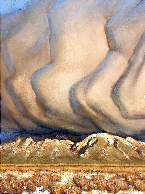
TAOS MOUNTAINS (PICURIS) PAINTED BY NATHANAEL VOLCKENING


NATHANAEL VOLKENING  Picuris Mountains (2,967 m - 9,734 ft) United States of America (New Mexico) In Winer bloom, oil on silk, 14 x 11cm, Taos Studio Society.


NATHANAEL VOLKENING
Picuris Mountains (2,967 m - 9,734 ft)
United States of America (New Mexico)

In Winer bloom, oil on silk, 14 x 11cm, Taos Studio Society.


The mountains
Picuris Mountains (2,967 m - 9,734 feet) is one of the Ridge in Taos County, nearby Osha Canyon and Vallecitos. Named Pikuria – those who paint – by Spanish colonizer Juan de Oñate, Picuris is located 24 miles (38 km) southeast of Taos in the Sangre de Cristo Mountains via N.M. 68, 518, and 75. Picuris, once the largest, today is one of the smallest Tiwa pueblos, with some 1,801 inhabitants (Census 2000). Like Taos, it was influenced by Plains Indian culture, particularly the Apaches
If one like biking, the ride takes you into the scenic and historic part of Picuris Mountains. About 2 miles from the start of this ride you will cross the historic Camino Real, or “Royal Highway,” that served as the original highway to Taos for traders, settlers, and Native Americans traveling north and south for several hundred years.
In late spring through fall this ride is free of snow and dry. It can be pretty beastly pushing up this mountain in the middle of summer. Plan on riding early or late in the day to avoid the heat.

_______________________________

2022 - Wandering Vertexes / Mountain paintings
By Francis Rousseau

Thursday, March 31, 2022

PICO DE ORIZABA / CILALTÉPETL PAINTED BY DIEGO RIVERA

DIEGO RIVERA (1886-1957) Pico de Orizaba / Citlaltépetl (5,636 m -18,491 ft)  Mexico (Vera Cruz)
 
DIEGO RIVERA (1886-1957)
Pico de Orizaba / Citlaltépetl (5,636 m -18,491 ft) 
Mexico (Vera Cruz)


The mountain
Pico de Orizaba (5,636 m -18,491 ft) also known as Citlaltépetl is a stratovolcano, the highest mountain in Mexico and the third highest in North America, after Denali of Alaska in the United States and Mount Logan of Canada. It rises in the eastern end of the Trans-Mexican Volcanic Belt, on the border between the states of Veracruz and Puebla. The volcano is currently dormant but not extinct, with the last eruption taking place during the 19th century. It is the second most prominent volcanic peak in the world after Africa's Mount Kilimanjaro. Pico de Orizaba was important in pre-Hispanic cultures, such as those of the Nahuatl-speaking Aztecs and the Totonacs. The volcano is part of many native mythologies. Pico de Orizaba is located 200 kilometres (120 mi) east of Mexico City and approximately 480 kilometres (300 mi) south of the Tropic of Cancer. A companion peak lying about six km to the southwest of Pico de Orizaba is the Sierra Negra, at 4,640 metres (15,223 ft). Pico de Orizaba is one of only three volcanoes in México that continue to support glaciers and is home to the largest glacier in Mexico, Gran Glaciar Norte. Orizaba has nine known glaciers: Gran Glaciar Norte, Lengua del Chichimeco, Jamapa, Toro, Glaciar de la Barba, Noroccidental, Occidental, Suroccidental, and Oriental. Pico de Orizaba, like the Sierra Madre Oriental, forms a barrier between the coastal plains of the Gulf of Mexico and the Mexican Plateau. The volcano blocks the moisture from the Gulf of Mexico from saturating central Mexico and influences the climates of both areas. Both the state of Veracruz and Puebla depend on Pico de Orizaba for supplying fresh water. The largest river originating on the volcano is the Jamapa River.

The painter
Diego María de la Concepción Juan Nepomuceno Estanislao de la Rivera y Barrientos Acosta y Rodríguez, known as Diego Rivera was a prominent Mexican painter. His large frescoes helped establish the Mexican mural movement in Mexican art. Between 1922 and 1953, Rivera painted murals in, among other places, Mexico City, Chapingo, Cuernavaca, San Francisco, Detroit, and New York City. In 1931, a retrospective exhibition of his works was held at the Museum of Modern Art in New York. Rivera had a volatile marriage with fellow Mexican artist Frida Kahlo. In 1926, Rivera became a member of AMORC, the Ancient Mystical Order Rosae Crucis, an occult organization founded by American occultist Harvey Spencer Lewis. In 1926, Rivera was among the founders of AMORC's Mexico City lodge, called Quetzalcoatl, and painted an image of Quetzalcoatl for the local temple. In 1954, when he tried to be readmitted into the Mexican Communist Party from which he had previously been excluded because of his support of Trotsky, Rivera had to justify his AMORC activities. The Mexican Communist Party at that time excluded from its ranks members of Freemasonry, and regarded AMORC as suspiciously similar to Freemasonry. Rivera answered that, by joining AMORC, he wanted to infiltrate a typical “Yankee” organization on behalf of Communism. However, he also claimed that AMORC was “essentially materialist, insofar as it only admits different states of energy and matter, and is based on ancient Egyptian occult knowledge from Amenhotep IV and Nefertiti.”
___________________________________________ 


2022 - Wandering Vertexes...
by Francis Rousseau

Monday, March 28, 2022

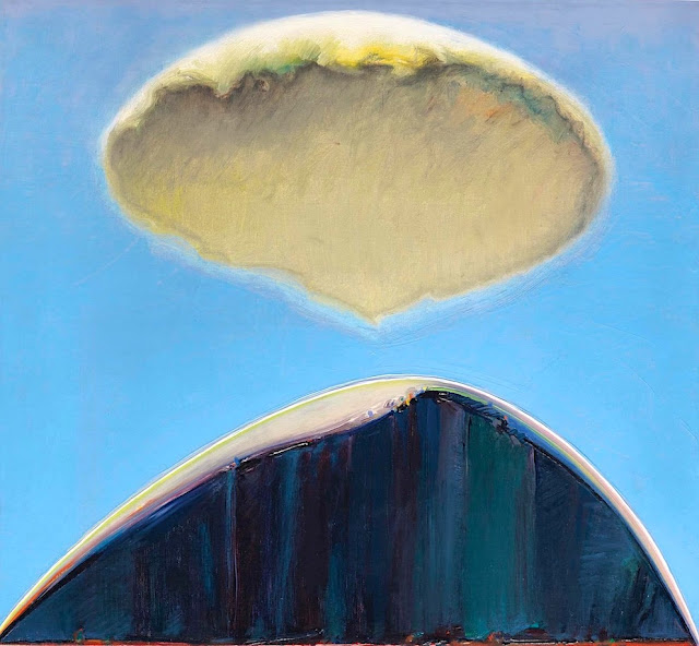
EL CAPITAN PAINTED BY WAYNE THIEBAUD


WAYNE THIEBAUD (1920-2021),El Capitan (2,309m - 7,573 ft), United States of America, In" Mount and Cloud", 1972, oil on canvas 20 1/4 x 22 in

WAYNE THIEBAUD (1920-2021)
El Capitan (2,309m - 7,573 ft)
United States of America

 In Mount and Cloud, 1972, oil on canvas 20 1/4 x 22 in.

 
The painter
Morton Wayne Thiebaud was an American painter known for his colorful works depicting commonplace objects—pies, lipsticks, paint cans, ice cream cones, pastries, and hot dogs—as well as for his landscapes and figure paintings. Thiebaud is associated with the pop art movement because of his interest in objects of mass culture, although his early works, executed during the fifties and sixties, predate the works of the classic pop artists. Thiebaud used heavy pigment and exaggerated colors to depict his subjects, and the well-defined shadows characteristic of advertisements are almost always included in his work.
Thiebaud was averse to labels such as "fine art" versus "commercial art" and described himself as "just an old-fashioned painter". He disliked Andy Warhol's "flat" and "mechanical" paintings and did not consider himself a pop artist.
In addition to pastries, Thiebaud painted characters such as Mickey Mouse as well as landscapes, streetscapes, and cityscapes, which were influenced by the work of Richard Diebenkorn. His paintings such as Sunset Streets (1985) and Flatland River (1997) are noted for their hyper realism, and have been compared to Edward Hopper's work, another artist who was fascinated with mundane scenes from everyday American life.
In 1962, Thiebaud's work was included, along with Roy Lichtenstein, Andy Warhol, Jim Dine, and Robert Dowd, in the historically important and ground-breaking "New Painting of Common Objects" curated at the Pasadena Art Museum.  This exhibition is considered to have been one of the first Pop Art exhibitions in the United States. These painters were part of a new movement, in a time of social unrest, which shocked the U.S. and the art world.

The mountain
El Capitan (2,309m - 7,573 ft) is a vertical rock formation in Yosemite National Park, located on the north side of Yosemite Valley, near its western end. The granite monolith extends about 3,000 feet (900 m) from base to summit along its tallest face and is one of the world's favorite challenges for rock climbers.
The formation was named "El Capitan" by the Mariposa Battalion when it explored the valley in 1851. El Capitan ("the captain") was taken to be a loose Spanish translation of the local Native American name for the cliff, variously transcribed as "To-to-kon oo-lah" or "To-tock-ah-noo-lah".
It is unclear if the Native American name referred to a specific tribal chief or simply meant "the chief" or "rock chief". In modern times, the formation's name is often contracted to "El Cap", especially among rock climbers and BASE jumpers.
The top of El Capitan can be reached by hiking out of Yosemite Valley on the trail next to Yosemite Falls, then proceeding west. For climbers, the challenge is to climb up the sheer granite face. There are many named climbing routes, all of them arduous, including Iron Hawk and Sea of Dreams, for example.
The Nose was first climbed in 1958 by Warren Harding, Wayne Merry and George Whitmore in 47 days using "siege" tactics: climbing in an expedition style using fixed ropes along the length of the route, linking established camps along the way.
In September 1973, Beverly Johnson and Sibylle Hechtel were the first team of women to ascend El Capitan via the Triple Direct route.

_______________________________


2022 - Wandering Vertexes...
by Francis Rousseau

Saturday, February 5, 2022

LOS FRAILES OR THE ORGANS OF ACTOPAN BY ALEXANDER VON HUMBOLDT


ALEXANDER VON HUMBOLDT (1769-1859) WILHELM FRIEDRICH ( 1760-1820), engraver The Organs of Actopan or Los Frailes (1,140 m - 3,740 ft) Mexico (Hidalgo) In Vues des Cordillères, et monumens des peuples indigènes de l'Amérique from the book  Voyage aux régions équinoxiales du nouveau continent, 1813

ALEXANDER VON HUMBOLDT (1769-1859)
WILHELM FRIEDRICH ( 1760-1820), engraver
The Organs of Actopan or Los Frailes (1,140 m - 3,740 ft)
Mexico (Hidalgo)

In Vues des Cordillères, et monumens des peuples indigènes de l'Amérique from the book  Voyage aux régions équinoxiales du nouveau continent, 1813


About this engraving and the mountain

On May 23 and 24, Humboldt would tour the Actopan Valley, and then leave on May 25 for Mexico City. During the visit, Humboldt drew and studied the Organs of Actopan, also known as Los Frailes,located 17 km southeast of Actopan in the municipality of El Arenal. Humboldt determines their height trigonometrically.In Actopan. The slender part of the rock is a hundred meters high; but the absolute elevation of the summit of the mountain, where the Organos begin to stand out, is 585 toises (1,140 m - 3,740 ft) .  It is on the way from Mexico to the mines of Guanaxuatotjuon distinguishes from very far away, and standing out on Thoiizon, the rock of Mamanchota: it rises in the middle of a forest of oaks, and oflers a very picturesque aspect. 

The artist and explorer
Friedrich Wilhelm Heinrich Alexander von Humboldt was a Prussian geographer, naturalist, explorer, and influential proponent of Romantic philosophy and science. He was the younger brother of the Prussian minister, philosopher, and linguist Wilhelm von Humboldt (1767–1835). Humboldt's quantitative work on botanical geography laid the foundation for the field of biogeography. Humboldt's advocacy of long-term systematic geophysical measurement laid the foundation for modern geomagnetic and meteorological monitoring.
Between 1799 and 1804, Humboldt travelled extensively in Latin America, exploring and describing it for the first time from a modern scientific point of view. His description of the journey was written up and published in an enormous set of volumes over 21 years. Humboldt was one of the first people to propose that the lands bordering the Atlantic Ocean were once joined (South America and Africa in particular). Humboldt resurrected the use of the word cosmos from the ancient Greek and assigned it to his multi-volume treatise, Kosmos, in which he sought to unify diverse branches of scientific knowledge and culture. This important work also motivated a holistic perception of the universe as one interacting entity.
On their way back to Europe from Mexico on their way to the United States, Humboldt and his fellow scientist Aimé Bonpland stopped in Cuba for a while. After their first stay in Cuba of three months they returned the mainland at Cartagena de Indias (now in Colombia), a major center of trade in northern South America. Ascending the swollen stream of the Magdalena River to Honda and arrived in Bogotá on July 6, 1801 where they met Spanish botanist José Celestino Mutis, the head of the Royal Botanical Expedition to New Granada, staying there until September 8, 1801. Mutis was generous with his time and gave Humboldt access to the huge pictorial record he had compiled since 1783. Humboldt had hopes of connecting with the French sailing expedition of Baudin, now finally underway, so Bonpland and Humboldt hurried to Ecuador. They crossed the frozen ridges of the Cordillera Real, they reached Quito on 6 January 1802, after a tedious and difficult journey.
Their stay in Ecuador was marked by the ascent of Pichincha and their climb of Chimborazo, where Humboldt and his party reached an altitude of 19,286 feet (5,878 m). This was a world record at the time, but a thousand feet short of the summit. Humboldt's journey concluded with an expedition to the sources of the Amazon en route for Lima, Peru.
At Callao, the main port for Peru, Humboldt observed the transit of Mercury. On 9 November and studied the fertilizing properties of guano, rich in nitrogen, the subsequent introduction of which into Europe was due mainly to his writings.
___________________________________________
2022 - Wandering Vertexes...
by Francis Rousseau


Sunday, December 19, 2021

MONT RAOUL BLANCHARD (LAURENTIDES) PAINTED BY ALEXANDER YOUNG JACKSON


ALEXANDER Y. JACKSON (1882-1974) Mont Raoul-Blanchard (1,166 m -3,825 ft) Canada (Québec)  In "Jour gris, Laurentides", huile sur toile, 1931, Musée des beaux-arts de Montréal.


ALEXANDER YOUNG JACKSON (1882-1974)
Mont Raoul Blanchard (1,166 m -3,825 ft)
Canada (Québec)

In "Jour gris, Laurentides", huile sur toile, 1931, Musée des beaux-arts de Montréal


The mountain
Mount Raoul Blanchard  (1,166 m -3,825 ft) is the highest peak in the Laurentians and the eighth highest in Quebec. It is located 64 km northeast of Quebec and 19 km north of Saint-Tite-des-Caps. The mount bears the name of the French geographer Raoul Blanchard (1877-1965), academician, specialist of the Alps, but also of Quebec. It is to pay homage to this illustrious geographer that the Geographical Commission designated this mountain in 1971. This mountain is located on the seigneury of Beaupré, a private domain held by the seminary of Quebec, and is thus inaccessible without the right of access

La montagne
Le mont Raoul-Blanchard (1,166 m -3,825 ft) est le plus haut sommet des Laurentides et le huitième plus haut au Québec  Il est situé à 64 km au nord-est de Québec et à 19 km au nord de Saint-Tite-des-Caps.  Le mont porte le nom du géographe français Raoul Blanchard (1877-1965), académicien, spécialiste des Alpes, mais aussi du Québec. C’est pour rendre hommage à cet illustre géographe que la Commission de géographie a désigné ce mont en 1971Cette montagne est située sur la seigneurie de Beaupré, un domaine privé détenu par le séminaire de Québec, et est ainsi inaccessible sans droit d'accès.

The painter
Alexander Young Jackson was a Canadian painter and a founding member of the Group of Seven. Jackson made a significant contribution to the development of art in Canada, and was instrumental in bringing together the artists of Montreal and Toronto.  He exhibited with the Group of Seven from 1920. In addition to his work with the Group of Seven, his long career included serving as a War Artist during World War I (1917–19) and teaching at the Banff School of Fine Arts, from 1943 to 1949. In his later years he was artist-in-residence at the McMichael Canadian Art Collection in Kleinburg, Ontario.

Le peintre
Alexander Young Jackson, est un peintre canadien et un membre fondateur du Groupe des Sept. Ses œuvres ont été exposées à la Galerie L'Art français. Après que son père ait abandonné sa famille de six enfants, il travaille, encore tout jeune, comme garçon de bureau dans une entreprise de lithographie, où il assimile une solide formation artistique. Le soir, il suit des cours en arts qui sont alors donnés au Monument-National de Montréal. C'est après la guerre,que Jackson  organise des expéditions pour peindre le fleuve Saint-Laurent, le Nord canadien, le bouclier canadien (Les Laurentides ci-dessus) et plusieurs régions de la Colombie-Britannique et de l'Alberta En 1919, Jackson et six amis peintres fondent le Groupe des Sept. Bien que le nom de Jackson soit couramment associé à ce groupe, il reste un artiste relativement solitaire pendant toute sa vie, évitant notamment les manifestations mondaines.
_______________________________

2021 - Wandering Vertexes...
by Francis Rousseau

Saturday, December 4, 2021

MOUNT KATAHDIN (3) PAINTED BY FREDERIC EDWIN CHURCH


FREDERIC  EDWIN  CHURCH Mount Katahdin (1,605 m - 5,267ft) United States of America (Maine) In Mt. Katahdin from Lake Katahdin,  Medium/ Brush and oil, pencil on cardboard,1860–70, 28.4 x 30.6 cm ,Smithsonian/ Cooper Hewitt,

FREDERIC EDWIN CHURCH (1826-1900)
Mount Katahdin (1,605 m - 5,267ft)
United States of America (Maine)


In Mt. Katahdin from Lake Katahdin,  Medium/ Brush and oil, pencil on cardboard,1860–70, 28.4 x 30.6 cm ,Smithsonian/ Cooper Hewitt,


About this painting
Frederic Edwin Churh painted Mt Katahdin several times. Two of those paintings has already peen publish in this blogs. : 13 Decembeer 2016 and 7 may 2018   very often at sunset but  never with the golden light we can see on the canvas above...

The mountain
Mount Katahdin (1,605 m - 5,267 feet) is the highest mountain in the U.S. state of Maine and the northern terminus of the Appalachian Trail. The mountain, being a mile above sea level, towers above the comparatively low Maine lakes and forests. Named Katahdin by the Penobscot Indians, which means "The Greatest Mountain", Katahdin is the centerpiece of Baxter State Park. The official name is "Mount Katahdin" as decided by the US Board on Geographic Names in 1893. Among some Native Americans, Katahdin was believed to be the home of the storm god Pamola, and thus an area to be avoidedIt is a steep, tall mountain formed from a granite intrusion weathered to the surface.
Katahdin was known to the Native Americans in the region, and was known to Europeans at least since 1689. It has inspired hikes, climbs, journal narratives, paintings, and a piano sonata. The area around the peak was protected by Governor Percival Baxter starting in the 1930s. Katahdin is located near a stretch known as the Hundred-Mile Wilderness.
Katahdin is referred to 60 years after Field’s climb of Agiokochuk (Mount Washington) in the writings of John Gyles, a teenage colonist who was captured near Portland, Maine in 1689 by the Abenaki. While in the company of Abenaki hunting parties, he traveled up and down several Maine rivers including both branches of the Penobscot, passing close to “Teddon”. He remarked that it was higher than the White Hills above the Saco River.
The first recorded climb of "Catahrdin" was by Massachusetts surveyors Zackery Adley and Charles Turner, Jr. in August 1804.[14] In the 1840s Henry David Thoreau climbed Katahdin, which he spelled "Ktaadn"; his ascent is recorded in a well-known chapter of The Maine Woods. A few years later Theodore Winthrop wrote about his visit in Life in the Open Air. Painters Frederic Edwin Church and Marsden Hartley are well-known artists who created landscapes of Katahdin.
In the 1930s Governor Percival Baxter began to acquire land and finally deeded more than 200,000 acres (809 km2) to the State of Maine for a park, named Baxter State Park after him. The summit was officially recognized by the US Board on Geographic Names as "Baxter Peak" in 1931.

The painter
Frederic Edwin Church was an American landscape painter born in Hartford, Connecticut. He was a central figure in the Hudson River School of American landscape painters, perhaps best known for painting large panoramic landscapes, often depicting mountains, waterfalls, and sunsets, but also sometimes depicting dramatic natural phenomena that he saw during his travels to the Arctic and Central and South America. Church's paintings put an emphasis on light and a romantic respect for natural detail. In his later years, Church painted classical Mediterranean and Middle Eastern scenes and cityscapes. Church was the product of the second generation of the Hudson River School and the pupil of Thomas Cole, the school’s founder. The Hudson River School was established by the British Thomas Cole when he moved to America and started painting landscapes, mostly of mountains and other traditional American scenes.  Both Cole and Church were devout Protestants and the latter's beliefs played a role in his paintings especially his early canvases.  Church did differ from Cole in the topics of his paintings: he preferred natural and often majestic scenes over Cole's propensity towards allegory.
Church, like most second generation Hudson River School painters, used extraordinary detail, romanticism, and luminism in his paintings. Romanticism was prominent in Britain and France in the early 1800s as a counter-movement to the Enlightenment virtues of order and logic. Artists of the Romantic period often depicted nature in idealized scenes that depicted the richness and beauty of nature, sometimes also with emphasis on the grand scale of nature.
This tradition carries on in the works of Frederic Church, who idealizes an uninterrupted nature, highlighted by creating excruciatingly detailed art. The emphasis on nature is encouraged by the low horizontal lines, and preponderance of sky to enhance the wilderness; humanity, if it is represented, is depicted as small in comparison with the greater natural reality. The technical skill comes in the form of Luminism, a Hudson River School innovation particularly present in Church's works. Luminism is also cited as encompassing several technical aspects, which can be seen in Church’s works. One example is the attempt to “hide brushstrokes” which makes the scene seem more realistic and lessen the artist’s presence in the work. Most importantly is the emphasis on light (hence luminism) in these scenes. The several sources of light create contrast in the pictures that highlights the beauty and detailed imagery in the painting.
 
_________________________________________

2021 - Wandering Vertexes...
by Francis Rousseau 

Wednesday, November 24, 2021

BLUE MOUNTAIN PEAK PAINTED BY FREDERIC EDWIN CHURCH


FREDERIC EDWIN CHURCH (1826-1900) Blue Mountain Peak, ( 2256 m - 7402 ft) Jamaica  in Jamaica landscape, West Indies, August 1868, watercolor , Smithsonian/ Cooper Hewitt, Smithsonian Design Museum


FREDERIC EDWIN CHURCH (1826-1900)
Blue Mountain Peak (2,256 m - 7,402 ft)
Jamaica

In Jamaica landscape, West Indies, August 1868, watercolor, Smithsonian/ Cooper Hewitt,  Smithsonian Design Museum

The mountain
Blue Mountain Peak (2,256m - 7401ft) is the highest mountain peak in the Blues mountains, occupying the eastern third of Jamaica. It is also the highest peak in Jamaica.
In May 1655, a British expedition led by Admiral William Penn and General Robert Venables seized the island, still sparsely populated, after having failed to take Santo Domingo. The Spaniards flee after having freed their slaves. Scattered in the jungle, they create dozens of secret villages on the northern slope of the Blue Mountains with its peculiar recrystallized and dolomitic limestone soil, and in the "Cockpit country", pierced by bowl-shaped depressions and watered by heavy rainfall. For a century and a half, these two areas will serve, for their many caches, a rear base with numerous revolts of slaves.
The Jamaica Blue Mountain coffee, which is grown on the mountain slopes of the same name, is one of the most expensive and one of the best in the world.

The painter
Frederic Edwin Church was an American landscape painter born in Hartford, Connecticut. He was a central figure in the Hudson River School of American landscape painters, perhaps best known for painting large panoramic landscapes, often depicting mountains, waterfalls, and sunsets, but also sometimes depicting dramatic natural phenomena that he saw during his travels to the Arctic and Central and South America. Church's paintings put an emphasis on light and a romantic respect for natural detail. In his later years, Church painted classical Mediterranean and Middle Eastern scenes and cityscapes. Church was the product of the second generation of the Hudson River School and the pupil of Thomas Cole, the school’s founder. The Hudson River School was established by the British Thomas Cole when he moved to America and started painting landscapes, mostly of mountains and other traditional American scenes. Both Cole and Church were devout Protestants and the latter's beliefs played a role in his paintings especially his early canvases. Church did differ from Cole in the topics of his paintings: he preferred natural and often majestic scenes over Cole's propensity towards allegory.
Church, like most second generation Hudson River School painters, used extraordinary detail, romanticism, and luminism in his paintings. Romanticism was prominent in Britain and France in the early 1800s as a counter-movement to the Enlightenment virtues of order and logic. Artists of the Romantic period often depicted nature in idealized scenes that depicted the richness and beauty of nature, sometimes also with emphasis on the grand scale of nature.
This tradition carries on in the works of Frederic Church, who idealizes an uninterrupted nature, highlighted by creating excruciatingly detailed art. The emphasis on nature is encouraged by the low horizontal lines, and preponderance of sky to enhance the wilderness; humanity, if it is represented, is depicted as small in comparison with the greater natural reality. The technical skill comes in the form of Luminism, a Hudson River School innovation particularly present in Church's works. Luminism is also cited as encompassing several technical aspects, which can be seen in Church’s works. One example is the attempt to “hide brushstrokes” which makes the scene seem more realistic and lessen the artist’s presence in the work. Most importantly is the emphasis on light (hence luminism) in these scenes. The several sources of light create contrast in the pictures that highlights the beauty and detailed imagery in the painting.

___________________________________________ 


2021 - Wandering Vertexes...
by Francis Rousseau

Monday, November 1, 2021

COFRE DE PEROTE / NAUPA-TECVUTÉPTL SKETCHED BY ALEXANDER VON HUMBOLDT


ALEXANDER VON HUMBOLDT  (1769-1859), Cofre de Perote/ Naupa-Tecutépetl (4,282 m (14,049 ft) Mexico


ALEXANDER VON HUMBOLDT (1769-1859),
Cofre de Perote/ Naupa-Tecutépetl (4,282 m (14,049 ft)
Mexico

 The mountain
Cofre de Perote, also known by its Nahuatl names Naupa-Tecutépetl ,  meaning something like "Place of Four Mountain" or "Mountain of the Lord of Four Places", is an inactive volcano located in the Mexican state of Veracruz, at the point where the Trans-Mexican Volcanic Belt, home to all of Mexico's highest peaks, joins the Sierra Madre Oriental. Cofre de Perote is Mexico's eighth highest mountain summit.
Cofre de Perote is a shield volcano, shaped very differently from the stratovolcanic Pico de Orizaba, which lies about 50 km (31 mi) to the southeast. A cofre is a coffer, and the name alludes to a volcanic outcropping on the shield which constitutes the peak of the mountain. To the north is the town of Perote, Veracruz, after which the mountain is named. The area surrounding the volcano was protected by the Mexican government as a national park, known as Cofre de Perote National Park (Parque Nacional Cofre de Perote), in 1937.

The artist
Friedrich Wilhelm Heinrich Alexander von Humboldt was a Prussian geographer, naturalist, explorer, and influential proponent of Romantic philosophy and science. He was the younger brother of the Prussian minister, philosopher, and linguist Wilhelm von Humboldt (1767–1835). Humboldt's quantitative work on botanical geography laid the foundation for the field of biogeography. Humboldt's advocacy of long-term systematic geophysical measurement laid the foundation for modern geomagnetic and meteorological monitoring.
Between 1799 and 1804, Humboldt travelled extensively in Latin America, exploring and describing it for the first time from a modern scientific point of view. His description of the journey was written up and published in an enormous set of volumes over 21 years. Humboldt was one of the first people to propose that the lands bordering the Atlantic Ocean were once joined (South America and Africa in particular). Humboldt resurrected the use of the word cosmos from the ancient Greek and assigned it to his multi-volume treatise, Kosmos, in which he sought to unify diverse branches of scientific knowledge and culture. This important work also motivated a holistic perception of the universe as one interacting entity.
On their way back to Europe from Mexico on their way to the United States, Humboldt and his fellow scientist Aimé Bonpland stopped in Cuba for a while. After their first stay in Cuba of three months they returned the mainland at Cartagena de Indias (now in Colombia), a major center of trade in northern South America. Ascending the swollen stream of the Magdalena River to Honda and arrived in Bogotá on July 6, 1801 where they met Spanish botanist José Celestino Mutis, the head of the Royal Botanical Expedition to New Granada, staying there until September 8, 1801. Mutis was generous with his time and gave Humboldt access to the huge pictorial record he had compiled since 1783. Humboldt had hopes of connecting with the French sailing expedition of Baudin, now finally underway, so Bonpland and Humboldt hurried to Ecuador. They crossed the frozen ridges of the Cordillera Real, they reached Quito on 6 January 1802, after a tedious and difficult journey.
Their stay in Ecuador was marked by the ascent of Pichincha and their climb of Chimborazo, where Humboldt and his party reached an altitude of 19,286 feet (5,878 m). This was a world record at the time, but a thousand feet short of the summit. Humboldt's journey concluded with an expedition to the sources of the Amazon en route for Lima, Peru.
At Callao, the main port for Peru, Humboldt observed the transit of Mercury. On 9 November and studied the fertilizing properties of guano, rich in nitrogen, the subsequent introduction of which into Europe was due mainly to his writings.
___________________________________________
2021 - Wandering Vertexes...
by Francis Rousseau

Tuesday, October 5, 2021

MOUNT MARCY PAINTED BY JONAS LIE


JONAS LIE (1880-1940) Mount Marcy (1,629m - 5,343ft) United States of America (Essex County)  In Snow - Adirondacks, Private collection (Christie's)

 
JONAS LIE (1880-1940)
Mount Marcy (1,629m - 5,343ft)
United States of America (Essex County)

In Snow - Adirondacks, Private collection (Christie's)


The mountain
Mount Marcy (1,629m - 5,343ft) in Mohawk langage Tewawe’estha is the highest point in New York State. It is located in the Town of Keene in Essex County. The mountain is in the heart of the Adirondack High Peaks Region of the High Peaks Wilderness Area. Its stature and expansive views make it a popular destination for hikers, who crowd its summit in the summer months.
Lake Tear of the Clouds, at the col between Mt. Marcy and Mt. Skylight, is often cited as the highest source of the Hudson River, via Feldspar Brook and the Opalescent River, even though the main stem of the Opalescent River has as its source a higher point two miles north of Lake of the Clouds, and that stem is a mile longer than Feldspar Brook.
The mountain is named after Gov. William L. Marcy, the 19th-century Governor of New York, who authorized the environmental survey that explored the area. Its first recorded ascent was on August 5, 1837, by a large party led by Ebenezer Emmons looking for the source of the East Fork of the Hudson River.  Today the summit may be reached by multiple trails; though long by any route, a round-trip may be made in a day.

The painter
Jonas Lie was a Norwegian-born American painter. He is best known for colorful paintings of coastlines of New England and city scenes of New York City.
Between 1901 and the memorial exhibition in 1940 his work was shown all over America. In 1905 Lie exhibited 34 pictures in the Pratt Institute, Brooklyn Museum of Art. Between 1905 and 1938 Lie had 57 one-man shows, each including from 12 to 45 paintings. He participated in important annual and biennial exhibitions at the National Academy of Design, the Pennsylvania Academy of the Fine Arts, the Art Institute of Chicago, and the Corcoran Gallery of Art in Washington as well as most of the world fairs. While living in Panama in 1913, he painted scenes of the construction of Panama Canal which were later donated to U.S. Military Academy at West Point in memory of the West Pointer who, as chief engineer, was most potent in channeling the isthmus, General George W. Goethals. In 1932, Jonas Lie was awarded the Knight of Order of St. Olav by the King of Norway.
Jonas Lie often depicted the sea, channels, and ships with dramatic perspective and powerful use of color. He became known for colorful impressionistic scenes of harbors & coves, painted during the many summers he spent on the coasts of New England & Canada. Throughout his prolific career he painted brilliantly colored images of the rocky coves and harbors that identify the region's dramatic shoreline.

___________________________________________

2021 - Wandering Vertexes...
by Francis Rousseau

Thursday, September 30, 2021

BLACK MESA (3) PAINTED BY GEORGIA O' KEEFFE


GEORGIA O' KEEFFE (1887–1986) Black Mesa (1,739 m - 5,705 feet) United States of America (Colorado, New Mexico, and Oklahoma)  In Near Abiquiu, New Mexico, 1931 Oil on canvas, 0.6 x 91.4 cm, Georgia O' Keeffe Museum

GEORGIA O' KEEFFE (1887–1986)
Black Mesa (1,739 m - 5,705 feet)
United States of America (Colorado, New Mexico, and Oklahoma)

In Near Abiquiu, New Mexico, 1931 Oil on canvas, 0.6 x 91.4 cm, Georgia O' Keeffe Museum


The painter

Georgia O’Keeffe is one of the most significant and intriguing artists of the twentieth century, known internationally for her boldly innovative art. Her distinct flowers, dramatic cityscapes, glowing landscapes, and images of bones against the stark desert sky are iconic and original contributions to American Modernism.
Born on November 15, 1887, the second of seven children, Georgia Totto O’Keeffe grew up on a farm near Sun Prairie, Wisconsin. She studied at the Art Institute of Chicago in 1905-1906 and the Art Students League in New York in 1907-1908. Under the direction of William Merritt Chase, F. Luis Mora, and Kenyon Cox she learned the techniques of traditional realist painting. The direction of her artistic practice shifted dramatically in 1912 when she studied the revolutionary ideas of Arthur Wesley Dow. Dow’s emphasis on composition and design offered O’Keeffe an alternative to realism. She experimented for two years, while she taught art in South Carolina and west Texas. Seeking to find a personal visual language through which she could express her feelings and ideas, she began a series of abstract charcoal drawings in 1915 that represented a radical break with tradition and made O’Keeffe one of the very first American artists to practice pure abstraction. O’Keeffe mailed some of these highly abstract drawings to a friend in New York City, who showed them to Alfred Stieglitz. An art dealer and internationally known photographer, he was the first to exhibit her work in 1916. He would eventually become O’Keeffe’s husband.
In the summer of 1929, O’Keeffe made the first of many trips to northern New Mexico. The stark landscape, distinct indigenous art, and unique regional style of adobe architecture inspired a new direction in O’Keeffe’s artwork. For the next two decades she spent part of most years living and working in New Mexico . She made the state her permanent home in 1949, three years after Stieglitz’s death. O’Keeffe’s New Mexico paintings coincided with a growing interest in regional scenes by American Modernists seeking a distinctive view of America. Her simplified and refined representations of this region express a deep personal response to the high desert terrain.
In the 1950s, O’Keeffe began to travel internationally. She created paintings that evoked a sense of the spectacular places she visited, including the mountain peaks of Peru and Japan’s Mount Fuji. At the age of seventy-three she embarked on a new series focused on the clouds in the sky and the rivers below.
Suffering from macular degeneration and discouraged by her failing eyesight, O’Keeffe painted her last unassisted oil painting in 1972. But O’Keeffe’s will to create did not diminish with her eyesight. In 1977, at age ninety, she observed, “I can see what I want to paint. The thing that makes you want to create is still there.”
Late in life, and almost blind, she enlisted the help of several assistants to enable her to again create art. In these works she returned to favorite visual motifs from her memory and vivid imagination.
Georgia O’Keeffe died in Santa Fe, on March 6, 1986, at the age of 98.

The mountain 
Black Mesa  (1,739 m - 5,705 feet) is a mesa in the U.S. states of Colorado, New Mexico, and Oklahoma. It extends from Mesa de Maya, Colorado southeasterly 28 miles (45 km) along the north bank of the Cimarron River, crossing the northeast corner of New Mexico to end at the confluence of the Cimarron River and Carrizo Creek near Kenton in the Oklahoma panhandle. Its highest elevation is  in Colorado. The highest point of Black Mesa within New Mexico is 1,597 m -  5,239 feet.  The plateau that formed at the top of the mesa has been known as a "geological wonder" of North America. There is abundant wildlife in this shortgrass prairie environment, including mountain lions, butterflies, and the Texas horned lizard.
The plateau has been home to Plains Indians.
In the late-nineteenth and early twentieth century the area was a hideout for outlaws such as William Coe and Black Jack Ketchum. The outlaws built a fort known as the Robbers' Roost. The stone fort housed a blacksmith shop, gun ports, and a piano. The present-day Oklahoma Panhandle area, which was then considered a no man's land, lacked law enforcement agencies and hence the outlaws found it safe to hide in the region. However, as new settlers arrived in the area for copper and coal mining and also for cattle ranching activities by grazing cattle in the mesa region, law enforcement became more effective, and the outlaws were brought under control.
___________________________________________
2021 - Wandering Vertexes...
by Francis Rousseau

Monday, September 27, 2021

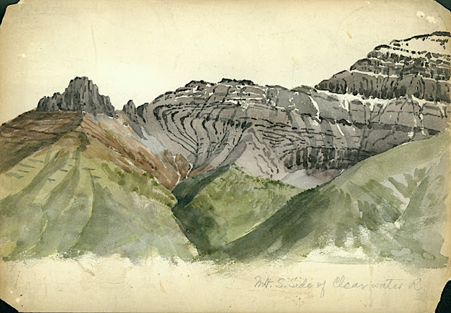
CLYDE PEAK PAINTED BY ARTHUR P. COLEMAN


ARTHUR P. COLEMAN (1852-1939), Clyde Peak (2,624 m - 8,610 f) United States of America (Montana)  In Mountain South Clide, watercolor on paper, 1895 A.P Coleman Funds.


ARTHUR P. COLEMAN (1852-1939)
Clyde Peak (2,624 m - 8,610 ft)
United States of America (Montana)

In Mountain South Clide, watercolor on paper, 1895 A.P Coleman Funds.


The mountain
Clyde Peak 2,624 m- is an 8,610 ft) is  located in Glacier National Park in the U.S. state of Montana. The mountain straddles the border shared by Flathead County and Glacier County. It is situated on the Continental Divide so precipitation runoff from the west side of the mountain drains into Thompson Creek which is part of the Middle Fork Flathead Riverwatershed, and the east side drains into headwaters of Red Eagle Creek, which flows to Red Eagle Lake, thence Saint Mary Lake. It is set in the Lewis Range, and the nearest higher neighbor is Mount Logan 1.44 mile to the northwest. Topographic relief is significant as the southwest aspect rises approximately 4,000 feet (1,220 meters) in one mile.
The mountain's name commemorates Norman Clyde (1885–1972), who made the first ascent of this peak on July 23, 1923.  Clyde is credited with 130 first ascents, most of which were in the Sierra Nevada of California.[ In 1923 he spent 36 days in Glacier National Park, Montana, where he climbed 36 mountains, including 11 first ascents.


The painter
Arthur Philemon Coleman was a Canadian a geologist, professor, minerals prospector, artist, Rockies explorer, backwoods canoeist, world traveller, scientist, popular lecturer, museum administrator, memoirist and... one of Canada’s most beloved scientist.
Arthur Coleman is a fine example of that rare bird, a polished amateur artist whose drawings and paintings stand comfortably beside those of many professionals. He was active during the time when sketching and painting was ceding to photography the task of recording the visible world. Although he was also a photographer, painting was, for him, both a poetic and a descriptive pursuit, a way of wrapping an artistic expression around a phenomenon he was interested in or moved by. Thus motivated, Coleman's paintings give much joy and command a good deal of respect. The more surprising, perhaps given that he used to introduced himself more as a geologist than a painter.
Coleman travelled throughout the United States for professional conferences as well as geological field work. He visited many of the major American mountain ranges including: the American Cordillera Mountains (Washington, Oregon and California); the Sierra Nevada Mountains (California and Nevada); Yellowstone National Park (Wyoming, Montana and Idaho); and the Appalachian Mountains (eastern United States). Pleistocene glaciation had extended in Northern Europe as far south as Berlin and London and covered an area of two million square miles. Coleman also visited such countries as India, Australia, Brazil, Argentina, Scandinavia, Bolivia, New Zealand, South Africa and Uruguay. In his final years he made two expeditions to the Andes in Colombia, to mountains in Southern Mexico and to two mountains in Central America. He achieved the first ascent of Castle Mountain in 1884, and in 1907, he was the first white man to attempt to climb Mount Robson. He made a total of eight exploratory trips to the Canadian Rockies, wholly four of them looking for the mythical giants of Hooker and Brown.
From 1901 to 1922, he was a Professor of Geology at the University of Toronto and was Dean of the Faculty of Arts from 1919 to 1922. From 1931 to 1934, he was a geologist with the Department of Mines of the Government of Ontario. He was elected a Fellow of the Royal Society of Canada in 1900 and was its President in 1921. In 1929, he was appointed Honorary Vice-President of the Royal Canadian Geographical Society.
"Mount Coleman" and "Coleman Glacier" in Banff National Park is named in his honor. He was awarded the Penrose Medal in 1936.
He planned to climb "his" mountain, "Mount Coleman"'in the Albertan Rockies, and had also prepared a trip to British Guiana, but death intervened.
He was author of:
- Reports on the Economic Geology of Ontario (1903)
- Lake Ojibway; Last of the Great Glacial Lakes (1909)
- The Canadian Rockies: New and Old Trails (1911)
- Ice Ages, Recent and Ancient (1926), and was co-author of Elementary Geology (1922).
- The Last Million Years (1941) edited by George F. Kay

 
___________________________________________
2021 - Wandering Vertexes...
by Francis Rousseau