google.com, pub-0288379932320714, DIRECT, f08c47fec0942fa0 GRAVIR LES MONTAGNES... EN PEINTURE: - NORTH AMERICA
Showing posts with label - NORTH AMERICA. Show all posts

Sunday, September 19, 2021

COBB MOUNTAIN PAINTED BY GIDEON JACQUES DENNY


GIDEON JACQUES DENNY (1830-1886),  Cobb Mountain 1440 m - 4723ft United States of America (California)   In City of Lake Port on Clear Lake, 1876. Oil on canvas, Crocker Art Museum

GIDEON JACQUES DENNY (1830-1886)
Cobb Mountain (14,40 m - 4,723 ft)
United States of America (California) 


In City of Lake Port on Clear Lake, 1876. Oil on canvas. Crocker Art Museum, Sacramento 


The painter
Gideon Jacques Denny (1830–1886) was a landscape artist speciailized in marine artist. So the mountains painted in his works are always more or less "accidental" ! Born in Wilmington, Delaware on July 15, 1830, he worked on ships in the Chesapeake Bay. He traveled to California in 1849 with the Gold Rush. He worked as a teamster on the San Francisco docks and was a member of the San Francisco Committee of Vigilance. After two years in California, he moved to Milwaukee, where he studied painting with Samuel Marsden Brookes. After six years of study in Milwaukee, Denny returned to San Francisco and established a studio on Bush Street. In 1862, Brookes moved to San Francisco and shared a studio with Denny. In 1868, Denny spent two months in Hawaii visiting several islands. He is also known to have visited Canada and South America. Denny died of malaria in Cambria. The Berkeley Art Museum and Pacific Film Archive, the Bishop Museum (Honolulu), the Crocker Art Museum (Sacramento, California), the Fine Arts Museums of San Francisco, Monterey Peninsula Museum of Art, and the Oakland Museum of California are among the public collections holding works by Gideon Jacques Denny.

The mountain
The Lakeport area is located on a sediment-filled valley adjacent to Clear Lake. The majority of faults in the County are located in the Cobb Mountain area. Cobb Mountain (1,440 m- 4,720 feet ) is the tallest mountain in the Mayacamas Mountains of California. The mountain also has a sub-peak named Cobb Mountain – Southwest Peak (1367 m- 4483 ft). Southwest Peak lies on the Sonoma-Lake county line and is the highest point in Sonoma County. Nearby tall peaks like Mount Saint Helena and Snow Mountain can be seen from this summit. Cobb Mountain is one of the mountains in the Cobb Mountain Area, many of which have volcanic origin. Others are Boggs Mountain, Mount Hannah and Seigler Mountain. There are isolated small valleys and basins between the mountain peaks. The east end of Cobb Mountain drains into the headwaters of Putah Creek, then into the Sacramento River, the San Francisco Bay, and the Pacific Ocean. The south slopes of Cobb Mountain drain into Anderson Creek, and thence into Putah Creek. The southwest slopes of Cobb Mountain drain into Cobb Creek, thence into Big Sulphur Creek, the Russian River, and into the Pacific. The northwest slopes of Cobb Mountain drain into Alder Creek, thence into Kelsey Creek, Clear Lake, Cache Creek, and the Sacramento River. The northeast slopes of Cobb Mountain drain into Kelsey Creek. Much of Cobb Mountain lies within The Geysers Geothermal Field, and several geothermal plants are located on the mountain. Other areas on the mountain are owned by Cobb Mountain Spring Water (now sold as Mayacamas Mountain Spring Water) or are privately held timberlands. Because much of Cobb Mountain is privately owned, it is largely not accessible to the general public. The mountain is named after John Cobb, the first pioneer to settle in the area. In 1853 he arrived in California and homesteaded in Cobb Valley and went on to become the county assessor and the road overseer for the Clearlake District in 1855. He built a combined saw and gristmill in 1859, which was later destroyed by fire. He sold his interests and moved to Napa County around 1860. The Cobb Mountain area was devastated in 2015 by the Valley Fire, including much of the town of Cobb, as well as several geothermal facilities.

___________________________________________

2021 - Wandering Vertexes...
by Francis Rousseau


Wednesday, August 25, 2021

PICURIS MOUNTAINS PAINTED BY VICTOR HIGGINS


VICTOR HIGGINS ( 1884-1949)   Picuris Mountains (2,967 m -  9,734 feet)  United States of America (New Mexico)    In Taos Mountain, ca. 1940, oil on canvas,
 
VICTOR HIGGINS ( 1884-1949)
Picuris Mountains (2,967 m - 9,734 ft)
United States of America (New Mexico)

In Taos Mountain, ca. 1940, oil on canvas, Private collection 


The mountains
Picuris Mountains (2,967 m - 9,734 feet) is one of the Ridge in Taos County, nearby Osha Canyon and Vallecitos. Named Pikuria – those who paint – by Spanish colonizer Juan de Oñate, Picuris is located 24 miles (38 km) southeast of Taos in the Sangre de Cristo Mountains via N.M. 68, 518, and 75. Picuris, once the largest, today is one of the smallest Tiwa pueblos, with some 1,801 inhabitants (Census 2000). Like Taos, it was influenced by Plains Indian culture, particularly the Apaches
If one like biking, the ride takes you into the scenic and historic part of Picuris Mountains. About 2 miles from the start of this ride you will cross the historic Camino Real, or “Royal Highway,” that served as the original highway to Taos for traders, settlers, and Native Americans traveling north and south for several hundred years.
In late spring through fall this ride is free of snow and dry. It can be pretty beastly pushing up this mountain in the middle of summer. Plan on riding early or late in the day to avoid the heat.

The artist
William Victor Higgins was an American painter and teacher, born at Shelbyville, Indiana. He studied at the Art Institute in Chicago and at the Chicago Academy of Fine Arts.
In Paris he was a pupil of Robert Henri, René Menard and Lucien Simon, and when he was in Munich he studied with Hans von Hayek. He was an associate of the National Academy of Design. Higgins moved to Taos, New Mexico in 1913 and joined in 1917 the Taos Society of Artists founded two years before by Joseph Henry Sharp, W. Herbert Dunton, Eanger Irving Couse et Oscar Edmund Berninghaus.
In 1923 he founded The Hartwood Foundation with Louise Harwood and Bert Phillips. He then painted a lot of works representing the mountains range surrounding the city of Taos and especially the Pueblo Mountains.
During the Depression, he was commissioned to paint a mural inside the Taos County Courthouse financed by the PWAP, titled Moises, El Legislador.

_______________________________

2021 - Wandering Vertexes 
A blog by Francis Rousseau

Saturday, July 24, 2021

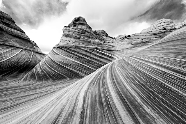
VERMILION CLIFFS PHOTOGRAPHED BY ANSEL ADAMS

ANSEL ADAMS (1902-1984) Vermilion Cliffs (944 m to 2164m - 3,100 to 7,100 feet.) United States of America (Arizona-Utah)


ANSEL ADAMS (1902-1984)
Vermilion Cliffs (944 m to 2164m - 3,100 to 7,100 feet.)
United States of America ( Arizona-Utah)


The site
The Vermilion Cliffs are the second "step" up in the five-step Grand Staircase of the Colorado Plateau, in northern Arizona and southern Utah. They extend west from near Page, Arizona, for a considerable distance, in both Arizona and Utah.  112,500 acres (45,500 ha) of the region were designated as the Paria Canyon-Vermilion Cliffs Wilderness in 1984. An even greater area was protected within Vermilion Cliffs National Monument in 2000. The Vermilion Cliffs are composed of the resistant red sandstone beds of the Lower Jurassic Moenave and Kayenta Formations.  They are made up of deposited silt and desert dunes, cemented by infiltrated carbonates and intensely colored by red iron oxide and other minerals, particularly bluish manganese. They are in the physiographic High Plateaus Section and Canyon Lands Section of the Colorado Plateau Province.  The Vermillion Cliffs were on an important route from Utah to Arizona used by settlers during the 19th Century. Present day U.S. Highway 89A basically follows the old wagon route past the cliffs through House Rock Valley and up the Kaibab Plateau to Jacob Lake.
Famous locations in the cliff area include Lee's Ferry, Glen Canyon and the Glen Canyon National Recreation Area, The Wave, Coyote Buttes, and others. Reddish or vermilion-colored cliffs are found along U.S. Highway 89A near Navajo Bridge, and may be seen from U.S. Highway 89 close to Bitter Springs. Highway 89A runs alongside the Vermilion Cliffs for most of its route between Jacob Lake and Marble Canyon, and offers a great view of the cliffs.

The photographer
Ansel Easton Adams was an American photographer and environmentalist.
His black-and-white landscape photographs of the American West, especially Yosemite National Park, have been widely reproduced on calendars, posters, books, and the internet. Adams and Fred Archer developed the Zone System as a way to determine proper exposure and adjust the contrast of the final print. The resulting clarity and depth characterized his photographs. He primarily used large-format cameras because their high resolution helped ensure sharpness in his images. Adams founded the photography group known as Group f/64, along with fellow photographers Willard Van Dyke and Edward Weston and Imogen Cunningham.
In September 1941, Adams contracted with the Department of the Interior to make photographs of National Parks, Indian reservations, and other locations for use as mural-sized prints for decoration of the Department's new building. Part of his understanding with the Department was that he might also make photographs for his own use, using his own film and processing... 

Full entry

___________________________________________


2021 - Wandering Vertexes...
by Francis Rousseau

Wednesday, June 16, 2021

EL JORULLO SKETCHED BY ALEXANDER VON HUMBOLDT


ALEXANDER VON HUMBOLDT (1769-1859) El Jorullo (1,329m- 4,360ft) Mexico   In Volcan de Jorullo,  Vue des Coridllères et monumens des peuples indigènes de l'Amérique, 1816, Paris chez F. Schoell.

 ALEXANDER VON HUMBOLDT (1769-1859)
El Jorullo (1,329m- 4,360ft)
Mexico

 In Volcan de Jorullo,  Vue des Coridllères et monumens des peuples indigènes de l'Amérique, 1816, Paris chez F. Schoell.


About this drawing
Alexander von Humboldt climbed El Jorullo during the Mexican portion of his scientific expedition to Spanish America. When he visited on 19 September 1803, its multiple cones were still smoldering and the air was extremely hot and filled with volcanic gases. He wrote a detailed description of the climb, noting that his face and those of his travel companions were burned. The volcano enriched the local soil and there was considerable vegetation. Humboldt sketched the volcano in the distance (see above), showing multiple smoking cones. Humboldt undertook the climb with his scientific travel partner Aimé Bonpland, as well as a local Basque settler Ramón Epelde, and two local indigenous servants, whose names have not been recorded. Humboldt noted their assistance on site. Humboldt also notes that he consulted a 1782 publication Rusticatio Mexicana, by Rafael Landívar, who calculated the height of the volcano and the temperature of the thermal waters.


The volcano
El Jorullo  (1,329m- 4,360ft) is a cinder cone volcano in Michoacán, central Mexico, on the southwest slope of the central plateau, 33 miles (53 kilometers) southeast of Uruapan in an area known as the Michoacán-Guanajuato volcanic field.  It is about 6 miles (10 km) east-northeast of La Huacana.  El Jorullo has four smaller cinder cones which have grown from its flanks.  El Jorullo's crater is about 1,300 by 1,640 feet (400 by 500 m) wide and 490 feet (150 m) deep.   El Jorullo is one of two known volcanoes to have developed in Mexico in recent history. The second, born about 183 years later, was named Parícutin after a nearby village that it eventually destroyed. Parícutin is about 50 miles (80 km) northwest of El Jorullo. El Jorullo was first erupted on 29 September 1759. Earthquakes occurred prior to this first day of eruption. Once the volcano started erupting, it continued for 15 years, eventually ending in 1774.
El Jorullo did not develop on a corn field like Parícutin did, but it did destroy what had been a rich agricultural area. It grew approximately 820 feet (250 meters) from the ground in the first six weeks. The eruptions from El Jorullo were primarily phreatic and phreatomagmatic. This 15 year eruption was the longest one El Jorullo has had, and was the longest cinder cone eruption known. Lava flows can still be seen to the north and west of the volcano.  Parícutin and El Jorullo both rose in an area known for its volcanoes. Called the Trans-Mexican Volcanic Belt, the region stretches about 700 miles (1,120 km) from east to west across southern Mexico. The eruptive activity deposited a layer of volcanic rock some 6,000 feet thick, creating a high and fertile plateau. During summer months, the heights snag moisture-laden breezes from the Pacific Ocean; rich farmland, in turn, has made this belt the most populous region in Mexico. Though the region already boasted three of the country's four largest cities: Mexico City, Puebla, and Guadalajara (the area around Parícutin, some 200 miles west of the capital), it was still a peaceful backwater inhabited by Purépecha in the early 1940s. The crater and lake can now be reached by car.


The artist
Friedrich Wilhelm Heinrich Alexander von Humboldt was a Prussian geographer, naturalist, explorer, and influential proponent of Romantic philosophy and science. He was the younger brother of the Prussian minister, philosopher, and linguist Wilhelm von Humboldt (1767–1835). Humboldt's quantitative work on botanical geography laid the foundation for the field of biogeography. Humboldt's advocacy of long-term systematic geophysical measurement laid the foundation for modern geomagnetic and meteorological monitoring.
Between 1799 and 1804, Humboldt travelled extensively in Latin America, exploring and describing it for the first time from a modern scientific point of view. His description of the journey was written up and published in an enormous set of volumes over 21 years. Humboldt was one of the first people to propose that the lands bordering the Atlantic Ocean were once joined (South America and Africa in particular). Humboldt resurrected the use of the word cosmos from the ancient Greek and assigned it to his multi-volume treatise, Kosmos, in which he sought to unify diverse branches of scientific knowledge and culture. This important work also motivated a holistic perception of the universe as one interacting entity.
On their way back to Europe from Mexico on their way to the United States, Humboldt and his fellow scientist Aimé Bonpland stopped in Cuba for a while. After their first stay in Cuba of three months they returned the mainland at Cartagena de Indias (now in Colombia), a major center of trade in northern South America. Ascending the swollen stream of the Magdalena River to Honda and arrived in Bogotá on July 6, 1801 where they met Spanish botanist José Celestino Mutis, the head of the Royal Botanical Expedition to New Granada, staying there until September 8, 1801. Mutis was generous with his time and gave Humboldt access to the huge pictorial record he had compiled since 1783. Humboldt had hopes of connecting with the French sailing expedition of Baudin, now finally underway, so Bonpland and Humboldt hurried to Ecuador. They crossed the frozen ridges of the Cordillera Real, they reached Quito on 6 January 1802, after a tedious and difficult journey.
Their stay in Ecuador was marked by the ascent of Pichincha and their climb of Chimborazo, where Humboldt and his party reached an altitude of 19,286 feet (5,878 m). This was a world record at the time, but a thousand feet short of the summit. Humboldt's journey concluded with an expedition to the sources of the Amazon en route for Lima, Peru.
At Callao, the main port for Peru, Humboldt observed the transit of Mercury. On 9 November and studied the fertilizing properties of guano, rich in nitrogen, the subsequent introduction of which into Europe was due mainly to his writings.

___________________________________________ 


2021 - Wandering Vertexes and Mountain paintings 
by Francis Rousseau

Wednesday, June 2, 2021

ODORAY MOUNTAIN PAINTED BY J.E.H. MACDONALD

J.E.H. MACDONALD (1873-1932) Odoray mountain (3,137 m- 10,292 ft) Canada (British Columbia)


J.E.H. MACDONALD (1873-1932)
Odoray mountain (3,137 m- 10,292 ft)
Canada (British Columbia)

In Mont Odoray, 1930, Huile sur carton, 21,6 x 26,7cm, Musée des beaux-arts du Canada, Ottawa


The mountain
Odaray Mountain (3,137-m - 10,292 ft) is a summit located west of Lake O'Hara in the Bow Range of Yoho National Park, in the Canadian Rockies of British Columbia, Canada. Its nearest higher peak is Mount Huber, 3.86 km (2.40 mi) to the east. The standard climbing route follows the southeast glacier and ridge starting from Elizabeth Parker hut. Pronunciation sounds like the two words "ode array". Odaray Mountain is composed of sedimentary rock laid down during the Precambrian to Jurassic periods. Formed in shallow seas, this sedimentary rock was pushed east and over the top of younger rock during the Laramide orogeny. The first ascent of the mountain was made in 1887 by James J. McArthur, and he named it Odaray which is the expression for "many waterfalls" in the Stoney language. Other reports have it being named in 1894 by Samuel Evans Stokes Allen for the Stoney Indianword for "cone". However, it is possible that McArthur only ascended the lesser secondary summit cone (2965 m) now known as Little Odaray which is southeast of the true summit. The mountain's current name became official in 1952 when the Geographical Names Board of Canada rescinded the name Mount Odaray.

The artist
James Edward Hervey MacDonald RCA was an English-Canadian artist who initiated the first major Canadian national art movement. He was the father of the illustrator Thoreau MacDonald. n 1895, MacDonald took a position as a commercial designer at Grip Ltd, an important commercial art firm, where he further developed his design skills. In the coming years, he encouraged his colleagues—including future artist Tom Thomson—to develop their skills as painters. In 1920, MacDonald co-founded the Group of Seven, which dedicated itself to promoting a distinct Canadian art developed through direct contact with the Canadian landscape. The other founding members were Frederick Varley, A. Y. Jackson, Lawren Harris, Frank Johnston, Arthur Lismer, and Franklin Carmichael. MacDonald had worked with Lismer, Varley, Johnston, and Carmichael at the design firm Grip Ltd. in Toronto. Together they initiated the first major Canadian national art movement, producing paintings directly inspired by the Canadian landscape. Every summer beginning in 1924, MacDonald travelled to the Canadian Rockies to paint the mountainous landscapes that dominated his later work. By this time he had become somewhat alienated from the rest of the Group of Seven, as many of the younger members were beginning to paint in a more abstract manner.  Today, MacDonald is viewed with general admiration for his art, with one writer commenting, "no Canadian landscape painter possessed a richer command of colour and pigment than J. E. H. MacDonald ... His brushwork is at once disciplined and vigorous. His best on-the-spot sketches possess an intensity and freshness of execution not dissimilar from Van Gogh."

______________________________________

2021 - Wandering Vertexes...
by Francis Rousseau

Saturday, May 29, 2021

LONGS PEAK PAINTED BY THOMAS WORTHINGTON WHITTREDGE


THOMAS WORTHINGTON WHITTREDGE (1820-1910) Longs Peak (4,346 m - 14, 259 ft) United States of America (Colorado)  In Longs Peak (Colorado), oil on canvas, c1870, Museum of Fine Arts, Boston, american painter


THOMAS WORTHINGTON WHITTREDGE (1820-1910)
Longs Peak (4,346 m - 14, 259 ft)
United States of America (Colorado)

In Longs Peak (Colorado), oil on canvas, c1870, Museum of Fine Arts, Boston 


The mountain
Longs Peak (4,346 m - 14, 259 ft) is a high and prominent mountain summit in the northern Front Range of the Rocky Mountains of North America. This fourteener is located in the Rocky Mountain National Park Wilderness, 9.6 miles (15.5 km) southwest by south (bearing 209°) of the town of Estes Park, Colorado, United States. Longs Peak is the northernmost fourteener in the Rocky Mountains and the highest point in Boulder County and Rocky Mountain National Park. The mountain was named in honor of explorer Stephen Harriman Long and is featured on the Colorado state quarter. Longs Peak can be prominently seen from Longmont, Colorado, as well as from most of the northern Front Range Urban Corridor, being is one of the most prominent mountains in Colorado, rising 9,000 feet (2,700 m) above the western edge of the Great Plains. The peak is named for Major Stephen Long, who is said to be the first to spot the great mountains on behalf of the U.S. Government on June 30, 1820. Together with the nearby Mount Meeker, the two are sometimes referred to as the Twin Peaks (not to be confused with a nearby lower mountain called Twin Sisters). As the only fourteener in Rocky Mountain National Park, the peak has long been of interest to climbers. The easiest route is not "technical" during the summer season. It was probably first used by pre-Columbian indigenous people collecting eagle feathers.

The first recorded ascent was in August 23, 1868 by the surveying party of John Wesley Powell via the south side. The East Face of the mountain is 1,675 feet steep and is surmounted by a 1,000 feet steep sheer cliff known as "The Diamond" (so-named because of its shape, approximately that of a cut diamond seen from the side and inverted - see image at right).  The oldest person to summit Longs Peak was Rev. William "Col. Billy" Butler, who climbed it on September 2, 1926, his 85th birthday. In 1932, Clerin “Zumie” Zumwalt summited Longs Peak 53 times.
Longs Peak has one remaining glacier named Mills Glacier. The glacier is located around 12,800 feet (3,900 m) at the base of the Eastern Face, just above Chasm Lake. A permanent snowfield, called The Dove, is located north of Longs Peak. Longs Peak is one of fewer than 50 mountains in Colorado that have a glacier.


The painter
Thomas Worthington Whittredge was an American artist of the Hudson River School. Whittredge was a highly regarded artist of his time, and was friends with several leading Hudson River School artists including Albert Bierstadt and Sanford Robinson Gifford. He traveled widely and excelled at landscape painting, many examples of which are now in major museums. He served as president of the National Academy of Design from 1874 to 1875 and was a member of the selection committees for the 1876 Philadelphia Centennial Exposition and the 1878 Paris Exposition, both important venues for artists of the day.  Whittredge journeyed across the Great Plains to the Rocky Mountains in 1865 with Sanford Gifford and John Frederick Kensett. The trip resulted in some of Whittredge's most important works—unusually oblong, sparse landscapes that captured the stark beauty and linear horizon of the Plains. Whittredge later wrote in his autobiography, "I had never seen the plains or anything like them. They impressed me deeply. I cared more for them than for the mountains... Whoever crossed the plains at that period, notwithstanding its herds of buffalo and flocks of antelope, its wild horses, deer and fleet rabbits, could hardly fail to be impressed with its vastness and silence and the appearance everywhere of an innocent, primitive existence."
______________________________________

2021 - Wandering Vertexes...
by Francis Rousseau

Wednesday, March 24, 2021

BLACK MESA ( 2) PAINTED BY GEORGIA O'KEEFFE

 
GEORGIA O' KEEFFE (1887-1986)
Black Mesa (1,739 m - 5,705 ft)
United States of America (Colorado, New Mexico, and Oklahoma)

In Mesa and Road East, oil on canvas, 1952, Private collection


The mountain
Black Mesa (1,739 m - 5,705 feet) is a mesa in the U.S. states of Colorado, New Mexico, and Oklahoma. It extends from Mesa de Maya, Colorado southeasterly 28 miles (45 km) along the north bank of the Cimarron River, crossing the northeast corner of New Mexico to end at the confluence of the Cimarron River and Carrizo Creek near Kenton in the Oklahoma panhandle. Its highest elevation is in Colorado. The highest point of Black Mesa within New Mexico is 1,597 m - 5,239 feet. The plateau that formed at the top of the mesa has been known as a "geological wonder" of North America. There is abundant wildlife in this shortgrass prairie environment, including mountain lions, butterflies, and the Texas horned lizard. The plateau has been home to Plains Indians. In the late-nineteenth and early twentieth century the area was a hideout for outlaws such as William Coe and Black Jack Ketchum. The outlaws built a fort known as the Robbers' Roost. The stone fort housed a blacksmith shop, gun ports, and a piano. The present-day Oklahoma Panhandle area, which was then considered a no man's land, lacked law enforcement agencies and hence the outlaws found it safe to hide in the region. However, as new settlers arrived in the area for copper and coal mining and also for cattle ranching activities by grazing cattle in the mesa region, law enforcement became more effective, and the outlaws were brought under control.


The painter
Georgia O’Keeffe is one of the most significant and intriguing artists of the twentieth century, known internationally for her boldly innovative art. Her distinct flowers, dramatic cityscapes, glowing landscapes, and images of bones against the stark desert sky are iconic and original contributions to American Modernism.
Born on November 15, 1887, the second of seven children, Georgia Totto O’Keeffe grew up on a farm near Sun Prairie, Wisconsin. She studied at the Art Institute of Chicago in 1905-1906 and the Art Students League in New York in 1907-1908. Under the direction of William Merritt Chase, F. Luis Mora, and Kenyon Cox she learned the techniques of traditional realist painting. The direction of her artistic practice shifted dramatically in 1912 when she studied the revolutionary ideas of Arthur Wesley Dow. Dow’s emphasis on composition and design offered O’Keeffe an alternative to realism. She experimented for two years, while she taught art in South Carolina and west Texas. Seeking to find a personal visual language through which she could express her feelings and ideas, she began a series of abstract charcoal drawings in 1915 that represented a radical break with tradition and made O’Keeffe one of the very first American artists to practice pure abstraction.
O’Keeffe mailed some of these highly abstract drawings to a friend in New York City, who showed them to Alfred Stieglitz. An art dealer and internationally known photographer, he was the first to exhibit her work in 1916. He would eventually become O’Keeffe’s husband.
In the summer of 1929, O’Keeffe made the first of many trips to northern New Mexico. The stark landscape, distinct indigenous art, and unique regional style of adobe architecture inspired a new direction in O’Keeffe’s artwork. For the next two decades she spent part of most years living and working in New Mexico . She made the state her permanent home in 1949, three years after Stieglitz’s death. O’Keeffe’s New Mexico paintings coincided with a growing interest in regional scenes by American Modernists seeking a distinctive view of America. Her simplified and refined representations of this region express a deep personal response to the high desert terrain.
In the 1950s, O’Keeffe began to travel internationally. She created paintings that evoked a sense of the spectacular places she visited, including the mountain peaks of Peru and Japan’s Mount Fuji. At the age of seventy-three she embarked on a new series focused on the clouds in the sky and the rivers below.
Suffering from macular degeneration and discouraged by her failing eyesight, O’Keeffe painted her last unassisted oil painting in 1972. But O’Keeffe’s will to create did not diminish with her eyesight. In 1977, at age ninety, she observed, “I can see what I want to paint. The thing that makes you want to create is still there.”
Late in life, and almost blind, she enlisted the help of several assistants to enable her to again create art. In these works she returned to favorite visual motifs from her memory and vivid imagination.
Georgia O’Keeffe died in Santa Fe, on March 6, 1986, at the age of 98.

___________________________________________
2021 - Wandering Vertexes...
by Francis Rousseau 


Sunday, February 28, 2021

MOUNT HUBER PAINTED BY ROBERT GENN


https://wanderingvertexes.blogspot.com/2021/02/mount-huber-painted-by-robert-genn.html


ROBERT GENN (1936-2014)
Mount Huber (3,348 m - 10,984 ft)
Canada (British Columbia)

 In  Chinook over O' Hara, oil on canvas, 1970, Private collection  


The mountain
Mount Huber (3,348 m - 10,984 ft) summit located two kilometers east of Lake O'Hara in the Bow Range of Yoho National Park, in the Canadian Rockies of British Columbia, Canada. Its nearest higher peak is Mount Victoria, 1.0 km (0.62 mi) to the north-northeast. Mount Huber is a secondary summit of Mount Victoria which is on the Continental Divide. Named in 1903 by Samuel Allen for Emil Huber, a Swiss climber, who, with Carl Sulzer, were first to climb Mount Sir Donald in the Selkirk Mountains. The first ascent of the Mount Huber was made in 1903 by George Collier, E. Tewes, Christian Bohren, and Christian Kaufmann. The mountain's name became official in 1924 when approved by the Geographical Names Board of Canada. Mount Huber is composed of sedimentary rock laid down during the Precambrian to Jurassic periods. Formed in shallow seas, this sedimentary rock was pushed east and over the top of younger rock during the Laramide orogeny. Based on the Köppen climate classification, Mount Huber is located in a subarctic climate with cold, snowy winters, and mild summers ] Temperatures can drop below −20 °C with wind chill factors below −30 °C. Precipitation runoff from Mount Huber drains into tributaries of the Kicking Horse River which is a tributary of the Columbia River.

The painter
Robert Douglas Genn was a Canadian artist, who has gained recognition for his style, which is in the tradition of Canadian landscape painting. His work is in corporate and public collections, including Air Canada, Bank Of Montreal, Canadian General Insurance, Canadian Airlines, Canadian Utilities, The Churchill Corporation, Expo '86, Esso Resources, First City - California II, Highfield Oil & Gas, Molson Brewery Ltd., Montreal Trust, Shell Resources, University of Alberta, Westgate Chevrolet, Glenbow Museum and Government of Belgium.
Born in Victoria, British Columbia, Genn has often been compared with members of the 1920s Canadian Group of Seven. In 1961, he met Lawren Harris who was a neighbour in Point Grey, Vancouver. Genn had problems with painting skies, and Harris's advice was to turn the picture upside-down: "Paint down from the trees to the clouds at the bottom of the picture to get the perspective right." Genn said this was "valuable advice", which enabled him "to control the gradation, and work up into the trees in a more abstract manner."
He ran the Painter's Keys web site, a worldwide artists' community, with his staff and volunteers. The web site sends out an erudite free twice-weekly newsletter, which is sent to 135,000 artists in over 100 countries, and claims the largest collection of art quotes online with over 5,382 authors quoted.
In 2005, Genn campaigned against the Chinese website, arch-world.com, which was selling thousands of high-resolution images of around 2,800 artists' work illegally, without permission. After failing to gain support from the Canadian government or the African embassy in Ottawa, Genn used his web site to enlist subscribers' support to email objections to the arch-world, resulting within days in over 1,000 online complaints from artists, dealers and politicians to the company and governments. This stimulated a diplomatic protest letter to the Chinese Ministry of Commerce, Trading and Law Department from the Canadian Embassy in Beijing. Genn credited the campaign with the subsequent removal of images by 800 Canadian artists from arch-world, although many works were reinstated on arch-world soon after.
Genn has been a member of the Board of Directors at Emily Carr College of Art & Design.
Genn announced in his Twice-Weekly Letter of 25 October 2013 that he had been diagnosed with pancreatic cancer. He died at his Surrey, British Columbia home on 27 May 2014.

___________________________________________
2021 - Wandering Vertexes...
by Francis Rousseau 


Thursday, February 25, 2021

THE GRAND TETON (3) PAINTED BY EVE DREWELOWE


https://wanderingvertexes.blogspot.com/2021/02/the-grand-teton-3-painted-by-eve.html

EVE DREWELOWE (1899-1988)
Grand Teton  (4,199 m - 13,775 ft)
United States of America (Wyoming)

In Sunlit sumit (Grand Teton) watercolor, 1949- Collection Kirkland, Museum of Fine & Decorative Art.

 
About this painting
This watercolor is a variation painted almost 10 years after a first watercolor dating from the 1930s, in exactly the same place but in a different season, in warmer colors and, as we can see, on a day when the sun appeared between the clouds.

The mountain
Grand Teton (4,199 m - 13,775 ft) is the highest mountain in Grand Teton National Park in Northwest Wyoming, and a classic destination in American mountaineering. It is the highest point of the Teton Range, and the second highest peak in the U.S. state of Wyoming after Gannett Peak. The mountain is entirely within the Snake River drainage basin, which it feeds by several local creeks and glaciers.The Teton Range is a subrange of the Rocky Mountains, which extend from southern Alaska to northern New Mexico.
Grand Teton's name was first recorded as Mount Hayden by the Washburn-Langford-Doane Expedition of 1870. However, the name "the Grand Teton" had early currency. The Edition of April, 1901 of the USGS 1:125,000 quadrangle map of the area shows "Grand Teton" as the name of the peak. A United States National Park named "Grand Teton National Park" was established by law in 1929. By 1931, the name Grand Teton Peak was in such common usage that it was recognized by the USGS Board on Geographic Names. Another shift in usage led the Board to shorten the name on maps to Grand Teton in 1970. The origin of the name is disputed. The most common explanation is that "Grand Teton" means "large teat" in French, named by either French-Canadian or Iroquois members of an expedition led by Donald McKenzie of the North West Company. However, other historians disagree, and claim that the mountain was named after the Teton Sioux tribe of Native Americans.

The painter
Eve Drewelowe was an American painter. Her career spanned six decades and produced more than 1,000 works of art in oil, watercolor, pen and ink and other media in styles that included impressionism, social realism and abstraction.
Despite dabbling with other artistic styles, Drewelowe always showed an inclination toward landscapes. She once said: “my waking thought from an embryo on was my need to be an artist.”
Though never known to have used the word to describe herself, Eve Drewelowe is often considered a feminist artist. Her personal life exhibited feminist themes: the artist retained her maiden name and publicly stated a disinterest in housework and parenting. Drewelowe chose not to take her husband’s last name because in her opinion it should not matter to others whether she is married or not. When Drewelowe and Van Ek returned from their travels and started building a house together. She did not want to be involved in the pleasantries of being the dean’s wife, especially hosting dinner parties, so she specified to have the house built lacking a dining room. She always maintained that she did not want to have children of her own, much to her mother’s dismay.
Although Drewelowe is mainly renowned in Colorado and Iowa, she had solo exhibitions all over the country. Her work was shown at National Association of Women Artists exhibitions, the Art Institute of Chicago, the Denver Art Museum, the National Museum of Women in the Arts and numerous other esteemed institutions. Although women had been in the profession of art for 20–30 years at the beginning of Drewelowe’s career, she still faced opposition and sexism. Critics believe that she could have been much more acclaimed had she not been a woman and had she not fallen ill at the peak of her career. Others believe that her “reincarnation” and transition to abstract paintings increased Drewelowe’s popularity as an artist by keeping her relevant in an evolving artistic world.

___________________________________________

2021 - Wandering Vertexes...
by Francis Rousseau


Saturday, January 16, 2021

POPOCATEPETL AND IZTACCHIHUATL (6) PAINTED BY JOSÉ MARIRA VELASCO


JOSE MARIA VELASCO (1840-1912)
Popocatépetl (5, 426 m -17, 802 ft) on left)
Iztaccíhuatl (5,230 m - 17,160 ft) (on right)
Mexico

In Popocatepetl and Iztacchihuatl , 1895, watercolor, The José María Velasco Museum, Mexico


The volcanoes
Popocatépetl (5,426 m - 17,802 ft), on right in this painting, is an active volcano, located in the states of Puebla, Mexico, and Morelos, in Central Mexico, and lies in the eastern half of the Trans-Mexican volcanic belt. The name Popocatépetl comes from the Nahuatl words Popōca (It smokes) and Tepētl (mountain), meaning Smoking Mountain. It is the second highest peak in Mexico, after Citlaltépetl (Pico de Orizaba) at 5,636 m (18,491 ft).
It is linked to the Iztaccihuatl volcano to the north by the high saddle known as the Paso de Cortés.
Popocatépetl is 70 km (43 mi) southeast of Mexico City, from where it can be seen regularly, depending on atmospheric conditions. Until recently, the volcano was one of three tall peaks in Mexico to contain glaciers, the others being Iztaccihuatl and Pico de Orizaba.
Iztaccíhuatl (5,230 m - 17,160 ft) is dormant volcanic mountain in Mexico located on the border between the State of Mexico and Puebla. It is the nation's third highest, after Pico de Orizaba 5,636 m (18,491 ft) and Popocatépetl 5,426 m (17,802 ft). The name "Iztaccíhuatl" is Nahuatl for "White woman", reflecting the four individual snow-capped peaks which depict the head, chest, knees and feet of a sleeping female when seen from east or west.The peak is sometimes nicknamed La Mujer Dormida (The Sleeping Woman.) Iztaccíhuatl is to the north of Popocatépetl, to which it is connected by the high altitude Paso de Cortés. Depending on atmospheric conditions Iztaccíhuatl is also visible much of the year from Mexico City some 70 km (43 mi) to the northwest.
The first recorded ascent was made in 1889, though archaeological evidence suggests the Aztecs and previous cultures climbed it previously. It is the lowest peak containing permanent snow and glaciers in Mexico.
In Aztec mythology : Iztaccíhuatl was a princess who fell in love with one of her father's warriors, Popocatépetl. The emperor sent Popocatépetl to war in Oaxaca, promising him Iztaccíhuatl as his wife when he returned (which Iztaccíhuatl's father presumed he would not). Iztaccíhuatl was falsely told that Popocatépetl had died in battle, and believing the news, she died of grief. When Popocatépetl returned to find his love dead, he took her body to a spot outside Tenochtitlan and kneeled by her grave. The gods covered them with snow and changed them into mountains.
Popocatépetl became an active volcano, raining fire on Earth in blind rage at the loss of his beloved.

The painter

José Maria Tranquilino Francisco de Jesus Velasco Gomez Obregуn, generally known as José Maria Velasco, was a 19th-century Mexican polymath, most famous as a painter who made Mexican geography a symbol of national identity through his paintings. He was both one of the most popular artists of the time and internationally renowned. He received many distinctions such as the gold medal of the Mexican National Expositions of Bellas Artes in 1874 and 1876; the gold medal of the Philadelphia International Exposition in 1876, on the centenary of U.S. independence; and the medal of the Paris Universal Exposition in 1889, on the centenary of the outbreak of the French Revolution. His painting El valle de Mexico is considered Velasco's masterpiece, of which he created seven different renditions. Of all the nineteenth-century painters, Velasco was the "first to be elevated in the post-Revolutionary period as an exemplar of nationalism."
Velasco's long career elevated Mexican landscape painting to international standing. One of his landscapes of the Valley of Mexico is in the Vatican Museum, a gift to Pope Leo XIII. His scenes of the Mexican landscape are a visual source for environmental historians, since they show the Valley of Mexico before its degradation in the twentieth century, with air pollution and urban sprawl. His landscape art has a wide appeal, since it is more accessible than history paintings that require the viewer to understand a particular event.
Today the Government of the State of Mexico, where Velasco was from, presents an award for artistic merit in his name to painters born in that state. Among the most outstanding winners are Luis Nishizawa, Leopoldo Flores, Ignacio Barrios and Héctor Cruz.
The José María Velasco Museum was opened in 1992 in Toluca City with the task of preserving and promoting his paintings.

_______________________________

2021 - Wandering Vertexes...
by Francis Rousseau

Wednesday, January 13, 2021

CRISTO MOUNTAINS PAINTED BY WILLIAM VICTOR HIGGINS


https://wanderingvertexes.blogspot.com/2021/01/cristo-mountains-painted-by-william.html

WILLIAM VICTOR HIGGINS (1884-1949)
Cristo mountains (4,374m-14, 351ft)
United States of America (Colorado and New Mexico)

In  Taos mountains New Mexico, 1921, oil on canvas

The mountains
Cristo mountains (culminating at Bianca Peak 4,374m-14, 351ft ), origanally The Sangre de Cristo Mountains (Spanish for "Blood of Christ") are the southernmost subrange of the Rocky Mountains. They are located in southern Colorado and northern New Mexico in the United States. The mountains run from Poncha Pass in South-Central Colorado, trending southeast and south, ending at Glorieta Pass, southeast of Santa Fe, New Mexico. The mountains contain a number of fourteen thousand foot peaks in the Colorado portion, as well as all the peaks in New Mexico which are over thirteen thousand feet.
The name of the mountains may refer to the occasional reddish hues observed during sunrise and sunset, and when alpenglow occurs, especially when the mountains are covered with snow. Although the particular origin of the name is unclear, it has been in use since the early 19th century. Before that time the terms "La Sierra Nevada", "La Sierra Madre", "La Sierra", and "The Snowies" (used by English speakers) were used. According to tradition, "sangre de Cristo" were the last words of a Catholic priest who was killed by Indians.

The artist
William Victor Higgins was an American painter and teacher, born at Shelbyville, Indiana. He studied at the Art Institute in Chicago and at the Chicago Academy of Fine Arts.
In Paris he was a pupil of Robert Henri, René Menard and Lucien Simon, and when he was in Munich he studied with Hans von Hayek. He was an associate of the National Academy of Design. Higgins moved to Taos, New Mexico in 1913 and joined in 1917 the Taos Society of Artists founded two years before by Joseph Henry Sharp, W. Herbert Dunton, Eanger Irving Couse et Oscar Edmund Berninghaus.
In 1923 he founded The Hartwood Foundation with Louise Harwood and Bert Phillips. He then painted a lot of works representing the mountains range surrounding the city of Taos and especially the Pueblo Mountains.
During the Depression, he was commissioned to paint a mural inside the Taos County Courthouse financed by the PWAP, titled Moises, El Legislador. 

_______________________________

2021 - Wandering Vertexes / Mountain paintings
By Francis Rousseau

Thursday, January 7, 2021

MOUNT BURKE & BAY OF ISLANDS PAINTED BY FRANKLIN CARMICHAEL

https://wanderingvertexes.blogspot.com/2021/01/mount-burke-bay-of-islands-painted-by.html


FRANKLIN CARMICHAEL (1890–1945)
Mount Burke (1,270 m  - 4,167 ft)
Canada (British Columbia)

In Bay of Islands from Mt. Burke, 1931, oil on canvas, 101.6 x 122.0 cm, 

McMichael Canadian Art Collection


The mountain

Mount Burke (1,270 m (4,167 ft), is a mountain located in northeast Coquitlam, British Columbia, north of Port Coquitlam on the ridge system leading to Coquitlam Mountain. Most of the mountain is part of Pinecone Burke Provincial Park.   Mount Burke was named for Edmund Burke by Captain George Henry Richards of HMS Plumper while surveying Burrard Inlet in 1859.
The mountain was placed in Pinecone Burke Provincial Park on the park's creation in 1995.
Many people confuse Mount Burke, with the much higher and larger Burke Ridge, which is more commonly known as Burke Mountain, and in the 1920s Burke Ridge was more commonly known as Dollar Mountain, after the Canadian Robert Dollar Company, who logged the lower portions of the mountain.

The artist
Franklin Carmichael was a Canadian artist and member of the Group of Seven. Though he was primarily famous for his use of watercolours, he also used oil paints, charcoal and other media to capture the Ontario landscapes of which he was fond. Besides his work as a painter, he worked as a designer and illustrator, creating promotional brochures, advertisements in newspapers and magazines, and stylizing books. Near the end of his life, Carmichael taught in the Graphic Design and Commercial Art Department at the Ontario College of Art (today the Ontario College of Art and Design). The youngest original member of the Group of Seven, Carmichael often found himself socially on the outside of the group. Despite this, the art he produced was of equal measure in terms of style and approach to the other members' contributions, vividly expressing his spiritual views through his art.  Carmichael was a passionate landscape painter. Many of his paintings depict the trees, rocks, hills, and mountains of Ontario. His earlier works had flat juxtapositions of colour, but as he matured through the 1920s he emphasized depth and three dimensional space. Beyond simple representation of picturesque views, Carmichael attempted to capture contrast.  Contemporary Emily Carr wrote that Carmichael's work was, "A little pretty and too soft, but pleasant."Carmichael was a member of the Royal Canadian Academy of Arts.  In 1952, Dr. Ann Curtin and Carmichael's widow founded the Franklin Carmichael Art Group, now located at 34 Riverdale Drive in Toronto.


__________________________________________

2021 - Wandering Vertexes / Mountain paintings
By F rancis Rousseau


Sunday, October 25, 2020

MUIR GLACIER PAINTED BY THOMAS HILL

THOMAS HILL (1829-1908) Muir Glacier (90 m - 200 ft) United States of America ( Alaska)


THOMAS HILL (1829-1908)
Muir Glacier (90 m - 200 ft)
United States of America ( Alaska)

In Muir Glacier, Alaska. oil on canvas, Oakland Museum of California

The Glacier
Muir Glacier is a glacier in Glacier Bay National Park and Preserve in the U.S. state of Alaska. It is currently about 0.7 km (0.43 mi) wide at the terminus. As recently as the mid-1980s the glacier was a tidewater glacier and calved icebergs from a wall of ice 90 m (200 feet) tall.
The glacier is named after Scottish-born naturalist John Muir, who traveled around the area and wrote about it, generating interest in the local environment and in its preservation. His first two visits were in 1879 (at age 41) and 1880. During the visits, he sent an account of his visits in installments to the San Francisco Bulletin. Later, he collected and edited these installments in a book, Travels in Alaska, published in 1915, the year after he died.
Muir Glacier has undergone very rapid, well-documented retreat since its Little Ice Age maximum position at the mouth of Glacier Bay around 1780. In 1794, the explorer Captain George Vancouver found that most of Glacier Bay was covered by an enormous ice sheet, some 1,200 meters (3,900 ft) in places.
In 1904 the glacier reportedly "broke through the mountains" with Pyramid Peak to the west and Mt. Wright and Mount Case to the east.
From 1892 to approximately 1980, it had retreated nearly 32 kilometers (20 mi). Between 1941 and 2004, the glacier retreated more than 12 kilometers (7.5 mi) and thinned by over 800 meters (2,600 ft). Ocean water has filled the valley replacing the ice and creating Muir Inlet.


The painter
Thomas Hill was an American artist of the 19th century. He produced many fine paintings of the California landscape, in particular of the Yosemite Valley, as well as the White Mountains of New Hampshire. Hill’s work was often driven by a vision resulting from his experiences with nature. For Thomas Hill, Yosemite Valley and the White Mountains of New Hampshire were his sources of inspiration to begin painting and captured his direct response to nature.
Hill was loosely associated with the Hudson River School of painters. The Hudson River School celebrated nature with a sense of awe for its natural resources, which brought them a feeling of enthusiasm when thinking of the potential it held. Mainly the earlier members of the Hudson River School, around the 1850-60’s, displayed man as in unison with nature in their landscape paintings by often painting men on a very small scale compared to the vast landscape. Thomas Hill often brought this technique into his own paintings in for example in his painting, Yosemite Valley, 1889.
He made early trips to the White Mountains with his friend Benjamin Champney and painted White Mountain subjects throughout his career. An example of his White Mountain subjects is Mount Lafayette in his Mount Lafayette in Winter.
Hill acquired the technique of painting en plein air. These paintings in the field later served as the basis for larger finished works. In plein air means to “paint outdoors and directly from the landscape”,[ which Hill incorporated into many of his paintings. Hill’s landscape paintings demonstrate how he combined his powers of observation with powerful motifs in each painting.
Hill’s move to California in 1861 brought him new material for his paintings. He chose monumental vistas, like Yosemite. During his lifetime, Hill’s paintings were popular in California, costing as much as $10,000. Hill's best works are considered to be these monumental subjects, including Great Canyon of the Sierra, Yosemite, Vernal Falls and Yosemite Valley.

___________________________________________

2020 - Wandering Vertexes...
by Francis Rousseau

Saturday, October 17, 2020

CADILLAC MOUNTAIN BY SANFORD ROBINSON GIFFORD


SANFORD ROBINSON GIFFORD (1823-1880) Cadillac Mountain (466 m - 1,530 ft) United States of America (Maine)  In The Artist Sketching at Mount Desert, Maine, oil on canvas 1860s,  National Gallery of art, Washington DC

SANFORD ROBINSON GIFFORD (1823-1880)
Cadillac Mountain (466 m - 1,530 ft)
United States of America (Maine)

In The Artist Sketching at Mount Desert, Maine, oil on canvas 1860s, 
National Gallery of art, Washington DC 

The mountain,
Cadillac Mountain (466 m-1,530 ft) is located on Mount Desert Island, within Acadia National Park, in the U.S. state of Maine. Its summit is the highest point in Hancock County and the highest within 25 miles (40 km) of the shoreline of the North American continent between the Cape Breton Highlands, Nova Scotia and peaks in Mexico. It is known as the first place in the U.S. to see the sunrise, although that is only true for a portion of the year. Before being renamed in 1918, the mountain had been called Green Mountain. The new name honors the French explorer and adventurer Antoine Laumet de La Mothe, sieur de Cadillac. In 1688, De la Mothe requested and received from the Governor of New France a parcel of land in an area known as Donaquec which included part of the Donaquec River (now the Union River) and the island of Mount Desert in the present-day U.S. state of Maine. Antoine Laumet de La Mothe, a shameless self-promoter who had already appropriated the "de la Mothe" portion of his name from a local nobleman in his native Picardy, thereafter referred to himself as Antoine de la Mothe, sieur de Cadillac, Donaquec, and Mount Desert ! From 1883 until 1893 the Green Mountain Cog Railway ran to the summit to take visitors to the Green Mountain Hotel. The hotel burned down in 1895 and the cog train was sold and moved to the Mount Washington Cog Railway in New Hampshire
 
The painter 

Sanford Robinson Gifford was born in Greenfield, New York and spent his childhood in Hudson, New York, the son of an iron foundry owner. He attended Brown University 1842-44, before leaving to study art in New York City in 1845. He studied drawing, perspective and anatomy under the direction of the British watercolorist and drawing-master, John Rubens Smith.  He also studied the human figure in anatomy classes at the Crosby Street Medical college and took drawing classes at the National Academy of Design.  By 1847 he was sufficiently skilled at painting to exhibit his first landscape at the National Academy and was elected an associate in 1851, an academician in 1854. Thereafter Gifford devoted himself to landscape painting, becoming one of the finest artists of the early Hudson River School.
Like most Hudson River School artists, Gifford traveled extensively to find scenic landscapes to sketch and paint. In addition to exploring New England, upstate New York and New Jersey, Gifford made extensive trips abroad. He first traveled to Europe from 1855 to 1857, to study European art and sketch subjects for future paintings. During this trip Gifford also met Albert Bierstadt and Worthington Whittredge.
In 1858, he traveled to Vermont, "apparently" with his friend and fellow painter Jerome Thompson. Details of their visit were carried in the contemporary Home Journal. Both artists submitted paintings of Mount Mansfield, Vermont's tallest peak, to the National Academy of Design's annual show in 1859. Thompson's work, "Belated Party on Mansfield Mountain" is now owned by the MET in New York, according to the report.
Thereafter, he served in the Union Army as a corporal in the 7th Regiment of the New York Militia upon the outbreak of the Civil War. A few of his canvases belonging to New York City's Seventh Regiment and the Union League Club of New York are testament to that troubled time.
During the summer of 1867, Gifford spent most of his time painting on the New Jersey coast, specifically at Sandy Hook and Long Branch, according to an auction Web site.
Another journey, this time with Jervis McEntee and his wife, took him across Europe in 1868. Leaving the McEntees behind, Gifford traveled to the Middle East, including Egypt in 1869. Then in the summer of 1870 Gifford ventured to the Rocky Mountains in the western United States, this time with Worthington Whittredge and John Frederick Kensett. At least part of the 1870 travels were as part of a Hayden Expedition, led by Ferdinand Vandeveer Hayden.
Returning to his studio in New York City, Gifford painted numerous major landscapes from scenes he recorded on his travels. Gifford's method of creating a work of art was similar to other Hudson River School artists. He would first sketch rough, small works in oil paint from his sketchbook pencil drawings. Those scenes he most favored he then developed into small, finished paintings, then into larger, finished paintings.
Gifford referred to the best of his landscapes as his "chief pictures". Many of his chief pictures are characterized by a hazy atmosphere with soft, suffuse sunlight. Gifford often painted a large body of water in the foreground or middle distance (see above) in which the distant landscape would be gently reflected. Examples of Gifford's "chief pictures" in museum collections today include: Lake Nemi (1856–57), Toledo Museum of Art, Toledo, Ohio ; The Wilderness (1861), Toledo Museum of Art, Toledo, Ohio ;  A Passing Storm (1866), Wadsworth Atheneum, Hartford, Connecticut ;  Ruins of the Parthenon (1880), Corcoran Gallery of Art, Washington, D.C.
On August 29, 1880, Gifford died in New York City, having been diagnosed with malarial fever. The MET in New York City celebrated his life that autumn with a memorial exhibition of 160 paintings. A catalog of his work published shortly after his death recorded in excess of 700 paintings during his career.


_______________________________
2020 - Wandering Vertexes...
by Francis Rousseau


Wednesday, October 14, 2020

TETON RANGE PAINTED BY THOMAS MORAN

THOMAS MORAN (1837-1926) Grand Teton (4,199 m - 13,775 ft) United States of America (Wyoming)  In Teton range, Oil on cnavas, 1897, 76.2 x 114.3 cm, The MET, (on view on Gallery 765)

THOMAS MORAN (1837-1926)
Grand Teton (4,199 m - 13,775 ft)
United States of America (Wyoming)

In Teton range, Oil on cnavas, 1897, 76.2 x 114.3 cm, The MET, (on view on Gallery 765)

 About this painting in the MET note
" As Albert Bierstadt claimed the Rocky Mountains and the Sierra Nevada for his art, so Moran made the Yellowstone region and the Grand Canyon his signature subjects. His dazzling watercolors of Yellowstone led directly to its designation, in 1872, as the first national park. A native of Great Britain and an ardent admirer of the English painter J. M. W. Turner, Moran used prismatic color to capture the splendors of the American West—such as this dramatic view of the Tetons, located just south of Yellowstone. For centuries, Indigenous communities lived on and cared for this land, yet they are notably absent from Moran’s work. Instead, the artist depicted the landscape as an untouched pre-industrial paradise—thus, ripe for White settlement and colonization "


The mountain
Grand Teton (4,199 m - 13,775 ft) is the highest mountain in Grand Teton National Park in Northwest Wyoming, and a classic destination in American mountaineering. It is the highest point of the Teton Range, and the second highest peak in the U.S. state of Wyoming after Gannett Peak. The mountain is entirely within the Snake River drainage basin, which it feeds by several local creeks and glaciers.The Teton Range is a subrange of the Rocky Mountains, which extend from southern Alaska to northern New Mexico.  Grand Teton's name was first recorded as Mount Hayden by the Washburn-Langford-Doane Expedition of 1870. However, the name "the Grand Teton" had early currency. The Edition of April, 1901 of the USGS 1:125,000 quadrangle map of the area shows "Grand Teton" as the name of the peak. A United States National Park named "Grand Teton National Park" was established by law in 1929. By 1931, the name Grand Teton Peak was in such common usage that it was recognized by the USGS Board on Geographic Names. Another shift in usage led the Board to shorten the name on maps to Grand Teton in 1970. The origin of the name is disputed. The most common explanation is that "Grand Teton" means "large teat" in French, named by either French-Canadian or Iroquois members of an expedition led by Donald McKenzie of the North West Company. However, other historians disagree, and claim that the mountain was named after the Teton Sioux tribe of Native Americans.

The painter

Thomas Moran was an American painter and printmaker of the Hudson River School in New York whose work often featured the Rocky Mountains. Moran and his family took residence in New York where he obtained work as an artist. He was a younger brother of the noted marine artist Edward Moran, with whom he shared a studio. A talented illustrator and exquisite colorist, Thomas Moran was hired as an illustrator at Scribner's Monthly. During the late 1860s, he was appointed the chief illustrator for the magazine, a position that helped him launch his career as one of the premier painters of the American landscape, in particular, the American West.
Moran along with Albert Bierstadt, Thomas Hill, and William Keith are sometimes referred to as belonging to the Rocky Mountain School of landscape painters because of all of the Western landscapes made by this group.
Thomas Moran has a painting exhibited as part of the White House collection with The Three Tetons painted in 1895.

_____________________________

2020 - Wandering Vertexes...
by Francis Rousseau

Sunday, July 26, 2020

BLAKCHEAD / MONHEGAN PAINTED BY NICHOLAS ROERICH


NICHOLAS ROERICH (1874-1947)
Blackhead (50 m-150 ft) 
United States of America (Maine)

In Monhegan, Maine From Ocean series,  1922, Roerich Museum NYC


The rock
Blackhead (50m-150 ft) are northside cliffs situated on Monhegan, Manana Island, that have drawn the interest of many artists. The beginnings of the art colony on Monhegan date to the mid-19th century; by 1890, it was firmly established. Two of the early artists in residence from the 1890s, William Henry Singer (1868–1943) and Martin Borgord (1869–1935), left Monhegan to study at the Académie Julian in Paris in 1901. Among many early members who found inspiration on the island were summer visitors from the New York School of Art and the Pennsylvania Academy of the Fine Arts, such as Robert Henri, Frederick Waugh, George Bellows, Edward Hopper and Rockwell Kent. The Monhegan Museum celebrated more the continuing draw of the island for artists in a 2014 exhibit entitled, “The Famous and the Forgotten: Revisiting Monhegan’s Celebrated 1914 Art Exhibition."
Monhegan is a plantation in Lincoln County, Maine, United States, about 12 nautical miles (22 km) off the mainland. The population was 75 at the 2000 census. The plantation comprises its namesake island and the uninhabited neighboring island of Manana. The island is accessible by scheduled boat service from Boothbay Harbor, New Harbor and Port Clyde. It was designated a National Natural Landmark for its coastal and island flora in 1966.

The painter
Nicholas Roerich known also as Nikolai Konstantinovich Rerikh (Никола́й Константи́нович Ре́рих) is quite an important figure of mountain paintings in the early 20th century. He was a Russian painter, writer, archaeologist, theosophist, perceived by some in Russia as an enlightener, philosopher, and public figure. In his youth was he was quite influenced by a movement in Russian society around the occult and was interested in hypnosis and other spiritual practices. His paintings are said to have hypnotic expression.

More about the painter =>

_______________________________

2020 - Wandering Vertexes...
by Francis Rousseau

Sunday, June 28, 2020

UNCOMPAHGRE PEAK PAINTED BY CHARLES PARTRIDGE ADAMS


CHARLES PARTRIDGE ADAMS (1858 -1942)
Uncompahgre Peak / San Juan Mountains  (4,361 m -  14,309 ft)
United States of America  (Colorado)

 In Gathering Storm near San Juan mountains, oil on canvas, 1899

The mountain
Uncompahgre Peak  (4,361 m -  14,309 ft)(is the sixth highest summit of the Rocky Mountains of North America and the U.S. state of Colorado. The prominent  fourteener is the highest summit of the San Juan Mountains and the highest point in the drainage basin of the Colorado River and the Gulf of California. It is located in the Uncompahgre Wilderness in the northern San Juans, in northern Hinsdale County approximately 7 miles (11 km) west of the town of Lake City.
Uncompahgre Peak has a broad summit plateau, rising about 1,500 ft (500 m) above the broad surrounding alpine basins. The south, east and west sides are not particularly steep, but the north face boasts a 700 ft (210 m) cliff. Like all peaks in the San Juan Mountains, Uncompahgre is of volcanic origin, but is not a volcano. The rock is of poor quality for climbing, precluding an ascent of the north face.
The peak's name comes from the Ute word Uncompaghre, which loosely translates to "dirty water" or "red water spring" and is likely a reference to the many hot springs in the vicinity of Ouray, Colorado.

The painter
Charles Partridge Adams was a largely self-taught American landscape artist who painted primarily in Colorado, and secondarily in California. Some paintings were also made in other Rocky Mountain states, the Pacific Northwest and Canada, and a few in Louisiana, the East Coast and Europe.
Adams is widely considered to have been Colorado’s finest landscape artist. He is best known for his stunning views of snowy mountain peaks in early morning or sunset light, or wreathed in storm clouds, and for his luminous sunset and twilight paintings of the river bottoms near Denver. His works show an intensely personal and poetic response to the Colorado mountains and plains, with unusual sensitivity to the changing effects of light, atmosphere and season.
More about the painter =>

_____________________________

2020 - Wandering Vertexes..
by Francis Rousseau

Thursday, June 25, 2020

MOUNT WHITNEY PAINTED BY FRANZ BISHOFF


FRANZ BISHOFF (1864-1929)
Mount Whitney  (4,421 m - 14,505 ft)
United States of America (California)

The mountain
Mount Whitney (4,421 m - 14,505 ft) is the tallest mountain in California, as well as the highest summit in the contiguous United States and the Sierra Nevada. It is in Central California, on the boundary between California's Inyo and Tulare counties. The west slope of the mountain is in Sequoia National Park and the summit is the southern terminus of the John Muir Trail which runs 211.9 mi (341.0 km) from Happy Isles in Yosemite Valley. The east slope is in the Inyo National Forest in Inyo County.
The rise is caused by a normal fault system that runs along the eastern base of the Sierra, below Mount Whitney. Thus, the granite that forms Mount Whitney is the same as the granite that forms the Alabama Hills, thousands of feet lower down. The raising of Whitney (and the downdrop of the Owens Valley) is due to the same geological forces that cause the Basin and Range Province: the crust of much of the intermontane west is slowly being stretched.
In July 1864, the members of the California Geological Survey named the peak after Josiah Whitney, the State Geologist of California and benefactor of the survey.

The painter
Franz Albert Bischoff was an American artist known primarily for his China painting, floral paintings and California landscapes. He was born in Steinschцnau, Austria (now in Czech Republic).He immigrated to the United States as a teenager where he became a naturalized citizen. While in Europe, his early training was focused upon applied design, watercolor and ceramic decorations. After arriving in the United States, Bischoff worked in New York, Fostoria, Ohio, Detroit, Michigan and Dearborn, Michigan. While in Detroit and Dearborn, he gained success as a porcelain painter, and as a teacher of the techniques, as well as a manufacturer of ceramic glazes as well as a teacher of watercolor painting.Franz Bischoff decided to visit California in 1900 and ultimately chose to settle in the Los Angeles area in 1906. Shortly after arriving, he started making arrangements to design and build a large Italian Renaissance style home in Pasadena that also became his studio. This landmark home was completed in 1908. Bischoff was one of the earliest members of the California Art Club, and the group's second meeting was held at his studio on February 5, 1910. Also present at that meeting were Carl Oscar Borg and William Wendt.Inspired by the California countryside, Bischoff attempted to capture the area's brilliant light and diverse landscapes. Spending less time with ceramic painting following the start of World War I, Bischoff took up canvas painting. He painted local farms, fishing wharfs, coastal landscapes and scenes of the Sierra Nevada and the mountains of Utah, including Zion National Park. Recognized during his career for use of color and vivid composition, his paintings always displayed reverence for nature. One critic commented that some of his later works flirted with Expressionism and his use of colors were reminiscent of Fauvism. Franz Bischoff died of heart failure at home in his adopted city of South Pasadena, California on February 5, 1929.

___________________________________________
2020 - Wandering Vertexes...
by Francis Rousseau

Monday, June 22, 2020

TIOGA PEAK PAINTED BY EDGAR PAYNE


EDGAR PAYNE (1883-1947)
Tioga Peak  (3,513 m - 11,526 ft)  
United States of America (California) 

The mountain
Tioga Peak (3,513 m - 11,526 ft)   is technically outside of Yosemite National Park, a bit north-north-east of Tioga Pass. It is in the Inyo National Forest. Tioga Peak is north of Tioga Pass, at the head of Lee Vining Canyon. Highway 120 goes direct past its south and east slopes. It is easily accessible, a class 1 to class 2 scramble, from Gardisky Lake. The summit is like a rolling dome. It has some of the best views of the Tioga Pass region. Both Mount Dana and Tioga Pass are visible, from the summit.
Tioga Peak is a rounded peak, made of metamorphic rock. Metamorphic rocks make up a large part of the Earth's crust and form 12% of the Earth's land surface.  They are classified by texture and by chemical and mineral assemblage (metamorphic facies).

The painter 
Edgar Alwin Payne was an American Western landscape painter and muralist. He made his way to California for the first time in 1909, at the age of 26. He spent several months painting at Laguna Beach, then headed to San Francisco. In San Francisco he met other artists, including commercial artist Elsie Palmer (1884–1971). On  November 1912, Edgar married Elsie  Palmer.  As a couple they became well known in Chicago's art circle. Between 1915 and 1918-19, Edgar maintained a professional address in Chicago at the Tree Studio Building on East Ohio Street.
He earned his first major commission in 1917. In a bid to attract tourism, the Atchison, Topeka and Santa Fe Railroad asked him to paint the Southwest, along the railroads' trek from Albuquerque to California. This commission not only solidified his reputation as an artist, it also forever linked him to Western America. Although he painted in Europe, he is most remembered for his work from the Four Corners area of the Navajo Nation Reservation, Yosemite, and the California coast. This area, from Taos, New Mexico to the Grand Canyon, became one of Payne's two main inspirations for the next twenty years.
The Santa Fe Railroad commissions were the turn of the century brainchild of William H. Simpson, chief of the railway's advertising department. Starting in 1892, with Thomas Moran, Simpson exchanged travel on the train, along with lodging at railroad hotels and meals at railroad restaurants, and sometimes even cash, for paintings, photographs, pottery, and jewelry. This endeavor lasted for decades and made the Santa Fe one of the largest collectors of southwestern fine art.
His lifelong obsession with the Sierras would lead him to produce a documentary film, “Sierra Journey”. In 1941 he wrote "Composition of Outdoor Painting", a comprehensive book on composition and composition forms. The book also explains landscape painting techniques, color, repetition, rhythm, and value. The seventh edition printing of the work was completed in 2005.

___________________________________________
2020 - Wandering Vertexes...
by Francis Rousseau