google.com, pub-0288379932320714, DIRECT, f08c47fec0942fa0 GRAVIR LES MONTAGNES... EN PEINTURE

Sunday, December 25, 2016

KOLSASS MOUNTAIN PAINTED BY CLAUDE MONET


CLAUDE MONET (1840-1926)
  Kolsås or Kolsass  mountain  (342 m - 1,122 ft)
Norway

Four "portraits" of Mont Kolsass in 1895 
1.  In Mont Kolsass, 1895, oil on canvas,  Musée Marmottan, Paris 
2. In Mont Kolsass, 1895, oil on canvas, Musée d'Orsay. Paris 
3. In Mont Kolsass, reflets roses 1895, oil on canvas, Private collection, USA.  
4. In Mont Kolsass,  tempête de neige 1895, oil on canvas, Private collection, Japan

The mountain 
Kolsås or Kolsass Mountain (342 m - 1,122 ft) is a wooded mountain ridge in the municipality of Bærum, Norway. Geologically, Kolsås belongs to the Oslo Graben area. Its two peaks (one at 387m the other at 342m) consist of hard rhomb porphyric lava covering softer rocks, forming steep cliffs to the east, south and west. An old farm beneath the mountain has the name Kolsberg. The first element in this name is the genitive case of the old male name Kolr, and the last element is "berg" (mountain). The parish and municipality of Bærum (Old Norse Bergheimr) is probably named after this prominent mountain. The last element in the name of the mountain was later changed to ås (mountain ridge) to distinguish it from the name of the farm.
The area from Kolsås to Dælivannet is a protected landscape area from 1978 (five square kilometers), with four nature reserves: Skotta, Dalbo, Kolsåsstupene and Kolsåstoppen nature reserve.
Kolsås has been a training area for climbers since beginning of the 20th century. Today it is the largest rock climbing area in the Oslo region. The wall Øvre Sydstup on the southern wall has more than 200 climbing routes. The northern hillside of Kolsås has alpine skiing facilities.
Kolsåsbanen is part of the subway rail system Oslo T-bane, running from downtown Oslo to Kolsås station, via Gjettum station and Hauger station.
The military base Kolsås leir, partly located inside the mountain, was home of NATO's Allied Forces Northern Europe (AFNORTH) until 1994.
The area has occurrences of old petroglyphs, tumuli and limestone quarries.
The French painter Claude Monet painted Mont Kolsaas in 1895 in a series of 4 paintings (see above)  one is permanently shown at the Musée d’Orsay , an other in Musée Marmottan. in Paris The 2 others shows on this blog are held in private collections in  USA and Japan. 

The painter 
Oscar-Claude Monet better known as Claude Monet  was a founder of French Impressionist painting, and the most consistent and prolific practitioner of the movement's philosophy of expressing one's perceptions before nature, especially as applied to plein-air landscape painting. The term "Impressionism" is derived from the title of his painting « Impression, soleil levant » (Impression, Sunrise), which was exhibited in 1874 in the first of the independent exhibitions mounted by Monet and his associates as an alternative to the Salon de Paris.
Monet's ambition of documenting the French countryside led him to adopt a method of painting the same scene many times in order to capture the changing of light and the passing of the seasons exactly like the japanese artist  Hokusai (1760-1849) did with his 36 views of Mount Fuji.
Monet repeated this kind of exercice de style with his series on Les Petites Dalles

Monet and Mont Kolsass
 A text  in french  from the book Claude Monet, une vie dans le paysage by Marianne Alphant - Editions Hazan, 1993.

 « Au cours  l'hiver 1895 le peintre français fit un séjour en Norvège. et peignit a plusieurs reprises à différentes heures du jour et dans différentes conditions climatiques une montagne, le mont Kolsaas. Mais sitôt réalisées leur auteur n'en fut guère satisfait et elles furent vite éclipsées par l'exposition des Cathédrales. Des vingt-sept ou vingt-huit qui furent recensées, le musée Rodin n'en propose qu'une douzaine, issues de collections publiques (Orsay, Marmottan) aussi bien que privées (Japon, Etats-Unis) et déjà présentées à Stavanger, en Norvège.
Monet effectua ce long voyage vers le Nord sur l'invitation de son beau-fils Jacques Hoschedé, pour saisir quelques effets de neige qu'il escomptait bien capter facilement là-bas. En quoi il se trompait généreusement, erreur à l'origine d'un de ses plus intéressants ratages. 
Les quatre «portraits» du mont Kolsaas sont assez intrigants en ce que l’on y perçoit tout l'art du peintre pour «rendre» l'impalpable  bien que cela l'entraînent vers des contrées inexplorées.  « Le motif se met à flotter dans une atmosphère qui ne le porte plus, ne le soutient plus, l'abandonnant au gré d'une humeur vagabonde, à la manière d'un nuage libre de dériver au gré des vents. L'impression d'échec provient alors d'une incapacité à arrimer la figure, à saisir l'objet à bras le corps, à se tenir d'aplomb face à ce qui le surplombe. Mais la valeur inestimable de cet apparent échec excède largement cet effet de brouillon. (…) 
Les peintures  ne doivent pas leur sentiment d'incomplétude à une quelconque précipitation mais bien plutôt au désir de se fondre dans un immense éloge à la blancheur. (…) 
 Le mont Kolsaas ressemble de la sorte au dernier souffle ou à l'éternuement d'un linceul qui, l'instant suivant, s'affaissera dans l'indéterminé d'une forme sans contour. Autrement dit, l'informe. Ces quelques peintures représentent sans doute l'une des rares tentatives de distinguer la neige de la blancheur, de séparer les deux corps comme on le ferait dans une expérience chimique de dissociation. Car la neige n'est pas blanche, pas plus que le blanc n'est la couleur de la neige. L'un et l'autre entrent doucement en conflit pour que, dans l'intervalle, à la faveur d'une anecdote ­ petit pont ou rivière ­, se glisse l'élément qui permettra de rassurer la vision. Entre la neige et la blancheur, il y a un mariage fatal qu'il faut à tout prix éviter faute de s'y endormir. Entre le ciel et le bleu, c'est pareil mais c'est une autre histoire. Les deux histoires se rejouent chaque fois qu'un peintre essaie de fixer leur frontière, leur bord extrême. Comment cette peinture pourrait-elle alors s'achever ?.  "
 
___________________________________________

2016 - Wandering Vertexes...
by Francis Rousseau


Saturday, December 24, 2016

WETTERHORN PAINTED BY BARONESS HELGA VON CRAMM


BARONESS HELGA VON CRAMM (1840-1919)
The Wetterhorn (3, 692m -12, 113ft)
 Switzerland

In Weterhorn seen from the Little Scheideck,  Christmas card chromolithograph, 1870 or 880 

The mountain 
The Wetterhorn (3,692m-12,113ft) in the  Bernese Alps, towers above the village of Grindelwald. Formerly known as Hasle Jungfrau, it is one of three summits of a mountain named Wetterhorn sensu lato, or the "Wetterhцrner", the highest summit of which is the Mittelhorn (3,704 m) and the most distant the Rosenhorn (3,689 m). The Mittelhorn and Rosenhorn are mostly hidden from view from Grindelwald. The Grosse Scheidegg Pass crosses the col to the north, between the Wetterhorn and the Schwarzhorn.
Climbing 
The Wetterhorn summit was first reached on August 31, 1844, by the Grindelwald guides Hans Jaun and Melchior Bannholzer, three days after they had co-guided a large party organized by the geologist Edouard Desor to the first ascent of the Rosenhorn. The Mittelhorn was first summitted on 9 July 1845 by the same guides, this time accompanied by a third guide, Kaspar Abplanalp, and by Stanhope Templeman Speer. The son of a Scottish physician, Speer lived in Interlaken, Switzerland.
A September 1854 ascent by a party including Alfred Wills is much celebrated in Great Britain. Apparently believing to be the first ascendant, Wills' description of this trip in his book "Wanderings Among the High Alps" (published in 1856) helped make mountaineering fashionable in Britain and ushered in the systematic exploration of the Alps by British mountaineers, the so-called golden age of alpinism.  Despite several well-documented earlier ascents and the fact that he was guided to the top, even in his obituary in 1912 he was considered to be "certainly the first who can be said with any confidence to have stood upon the real highest peak of the Wetterhorn proper" (i.e. the 3,692 m summit).  In a subsequent corrigendum, the editors admitted two earlier ascents, but considered his still "the first completely successful" one.
In 1866, Lucy Walker was the first documented female ascendant of the peak.
The 24-year-old English mountaineer William Penhall and his Meiringen guide Andreas Maurer were killed by an avalanche high up on the Wetterhorn on 3 August 1882.
The famed guide and Grindelwald native Christian Almer climbed the mountain many times in his life, including on his first of many trips with Meta Brevoort and her nephew W. A. B. Coolidge in 1868. His last ascent was in 1898 at the age of 70 together with his wife to celebrate their golden anniversary on top.  Winston Churchill is also supposed  to have climbed the Wetterhorn in 1894.
The Wetterhorn summit was the intended terminal for the world's first passenger carrying aerial tramway, but only the first quarter was built. It was in operation until the beginning of World War I.
There are four "normal" routes, depending on direction and season. You will need rope, ax, crampons. Hundred years a ago, a cable car from Grindelwald (1200 m) in three stages was planned. The lowest part can still be seen and is an interesting reminder of the enthusiasm investors had before World War I.
Wetterhorn is neither a difficult, nor an easy mountain. Each access has its specialty. Three huts and  one bivouac are at your choice and if you are in good shape and can climb 2500 meters in one morning, you do not have to bother about huts. The choice of the huts varies according to the season. In summer you have two huts with extremely nice walks. Even if you do not succeed in climbing the Wetterhorn, you will like the view and the variation of the climb to the Dossen - or Gleckstein huts. If you have an inexperienced person or child with you, a short rope is nice to have. Since the Wetterhorn can be seen from most mountains within 100 miles, the view is unique. Although everything up there is snow and ice, looking perpendicularly down to the green pastures of Grindelwald provides an unforgettable contrast

The painter 
Baroness Helga von Cramm was a German and Swiss water-colourist and graphic artist. She made her quite famous with her in chromolithograh Christmas cards.  Helga von Cramm lived in Britain, Switzerland (St. Moritz), Germany and Italy, and Florence.
Helga was the eldest child of Wolf Frederick Adolf Freiherr von Cramm-Burchard  Helga's father, having been brought up in the Court at Brunswick, educated at the court of knights, served in the Brunswick Cuirassiers , was an equerry and an hereditary Chamberlain and Lord of the Kings Bedchamber (that of William VIII of Braunschweig). Later he retired to his estate at Rhode. Her brother Aschwin Thedel Adelbert Freiherr v. Sierstorpff-Cramm, is one of the four great-grandfathers of Queen Beatrix of the Netherlands, now Princess Beatrix, and mother of the present king, Willem-Alexander. Helga was thus a great-great aunt of the former Dutch Queen.
In the United Kingdom, from 1877, she exhibited at the : Society of Women Artists,  Royal Scottish Academy,  Royal Institute of Painters in Water Colours,  Dudley Gallery, Fine Art Society, Glasgow Institute,Grosvenor Gallery, Royal Hibernian Academy of Arts ,Royal Society of British Artists and at a few other places...

Friday, December 23, 2016

GRAND CANYON OF THE YELLOWSTONE BY THOMAS MORAN


THOMAS MORAN  (1837-1926)
Grand Canyon of the Yellowstone  (240 - 370 m / 800 - 1,200 ft  
United States of America (Wyoming)

 1.   In The Grand Canyon, 1900,  oil on canvas Smithsonian American Art Museum
2.  In The Grand Canyon of the Yellowstone,1904, oil on canvas, Honolulu Museum of Art.

The mountain  
The Grand Canyon of the Yellowstone- not to be confused with Grand Canyon of the Colorado River or any other Grand Canyons - is the first large canyon on the Yellowstone River downstream from Yellowstone Falls in Yellowstone National Park in Wyoming. The canyon is approximately 24 miles (39 km) long, between 800 and 1,200 ft (240 and 370 m) deep and from .25 to .75 mi (0.40 to 1.21 km) wide.
The specifics of the geology of the canyon are not well understood, except that it is an erosional feature rather than the result of glaciation. After the Yellowstone Caldera eruption of about 600,000 years ago, the area was covered by a series of lava flows. The area was also faulted by the doming action of the caldera before the eruption. The site of the present canyon, as well as any previous canyons, was probably the result of this uplift and related faulting, which allowed erosion to proceed at an accelerated rate. The area was also covered by the glaciers that formed during several ice ages. Glacial deposits probably filled the canyon at one time, but have since been eroded away, leaving little or no evidence of their presence.
Although trappers and prospectors who visited the Yellowstone region had knowledge of the canyon earlier, the first significant descriptions were publicized after the Cook–Folsom–Peterson Expedition of 1869 and the Washburn-Langford-Doane Expedition of 1870.
When Charles W. Cook first viewed the canyon after traveling west from the Lamar Valley on September 20, 1869, he subsequently wrote these words in his journal:
«I was riding ahead, the two pack animals following, and then Mr. Folsom and Mr. Peterson on their saddle horses. I remembered seeing what appeared to be an opening in the forest ahead, which I presumed to be a park, or open country. While my attention was attracted by the pack animals, which had stopped to eat grass, my saddle horse suddenly stopped. I turned and looked forward from the brink of the great canyon, at a point just across from what is now called Inspiration Point. I sat there in amazement, while my companions came up, and after that, it seemed to me that it was five minutes before anyone spoke. »
Source
- Wikipedia page 

The painter
Thomas Moran was an American painter and printmaker of the Hudson River School in New York whose work often featured the Rocky Mountains. Moran and his family took residence in New York where he obtained work as an artist. He was a younger brother of the noted marine artist Edward Moran, with whom he shared a studio. A talented illustrator and exquisite colorist, Thomas Moran was hired as an illustrator at Scribner's Monthly. During the late 1860s, he was appointed the chief illustrator for the magazine, a position that helped him launch his career as one of the premier painters of the American landscape, in particular, the American West.
Moran along with Albert Bierstadt, Thomas Hill, and William Keith are sometimes referred to as belonging to the Rocky Mountain School of landscape painters because of all of the Western landscapes made by this group.
Thomas Moran has a painting exhibited as part of the White House collection. In the photograph depicting President Barack Obama and Israeli President Shimon Peres in the Oval Office it is seen on the wall: the portrait of George Washington is between City of Washington From Beyond the Navy Yard (1833) by George Cooke (on the left) and The Three Tetons (1895) by Thomas Moran (on the right).
Source: 
- The National Gallery of Art, Washington 

Thursday, December 22, 2016

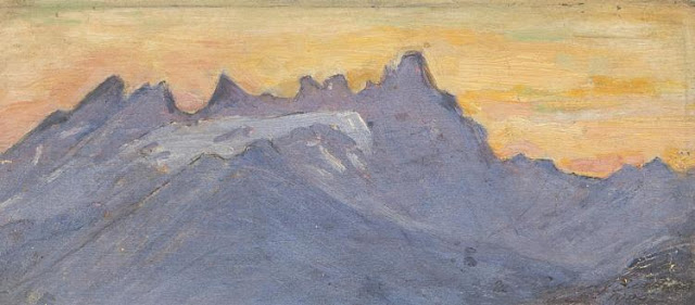
LES DENTS DU MIDI PAINTED BY BLANCHE BERTHOUD

http://wanderingvertexes.blogspot.com

 BLANCHE BERTHOUD  (1864 -1938)  
Les Dents du Midi (3,114 m to 3,257 m -10,216 ft to10,685 ft) 
Switzerland 

In Les dents du Midi, 1909, oil on wooden panel

2 others paintings of Les Dents du Midi in this blog: 

The mountain 
The Dents du Midi (Teeth of the south) (3,114 m to 3,257 m -10,216 ft to10,685 ft) are a mountain range, 3 kilometers long, located in the Chablais Alps in the canton of Valais in Switzerland. Overlooking the valley of Illiez and Rhône Valley on south, they face the lake Salanfe, an artificial reservoir, and are part of the geological whole massif Giffre.
The name "Dents du Midi" is recent. The people formerly called them "Dents Tsallen". It was only towards the end of the19e century that the name "Dents du Midi" came officially.
Each « tooth » had several names over the centuries and according to its geological evolution.
- The "Cime de l'Est" (3178 meters) called "Mont Novierre" before the mid-17th century, and "Mont Saint-Michel "after landslides in 1635 and 1636 and finally "Dent Noire" (until the 19th century).
- The "Dent Jaune" (3186 m) was called the "Dent Rouge" until 1879.
- The "Doigt de Champéry" (in 1882) and then the Doigt Salanfe (in 1886) turned just into "Les Doigts" (Fingers) (3205 m and 3210 m).
- The  "Haute Cime" (3257 m) also had many names : "Dent de l’Ouest" (until 1784)an then "Dent du Midi", "Dent de Tsallen" and "Dent de Challent."
- As for l’Eperon (3114 m) (The Spur), it is assumed that there were two peaks but a landslide in the Middle Ages significantly changed its crest.
- The Forteresse (3164 m) and the Cathedral (3160 m) have not changed names.
The evolution of this massif continues nowadays. So on the morning of 30 October 2006, a volume of 1 million m3 of rock broke away from the edge of the Haute Cime and slid down the slope to an altitude of about 3000 m. The event did not present danger to the nearby village of Val-d'Illiez but roads and trails were closed for security reasons. According to the cantonal geologist, the landslide was caused by the thawing of rocks, helped by warm summers of recent years.

The painter 
Blanche Berthoud was a Swiss painter from the region Neufchatel (Switzerland) who was very active throughout the first half of the 20th century. She was part of the  Société romande des femmes peintres  (Romande Society of Women Painter) founded  by the painter Jeanne Lombard (1865-1945) who defended very fiercely mountain women painters, a world often reserved for men. She made several paintings and watercolors of the Breithorn, one of which was acquired by the Museum of Art and History of Neufchatel.

2016 - Wandering Vertexes...
by Francis Rousseau 

Wednesday, December 21, 2016

TOHIVEA / TOHIEA PAINTED BY CECIL WILLIAM HODGES


CECIL WILLIAM HODGES (1744-1797) 
 Mount Tohivea or Tohiea (1,207m- 3,960ft)  
  France  (French Polynesia )  


 In View taken in the bay of Moorea, 1774, oil on canvas,  The National Maritime Museum, London.

The mountain 
Mount Tohivea (1,207 m - 3,960 feet) also called  Tohiea is a volcanic peak and the highest point on the island of Moorea in French Polynesia. On its slopes are many streams and fertile soils. There are hiking trails along the summit close to Belvedere Point where people can view Mont Routui and the two bays and three peninsulas of Moorea. Mount Tohivea is a dormant volcano that is easily visible from Papeete, the capital of French Polynesia. The surrounding peaks are almost as tall as Mount Tohivea.
Mount Tohivea was formed about two million years ago. Its last eruption was so big, there was a landslide that formed the 2 bays. After the eruption, the volcano became dormant. The area was first settled by early Polynesians during the early 4th century. Then Charles Darwin explored the area. After many years the area became very populated. Then people made trails and then it become a park. Today, the park is a tourist attraction.
Mount Tohivea is a lot visited since it has easy access from Papeete. Many people walk the trails since there is beautiful scenery. People from Tahiti use the Moorea Temae Airport or the Aremeti Ferry to get to Moorea. Mount Tohivea is visible behind Mount Rotui from the two bays
There about 5 miles (8.0 km) of dirt hiking trails along the Mount Tohivea's slopes. The trails are about 2 feet (0.61 m) wide. There are some points with views of Cook's Bay, Opunohu Bay, the Pacific Ocean, and Pao Pao, the largest commune of Moorea. The animals that people can see are mainly Geckos and Salamanders. The hiking trails end close to Mont Mouaroa which is only a couple of miles west of Mont Tohivea. People can also see Mont Mouaroa from both the main road and the two bays. People can mainly see Mont Mouaroa from Opuhunu bay.S ome of the hiking trails go to the bottom of Moorea from the south point. People can also see Mont Tohivea from the south point and get on the trails from there.
There are also farms at the bottom of Mount Tohivea. The farmers mainly farm pineapples and potatoes. The farmers give the pineapples to the Moorea Juice Factory. People can see the farms as they drive the small road up the valley. The farms are mainly located at where the small road starts at the bottom of Opuhunu Bay. There is also a shrimp farm.

The painter 
William Hodges was an English painter, member of James Cook's second voyage to the Pacific Ocean, and best known for the sketches and paintings of locations he visited on that voyage, including Table Bay, Tahiti, Easter Island, and the Antarctic. He studied under William Shipley, and afterwards in the studio of Richard Wilson, where he met Thomas Jones. Between 1772 and 1775 Hodges accompanied James Cook to the Pacific as the expedition's artist. Many of his sketches and wash paintings were adapted as engravings in the original published edition of Cook's journals from the voyage.
Most of the large-scale landscape oil paintings from his Pacific travels for which Hodges is best known were finished after his return to London; he received a salary from the Admiralty for the purposes of completing them. These paintings depicted a stronger light and shadow than had been usual in European landscape tradition. Contemporary art critics complained that his use of light and colour contrasts gave his paintings a rough and unfinished appearance.
In 1778, under the patronage of Warren Hastings, Hodges travelled to India, one of the first British professional landscape painters to visit that country. He remained there for six years, staying in Lucknow with Claude Martin in 1783. His painting of "Futtypoor Sicri" is in Sir John Soane's Museum.
Later Hodges travelled also across Europe, including a visit to St. Petersburg in Russia in 1790.
In 1793 Hodges published an illustrated book about his travels in India.
In late 1794 Hodges opened an exhibition of his own works in London that included two large paintings called The Effects of Peace and The Effects of War.  In late January, 1795, with Britain engaged in the War of the First Coalition against Revolutionary France and feelings running high, the exhibition was visited by Prince Frederick, Duke of York and Albany, the second son of King George III. The Duke took offence at the political nature of Hodges' paintings and ordered the exhibition closed; this royal censure effectively ended Hodges' career as a painter.
Hodges retired to Devon and became involved with a bank, which failed during the banking crisis of March, 1797. On 6 March of that year, he died from what was officially recorded as "gout in the stomach", but which was also rumoured to be suicide from an overdose of laudanum.
Hodges Knoll in Antarctica is named after William Hodges.
Source: 

Tuesday, December 20, 2016

JUNGFRAU PAINTED BY CLEMENT CASTELLI


CLEMENT CASTELLI (1870-1959)  
Jungfrau  (4,158m- 13, 642ft)
Switzerland

The mountain 
The Jungfrau   (4,158 m- 13,642 ft) ("The virgin" in german)  is one of the main summits of the Bernese Alps, located between the northern canton of Bern and the southern canton of Valais, halfway between Interlaken and Fiesch. Together with the Eiger and Mönch, the Jungfrau forms a massive wall overlooking the Bernese Oberland and the Swiss Plateau, one of the most distinctive sights of the Swiss Alps. It is one of the most represented by artists summits with the Matterhorn and the Mont Blanc.
The summit was first reached on August 3, 1811 by the Meyer brothers of Aarau and two chamois hunters from Valais. The ascent followed a long expedition over the glaciers and high passes of the Bernese Alps. It was not until 1865 that a more direct route on the northern side was opened.
The construction of the Jungfrau railway in the early 20th century, which connects Kleine Scheidegg to the Jungfraujoch, the saddle between the Mönch and the Jungfrau, made the area one of the most-visited places in the Alps. Along with the Aletsch Glacier to the south, the Jungfrau is part of the Jungfrau-Aletsch area, which was declared a World Heritage Site in 2001.
Politically, the Jungfrau is split between the municipalities of Lauterbrunnen (Bern) and Fieschertal (Valais). It is the third-highest mountain of the Bernese Alps after the nearby Finsteraarhorn and Aletschhorn, respectively 12 and 8 km away. But from Lake Thun, and the greater part of the canton of Bern, it is the most conspicuous and the nearest of the Bernese Oberland peaks; with a height difference of 3,600 m between the summit and the town of Interlaken. This, and the extreme steepness of the north face, secured for it an early reputation for inaccessibility.
The landscapes around the Jungfrau are extremely contrasted. Instead of the vertiginous precipices of the north-west, the south-east side emerges from the upper snows of the Aletsch Glacier at around 3,500 metres. The 20 km long valley of Aletsch on the south-east is completely uninhabited and also surrounded by other similar glacier valleys. The whole area constitutes the largest glaciated area in the Alps as well as in Europe.
Climbing 
In 1811, the brothers Johann Rudolf (1768–1825) and Hieronymus Meyer, sons of Johann Rudolf Meyer (1739–1813), the head of a rich merchant family of Aarau, with several servants and a porter picked up at Guttannen, having reached the summit for the first time.
The normal route follows the traces of the first climbers, but the long approach on the Aletsch Glacier is no longer necessary. From the area of the Jungfraujoch the route to the summit takes only a few hours. Most climbers start from the Mönchsjoch Hut. After a traverse of the Jungfraufirn the route heads to the Rottalsattel (3,885 m), from where the southern ridge leads to the Jungfrau. It is not considered a very difficult climb but it can be dangerous on the upper section above the Rottalsattel, where most of the accidents happen. The use of the Jungfrau railway can cause some acclimatization troubles as the difference of altitude between the railway stations of Interlaken and Jungfraujoch is almost 3 km. The final section of the climb is accomplished along one of the longest and sharpest arêtes of frozen snow to be found in the Alps, beyond which the eye plunges abruptly down a precipice 3,000 ft. in height into the depths of the Rottal, on the west of the Jungfrau. With perfect steadiness and first-rate guides there is no danger, unless too early in the season, or soon after a heavy fall of fresh snow. When it is necessary to cut steps all the way in hard frozen névé, the work is very laborious, and 3 hours may be consumed in ascending the 725 ft that separate the Sattel from the summit. Some rocks jut out close to the top, but the actual peak consists of a nearly level ridge of frozen snow falling away on either side like a house-top with an excessively steep roof. The view, on one side, commands the icy plains of the Aletsch Glacier, and the highest alpine peaks far and near; on the other overlooks populous valleys that lie at a depth of 2 miles below the spectator's feet.

The painter 
Clement (or Clemente) Castelli was born in Premia, Italy.  He moved to Paris in 1880, and studied painting with  Jules Adler and Léon Bellemont before to be a member of the  " Société des peintres de Montagnes " (Mountain Painters Society). Clement Castelli spent most of his career painting mountains in the French Alps (Chamonix Valley, La Meije and Oisans) but also the Swiss Alps (many paintings representing the Matterhorn in particular and the Junfgfrau) and Italian Alps. It painted as  mountain landscapes as well as valley bottoms or views from the peaks that its qualities of mountaineer allows it to frequent. He also painted some paintings on the Pyrenean sites (the Cirque de Gavarnie, the lake of Gaube or the valley of Ossau) which he exhibited in Tarbes. It was a prolific artist who  often paints on small panels, easier to carry with him in  mountains, but also on canvas. He paints with a brush, quite classically; its palette, made of rather "cold" colors is characteristic.
A stamp, affixed to the back of his paintings, indicates that at least for a time, his studio was located in Paris, rue du Faubourg-du-Temple. Clement Castelli has exhibited his works for many years at the Salon des Artistes Indépendants and at the Salon des Artistes Français.

Monday, December 19, 2016

MAUNA LOA PAINTED BY JULES TAVERNIER


JULES TAVERNIER (1844-1889) 
Mauna Loa volcano  (4,170m - 13, 680 ft)
 United States of America  (Hawai'i)

 In  Mokuaweoweo at the top of Mauna Loa, oil on canvas, Honolulu Museum of Arts  

The volcano 
Mauna Loa  (4,170m - 13, 680ft)  which means Long Mountain in Hawaiian, is one of five volcanoes that form the Island of Hawaii in the U.S. state of Hawaiʻi in the Pacific Ocean. The largest subaerial volcano in both mass and volume, Mauna Loa has historically been considered the largest volcano on Earth. It is an active shield volcano with relatively gentle slopes, with a volume estimated at approximately 18,000 cubic miles (75,000 km3), although its peak is about 120 feet (37 m) lower than that of its neighbor, Mauna Kea. Lava eruptions from Mauna Loa are silica-poor and very fluid, and they tend to be non-explosive.
Mauna Loa has probably been erupting for at least 700,000 years, and may have emerged above sea level about 400,000 years ago. The oldest-known dated rocks are not older than 200,000 years. The volcano's magma comes from the Hawaii hotspot, which has been responsible for the creation of the Hawaiian island chain over tens of millions of years. The slow drift of the Pacific Plate will eventually carry Mauna Loa away from the hotspot within 500,000 to one million years from now, at which point it will become extinct.
Mauna Loa's most recent eruption occurred from March 24 to April 15, 1984. No recent eruptions of the volcano have caused fatalities, but eruptions in 1926 and 1950 destroyed villages, and the city of Hilo is partly built on lava flows from the late 19th century. Because of the potential hazards it poses to population centers, Mauna Loa is part of the Decade Volcanoes program, which encourages studies of the world's most dangerous volcanoes. Mauna Loa has been monitored intensively by the Hawaiian Volcano Observatory since 1912. Observations of the atmosphere are undertaken at the Mauna Loa Observatory, and of the Sun at the Mauna Loa Solar Observatory, both located near the mountain's summit. Hawaii Volcanoes National Park covers the summit and the southeastern flank of the volcano, and also incorporates Kilauea, a separate volcano.
Source: 

The painter 
Jules Tavernier was a French painter, illustrator, and an important member of Hawaii’s Volcano School.  He studied with the French painter, Félix Joseph Barrias (1822–1907). he left France in the 1870s and never  return. Tavernier was employed as an illustrator by Harper's Magazine, which sent him, along with Paul Frenzeny, on a year-long coast-to-coast sketching tour in 1873.
 Eventually, he continued westward to Hawaii, where he became quite famous as a landscape painter. He was fascinated by Hawaii’s erupting volcanoes—a subject that pre-occupied him for the rest of his life, which was spent in Hawaii, Canada and the western United States. Tavernier died on 18 May 1889 in Honolulu, Hawaii. He painted several version of the Kilauea erupting between 1880 and the end of his life.
Among the public collections holding paintings by Jules Tavernier are the Brigham Young University Museum of Art (Provo, UT), the Colorado Springs Fine Arts Center (Colorado Springs, CO), the Crocker Art Museum (Sacramento), the Gilcrease Museum (Tulsa, OK), Hearst Art Gallery (Saint Mary's College of California, Moraga, CA), the Honolulu Museum of Art, the Museum of Nebraska Art (Kearney, NE), the Oakland Museum of California, the San Diego Museum of Art, the Stark Museum of Art (Orange, TX), the Society of California Pioneers (San Francisco, CA), the Washington County Museum of Fine Arts (Hagerstown, MD) and the Yosemite Museum (Yosemite National Park).
After his death his art lived on in the hearts and homes of Hawaiians, and many more artists picked up on the volcano landscape theme he started. His Western art was mostly forgotten.
Fifty years after his death the Honolulu Advertiser remembered Jules Tavernier in December 1940 with the comment: “...to the generation which knew King Kalakaua, Tavernier recalls to mind some of the greatest paintings ever made of Hawaii volcanoes.”
At the beginning of the twenty-first century interest has reawakened in Tavernier's Western landscape art; museums are purchasing his pictures and prices for his oil paintings are increasing.
His students included D. Howard Hitchcock (1861–1943), Amédée Joullin (1862–1917), Charles Rollo Peters (1862–1917) and Manuel Valencia (1856–1935).
Source:
Tigertail Virtual Museum 

Sunday, December 18, 2016

MONTE EPOMEO PAINTED BY L. T. TURPIN DE CRISSE


LANCELOT THEODORE TURPIN DE CRISSE  (1782-1859)  
Monte Epomeo (789 m - 2,589 ft) 
Italy (Ischia Island)  

 In  Vue depuis Lacco sur le Mont Epomeo, Ischia, 1824, oil on canvas,
 Wallraf Richartz Museum, Köln  

The mountain 
Monte Epomeo (789 m - 2,589 ft) is the highest mountain on the volcanic island of Ischia, in the Gulf of Naples, Italy. Epomeo is believed to be a volcanic horst which towers above the rest of Ischia. Much of Epomeo is covered in lush greenery, with a few vineyards also occupying its slopes. Approximately 75 m (246 ft) from the peak the mountain is covered in white lava which may be confused with snow. A path leads to the summit of the mountain from Fontana, one of its quiet traditional villages.

The  painter 
Lancelot-Théodore, Comte de Turpin de Crissé  was a French writer and painter. His most familiar works are landscapes with structures, usually set in Italy. His father was Colonel Henri Roland Lancelot Turpin de Crissé, an amateur painter of some note. The family was financially ruined by the Revolution and had to flee Paris, but he was able to finish his studies in Switzerland and Italy, thanks to the patronage of Marie-Gabriel-Florent-Auguste de Choiseul-Gouffier.  Upon his return to France in 1809, he exhibited at the Salon. He was then granted the protection of the Imperial Family and became Chamberlain to the former Empress Josephine after her divorce. In 1810, he accompanied her on a trip to Switzerland and Savoy, returning with a large album of drawings.
In 1813, he married into a noble family and received a large inheritance from a cousin.  Three years later, he became a member of the Académie des Beaux-Arts. He was then appointed to the "Board of Royal Museums" (1824) and Inspector-General for the "Département des Beaux-Arts" (1825). That same year, he was awarded the Légion d'honneur.  He was named an honorary member of the Maison du Roi in 1829. During this period he made three lengthy trips to Italy; the last on the occasion of his appointment to the Accademia di Belle Arti di Venezia.
Despite his association with the Bonapartes, he was a staunch Legitimist, resigning all of his offices following the advent of the July Monarchy in 1830 and returning to private life.  He continued to exhibit, however, including a show at the Royal Academy of Arts in 1832. Three years later, he published Souvenirs du vieux Paris, exemples d'architecture de temps et de styles divers.
He continued to advocate for the Bourbons until his death.
He was also known as an avid art collector and promoted many contemporary artists through purchases of their works. Among them were Blondel, Granet and Ingres. His collection included antiquities as well, which he donated to the Musée des Beaux-Arts d'Angers.
 From December 2006 to April 2007, the museum presented a major retrospective of his works, in an effort to make his name known again.
 Sources: 
-  National Gallery of Art 

Saturday, December 17, 2016

THE CERVIN /MATTERHORN BY JOHN SINGER SARGENT

http://wanderingvertexes.blogspot.com

JOHN SINGER SARGENT  (1856–1925) 
 Le Cervin  or Matterhorn  (4,478m -14,691ft)
Switzerland - Italy border

 In The Cervin, watercolour, 1905 -  Private collection 

The mountain 
The  Mont Cervin (4,478m -14,691ft) also known as the Matterhorn is an alpine summit located on the Swiss-Italian border between the canton of Valais and the Aosta Valley in Switzerland. It has several other names: Cervino in Italian, Grand'Bèca in Arpitan, Matterhorn in German. The Cervin / Matterhorn is the most famous mountain in Switzerland, including the pyramidal shape that it offers from the village of Zermatt, in the German-speaking part of the canton of Valais.
Its four sides are joined about 400 meters below the summit in a summit pyramid, called "roof." Its summit is a broad ridge about two meters, on which stand actually two summits: one called "Swiss summit," the farther east, and the "Italian summit" slightly lower (4,476 meters), on the west side of the ridge. The two are separated by a notch in the hollow of which a cross was laid in September 1901.
Its north face is one of the three great north faces of the Alps with the Eiger and the Grandes Jorasses.
The most famous faces of the Matterhorn are the faces east and north, seen from Zermatt. The first
1, 000 meters high, has great risk of falling rocks, which makes it dangerous climb. The north face high of 1100 meters, is one of the most dangerous sides of the Alps, particularly because of the risks of landslides and storms. The south side, overlooking the Breuil (Valtournenche above) is high, it, 1 350 meters. This is the face that offers the most channels. And finally, the west face the highest with its 1400 meters, is the one that is the subject of fewer climbs attempts. Between the west side and the north side there is also the north-northwest side, which does not stretch to the summit but stopped Zmutt Nose, on the bridge of the same name. This is the most dangerous route for climbing the Matterhorn. There is also a south-facing southeast, deemed to be the most difficult of the south face route, which leads to the Pic Muzio, on Furggen Shoulder.
Due to its pyramidal form, the Matterhorn has four main ridges, through which pass most of climbing routes. The easiest ridge, that borrows the normal route, is the Hörnli ridge (Hörnligrat in German): it is between the faces east and north, facing the Zermatt valley. Further west lies the Zmutt ridge (Zmuttgrat), between the north and west sides. Between the western and southern sides is the Lion ridge (Liongrat), also known as Italian ridge, which passes through the Tyndall peak, summit of the southern part of the west side, at which begins the upper face. Finally, the south side is separated from the face is Furggen
Swiss normal route from the cabin of the Hörnli, located at 3260 meters. Since Zermatt is accessed by gondola Schwarzsee; there are 700 vertical meters to the hut and 1200 vertical meters to the summit.
Difficulty (Hörnli ridge): AD (fairly difficult), 3 climbing passage; fixed ropes were installed near the top for easy ascension.
The Italian normal route, taking his departure in Breuil, follows almost entirely the southwest ridge, called the Lion ridge. It was inaugurated by the guide valtournain Jean-Antoine Carrel 17 July 1865.
The climb from the Italian side includes three steps:
- du Breuil (2012 meters) at the shelter Duke of Abruzzi in Oriondé (2802 meters)
- the refuge Duca degli Abruzzi refuge to Jean-Antoine Carrel (3830 meters)
- Jean-Antoine Carrel refuge at the summit (4478 meters).
The ascent by Hörnli ridge, July 14, 1865, was considered the last of the great feats of mountaineering in the Alps. But this ascent error ended at the beginning of the descent, in the death of 4 of the 7 members of the roped Victorieuse.

The painter 
John Singer Sargent  was an American artist who  created roughly 900 oil paintings and more than 2,000 watercolors, as well as countless sketches and charcoal drawings. His oeuvre documents worldwide travel, from Venice to the Tyrol, Switzerland, Corfu, the Middle East, Montana, Maine, and Florida. He was trained in Paris prior to moving to London. Sargent enjoyed international acclaim as a portrait painter, but  in later life he expressed ambivalence about the restrictions of formal portrait work, and devoted much of his energy to mural painting and working en plein air. He lived most of his life in Europe.  Each destination offered pictorial stimulation and treasure.  Even at his leisure, in escaping the pressures of the portrait studio, he painted with restless intensity, often painting from morning until night.  His hundreds of watercolors of Venice are especially notable, many done from the perspective of a gondola. His colors were sometimes extremely vivid and as one reviewer noted, "Everything is given with the intensity of a dream." In the Middle East and North Africa Sargent painted Bedouins, goatherds, and fisherman. In the last decade of his life, he produced many watercolors in Maine, Florida, and in the American West, of fauna, flora, and native peoples.
With his watercolors, Sargent was able to indulge his earliest artistic inclinations for nature, architecture, exotic peoples, and noble mountain landscapes. And it is in some of his late works where one senses Sargent painting most purely for himself. His watercolors were executed with a joyful fluidness.   His first major solo exhibit of watercolor works was at the Carfax Gallery in London in 1905. In 1909, he exhibited eighty-six watercolors in New York City, eighty-three of which were bought by the Brooklyn Museum. Evan Charteris wrote in 1927: 'To live with Sargent's water-colours is to live with sunshine captured and held, with the luster of a bright and legible world, 'the refluent shade' and 'the Ambient ardours of the noon.'
Although not generally accorded the critical respect given Winslow Homer, perhaps America's greatest watercolorist, scholarship has revealed that Sargent was fluent in the entire range of opaque and transparent watercolor technique, including the methods used by Homer.

2016 - Wandering Vertexes...
by Francis Rousseau 

Friday, December 16, 2016

MACHAPUCHARE SACRED MOUNTAIN IN VINTAGE POSTCARD 1949


VINTAGE POSTCARD 1949
Machhapucchhre or Machapuchare (6,993 m - 22,943 ft)  
Nepal 

©wanderingvertexes collection.  All right reserved. Copy forbidden

The mountain
Machapuchare (6,993 m - 22,943 ft) or  Machhapuchchhre or Machhapuchhre is a mountain in the Annapurna Himalayas of north central Nepal. It is revered by the local population as particularly sacred to the god Shiva, and hence is off limits to climbing.
Machapuchare is at the end of a long spur ridge, coming south out of the main backbone of the Annapurna Himalayas, which forms the eastern boundary of the Annapurna Sanctuary. The Sanctuary is a favorite trekking destination, and the site of the base camps for the South Face of Annapurna and for numerous smaller objectives. The peak is about 25 km (16 mi) north of Pokhara, the main town of the region. Due to its southern position in the range, and the particularly low terrain that lies south of the Annapurna Himalayas, Machapuchare commands tremendous vertical relief in a short horizontal distance. This, combined with its steep, pointed profile, make it a particularly striking peak, despite a lower elevation than some of its neighbors. Its double summit resembles the tail of a fish, hence the name meaning "fish's tail" in Nepalese. It is also nicknamed the "Matterhorn of Nepal".
Climbing 
Machapuchare has never been climbed to its summit. The only attempt was in 1957 by a British team led by Lieutenant Colonel Jimmy Roberts. Climbers Wilfrid Noyce and A. D. M. Cox climbed to within 150 m (492 ft) of the summit via the north ridge, to an approximate altitude of 22,793 ft (6,947 m). They did not complete the ascent, as they had promised not to set foot on the actual summit.
Since then, the mountain has been declared sacred, and is now closed to climbers. Nowadays it is illegal to climb Machapuchare. 

Vintage postcards
Postcards became popular at the turn of the 20th century, especially for sending short messages to friends and relatives. They were collected right from the start, and are still sought after today by collectors of pop culture, photography, advertising, wartime memorabilia, local history, and many other categories.
Postcards were an international craze, published all over the world. The Detroit Publishing Co. and Teich & Co. were two of the major publishers in the U.S, and sometimes individuals printed their own postcards as well. Yvon were the most famous in France. Many individual or anonymous publishers did exist around the world and especially in Africa and  Asia (Japan, Thailand, Nepal, China, Java) between 1920 and 1955. These photographer were mostly local notables, soldiers, official guides belonging to the colonial armies (british french, belgium...) who sometimes had rather sophisticated equipment and readily produced colored photograms or explorers, navigators, climbers (Vittorio Sella and the Archiduke of Abruzzi future king of Italy remains the most famous of them).
There are many types of collectible vintage postcards.
Hold-to-light postcards were made with tissue paper surrounded by two pieces of regular paper, so light would shine through. Fold-out postcards, popular in the 1950s, had multiple postcards attached in a long strip. Real photograph postcards (RPPCs) are photographs with a postcard backing.
Novelty postcards were made using wood, aluminum, copper, and cork. Silk postcards–often embroidered over a printed image–were wrapped around cardboard and sent in see-through glassine paper envelopes; they were especially popular during World War I.
In the 1930s and 1940s, postcards were printed on brightly colored paper designed to look like linen.
Most vintage postcard collectors focus on themes, like Christmas, Halloween, portraits of movie stars, European royalty and U.S. presidents, wartime imagery, and photos of natural disasters or natural wonders. Not to mention cards featuring colorful pictures by famous artists like Alphonse Mucha, Harrison Fisher, Ellen Clapsaddle, and Frances Brundage.
For vintage postcards, subject matter, condition, and rarity, plus general desirability and demand, determine value.

Thursday, December 15, 2016

MONADNOCK MOUNTAIN PAINTED BY ROCKWELL KENT


ROCKWELL KENT (1882-1971)
Monadnock  mountain  (965m - 3, 125ft) 
United States of America (New Hampshire) 

In Mount Monadnock- afternoon, oil on canvas    

The mountain 
Mount Monadnock (965m - 3, 125ft) or Grand Monadnock is a mountain in the New England state of New Hampshire. It is the most prominent mountain peak in southern New Hampshire and is the highest point in Cheshire County, New Hampshire. It has long been known as one of the most frequently climbed mountains in the world. The word "monadnock" is an Abenaki-derived word used to describe a mountain. Loosely translated it means "mountain that stands alone", although the exact meaning of the word (what kind of mountain) is uncertain. The term was adopted by early settlers of southern New Hampshire and later by American geologists as an alternative term for an Inselberg or isolated mountain. Mount Monadnock is often called Grand Monadnock, to differentiate it from other Vermont and New Hampshire peaks with "Monadnock" in their names. Its official name on federal maps is "Monadnock Mountain".
Both Ralph Waldo Emerson and Henry David Thoreau visited the mountain and wrote fondly of it. Emerson was a frequent visitor, and made the mountain the subject of "Monadnoc", one of his most famous poems. Thoreau visited the mountain four times between 1844 and 1860 and spent a great deal of time observing and cataloging natural phenomena. He is regarded as having written one of the first serious naturalist inventories of the mountain. A bog near the summit of Mount Monadnock and a rocky lookout off the Cliff Walk trail are named after him; another lookout is named after Emerson.
Mount Monadnock is nearly 1,000 feet (300 m) higher than any other mountain peak within 30 miles (48 km) and rises 2,000 feet (610 m) above the surrounding landscape. Mount Monadnock, 62 miles (100 km) northwest of Boston and 38 miles (61 km) southwest of Concord, is located within the towns of Jaffrey and Dublin, New Hampshire.
Monadnock's bare, isolated, and rocky summit provides expansive views. A number of hiking trails ascend the mountain, including the 110-mile (180 km) Metacomet-Monadnock Trail and the 50-mile (80 km) Monadnock-Sunapee Greenway.
The earliest recorded ascent of Mount Monadnock took place in 1725 by Captain Samuel Willard and fourteen rangers under his command who camped at the top and used the summit as a lookout while patrolling for Native Americans. Before the practice came to be frowned upon, many early hikers carved their names in the summit; the earliest such engraving reads "S. Dakin, 1801" and is attributed to a local town clerk. Notable "power hiking" records associated with the mountain include that of Garry Harrington, who hiked to the summit 16 times in a 24-hour period, and Larry Davis, who claimed to have hiked to the summit daily for 2,850 consecutive days (7.8 years).
Monadnock is often claimed to be the second-most frequently climbed mountain in the world, after Mount Fuji in Japan. Monadnock is climbed by 125,000 hikers yearly, while Mount Fuji sees 200,000-300,000 hikers yearly.  However, according to UNESCO, neither mountain comes close in climbing popularity to Tai Shan in China, with more than 2 million visitors a year.

The painter
Rockwell Kent, artist, author, and political activist, had a long  and varied career. During his lifetime, he worked as an architectural draftsman, illustrator, printmaker, painter, lobsterman, ship's carpenter, and dairy farmer. Born in Tarrytown Heights, New York, he lived in Maine, Newfoundland, Alaska, Greenland, and the Adirondacks and explored the waters around Tierra del Fuego in a small boat. Kent's paintings, lithographs, and woodcuts often portrayed the bleak and rugged aspects of nature; a reflection of his life in harsh climates.His experience as a carpenter and builder and his familiarity with tools served him well when he took up the graphic process. His blocks were marvels of beautiful cutting, every line deliberate and under perfect control. The tones and lines in his lithography were solidly built up, subtle, and full of color. He usually made preliminary studies- old-mater style- for composition or detail before starting on a print. Nothing was vague or accidental about his work; his expression was clear and deliberate. Neither misty tonalities nor suggestiveness were to his taste. He was a highly objectified art - clean, athletic, sometimes almost austere and cold. He either recorded adventures concretely, or dealt in ideas. His studio was a model of the efficient workshop: neat, orderly, with everything in its place. His handwriting, the fruit of his architectural training, was beautiful and precise.
When Kent died of a heart attack in 1971, The New York Times described him as "... a thoughtful, troublesome, profoundly independent, odd and kind man who made an imperishable contribution to the art of bookmaking in the United States."  Richer, more accurate accounts of the scope of the artist's influential career as a painter and writer have since superseded this cursory summing-up of an American life. Retrospectives of the artist's paintings and drawings have been mounted, most recently by The Rooms in St. John's, Newfoundland, where the exhibition Pointed North: Rockwell Kent in Newfoundland and Labrador was curated by Caroline Stone in the summer of 2014. Other recent exhibitions include the Richard F. Brush Art Gallery and Owen D. Young Library at St. Lawrence University (Canton, New York) in the autumn of 2012; the Farnsworth Art Museum (Rockland, Maine) during the spring through autumn of 2012; the Bennington Museum in Vermont during the summer of 2012; and the Philadelphia Museum of Art in the spring through summer of 2012. An exhibition marking the centennial of Kent's time in Winona, Minnesota, took place there in 2013. Among the many notes of increasing awareness of Kent's contributions to American culture is the reproduction of one of Kent's pen-and-ink drawings from Moby Dick on a U.S. postage stamp, part of the 2001 commemorative panel celebrating such American illustrators as Maxfield Parrish, Frederic Remington, and Norman Rockwell.
Noted American and Canadian writers in recent years have found much gold to mine in Kent's improbable personal and public life. The year he spent in Newfoundland, for example, is fictionally (and very loosely) recalled by Canadian writer Michael Winter in The Big Why, his 2004 Winterset Award-winning novel. And certain qualities of the protagonist of Russell Banks's 2008 novel The Reserve are inspired by aspects of Kent's complex personality. Kent's work also figures in Steve Martin's 2010 novel An Object of Beauty and is the subject of a chapter in Douglas Brinkley's 2011 history The Quiet World: Saving Alaska's Wilderness Kingdom: 1879–1960.
The Archives of American Art is the repository for Kent's voluminous correspondence.

Wednesday, December 14, 2016

CIRQUE OF AÏN OUARKA PHOTOGRAPHED BY FREDERIC GADMER


FREDERIC GADMER (1878-1954)
 The Cirque of Aïn Ouarka  (1,672m - 5,485ft)
 Algeria
In Aïn -Ourka et les Pitons de Marne Verte, 1921 Autochrome Lumière,
Musée Départemental Albert Kahn 

The mountain 
The Cirque of Aïn Ouarka   (1,672m - 5,485ft) is a basin surrounded by steep mountains of green marl, where one can find two clear and deep saltwater ponds, coming from thermal waters. In this volcanic crater, in an exceptional landscape is located  the spa of Aïn Ouarka. Situated in the heart of the Ksours Mountains in the Western Saharan Atlas, Aïn Ouarka, part of the municipality of Asla, is located at a distance of 60 kilometers from the town of Aïn Sefra in the Wilaya of Naama.
The area of the high steppe plains of the Algerian western south is characterized by its great extents estimated at 6 million hectares and contains several types of natural environments articulated around ecosystems. Thus, under in arid climate, we find accessible zones of freshness, due to the presence of an important quantity of water, a rather rich biodiversity allowing the cohabitation of domestic, economic and ecological activities. The ecosystem of Aïn Ouarka is presented as a revealing case, requiring a careful thought in regards of its natural assets, its environmental constraints and its future prospects. The therapeutic benefits of water of this site has been highlighted from the very start of the century and much of researchers testify to the presence of two large lakes, with water clear and deep  showing  a site with important vegetation which shelters migratory birds temporarily. At present, the site of Aïn Ouarka, gives the impression of two small water marres very distant one from the other.

The photographer 
Frédéric Georges Gadmer was born in 1878 in France into a Protestant family; his father, Leon, son of Swiss émigré, was confectioner, and his mother, Marie Georgine, was unemployed. Before World War II, he follows his family in Paris and works as a photographer for the house Vitry, located Quai de la Rapée. As an heliogravure company, it performs work for the sciences and the arts, travel and education. In 1898 Gadmer completed his military service as a secretary to the staff then recalled in 1914 at the time of mobilization. In 1915, he joined the newly created  "Photographic Section of the Army" and carried pictures on the front, in the Dardanelles, with General Gouraud, then in Cameroon. In 1919, at age 41, he was hired as a photographer by Albert Khan for his project called "Archives of the Planet". He finds there his comrades of  "the film and photographic section of the army" Paul Castelnau and Fernand Cuville. Soon as he arrived, he made reports in Syria, Lebanon, Turkey and Palestine. It was the first to make a color portrait of Mustafa Kemal, leader of the Young Turks. In 1921, he returned to the Levant with Jean Brunhes, the scientific director of the Archives of the Planet. The same year, he attended General Gouraud, appointed High Commissioner in Syria. Operator and prolific photographer, specializing in distant lands and landscapes, it covers Iraq, Persia, Afghanistan, Algeria and Tunisia. In 1930, he accompanied Father Francis Aupiais in Dahomey. He also works in Europe. In 1931, at the request of Marechal Lyautey, he photographies the Colonial Exhibition. It is one of the last person to leave the "Archives of the Planet" threatened by the Albert Kahn's bankruptcy in 1932. He then worked at the famous french newspaper L'Illustration and carries postcards for Yvon. He died in Paris, unmarried, in 1954 and is buried in Saint-Quentin, as his parents.
Source: 

About the  "Autochrome Lumière" Photos
The autochrome is a photographic reproduction of process colors patented December 17, 1903 by Auguste and Louis Lumière french brothers. This is the first industrial technique of photography colors, it produces positive images on glass plates. It was used between 1907 and 1932 approximately an particularly in many pictures of the World War I. A important number of photographs of mountains and landscapes around the world was made with this technique, particularly in the for  the Project "The archives of the planet" by Albert Kahn.  
Source: 

Tuesday, December 13, 2016

MOUNT KATAHDIN PAINTED BY FREDERIC EDWIN CHURCH


FREDERIC EDWIN CHURCH  (1826-1900)
Mount Katahdin (1,605 m - 5,267 f)
United States of America (Maine)

In Twilight (Katahdin), 1860, oil on canvas, The MET

The mountain  
Mount Katahdin (1,605 m - 5,267 feet)  is the highest mountain in the U.S. state of Maine and the northern terminus of the Appalachian Trail. The mountain, being a mile above sea level, towers above the comparatively low Maine lakes and forests. Named Katahdin by the Penobscot Indians, which means "The Greatest Mountain", Katahdin is the centerpiece of Baxter State Park.  The official name is "Mount Katahdin" as decided by the US Board on Geographic Names in 1893. Among some Native Americans, Katahdin was believed to be the home of the storm god Pamola, and thus an area to be avoidedIt is a steep, tall mountain formed from a granite intrusion weathered to the surface. 
Katahdin was known to the Native Americans in the region, and was known to Europeans at least since 1689. It has inspired hikes, climbs, journal narratives, paintings, and a piano sonata. The area around the peak was protected by Governor Percival Baxter starting in the 1930s. Katahdin  is located near a stretch known as the Hundred-Mile Wilderness.
Katahdin is referred to 60 years after Field’s climb of Agiokochuk (Mount Washington) in the writings of John Gyles, a teenage colonist who was captured near Portland, Maine in 1689 by the Abenaki. While in the company of Abenaki hunting parties, he traveled up and down several Maine rivers including both branches of the Penobscot, passing close to “Teddon”. He remarked that it was higher than the White Hills above the Saco River.
The first recorded climb of "Catahrdin" was by Massachusetts surveyors Zackery Adley and Charles Turner, Jr. in August 1804.[14] In the 1840s Henry David Thoreau climbed Katahdin, which he spelled "Ktaadn"; his ascent is recorded in a well-known chapter of The Maine Woods. A few years later Theodore Winthrop wrote about his visit in Life in the Open Air. Painters Frederic Edwin Church and Marsden Hartley are well-known artists who created landscapes of Katahdin. On 30 November 2011, Christie's auctioned Church's 1860 painting Twilight (Katahdin) for $3.1 million.(see above)
In the 1930s Governor Percival Baxter began to acquire land and finally deeded more than 200,000 acres (809 km2) to the State of Maine for a park, named Baxter State Park after him. The summit was officially recognized by the US Board on Geographic Names as "Baxter Peak" in 1931.
Climbing 
The many routes to the summit all involve at least some scrambling from second to fourth class and come from three general directions, north, east and southwest. However there are several technical routes both rock and ice. A campsite, Chimney Pond, sits within the cirque called the Great Basin. From this point, one can ascend the Cathedral Ridge Route (1.7 mi.) that runs up the salient ridge just west of Baxter Peak or the Saddle Trail (2.2 mi.) which is a bit more pedestrian. Or if you want to head up the Knife Edge (1.1 mi.) you would ascend the Dudley Trail to Pamola Peak (1.3 mi.). You can also head west from Chimney Pond to Hamlin Peak via the Hamlin Ridge Trail (2.2 mi.) if you want to hike the entire western side of the mountain to the summit. You can also climb directly from the east via the Roaring Brook Campground in the Helon Taylor Trail (4.3 mi to summit). This takes you directly to Pamola Peak and the Knife Edge route to the summit and bypasses Chimney Pond.

The painter
Frederic Edwin Church was an American landscape painter born in Hartford, Connecticut. He was a central figure in the Hudson River School of American landscape painters, perhaps best known for painting large panoramic landscapes, often depicting mountains, waterfalls, and sunsets, but also sometimes depicting dramatic natural phenomena that he saw during his travels to the Arctic and Central and South America. Church's paintings put an emphasis on light and a romantic respect for natural detail. In his later years, Church painted classical Mediterranean and Middle Eastern scenes and cityscapes. Church was the product of the second generation of the Hudson River School and the pupil of Thomas Cole, the school’s founder. The Hudson River School was established by the British Thomas Cole when he moved to America and started painting landscapes, mostly of mountains and other traditional American scenes.  Both Cole and Church were devout Protestants and the latter's beliefs played a role in his paintings especially his early canvases.  Church did differ from Cole in the topics of his paintings: he preferred natural and often majestic scenes over Cole's propensity towards allegory.
Church, like most second generation Hudson River School painters, used extraordinary detail, romanticism, and luminism in his paintings. Romanticism was prominent in Britain and France in the early 1800s as a counter-movement to the Enlightenment virtues of order and logic. Artists of the Romantic period often depicted nature in idealized scenes that depicted the richness and beauty of nature, sometimes also with emphasis on the grand scale of nature.
This tradition carries on in the works of Frederic Church, who idealizes an uninterrupted nature, highlighted by creating excruciatingly detailed art. The emphasis on nature is encouraged by the low horizontal lines, and preponderance of sky to enhance the wilderness; humanity, if it is represented, is depicted as small in comparison with the greater natural reality. The technical skill comes in the form of Luminism, a Hudson River School innovation particularly present in Church's works. Luminism is also cited as encompassing several technical aspects, which can be seen in Church’s works. One example is the attempt to “hide brushstrokes” which makes the scene seem more realistic and lessen the artist’s presence in the work. Most importantly is the emphasis on light (hence luminism) in these scenes. The several sources of light create contrast in the pictures that highlights the beauty and detailed imagery in the painting.

Monday, December 12, 2016

TYCHO PEAK BY NASA LUNAR RECONNAISSANCE ORBITER


NASA LUNAR RECONNAISSANCE ORBITER (since 2009)
Tycho Peak  (2,000m or 2 km - 1, 24miles)
The Moon 

© NASA/GSFC/Arizona State University
 © Goddard Space Flight Center / Arizona State University

The peak 
A very popular target with amateur astronomers, Tycho is located at 43.37°S, 348.68°E, and is about 51 miles (82 km) in diameter. The summit of the central peak is 1.24 miles (2 km) above the crater floor (images 1& 2). The distance from Tycho's floor to its rim is about 2.92 miles (4.7 km).
Tycho crater's central peak complex (image 3) is about 9.3 miles (15 km) wide.
Many rock fragments ("clasts") ranging in size from some 33 feet (10 m) to hundreds of yards are exposed in the central peak slopes. Were these distinctive outcrops formed as a result of crushing and deformation of the target rock as the peak grew? Or do they represent preexisting rock layers that were brought intact to the surface?
Tycho's features are so steep and sharp because the crater is only about 110 million years old -- young by lunar standards. Over time micrometeorites and not-so-micro meteorites, will grind and erode these steep slopes into smooth mountains. For a preview of Tycho's central peak may appear like in a few billion years, look at Bhabha crater.
On May 27, 2010, LRO captured a top-down view of the summit (above), including the large boulder seen in the image. Also note the fractured impact melt deposit that surrounds the boulder. And the smooth area on top of the boulder, is that also frozen impact melt? These images from the LRO Camera clearly show that the central peak formed very quickly: the peak was there when impact melt that was thrown straight up during the impact came back down, creating mountains almost instantaneously. Or did the melt get there by a different mechanism? The fractures probably formed over time as the steep walls of the central peak slowly eroded and slipped downhill. Eventually the peak will erode back, and this massive boulder will slide 1.24 miles (2 km) to the crater
On June 10, 2011, NASA's Lunar Reconnaissance Orbiter spacecraft angled its orbit 65° to the west, allowing the LRO Camera NACs to capture a dramatic sunrise view of Tycho crater.
Source: 
- NASA missions official website/ Tycho peak 

The Imager 
The Lunar Reconnaissance Orbiter (LRO) is a NASA robotic spacecraft currently orbiting the Moon since 2009 in an eccentric polar mapping orbit. Data collected by LRO has been described as essential for planning NASA's future human and robotic missions to the Moon. Its detailed mapping program is identifying safe landing sites, locating potential resources on the Moon, characterizing the radiation environment, and demonstrating new technologies.
Launched on June 18, 2009, in conjunction with the Lunar Crater Observation and Sensing Satellite (LCROSS), as the vanguard of NASA's Lunar Precursor Robotic Program, LRO was the first United States mission to the Moon in over ten years. LRO and LCROSS were launched as part of the United States's Vision for Space Exploration program.
The probe has made a 3-D map of the Moon's surface at 100-meter resolution and 98.2% coverage (excluding polar areas in deep shadow), including 0.5-meter resolution images of Apollo landing sites.
The first images from LRO were published on July 2, 2009, showing a region in the lunar highlands south of Mare Nubium (Sea of Clouds).
The total cost of the mission is reported as US$583 million, of which $504 million pertains to the main LRO probe and $79 million to the LCROSS satellite.
Source: 
- NASA missions official website

Sunday, December 11, 2016

CHERNUSHKA NUNATAK PAINTED BY DAVID ROSENTHAL


DAVID ROSENTHAL  (bn.1953)
Chernushka Nunatak (1,640 metres - 5,380 ft)
Antarctica

In  Aerial view of Nunatak, oil on canvas

The mountain 
Chernushka Nunatak  (1,640 metres -5,380 ft) is a isolated nunatak located at coordinates  71°35′S 12°1′E, lying 2 nautical miles (4 km) southwest of Sandseten Mountain on the west side of the Westliche Petermann Range in the Wohlthat Mountains. It was discovered and plotted from air photos by the Third German Antarctic Expedition, 1938–39. It was mapped from air photos and surveys by the Sixth Norwegian Antarctic Expedition, 1956–60, and remapped by the Soviet Antarctic Expedition, 1960–61. It was named by the USSR as a token of the Soviet scientists' achievements in the study of space, by commemorating Chernushka, a dog that was sent into space and safely returned to earth.
Nunataks, also called glacial islands, are exposed portions of ridges, mountains, or peaks not covered with ice or snow within (or at the edge of) an ice field or glacier. Nunataks present readily identifiable landmark reference points in glaciers or ice caps and are often named. The term is derived from the Inuit word, nunataq. Isolated or located by small groups,  there are nearly seventy nunataks in Antartica continent.


The artist 
David Rosenthal is known as an Antarctic Painter, Painter of Ice, Arctic Artist, Alaskan Artist and an Extreme Artist. He has been lured to cold climates regularly to record snow, ice, and landscapes. Davids paintings of glaciers and icebergs are astoundingly realistic and at the same ethereal at the same time. However his work also includes much more than ice, icebergs and glaciers... Cordova, Alaska is the place David Rosenthal calls home. As an artist and art teacher David has taught and continues to teach many students in Alaska. While teaching art in Alaska, David has instructed students and artist in many programs including the Alaska Artists in the Schools Program, Prince William Sound Community College and University of Alaska Fairbanks Summer Sessions. Alaskan artist David Rosenthal makes it a priority to travel around Alaska as much as possible to continue to capture the incredible beauty in his artwork of Alaska.
Having spent over sixty months on the Ice, including four austral winters and six austral summers, David became an Antarctic artist and has created art images from a large variety of places in every season. David has completed paintings of the antarctic landscape from all across Antarctica. Time in Antarctica included travel as a participant in the National Science Foundation Antarctic Artists and Writers Program during a summer and a winter at McMurdo Station as well as most of a winter at Palmer Station. David has also worked for the NSF contractor for two winters and four summers in various job capacities as a way to spend time and become familiar with the landscape.
Rosenthal's work also includes many water colors, oil paintings, sketches and small studies. The paintings seem to magically reflect the intensity of nature's colors and the atmospheric phenomena that David witnesses. David really is a master of Extreme Art!
Source:
David Rosenthal website 
_______________________________
2016 - Wandering Vertexes...
by Francis Rousseau