google.com, pub-0288379932320714, DIRECT, f08c47fec0942fa0 GRAVIR LES MONTAGNES... EN PEINTURE: 4000 - 5000 meters
Showing posts with label 4000 - 5000 meters. Show all posts

Wednesday, April 6, 2022

THE DOM AND THE TÄSCHORN PAINTED BY W. F. BURGER

WILHELM FRIEDRICH BURGER (1882 -1964 ) The Dom (4,545 m (14,911 ft) The Täschhorn (4,491 m -14,734 ft) Switzerland  In The Dom and Täschhorn above Zermatt, watercolour, 30.5 x 37.5 cm. Courtesy John Mitchell Fine Arts London

WILHELM FRIEDRICH BURGER (1882 -1964)
The Dom (4,545 m (14,911 ft)
The Täschhorn (4,491 m -14,734 ft)
Switzerland

In The Dom and Täschhorn above Zermatt, watercolour, 30.5 x 37.5 cm.
Courtesy John Mitchell Fine Arts London

 
The mountains
The Dom (4 ,545 m  -14,911 ft)  is a mountain of the Pennine Alps, located between Randa and Saas-Fee in the canton of Valais in Switzerland. It is the seventh highest summit in the Alps, overall.  Based on prominence, it can be regarded as the third highest mountain in the Alps, and the second highest in Switzerland, after Monte Rosa. The Dom is the main summit of the Mischabel group (German: Mischabelhörner), which is the highest massif lying entirely in Switzerland. The Dom is noteworthy for its 'normal route' of ascent having the greatest vertical height gain of all the alpine 4000 metre peaks, and none of that route's 3,100 metres of height can be achieved using mechanical means. Although Dom is a German cognate for 'dome', it can also mean 'cathedral' and the mountain is named after Canon Berchtold of Sitten cathedral, the first person to survey the vicinity. The former name Mischabel comes from an ancient German dialect term for pitchfork, as the highest peaks of the massif stand close to each other.
The Täschhorn (4,491 m - 14,734 ft) is  lying south of the Dom within the Mischabel range.  Täschorn is a little lower than Dom but more difficult to access because there is mandatory rock climbing. Täschorn is a 3 sides pyramid.  East face is above Saas Fee, W face is above Täsch (last village before Zermatt), and huge South face is above Täschalp (Ottavan).  Each side belongs a glacier: on Täsch side is Kingletscher, on Ottavan side is Weingartengletscher, on Saas side is Feegletscher. The first ascent of the mountain was by John Llewelyn Davies and J. W. Hayward with guides Stefan and Johann Zumtaugwald and Peter-Josef Summermatter on 30 July 1862. The normal route is on the SE ridge starting from Mischabeljoch. To join the Mischabel pass, it's possible to come from either Saas Fee side or Täsch side.

 
The painter
Wilhelm, or Willy, Burger is nowadays widely recognized as one of the leading graphic artists of his time. His lithograph posters such as, Jungfraubahn. Station Jungfrau: Joch 3457m. Aletschgletscher, 1914 and St. Moritz, 1912are far better known – and more costly – than his oil paintings. However, he was first and foremost a painter by training who apprenticed in Zurich before leaving for Philadelphia and New York in 1908. He returned to Switzerland in 1913 where he set up a studio in Rüschlikon on the west shore of Lake Zürich from where he would travel throughout the Alps, the Mediterranean and as far afield as Egypt for his commissions. Although Burger cannot be categorized as a Symbolist in the strictest sense, his palette, his penchant for jagged outlines and his ethereal skies owe much to Ferdinand Hodler, the leading Swiss painter of the late nineteenth century. Hovering between Realism and Symbolism in style, this late afternoon view over the Zürichsee from the edge of the lake at Rüschlikon is an overt homage to Hodler who painted nearly 150 pictures of the Swiss lakes, many of them in a similar, panoramic format. Burger went so far as to sign his picture with a more spidery signature than usual – a pastiche of Hodler’s.
From 1901 onwards, Hodler began to concentrate on a series of acclaimed visions of Lac Léman (Geneva) in which he delineated horizontal bands of differing colours and tone. As he developed the theme of receding lines across the lake, or ‘parallelism’, as he called it, Mont Blanc and its surrounding peaks were introduced into the background. Hodler died in 1918 but in these late paintings he sought to express his concept of unité – the idea that there was a fundamental order to the universe and the artist’s role was to reveal it.

____________________________________
2022 - Wandering Vertexes...
by Francis Rousseau

Friday, March 25, 2022

MOUNT LISTER & MOUNT HOOKER PAINTED BY DAVID ROSENTHAL


DAVID ROSENTHAL (bn. 1953) Mount Lister ( 4,025m- 13, 200ft) Antarctica (Victoria Land)

DAVID ROSENTHAL (bn. 1953)
Mount Lister  ( 4,025m- 13, 200ft)
Mount Hooker ( 3, 800m - 12, 500 ft)
Antarctica (Victoria Land)


The mountain
Mount Lister is a massive mountain,forming the highest point in the Royal Society Range of Victoria Land, Antarctica. It was discovered by the British National Antarctic Expedition (1901–1904) which named it for Lord Joseph Lister, President of the Royal Society, 1895–1900. Waikato Spur, a rock spur about 3 nmi (5.6 km) long, extends northwestward from Mount Lister. The spur separates the upper part of Emmanuel Glacier from the Carleton Glacier. The spur was named by the US Advisory Committee on Antarctic Names (US-ACAN) in 1994 after the University of Waikato in Hamilton, New Zealand, in association with nearby features that are named after colleges and universities. 

Mount Hooker standing immediately south of Mount Lister in the Royal Society Range of Victoria Land, Antarctica. It was discovered by the British National Antarctic Expedition, 1901–04, which named it for Sir Joseph Dalton Hooker.


The Painter
David Rosenthal is known as one of the best Antarctic Painter, Painter of Ice, Arctic Artist, Alaskan Artist and an Extreme Artist. He has been lured to cold climates regularly to record snow, ice, and landscapes. Davids paintings of glaciers and icebergs are astoundingly realistic and at the same ethereal at the same time. However his work also includes much more than ice, icebergs and glaciers... Cordova, Alaska is the place David Rosenthal calls home. As an artist and art teacher David has taught and continues to teach many students in Alaska. While teaching art in Alaska, David has instructed students and artist in many programs including the Alaska Artists in the Schools Program, Prince William Sound Community College and University of Alaska Fairbanks Summer Sessions. Alaskan artist David Rosenthal makes it a priority to travel around Alaska as much as possible to continue to capture the incredible beauty in his artwork of Alaska.
Having spent over sixty months on the Ice, including four austral winters and six austral summers, David became an Antarctic artist and has created art images from a large variety of places in every season. David has completed paintings of the antarctic landscape from all across Antarctica. Time in Antarctica included travel as a participant in the National Science Foundation Antarctic Artists and Writers Program during a summer and a winter at McMurdo Station as well as most of a winter at Palmer Station. David has also worked for the NSF contractor for two winters and four summers in various job capacities as a way to spend time and become familiar with the landscape.
Rosenthal's work also includes many water colors, oil paintings, sketches and small studies. The paintings seem to magically reflect the intensity of nature's colors and the atmospheric phenomena that David witnesses. David really is a master of Extreme Art!

_______________________________
2022 - Wandering Vertexes...
by Francis Rousseau

Tuesday, March 22, 2022

THE MER DE GLACE AND GRAND CHARMOZ PAINTED BY GABRIEL LOPPÉ


GABRIEL LOPPÉ (1825-1913), Les Aiguilles du Grand Charmoz (3,445m - 11,302ft) France  In La Mer de Glace et les Grands Charmoz, Chamonix, Huile sur toile, Courtesy JohnMitchell Fine Arts, London, Artcurial Paris,

GABRIEL LOPPÉ (1825-1913),
Les Aiguilles du Grand Charmoz (3,445m -11,302ft)
France

In La Mer de Glace et les Grands Charmoz, Chamonix, Huile sur toile, 

Courtesy John Mitchell Fine Arts, London, and Artcurial Paris,

 
The painter

Toussaint Gabriel Loppé was a French painter, photographer and mountaineer. He became the first foreigner to be made a member of the Alpine Club in London. His father was a captain in the French Engineers and Loppé's childhood was spent in many different towns in south-eastern France. Aged twenty-one Loppé climbed a small mountain in the Languedoc and found a group of painters sketching on the summit. He had found his calling and subsequently went off to Geneva where he met the reputed leading Swiss landscapist, Alexandre Calame (1810 -1864). Loppé took up mountaineering in Grindelwald in the 1850s and made friends easily with the many English climbers in France and Switzerland. Although he was frequently labelled as a pupil of Calame and his rival François Diday, Loppé was almost an entirely self-taught artist. He became the first painter to work at higher altitudes during climbing expeditions earning the right to be considered the founder of the peintres-alpinistes school, which became established in the Savoie at the turn of the nineteenth century.
Notable followers of Loppé include, Charles Henri Contencin (1875-1955) and Jacques Fourcy (1906-1990). Together with the first ascent of Mt Mallet in Chamonix’s Grandes Jorasses range, Loppé made over 40 ascents of Mont Blanc during his climbing career, which lasted until the late 1890s. He frequently made oil sketches from alpine summits, including a panorama of the view from the summit of Mont Blanc.
His paintings became celebrated for their atmosphere and spontaneity and he soon found himself taking part in many exhibitions in London and in Paris.
By 1896 Loppé had spent over fifty seasons climbing and painting in Chamonix. As the valley’s unrivalled ‘Court painter’ his work was in constant demand with the majority of his pictures going to English climbers and summer tourists.
In his later years, Loppé became fascinated with photography and was quite an innovator in this field too. His long exposure photograph of the Eiffel Tower struck by lightning, now in the Musée d'Orsay in Paris remains one of his iconic images. 

 
The mountain
The Aiguille des Grands Charmoz (3,445 m), is one of the Chamonix needles in the Mont Blanc massif. It is made up of a ridge bristling with " gendarmes", including La Carrée, and Bâton Wicks. The first ascent was done on August 9, 1885 by H. Dunod and P. Vignon with the guides J. Desailloux, F. Folliguet, F. and G. Simond, by the corridor Charmoz-Grépon. It is today the normal way of descent, the climb generally being made by the south-west slope and the northwestern edge (AD +), climbed 15 July 1880 by Albert F. Mummery with Alexandre Burgener and Benedikt Venetz, which stopped before the summit at point 3 435 m. The Aiguille des Grands Charmoz is linked with the Aiguille du Grépon for the crossing of Charmoz-Grépon (D), one of the great rocky classics of the Mont Blanc massif. The first crossing was done by Laurent Croux in 1904. The first ascent of the north face, via the needle of the Republic, and crossing the edges of the Charmoz was done by Raymond Leininger and G. Bicavelle in 1946. In 1974, Jean-Claude Droyer succeeded the solo climb of the western pillar of the Grand Charmoz (Cordier lane opened in 1970 by Patrick Cordier).
The Mt Blanc is one of the 7 highest summits in earth, (which are obviously 8 with 2 in Europe !):
Mount Everest (8,848m), Aconcagua (6,961m), Mt Denali or Mc Kinley (6,194m), Kilimandjaro (5,895m), Mt Elbrus (5,642m), Mount Vinson (4,892m) and Mount Kosciuszko (2,228m) in Australia.

The Glacier
The Mer de Glace (Sea of Ice) is an alpine valley glacier located on the northern slope of the Mont-Blanc massif. It is formed by the confluence of the Tacul glacier and the Leschaux glacier and flows into the Arve valley, on the territory of the municipality of Chamonix-Mont-Blanc, giving rise to the Arveyron. The glacier is seven kilometers long, its supply basin has a maximum length of twelve kilometers and an area of ​​40 km2, while its thickness reaches 300 meters. In the middle of the 20th century, an ice cave was pierced for the first time in the Mer de Glace. Due to the attraction's success, a cable car was put into service in 1961 to access it, then replaced by a cable car in 1988. Since 1973, an underground hydroelectric power station has been using the meltwater from the glacier.
Almost a million visitors go to Montenvers every year to contemplate the Mer de Glace. During peak periods, half of them visit the ice cave. Three museums are also located on the site. Skiing is possible from the Aiguille du Midi in winter. However, the retreat of the glacier, measured since 1860-1870, causes a loss of thickness of 120 meters in a century in its terminal part. It causes difficulties at the level of the ice cave, where more and more steps are necessary to reach the gondola, and requires considering its upstream movement, like the catchment of the hydroelectric power station in 2011.
_______________________________
2022 - Wandering Vertexes...
by Francis Rousseau


Saturday, March 12, 2022

LE GRAND COMBIN PAINTED BY GUSTAVE DORÉ

GUSTAVE DORÉ (1832-1883) Le Grand Combin (4,314 m- 14, 154ft) Switzerland  In Le Grand Combin, Suisse romande, Oil on panel,  26 x 35 cm. Private collection (Christies)

GUSTAVE DORÉ (1832-1883)
Le Grand Combin (4,314 m- 14, 154ft)
Switzerland

In Le Grand Combin, Suisse romande, Oil on panel,  26 x 35 cm. Private collection (Christies)

The mountain
The Grand Combin is a mountain massif in the western Pennine Alps in Switzerland. With its 4,314 metres (14,154 ft) highest summit, the Combin de Grafeneire, it is one of the highest peaks in the Alps and the second most prominent of its range. The Grand Combin is also a large glaciated massif consisting of several summits, among which three are above 4000 metres:
- Combin de Grafeneire (4,314 m -14,154 ft),
- Combin de Valsorey (4,183 m -13,724 ft),
- Combin de la Tsessette (4,134 m -13,563 ft).
The massif of the Grand Combin lies south of Verbier between the Val d'Entremont (west) and Val de Bagnes (west). The north-western facing side of Grand Combin is entirely covered by eternal snows and glaciers which are prone to serac falls. The southern and eastern walls are more steep and thus exempt of snow.
The topography of the Grand Combin is intricate. Between the Val d'Entremont and the Val de Bagnes are two high ridges, nearly parallel to each other and to those valleys, which both diverge from a short transverse ridge of great height. The southern end of the space enclosed between these three ridges is an elevated plateau of great extent, where the snows accumulate and feed the Corbassière Glacier which descends thence for about ten kilometers to the north. The glacier is surrounded by the peaks of Petit Combin, Combin de Corbassière and Combin de Boveire on the west, Grand Tavé and Tournelon Blanc on the east. Smaller glaciers lie on the external flanks such as Boveire and Mont Durand Glacier.
The Grand Combin, which yields in height to only a few European mountains, was long one of the least known of Alpine summits. The first to commence the exploration of the great massif which separates the Val de Bagnes from the Val d'Entremont was Gottlieb Samuel Studer, of Berne, who on August 14, 1851 reached for the first time the summit of the Combin de Corbassière with the guide Joseph-Benjamin Fellay, and has published an account of that and a subsequent excursion in Bergund Gletscher-Fahrten. He was followed in that ascent five years later by W. and C. E. Mathews, and in 1857, William Mathews anticipated Studer in the ascent of the second peak of the Grand Combin.
The first four expeditions on Grand Combin reached only the minor summit east of Grand Combin (Aiguille du Croissant). The first one was made by mountain guides from the valley (Maurice Fellay and Jouvence Bruchez) on July 20, 1857. The first complete ascent of Grand Combin was finally made on July 30, 1859 by Charles Sainte-Claire Deville with Daniel, Emmanuel and Gaspard Balleys, and Basile Dorsaz.
The Grand Combin de Valsorey on the west was reached for the first time on 16 September 1872 by J. H. Isler and J. Gillioz. They climbed the south south face above the Plateau du Couloir. The itinerary on the south-east ridge was opened on 10 September 1891 by O. Glynne Jones, A.Bovier and P. Gaspoz.
The "Penitents", those reliefs of ice that one see rising on the surface of the glacier of the Grand Combin, in this 1787 painting, have all disappeared at the beginning of 21th century, because of global warming...


The painter
Paul-Gustave-Louis-Christophe Doré said Gustave Doré, born January 6, 1832 in Strasbourg and died January 23, 1883 in Paris in his house in the rue Saint-Dominique, is an illustrator, writer, cartoonist, painter and French sculptor. It has been internationally recognized in his lifetime.
In 1851, two albums Three artists misunderstood and unhappy and Des-approval for a pleasure trip are published at Aubert. Freed from the inspiration of Rudolf Töppfer and compliance executives, Gustave Doré performs freely arranged vignettes with several dimensions. The plurality of page composition, its innovations and graphic variants are deployed mainly in Des-approval for a pleasure trip. His technique uses the lithographic pencil, drawing directly on the stone.
Paul Lafon, writer and editor, he had met with Philipon, agreed to his request to illustrate the works of Rabelais. In 1854, the book is published by Bry with 99 vignettes and 14 inset plates engraved on wood. This affordable edition with low printing quality and modest size (large octavo) is not up to the high ambitions of Gustave Doré. In 1854 and 1873 shows two versions of "Rabelais Works" and in 1855: The Hundred Tales of comical by Honoré de Balzac.
In 1856 he illustrates with a painter's hand, The Wandering Jew, a poem set to music by Pierre Dupont, a work break in his artistic career and in the history of the woodcut. Abandoning copper engraving usually privileged, Gustave Doré chooses the color of wood technical (interpretation etching). Doré formed its own school burners. Each plank of the work, with a short caption end of the poem is a work of painting. The large format of the book allows the transition to movies folio. The image is independent of the text. This work is having great success with the public.
Gustave Doré wants to deploy his talent in illustration of the great works of literature, with contempt observed towards caricature and drawing current. It will list the thirty masterpieces in the epic, comic or tragic his ideal library wishing illustrate them in the same format as the Wandering Jew, Dante's Inferno, the Tales by Perrault, Don Quixote, Homer, Virgil, Aristotle, Milton (The lost paradise) or Shakespeare ... The publishers refuse to perform these luxury publications of too much cost. Gustave Doré should self-publish the works of Dante in 1861. The critical and popular success hails striking prints on the text. A critic will assert that: "The author is crushed by the designer. More than Dante illustrated by Doré, Doré is illustrated by Dante. "
In the 1860s, he illustrated the Bible.
He attended high society and expands his pictorial activities it consists of large paintings like Dante and Virgil in the ninth circle of Hell (1861 - 311 × 428 cm - Musée de Brou), The Enigma (Musée d'Orsay ) or the Christ leaving court (1867-1872 - 600 × 900 cm² Museum of modern and Contemporary Art of Strasbourg).
According to Ray Harryhausen, famous designer of special effects, multiplying together drawings and illustrations of all kinds (fantastic, portraits-loads), its reputation extends to Europe, he met a huge success in England with the Doré Gallery that opened in London in 1869. In 1875, the figure of Samuel Coleridge's poem The Rime of the Ancient Mariner (Lament of the Ancient Mariner) published in London by Golden Gallery is one of his greatest masterpieces.
His art of composition culminated in London, a Pilgrimage by Blanchard Jerrold, true story about the London of the late nineteenth century when all classes are present, inspiration is particularly striking in the description of the London slums.
He died of a heart attack at age 51 on January 23, 1883, leaving an impressive work of more than ten thousand pieces, which will have later a strong influence on many illustrators. His friend Ferdinand Foch organizes the funeral at St. Clotilde, burial at Père Lachaise and a farewell meal at 73 rue Saint-Dominique

_______________________________

2022 - Wandering Vertexes...
by Francis Rousseau

Wednesday, January 12, 2022

BELUKHA MOUNTAIN (2) PAINTED BY NICHOLAS ROERICH


NICHOLAS ROERICH (1874-1947) Belukha Mountain (4,506 m, 14,784 ft) Russia-Kazakhstan, border    In  Path to Shambhala, oil on canvas,  1933,  Roerich Museum NYC

NICHOLAS ROERICH (1874-1947)
Belukha Mountain (4,506 m - 14,784 ft)
Russia - Kazakhstan border 

 In  Path to Shambhala, oil on canvas, 1933,  Roerich Museum NYC


About Shambala
Nicholas and Helena Roerich led a 1924–1928 expedition aimed at Shambhala. They also believed that Belukha Mountain in the Altai Mountains was an entrance to Shambhala, a common belief of that region. Inspired by Theosophical lore and several visiting Mongol lamas, Gleb Bokii, the chief Bolshevik cryptographer and one of the bosses of the Soviet secret police, along with his writer friend Alexander Barchenko, embarked on a quest for Shambhala, in an attempt to merge Kalachakra-tantra and ideas of Communism in the 1920s. Among other things, in a secret laboratory affiliated with the secret police, Bokii and Barchenko experimented with Buddhist spiritual techniques to try to find a key for engineering perfect communist human beings.  They contemplated a special expedition to Inner Asia to retrieve the wisdom of Shambhala – the project fell through as a result of intrigues within the Soviet intelligence service, as well as rival efforts of the Soviet Foreign Commissariat that sent its own expedition to Tibet in 1924. French Buddhist Alexandra David-Néel associated Shambhala with Balkh in present-day Afghanistan, also offering the Persian Sham-i-Bala, "elevated candle" as an etymology of its name.  In a similar vein, the Gurdjieffian J. G. Bennett published speculation that Shambalha was Shams-i-Balkh, a Bactrian sun temple.


The mountain

Belukha Mountain located in the Katun Mountains, is the highest peak of the Altai Mountains in Russia and the highest of the system of the South Siberian Mountains. It is part of the World Heritage Site entitled Golden Mountains of Altai. Located in the Altai Republic, Belukha is a three-peaked mountain massif that rises along the border of Russia and Kazakhstan, just a few dozen miles north of the point where this border meets with the border of China. There are several small glaciers on the mountain, including Belukha Glacier. Of the two peaks, the eastern peak (4,506 m, 14,784 ft.) is higher than the western peak (4,440 m, 14,567 ft.). Belukha was first climbed in 1914 by the Tronov brothers. Most ascents of the eastern peak follow the same southern route as that taken in the first ascent. Though the Altai is lower in elevation than other Asian mountain groups, it is very remote, and much time and planning are required for its approach.
In the summer of 2001, a team of scientists traveled to the remote Belukha Glacier to assess the feasibility of extracting ice cores at the site. Research was carried out from 2001 to 2003: both shallow cores and cores to bedrock were extracted and analyzed (Olivier and others, 2003; Fujita and others, 2004). Based on tritium dating techniques, the deeper cores may contain as much as 3,000–5,000 years of climatic and environmental records. A Swiss-Russian team also studied the glacier.
Since 2008, one is required to apply for a special border zone permit in order to be allowed into the area (if travelling independently without using an agency). Foreigners should apply for the permit to their regional FSB border guard office two months before the planned date.

The painter
Nicholas Roerich known also as Nikolai Konstantinovich Rerikh (Никола́й Константи́нович Ре́рих) is quite an important figure of mountain paintings in the early 20th century. He was a Russian painter, writer, archaeologist, theosophist, perceived by some in Russia as an enlightener, philosopher, and public figure. In his youth was he was quite influenced by a movement in Russian society around the occult and was interested in hypnosis and other spiritual practices. His paintings are said to have hypnotic expression.
Born in Saint Petersburg, Russia, he lived in various places around the world until his death in Naggar, Himachal Pradesh, India. Trained as an artist and a lawyer, his main interests were literature, philosophy, archaeology, and especially art. After the February Revolution of 1917 and the end of the czarist regime, Roerich, a political moderate who valued Russia's cultural heritage more than ideology and party politics, had an active part in artistic politics. With Maxim Gorky and Aleksandr Benois, he participated with the so-called "Gorky Commission" and its successor organization, the Arts Union (SDI).
After the October Revolution and the acquisition of power of Lenin's Bolshevik Party, Roerich became increasingly discouraged about Russia's political future. During early 1918, he, Helena, and their two sons George and Sviatoslav emigrated to Finland. After some months in Finland and Scandinavia, the Roerichs relocated to London, arriving in mid-1919. Later, a successful exhibition resulted in an invitation from a director at the Art Institute of Chicago, offering to arrange for Roerich's art to tour the United States. During the autumn of 1920, the Roerichs traveled to America by sea. The Roerichs remained in the United States from October 1920 until May 1923.
After leaving New York, the Roerichs – together with their son George and six friends – began the five-year-long 'Roerich Asian Expedition' that, in Roerich's own words: "started from Sikkim through Punjab, Kashmir, Ladakh, the Karakoram Mountains, Khotan, Kashgar, Qara Shar, Urumchi, Irtysh, the Altai Mountains, the Oyrot region of Mongolia, the Central Gobi, Kansu, Tsaidam, and Tibet" with a detour through Siberia to Moscow in 1926.
In 1929 Nicholas Roerich was nominated for the Nobel Peace Prize by the University of Paris. He received two more nominations in 1932 and 1935. His concern for peace resulted in his creation of the Pax Cultura, the "Red Cross" of art and culture. His work for this cause also resulted in the United States and the twenty other nations of the Pan-American Union signing the Roerich Pact on April 15, 1935 at the White House. The Roerich Pact is an early international instrument protecting cultural property.
In 1934–1935, the U.S. Department of Agriculture (then headed by Roerich admirer Henry A. Wallace) sponsored an expedition by Roerich and USDA scientists H. G. MacMillan and James F. Stephens to Inner Mongolia, Manchuria, and China.
Roerich was in India during the Second World War, where he painted Russian epic heroic and saintly themes, including: Alexander Nevsky, The Fight of Mstislav...
In 1942, Roerich received Jawaharlal Nehru at his house in Kullu. Together they discussed the fate of the new world: "We spoke about Indian-Russian cultural association, it is time to think about useful and creative cooperation ...”.
Gandhi would later recall about several days spent together with Roerich's family: "That was a memorable visit to a surprising and gifted family where each member was a remarkable figure in himself, with a well-defined range of interests." ..."Roerich himself stays in my memory. He was a man with extensive knowledge and enormous experience, a man with a big heart, deeply influenced by all that he observed". During the visit, "ideas and thoughts about closer cooperation between India and USSR were expressed. Now, after India wins independence, they have got its own real implementation[clarification needed]. And as you know, there are friendly and mutually-understanding relationships today between both our countries".
In 1942, the American-Russian cultural Association (ARCA) was created in New York.
Its active participants were Ernest Hemingway, Rockwell Kent, Charlie Chaplin, Emil Cooper, Serge Koussevitzky, and Valeriy Ivanovich Tereshchenko. The Association's activity was welcomed by scientists like Robert Millikan and Arthur Compton.
Roerich died on December 13, 1947.
Presently, the Nicholas Roerich Museum in New York City is a major institution for Roerich's artistic work. Numerous Roerich societies continue to promote his theosophical teachings worldwide. His paintings can be seen in several museums including the Roerich Department of the State Museum of Oriental Arts in Moscow; the Roerich Museum at the International Centre of the Roerichs in Moscow; the Russian State Museum in Saint Petersburg, Russia; a collection in the Tretyakov Gallery in Moscow; a collection in the Art Museum in Novosibirsk, Russia; an important collection in the National Gallery for Foreign Art in Sofia, Bulgaria; a collection in the Art Museum in Nizhny Novgorod Russia; National Museum of Serbia ; the Roerich Hall Estate in Nagar village in Kullu Valley, India; the Sree Chitra Art Gallery, Thiruvananthapuram, India;[17] in various art museums in India; and a selection featuring several of his larger works in The Latvian National Museum of Art.

_______________________________
2022 - Wandering Vertexes...
by Francis Rousseau

Monday, November 1, 2021

COFRE DE PEROTE / NAUPA-TECVUTÉPTL SKETCHED BY ALEXANDER VON HUMBOLDT


ALEXANDER VON HUMBOLDT  (1769-1859), Cofre de Perote/ Naupa-Tecutépetl (4,282 m (14,049 ft) Mexico


ALEXANDER VON HUMBOLDT (1769-1859),
Cofre de Perote/ Naupa-Tecutépetl (4,282 m (14,049 ft)
Mexico

 The mountain
Cofre de Perote, also known by its Nahuatl names Naupa-Tecutépetl ,  meaning something like "Place of Four Mountain" or "Mountain of the Lord of Four Places", is an inactive volcano located in the Mexican state of Veracruz, at the point where the Trans-Mexican Volcanic Belt, home to all of Mexico's highest peaks, joins the Sierra Madre Oriental. Cofre de Perote is Mexico's eighth highest mountain summit.
Cofre de Perote is a shield volcano, shaped very differently from the stratovolcanic Pico de Orizaba, which lies about 50 km (31 mi) to the southeast. A cofre is a coffer, and the name alludes to a volcanic outcropping on the shield which constitutes the peak of the mountain. To the north is the town of Perote, Veracruz, after which the mountain is named. The area surrounding the volcano was protected by the Mexican government as a national park, known as Cofre de Perote National Park (Parque Nacional Cofre de Perote), in 1937.

The artist
Friedrich Wilhelm Heinrich Alexander von Humboldt was a Prussian geographer, naturalist, explorer, and influential proponent of Romantic philosophy and science. He was the younger brother of the Prussian minister, philosopher, and linguist Wilhelm von Humboldt (1767–1835). Humboldt's quantitative work on botanical geography laid the foundation for the field of biogeography. Humboldt's advocacy of long-term systematic geophysical measurement laid the foundation for modern geomagnetic and meteorological monitoring.
Between 1799 and 1804, Humboldt travelled extensively in Latin America, exploring and describing it for the first time from a modern scientific point of view. His description of the journey was written up and published in an enormous set of volumes over 21 years. Humboldt was one of the first people to propose that the lands bordering the Atlantic Ocean were once joined (South America and Africa in particular). Humboldt resurrected the use of the word cosmos from the ancient Greek and assigned it to his multi-volume treatise, Kosmos, in which he sought to unify diverse branches of scientific knowledge and culture. This important work also motivated a holistic perception of the universe as one interacting entity.
On their way back to Europe from Mexico on their way to the United States, Humboldt and his fellow scientist Aimé Bonpland stopped in Cuba for a while. After their first stay in Cuba of three months they returned the mainland at Cartagena de Indias (now in Colombia), a major center of trade in northern South America. Ascending the swollen stream of the Magdalena River to Honda and arrived in Bogotá on July 6, 1801 where they met Spanish botanist José Celestino Mutis, the head of the Royal Botanical Expedition to New Granada, staying there until September 8, 1801. Mutis was generous with his time and gave Humboldt access to the huge pictorial record he had compiled since 1783. Humboldt had hopes of connecting with the French sailing expedition of Baudin, now finally underway, so Bonpland and Humboldt hurried to Ecuador. They crossed the frozen ridges of the Cordillera Real, they reached Quito on 6 January 1802, after a tedious and difficult journey.
Their stay in Ecuador was marked by the ascent of Pichincha and their climb of Chimborazo, where Humboldt and his party reached an altitude of 19,286 feet (5,878 m). This was a world record at the time, but a thousand feet short of the summit. Humboldt's journey concluded with an expedition to the sources of the Amazon en route for Lima, Peru.
At Callao, the main port for Peru, Humboldt observed the transit of Mercury. On 9 November and studied the fertilizing properties of guano, rich in nitrogen, the subsequent introduction of which into Europe was due mainly to his writings.
___________________________________________
2021 - Wandering Vertexes...
by Francis Rousseau

Wednesday, October 13, 2021

THE MONT BLANC & THE MER DE GLACE BY JOHN RUSKIN

JOHN RUSKIN (1819-1900), The Mont Blanc (4,808.13 m - 15,776.7 ft) France - Italy border  In Mer de Glace Chamonix, watercolor on paper, 1849, Ruskin Foundation


JOHN RUSKIN (1819-1900),
The Mont Blanc (4,808.13 m - 15,776.7 ft)
France - Italy border

In Mer de Glace Chamonix, watercolor on paper, 1849, Ruskin Foundation

The painter  
John Ruskin was the leading English art critic of the Victorian era, as well as an art patron, draughtsman, watercolourist, a prominent social thinker and philanthropist. He wrote on subjects as varied as geology, architecture, myth, ornithology, literature, education, botany and political economy. His writing styles and literary forms were equally varied. Ruskin also penned essays and treatises, poetry and lectures, travel guides and manuals, letters and even a fairy tale. The elaborate style that characterised his earliest writing on art was later superseded by a preference for plainer language designed to communicate his ideas more effectively. In all of his writing, he emphasised the connections between nature, art and society. He also made detailed sketches and paintings of rocks, plants, birds, landscapes, and architectural structures and ornamentation. He was hugely influential in the latter half of the 19th century, and up to the First World War. After a period of relative decline, his reputation has steadily improved since the 1960s with the publication of numerous academic studies of his work. Today, his ideas and concerns are widely recognised as having anticipated interest in environmentalism, sustainability and craft.
Ruskin first came to widespread attention with the first volume of Modern Painters (1843), an extended essay in defence of the work of J. M. W. Turner in which he argued that the principal role of the artist is "truth to nature". From the 1850s he championed the Pre-Raphaelites who were influenced by his ideas. His work increasingly focused on social and political issues. Unto This Last (1860, 1862) marked the shift in emphasis. In 1869, Ruskin became the first Slade Professor of Fine Art at the University of Oxford, where he established the Ruskin School of Drawing. In 1871, he began his monthly "letters to the workmen and labourers of Great Britain", published under the title Fors Clavigera (1871–1884). In the course of this complex and deeply personal work, he developed the principles underlying his ideal society. As a result, he founded the Guild of St George, an organisation that endures today.

The mountain
Mont Blanc (in French) or Monte Bianco (in Italian), both meaning "White Mountain", is the highest mountain in the Alps and the highest in Europe after the Caucasus peaks. It rises 4,808.73 m (15,777 ft) above sea level and is ranked 11th in the world in topographic prominence. The Mont Blanc is one of the Seven Summit, which includes the highest mountains of each of the seven continents. Summiting all of them is regarded as a mountaineering challenge, first achieved on April 30, 1985 by Richard Bass. The 7 highest summit, (which are obviously 8 with 2 in Europe !) are : Mount Everest (8,848m), Aconcagua (6,961m), Mt Denali or Mc Kinley (6,194m), Kilimandjaro (5,895m), Mt Elbrus (5,642m), Mount Vinson (4,892m) and Mount Kosciuszko (2,228m) in Australia.
The Glacier
The Mer de Glace  ( Sea of Ice) is an alpine valley glacier located on the northern slope of the Mont-Blanc massif, in the French department of Haute-Savoie. It is formed by the confluence of the Tacul glacier and the Leschaux glacier and flows into the Arve valley, on the territory of the municipality of Chamonix-Mont-Blanc, giving rise to the Arveyron. The glacier is seven kilometers long, its supply basin has a maximum length of twelve kilometers and an area of ​​40 km2, while its thickness reaches 300 meters.
In the seventeenth century, the glacier, which descends into the valley and threatens homes, is feared by the population, so that only its terminal tongue is known, under the name of Glacier des Bois. Then finished by a natural cave, it is the subject of numerous paintings. Its current name was given to it in 1741 by William Windham during the exploration he carried out with his British compatriot Richard Pococke. Two decades later, Horace-Bénédict de Saussure, the future instigator of the first ascent of Mont Blanc, made several observations of the glacier and asked Marc-Théodore Bourrit to promote it. It thus contributes to the development of alpine tourism and to the visit of numerous personalities of letters as well as of the aristocracy; scientists carried out experiments there in the 19th century. To shelter them, three increasingly large and comfortable shelters were successively built in Montenvers. At the beginning of the 20th century, the Montenvers railway, leaving from Chamonix, was created. In the middle of the century, an ice cave was pierced for the first time in the Mer de Glace. Due to the attraction's success, a cable car was put into service in 1961 to access it, then replaced by a cable car in 1988. Since 1973, an underground hydroelectric power station has been using the meltwater from the glacier.
Almost a million visitors go to Montenvers every year to contemplate the Mer de Glace. During peak periods, half of them visit the ice cave. Three museums are also located on the site. Skiing is possible from the Aiguille du Midi in winter. However, the retreat of the glacier, measured since 1860-1870, causes a loss of thickness of 120 meters in a century in its terminal part. It causes difficulties at the level of the ice cave, where more and more steps are necessary to reach the gondola, and requires considering its upstream movement, like the catchment of the hydroelectric power station in 2011.
_______________________________


2021 - Wandering Vertexes...
by Francis Rousseau

Wednesday, September 22, 2021

THE CERVIN / MATTERHORN PAINTED BY GABRIEL LOPPÉ

GABRIEL LOPPÉ (1825-1913) Le Cervin or Matterhorn (4,478m -14,691ft) Switzerland - Italy border  In "Le Mont Cervin par temps nuageux, l'après midi", étude, huile sur toile 29x 18, 5cm, 1884.

GABRIEL LOPPÉ (1825-1913)
Le Cervin or Matterhorn (4,478m -14,691ft)
Switzerland - Italy border

In "Le Mont Cervin par temps nuageux, l'après midi", étude, huile sur toile 29x 18, 5cm, 1884.

The mountain
The Mont Cervin (4,478m -14,691ft) also known as the Matterhorn is an alpine summit located on the Swiss-Italian border between the canton of Valais and the Aosta Valley in Switzerland. It has several other names: Cervino in Italian, Grand'Bèca in Arpitan, Matterhorn in German. The Cervin / Matterhorn is the most famous mountain in Switzerland, including the pyramidal shape that it offers from the village of Zermatt, in the German-speaking part of the canton of Valais.
Its four sides are joined about 400 meters below the summit in a summit pyramid, called "roof." Its summit is a broad ridge about two meters, on which stand actually two summits: one called "Swiss summit," the farther east, and the "Italian summit" slightly lower (4,476 meters), on the west side of the ridge. The two are separated by a notch in the hollow of which a cross was laid in September 1901.
Its north face is one of the three great north faces of the Alps with the Eiger and the Grandes Jorasses.
The most famous faces of the Matterhorn are the faces east and north, seen from Zermatt. The first
1, 000 meters high, has great risk of falling rocks, which makes it dangerous climb. The north face high of 1100 meters, is one of the most dangerous sides of the Alps, particularly because of the risks of landslides and storms. The south side, overlooking the Breuil (Valtournenche above) is high, it, 1 350 meters. This is the face that offers the most channels. And finally, the west face the highest with its 1400 meters, is the one that is the subject of fewer climbs attempts. Between the west side and the north side there is also the north-northwest side, which does not stretch to the summit but stopped Zmutt Nose, on the bridge of the same name. This is the most dangerous route for climbing the Matterhorn. There is also a south-facing southeast, deemed to be the most difficult of the south face route, which leads to the Pic Muzio, on Furggen Shoulder.
Due to its pyramidal form, the Matterhorn has four main ridges, through which pass most of climbing routes. The easiest ridge, that borrows the normal route, is the Hörnli ridge (Hörnligrat in German): it is between the faces east and north, facing the Zermatt valley. Further west lies the Zmutt ridge (Zmuttgrat), between the north and west sides. Between the western and southern sides is the Lion ridge (Liongrat), also known as Italian ridge, which passes through the Tyndall peak, summit of the southern part of the west side, at which begins the upper face. Finally, the south side is separated from the face is Furggen
Swiss normal route from the cabin of the Hörnli, located at 3260 meters. Since Zermatt is accessed by gondola Schwarzsee; there are 700 vertical meters to the hut and 1200 vertical meters to the summit.
Difficulty (Hörnli ridge): AD (fairly difficult), 3 climbing passage; fixed ropes were installed near the top for easy ascension.
The Italian normal route, taking his departure in Breuil, follows almost entirely the southwest ridge, called the Lion ridge. It was inaugurated by the guide valtournain Jean-Antoine Carrel 17 July 1865.
The climb from the Italian side includes three steps:
- du Breuil (2012 meters) at the shelter Duke of Abruzzi in Oriondé (2802 meters)
- the refuge Duca degli Abruzzi refuge to Jean-Antoine Carrel (3830 meters)
- Jean-Antoine Carrel refuge at the summit (4478 meters).
The ascent by Hörnli ridge, July 14, 1865, was considered the last of the great feats of mountaineering in the Alps. But this ascent error ended at the beginning of the descent, in the death of 4 of the 7 members of the roped Victorieuse.

The painter
Toussaint Gabriel Loppé was a French painter, photographer and mountaineer. He became the first foreigner to be made a member of the Alpine Club in London. His father was a captain in the French Engineers and Loppé's childhood was spent in many different towns in south-eastern France. Aged twenty-one Loppé climbed a small mountain in the Languedoc and found a group of painters sketching on the summit. He had found his calling and subsequently went off to Geneva where he met the reputed leading Swiss landscapist, Alexandre Calame (1810 -1864). Loppé took up mountaineering in Grindelwald in the 1850s and made friends easily with the many English climbers in France and Switzerland. Although he was frequently labelled as a pupil of Calame and his rival François Diday, Loppé was almost an entirely self-taught artist. He became the first painter to work at higher altitudes during climbing expeditions earning the right to be considered the founder of the peintres-alpinistes school, which became established in the Savoie at the turn of the nineteenth century.
Notable followers of Loppé include, Charles Henri Contencin (1875-1955) and Jacques Fourcy (1906-1990). Together with the first ascent of Mt Mallet in Chamonix’s Grandes Jorasses range, Loppé made over 40 ascents of Mont Blanc during his climbing career, which lasted until the late 1890s. He frequently made oil sketches from alpine summits, including a panorama of the view from the summit of Mont Blanc.
His paintings became celebrated for their atmosphere and spontaneity and he soon found himself taking part in many exhibitions in London and in Paris.
By 1896 Loppé had spent over fifty seasons climbing and painting in Chamonix. As the valley’s unrivalled ‘Court painter’ his work was in constant demand with the majority of his pictures going to English climbers and summer tourists.
In his later years, Loppé became fascinated with photography and was quite an innovator in this field too. His long exposure photograph of the Eiffel Tower struck by lightning, now in the Musée d'Orsay in Paris remains one of his iconic images.

___________________________________________

2021 - Wandering Vertexes...
by Francis Rousseau


Thursday, September 16, 2021

THE EIGER SKETCHED BY JOHN SINGER SARGENT

JOHN SINGER SARGENT (1856-1925) The Eiger (3,970 m -13,020 ft) Switzerland  In Eiger from Mürren (from “Splendid Mountain Watercolours” Sketchbook), 40.6 x 27.6 cm, Watercolor and graphite, The MET (Gift of Mrs. Francis Ormond, 1950. Public Domain.

JOHN SINGER SARGENT (1856-1925)
The Eiger (3,970 m -13,020 ft)
Switzerland


In Eiger from Mürren (from Splendid Mountain Watercolours Sketchbook),
Watercolor and graphite, 40.6 x 27.6 cm,
The MET (Gift of Mrs. Francis Ormond, 1950. Public Domain.


The painter
John Singer Sargent was an American artist who created roughly 900 oil paintings and more than 2,000 watercolors, as well as countless sketches and charcoal drawings. His oeuvre documents worldwide travel, from Venice to the Tyrol, Switzerland, Corfu, the Middle East, Montana, Maine, and Florida.
He was trained in Paris prior to moving to London. Sargent enjoyed international acclaim as a portrait painter, but in later life he expressed ambivalence about the restrictions of formal portrait work, and devoted much of his energy to mural painting and working en plein air. He lived most of his life in Europe. Each destination offered pictorial stimulation and treasure. Even at his leisure, in escaping the pressures of the portrait studio, he painted with restless intensity, often painting from morning until night. His hundreds of watercolors of Venice are especially notable, many done from the perspective of a gondola. His colors were sometimes extremely vivid and as one reviewer noted, "Everything is given with the intensity of a dream." In the Middle East and North Africa Sargent painted Bedouins, goatherds, and fisherman. In the last decade of his life, he produced many watercolors in Maine, Florida, and in the American West, of fauna, flora, and native peoples.
With his watercolors, Sargent was able to indulge his earliest artistic inclinations for nature, architecture, exotic peoples, and noble mountain landscapes. And it is in some of his late works where one senses Sargent painting most purely for himself. His watercolors were executed with a joyful fluidness. His first major solo exhibit of watercolor works was at the Carfax Gallery in London in 1905. In 1909, he exhibited eighty-six watercolors in New York City, eighty-three of which were bought by the Brooklyn Museum. Evan Charteris wrote in 1927: 'To live with Sargent's water-colours is to live with sunshine captured and held, with the luster of a bright and legible world, 'the refluent shade' and 'the Ambient ardours of the noon.'
Although not generally accorded the critical respect given Winslow Homer, perhaps America's greatest watercolorist, scholarship has revealed that Sargent was fluent in the entire range of opaque and transparent watercolor technique, including the methods used by Homer.


The mountain
The Eiger (3,970m- 13,020 ft) is located in the Bernese Alps, overlooking Grindelwald and Lauterbrunnen in the Bernese Oberland, just north of the main watershed and border with Valais. It is the easternmost peak of a ridge crest that extends across the Mönch to the Jungfrau at (4,158 m-13,642 ft), constituting one of the most emblematic sights of the Swiss Alps. While the northern side of the mountain rises more than 3,000m -10,000 ft above the two valleys of Grindelwald and Lauterbrunnen, the southern side faces the large glaciers of the Jungfrau-Aletsch area, the most glaciated region in the Alps. The most notable feature of the Eiger is its 1,800-metre-high - 5,900 ft north face of rock and ice, named Eigerwand or Nordwand, which is the biggest north face in the Alps. This huge face towers over the resort of Kleine Scheidegg at its base, on the homonymous pass connecting the two valleys.
The first ascent of the Eiger was made by Swiss guides Christian Almer and Peter Bohren and Irishman Charles Barrington, who climbed the west flank on August 11, 1858.
The north face, considered amongst the most challenging and dangerous ascents, was first climbed in 1938 by an Austrian-German expedition with Anderl Heckmair, Ludwig Vцrg, Heinrich Harrer and Fritz Kasparek. The Eiger has been highly-publicized for the many tragedies involving climbing expeditions.
In 1973 : first all female ascent of the face by Wanda Rutkiewicz, Danuta Gellner-Wach and Stefania Egierszdorff. All Polish.
In June 2006, François Bon and Antoine Montant make the first speedflying descent of the Eiger
Since 1935, at least sixty-four climbers have died attempting the north face, earning it the German nickname Mordwand, literally "murder(ous) wall"—a pun on its correct title of Nordwand (North Wall).
Although the summit of the Eiger can be reached by experienced climbers only, a railway tunnel runs inside the mountain, and two internal stations provide easy access to viewing-windows carved into the rock face. They are both part of the Jungfrau Railway line, running from Kleine Scheidegg to the Jungfraujoch, between the Mцnch and the Jungfrau, at the highest railway station in Europe. The two stations within the Eiger are Eigerwand (behind the north face) and Eismeer (behind the south face), at around 3,000 metres.
The Eiger is mentioned in records dating back to the 13th century, but there is no clear indication of how exactly the peak gained its name. The three mountains of the ridge are commonly referred to as the Virgin (German: Jungfrau – translates to "virgin" or "maiden"), the Monk (Mцnch), and the Ogre (Eiger; the standard German word for ogre is Oger). The name has been linked to the Latin term acer, meaning "sharp" or "pointed", but more commonly to the German eigen, meaning "own".

___________________________________________

2021 - Wandering Vertexes...
by Francis Rousseau


Saturday, May 29, 2021

LONGS PEAK PAINTED BY THOMAS WORTHINGTON WHITTREDGE


THOMAS WORTHINGTON WHITTREDGE (1820-1910) Longs Peak (4,346 m - 14, 259 ft) United States of America (Colorado)  In Longs Peak (Colorado), oil on canvas, c1870, Museum of Fine Arts, Boston, american painter


THOMAS WORTHINGTON WHITTREDGE (1820-1910)
Longs Peak (4,346 m - 14, 259 ft)
United States of America (Colorado)

In Longs Peak (Colorado), oil on canvas, c1870, Museum of Fine Arts, Boston 


The mountain
Longs Peak (4,346 m - 14, 259 ft) is a high and prominent mountain summit in the northern Front Range of the Rocky Mountains of North America. This fourteener is located in the Rocky Mountain National Park Wilderness, 9.6 miles (15.5 km) southwest by south (bearing 209°) of the town of Estes Park, Colorado, United States. Longs Peak is the northernmost fourteener in the Rocky Mountains and the highest point in Boulder County and Rocky Mountain National Park. The mountain was named in honor of explorer Stephen Harriman Long and is featured on the Colorado state quarter. Longs Peak can be prominently seen from Longmont, Colorado, as well as from most of the northern Front Range Urban Corridor, being is one of the most prominent mountains in Colorado, rising 9,000 feet (2,700 m) above the western edge of the Great Plains. The peak is named for Major Stephen Long, who is said to be the first to spot the great mountains on behalf of the U.S. Government on June 30, 1820. Together with the nearby Mount Meeker, the two are sometimes referred to as the Twin Peaks (not to be confused with a nearby lower mountain called Twin Sisters). As the only fourteener in Rocky Mountain National Park, the peak has long been of interest to climbers. The easiest route is not "technical" during the summer season. It was probably first used by pre-Columbian indigenous people collecting eagle feathers.

The first recorded ascent was in August 23, 1868 by the surveying party of John Wesley Powell via the south side. The East Face of the mountain is 1,675 feet steep and is surmounted by a 1,000 feet steep sheer cliff known as "The Diamond" (so-named because of its shape, approximately that of a cut diamond seen from the side and inverted - see image at right).  The oldest person to summit Longs Peak was Rev. William "Col. Billy" Butler, who climbed it on September 2, 1926, his 85th birthday. In 1932, Clerin “Zumie” Zumwalt summited Longs Peak 53 times.
Longs Peak has one remaining glacier named Mills Glacier. The glacier is located around 12,800 feet (3,900 m) at the base of the Eastern Face, just above Chasm Lake. A permanent snowfield, called The Dove, is located north of Longs Peak. Longs Peak is one of fewer than 50 mountains in Colorado that have a glacier.


The painter
Thomas Worthington Whittredge was an American artist of the Hudson River School. Whittredge was a highly regarded artist of his time, and was friends with several leading Hudson River School artists including Albert Bierstadt and Sanford Robinson Gifford. He traveled widely and excelled at landscape painting, many examples of which are now in major museums. He served as president of the National Academy of Design from 1874 to 1875 and was a member of the selection committees for the 1876 Philadelphia Centennial Exposition and the 1878 Paris Exposition, both important venues for artists of the day.  Whittredge journeyed across the Great Plains to the Rocky Mountains in 1865 with Sanford Gifford and John Frederick Kensett. The trip resulted in some of Whittredge's most important works—unusually oblong, sparse landscapes that captured the stark beauty and linear horizon of the Plains. Whittredge later wrote in his autobiography, "I had never seen the plains or anything like them. They impressed me deeply. I cared more for them than for the mountains... Whoever crossed the plains at that period, notwithstanding its herds of buffalo and flocks of antelope, its wild horses, deer and fleet rabbits, could hardly fail to be impressed with its vastness and silence and the appearance everywhere of an innocent, primitive existence."
______________________________________

2021 - Wandering Vertexes...
by Francis Rousseau

Saturday, May 15, 2021

MONTE BIANCO PAINTED BY CESARE MAGGI


Cesare Maggi (1881–1962) The Mont Blanc (4,808.13 m - 15,776.7 ft) France - Italy border  In  A view of Mont Blanc from Entrèves, Oil on canvas ,70x100 cm,  Private collection
 
 CESARE MAGGI (1881-1962)
The Mont Blanc (4,808.13 m - 15,776.7 ft)
France - Italy border

In  A view of Monte Bianco from Entrèves, Oil on canvas, 70x100 cm,  Private collection 


The painter
The italian painter Cesare Maggi was born into a family of actors, Maggi embarked on classical studies at his father’s wish but also took up painting at a very early age His debut in Florence at the Esposizione Annuale della Società di Belle Arti di Firenze in 1898 was followed by a short trip to Paris to catch up with the latest developments.
The crucial turning point in Maggi’s art came in 1889 with the posthumous show of work by Giovanni Segantini held by the Milanese Society of Fine Arts, which prompted a definitive shift to landscape painting of a Divisionist character. After a short stay in the Engadin, he returned to Milan before finally settling in Turin. Commercial collaboration with Alberto Grubicy until 1913 enabled Maggi to establish himself quickly as one of the leading representatives of the second generation of Divisionist painters in Italy. He painted a repertoire of readily comprehensible mountain landscapes focusing primarily on aspects of the visual perception of the reflection of light and colour but lacking the deep spirituality of Segantini’s work. He took part in the major Italian and European exhibitions and the Venice Biennale devoted an entire room to his work at the Esposizione Internazionale d’Arte of Venice in 1912. After an interlude devoted to portrait painting in the same decade, the artist’s mature work focused on greater simplification of subject matter, mostly in landscapes.
Maggi obtained the chair in painting at the Albertina Academy, Turin, in 1936.


The mountain
Mont Blanc (in French) or Monte Bianco (in Italian), both meaning "White Mountain", is the highest mountain in the Alps and the highest in Europe after the Caucasus peaks. It rises 4,808.73 m (15,777 ft) above sea level and is ranked 11th in the world in topographic prominence. The Mont Blanc is one of the Seven Summit, which includes the highest mountains of each of the seven continents. Summiting all of them is regarded as a mountaineering challenge, first achieved on April 30, 1985 by Richard Bass. The 7 highest summit, (which are obviously 8 with 2 in Europe !) are : Mount Everest (8,848m), Aconcagua (6,961m), Mt Denali or Mc Kinley (6,194m), Kilimandjaro (5,895m), Mt Elbrus (5,642m), Mount Vinson (4,892m) and Mount Kosciuszko (2,228m) in Australia.
The mountain lies in a range called the Graian Alps, between the regions of Aosta Valley, Italy, and Savoie and Haute-Savoie, France. The location of the summit is on the watershed line between the valleys of Ferret and Veny in Italy and the valleys of Montjoie, and Arve in France. The Mont Blanc massif is popular for mountaineering, hiking, skiing, and snowboarding.
The three towns and their communes which surround Mont Blanc are Courmayeur in Aosta Valley, Italy, and Saint-Gervais-les-Bains and Chamonix in Haute-Savoie, France. A cable car ascends and crosses the mountain range from Courmayeur to Chamonix, through the Col du Géant. Constructed beginning in 1957 and completed in 1965, the 11.6 km (7¼ mi) Mont Blanc Tunnel runs beneath the mountain between these two countries and is one of the major trans-Alpine transport routes.
Since the French Revolution, the issue of the ownership of the summit has been debated.
From 1416 to 1792, the entire mountain was within the Duchy of Savoy. In 1723 the Duke of Savoy, Victor Amadeus II, acquired the Kingdom of Sardinia. The resulting state of Sardinia was to become preeminent in the Italian unification.[ In September 1792, the French revolutionary Army of the Alps under Anne-Pierre de Montesquiou-Fézensac seized Savoy without much resistance and created a department of the Mont-Blanc. In a treaty of 15 May 1796, Victor Amadeus III of Sardinia was forced to cede Savoy and Nice to France. In article 4 of this treaty it says: "The border between the Sardinian kingdom and the departments of the French Republic will be established on a line determined by the most advanced points on the Piedmont side, of the summits, peaks of mountains and other locations subsequently mentioned, as well as the intermediary peaks, knowing: starting from the point where the borders of Faucigny, the Duchy of Aoust and the Valais, to the extremity of the glaciers or Monts-Maudits: first the peaks or plateaus of the Alps, to the rising edge of the Col-Mayor". This act further states that the border should be visible from the town of Chamonix and Courmayeur. However, neither the peak of the Mont Blanc is visible from Courmayeur nor the peak of the Mont Blanc de Courmayeur is visible from Chamonix because part of the mountains lower down obscure them. A Sardinian Atlas map of 1869 showing the summit lying two thirds in Italy and one third in France.
After the Napoleonic Wars, the Congress of Vienna restored the King of Sardinia in Savoy, Nice and Piedmont, his traditional territories, overruling the 1796 Treaty of Paris. Forty-five years later, after the Second Italian War of Independence, it was replaced by a new legal act. This act was signed in Turin on 24 March 1860 by Napoleon III and Victor Emmanuel II of Savoy, and deals with the annexation of Savoy (following the French neutrality for the plebiscites held in Tuscany and Emilia-Romagna to join the Kingdom of Sardinia, against the Pope's will). A demarcation agreement, signed on 7 March 1861, defines the new border. With the formation of Italy, for the first time Mont Blanc is located on the border of France and Italy.
The 1860 act and attached maps are still legally valid for both the French and Italian governments. One of the prints from the 1823 Sarde Atlas positions the border exactly on the summit edge of the mountain (and measures it to be 4,804 m (15,761 ft) high). The convention of 7 March 1861 recognises this through an attached map, taking into consideration the limits of the massif, and drawing the border on the icecap of Mont Blanc, making it both French and Italian.Watershed analysis of modern topographic mapping not only places the main summit on the border, but also suggests that the border should follow a line northwards from the main summit towards Mont Maudit, leaving the southeast ridge to Mont Blanc de Courmayeur wholly within Italy.
Although the Franco-Italian border was redefined in both 1947 and 1963, the commission made up of both Italians and French ignored the Mont Blanc issue. In the early 21st century, administration of the mountain is shared between the Italian town of Courmayeur and the French town of Saint-Gervais-les-Bains, although the larger part of the mountain lies within the commune of the latter.
 
___________________________________________
2021- Wandering Vertexes...
by Francis Rousseau 


Saturday, April 10, 2021

THE JUNGFRAU PAINTED BY GIORGIO AVANTI

GIORGIO AVANTI (c.1946), Jungfrau (4,158 m - 13, 642 ft) Switzerland, John Mitchell Gallery, Swiss painters, 
 
GIORGIO AVANTI (c.1946)
Jungfrau (4,158 m - 13, 642 ft) 
Switzerland
 
In Jungfrau 2019, oil on acrylic on canvas, 100 x 120 cm. Courtesy John Mitchell Gallery, London

The artist
A recognized Swiss author, poet and painter, Peter Studer uses ‘Giorgio Avanti’ as a pseudonym. He lives and works from a studio in Walchwil on the eastern shore of Lake Zug, in the heart of Switzerland.
Avanti’s use of intense colour has earned him the epithet as the colourist of the Alps and a lengthy article published about his life and work that came out in the October and November 2020 edition of Munich’s art magazine, Mundus, was subtitled The Kolorist der Alpen. Drawing parallels with the Polish colourists of the 1930s and 1940s, the closest living counterpart to Avanti is the recently deceased American painter, Wolf Kahn.
Studer was born in Luzern and studied for a career in law before taking up abstract painting in the 1980s. Moving to portraiture and genre scenes a decade later, Studer has spent the latter half of his career concentrating on the Swiss Alps. Mundus’s journalist, Lena Naumann, characterizes Avanti as a twenty-first century disciple of Giovanni Segantini in his interpretation of the Alps whereas the painter would align himself just as closely with the work of Ferdinand Hodler, the leading Swiss painter of the late nineteenth century and Willy Guggenheim, known as Varlin.
Peter Studer refers to his gift for poetry and short stories as ‘painting with words’. His vibrant canvases display their own poetry, one derived entirely from colour.

The mountain
The Jungfrau (4,158 m - 13,642 ft)
("The virgin" in german) is one of the main summits of the Bernese Alps, located between the northern canton of Bern and the southern canton of Valais, halfway between Interlaken and Fiesch. Together with the Eiger and Mönch, the Jungfrau forms a massive wall overlooking the Bernese Oberland and the Swiss Plateau, one of the most distinctive sights of the Swiss Alps. It is one of the most represented by artists summits with the Matterhorn and the Mont Blanc. The summit was first reached on August 3, 1811 by the Meyer brothers of Aarau and two chamois hunters from Valais. The ascent followed a long expedition over the glaciers and high passes of the Bernese Alps. It was not until 1865 that a more direct route on the northern side was opened. The construction of the Jungfrau railway in the early 20th century, which connects Kleine Scheidegg to the Jungfraujoch, the saddle between the Mönch and the Jungfrau, made the area one of the most-visited places in the Alps. Along with the Aletsch Glacier to the south, the Jungfrau is part of the Jungfrau-Aletsch area, which was declared a World Heritage Site in 2001.
Politically, the Jungfrau is split between the municipalities of Lauterbrunnen (Bern) and Fieschertal (Valais). It is the third-highest mountain of the Bernese Alps after the nearby Finsteraarhorn and Aletschhorn, respectively 12 and 8 km away. But from Lake Thun, and the greater part of the canton of Bern, it is the most conspicuous and the nearest of the Bernese Oberland peaks; with a height difference of 3,600 m between the summit and the town of Interlaken. This, and the extreme steepness of the north face, secured for it an early reputation for inaccessibility.
The landscapes around the Jungfrau are extremely contrasted. Instead of the vertiginous precipices of the north-west, the south-east side emerges from the upper snows of the Aletsch Glacier at around 3,500 metres. The 20 km long valley of Aletsch on the south-east is completely uninhabited and also surrounded by other similar glacier valleys. The whole area constitutes the largest glaciated area in the Alps as well as in Europe.
___________________________________________
2021 - Wandering Vertexes...
by Francis Rousseau

Saturday, March 27, 2021

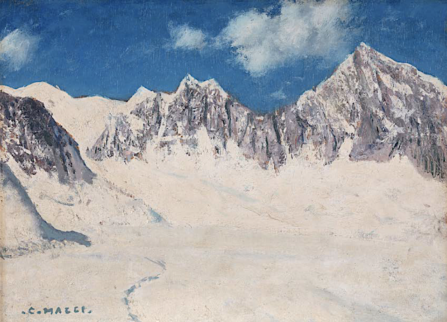
MONT-BLANC DU TACUL PAINTED BY CESARE MAGGI


Cesare Maggi (1881-1961),  Mont-Blanc du Tacul (4,248m -13,937 ft), France, Haute-Savoie,  Alpes, Alpes, Graian Alps Glacier du Géant, Chamonix, France, John Mitchell Gallery, London ,


CESARE MAGGI (1881-1962)
Mont Blanc du Tacul (4,248m -13,937 ft)
France ( Haute-Savoie)

 In Mont Blanc du Tacul seen from the Glacier du Géant, Chamonix, France. oil on panel, 27 x 37cm, courtesy John Mitchell Gallery, London 


The mountain
Mont Blanc du Tacul (4,248m - 13,937 ft) is a mountain in the Mont Blanc massif of the French Alps situated midway between the Aiguille du Midi and Mont Blanc. The Mont Blanc du Tacul looks like a large, snow-covered trapezoid. It is part of the peaks of the Alps over 4,000 meters, of which it is the twenty-fourth highest. To the north of the summit is the Aiguille du Midi, from which it is separated by the Col du Midi (3,532 m), to the south the Mont Maudit, from which it is separated by the Col Maudit (4,035 m), at the is the Aiguilles du Diable then the Glacier du Géant and to the west the Aiguille de Saussure (3,839 m) then the Bossons glacier which rises to its summit. It has a secondary summit, the eastern summit (4,247 m), which is the exit from the Gervasutti pillar. The official first ascent of Mont Blanc du Tacul was by a guideless party comprising Charles Hudson, Edward John Stevenson, Christopher and James Grenville Smith, E. S. Kennedy, Charles Ainslie and G. C. Joad on 8 August 1855. However, Courmayeur guides may have already ascended the peak during their attempts in 1854 and 1855 to force a way up Mont Blanc from the Italian side.

The painter
The italian painter Cesare Maggi was born into a family of actors, Maggi embarked on classical studies at his father’s wish but also took up painting at a very early age His debut in Florence at the Esposizione Annuale della Società di Belle Arti di Firenze in 1898 was followed by a short trip to Paris to catch up with the latest developments.
The crucial turning point in Maggi’s art came in 1889 with the posthumous show of work by Giovanni Segantini held by the Milanese Society of Fine Arts, which prompted a definitive shift to landscape painting of a Divisionist character. After a short stay in the Engadin, he returned to Milan before finally settling in Turin. Commercial collaboration with Alberto Grubicy until 1913 enabled Maggi to establish himself quickly as one of the leading representatives of the second generation of Divisionist painters in Italy. He painted a repertoire of readily comprehensible mountain landscapes focusing primarily on aspects of the visual perception of the reflection of light and colour but lacking the deep spirituality of Segantini’s work. He took part in the major Italian and European exhibitions and the Venice Biennale devoted an entire room to his work at the Esposizione Internazionale d’Arte of Venice in 1912. After an interlude devoted to portrait painting in the same decade, the artist’s mature work focused on greater simplification of subject matter, mostly in landscapes.
Maggi obtained the chair in painting at the Albertina Academy, Turin, in 1936.


___________________________________________
2021- Wandering Vertexes...
by Francis Rousseau

Thursday, February 25, 2021

THE GRAND TETON (3) PAINTED BY EVE DREWELOWE


https://wanderingvertexes.blogspot.com/2021/02/the-grand-teton-3-painted-by-eve.html

EVE DREWELOWE (1899-1988)
Grand Teton  (4,199 m - 13,775 ft)
United States of America (Wyoming)

In Sunlit sumit (Grand Teton) watercolor, 1949- Collection Kirkland, Museum of Fine & Decorative Art.

 
About this painting
This watercolor is a variation painted almost 10 years after a first watercolor dating from the 1930s, in exactly the same place but in a different season, in warmer colors and, as we can see, on a day when the sun appeared between the clouds.

The mountain
Grand Teton (4,199 m - 13,775 ft) is the highest mountain in Grand Teton National Park in Northwest Wyoming, and a classic destination in American mountaineering. It is the highest point of the Teton Range, and the second highest peak in the U.S. state of Wyoming after Gannett Peak. The mountain is entirely within the Snake River drainage basin, which it feeds by several local creeks and glaciers.The Teton Range is a subrange of the Rocky Mountains, which extend from southern Alaska to northern New Mexico.
Grand Teton's name was first recorded as Mount Hayden by the Washburn-Langford-Doane Expedition of 1870. However, the name "the Grand Teton" had early currency. The Edition of April, 1901 of the USGS 1:125,000 quadrangle map of the area shows "Grand Teton" as the name of the peak. A United States National Park named "Grand Teton National Park" was established by law in 1929. By 1931, the name Grand Teton Peak was in such common usage that it was recognized by the USGS Board on Geographic Names. Another shift in usage led the Board to shorten the name on maps to Grand Teton in 1970. The origin of the name is disputed. The most common explanation is that "Grand Teton" means "large teat" in French, named by either French-Canadian or Iroquois members of an expedition led by Donald McKenzie of the North West Company. However, other historians disagree, and claim that the mountain was named after the Teton Sioux tribe of Native Americans.

The painter
Eve Drewelowe was an American painter. Her career spanned six decades and produced more than 1,000 works of art in oil, watercolor, pen and ink and other media in styles that included impressionism, social realism and abstraction.
Despite dabbling with other artistic styles, Drewelowe always showed an inclination toward landscapes. She once said: “my waking thought from an embryo on was my need to be an artist.”
Though never known to have used the word to describe herself, Eve Drewelowe is often considered a feminist artist. Her personal life exhibited feminist themes: the artist retained her maiden name and publicly stated a disinterest in housework and parenting. Drewelowe chose not to take her husband’s last name because in her opinion it should not matter to others whether she is married or not. When Drewelowe and Van Ek returned from their travels and started building a house together. She did not want to be involved in the pleasantries of being the dean’s wife, especially hosting dinner parties, so she specified to have the house built lacking a dining room. She always maintained that she did not want to have children of her own, much to her mother’s dismay.
Although Drewelowe is mainly renowned in Colorado and Iowa, she had solo exhibitions all over the country. Her work was shown at National Association of Women Artists exhibitions, the Art Institute of Chicago, the Denver Art Museum, the National Museum of Women in the Arts and numerous other esteemed institutions. Although women had been in the profession of art for 20–30 years at the beginning of Drewelowe’s career, she still faced opposition and sexism. Critics believe that she could have been much more acclaimed had she not been a woman and had she not fallen ill at the peak of her career. Others believe that her “reincarnation” and transition to abstract paintings increased Drewelowe’s popularity as an artist by keeping her relevant in an evolving artistic world.

___________________________________________

2021 - Wandering Vertexes...
by Francis Rousseau