Friday, June 30, 2017

IBN SINA PEAK / LENIN PEAK IN VINTAGE STAMPS


VINTAGE STAMPS
Ibn Sina Peak / Lenin Peak (7,134 m - 23,406 ft)  
Tajikistan - Kyrgyzstan border 

1. In  Pik Lenin, Soviet Union 1986,  
from the series National Sports Committee Intl. Alpinist Camps- Part 1, courtesy mountainstamps.com collection
2. In Pik Lenin, Kyrgystan 2000
from the series International Year of Mountains, courtesy mountainstamps.com collection 
3. In Pik Lenin, Tajikistan 2011,  
from the series Old Steam Locomotives, courtesy mountainstamps.com collection  


The mountain 
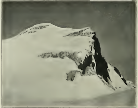
Lenin Peak (7,134 m - 23,406 ft)  renamed in July 2006 Ibn Sina Peak or Avicenna Peak, rises in Gorno-Badakhshan on the border of Tajikistan and Kyrgyzstan, and is the second-highest point of both countries. It is considered one of the easiest 7000 m peaks in the world to climb and it has by far the most ascents of any 7000 m or higher peak on Earth, with every year seeing hundreds of climbers make their way to the summit.  Lenin Peak is the highest mountain in the Trans-Alay Range of Central Asia, and in the Pamir Mountains in Tajikistan it is exceeded only by Ismoil Somoni Peak (7,495 m). It was thought to be the highest point in the Pamirs in Tajikistan until 1933, when Ismoil Somoni Peak (known as Stalin Peak at the time) was climbed and found to be more than 300 metres higher. Two mountains in the Pamirs in China, Kongur Tagh (7,649 m) and Muztagh Ata (7,546 m), are higher than the Tajik summits.
The peak was discovered in 1871 and originally named Mount Kaufmann after Konstantin Kaufman, the first Governor-General of Turkestan. In 1928, the mountain was renamed Lenin Peak after the Russian revolutionary and first leader of the Soviet Union, Vladimir Lenin. In Tajikistan, the peak was renamed again in July 2006, and today it is officially called in Tajik Qullai Abuali ibni Sino or  Ibn Sina Peak or, alternatively, Avicenna Peak after Abu Ali ibn Sina (Avicenna). In Kyrgyzstan, the peak is still officially called Lenin Chokusu (Lenin Peak).  Some sources give Achiktash as the Kyrgyz name for this 7,134 m mountain on the border with Tajikistan, but it seems that Achiktash, or more properly Achik-Tash, is the name of a plateau and a base camp at an elevation of 3,600 m on a popular northern climbing route to Lenin Peak, which starts in the southern Kyrgyz city of Osh, a day's drive north of the border.
Initial exploration of this part of Central Asia occurred in the period 1774–82. Arguably the first recorded travel through the region is the involuntary journey of the slave Filipp Efremov (an ethnic Russian), who escaped from slavery in Bukhara. He crossed the Fergana valley, then via Osh, the Chigirik Pass and Terekdavan Pass he reached the Kashgar and finally came over the Karakorum. He was the first European who crossed the Alai Mountains.
Scientific expeditions to the Alai Mountains began in 1871, when Alexei Pavlovich Fedchenko discovered the Trans-Alai  Range and its main peak. The first geographical expedition which came nearest to the base of the future Lenin Peak in the early 20th century was arguably the expedition of Nikolai Leopol'dovich Korzhenevskiy.
In September 1928, three mountaineers - the Germans Eugen Allwein and Karl Wien, and the Austrian Erwin Schneider - from a Soviet-German scientific expedition, made the first attempt to reach the highest point of the Trans-Alai Range, which at that time had the name Kaufman Peak. At the time, Kaufman Peak was the highest summit reached by men.
The title Lenin Peak was first applied to the highest point of the Trans-Alai Range in the same year (1928). When it was renamed after Lenin it was believed to be the highest point in the USSR.
On September 8, 1934, Kasian Chernuha, Vitaly Abalakov and Ivan Lukin, three members of a Soviet expedition, reached the summit at an elevation of 7,134 metres (23,406 ft). Their attempt lasted for four days with three camps (5700 m, 6500 m and 7000 m). The expedition started climbing from the Achik-Tash canyon in the Alai valley. The summit attempt itself was started along the Western ice slope of the Lenin glacier. They continued climbing along the North Face, passing the rocks that were later given the name Lipkin's Rocks. At the end of the second day they reached the crest of the NE ridge at an elevation of about 6500 m. During the following day and a half they climbed along the NE Ridge and, utterly exhausted, reached the summit.
 In 1937: the third ascent, when eight Soviet climbers under the direction of Lev Barkhash reached the summit by the same route. This was at the beginning of mass political repressions in the Soviet Union and many of the most prominent Soviet climbers, including Lev Barkhash, were brought to trial.
Subsequent attempts to climb Lenin Peak could not begin until 1950, when the USSR began to recover from the Second World War. On August 14, 1950, twelve climbers (V. Aksenov, K, Zaporojchenko, Y. Izrael, V. Kovalev, A. Kormshikov, Y. Maslov, E. Nagel, V. Narishkin, V. Nikonov, V. Nozdryuhin, I. Rojkov) under the direction of Vladimir Racek reached the summit for the fourth time.
In 1954, the route which now is known as the classic route, via the Razdelnaya Peak and NW Ridge, was first climbed  by the team of Soviet climbers under the direction of V. Kovalev (P. Karpov, E. Nagel, V. Narishkin, V. Nozdryuhin).
In 1989, Jaan Künnap, a decorated Estonian mountaineer, reached the top of Lenin Peak. This marked the first time an Estonian flag was flown at an altitude over 7000 m.
In 1960, a group of eight Soviet climbers made a successful direct climb along the North Face (15.08.1960).
There are 16 established routes, nine on the southern side and seven on the northern slopes. The peak is quite popular with climbers due to its easy access and some uncomplicated routes. However, the peak is not without its share of disasters.
 In 1974, an entire team of eight female climbers died high on the mountain in a storm.
In 1990, an avalanche triggered by an earthquake killed 43 climbers.

Thursday, June 29, 2017

SERRA DOS ORGAOS BY GEORG GRIMM


GEORG GRIMM (1846-1887) 
 Pedra do Sino (2,263m- 7,425 ft)
Dedo de Deus (1,682m - 5,551ft) 
Escalavrado  (1,490m -4,890 ft) 
Brazil

 In Serra dos Órgãos seen from Teresópolis, 1885, oil on canvas, Private collection 

The mountains 
Pedra do Sino (Bell Rock) at 2,263 metres (7,425 ft),  Dedo de Deus (God's finger) at 1,682m (5,551ft) and  Escalavrado at 1,692 m (5,551 ft) are the highest  peaks int the Serra dos Órgãos  (Organ Range), a mountain range located in the state of Rio de Janeiro, Brazil and containing the Serra dos Órgãos National Park. The peaks with steep rock walls are dramatic features that can be seen on a clear day from Rio de Janeiro, which is 50 kilometres (31 mi) distant. The Serra dos Órgãos cover san area of 20,024 hectares (49,480 acres). The range is an escarpment on the northern edge of the Guanabara Graben between the cities of Petropolis and Teresopolis. The name comes from perceived resemblance of the vertical rock formations created by erosion to the tubes of organs.
A north west fracture is exposed at the plateau's rock surfaces, which defines the direction of the ridges and valleys along the escarpment. One of these ridges contains several granite peaks including God's Finger. Formation of the rocks may have occurred around 620 million years ago. North east vertical fractures, spaced regularly about every 500 m (1,600 ft), cut the north west structures at right angles. Erosion along these fractures has isolated the massive rock blocks. The valleys have well-preserved deposits of debris that has fallen from the rock walls. In November 1981 a period of intense rain triggered hundreds of shallow landslides and flows of debris that blocked the BR-116 highway and killed about 20 people.

The painter 
Johann Georg Grimm  was a German painter, designer and decorator who is best known for the work he produced during a lengthy stay in Brazil. He worked his way across Bavaria, finally arriving in Munich in 1868, where he had accumulated just enough money to study at the Academy of Fine Arts under Karl von Piloty and Franz Adam. Despite living in a great poverty, he completed his studies successfully. He briefly served in the Franco-Prussian War, where he met the painter Thomas Georg Driendl, who would later join him in Brazil and work with him on several projects.
In 1872, he went on foot to Berlin, where a benefactor helped him to study fresco painting. He left Berlin later that year and headed for Italy. After extensive travels through Italy, North Africa via Sicily, Spain, France and England, he finally found himself in Lisbon and decided to go to Brazil, probably arriving in late 1877 or early 1878. He settled in Rio de Janeiro and soon teamed up with a fellow German immigrant who owned a painting and decorating company. His interest in landscapes began when he was hired by the owners of the nearby fazendas to paint topographical pictures of their properties, which he executed with photographic precision.
He briefly returned to Germany from 1880 to 1881, following the death of his father, then took off travelling again; this time eastward, to Greece, Turkey, Palestine and Egypt. After a stay in Corsica, he returned to Brazil. Shortly after his arrival, he and his old friend Driendl were hired to create decorations at the Liceu Literário Português which, unfortunately, were destroyed by fire in 1932. He then participated in an exhibition presented by the Sociedade Propagadora das Belas Artes, where he displayed the works he had painted after his earlier travel.  He received the Gold Medal and much public praise, which resulted in his appointment to a vacant chair at the Academia Imperial de Belas Artes,  obtained for him with the recommendation of Emperor Pedro II. One of the first things he did there was introduce the practice of plein-air painting.
Continuous disagreements with the Academy's leadership over his teaching methodology led to his resignation in 1884. Some of his students left with him and formed what came to be known as the "Grupo Grimm". It included many artists who would later become very well-known, such as Giovanni Battista Castagneto and Antônio Parreiras. The group had their first exhibition later that year at the Exposição Geral de Belas Artes, and several of them came away with Gold Medals.
Their association lasted only slightly more than a year, then broke up when Grimm was once again struck with wanderlust and moved to Minas Gerais, where he had worked during his first stay in the country. One of his initial projects there involved painting the curtains for the opera house in Sabará.This was followed by a tour of the coffee plantations, where he painted the life and work there as well as the architectural features he had depicted earlier.
During this time, he was diagnosed with tuberculosis. In June 1887, already ravaged by the disease, he called together his friends to say goodbye. He stayed for a short time with his brother in Wengen then, following his doctor's advice, went to Merano. Then, seeking a climate that was even more favorable, he went to Palermo. He died at the hospital there and was buried nearby.

Wednesday, June 28, 2017

XIANGIU PEAK / 翔宇峰 BY WU DACHENG / 吳大成


WU DACHENG / 吳大成 (1835–1902)
Xiangiu Peak / 翔宇峰 in Fragrant Hills (557m - 1,827ft)
China

In  Fragrant Mountains (清吳大澂山水扇面), Qing Dynasty (1644-1911), 
Folding fan mounted as an album leaf; ink on alum paper, The MET 

The Hill 
Xiangiu Peak / 翔宇峰 (557m - 1,827ft) is the highest point of the landscape complex known as The Fragrant Hills (Xiangshan / 象山)  located 25 km north west of Beijing. The park is a cool and appreciated place in summer for those wishing to escape the high temperatures of the capital.  The hills were occupied for the first time under the Jin Dynasty in 1186 and the Xiangshan Temple was built to house the Emperor during his hunting parties. But it is to the Emperor Qianlong that we owe the construction in 1745 of the largest part of the buildings. One can admire the Temple of the Clouds of Azure, the Fountain of Jade, the lake and the Summer Palace… to the skyscrapers of Beijing. Below, the botanical garden crosses the road leading to the Temple of the Lying Buddha (Wofosi). Famous for its five meter bronze lacquered coated Buddha, this temple was built under the Tang Dynasty. The best time to visit this 160 hectare park seems to be the late autumn when the leaves of the trees are dyed yellow and red. In this park, there are also pines, cypresses, maples, ginkos, fragrant orchards (apricots, pears, peaches) and many lilacs, all of which have subtle perfumes and explain the origin of the name of these hills.

The artist
The round, weighty brush strokes borrowed from the study of archaic scripts by late 19th century scholar artists are clearly seen in this fine ink landscape by Wu Dacheng.
As a Qing official, Wu Dacheng was a participant in several important events in 19th century history. When the Qing intervened in Annam in 1884 on behalf of the king against the French, Wu was sent to Tientsin to defend the city against the French attack. As governor of Guangdong, he negotiated customs duties on opium that continued to flow into the country through Canton and Macao, and without success recommended against ceding Macao to the Portuguese. As governor of Henan, he raised the standards of production in the lucrative silk and tea industries. When the Sino-Japanese War broke out in 1894, Wu took troops to defend a strategic northern mountain pass. His troops were defeated and he was dismissed from his post, after which he devoted his leisure to cultivating his talents as poet, calligrapher, seal cutter, connoisseur, collector, epigrapher and painter.

Tuesday, June 27, 2017

THE CANIGOU BY ALBERT MARQUET


ALBERT MARQUET (1875–1947) 
Canigou (2,784 m- 9,137 ft)
France (Pyrenees) 

 In Le Canigou vu de Vernet-les-Bains, 1940, watercolor on paper, Private collection 

The mountain 
The Canigou (2,784m - 9,137 ft.) is a mountain located in the Pyrenees-Orientales (southern France), south of Prades and north of Prats-de-Mollo-la-Preste. Its summit is a quadripoint between the territories of Casteil, Taurinya, Valmanya and Vernet-les-Bains. Its location makes it visible from the plains of Roussillon and from Conflent in France, and as well from Empordà in Spain. Due to its sharp flanks and its dramatic location near the coast, until the 18th century the Canigou was believed to be the highest mountain in the Pyrenees.
Twice a year, in early February and at the end of October, with good weather, the Canigou can be seen at sunset from as far as Marseille, 250 km away, by refraction of light. This phenomenon was observed in 1808 by baron Franz Xaver von Zach from the Notre-Dame de la Garde basilica in Marseille. All year long, it can also be seen, with good weather, from Agde, Port-Camargue and the Montagne Noire.
The mountain has symbolical significance for Catalan people. On its summit stands a cross that is often decorated with the Catalan flag.  Every year on 23 June, the night before St. John's day (nuit de la Saint Jean), day of the summer solstice, there is a ceremony called Flama del Canigó (Canigou Flame), where a fire is lit at the mountaintop. People keep a vigil during the night and take torches lit on the fire in a spectacular torch relay to light bonfires elsewhere. Many bonfires are lit in this way all over the Pyrénées-Orientales, Catalonia, Valencian Community, and Balearic Islands theoretically.

The painter 
Albert Marquet was a French painter, associated with the Fauvist movement. He initially became one of the Fauve painters and a lifelong friend of Henri Matisse. In 1890 Marquet moved to Paris to attend the Ecole des Arts Decoratifs, where he met Henri Matisse. They were roommates for a time, and they influenced each other's work. Marquet began studies in 1892 at the École des Beaux-Arts de Paris under Gustave Moreau, the famous symbolist artist. In 1905 he exhibited at the Salon d'Automne. Dismayed by the intense coloration in these paintings, critics reacted by naming the artists the "Fauves", i.e. the wild beasts. Although Marquet painted with the fauves for years, he used less bright and violent colours than the others, and emphasized less intense tones made by mixing complementaries, thus always as colors and never as grays.
Marquet subsequently painted in a more naturalistic style, primarily landscapes, but also several portraits and, between 1910 and 1914, several female nude paintings.
From 1907 to his death, Marquet alternated between working in his studio in Paris (a city he painted a lot of times) and many parts of the European coast and in North Africa. He was most involved with Algeria and Algiers and with Tunisia. He remained also impressed particularly with Naples and Venice where he painted the sea and boats, accenting the light over water.  During his voyages to Germany and Sweden he painted the subjects he usually preferred: river and sea views, ports and ships, but also cityscapes.
The watercolor of Pyrenees (above) is a rare example of Marquet painting mountains, which was not his favorite subject.
Marquet was particularly revered by the American painters Leland Bell and his wife Louisa Matthiasdottir. He was also revered by Bell's contemporaries Al Kresch and Gabriel Laderman. Since both Bell and Laderman were teachers in several American art schools, they have had an influence on younger American figurative artists and their appreciation of Marquet.
Matisse said ; "When I look at Hokusai, I think of Marquet—and vice versa ... I don't mean imitation of Hokusai, I mean similarity with him".

Monday, June 26, 2017

MOEBIUS PEAK BY VITTORIO SELLA


VITTORIO SELLA (1859-1943)
Moebius Peak (4,916 m-16,130 ft) 
Uganda - Congo border

1. In Moebius peak from the south east ridge of the Alexandra Peak, 1908 
hand painted photographs, Ruwenzori album
2.  In Moebius peak from the west, 1908, hand painted photographs, Ruwenzori album

The mountain 
Moebius Peak (4,916 m-16,130 ft) is one of the nine peaks constituting Mount Stanley.  The two highest summits are Margherita (5,109 m-16,763 ft)  and Alexandra (5,091m - 16, 703ft) and the others under 5000 m: Albert, Savoia, Elena, Elizabeth, Philip, Moebius and Great Tooth.  
Mt. Stanley was first climbed in 1906 by Duke of the Abruzzi, J. Petigax, C. Ollier, and J. Brocherel. Margherita Peak is named after Queen Margherita of Italy.
Mount Stanley is located in the Rwenzori range or Ruwenzori Range. It is the highest mountain of both the Democratic Republic of the Congo and Uganda, and the third highest in Africa, after Kilimandjaro (5,895 m) and Mount Kenya (5,199 m). The peak and several other surrounding peaks are high enough to support glaciers. Mount Stanley is named for the journalist and explorer, Sir Henry Morton Stanley. It is part of the Rwenzori Mountains National Park, a UNESCO world Heritage Site.

The photographer
Vittorio Sella is a mountain italian climber and photographer who took his passion for mountains from his uncle, Quintino Sella, founder of the Italian Alpine Club.  He accomplished many remarkable climbs in the Alps, the first wintering in the Matterhorn and Mount Rose (1882) and the first winter crossing of Mont Blanc (1888).
He took part in various expeditions outside Italy:
- Three in the Caucasus in 1889, 1890 and 1896 where a summit still bears his name;
- The ascent of Mount Saint Elias in Alaska in 1897;
- Sikkim and Nepal in 1899;
- Possibly climb Mount Stanley in Uganda in 1906 during an expedition to the Rwenzori;
- Recognition at  K2  and Chogolisa in 1909 ;
- In Morocco in 1925.
During expeditions in Alaska, Uganda and Karakoram (K2), he accompanied the Duke of Abruzzi, Prince Luigi Amedeo di Savoia.

Sunday, June 25, 2017

MOUNT KENYA PAINTED BY AKSELI GALLEN-KALLELA


AKSELI GALLEN-KALLELA (1865-1931) 
Mount Kenya (5,199 m -17,057 ft) 
Kenya 

1. In  Mount Kenya, November 1909, oil on canvas, Private collection 
2. In  Mount Kenya, 1910, oil on canvas, Private collection 

The mountain 
Mount Kenya  (5,199 m -17,057 ft)  is the highest mountain in Kenya and the second-highest in Africa, after Kilimanjaro. The origin of the name Kenya is not clear, but perhaps linked to the Kikuyu, Embu and Kamba words Kirinyaga, Kirenyaa and Kiinyaa which mean "God's resting place" in all three languages.  Mount Kenya is located in central Kenya, about 16.5 kilometres (10.3 mi) south of the equator, around 150 kilometres (93 mi) north-northeast of the capital Nairobi.
Mount Kenya is the source of the name of the Republic of Kenya.
Mount Kenya is a stratovolcano created approximately 3 million years after the opening of the East African rift.   Before glaciation, it was 7,000 m (23,000 ft) high. It was covered by an ice cap for thousands of years. This has resulted in very eroded slopes and numerous valleys radiating from the centre.  There are currently 11 small glaciers and 8 peaks of which the highest are : Batian (5,199 m -  (17,057 ft), Nelion (5,188 m - 17,021 ft)) and Point Lenana (4,985 m - 16,355 ft).   The forested slopes are an important source of water for much of Kenya (...)

The painter 
Akseli Gallen-Kallela was a Swedish-speaking Finnish painter who is best known for his illustrations of the Kalevala, the Finnish national epic. His work was considered very important for the Finnish national identity. He changed his name from Gallen to Gallen-Kallela in 1907. In 1884 he moved to Paris, to study at the Académie Julian and became friends with the Finnish painter Albert Edelfelt, the Norwegian painter Adam Dörnberger, and the Swedish writer August Strindberg.
In December 1894, Gallen-Kallela moved to Berlin to oversee the joint exhibition of his works with the works of Norwegian painter Edvard Munch. Here he became acquainted with the Symbolists.
On his return from Germany, Gallen studied print-making and visited London to deepen his knowledge, and in 1898 studied fresco-painting in Italy.
For the Paris World Fair in 1900, Gallen-Kallela painted frescoes for the Finnish Pavilion. In these frescoes, his political ideas became most apparent (...)

_______________________________
2017 - Wandering Vertexes...
by Francis Rousseau 

Saturday, June 24, 2017

MOUNT TALLAC PAINTED BY THOMAS HILL


THOMAS HILL (1829-1908) 
Mount Tallac (2,968m - 9, 739ft) 
United States of America (California) 

In  Mount Tallac from Lake Tahoe, 1880, oil on canvas, San Fransisco De Young Museum

The mountain
Mount Tallac  (2,968m - 9, 739ft) is a mountain peak southwest of Lake Tahoe, in El Dorado County, California. The peak lies within the Desolation Wilderness in the Eldorado National Forest.
Mount Tallac is quite visible from State Routes 89 and 28, and U.S. Route 50.  It is probably the most recognizable of the Tahoe Area peaks. With its distinctive "cross" of snow rising directly above the southwest corner of Lake Tahoe, Mount Tallac commands attention. While neither the highest peak in the area nor the hardest to summit, Mount Tallac nonetheless serves up enough adventure to satisfy nearly everyone.  Compared to the giants of the southern Sierra Nevada, Mount Tallac is a mere child. Still, it stands over 3,500 feet above the surface of Lake Tahoe, and from the summit, one may take in panoramic views of that amazing lake, as well as the enchanting peaks of Desolation Wilderness area. .The views from the summit, as well as the mountain's proximity to highway 89 and its wide selection of terrain types, make Mount Tallac one of the top hiking and backcountry skiing destinations in California.
Geologically, Mount Tallac is situated roughly on the boundary between the granites of the Sierra Nevada batholith, and the earlier metamorphosed sedimentary rocks. The southern and eastern slopes, especially Cathedral Peak, are crumbly, clinky "metaseds", while the other parts of the mountain are a bit more solid, but not Sierran granite, quite like Mount Ritter.
Source:
- Summit post

The painter
Thomas Hill was an American artist of the 19th century. He produced many fine paintings of the California landscape, in particular of the Yosemite Valley, as well as the White Mountains of New Hampshire. Hill’s work was often driven by a vision resulting from his experiences with nature. For Thomas Hill, Yosemite Valley and the White Mountains of New Hampshire were his sources of inspiration to begin painting and captured his direct response to nature.
Hill was loosely associated with the Hudson River School of painters. The Hudson River School celebrated nature with a sense of awe for its natural resources, which brought them a feeling of enthusiasm when thinking of the potential it held. Mainly the earlier members of the Hudson River School, around the 1850-60’s, displayed man as in unison with nature in their landscape paintings by often painting men on a very small scale compared to the vast landscape. Thomas Hill often brought this technique into his own paintings in for example in his painting, Yosemite Valley, 1889.
He made early trips to the White Mountains with his friend Benjamin Champney and painted White Mountain subjects throughout his career. An example of his White Mountain subjects is Mount Lafayette in his Mount Lafayette in Winter.
Hill acquired the technique of painting en plein air. These paintings in the field later served as the basis for larger finished works.
In plein air means to “paint outdoors and directly from the landscape”,[ which Hill incorporated into many of his paintings. Hill’s landscape paintings demonstrate how he combined his powers of observation with powerful motifs in each painting.
Hill’s move to California in 1861 brought him new material for his paintings. He chose monumental vistas, like Yosemite. During his lifetime, Hill’s paintings were popular in California, costing as much as $10,000.  Hill's best works are considered to be these monumental subjects, including Great Canyon of the Sierra, Yosemite, Vernal Falls and Yosemite Valley.
Source: 
- Sullivan Goss An American Gallery 

Friday, June 23, 2017

MACHU PICCHU PAINTED BY GEORGIA O'KEEFFE


GEORGIA O' KEEFFE (1887–1986)
Machu Picchu (2,430 m -7,970 ft)
Peru

1. In Machu Picchu, morning light (Peruvian Landscape), n.d. watercolor on paper (9 x 11 7/8 i.), 
Heckscher Museum of Art


The mountain and site 
Machu Picchu  is a 15th-century Inca citadel situated on a mountain ridge 2,430 m -7,970 ft above sea level. It is located in the Cusco Region, Urubamba Province, Machupicchu District in Peru, above the Sacred Valley, which is 80 kilometres (50 mi) northwest of Cuzco and through which the Urubamba River flows. Machu Picchu lies in the southern hemisphere, 13.164 degrees south of the equator. It is 80 kilometres (50 miles) northwest of Cusco, on the crest of the mountain Machu Picchu, located about 2,430 m-7,970 feet above mean sea level, over 1,000 m-3,300 ft lower than Cusco, which has an elevation of (3,600 m -11,800 ft. As such, it had a milder climate than the Inca capital. It is one of the most important archaeological sites in South America, one of the most visited tourist attractions in Latin America  and the most visited in Peru.
The city sits in a saddle between the two mountains Machu Picchu and Huayna Picchu, with a commanding view down two valleys and a nearly impassable mountain at its back.
Most archaeologists believe that Machu Picchu was built as an estate for the Inca emperor Pachacuti (1438–1472). Often mistakenly referred to as the "Lost City of the Incas" (a title more accurately applied to Vilcabamba), it is the most familiar icon of Inca civilization. The Incas built the estate around 1450 but abandoned it a century later at the time of the Spanish Conquest. Although known locally, it was not known to the Spanish during the colonial period and remained unknown to the outside world until American historian Hiram Bingham brought it to international attention in 1911.


The Painter
Georgia O’Keeffe is one of the most significant and intriguing artists of the twentieth century, known internationally for her boldly innovative art. Her distinct flowers, dramatic cityscapes, glowing landscapes, and images of bones against the stark desert sky are iconic and original contributions to American Modernism.
Born on November 15, 1887, the second of seven children, Georgia Totto O’Keeffe grew up on a farm near Sun Prairie, Wisconsin. She studied at the Art Institute of Chicago in 1905-1906 and the Art Students League in New York in 1907-1908. Under the direction of William Merritt Chase, F. Luis Mora, and Kenyon Cox she learned the techniques of traditional realist painting. The direction of her artistic practice shifted dramatically in 1912 when she studied the revolutionary ideas of Arthur Wesley Dow. Dow’s emphasis on composition and design offered O’Keeffe an alternative to realism. She experimented for two years, while she taught art in South Carolina and west Texas. Seeking to find a personal visual language through which she could express her feelings and ideas, she began a series of abstract charcoal drawings in 1915 that represented a radical break with tradition and made O’Keeffe one of the very first American artists to practice pure abstraction.
O’Keeffe mailed some of these highly abstract drawings to a friend in New York City, who showed them to Alfred Stieglitz. An art dealer and internationally known photographer, he was the first to exhibit her work in 1916. He would eventually become O’Keeffe’s husband.
In the summer of 1929, O’Keeffe made the first of many trips to northern New Mexico. The stark landscape, distinct indigenous art, and unique regional style of adobe architecture inspired a new direction in O’Keeffe’s artwork. For the next two decades she spent part of most years living and working in New Mexico . She made the state her permanent home in 1949, three years after Stieglitz’s death. O’Keeffe’s New Mexico paintings coincided with a growing interest in regional scenes by American Modernists seeking a distinctive view of America. Her simplified and refined representations of this region express a deep personal response to the high desert terrain.
In the 1950s, O’Keeffe began to travel internationally. She created paintings that evoked a sense of the spectacular places she visited, including the mountain peaks of Peru (see above) and Japan’s Mount Fuji. At the age of seventy-three she embarked on a new series focused on the clouds in the sky and the rivers below....


Thursday, June 22, 2017

MOUNT ETNA PAINTED BY CARL ROTTMANN


CARL ROTTMANN (1797-1950) 
                                             Mount Etna or Mongibello (3,329 m - 10,922ft) 
 Italy (Sicily) 

 In Taormina with Mount Etna, 1829, oil on canvas,  Neue Pinakothek Munchen  


The Mountain 
Mount Etna (3,329 m - 10,922ft) or Mongibello, Mungibeddu in Sicilian, Aetna in Latin is an active stratovolcano on the east coast of Sicily, in the Province of Catania, between Messina and Catania. It lies above the convergent plate margin between the African Plate and the Eurasian Plate. It is the tallest active volcano in Europe. It is the highest mountain in Italy south of the Alps. Etna covers an area of 1,190 km2 (459 sq mi) with a basal circumference of 140 km. This makes it by far the largest of the three active volcanoes in Italy, being about two and a half times the height of the next largest, Mount Vesuvius. Only Pico del Teide in Tenerife surpasses it in the whole of the European–North-African region.  In Greek Mythology, the deadly monster Typhon was trapped under this mountain by Zeus, the god of the sky and thunder and king of gods, and the forges of Hephaestus were said to also be located underneath it.
Mount Etna is one of the most active volcanoes in the world and is in an almost constant state of activity. The fertile volcanic soils support extensive agriculture, with vineyards and orchards spread across the lower slopes of the mountain and the broad Plain of Catania to the south. 
Due to its history of recent activity and nearby population, Mount Etna has been designated a Decade Volcano by the United Nations.
 In June 2013, it was added to the list of UNESCO World Heritage Sites.

The painter 
Carl Anton Joseph Rottmann was a German landscape painter and the most famous member of the Rottmann family of painters. Rottmann belonged to the circle of artists around the Ludwig I of Bavaria, who commissioned large landscape paintings exclusively from him. He is best known for mythical and heroising landscapes. The landscape painter Karl Lindemann-Frommel belonged to his school.
Rottmann  received his first drawing lessons from his father, Friedrich Rottmann, who taught drawing at the university in Heidelberg. He formed himself chiefly through the study of nature and of great masterworks. In his first artistic period, he painted atmospheric phenomena. After gaining prominence with Heidelberg at Sunset (a water color), and Castle Eltz, he settled in Munich in 1822 and devoted himself to Bavarian scenery. Here his second period began, and in 1824 he married Friedericke, the daughter of his uncle, Friedrich Ludwig von Sckell, who served as an attendant at court. Through this connection, he made the acquaintance of King Ludwig I of Bavaria, who in 1826/27 sponsored his travels in Italy in order to widen his repertoire, which up to that point consisted solely of domestic, German, landscapes. In Italy, Rottmann made sketches for the 28 Italian landscapes in fresco which he was commissioned to paint in the arcades of the Hofgarten at Munich. The cycle, completed in 1833, gave visual expression to Ludwig’s alliance with Italy, and raised the genre of landscape painting to the height of history painting, the preferred mode of the King’s other great commissions for monumental painting. The frescos unfortunately deteriorated under climatic influences. The cartoons for them are in the Darmstadt Gallery.
In 1834 Rottmann traveled to Greece to prepare for a commission from Ludwig for a second cycle; one might mark here the beginning of his third period. At first also intended for the Hofgarten arcade, the 23 great landscapes were eventually installed in the newly built Neue Pinakothek where they were given their own hall.
Of his easel pictures, Ammer Lake and Marathon are in the National Gallery, Berlin; The Acropolis of Sikyon and Corfu in the Pinakothek, Munich; others in the Schack Gallery, Munich, and in Karlsruhe; and seven in the Leipzig Museum.

Wednesday, June 21, 2017

MOUNT TARAWERA AND THE TERRACES BY CHARLES BLOMFIELD


CHARLES BLOMFIELD (1848-1926)
Mount Tarawera (1, 111m - 3,645ft) 
New Zealand (North Island)


1. In White Terraces,  Lake Rotomahana, 1885, oil on canvas,  Auckland Art Gallery Toi O Tamaki 
2. In  The Terraces, 1886, oil on canvas, Museum of New Zeland Te Papa Tongarewa
3. In Mount Tarawera in eruption on June 1886,  Museum of New Zeland Te Papa Tongarewa
4. In Mount Tarawera after eruption,1900 oil on canvas, Private collection 

The mountain 
Mount Tarawera (1, 111m - 3,645ft) is the volcano responsible for one of New Zealand's largest historic eruptions. Located 24 kilometres southeast of Rotorua in the North Island, it consists of a series of rhyolitic lava domes that were fissured down the middle by an explosive basaltic eruption in 1886, which killed an estimated 120 people. These fissures run for about 17 kilometres northeast-southwest.
The volcano's component domes include Ruawahia Dome, Tarawera Dome and Wahanga Dome. It is surrounded by several lakes, most of which were created or drastically altered by the 1886 eruption. These lakes include Lakes Tarawera, Rotomahana, Rerewhakaaitu, Okataina, Okareka, Tikitapu (Blue Lake) and Rotokakahi (Green Lake). The Tarawera River runs northeastwards across the northern flank of the mountain from Lake Tarawera.
Main eruptions 
- 1315 : Mount Tarawera erupted for the fist time on modern history. The ash thrown from this event may have affected temperatures around the globe and precipitated the Great Famine of 1315–17 in Europe.
- 1886 : Shortly after midnight on the morning of 10 June 1886, a series of more than 30 increasingly strong earthquakes were felt in the Rotorua area and an unusual sheet lightning display was observed from the direction of Tarawera. At around 2:00 am a larger earthquake was felt and followed by the sound of an explosion. By 2:30 am Mount Tarawera's three peaks had erupted, blasting three distinct columns of smoke and ash thousands of metres into the sky (see painting above). At around 3.30 am, the largest phase of the eruption commenced; vents at Rotomahana produced a pyroclastic surge that destroyed several villages within a 6 kilometre radius, and the Pink and White Terraces appeared to be obliterated.
The eruption was heard clearly as far away as Blenheim and the effects of the ash in the air were observed as far south as Christchurch, over 800 km away. In Auckland the sound of the eruption and the flashing sky was thought by some to be an attack by Russian warships.
Although the official contemporary death toll was 153, exhaustive research by physicist Ron Keam only identified 108 people killed by the eruption. Much of the discrepancy was due to misspelled names and other duplications. Allowing for some unnamed and unknown victims, he estimated that the true death toll was 120 at most.  Some people claim that many more people died.
The eruption also buried many Māori villages, including Te Wairoa which has now become a tourist attraction (Buried Village of Te Wairoa) and the world-famous Pink and White Terraces were lost. A small portion of the Pink Terraces was rediscovered under Lake Rotomahana 125 years later. Approximately 2 cubic kilometres of tephra was erupted, more than Mount St. Helens ejected in 1980. Many of the lakes surrounding the mountain had their shapes and areas dramatically altered, especially the eventual enlargement of Lake Rotomahana, the largest crater involved in the eruption, as it re-filled with water.
Legend
One legend surrounding the 1886 eruption is that of the phantom canoe. Eleven days before the eruption, a boat full of tourists returning from the Terraces saw what appeared to be a war canoe approach their boat, only to disappear in the mist half a mile from them. One of the witnesses was a clergyman, a local Maori man from the Te Arawa iwi. Nobody around the lake owned such a war canoe, and nothing like it had been seen on the lake for many years. It is possible that the rise and fall of the lake level caused by pre eruption fissures had freed a burial waka (canoe) from its resting place. Traditionally dead chiefs were tied in an upright position. A number of letters have been published from the tourists who experienced the event.
Though skeptics maintained that it was a freak reflection seen on the mist, tribal elders at Te Wairoa claimed that it was a waka wairua (spirit canoe) and was a portent of doom. It has been suggested that the waka was actually a freak wave on the water, caused by seismic activity below the lake, but locals believe that a future eruption will be signaled by the reappearance of the canoe.
Source: 
 - National Museum of Natural History

The painter 
 Charles Blomfield  was a New Zealand decorator, artist and music teacher born in London, England.
A widow, Blomfield's mother brought her family to New Zealand in the 1860's intending to settle in Northland as part of a settlement called Albertland. On arrival in Auckland they decided not to proceed on Northland to become farmers but to pursue urban trades in Auckland. The family remained in Auckland after that and many of the descendants of the various children still reside in the Auckland area.
Charles Blomfield lived in Freeman's Bay - 40 Wood Street, in a house built by his brother and allegedly made out of the timber from one large Kauri tree. As well as an exhibiting easel painter Blomfield worked as a sign-writer and interior decorator; for this trade he maintained studios in shops at various times. These were usually on Karangahape Road, one of these was shared with his daughter who made a living painting floral pieces which she also exhibited at the Auckland Society of Arts.
Blomfield travelled throughout the centre of the North Island on several occasions in the 1870s and 80s creating many landscape paintings of the New Zealand countryside, often for sale to visitors to New Zealand. He was fortunate to view the famed Pink and White Terraces several times and paint them before they were destroyed by the eruption of Tarawera in 1886. His meticulous sketches and finished paintings are some of the main records of them (see above).  For the remainder of his life he was probably able to rely on new versions of his classic views of them to supplement his income.
His paintings are widely regarded as the epitome of 19th century New Zealand landscape art, although his work, like many of his contemporaries, fell out of fashion during the 20th century, only to be re-evaluated in the 1970s. He was unable to come to terms with developments in art and remained staunchly conservative and hostile to 'modern art'. In his later years he found himself increasingly sidelined by the artistic circles in Auckland which he had previously shone in and was probably embittered by this.
Blomfield died at his residence in Wood Street in 1926. He was survived by several children. One of his brothers, William, was a noted newspaper cartoonist.
 Source : 


Tuesday, June 20, 2017

MONTAGNE SAINTE VICTOIRE BY AUGUSTE RENOIR


PIERRE-AUGUSTE RENOIR  (1841-1919)
 Mount of Sainte-Victoire (1, 011 m - 3, 316ft)
France (Provence) 

In La Montagne Sainte Victoire, ca.1888-89, oil on canvas,  (53x64,1cm) 

The mountain
Mont Sainte-Victoire our Montagne Sainte-Victoire (1,011 m-3,316ft)  also called Mont Venturi is a limestone massif in the South of France, in the region Provence-Alpes-Côte d'Azur. Located east of Aix-en-Provence, it has experienced international fame, due to the more than 80 works Paul Cézanne did on it. It hosts many hikers, climbers and nature lovers, and is a major element of Aix landscape. The range of the Sainte-Victoire is 18 kilometers long and 5 kilometers from large, following a strict east-west orientation. It is located on the Bouches-du-Rhône and Var, and in the towns of Puyloubier, Saint-Antonin-sur-Bayon, Rousset, Châteauneuf-le-Rouge, Beaurecueil, Le Tholonet Vauvenargues, Saint-Marc-Jaumegarde, Pourrières, Artigues and Rians.
D 10 and D 17 (Route Cézanne) are the main roads to skirt the mountains. On the northern side, the D10 crosses the Col de Claps (530 m) and the Col des Portes (631 m). On the southern side, the D 17 walks on the Plateau de Cengle and crossed the Collet blanc de Subéroque (505 m)...
The painter 
 Pierre-Auguste Renoir, commonly known as Auguste Renoir  was a French artist who was a leading painter in the development of the Impressionist style.
Renoir's paintings are notable for their vibrant light and saturated color, most often focusing on people in intimate and candid compositions. The female nude was one of his primary subjects. In characteristic Impressionist style, Renoir suggested the details of a scene through freely brushed touches of color, so that his figures softly fuse with one another and their surroundings.
His initial paintings show the influence of the colorism of Eugène Delacroix and the luminosity of Camille Corot. He also admired the realism of Gustave Courbet and Édouard Manet, and his early work resembles theirs in his use of black as a color. Renoir admired Edgar Degas' sense of movement. Another painter Renoir greatly admired was the 18th-century master François Boucher.
In the late 1860s, through the practice of painting light and water en plein air (outdoors), he and his friend Claude Monet discovered that the color of shadows is not brown or black, but the reflected color of the objects surrounding them, an effect known today as diffuse reflection. Several pairs of paintings exist in which Renoir and Monet worked side-by-side, depicting the same scenes (La Grenouillère, 1869). He rarely painted landscapes without silhouettes like the Mount Sainte Victoire above, probably done as a tribute to Paul Cézanne.
One of the best known Impressionist works is Renoir's 1876 Dance at Le Moulin de la Galette (Bal du moulin de la Galette). The painting depicts an open-air scene, crowded with people at a popular dance garden on the Butte Montmartre close to where he lived. The works of his early maturity were typically Impressionist snapshots of real life, full of sparkling color and light. By the mid-1880s, however, he had broken with the movement to apply a more disciplined formal technique to portraits and figure paintings, particularly of women. It was a trip to Italy in 1881 when he saw works by Raphael and other Renaissance masters, that convinced him that he was on the wrong path, and for the next several years he painted in a more severe style in an attempt to return to classicism. Concentrating on his drawing and emphasizing the outlines of figures, he painted works such as The Large Bathers (1884–87; Philadelphia Museum of Art) during what is sometimes called his "Ingres period".
After 1890 he changed direction again. To dissolve outlines, as in his earlier work, he returned to thinly brushed color. From this period onward he concentrated on monumental nudes and domestic scenes, fine examples of which are Girls at the Piano, 1892, and Grandes Baigneuses, 1887. The latter painting is the most typical and successful of Renoir's late, abundantly fleshed nudes.
A prolific artist, he created several thousand paintings. The warm sensuality of Renoir's style made his paintings some of the most well-known and frequently reproduced works in the history of art. The single largest collection of his works—181 paintings in all—is at the Barnes Foundation, in Philadelphia.
He was the father of actor Pierre Renoir (1885–1952), filmmaker Jean Renoir (1894–1979) and ceramic artist Claude Renoir (1901–1969). He was the grandfather of the filmmaker Claude Renoir (1913–1993), son of Pierre.

Monday, June 19, 2017

MOUNT BANAHAW PAINTED BY FERNANDO AMORSOLO


FERNANDO AMORSOLO (1882-1972)
 Mount Banahaw (2, 170m- 7, 120ft)
Philippines (Luzon)

In Banahao de Luchan, oil on canvas

The Mountain 
Mount Banahaw (2, 170m- 7, 120ft) also called Banahao or Banбjao is an active volcano on Luzon in the Philippines. The three-peaked volcano complex is located between the provinces of Laguna and Quezon and is the tallest mountain in the Calabarzon region dominating the landscape for miles around.
The andesitic Banahaw volcano complex is composed of several mountains of which Mount Banahaw is the largest . The summit is topped by a 1.5 by 3.5 kilometres (0.93 mi × 2.17 mi) and 210 metres (690 ft) deep crater that is breached on the southern rim believed to have been caused by the 1730 eruption. Prior to 1730, a lake occupied the summit crater of Mount Banahaw. The resulting flood destroyed the town of Sariaya, Quezon located below the mountain. The las eruption was in 1843.
Banahaw is a traditional pilgrimage site for locals, believed by many as a "Holy mountain", a spiritually-charged location.  The mountain and its environs are considered sacred by local residents; the water from its sacred springs are deemed "holy water" for allegedly having beneficial qualities, issuing forth from locations called "puestos" or "holy sites". These sites are unique natural features composed not only of springs, but also caves, streams and boulders; with names with biblical allusions, and shrines erected in, on or around them. These locations were allegedly revealed to a man named Agripino Lontoc by the "Santong Boses" or the "Holy Voices", which also gave the names to these places way back during the Spanish Colonial Era. Another one of this mountain is the adjacent Mount Banahaw de Lucbán.
Due to incessant climbing activity the mountain trails have become littered with trash. In March 2004, the Department of Environment and Natural Resources ordered a 5-year suspension of hiking activity in the mountains, covering the Dolores and Sariaya trails. Reopening was delayed was then scheduled to March 2012, but was further extended to February 2015. Mount Banahaw is located in a protected area known as Mounts Banahaw–San Cristobal Protected Landscape covering 10,901 hectares (26,940 acres) of land.

The painter 
Fernando Cueto Amorsolo was one of the most important artists in the history of painting in the Philippines.Amorsolo was a portraitist and painter of rural Philippine landscapes. He is popularly known for his craftsmanship and mastery in the use of light. After graduating from the Univeajor influences on his work. Amorsolo set up his own studio upon his return to Manila and painted prodigiously during the 1920s and the 1930s. His Rice Planting (1922), which appeared on posters and tourist brochures, became one of the most popular images of the Commonwealth of the Philippines. Beginning in the 1930s, Amorsolo's work was exhibited widely both in the Philippines and abroad. His bright,optimistic, pastoral images set the tone for Philippine painting before World War II . Except for his darker World War II-era paintings, Amorsolo painted quiet and peaceful scenes throughout his career.
Amorsolo was sought after by influential Filipinos including Luis AranetaAntonio Araneta and Jorge B. Vargas. Amorsolo also became the favourite Philippine artist of United States officials and visitors to the country. Due to his popularity, Amorsolo had to resort to photographing his works and pasted and mounted them in an album. Prospective patrons could then choose from this catalog of his works. Amorsolo did not create exact replicas of his trademark themes; he recreated the paintings by varying some elements.
His works later appeared on the cover and pages of children textbooks, in novels, in commercial designs, in cartoons and illustrations for the Philippine publications such The IndependentPhilippine MagazineTelembangEl Renacimiento Filipino, and Excelsior. He was the director of the University of the Philippine's College of Fine Arts from 1938 to 1952.
During the 1950s until his death in 1972, Amorsolo averaged to finishing 10 paintings a month. However, during his later years, diabetes, cataracts, arthritis, headaches, dizziness and the death of two sons affected the execution of his works. Amorsolo underwent a cataract operation when he was 70 years old, a surgery that did not impede him from drawing and painting.
After being confined at the St. Luke's Hospital in Quezon City for two months, Amorsolo died  at the age of 79 on April 24, 1972. The volume of paintings, sketches and studies of Amorsolo is believed to have reached more than 10,000 pieces. Amorsolo was an important influence on contemporary Filipino art and artists, even beyond the so-called "Amorsolo school." Amorsolo's influence can be seen in many landscape paintings by Filipino artists, including early landscape paintings by abstract painter Federico Aguilar Alcuaz.
In 2003, Amorsolo's children founded the Fernando C. Amorsolo Art Foundation, which is dedicated to preserving Fernando Amorsolo's legacy, promoting his style and vision, and preserving a national heritage through the conservation and promotion of his works.
Sources
 - Fernando Amorsolo foundation web site 

2017 - Wandering Vertexes...
by Francis Rousseau 

Sunday, June 18, 2017

CERVIN / MATTERHORN BY EMIL NOLDE


EMIL NOLDE  (1867-1956) 
Cervin / Matterhorn  (4,478m -14,691ft)
Switzerland - Italy 

In Das Matterhorn Ladrelt (Smiling Watterhorn), 1897, gouache-poscard, 


The mountain 
The  Mont Cervin (4,478m -14,691ft) also known as the Matterhorn is an alpine summit located on the Swiss-Italian border between the canton of Valais and the Aosta Valley in Switzerland. It has several other names: Cervino in Italian, Grand'Bèca in Arpitan, Matterhorn in German. The Cervin / Matterhorn is the most famous mountain in Switzerland, including the pyramidal shape that it offers from the village of Zermatt, in the German-speaking part of the canton of Valais.
Its four sides are joined about 400 meters below the summit in a summit pyramid, called "roof." Its summit is a broad ridge about two meters, on which stand actually two summits: one called "Swiss summit," the farther east, and the "Italian summit" slightly lower (4,476 meters), on the west side of the ridge. The two are separated by a notch in the hollow of which a cross was laid in September 1901.
- More about Mont Cervin / Matterhorn

The painter 
Emil Nolde (born Emil Hansen) was a German-Danish painter and printmaker. He was one of the first Expressionists, a member of Die Brücke (The Bridge) of Dresden in 1906, and was one of the first oil painting and watercolor painters of the early 20th century to explore color. He is known for his brushwork and expressive choice of colors. Golden yellows and deep reds appear frequently in his work, giving a luminous quality to otherwise somber tones. His watercolors include vivid, brooding storm-scapes and brilliant florals.
Nolde's intense preoccupation with the subject of flowers reflects his continuing interest in the art of Vincent van Gogh.
From the early 1920s,  Nolde was a supporter of the Nazi party, having become a member of its Danish section. He expressed anti-semitic, negative opinions about Jewish artists, and considered "Expressionism to be a distinctively Germanic style". This view was shared by some other members of the Nazi party, notably Joseph Goebbels and Fritz Hippler.
However Hitler rejected all forms of modernism as "degenerate art", and the Nazi regime officially condemned Nolde's work. Until that time he had been held in great prestige in Germany. A total of 1,052 of his works were removed from museums, more than those of any other artist.  Some were included in the Degenerate Art exhibition of 1937, despite his protests, including (later) a personal appeal to Nazi gauleiter Baldur von Schirach in Vienna. He was not allowed to paint—even in private—after 1941. Nevertheless, during this period he created hundreds of watercolors, which he hid. He called them the "Unpainted Pictures".
In 1942 Nolde wrote: "There is silver blue, sky blue and thunder blue. Every color holds within it a soul, which makes me happy or repels me, and which acts as a stimulus. To a person who has no art in him, colors are colors, tones tones...and that is all. All their consequences for the human spirit, which range between heaven to hell, just go unnoticed."
After World War II, Nolde was once again honored, receiving the German Order of Merit, He died in Seebüll (now part of Neukirchen). The Schiefler Catalogue raisonné of his prints describes 231 etchings, 197 woodcuts, 83 lithographs, and 4 hectographs.

About this work 
The postcards series date from  pre-expressionist phase of Nolde’s career (though he was around 30 when he created them). After hiking in the Swiss Alps, Nolde did a painting, Mountain Giants, presenting the mountains in human form. Nolde wrote : “The picture went to the annual exhibition in Munich in 1896. [Ferdinand] Hodler’s picture “Night”  which established his fame, was also there. But my “Mountain Giants" was soon returned, rejected… In those days there was a general and stormy derision and ridicule about each of Hodler’s pictures. ‘And his colors are as ugly as can be possible!’ What help was my contradiction and my firm conviction that his sinuous, pushing, wry bodies are part of the character of the mountain folk, just as the firs on the mountain slopes are gnarled and grown oddly.” From then, he painted practically every Swissw Alps Summit in human form: the Zugspitze, the Waxenstein, the Eiger, the Monch, the Jungfrau, the Grand Saint- Gothard, Piz Bernina, the Morteratch, the Ortler, the Finsteraarhorn... they will be posted one after one in this blog, the Cervin / Matterhorn being the first one.


Saturday, June 17, 2017

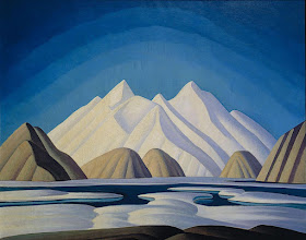
MOUNT ODIN & BUFFIN MOUNTAINS BY LAWREN HARRIS


LAWREN S.  HARRIS (1885-1970)
 Mount Odin and Baffin mountains (2, 147m to 1, 675m - 7, 044ft to 3, 495ft) 
Canada (Nunavut)


The Mountain 
The Baffin Mountains are a mountain range composed by 10 peaks running along the northeastern coast of Baffin Island and Bylot Island, Nunavut, Canada; they are  are part of the Arctic Cordillera. The ice-capped mountains are some of the highest peaks of eastern North America. While they could be considered a single mountain range as they are separated by bodies of water to make Baffin Island, this is not true, as they are closely related to the other mountain ranges that make the much larger Arctic Cordillera mountain range.
The highest point is Mount Odin (2,147 m -7,044 ft) while Mount Asgard at (2,015 m -6,611 ft) is perhaps the most famous. The highest point in the northern Baffin Mountains is Qiajivik Mountain (1,963 m -6,440 ft).
Highest Peaks of the Baffin Mountains are : 
- Mount Odin  (2,147m - 7,044ft)
- Mount Asgard (2,015m - 6,611ft) 
- Qiajivik Mountain (1,963m - 6,440ft)
- Angilaaq Mountain (1,951m - 6,401ft)
- Kisimngiuqtuq Peak (1,905m -  6,250ft)
- Ukpik Peak (1,809m - 5,935ft)
- Bastille Peak (1,733m - 5,686ft)
- Mount Thule (1,711m- 5,61ft)
- Angna Mountain (1,710m- 5,610ft)
- Mount Thor (1,675m-  5,495ft)
There are no trees in the Baffin Mountains because the mountains are north of the Arctic tree line. The dominant vegetation in the Baffin Mountains is a discontinuous cover of mosses, lichens and cold-hardy vascular plants such as sedge and cottongrass. 
Rocks that comprise the Baffin Mountains are primarily deeply dissected granitic rocks. It was covered with ice until about 1500 years ago, and vast parts of it are still ice-covered. Geologically, the Baffin Mountains form the eastern edge of the Canadian Shield, which covers much of Canada's landscape.
The ranges of the Baffin Mountains are separated by deep fjords and glaciated valleys with many spectacular glacial and ice-capped mountains. The snowfall in the Baffin Mountains is light, much less than in places like the Saint Elias Mountains in southeastern Alaska and southwestern Yukon which are plastered with snow.
The largest ice cap in the Baffin Mountains is the Penny Ice Cap, which has an area of 6,000 km2 (2,300 sq mi). During the mid-1990s, Canadian researchers studied the glacier's patterns of freezing and thawing over centuries by drilling ice core samples.
One of the first mountaineering expeditions in the Baffin Mountains was in 1934 by J.M Wordie, in which two peaks called Pioneer Peak and Longstaff Tower were climbed.
The Auyuittuq National Park was established in 1976. It features many of Arctic wilderness, such as fjords, glaciers and ice fields. In Inuktitut - the language of Nunavut's Aboriginal people, Inuit - Auyuittuq means "the land that never melts". Although Auyuittuq was established in 1976 as a national park reserve, it was upgraded to a full national park in 2000.
There were Inuit settlements in the Baffin Mountains before European contact. The first European contact is believed to have been by Norse explorers in the 11th century, but the first recorded sighting of Baffin Island was Martin Frobisher during his search for the Northwest Passage in 1576.

The Painter
Lawren Stewart Harris  was a leading landscape canadian painter, imbuing his paintings with a spiritual dimension. An inspirer of other artists, he was a key figure in the Group of Seven and gave new vision to representations of the northern Canadian landscape. During the 1920s, Harris's works became more abstract and simplified, especially his stark landscapes of the Canadian north and Arctic.  He also stopped signing and dating his works so that people would judge his works on their own merit and not by the artist or when they were painted.

_______________________________
2017 - Wandering Vertexes...
by Francis Rousseau 

Friday, June 16, 2017

THE CIRQUE DE GAVARNIE BY GUSTAVE DORE


GUSTAVE DORE (1832-1883) 
Cirque de Gavarnie (1, 500m - 4900ft) 
France (Pyrénées)

In Le Cirque de Gavarnie, les chutes, la Brèche de Roland, 1882, watercolor on paper

The mountain 
The Cirque de Gavarnie (1, 500m - 4900ft)  is a cirque (an amphitheatre-like valley formed by glacial erosion) in the central Pyrenees, in south-western France, close to the border of Spain. It was described by Victor Hugo as "the Colosseum of nature" due to its enormous size and horseshoe shape causing a resemblance to an amphitheatre. It is located within the commune of Gavarnie, the department of Hautes-Pyrénées, and the Pyrenees National Park. Major features of the cirque are La Brèche de Roland (Roland's Pass) and the Gavarnie Falls.
The cirque is 800 m wide (on the deepest point) and about 3,000 m wide at the top. 
During the warmer seasons of spring and fall, there are a number of large meltwater falls that spill into the cirque. The largest of these is Gavarnie Falls, the second highest waterfall in Europe. It descends some 422 metres (1,385 ft) over a series of steps before reaching the floor of the cirque.
There are also several passes and clefts between the peaks that form the rim of the Cirque. The largest is La Brèche de Roland (2,800 m - 9,200 ft) above sea level.  Legend says that its sheer walls were cut into the mountain by the sword of the hero Roland, nephew to Charlemagne.
The cirque, and many others like it in the Pyrenees, was formed by the process of glacial erosion. The Cirque de Gavarnie's uniquely immense size was likely caused by repeated cycles of glacial scraping over millions of years.
A number of rare plants and animals live on the peaks at the upper rim of the Cirque de Gavarnie, protected on both the French and the Spanish sides by national parks. Martagon lillies grow in the pine forests. Saxifraga and other tiny alpine flowers cling to the rock faces. Chamois, a type of mammal similar to goats or antelope, live among the crags.
Source:
- Tourism office Gavarnie 

The painter
Paul-Gustave-Louis-Christophe Doré said Gustave Doré, born January 6, 1832 in Strasbourg and died January 23, 1883 in Paris in his house in the rue Saint-Dominique, is an illustrator, writer, cartoonist, painter and French sculptor. It has been internationally recognized in his lifetime.
- More about Gustave Doré