Wednesday, October 31, 2018

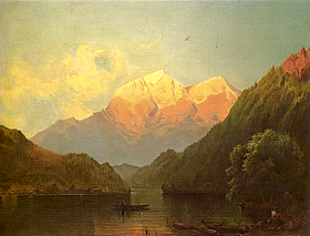
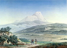
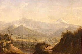
EL CHIMBORAZO PAINTED BY RAFAEL SALAS


http://wanderingvertexes.blogspot.com

RAFAEL SALAS (1824-1906),
El Chimborazo (6,263 m -20,548 ft)  
Ecuador 

In View of Chimborazo, oil on canvas, 1890,  Museo de Arte del Banco de la Republica, Bogota.

The mountain
Chimborazo  (6,263 m -20,548 ft) is a currently inactive stratovolcano in the Cordillera Occidental range of the Andes ans the highest mountain in Ecuador and the Andes north of Peru ; it is higher than any more northerly summit in the Americas. Chimborazo is not the highest mountain by elevation above sea level, but its location along the equatorial bulge makes its summit the farthest point on the Earth's surface from the Earth's center.
Chimborazo is at the main end of the Ecuadorian Volcanic Arc, north west of the town of Riobamba. Chimborazo is in la Avenida de los Volcanes (the Avenue of Volcanoes) west of the Sanancajas mountain chain. Carihuairazo, Tungurahua, Tulabug, and El Altar are all mountains that neighbor Chimborazo.  The closest mountain peak, Carihuairazo, is 5.8 mi (9.3 km) from Chimborazo. There are many microclimates near Chimborazo, varying from desert in the Arenal to the humid mountains in the Abraspungo valley.
Its last known eruption is believed to have occurred around A.D. 550.
Until the beginning of the 19th century, it was thought that Chimborazo was the highest mountain on Earth (measured from sea level), and such reputation led to many attempts on its summit during the 17th and 18th centuries.
In 1746, the volcano was explored by French academicians from the  French Geodesic Mission. Their mission was to determine the sphericity of the Earth. Their work along with another team in Lapland established that the Earth was an oblate spheroid rather than a true sphere. They did not reach the summit of Chimborazo.
In 1802, during his expedition to South America, Baron Alexander von Humboldt, accompanied by Aimé Bonpland and the Ecuadorian Carlos Montufar, tried to reach the summit. From his description of the mountain, it seems that before he and his companions had to return suffering from altitude sickness they reached a point at 5,875 m, higher than previously attained by any European in recorded history. (Incans had reached much higher altitudes previously; see Llullaillaco). In 1831, Jean-Baptiste Boussingault and Colonel Hall reached a new "highest point", estimated to be 6,006 m.
On 4 January 1880, the English climber Edward Whymper reached the summit of Chimborazo.

The painter 
Rafael Salas was an important Ecuadorian  landscape and genre painter  of nineteenth century South America neoclassicism. He was the last son of the famous Salas artists dynasty among which  his  half brother Ramon Salas ( 1815-1880), the fist professor a t Academy of fine Arts of Quito and  responsive for the taste of Costumbrismo; and above all their father Antonio Salas (1795-1860) a colonial artist specialized in religious themes like La Muerte de San José and La Negacion de San Pedro in the Cathedral of Quito.

_______________________________
2018 - Wandering Vertexes
Un blog de Francis Rousseau 
Tuesday, October 30, 2018

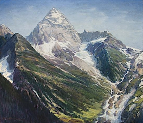
MOUNT ASSINIBOINE BY HENRY JOSEPH BREUER


http://wanderingvertexes.blogspot.com

HENRY JOSEPH BREUER  (1860-1932) 
Mount Assiniboine (3,618m - 11,870ft) 
Canada (Alberta)

The mountain
Mount Assiniboine (3,618m - 11,870ft) also known as Assiniboine Mountain, is a pyramidal peak mountain located on the Great Divide, on the British Columbia/Alberta border in Canada.
It is the highest peak in the Southern Continental Ranges of the Canadian Rockies. Mt. Assiniboine rises nearly 1,525 m (5,003 ft) above Lake Magog. Because of its resemblance to the Matterhorn in the Alps, it is nicknamed the "Matterhorn of the Rockies". Mt. Assiniboine was named by George M. Dawson in 1885. When Dawson saw Mt. Assiniboine from Copper Mountain, he saw a plume of clouds trailing away from the top. This reminded him of the plumes of smoke emanating from the teepees of Assiniboine Indians. Mt. Assiniboine lies on the border between Mount Assiniboine Provincial Park, in British Columbia, and Banff National Park, in Alberta. The park does not have any roads and thus can only be reached by a six-hour hike 27 km (17 mi), three-hour bike ride (now disallowed to reduce human / grizzly encounters) or helicopter. The usual approach is via Bryant Creek. From Canmore follow the Smith-Dorien road to the Mount Shark parking lot. The trail is well signed. A helipad is also here.
Mt. Assiniboine was first climbed in 1901 by James Outram, Christian Bohren and Christian Hasler. In 1925, Lawrence Grassi became the first person to make a solo ascent. On August 27, 2001, Bohren's granddaughter Lonnie along with three others made a successful ascent, celebrating the 100th anniversary of the first ascent.

The painter 
Not to be  confused with the austrian physician, Joseph Breuer, Henry-Joseph Breuer, born in Philadelphia, Pennsylvania,  in 1860, is a american painter who earned a reputation as a well-known "painter of poetic landscapes."  He studied art during the 1870s in Buffalo, New York, and then worked as a designer-decorator for the Rockwood Pottery Company in Cincinnati where he also attended the Art Academy. He worked for five years as a lithographer in New York City. 

In 1888, he settled in San Francisco where he became art editor for the San Francisco Chronicle and Californian magazine. Then he went to France for art study and was influenced by the Barbizon School of impressionist painters of rural landscapes. 

Living out of a horse-drawn wagon, he traveled extensively along the western coast of California and Oregon, painting and earning a national reputation for his landscapes. He also painted in Arizona including Canyon de Chelly in Navajo country and did commissioned views of the San Gabriel Valley for the St. Louis Exposition in 1904.

In 1903 he spent two weeks in  Mount Shasta which had a great impact on him. In the Cincinatti  Time Stars he wrote:  " I board a train to some station somewhere near Mount Shasta,and this into the woods. I man a one- man camp every night for two weeks.  It was cold and sometimes miserable in the thick, wet, cold mist of the mountain side, but the days were grand before that high, white altar, Shasta! I shall feel for all my life that I was a true pilgrim, and for the sake of days like that, I am happy to be what I am, a landscape painter..."

_______________________________
2018 - Wandering Vertexes...

by Francis Rousseau 

Monday, October 29, 2018

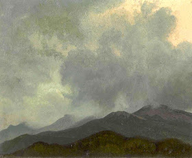
THE WHITES PAINTED BY ALBERT BIERSTADT

http://wanderingvertexes.blogspot.com


 ALBERT BIERSTADT (1830-1902) 
White Mountains  (1,917m - 6,288ft) 
United States of America  (New Hampshire) 

In  Turbulent Clouds, White Mountains, New Hampshire,  oil on canvas, 1858 

The mountain 
The White Mountains also called The Whites are a mountain range covering about a quarter of the state of New Hampshire and a small portion of western Maine in the United States. They are part of the northern Appalachian Mountains and the most rugged mountains in New England. The range is heavily visited due to its proximity to Boston and, to a lesser extent, New York City and Montreal, Quebec, Canada.
Most of the area is public land, including the White Mountain National Forest and a number of state parks. Its most famous mountain is  (1,917 m- 6,288-ft) Mount Washington, which is the highest peak in the Northeastern U.S. and for 76 years held the record for fastest surface wind gust in the world (231 miles per hour (372 km/h) in 1934 . 
The White Mountains also include the Franconia Range, Sandwich Range, Carter-Moriah Range and Kinsman Range in New Hampshire, and the Mahoosuc Range straddling the border between it and Maine. In all, there are 48 peaks within New Hampshire as well as one (Old Speck Mountain) in Maine over 4,000 feet (1,200 m), known as the four-thousand footers.
The Whites are known for a system of alpine huts for hikers operated by the Appalachian Mountain Club. The Appalachian Trail crosses the area from southwest to northeast.


The painter 
Albert Bierstadt was a German-born American painter. He was brought to the United States at the age of one by his parents. He later returned to study painting for several years in Düsseldorf. At an early age Bierstadt developed a taste for art and made clever crayon sketches in his youth. 
In 1851, he began to paint in oils. He became part of the Hudson River School in New York, an informal group of like-minded painters who started painting along this scenic river. Their style was based on carefully detailed paintings with romantic, almost glowing lighting, sometimes called luminism. An important interpreter of the western landscape, Bierstadt, along with Thomas Moran, is also grouped with the Rocky Mountain School.
In 1858 he exhibited a large painting of a Swiss landscape at the National Academy of Design, which gained him positive critical reception and honorary membership in the Academy.  At this time Bierstadt began painting scenes in New England and upstate New York, including in the Hudson River valley. A group of artists known as the Hudson River School portrayed its majestic landscapes and craggy areas, as well as the light affected by the changing waters.
In 1859, Bierstadt traveled westward in the company of Frederick W. Lander, a land surveyor for the U.S. government, to see those landscapes.  He continued to visit the American West throughout his career.
During the American Civil War, Bierstadt paid for a substitute to serve in his place when he was drafted in 1863. He completed one Civil War painting Guerrilla Warfare, Civil War in 1862, based on his brief experiences with soldiers stationed at Camp Cameron in 1861.
Bierstadt's painting was based on a stereoscopic photograph taken by his brother Edward Bierstadt, who operated a photography studio at Langley's Tavern in Virginia. Bierstadt's painting received a positive review when it was exhibited at the Brooklyn Art Association at the Brooklyn Academy of Music in December 1861. Curator Eleanor Jones Harvey observes that Bierstadt's painting, created from photographs, "is quintessentially that of a voyeur, privy to the stories and unblemished by the violence and brutality of first-hand combat experience."
In 1860, he was elected a member of the National Academy; he received medals in Austria, Bavaria, Belgium, and Germany.[ In 1867 he traveled to London, where he exhibited two landscape paintings in a private reception with Queen Victoria. He traveled through Europe for two years, cultivating social and business contacts to sustain the market for his work overseas.
As a result of the publicity generated by his Yosemite paintings, Bierstadt's presence was requested by every explorer considering a westward expedition, and he was commissioned by the Atchison, Topeka, and Santa Fe Railroad to visit the Grand Canyon for further subject matter.
Bierstadt's technical proficiency, earned through his study of European landscape, was crucial to his success as a painter of the American West. It accounted for his popularity in disseminating views of the Rockies to those who had not seen them. The immense canvases he produced after his trips with Lander and Ludlow established him as the preeminent painter of the western American landscape. 
Despite his popular success, Bierstadt was criticized by some contemporaries for the romanticism evident in his choices of subject and his use of light was felt to be excessive. 
In 1882 Bierstadt's studio at Irvington, New York, was destroyed by fire, resulting in the loss of many of his paintings. By the time of his death on February 18, 1902, the taste for epic landscape painting had long since subsided. Bierstadt was then largely forgotten. He was buried at the Rural Cemetery in New Bedford, Massachusetts.
Interest in his work was renewed in the 1960s, with the exhibition of his small oil studies. The subsequent reassessment of Bierstadt's work has placed it in a favorable context.
Bierstadt's theatrical art, fervent sociability, international outlook, and unquenchable personal energy reflected the epic expansion in every facet of western civilization during the second half of the nineteenth century.
Bierstadt was a prolific artist, having completed over 500 paintings during his lifetime. Many of these are held by museums across the United States.

_______________________________
2018 - Wandering Vertexes...
by Francis Rousseau 

Sunday, October 28, 2018

NEVADO HUASCARAN BY TEOFILO CASTILLO GUAS

http://wanderingvertexes.blogspot.com

TEOFILO CASTILLO  GUAS (1857-1922)
Nevado Huascaran (6,768m - 22, 205 ft) 
Peru 

The mountain 
 Novado Huascarán  or Huascaran  ( 6,768m - 22, 205 ft)  is a mountain in the Peruvian province of Yungay (Ancash Region), situated in the Cordillera Blanca range of the western Andes. The highest southern summit of Huascarán (Huascarán Sur) is the highest point in Peru, the northern part of Andes (north of Lake Titicaca) and in all of the Earth's Tropics. Huascarán is the fourth highest mountain in the Western Hemisphere and South America after Aconcagua, Ojos del Salado, and Monte Pissis. The mountain was named after Huáscar, a 16th-century Inca emperor who was the Sapa Inca of the Inca empire.
The summit of Huascarán is the place on Earth with the smallest gravitational force.
Huascarán Sur was first reached on 20 July 1932 by a joint German–Austrian expedition. The team followed what would become later the normal route (named today Garganta route). The north peak (Huascarán Norte) had previously been climbed on 2 September 1908 by a U.S. expedition that included Annie Smith Peck, albeit this first ascent is somewhat disputed.

The painter 
The peruvian painter, art critic and photographer Teófilo Castillo Guas was very representative of the peruvian pictorial academicism,  influenced by the impressionism.
He studied at the Seminary of Santo Toribio in Lima and later in Europe: Spain, Belgium and France, countries where he contacted masterly art production. Returning to Peru, he stood out by exhibiting his paintings, inspired by the traditions of Ricardo Palma.
In 1888 he traveled to Buenos Aires where he married María Gaubeka and worked as a photographer and painter. In 1906 he returned to Peru to open his own workshop.
In the bieginning ot 20th century,  he worked as a painter and art critic in charge of the artistic direction of the magazines PrismaLa Ilustración Peruana and Variedades , where he presented reproductions in three colors (trichromes) of his main works.
He enthusiastically promoted the founding of the National School of Fine Arts in Lima.
From 1920 to his death, he settled in Tucumán, where he directed the magazine Sol y Nieve (Sun and Snox . In addition, he painted a large canvas depicting General Manuel Belgrano presenting the Argentine flag to the Congress of Tucumán in 1816, a work that the Argentine government acquired for 20,000 pesos.
He was also noted for his canvases of colonial evocation inspired by episodes of the Peruvian Traditions of Ricardo Palma, which he made with a quick, colorful brush, in which the characters and the crowds in the processions vibrate, among browns and pinks, greens and blues.


____________________________________
2018 - Wandering Vertexes...
by Francis Rousseau 

Saturday, October 27, 2018

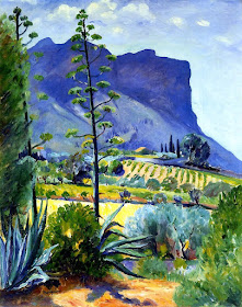
CAP CANAILLE PAINTED BY HENRI MANGUIN


http://wanderingvertexes.blogspot.com

HENRI MANGUIN  (1874-1949)
Cap Canaille (394 m -1292, 65 ft)
France

 In  Aloés en fleurs, Cassis, oil on panel, 1912, Private owner

The mountain
Cap Canaille (394m) is a cape in France located in the the Provence-Alpes-Côte d'Azur region with a culminating point called " La Grande Tête"  (The great Head). It is located near the city of Cassis, north-west of La Ciotat. Its red rock is composed of detritic limestones. Going into the Mediterranean Sea, it consists of rocky and steep banks dominated by the western extremity of the Soubeyranes cliffs. The latter are, after the Slieve League in Ireland, one of the highest maritime cliffs in Europe and constitute, in La Ciotat, the highest cliffs in France with a maximum altitude of 394 meters. A road, the D141 called "Route des Crêtes", connects Cassis to La Ciotat by approaching the edge of the cliff.  Several gazebos are set up there with a spectacular view on the French Riviera and the sea. Cap Canaille is well known for having inspired a lot of painters of the end of 19th century and beginning of 20th. Its name is due to a distortion of the Provençal langage  Cap Naio  "Cap Naille" in French, meaning "Swimming mountain " or a distorsion of the roman latin name Mons Canalis meaning " Mountain  of Aqueducts".

The painter 
The French painter Henri-Charles Manguin although often considered a precursor of  Fauvism in 1905, is not very well konwn. Studying at  Gustave Moreau's studio at the École des Beaux-Arts in Paris, he befriends Albert Marquet, Henri Matisse and Georges Rouault. In 1902, he participated for the first time in the Salon des Independants. In 1904, he discovered the small fishing port of Saint-Tropez in the south of France and got in touch with Paul Signac. He exhibited at the Salon d'Automne, in the United States and at the Venice Biennale. 
Ambroise Vollard buys him 150 paintings.
 In 1924, he participated in the project of the future Annonciade Museum in Saint-Tropez. In 1938, the Druet Gallery closed, his son bought the unsold ones: Manguin destroyed eight paintings, then exhibited all over the world.  In 1942, he rented a workshop in Avignon. Henri Manguin dies in his house of Oustalet in Saint-Tropez on September 25, 1949. The Salon organizes a posthumous retrospective of his works in 1950.

_______________________________
2018 - Wandering Vertexes...
by Francis Rousseau 

Friday, October 26, 2018

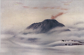
MOUNT EREBUS BY EDWARD ADRIAN WILSON

http://wanderingvertexes.blogspot.com

EDWARD ADRIAN WILSON (1872-1912) 
Mount Erebus (3, 794 m - 12, 448ft)
Antarctica

  In Mount Erebus 1911, watercolour,  Museum- Royal Geographical Society,  London

The mountain 
Mount Erebus (3, 794 m - 12, 448ft), not to be confused with Mount Elbrus is the second-highest volcano in Antarctica (after Mount Sidley) and the southernmost active volcano on Earth. It is the sixth highest ultra mountain on an island, located on Ross Island, which is also home to three inactive volcanoes:  Mount Terror, Mount Bird, and Mount Terra Nova.
The volcano has been active since c. 1.3 million years ago and is the site of the Mount Erebus Volcano Observatory run by the New Mexico Institute of Mining and Technology.
Mount Erebus was discovered on January 27, 1841 (and observed to be in eruption) by polar explorer Sir James Clark Ross who named it and its companion, Mount Terror, after his ships, Erebus and Terror (which were later used by Sir John Franklin on his disastrous Arctic expedition). Erebus is a dark region in Hades in Greek mythology. Present with Ross on the Erebus was the young Joseph Hooker, future president of the Royal Society and close friend of Charles Darwin. Erebus was an Ancient Greek primordial deity of darkness, the son of Chaos.
Mount Erebus is classified as a polygenetic stratovolcano. The bottom half of the volcano is a shield and the top half is a stratocone. The composition of the current eruptive products of Erebus is anorthoclase-porphyritic tephritic phonolite and phonolite, which are the bulk of exposed lava flow on the volcano.  Erebus is the world's only presently erupting phonolite volcano.
Researchers spent more than three months during the 2007–08 field season installing an unusually dense array of seismometers around Mount Erebus to listen to waves of energy generated by small, controlled blasts from explosives they buried along its flanks and perimeter and to record scattered seismic signals generated by lava lake eruptions and local ice quakes. By studying the refracted and scattered seismic waves, the scientists produced an image of the uppermost (top few km) of the volcano to understand the geometry of its "plumbing" and how the magma rises to the lava lake. These results demonstrated a complex upper-volcano conduit system with appreciable upper-volcano magma storage to the northwest of the lava lake at depths hundreds of meters below the surface.

The artist
Edward Adrian Wilson,  nicknamed "Uncle Bill" was an English physician, polar explorer, natural historian, painter and ornithologist. Wilson took part in two British expeditions to Antarctica, the Discovery Expedition (1901-1904)  and the tragic Terra Nova Expedition (1907-1912), both under the leadership of Scott.
Dr. Edward A. Wilson  is widely regarded as one of the finest artists ever to have worked in the Antarctic. Sailing with Captain Scott aboard 'Discovery' (1901-1904), he became the last in a long tradition of 'exploration artists' from an age when pencil and water-colour were the main methods of producing accurate scientific records of new lands and animal species. He combined scientific, topographical and landscape techniques to produce accurate and beautiful images of the last unknown continent. Such was the strength of his work that it also helped to found the tradition of modern wildlife painting. In particular Wilson captured the essence of the flight and motion of Southern Ocean sea-birds on paper.
Returning with Captain Scott aboard 'Terra Nova' (1910-1913) as Chief of Scientific Staff, he continued to record the continent and its wildlife with extraordinary deftness. Chosen to accompany Captain Scott to the South Pole, his last drawings are from one of the most famous epic journeys in exploration history. Along with his scientific work, Wilson's pencil recorded the finding of Roald Amundsen's tent at the South Pole by Captain Scott. Wilson died, along with the other members of the British Pole Party, during the return journey, in March 1912. The drawings and paintings were created at considerable personal cost in the freezing conditions in which Wilson worked. He often suffered severely from the cold whilst sketching and also from snow-blindness, or sunburn of the eye. They provide a remarkable testament to one of the great figures of the heroic age of Antarctic exploration. The book has been produced as a companion volume to 'Edward Wilson's Nature Notebooks' by two of Wilson's great nephews, to mark the centenary of his death.

_______________________________
2018 - Wandering Vertexes..
Un blog de Francis Rousseau
Thursday, October 25, 2018

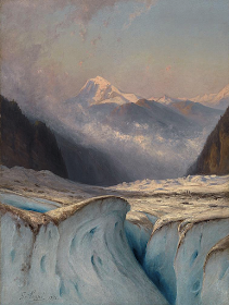
THE BUET PAINTED BY GABRIEL LOPPÉ


http://wanderingvertexes.blogspot.com

GABRIEL LOPPÉ (1825-1913)
 Mount Buet  (3, 096 m - 10, 157 ft)  
 France 

 In Le Buet vu du glacier d'Argentière, oil on canvas,  John Mitchell Fine Paintings Gallery, London

The mountain 
Mount Buet  (3, 096 m - 10, 157 ft)    also called simply The Buet is a summit of the massif of Giffre, in Haute-Savoie. It is also called the Mont Blanc des Dames (The Ladies Mont Blanc). It dominates the Cirque des Fonds.  From its summit, the highest in the department except  the Mont-Blanc massif, offers an exceptional view of the latter, as well as the red needles and the Haut-Giffre. The Buet played an important role in the birth of mountaineering and the conquest of Mont Blanc in the 18th century.
 The first a ascension took place in 1765 by Genevan scientist Jean André Deluc and his brother. The brothers Deluc reach first the summit of the Buet, on the side of Sixt in 1770. They conduct a series of experiments, including the calculation of the time required to bring water to a boil at this altitude. They are the first to use the barometer to measure an altitude. This epic is considered the first climb in the high mountains in the Alps. Six years later, in 1776, Horace-Bénédict de Saussure took the route and made preliminary observations to the ascent of Mont Blanc.
In 1910, the Grenairon refuge was built on Mount Buet. Destroyed in 1984 by a fire, it was rebuilt in 1985 in the same way.

The painter 
Toussaint Gabriel Loppé was a French painter, photographer and mountaineer. He became the first foreigner to be made a member of the Alpine Club in London. His father was a captain in the French Engineers and Loppé's childhood was spent in many different towns in south-eastern France. Aged twenty-one Loppé climbed a small mountain in the Languedoc and found a group of painters sketching on the summit. He had found his calling and subsequently went off to Geneva where he met the reputed leading Swiss landscapist, Alexandre Calame (1810 -1864). Loppé took up mountaineering in Grindelwald in the 1850s and made friends easily with the many English climbers in France and Switzerland. Although he was frequently labelled as a pupil of Calame and his rival François Diday, Loppé was almost an entirely self-taught artist. He became the first painter to work at higher altitudes during climbing expeditions earning the right to be considered the founder of the peintres-alpinistes school, which became established in the Savoie at the turn of the nineteenth century.
Notable followers of Loppé include, Charles Henri Contencin (1875-1955) and Jacques Fourcy (1906-1990). Together with the first ascent of Mt Mallet in Chamonix’s Grandes Jorasses range, Loppé made over 40 ascents of Mont Blanc during his climbing career, which lasted until the late 1890s.  He frequently made oil sketches from alpine summits, including a panorama of the view from the summit of Mont Blanc.
His paintings became celebrated for their atmosphere and spontaneity and he soon found himself taking part in many exhibitions in London and in Paris.
By 1896 Loppé had spent over fifty seasons climbing and painting in Chamonix. As the valley’s unrivalled ‘Court painter’ his work was in constant demand with the majority of his pictures going to English climbers and summer tourists.
In his later years, Loppé became fascinated with photography and was quite an innovator in this field too. His long exposure photograph of the Eiffel Tower struck by lightning, now in the Musée d'Orsay in Paris remains one of his iconic images. 

_______________________________
2018 - Wandering Vertexes...
by Francis Rousseau 

Wednesday, October 24, 2018

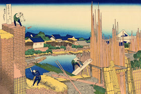
FUJIYAMA / 富士山 (n°5) BY HOKUSAI / 葛飾 北斎


http://wanderingvertexes.blogspot.com


KATSUSHIKA HOKUSAI (1760–1849)
Fujiyama / 富士山 (3, 776 m -12,389 ft)
Japan

In Honjo Tatekawa, (The timberyard at Honjo), n°5 from the series 
36 Views of Mount Fuji (1830- 32),  woodblock print, ink and color on paper, 1830 edition, 

About the 36 Views of Mt Fuji 
Thirty-six Views of Mount Fuji (富嶽三十六景 Fugaku Sanjūrokkei) is a series of landscape prints created by the Japanese ukiyo-e artist Hokusai (1760? - 1849).
The series depicts Mount Fuji from different locations and in various seasons and weather conditions. The original thirty-six prints were so popular that Hokusai expanded the series by ten.
The earliest impressions appear faded when compared to the versions usually seen, but are closer to Hokusai's original conception. The original prints have a deliberately uneven blue sky, which increases the sky's brightness and gives movement to the clouds. The peak is brought forward with a halo of Prussian blue. Subsequent prints have a strong, even blue tone and the printer added a new block, overprinting the white clouds on the horizon with light blue. Later prints also typically employ a strong benigara (Bengal red) pigment, which lent the painting its common name of Red Fuji. The green block colour was recut, lowering the meeting point between forest and mountain slope.

The artist
Katsushika Hokusai (葛飾 北斎)  was a Japanese artist, ukiyo-e painter and printmaker of the Edo period. He was influenced by such painters as Sesshu, and other styles of Chinese painting. Born in Edo (now Tokyo), Hokusai is best known as author of the woodblock print series Thirty-six Views of Mount Fuji (富嶽三十六景 c. 1831) which includes the internationally recognized print, The Great Wave off Kanagawa, created during the 1820s.
Hokusai created the "Thirty-Six Views of Mt Fuji " both as a response to a domestic travel boom and as part of a personal obsession with Mount Fuji. In this series, Mt Fuji is painted on different meteorological conditions, in different hours of the days, in different seasons and from different places.

The mountain 
This is the legendary Mount Fuji or Fujiyama (富士山).
It is located on Honshu Island and is the highest mountain peak in Japan at 3,776.24 m (12,389 ft). Several names are attributed to it:  "Fuji-san", "Fujiyama" or, redundantly, "Mt. Fujiyama". Usually Japanese speakers refer to the mountain as "Fuji-san".  The other Japanese names for Mount Fuji,  have become obsolete or poetic like: Fuji-no-Yama (ふじの山 - The Mountain of Fuji), Fuji-no-Takane (ふじの高嶺- The High Peak of Fuji), Fuyō-hō (芙蓉峰 - The Lotus Peak), and Fugaku (富岳/富嶽), created by combining the first character of 富士, Fuji, and 岳, mountain.
Mount Fuji is an active stratovolcano that last erupted in 1707–08. Mount Fuji lies about 100 kilometres (60 mi) south-west of Tokyo, and can be seen from there on a clear day.
Mount Fuji's exceptionally symmetrical cone, which is snow-capped several months a year, is a well-known symbol of Japan and it is frequently depicted in art and photographs, as well as visited by sightseers and climbers.
Mount Fuji is one of Japan's Three Holy Mountains (三霊山) along with Mount Tate and Mount Haku. It is also a Special Place of Scenic Beauty and one of Japan's Historic Sites.
It was added to the World Heritage List as a Cultural Site on June 22, 2013. As per UNESCO, Mount Fuji has “inspired artists and poets and been the object of pilgrimage for centuries”. UNESCO recognizes 25 sites of cultural interest within the Mt. Fuji locality. These 25 locations include the mountain itself, Fujisan Hongū Sengen Shrine and six other Sengen shrines, two lodging houses, Lake Yamanaka, Lake Kawaguchi, the eight Oshino Hakkai hot springs, two lava tree molds, the remains of the Fuji-kō cult in the Hitoana cave, Shiraito Falls, and Miho no Matsubara pine tree grove; while on the low alps of Mount Fuji lies the Taisekiji temple complex, where the central base headquarters of Nichiren Shoshu Buddhism is located.

_______________________________
2018 - Wandering Vertexes...
by Francis Rousseau 

Tuesday, October 23, 2018

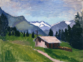
THE GRANDE CASSE PAINTED BY HENRI MATISSE


http://wanderingvertexes.blogspot.com

HENRI MATISSE (1869- 1954) 
The Grande Casse (3, 855 m - 12,648 ft)  
France 

 In  Les Alpes de Savoie, 1901. oil on canvas,  Musée Picasso, Paris 

The mountain 
The Grande Casse (3, 855 m - 12,648 ft) is the highest mountain of the Vanoise Massif in the Graian Alps in the region of Savoie, France. It is located in the heart of the Vanoise National Park, near the village of Pralognan-la-Vanoise, which is about 25 km southeast of the nearest town, Moûtiers. It has a steep 600 m high north face. The other sides of the mountain are more gentle, mostly consisting of broken rocks. A high ridge connects it to the nearby peak of Grande Motte. The ridge connecting the Grande Casse and the Grande Motte is the watershed between the Tarentaise Valley in the north and Maurienne valley to the south.
The first ascent was made by William Mathews along with guides Michel Croz and E. Favre via the southwest face on 8 August 1860.  The north face was climbed on 6 August 1933 by the Italians Aldo Bonacossa and L. Binaghi.

The painter 
The most famous french artist Henri Émile Benoît Matisse is known for both his use of colour and his fluid and original draughtsmanship. He was a draughtsman, printmaker, and sculptor, but is known primarily as a painter. Matisse is commonly regarded, along with Pablo Picasso, as one of the artists who best helped to define the revolutionary developments in the visual arts throughout the opening decades of the twentieth century, responsible for significant developments in painting and sculpture.
The intense colorism of the works he painted between 1900 and 1905 brought him notoriety as one of the Fauves.  Many of his finest works were created in the decade or so after 1906, when he developed a rigorous style that emphasized flattened forms and decorative pattern. In 1917 he relocated to a suburb of Nice on the French Riviera, and the more relaxed style of his work during the 1920s gained him critical acclaim as an upholder of the classical tradition in French painting. After 1930, he adopted a bolder simplification of form. When ill health in his final years prevented him from painting, he created an important body of work in the medium of cut paper collage.
His mastery of the expressive language of colour and drawing, displayed in a body of work spanning over a half-century, won him recognition as a leading figure in modern art.
The painting above showing The Grande Casse peak from the west, belongs to the early paintings period, all painted before 1905.
_______________________________
2018 - Wandering Vertexes...
by Francis Rousseau 

Monday, October 22, 2018

JEBEL SAGHRO BY JACQUES MAJORELLE

http://wanderingvertexes.blogspot.com

JACQUES MAJORELLE (1886-1962), 
Jebel Saghro or Adrar Saghro (2,712 m - 8,898 ft) 
Morocco 

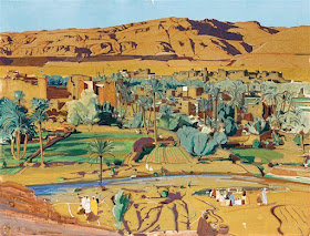
 In Tinghir todra, oil on canvas, 1930, Private owner

The mountain 
The Jebel Saghro  or Adrar Saghro (2,712 m - 8,898 ft) is located less than 100 km south of the central High Atlas, Morocco, overlooking the valleys of Drâa and Dadès, eastern part of the Anti-Atlas.
Lunar landscapes of plateaus, peaks, canyons, forest of pitons, immensity of spaces. In this chaos of black rocks, the small villages, are reduced to a few small houses surrounded by a bouquet of palm or almond trees. The north-south crossings are made by three passes traversed by difficult and very spectacular tracks: the Tazazert pass (2,283 m), the Kouaouch pass (2,592 m), and the Tagmout pass (1,919 m). The highest point of the mountain is the Amalou n Mansour (2,712 m) which is located southeast of the village of Iknioun.
Charles de Foucauld, gone in search of spirituality, is one of the first Western travelers having explored Jebel Saghro, (Reconnaissance au Maroc  published in 1888 in Paris).

The painter 
Jacques Majorelle son of the celebrated Art Nouveau furniture designer Louis Majorelle, was a French painter. He studied at the École des Beaux-Arts in Nancy in 1901 and later at the Académie Julian in Paris with Schommer and Royer. Majorelle became a noted Orientalist painter, but is most remembered for constructing the villa and gardens that now carry his name, Les Jardins Majorelle in Marrakech.
In around 1917 he travelled to Morocco to recover from heart problems and after short period spent in Casablanca, he visited Marrakech, where he fell in love with the vibrant colours and quality of light he found there. Initially, he used Marrakech as a base for trips to Spain, Italy and other parts of North Africa, including Egypt. Eventually, however, he settled in Marrakech permanently.
He drew inspiration for his paintings from his trips and from Marrakesch itself. His paintings include many street scenes, souks and kasbahs as well as portraits of local inhabitants. He opened a handicrafts workshop in Marrakech and also designed posters to promote travel to Morocco.  His work was profoundly affected by his voyages around the Mediterannean and North Africa. He introduced a more coloured vision, bathed in light where the drawing disappears and the image emerges from large spots of colour laid flat. It seemed as if he had discoved the sun in these countries. His style exhibited more freedom and spontaneity.
During his lifetime, many of Majorelle's paintings were sold to private buyers and remain in private collections. Some of his early works can be found in Museums around his birthplace such as the Musée de l'Ecole de Nancy. Examples of his later work can be seen in the Mamounia Hotel, Marrakesch, the French Consulate of Marrakech and in the Villa at the Majorelle Gardens.

_______________________________
2018 - Wandering Vertexes...
by Francis Rousseau 

Sunday, October 21, 2018

THE POPOCATEPTL (2) BY JOSE MARIA VELASCO


JOSE MARIA VELASCO (1840-1912)
The Popocatépetl (5,426 m -17,802 ft)  
Mexico

 In Popocatepetl and greenery, oil on canvas, private owner 

The mountain 
Popocatépetl  (5,426 m - 17,802 ft) is an active volcano, located in the states of Puebla, Mexico, and Morelos, in Central Mexico, and lies in the eastern half of the Trans-Mexican volcanic belt.  The name Popocatépetl comes from the Nahuatl words popōca  (it smokes) and tepētl  (mountain), meaning Smoking Mountain. It is the second highest peak in Mexico, after Citlaltépetl (Pico de Orizaba) at 5,636 m (18,491 ft).
It is linked to the Iztaccihuatl volcano to the north by the high saddle known as the Paso de Cortés.
Popocatépetl is 70 km (43 mi) southeast of Mexico City, from where it can be seen regularly, depending on atmospheric conditions. Until recently, the volcano was one of three tall peaks in Mexico to contain glaciers, the others being Iztaccihuatl and Pico de Orizaba. In the 1990s, the glaciers such as Glaciar Norte (North Glacier) greatly decreased in size, partly due to warmer temperatures but largely due to increased volcanic activity. By early 2001, Popocatépetl's glaciers were gone; ice remained on the volcano, but no longer displayed the characteristic features of glaciers such as crevasses.
Magma erupting from Popocatépetl has historically been predominantly andesitic, but it has also erupted large volumes of dacite. Magma produced in the current cycle of activity tends to be a mixture of the two.

The Painter 
José Maria Tranquilino Francisco de Jesus Velasco Gomez Obregуn, generally known as José Marнa Velasco, was a 19th-century Mexican polymath, most famous as a painter who made Mexican geography a symbol of national identity through his paintings.
Velasco's long career elevated Mexican landscape painting to international standing. One of his landscapes of the Valley of Mexico is in the Vatican Museum, a gift to Pope Leo XIII. His scenes of the Mexican landscape are a visual source for environmental historians, since they show the Valley of Mexico before its degradation in the twentieth century, with air pollution and urban sprawl. His landscape art has a wide appeal, since it is more accessible than history paintings that require the viewer to understand a particular event.
Today the Government of the State of Mexico, where Velasco was from, presents an award for artistic merit in his name to painters born in that state. Among the most outstanding winners are Luis Nishizawa, Leopoldo Flores, Ignacio Barrios and Héctor Cruz.
The José María Velasco Museum was opened in 1992 in Toluca City with the task of preserving and promoting his paintings

_______________________________
2018 - Wandering Vertexes...
by Francis Rousseau 

Saturday, October 20, 2018

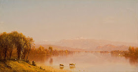
MOUNT WAHINGTON OR AGIOCOCHOOK BY SANFORD ROBINSON GIFFORD

http://wanderingvertexes.blogspot.com


SANFORD ROBINSON GIFFORD (1823-1880)
Mount Washington or Agiocochook  (1,916 m- 6,288 ft)
United States of America 

 In Indian Summer in the White Mountains, oil on canvas, 1862, Mint Museum of Art

The mountain 
Mount Washington (1,916 m- 6,288 ft), called Agiocochook by some Native American tribes, is the highest peak in the Northeastern United States at  and the most topographically prominent mountain east of the Mississippi River. The mountain is located in the Presidential Range of the White Mountains, in the township of Sargent's Purchase, in Coös County, New Hampshire. While nearly the whole mountain is in the White Mountain National Forest, an area of 60.3 acres (24.4 ha) surrounding and including the summit is occupied by Mount Washington State Park.
The mountain is notorious for its erratic weather. On the afternoon of April 12, 1934, the Mount Washington Observatory recorded a windspeed of 231 miles per hour (372 km/h) at the summit, the world record for most of the 20th century, and still a record for measured wind speeds not involved with a tropical cyclone.
The Mount Washington Cog Railway ascends the western slope of the mountain, and the Mount Washington Auto Road climbs to the summit from the east. The mountain is visited by hikers, and the Appalachian Trail crosses the summit. Other common activities include glider flying, backcountry skiing, and annual cycle and running races such as the Auto Road Bicycle Hillclimb and Road Race.

The painter 
Like most Hudson River School artists, Gifford traveled extensively to find scenic landscapes to sketch and paint. In addition to exploring New England, upstate New York and New Jersey, Gifford made extensive trips abroad. He first traveled to Europe from 1855 to 1857, to study European art and sketch subjects for future paintings. During this trip Gifford also met Albert Bierstadt and Worthington Whittredge.
In 1858, he traveled to Vermont, "apparently" with his friend and fellow painter Jerome Thompson. Details of their visit were carried in the contemporary Home Journal. Both artists submitted paintings of Mount Mansfield, Vermont's tallest peak, to the National Academy of Design's annual show in 1859. Thompson's work, "Belated Party on Mansfield Mountain" is now owned by the MET in New York, according to the report.
Thereafter, he served in the Union Army as a corporal in the 7th Regiment of the New York Militia upon the outbreak of the Civil War. A few of his canvases belonging to New York City's Seventh Regiment and the Union League Club of New York are testament to that troubled time.
Gifford referred to the best of his landscapes as his "chief pictures". Many of his chief pictures are characterized by a hazy atmosphere with soft, suffuse sunlight. Gifford often painted a large body of water in the foreground or middle distance (see above) in which the distant landscape would be gently reflected. A catalog of his work published shortly after his death recorded in excess of 700 paintings during his career.

_______________________________

2018 - Wandering Vertexes...
by Francis Rousseau 

Friday, October 19, 2018

MOUNT STURGEON OR WURGARRI BY EUGENE VON GUERARD

http://wanderingvertexes.blogspot.com

EUGENE VON GUERARD  (1811-1901)
Mount Sturgeon or Wurgarri  (575 m - 1,886 ft) 
Australia (Victoria) 

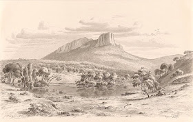
 In Mount Sturgeon and the Wannon in the Grampians, Victoria 1858, pencil on paper

The mountain 
Mount Wurgarri  (575 m-1,886 ft)  also called Mount Sturgeon is a mountain in Australia located in the Southern Grampians region and the state of Victoria , about 230 kilometers west of the state capital of Melbourne. The width at the base is 2.1 km.  The area around Mount Wurgarri is almost unpopulated, with less than two inhabitants per square kilometer.  In the surroundings around Mount Wurgarri grows mainly savannah forest.  The average annual average is 927 millimeters. The rainy month is July, with an average of 143 mm rainfall , and the driest is February, with 25 mm rainfall.

The painter 
Johann Joseph Eugene von Guerard was an Austrian-born artist, active in Australia from 1852 to 1882. Known for his finely detailed landscapes in the tradition of the Düsseldorf school of painting, he is represented in Australia's major public galleries, and is referred to in the country as Eugene von Guerard. In 1852 von Guerard arrived in Victoria, Australia, determined to try his luck on the Victorian goldfields. As a gold-digger he was not very successful, but he did produce a large number of intimate studies of goldfields life, quite different from the deliberately awe-inspiring landscapes for which he was later to become famous. Realizing that there were opportunities for an artist in Australia, he abandoned the diggings and was soon undertaking commissions recording the dwellings and properties of wealthy pastoralists.
By the early 1860s, von Guerard was recognized as the foremost landscape artist in the colonies, touring Southeast Australia and New Zealand in pursuit of the sublime and the picturesque.  He is most known for the wilderness paintings produced during this time, which are remarkable for their shadowy lighting and fastidious detail.  Indeed, his View of Tower Hill in south-western Victoria was used as a botanical template over a century later when the land, which had been laid waste and polluted by agriculture, was systematically reclaimed, forested with native flora and made a state park. The scientific accuracy of such work has led to a reassessment of von Guerard's approach to wilderness painting, and some historians believe it likely that the landscapist was strongly influenced by the environmental theories of the leading scientist Alexander von Humboldt. Others attribute his 'truthful representation' of nature to the criterion for figure and landscape painting set by the Düsseldorf Academy.

_______________________________
2018 - Wandering Vertexes...
by Francis Rousseau 


Thursday, October 18, 2018

MUHABURA VOLCANO IN VINTAGE POSTCARD 1930


VINTAGE POSTCARDS 1930 
Mount Muhabura  (4,127 m - 13,540 ft) 
Rwanda - Uganda border 

`The mountain 
Mount Muhabura  ( 4,127 m - 13,540 ft)  also known as Mount Muhavura, is an extinct volcano in the Virunga Mountains on the border between Rwanda and Uganda. Muhabura is the third highest of the eight major mountains of the mountain range, which is a part of the Albertine Rift, the western branch of the East African Rift. Muhabura is partly in the Volcanoes National Park, Rwanda and partly in the Mgahinga Gorilla National Park, Uganda. The name Muhabura means "The Guide" in the local language, Kinyarwanda. It can be seen from many parts of Uganda and Rwanda because of its slope.


2018 - Wandering Vertexes...
by Francis Rousseau 

Wednesday, October 17, 2018

PECA VIEJA PAINTED BY DAVID BOMBERG


http://wanderingvertexes.blogspot.com 

DAVID BOMBERG (1890-1957)  
Peca Vieja (2,617m) 
Spain (Asturias)

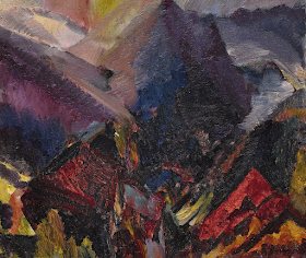
In Sunrise in the mountains, Picos de Asturias, oil on canvas, 1935

The mountain
Peca Vieja (2,617m) is a mountain that is one of the Picos de Europa, also known as Picos de Aturias or Picos in Spain. The peaks of Europe (in Spanish: Picos de Europa, often called Los Picos), the highest massif of the Cordillera Cantabria, are located between the provinces of Asturias, Leûn and Cantabria, about thirty kilometers from the sea. They culminate in Torre de Cerredo, at 2,648 m.
The approximate dimensions of the massif are 40 km long (east - west) by 20 km wide (north - south) and an area of ​​502 km2. On May 30, 1995, the Picos de Europa National Park was created. For sailors coming from the west on the Atlantic Ocean who sailed by sight, Los Picos was the first land visible on the horizon, which explains the origin of the name. They are framed in the north by the Sierra de Cuera and the Sierra del Escudo, to the south by the Sierra de Alba and to the west by the Sierra de Ave.

The painter 
David Garshen Bomberg was an English painter, and one of the Whitechapel Boys. Bomberg was one of the most audacious of the exceptional generation of artists who studied at the Slade School of Art under Henry Tonks, and which included Mark Gertler, Stanley Spencer, C.R.W. Nevinson and Dora Carrington.  Bomberg painted a series of complex geometric compositions combining the influences of cubism and futurism in the years immediately preceding World War I; typically using a limited number of striking colours, turning humans into simple, angular shapes, and sometimes overlaying the whole painting a strong grid-work colouring scheme. He was expelled from the Slade School of Art in 1913, with agreement between the senior teachers Tonks, Frederick Brown and Philip Wilson Steer, because of the audacity of his breach from the conventional approach of that time.
Whether because his faith in the machine age had been shattered by his experiences as a private soldier in the trenches or because of the pervasive retrogressive attitude towards modernism in Britain Bomberg moved to a more figurative style in the 1920s and his work became increasingly dominated by portraits and landscapes drawn from nature. Gradually developing a more expressionist technique, he travelled widely through the Middle East and Europe.

2018 - Wandering Vertexes...
by Francis Rousseau 


Tuesday, October 16, 2018

AI-PETRI PAINTED BY IVAN AIVAZOVSKY

http://wanderingvertexes.blogspot.com


IVAN AIVAZOVSKY (1817-1900)
Ai-Petri  (1,234.2 m - 4,049 ft)
Crimea - Russia 

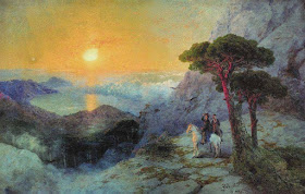
In Pushkin at Ai-Petri Peak during sunrise, watercolour 

 The mountain 
Ai-Petri  (1,234.2 m - 4,049 ft) meaning  Saint Peter in Greek,  is a peak in the Crimean Mountains. For administrative purposes it is in the Yalta municipality of Crimea.  Ai-Petri is one of the windiest places in Crimea. The wind blows for 125 days a year, reaching a speed of 50 m/s (110 mph). The peak is located above the city of Alupka and the town of Koreiz. There is a cable car that takes passengers from a station near Alupka to the main area in Ai-Petri.

The painter 
Ivan Konstantinovich Aivazovsky (Ива́н Константи́нович Айвазо́вский)  was a Russian Romantic painter. Despite he is considered one of the greatest marine artists in history, he painted a few mountains landscapes.  Aivazovsky was born into an Armenian family in the Black Sea port of Feodosia and was mostly based in his native Crimea.  Following his education at the Imperial Academy of Arts, Aivazovsky traveled to Europe and lived briefly in Italy in the early 1840s. He then returned to Russia and was appointed the main painter of the Russian Navy. Aivazovsky had close ties with the military and political elite of the Russian Empire and often attended military maneuvers. He was sponsored by the state and was well-regarded during his lifetime. The saying "worthy of Aivazovsky's brush", popularized by Anton Chekhov, was used in Russia for "describing something ineffably lovely.One of the most prominent Russian artists of his time, Aivazovsky was also popular outside Russia. He held numerous solo exhibitions in Europe and the United States. During his almost 60-year career, he created around 6,000 paintings, making him one of the most prolific artists of his time. The vast majority of his works are seascapes, but he often depicted battle scenes, Armenian themes, and portraiture. Most of Aivazovsky's works are kept in Russian, Ukrainian and Armenian museums as well as private collections.

_______________________________
2018 - Wandering Vertexes...

by Francis Rousseau 

Monday, October 15, 2018

THE GIEWONT BY JAN NEPOMUCEN GLOWACKI


JAN NEPOMUCEN GLOWACKI (1802-1847)
Giewont (1, 895 m- 6, 217 ft)
Poland


The mountains 
Giewont is a mountain massif in the Tatra Mountains of Poland. It  is 1,895 m - at its highest.
The massif has three peaks (all m/metres in AMSL):
- Great Giewont - Wielki Giewont (1,895 m- 6, 217 ft)
- Long Giewont - Długi Giewont (1,867 m- 6, 125 ft)
- Small Giewont -  Polish Mały Giewont (1,728 m - 5,669 ft)
There is a mountain pass located between Great and Long Giewont, known as Szczerba (1,823 m-  5, 980 ft).  Long Giewont and Great Giewont are situated at a higher altitude than the nearby town of Zakopane, making them clearly visible from that city.
On Great Giewont, there is a 15 m steel cross (erected in 1901) - the site of religious pilgrimages. The area is notorious for its hazardous nature during thunderstorms, so this should be taken into consideration when approaching the summit.
The first recorded ascent to Giewont's summit was undertaken in 1830 by Franciszek Herbich and Aleksander Zawadzki (a19th century explorer). The first winter ascent of Giewont occurred in 1904 by a group of five mountaineers led by Mariusz Zaruski. Nowadays the climbing on Giewont is strictly banned. On the other hand, hiking on the hiking trails is allowed and the access (except the winter) is not difficult hence Giewont is a very popular destination among amblers and Sunday tourists. In the summer up to few thousands tourists a day ascend the top.

The painter 
Jan Nepomucen Głowacki was a Polish realist painter of the Romantic era, regarded as the most outstanding landscape painter of the early 19th century in Poland under the foreign partitions. Głowacki studied painting at the Kraków School of Fine Arts and later at the academies of Prague and Vienna, as well as Rome and Munich. He returned to Kraków in 1828, and became a teacher of painting and drawing. From 1842 he served as a professor in the Faculty of Landscape Painting at the School of Fine Arts. His work can be found at the National Museum of Poland and its branches. Some of his work was looted by Nazi Germany in World War II and has never been recovered.
Głowacki was the first Polish artist to devote an entire series of works to the Tatra Mountains.
 He was also the first, to produce studies for his oil paintings on strenuous outdoor trips. Landscapes such as "Widok z Poronina" (View from Poronin, 1836) and "Morskie Oko" are said to mark the beginning of realist Polish mountain painting.

2018 - Wandering Vertexes...


by Francis Rousseau 

Sunday, October 14, 2018

THE MONT BLANC BY JEAN-ANTOINE LINCK


JEAN-ANTOINE LINCK (1766-1843
 The Mont Blanc ( 4,808 m -15,777 ft)
France- Italy border 

 In Vue du massif du Mont-Blanc de Epaule droite des Aiguilles Vertes des Charmoz, du Plan du Midi, du Goute du Bionnassay, du Trelatete, des Montagnes du Prarion et Pormenaz, Aquatinta, Swiss National Library 

The mountain 
 The Mont Blanc ( 4,808.73 m -15,777 ft) or Monte Bianco, both meaning "White Mountain", is the highest mountain in the Alps and the highest in Europe after the Caucasus peaks. It is ranked 11th in the world in topographic prominence.  The Mont Blanc is one of the Seven Summit, which includes the highest mountains of each of the seven continents. Summiting all of them is regarded as a mountaineering challenge, first achieved on April 30, 1985 by Richard Bass.  The 7 highest summits, (which are obviously 8 with 2 in Europe !) are :  
Mount Everest (8,848m), Aconcagua (6,961m), Mt Denali or Mc Kinley (6,194m),  Kilimandjaro (5,895m), Mt Elbrus (5,642m), Mount Vinson (4,892m) and Mount Kosciuszko  (2,228m) in Australia.
The mountain lies in a range called the Graian Alps, between the regions of Aosta Valley, Italy, and Savoie and Haute-Savoie, France. The location of the summit is on the watershed line between the valleys of Ferret and Veny in Italy and the valleys of Montjoie, and Arve in France. The Mont Blanc massif is popular for mountaineering, hiking, skiing, and snowboarding.
The three towns and their communes which surround Mont Blanc are Courmayeur in Aosta Valley, Italy, and Saint-Gervais-les-Bains and Chamonix in Haute-Savoie, France.  A cable car ascends and crosses the mountain range from Courmayeur to Chamonix, through the Col du Géant. Constructed beginning in 1957 and completed in 1965, the 11.6 km (7¼ mi) Mont Blanc Tunnel runs beneath the mountain between these two countries and is one of the major trans-Alpine transport routes.
Since the French Revolution, the issue of the ownership of the summit has been debated. 
 In the early 21st century, administration of the mountain is shared between the Italian town of Courmayeur and the French town of Saint-Gervais-les-Bains, although the larger part of the mountain lies within the commune of the latter.

The artist
Jean-Antoine Linck, is a swiss painter and draftsman who lived and worked at the end of the 18th century and beginning of 19th century, at the time nature and mountains were up to date in high society  in Switzerland and France.He is the son of Jean-Conrad, an enameller and engraver from Geneva who initiates his apprenticeship. He was then trained by Carl Hackert with Wolfgang Adam Toepffer. In 1802, he opened his own studio in Geneva, in the district of Montbrillant. His works, depicting the surroundings of Geneva, Savoy, the Alps and the Mont Blanc, were inspired by those of the great master of that " genre" Johann Ludwig Aberli and were successful with Josephine de Beauharnais, the French Empress and Catherine II, the Russian Empress, meanwhile alpine tourism began to develop.

2018 - Wandering Vertexes...
by Francis Rousseau 

Saturday, October 13, 2018

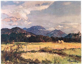
MOUNT BANAHAW (3) BY FERNANDO AMORSOLO

http://wanderingvertexes.blogspot.com

FERNANDO AMORSOLO (1882-1972),
Mount Banahaw (2, 170m- 7, 120 ft) 
Philippines (Luzon)

The mountain
Mount Banahaw (2, 170m- 7, 120 ft) is an active volcano on Luzon in the Philippines. The three-peaked volcano complex is located between the provinces of Laguna and Quezon and is the tallest mountain in the Calabarzon region dominating the landscape for miles around. 
Mount Banahaw is a traditional pilgrimage site for locals, believed by many as a "Holy mountain", a spiritually-charged location. The mountain and its environs are considered sacred by local residents; the water from its sacred springs are deemed "holy water" for allegedly having beneficial qualities, issuing forth from locations called "puestos" or "holy sites". These sites are unique natural features composed not only of springs, but also caves, streams and boulders; with names with biblical allusions, and shrines erected in, on or around them. These locations were allegedly revealed to a man named Agripino Lontoc by the "Santong Boses" or the "Holy Voices", which also gave the names to these places way back during the Spanish Colonial Era. Another one of this mountain is the adjacent Mount Banahaw de Lucbán.
Due to incessant climbing activity the mountain trails have become littered with trash. In March 2004, the Department of Environment and Natural Resources ordered a 5-year suspension of hiking activity in the mountains, covering the Dolores and Sariaya trails. Reopening was delayed was then scheduled to March 2012, but was further extended to February 2015.
The painter 
Fernando Cueto Amorsolo was one of the most important artists in the history of painting in the Philippines.Amorsolo was a portraitist and painter of rural Philippine landscapes. He is popularly known for his craftsmanship and mastery in the use of light. After graduating from the Univeajor influences on his work. Amorsolo set up his own studio upon his return to Manila and painted prodigiously during the 1920s and the 1930s. His Rice Planting (1922), which appeared on posters and tourist brochures, became one of the most popular images of the Commonwealth of the Philippines. Beginning in the 1930s, Amorsolo's work was exhibited widely both in the Philippines and abroad. His bright,optimistic, pastoral images set the tone for Philippine painting before World War II . Except for his darker World War II-era paintings, Amorsolo painted quiet and peaceful scenes throughout his career.

_______________________________
2018 - Wandering Vertexes...
by Francis Rousseau 

Friday, October 12, 2018

EL CAYAMBE BY ALEXANDER VON HUMBOLDT


http://wanderingvertexes.blogspot.com

ALEXANDER VON HUMBOLDT  (1769-1859) 
 Cayambe  (5,790 m -19,000 ft)
 Ecuador

  In Vues des Cordillères et Monumens des Peuples Indigènes de l’Amérique  
book published in 1816 in Paris,  University of Ottawa 

The mountain 
Cayambe or Volcбn Cayambe (5,790 m -19,000 ft) is the name of a volcano located in the Cordillera Central, a range of the Ecuadorian Andes. It is located in Pichincha province some 70 km (43 mi) northeast of Quito. It is the third highest mountain in Ecuador.
Cayambe, which has a permanent snow cap, is a Holocene compound volcano which last erupted in March 1786. At 4,690 metres (15,387 ft) on its south slope is the highest point in the world crossed by the Equator and the only point on the Equator with snow cover. The volcano and most of its slopes are within the Cayambe Coca Ecological Reserve.  Studies conducted since 1995 by a joint team of Ecuadorian and French researchers have shown that during the last 4000, the Cayambe has experienced periods of intense eruptive activity about 700 years alternating with rest periods of 500 to 600 years. The resumption of eruptions must be considered.
Moreover, the region is home to numerous flower plantations for export; however, the non-secure management and toxic effects of these crops have caused serious damage to the environment and create health problems among employees of the plantations.

The cartographer and painter  
Friedrich Wilhelm Heinrich Alexander von Humboldt was a Prussian geographer, naturalist, explorer, and influential proponent of Romantic philosophy and science. He was the younger brother of the Prussian minister, philosopher, and linguist Wilhelm von Humboldt (1767–1835). Humboldt's quantitative work on botanical geography laid the foundation for the field of biogeography. Humboldt's advocacy of long-term systematic geophysical measurement laid the foundation for modern geomagnetic and meteorological monitoring.
Between 1799 and 1804, Humboldt travelled extensively in Latin America, exploring and describing it for the first time from a modern scientific point of view. His description of the journey was written up and published in an enormous set of volumes over 21 years. Humboldt was one of the first people to propose that the lands bordering the Atlantic Ocean were once joined (South America and Africa in particular). Humboldt resurrected the use of the word cosmos from the ancient Greek and assigned it to his multi-volume treatise, Kosmos, in which he sought to unify diverse branches of scientific knowledge and culture. This important work also motivated a holistic perception of the universe as one interacting entity.
On their way back to Europe from Mexico on their way to the United States, Humboldt and his fellow scientist Aimé Bonpland stopped in Cuba for a while. After their first stay in Cuba of three months they returned the mainland at Cartagena de Indias (now in Colombia), a major center of trade in northern South America. Ascending the swollen stream of the Magdalena River to Honda and arrived in Bogotá on July 6, 1801 where they met Spanish botanist José Celestino Mutis, the head of the Royal Botanical Expedition to New Granada, staying there until September 8, 1801. Mutis was generous with his time and gave Humboldt access to the huge pictorial record he had compiled since 1783.  Humboldt had hopes of connecting with the French sailing expedition of Baudin, now finally underway, so Bonpland and Humboldt hurried to Ecuador. They crossed the frozen ridges of the Cordillera Real, they reached Quito on 6 January 1802, after a tedious and difficult journey.
Their stay in Ecuador was marked by the ascent of Pichincha and their climb of Chimborazo, where Humboldt and his party reached an altitude of 19,286 feet (5,878 m). This was a world record at the time, but a thousand feet short of the summit.  Humboldt's journey concluded with an expedition to the sources of the Amazon en route for Lima, Peru.

2018 - Wandering Vertexes...
by Francis Rousseau 


Thursday, October 11, 2018

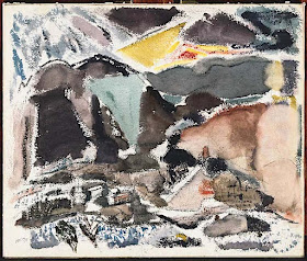
BEAR MOUNTAIN PAINTED BYJOHN MARIN


http://wanderingvertexes.blogspot.com

JOHN MARIN (1870-1953) 
Bear Mountain  (393m - 1,289ft)
United States of America 

The mountain 
Bear Mountain  (393m - 1,289ft) is one of the best-known peaks of New York's Hudson Highlands. Located partially in Orange County in the town of Highlands and partially in Rockland County in the town of Stony Point, it lends its name to the nearby Bear Mountain Bridge and Bear Mountain State Park that contains it. Its summit, accessible by a paved road, has several roadside viewpoints, a picnic area and an observatory, the Perkins Memorial Tower. It is crossed by several hiking trails as well, including the oldest section of the Appalachian Trail (AT). As of 2015, the AT across Bear Mountain is continuing to be improved by the New York–New Jersey Trail Conference to minimize erosion and improve accessibility and sustainability as part of a project to rebuild and realign the trail that began in 2006.
The steep eastern face of the mountain overlooks the Hudson River. The eastern side of the mountain consists of a pile of massive boulders, often the size of houses, that culminate in a 50-foot (15 m) cliff face at approximately the 1,000-foot (300 m) level. A direct scramble from the shore of Hessian Lake to Perkins Memorial Drive on the summit requires a gain of about 1,000 feet (300 m) in roughly 0.8 miles (1.3 km). From the summit, one can see as far as Manhattan, and the monument on High Point in New Jersey.


The painter 
John Marin was a seminal American modernist painter. He was one of the first Americans to employ techniques of abstraction in his calligraphic depictions of landscapes and city streets. Along with Arthur Dove, Marsden Hartley, and Georgia O’Keeffe, Marin helped introduce a new aesthetic model for American painters. “I must for myself insist that when finished, that is when all the parts are in place and are working, that now it has become an object and will therefore have its boundaries as definite as the prow, the stern, the sides, and bottom bound as a boat” he once reflected.
Marin started his career in art later in life, graduating from the Pennsylvania Academy of the Fine Arts in 1901 at the age of 30. In 1905, he travelled to Europe, lived in Paris (1905-1909) where he developed his signature watercolor technique and met the artist Edward Steichen. It was Steichen that introduced his work to the photographer Alfred Stieglitz, who mounted Marin’s first solo show in 1909, and financially supported the artist over the remainder of his career.
Today, his works are held in the collections of The Museum of Modern Art in New York, the Phillips Collection in Washington, D.C., and the Art Institute of Chicago, among others.
He developed a more dynamic, fractured style from 1912 to depict the interaction of conflicting forces, and gradually evolved summary ways of rendering his vivid impressions of sea, sky, mountains or the skyscrapers of Manhattan. In the 1920s worked almost exclusively in watercolour; after 1930 painted largely in oils.

2018 - Wandering Vertexes...
by Francis Rousseau