google.com, pub-0288379932320714, DIRECT, f08c47fec0942fa0 GRAVIR LES MONTAGNES... EN PEINTURE: Java
Showing posts with label Java. Show all posts

Saturday, February 25, 2023

LE PLATEAU VOLCANIQUE DE DIENG PEINT PAR MAX FLEISCHER


MAX FLEISCHER (1861-1930) Dieng Plateau (2,565m) Indonésie (Java )  In Voorstellend de tempel Candi Bima op het Diengplateau, Huile sur toile, 1912, Tropenmuseum


MAX FLEISCHER (1861-1930)
Dieng Plateau (2,565m)
Indonésie (Java) 

In Voorstellend de tempel Candi Bima op het Diengplateau, Huile sur toile, 1912, Tropenmuseum


Le plateau volcanique
Le plateau de Dieng qui culmine à 2 565 mètres d'altitude est situé en Indonésie, dans le centre de Java, au nord-ouest du Sumbing, un volcan, et au nord de la ville de Wonosobo. Le plateau est constitué d'une caldeira mesurant quatorze kilomètres de longueur dans le sens est-ouest pour six kilomètres de largeur. Le fond de la dépression s'élève entre 1 600 et 2 000 mètres d'altitude. Ce volcan est encore actif avec d'importantes émissions de gaz volcaniques sulfurés formant des fumerolles, des mares de boue et des lacs acides. Sa dernière éruption remonte au 27 septembre 2009. La caldeira renferme une vingtaine de cônes volcaniques, cinq cratères, quatre dômes de lave et dix champs de fumerolles et mares de boue. Le climat y est plus humide que dans les plaines environnantes avec une plus forte pluviométrie et de fréquentes brumes. Ce climat combiné aux sols volcaniques fertiles ont permis le développement de l'agriculture dans le fond et sur les pentes de la caldeira. Intensément peuplé le plateau constitue un site archéologique avec la présence de huit temples hindouistes en ruine. Les plus anciennes constructions du plateau de Dieng sont représentées par huit temples hindouistes datant des 7e et 8e siècles. Leur nombre original se situait autour de 400. Ces temples en pierre sont de petite taille et plutôt simples comparés à des édifices plus récents comme les temples de Borobudur et de Prambanan. Ils étaient dédiés à des divinités ancestrales mais n'avaient pas vocation à servir de lieu de culte aux hommes.
 

L'artiste
Richard Paul Max Fleischer était un peintre et bryologue allemand. Dans le domaine de la botanique, son nom est associé à son travail sur les mousses de Java. ll suivit des cours d'art à Breslau et obtint son diplôme de professeur d'art en 1881. Il poursuivit ses études à Munich et à Paris, où son intérêt pour les sciences naturelles s'amplifia. Il s'installa ensuite à Zurich en 1892 pour étudier la géologie  Dans la dernière partie des années 1890, il fut invité par le botaniste Melchior Treub à Java comme 'illustrateur. Parallèlement à ses fonctions artistiques, il  collecta des spécimens régionaux et mena des recherches sur les mousses de l'île. Durant son séjour aux Indes orientales néerlandaises, il apprit  également la technique de création d' imprimés batik à partir de teintures végétales. Après plusieurs années passées à Java, il voyagea en Nouvelle-Guinée, dans l' archipel Bismarck, en Australie  en Nouvelle-Zélande et en Amérique du Sud  avant de retourner en Allemagne en 1903. De 1908 à 1913, il revisite l'Asie du Sud-Est maritime , où il collectionne surtout des bryophytes mais aussi orchidées et champignons de Java. En 1914, il commença à travailler au musée botanique de Berlin et trois ans plus tard, il fut nommé professeur de botanique à l' Université de Berlin . En 1925, il se rendit aux îles Canaries pour peindre et étudier les mousses de la région. Au cours de l'année suivante, il s'installe à La Haye et, en 1927 il retourna aux Canaries. Après sa mort en 1930, ses collections privées et sa bibliothèque furent achetées par un antiquaire de Leipzig. 
_________________________________________

2023 - Wandering Vertexes ....
Errant au-dessus des Sommets Silencieux...
Un blog de Francis Rousseau

Thursday, September 8, 2022

GUNUNG LAWU PAINTED BY ARTHUR ELAND


ARTHUR ELAND (1884-1948) Gunung Lawu ( 3,265 m - 10,712 ft) Indonesia (Java)  In "Mountains in Indonesia", oil on canvas, 1912, Private collection

ARTHUR ELAND (1884-1948)
Gunung Lawu ( 3,265 m - 10,712 ft)
Indonesia (Java)

In "Mountains in Indonesia", oil on canvas, 1912, Private collection


The painter 
There is not much biographical information about Arthur Eland, except that he was Leo Eland's twin brother. These two Dutch  brothers were born in 1884 in the Dutch East Indies on Java in Salatiga. After the death of Arthur and since the 1970s, many of his canvases and watercolors representing large Indonesian volcanic landscapes have gone into auctions especially at Christie's and have acquired unmistakable market value. Christie's classified him as a  "colonial impressionist painter". Impressionist he certainly  is, no doubt about it.

The mountain
Gunung Lawu is a massive compound stratovolcanostraddling the border between East Java and Central Java, Indonesia. The north side is deeply eroded and the eastern side contains parasitic crater lakes and parasitic cones. A fumarolic area is located on the south flank at 2,550 m. The only reported activity of Lawu took place in 1885, when rumblings and light volcanic ash falls were reported. The recent study provided insights into geothermal heat flow suggesting that Mt. Lawu is still active today.
Mount Lawu is the home of the God Parwatarajadewa(also called Hyang Girinatha in the manuscript Serat Centhini). The New Javanese manuscript Serat Manikmaya states that Mount Lawu is part of the eighteen sacred mountains of Central Java, and scholars agree that it had great religious significance to the Hindus of Java. Poerbatjaraka stated that the original name of Lawu is Katong, which means God. The name Katong is likely associated with the ruins of Mount Meru, the sacred five peaked mountain and center of the universe. This assosiation makes it likely that it is a seat of God, for which it is named. The last mention of this name was in the reign of Bhre Kertabhumi (1474-1478), and the first mention of Mount Lawu was in the Bhujangga Manik in the early 16th century, which indicates the name change took place between the 15th and 16th centuries, coinciding with the Islamic invasion.

___________________________________________
2022 - Wandering Vertexes...
by Francis Rousseau

Wednesday, January 26, 2022

GUNUNG BROMO (2) PAINTED BY SUDJONO ABDULLAH

SUDJONO ABDULLAH (1911-1993) Gunung Bromo (2,329m - 7,641ft) Indonesia (Java Timur)  In Sawa Landscape, 1959, oil on canvas, Private collection

SUDJONO ABDULLAH (1911-1993)
Gunung Bromo (2,329m - 7,641ft)
Indonesia (Java Timur)

In Sawa Landscape, 1959, oil on canvas, Private collection

The volcano
Gunung Bromo (2,329m - 7,641ft) or Gunung Brama, an active volcano,in East Java, Indonesia, is not the highest peak of the Tengger massif, but the best known. The massif area is one of the most visited tourist attractions in East Java, Indonesia. The volcano belongs to the Bromo Tengger Semeru National Park. The name of Bromo derived from Javanese pronunciation of Brahma, the Hindu creator god. Gunung Bromo sits in the middle of a plain called the "Sea of Sand" a protected nature reserve since 1919. The best way to visit Gunung Bromo is from the nearby mountain village of Cemoro Lawang, from where it is possible to walk during 45 mn to the volcano. It is also possible to take an organised jeep tour, which includes a stop at the viewpoint on Gunung Penanjakan (2,770 m - 9,088 ft). On the fourteenth day of the Hindu festival of Yadnya Kasada, the Tenggerese people of Probolinggo, East Java, travel up the mountain in order to make offerings of fruit, rice, vegetables, flowers and sacrifices to the mountain gods by throwing it into the caldera of the volcano. The origin of the ritual lies in the 15th century legend when princess Roro Anteng started the principality of Tengger with her husband, Joko Seger. The couple were childless and therefore beseeched the assistance of the mountain gods. The gods granted them 24 children but stipulated that the 25th child, named Kesuma, must be thrown into the volcano as a human sacrifice. The gods' request was implemented. The tradition of throwing sacrifices into the volcano to appease these ancient deities continues today and is called the Yadnya Kasada ceremony. Though fraught with danger, some locals risk climbing down into the crater in an attempt to recollect the sacrificed goods that they believe could bring them good luck.
Depending on the degree of volcanic activity, the Indonesian Centre for Volcanology and Disaster Hazard Mitigation sometimes issues warnings against visiting Mount Bromo.
Mount Bromo recently erupted in 2004, 2010, 2011 and 2015.
 

The painter
Raden Soedjono Abdullah was born in Yogyakarta, the son of Abdullah Suriosubroto, a famous landscape painter and was also the brother of Basoeki Abdullah. He used to help his father cleaning the pallet from which he found his way to be a painter. He finished his school from HIS Indonesian Dutch School and worked as a poster artist for the Rex Theater in Yogyakarta. During the Japanese colonization in Indonesia, Sudjono went to Parangtritis, Parangkusumo where he continued to paint. During the 1970s, Soedjono moved to Kertosono in East Java, where he lived up to his death.

___________________________________________

2022 - Wandering Vertexes...
by Francis Rousseau

Sunday, October 3, 2021

GUNUNG BROMO PAINTED BY SUDJONO ABDULLAH


SUDJONO ABDULLAH (1911-1993) Gunung Bromo (2,329m - 7,641ft) Indonesia (Java Timur)  In Gunung Bromo, 1960, oil on canvas,Ptviatre collection


SUDJONO ABDULLAH (1911-1993)
Gunung Bromo (2,329m - 7,641ft)
Indonesia (Java Timur)

In Gunung Bromo, 1960, oil on canvas, Private collection


The volcano
Gunung Bromo (2,329m - 7,641ft) or Gunung Brama, an active volcano,in East Java, Indonesia, is not the highest peak of the Tengger massif, but the best known. The massif area is one of the most visited tourist attractions in East Java, Indonesia. The volcano belongs to the Bromo Tengger Semeru National Park. The name of Bromo derived from Javanese pronunciation of Brahma, the Hindu creator god. Gunung Bromo sits in the middle of a plain called the "Sea of Sand"  a protected nature reserve since 1919. The best way to visit Gunung Bromo is from the nearby mountain village of Cemoro Lawang, from where it is possible to walk during 45 mn to the volcano. It is also possible to take an organised jeep tour, which includes a stop at the viewpoint on Gunung Penanjakan (2,770 m - 9,088 ft).

On the fourteenth day of the Hindu festival of Yadnya Kasada, the Tenggerese people of Probolinggo, East Java, travel up the mountain in order to make offerings of fruit, rice, vegetables, flowers and sacrifices to the mountain gods by throwing it into the caldera of the volcano. The origin of the ritual lies in the 15th century legend when princess  Roro Anteng started the principality of Tengger with her husband, Joko Seger. The couple were childless and therefore beseeched the assistance of the mountain gods. The gods granted them 24 children but stipulated that the 25th child, named Kesuma, must be thrown into the volcano as a human sacrifice. The gods' request was implemented. The tradition of throwing sacrifices into the volcano to appease these ancient deities continues today and is called the Yadnya Kasada ceremony. Though fraught with danger, some locals risk climbing down into the crater in an attempt to recollect the sacrificed goods that they believe could bring them good luck.
Depending on the degree of volcanic activity, the Indonesian Centre for Volcanology and Disaster Hazard Mitigation sometimes issues warnings against visiting Mount Bromo.
 Mount Bromo recently erupted in 2004, 2010, 2011 and 2015.


The painter
Raden Soedjono Abdullah was born in Yogyakarta, the son of Abdullah Suriosubroto, a famous landscape painter and was also the brother of Basoeki Abdullah. He used to help his father cleaning the pallet from which he found his way to be a painter. He finished his school from HIS Indonesian Dutch School and worked as a poster artist for the Rex Theater in Yogyakarta. During the Japanese colonization in Indonesia, Sudjono went to Parangtritis, Parangkusumo where he continued to paint. During the 1970s, Soedjono moved to Kertosono in East Java, where he lived up to his death.

___________________________________________

2021 - Wandering Vertexes...
by Francis Rousseau

Saturday, July 4, 2020

GUNUNG MERAPI (4) PAINTED BY RADEN SALEH


RADEN SALEH (1811-1880)
Gunung Merapi or Mount Merapi (2,914m - 9,500 ft)
Indonesia (Java)

In Merapi-Eruption by Day, 1865, Oil on canvas, National Gallery Singapore

About the painting
The Merapi volcano is one of the most active in Indonesia and the ring of fire on which it is located. Its silhouette changes constantly, because its lava dome explodes regularly and changes its contours. The Merapi volcano is constantly erupting and counts in its very ancient history certain major eruptions which have modified the climate of the planet, and a cataclysmic eruption which almost exterminated the human species.


The mountain
Mount Merapi or Gunung Merapi (2,914m - 9,500 ft) is an active stratovolcano located on the border between Central Java and Yogyakarta, Indonesia. It is the most active volcano in Indonesia and has erupted regularly since 1548. It is located approximately 28 kilometres (17 mi) north of Yogyakarta city which has a population of 2.4 million, and thousands of people live on the flanks of the volcano, with villages as high as 1,700 metres (5,600 ft) above sea level.
Smoke can often be seen emerging from the mountaintop, and several eruptions have caused fatalities. Pyroclastic flow from a large explosion killed 27 people on 22 November 1994, mostly in the town of Muntilan, west of the volcano.Another large eruption occurred in 2006, shortly before the Yogyakarta earthquake. In light of the hazards that Merapi poses to populated areas, it has been designated as one of the Decade Volcanoes.
More about  Gunung Merapi....


The painter
Raden Saleh Sjarif Boestaman was a pioneering Indonesian Romantic painter of Arab-Javanese ethnicity. He was considered to be the first "modern" artist from Indonesia (then Dutch East Indies), and his paintings corresponded with nineteenth-century romanticism which was popular in Europe at the time. He also expressed his cultural roots and inventiveness in his work.
Raden Saleh Sjarif Boestaman was born in 1811 in Semarang on the island of Java into a noble Hadhrami family where his father was Sayyid Husen bin Alwi bin Awal bin Yahya, an Indonesian of Arab descent.
Young Raden Saleh was first taught in Bogor by the Belgian artist A.J. Payen. Payen acknowledged the youth's talent, and persuaded the colonial government of the Netherlands to send Raden Saleh to the Netherlands to study art. He arrived in Europe in 1829 and began to study under Cornelius Kruseman and Andreas Schelfhout. From Schelfhout, Raden Saleh furthered his skills as a landscape painter.
During his stay in Paris, Saleh met Horace Vernet whose painting frequently took themes of African wildlife. Compared to Vernet, Saleh's painting seems to be more influenced by the romantic painter Eugène Delacroix. This could be seen in one of Saleh's work, Hunting Lion, 1840, which has similar composition to Delacroix's La Liberté guidant le peuple. However, Werner Kraus, a researcher in the Southeast-Asian Art Center of Passau, German, said that Saleh "never mentioned Delacroix. Perhaps he saw Delacroix's, and possibly Vernet's, works during an exhibition."
While in Europe, in 1836 Saleh became the first indigenous Indonesian to be initiated into Freemasonry. From 1839, he spent five years at the court of Ernest I, Duke of Saxe-Coburg and Gotha, who became an important patron.
Raden Saleh visited several European cities. Many of his paintings were exhibited at the Rijksmuseum in Amsterdam. Several of his paintings were destroyed when the Colonial Dutch pavilion in Paris was burnt in 1931.
Raden Saleh returned to Dutch East Indies in 1852 after living in Europe for 20 years. He worked as conservator for the colonial collection of government art and continued painting portraits of the Javanese aristocracy, and many more landscape paintings.

___________________________

2020 - Wandering Vertexes
Un blog de Francis Rousseau

Wednesday, January 22, 2020

GUNUNG BATOK PAINTED BY SUDJONO ABDULLAH


SUDJONO ABDULLAH (1911-1993)
Gunung Batok (2,440 m - 8,010 ft)
Indonesia (Java) 
In  Beternak Bebek (Raising ducks), oil on canvas, 1950, Private collection Indonesia 

About the painting
This painting shows a rare view of the volcano's complex around  Gunung Bromo on the ancient caldeira of the Tengger volcano of 10 km diameter.  Bromo have emerged from this ancient caldeira and also the Batok  in front of this view. The highest mountain in back is the Semeru volcano still active at 3,676 m altitude the highest mount of Java.

The volcano
Gunung Batok  (2,440 m - 8,010 ft) is a cinder cone located in East Java, Indonesia. This volcano is located between four regencies: Probolinggo Regency, Pasuruan Regency, Lumajang Regency, and Malang Regency. The location of Mount Batok is west from Mount Bromo. This mountain is one of the inactive volcanoes located within the Tengger caldera.
In Javanese, Batok means "coconut shell". The Tenggerese people believe that Mount Batok was formed from a coconut shell which was kicked by Resi Bima, a powerful giant, after failing to fulfill the conditions proposed by Rara Anteng to marry her.

The painter
Raden Soedjono Abdullah was born in Yogyakarta, the son of Abdullah Suriosubroto, a famous landscape painter and was also the brother of Basoeki Abdullah. He used to help his father cleaning the pallet from which he found his way to be a painter. He finished his school from HIS Indonesian Dutch School and worked as a poster artist for the Rex Theater in Yogyakarta. During the Japanese colonization in Indonesia, Sudjono went to Parangtritis, Parangkusumo where he continued to paint. During the 1970s, Soedjono moved to Kertosono in East Java, where he lived up to his death.

___________________________________________

2020 - Wandering Vertexes...
by Francis Rousseau

Saturday, September 14, 2019

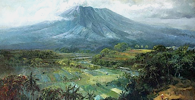
ARJUNO-WELIRANG TWIN VOLCANO BY ARTHUR ELAND


ARTHUR ELAND (1884-1948)
Arjuno-Welirang twin volcano 
(3,339 m - 10,955 ft for Arjuno)
(3,156 m -10,354 ft for Welirang)
Indonesia (Java)

The  volcano
Arjuno-Welirang (3,339 m - 10,955 ft for Arjuno and 3,156 m (10,354 ft fot Welirang) is a twin stratovolcano (the 'twins' being mount Arjuno and mount Welirang) in the province of East Java on Java, Indonesia.  Twins volcanoes are quite common aroud earth.
Mount Arjuno-Welirang lies about 50 kilometers (31 mi) south of Surabaya, and 20 kilometers (12 mi) north of Malang. 
There is at least one other stratovolcano in the area, and there are around 10 pyroclastic cones nearby.  They are located in a 6 km line between Arjuno and Welirang. The Arjuno-Welirang volcanic complex itself lies in the older two volcanoes, Mount Ringgit to the east and Mount Linting to the south. The summit lacks vegetation. Fumarolic areas with sulfur deposits are found in several locations on Welirang.
The name Arjuno is Javanese rendition of Arjuna, a hero in Mahabharata epic, while Welirang is Javanese word for sulfur.
A 1950 eruption had a VEI=2. There was an explosive eruption. Another eruption occurred two years later in 1952. This eruption had a VEI=0.

The painter 
There is not much biographical information about Arthur Eland, except that he was Leo Eland's twin brother. These two Dutch  brothers were born in 1884 in the Dutch East Indies on Java in Salatiga. After the death of Arthur and since the 1970s many of his canvases and watercolors representing large Indonesian volcanic landscapes have gone into auctions especially at Christie's and have acquired unmistakable market value. Christie's classified him after the colonial impressionist painters
___________________________________________
2019 - Wandering Vertexes...
by Francis Rousseau 

Monday, April 22, 2019

GUNUNG SUMBING PAINTED BY ERNEST DEZENTJE


ERNEST DEZENTJE (1885-1972) 
Gunung Sumbing  (3,371m -11,060 ft) 
Indonesia  (Java)

The mountain 
Gunung Sumbing  (3,371 m - 11,060 ft)  or Gurung Sumbing  (meaning Mount Sumbing) is a prominent high stratovolcano that lies across a 1400-m-high saddle from symmetrical Sundoro (3,136m) volcano in central Java. Prominent cones are located on the N and SE flanks, which is somewhat more dissected than Sundoro. An 800-m-wide horseshoe-shaped summit crater breached to the NE is partially filled by a lava dome that fed a lava flow down to 2400 m elevation. Emplacement of the dome followed the eruption of extensive pyroclastic flows down the NE flank.
The only report of historical activity, in about 1730 CE, may have produced the small phreatic craters found at the summit.
The announcement of an eruption in the Smithsonian/USGS Weekly Volcanic Activity Report (30 July-5 August 2008) was later found to be false. The Darwin Volcanic Ash Advisory Center (VAAC) noted that a pilot reported an eruption plume from Sumbing on 1 August 2008. The plume allegedly rose to an altitude of 4.9 km and drifted W. However, ash was not identified on satellite imagery. Center of Volcanology and Geological Hazard Mitigation (CVGHM) observers at the local observatory saw only non-eruptive processes at the volcano, and they noted brush fires in September and October. A common problem in this active region occurs when drifting plumes become linked to the wrong volcano.

The painter
The ‘Indisch’- Indonesian landscape painter Ernest Regnard Leonce Dezentjé was an autodidact.  His career  (mostly local) began when first president of the Republic of Indonesia, Soekarno (1901-1970), - who declared the independence of the country in 1945, felt in love with his painting and decided to make him the  "court painter".  Dezentje was then labelled an impressionist of the early Indonesian School, being considered by critics and young artists as a  typical establishment artist.  Along his eminently nationalistic themas the mountains and volcanoes of Indonesia took a important place.

__________________________________________________
2019 - Wandering Vertexes...
by Francis Rousseau 

Saturday, April 6, 2019

GUNUNG SEMERU BY ERNEST DEZENTJE


ERNEST DEZENTJE (1885- 1972) 
Gunung Semeru  (3, 676m - 12, 060ft) 
Indonesia 

The mountain 
Mount Semeru - Gunung Semeru or Gunung Mahameru indonesian - (3, 676m - 12, 060ft)  is an active volcano located in East Java, Indonesia. It is the highest mountain on the island of Java. This stratovolcano is also known as Mahameru, meaning 'The Great Mountain. The name derived from the Hindu-Buddhist mythical mountain of Meru or Sumeru, the abode of gods.  Semeru is named from Sumeru, the central world-mountain in Buddhist cosmology and by extension Hinduism. As stated in legend, it was transplanted from India; the tale is recorded in the 15th-century East Javanese work Tantu Pagelaran. It was originally placed in the western part of the island, but that caused the island to tip, so it was moved eastward. On that journey, parts kept coming off the lower rim, forming the mountains Lawu, Wilis, Kelut, Kawi, Arjuno and Welirang. The damage thus caused to the foot of the mountain caused it to shake, and the top came off and created Penanggungan as well. Indonesian Hindus also hold a belief that the mountain is the abode of Shiva in Java.
Gunung Semeru or Mahameru is very steep rising abruptly above the coastal plains of eastern Java. Semeru lies at the south end of the Tengger Volcanic Complex.
Semeru's eruptive history is extensive.
Since 1818, at least 55 eruptions have been recorded (10 of which resulted in fatalities) consisting of both lava flows and pyroclastic flows. All historical eruptions have had a VEI of 2 or 3. Semeru has been in a state of near-constant eruption from 1967 to the present. At times, small eruptions happen every 20 minutes or so.
In 2014, there are as many as 25 non-native plants in Mount Semeru National Park, which threaten the endemic local plants. The foreign plants were imported by a Dutch botanist named Van Steenis, in the colonial era. They include Foeniculum vulgare mill, Verbena brasiliensis, chromolaena odorata, and Salvinia molesta.
Mud erosion from surrounding vegetable plantations are also making problem of silting of Ranu Pane Lake, which the lake becomes smaller and shallower. Research predicted the lake will disappear in about 2025, except the kind of vegetables plantation is replaced with more ecological plantations.
Semeru is regularly climbed by tourists, usually starting from the village of Ranu Pane to the north, but though non-technical it can be dangerous. mainly because of the  poisonous gases on Mount Semeru.

The painter
The ‘Indisch’- Indonesian landscape painter Ernest Regnard Leonce Dezentjé was an autodidact.  His career  (mostly local) began when first president of the Republic of Indonesia, Soekarno (1901-1970), - who declared the independence of the country in 1945, felt in love with his painting and decided to make him the  "court painter".  Dezentje was then labelled an impressionist of the early Indonesian School, being considered by critics and young artists as a  typical establishment artist.  Along his eminently nationalistic themas the mountains and volcanoes of Indonesia took a important place.

__________________________________________________
2019 - Wandering Vertexes...
by Francis Rousseau 

Thursday, January 31, 2019

GUNUNG SUMBING & SUNDORO BY WILLEM IMANDT


WILLEM IMANDT (1882-1967) 
 Gunung Sumbing  (3,371 m - 11, 060ft) - on right 
Gunung Sundoro  (3,136 m - 10, 289 ft) - on left 
Indonesia (Central Java) 

 In Mount Sundoro and Mount Sumbing, oil on canvas, 1939

The volcanoes 
Gunung Sumbing (3,371 m - 11, 060ft) on right on this painting,  is an active stratovolcano in Central Java, Indonesia, symmetrical with Gunung Sundoro. The only report of historical eruptions is from 1730. It has created a small phreatic crater at the summit.
Gunung Sundoro  (3,136 m - 10, 289 ft)  also called  Sindara or   Sindoro, on left on this painting, is an active stratovolcano in Central Java, Indonesia. Parasitic craters and cones are found in the northwest-southern flanks; the largest is called Kembang. A small lava dome occupies the volcano's summit. Historical eruptions have been mostly mild-to-moderate.

The painter 
Willem Imandt was born in a tiny village in Zealand Flanders, close to the Dutch-Belgian border. He successfully started a career as teacher, with posts in his birth region and Amsterdam. He was also a talented draughtsman, without more than a basic education in this field. In 1908, he went to the Dutch East Indies, where he was employed in a number of cities on Sulawesi and Java until his retirement in 1929. At that point, he took up his old vocation and had a successful career as a painter.
 Imandt developed his own style. He concentrated on a few themes - landscapes and marines - and earned growing appreciation, that was also reflected in the prices his works fetched. His income from painting soon surpassed his teacher's salary. When he repatriated he was a wealthy man, who in Flanders continued to paint to fulfill the demand of other repatriates for a tangible and nostalgic memory of their Indies years. The Indies still were alluring Imandt, and in 1938 he returned as a famous painter. He was, as all Dutchmen, interned in a Japanese camp, as was his wife. They survived and returned for good in 1946. But as a painter oblivion was his fate. He died in The Hague in 1967. Now, Imandt is a respected part of the revival in interest (as well as a beneficiary of proceeds from the auctions). 
_______________________________
 
2019 - Wandering Vertexes...
by Francis Rousseau 

Monday, January 14, 2019

GUNUNG BROMO BY TEMPEST ANDERSON


TEMPEST ANDERSON (1846-1913)
Gunung Bromo (2,329m - 7,641ft)
Indonesia (Java Timur) 

The mountain 
Gunung Bromo (2,329m - 7,641ft) or Gunung Brama, an active volcano,in East Java, Indonesia,  is not the highest peak of the Tengger massif, but the best known. The massif area is one of the most visited tourist attractions in East Java, Indonesia. The volcano belongs to the Bromo Tengger Semeru National Park. The name of Bromo derived from Javanese pronunciation of Brahma, the Hindu creator god. Gunung Bromo sits in the middle of a plain called the "Sea of Sand"  a protected nature reserve since 1919. The best way to visit Gunung Bromo is from the nearby mountain village of Cemoro Lawang, from where it is possible to walk during 45 mn to the volcano. It is also possible to take an organised jeep tour, which includes a stop at the viewpoint on Gunung Penanjakan (2,770 m - 9,088 ft).
On the fourteenth day of the Hindu festival of Yadnya Kasada, the Tenggerese people of Probolinggo, East Java, travel up the mountain in order to make offerings of fruit, rice, vegetables, flowers and sacrifices to the mountain gods by throwing it into the caldera of the volcano. The origin of the ritual lies in the 15th century legend when princess  Roro Anteng started the principality of Tengger with her husband, Joko Seger. The couple were childless and therefore beseeched the assistance of the mountain gods. The gods granted them 24 children but stipulated that the 25th child, named Kesuma, must be thrown into the volcano as a human sacrifice. The gods' request was implemented. The tradition of throwing sacrifices into the volcano to appease these ancient deities continues today and is called the Yadnya Kasada ceremony. Though fraught with danger, some locals risk climbing down into the crater in an attempt to recollect the sacrificed goods that they believe could bring them good luck.
Depending on the degree of volcanic activity, the Indonesian Centre for Volcanology and Disaster Hazard Mitigation sometimes issues warnings against visiting Mount Bromo.
 Mount Bromo recently erupted in 2004, 2010, 2011 and 2015.

The photographer
Tempest Anderson  was an ophthalmic surgeon at York County Hospital in the United Kingdom, and an expert amateur photographer and vulcanologist. He was a member of the Royal Society Commission which was appointed to investigate the aftermath of the eruptions of Soufriere volcano, St Vincent and Mont Pelee, Martinique, West Indies which both erupted in May 1902. Some of his photographs of these eruptions were subsequently published in his book, Volcanic Studies in Many Lands. Tempest Anderson spent nine months in Mexico, Guatemala and the West Indies in 1906/1907. He travelled to Mexico to attend the 10th Congres Geologique International before sailing by mail steamer to Guatemala to study the effects of the 1902 earthquake. During the trip he observed and photographed Cerro Quemado, Santa Maria, and Atitlan. During this trip he collected first hand accounts of the 1902 eruption of the Santa Maria and the immediate aftermath. Captain Saunders of the Pacific Mail Steamer S.S. Newport observed the eruption cloud which rose to a great height. The Captain measured it using a sextant and recorded it as reaching 17 to 18 miles. The sounds accompanying the eruption were loud and were heard even louder at more distant places than close to the mountain. The eruption was heard as far away as Guatemala City, the noises so strong, they were assumed to come from neighbouring volcanoes.
_______________________________

2019 - Wandering Vertexes...
by Francis Rousseau 


Thursday, December 20, 2018

GUNUNG SUMBING (2) PAINTED BY BASOEKI ABDULLAH


BASOEKI ABDULLAH (1915 -1993), 
Gunung Sumbing  (3,371m- 11, 060ft) 
 Indonesia (Java) 

The mountain 
Gunung Sumbing  (3,371 m - 11,060 ft)  or Gurung Sumbing  (meaning Mount Sumbing) is a prominent high stratovolcano that lies across a 1400-m-high saddle from symmetrical Sundoro (3,136m) volcano in central Java. Prominent cones are located on the N and SE flanks, which is somewhat more dissected than Sundoro. An 800-m-wide horseshoe-shaped summit crater breached to the NE is partially filled by a lava dome that fed a lava flow down to 2400 m elevation. Emplacement of the dome followed the eruption of extensive pyroclastic flows down the NE flank.
The only report of historical activity, in about 1730 CE, may have produced the small phreatic craters found at the summit.
The announcement of an eruption in the Smithsonian/USGS Weekly Volcanic Activity Report (30 July-5 August 2008) was later found to be false. The Darwin Volcanic Ash Advisory Center (VAAC) noted that a pilot reported an eruption plume from Sumbing on 1 August 2008. The plume allegedly rose to an altitude of 4.9 km and drifted W. However, ash was not identified on satellite imagery. Center of Volcanology and Geological Hazard Mitigation (CVGHM) observers at the local observatory saw only non-eruptive processes at the volcano, and they noted brush fires in September and October. A common problem in this active region occurs when drifting plumes become linked to the wrong volcano.

The painter 
Basoeki (or Basuki) Abdullah is one of the modern master painters of Indonesia, known as a realist and naturalist painter. He has been appointed as the official painter of Merdeka Palace in Jakarta and works adorn palaces and presidential countries Indonesia, in addition to have been collectibles from around the world. His father, Abdullah Suriosubroto, was a famous painter and dancer, while his grandfather,  Doctor Wahidin Sudirohusodo, was a prominent Indonesian National Awakening Movement in the early 1900's. Since the age of 4 years, he began to paint  famous personalities such as Mahatma Gandhi, Rabindranath Tagore and even "Jesus Christ and Krishnamurti".
His acquired a formal education in the Basoeki Abdullah Catholic and Catholic Mulo in Solo.
In 1933,  he obtained a scholarship to study at the Academic Arts in The Hague, Netherlands, and completed his studies within 3 years with awarded Certificate of Royal International of Art (RIA). On 6 September 1948,  during the revolutionary period,  Basoeki Abdullah is housed in Amsterdam (Netherlands) during the coronation of Queen Juliana which held a contest to paint, he defeated 87 European painters and managed to come out as winners.
Since then, the world began to recognize Basoeki Abdullah, during his frequent visits around Europe (Italy and France) and was well known by many resident artists with a worldwide reputation.
_______________________________
2018 - Wandering Vertexes...
by Francis Rousseau

Wednesday, November 21, 2018

GUNUNG SUMBING (1) BY BASOEKI ABDULLAH


BASOEKI ABDULLAH (1915 -1993)
Gunung Sumbing  (3,371m -11,060 ft) 
Indonesia  (Java)

The mountain 
Gunung Sumbing  (3,371 m - 11,060 ft)  or Gurung Sumbing  (meaning Mount Sumbing) is a prominent high stratovolcano that lies across a 1400-m-high saddle from symmetrical Sundoro (3,136m) volcano in central Java. Prominent cones are located on the N and SE flanks, which is somewhat more dissected than Sundoro. An 800-m-wide horseshoe-shaped summit crater breached to the NE is partially filled by a lava dome that fed a lava flow down to 2400 m elevation. Emplacement of the dome followed the eruption of extensive pyroclastic flows down the NE flank.
The only report of historical activity, in about 1730 CE, may have produced the small phreatic craters found at the summit.
The announcement of an eruption in the Smithsonian/USGS Weekly Volcanic Activity Report (30 July-5 August 2008) was later found to be false. The Darwin Volcanic Ash Advisory Center (VAAC) noted that a pilot reported an eruption plume from Sumbing on 1 August 2008. The plume allegedly rose to an altitude of 4.9 km and drifted W. However, ash was not identified on satellite imagery. Center of Volcanology and Geological Hazard Mitigation (CVGHM) observers at the local observatory saw only non-eruptive processes at the volcano, and they noted brush fires in September and October. A common problem in this active region occurs when drifting plumes become linked to the wrong volcano.

The painter 
Basoeki (or Basuki) Abdullah is one of the modern master painters of Indonesia, known as a realist and naturalist painter. He has been appointed as the official painter of Merdeka Palace in Jakarta and works adorn palaces and presidential countries Indonesia, in addition to have been collectibles from around the world. His father, Abdullah Suriosubroto, was a famous painter and dancer, while his grandfather,  Doctor Wahidin Sudirohusodo, was a prominent Indonesian National Awakening Movement in the early 1900's. Since the age of 4 years, he began to paint  famous personalities such as Mahatma Gandhi, Rabindranath Tagore and even "Jesus Christ and Krishnamurti".
His acquired a formal education in the Basoeki Abdullah Catholic and Catholic Mulo in Solo.
In 1933,  he obtained a scholarship to study at the Academic Arts in The Hague, Netherlands, and completed his studies within 3 years with awarded Certificate of Royal International of Art (RIA). On 6 September 1948,  during the revolutionary period,  Basoeki Abdullah is housed in Amsterdam (Netherlands) during the coronation of Queen Juliana which held a contest to paint, he defeated 87 European painters and managed to come out as winners.
Since then, the world began to recognize Basoeki Abdullah, during his frequent visits around Europe (Italy and France) and was well known by many resident artists with a worldwide reputation.

_______________________________

2018 - Wandering Vertexes...
by Francis Rousseau 

Sunday, August 26, 2018

GUNUNG BROMO PAINTED BY ERNEST DEZENTJE


ERNEST DEZENTJE (1885- 1972),
Gunung Bromo (2,329m - 7,641ft)
Indonesia (Java Timur)

The mountain 
Gunung Bromo (2,329m - 7,641ft) or Gunung Brama, an active volcano,in East Java, Indonesia,  is not the highest peak of the Tengger massif, but the best known. The massif area is one of the most visited tourist attractions in East Java, Indonesia. The volcano belongs to the Bromo Tengger Semeru National Park. The name of Bromo derived from Javanese pronunciation of Brahma, the Hindu creator god. Gunung Bromo sits in the middle of a plain called the "Sea of Sand"  a protected nature reserve since 1919. The best way to visit Gunung Bromo is from the nearby mountain village of Cemoro Lawang, from where it is possible to walk during 45 mn to the volcano. It is also possible to take an organised jeep tour, which includes a stop at the viewpoint on Gunung Penanjakan (2,770 m - 9,088 ft).
On the fourteenth day of the Hindu festival of Yadnya Kasada, the Tenggerese people of Probolinggo, East Java, travel up the mountain in order to make offerings of fruit, rice, vegetables, flowers and sacrifices to the mountain gods by throwing it into the caldera of the volcano. The origin of the ritual lies in the 15th century legend when princess  Roro Anteng started the principality of Tengger with her husband, Joko Seger. The couple were childless and therefore beseeched the assistance of the mountain gods. The gods granted them 24 children but stipulated that the 25th child, named Kesuma, must be thrown into the volcano as a human sacrifice. The gods' request was implemented. The tradition of throwing sacrifices into the volcano to appease these ancient deities continues today and is called the Yadnya Kasada ceremony. Though fraught with danger, some locals risk climbing down into the crater in an attempt to recollect the sacrificed goods that they believe could bring them good luck.
Depending on the degree of volcanic activity, the Indonesian Centre for Volcanology and Disaster Hazard Mitigation sometimes issues warnings against visiting Mount Bromo.
 Mount Bromo recently erupted in 2004, 2010, 2011 and 2015.

The painter
The ‘Indisch’- Indonesian landscape painter Ernest Regnard Leonce Dezentjé was an autodidact.  His career  (mostly local) began when first president of the Republic of Indonesia, Soekarno (1901-1970), - who declared the independence of the country in 1945, felt in love with his painting and decided to make him the  "court painter".  Dezentje was then labelled an impressionist of the early Indonesian School, being considered by critics and young artists as a  typical establishment artist.  Along his eminently nationalistic themas the mountains and volcanoes of Indonesia took a important place.


Wednesday, June 6, 2018

GUNUNG MERAPI (2) BY ARTHUR ELAND


ARTHUR ELAND (1884-1948)
 Gunung Merapi (2,914m - 9,500 ft)
Indonesia (Java) 

The mountain 
Gunung Merapi (2,914m - 9,500 ft)  is an active stratovolcano located on the border between Central Java and Yogyakarta, Indonesia. It is the most active volcano in Indonesia and has erupted regularly since 1548. It is located approximately 28 kilometres (17 mi) north of Yogyakarta city which has a population of 2.4 million, and thousands of people live on the flanks of the volcano, with villages as high as 1,700 metres (5,600 ft) above sea level.
Smoke can often be seen emerging from the mountaintop, and several eruptions have caused fatalities. Pyroclastic flow from a large explosion killed 27 people on 22 November 1994, mostly in the town of Muntilan, west of the volcano.Another large eruption occurred in 2006, shortly before the Yogyakarta earthquake. In light of the hazards that Merapi poses to populated areas, it has been designated as one of the Decade Volcanoes.
On 25 October 2010 the Indonesian government raised the alert for Mount Merapi to its highest level and warned villagers in threatened areas to move to safer ground. People living within a 20 km (12 mi) zone were told to evacuate. Officials said about 500 volcanic earthquakes had been recorded on the mountain over the weekend of 23–24 October, and that the magma had risen to about 1 kilometre (3,300 ft) below the surface due to the seismic activity. On the afternoon of 25 October 2010 Mount Merapi erupted lava from its southern and southeastern slopes.
The mountain was still erupting on 30 November 2010, but due to lowered eruptive activity on 3 December 2010 the official alert status was reduced to level 3. The volcano is now 2930 metres high, 38 metres lower than before the 2010 eruptions.
After a large eruption in 2010 the characteristic of Mount Merapi was changed. On 18 November 2013 Mount Merapi burst smoke up to 2,000 meters high, one of its first major phreatic eruptions after the 2010 eruption. Researchers said that this eruption occurred due to combined effect of hot volcanic gases and abundant rainfall.
In 2004 an area of 6,410 hectares around Mount Merapi was established as a national park. The decision of the Ministry of Forestry to declare the park has been subsequently challenged in court by The Indonesian Forum for Environment, on grounds of lack of consultation with local residents. During the 2006 eruption of the volcano it was reported that many residents were reluctant to leave because they feared their residences would be confiscated for expansion of the national park, meaning they wouldn't have a house.
Merapi is very important to Javanese, especially those living around its crater. As such, there are many myths and beliefs attached to Merapi. It is believed that when the gods had just created the Earth, Java was unbalanced because of the placement of Mount Jamurdipo on the west end of the island. In order to assure balance, the gods (generally represented by Batara Guru) ordered the mountain to be moved to the centre of Java. However, two armourers, Empu Rama and Empu Permadi, were already forging a sacred keris at the site where Mount Jamurdipo was to be moved. The gods warned them that they would be moving a mountain there, and that they should leave; Empu Rama and Empu Permadi ignored that warning. In anger, the gods buried Empu Rama and Empu Permadi under Mount Jamurdipo; their spirits later became the rulers of all mystical beings in the area. In memory of them, Mount Jamurdipo was later renamed Mount Merapi, which means "fire of Rama and Permadi.
The Javanese believe that the Earth is not only populated by human beings, but also by spirits (makhluk halus). Villages near Merapi believe that one of the palaces (in Javanese kraton) used by the rulers of the spirit kingdom lies inside Merapi, ruled by Empu Rama and Empu Permadi. This palace is said to be a spiritual counterpart to the Yogyakarta Sultanate, complete with roads, soldiers, princes, vehicles, and domesticated animals. Besides the rulers, the palace is said to also be populated by the spirits of ancestors who died as righteous people. The spirits of these ancestors are said to live in the palace as royal servants (abdi dalem), occasionally visiting their descendants in dreams to give prophecies or warnings. "
To keep the volcano quiet and to appease the spirits of the mountain, the Javanese regularly bring offerings on the anniversary of the sultan of Yogyakarta's coronation. For Yogyakarta Sultanate, Merapi holds significant cosmological symbolism, because it is forming a sacred north-south axis line between Merapi peak and Southern Ocean (Indian Ocean). The sacred axis is signified by Merapi peak in the north, the Tugu Yogyakarta (id) monument near Yogyakarta main train station, the axis runs along Malioboro street to Northern Alun-alun (square) across Keraton Yogyakarta (sultan palace), Southern Alun-alun, all the way to Bantul and finally reach Samas and Parangkusumo beach on the estuary of Opak river and Southern Ocean. This sacred axis connected the hyangs or spirits of mountain revered since ancient times—often identified as "Mbah Petruk" by Javanese people—The Sultan of Yogyakarta as the leader of the Javanese kingdom, and Nyi Roro Kidul as the queen of the Southern Ocean, the female ocean deity revered by Javanese people and also mythical consort of Javanese kings.

The painter 
There is not much biographical information about Arthur Eland, except that he was Leo Eland's twin brother. These two Dutch  brothers were born in 1884 in the Dutch East Indies on Java in Salatiga. After the death of Arthur and since the 1970s many of his canvases and watercolors representing large Indonesian volcanic landscapes have gone into auctions especially at Christie's and have acquired unmistakable market value. Christie's classified him after the colonial impressionist painters

Sunday, April 8, 2018

GUNUNG, SEMERU, BROMO AND BATUR BY ENVER LARNEY


ENVER LARNEY (bn. 1955)    
Gunung Semeru (3, 676m - 12, 060ft) 
 Gunung Bromo (2,329m - 7,641ft)
Gunung Batur (1,717 m - 5,633ft) 
Indonesia (Java) 

 In Gunung Semeru, Bromo and Batok Jawa Timor Indonesia,  2008

The volcanoes
Gunung Bromo (2,329m - 7,641ft) or Gunung Brama, an active volcano, in East Java, Indonesia,  is not the highest peak of the Tengger massif, but the best known. The massif area is one of the most visited tourist attractions in East Java, Indonesia. The volcano belongs to the Bromo Tengger Semeru National Park. The name of Bromo derived from Javanese pronunciation of Brahma, the Hindu creator god. Gunung Bromo sits in the middle of a plain called the "Sea of Sand"  a protected nature reserve since 1919. The best way to visit Gunung Bromo is from the nearby mountain village of Cemoro Lawang, from where it is possible to walk during 45 mn to the volcano. It is also possible to take an organised jeep tour, which includes a stop at the viewpoint on Gunung Penanjakan (2,770 m - 9,088 ft). Mount Bromo recently erupted in 2004, 2010, 2011 and 2015.
Gunung Semeru  (3, 676m - 12, 060ft)  or Gunung Mahameru indonesian is an active volcano located in East Java, Indonesia. It is the highest mountain on the island of Java. This stratovolcano is also known as Mahameru, meaning 'The Great Mountain. The name derived from the Hindu-Buddhist mythical mountain of Meru or Sumeru, the abode of gods.  Semeru is named from Sumeru, the central world-mountain in Buddhist cosmology and by extension Hinduism. As stated in legend, it was transplanted from India; the tale is recorded in the 15th-century East Javanese work Tantu Pagelaran.  Since 1818, at least 55 eruptions have been recorded (10 of which resulted in fatalities) consisting of both lava flows and pyroclastic flows. All historical eruptions have had a VEI of 2 or 3. Semeru has been in a state of near-constant eruption from 1967 to the present. At times, small eruptions happen every 20 minutes or so.
Gunung Batur (1,717 m - 5, 633ft) is an Indonesian volcano located in the north of the island of Bali. This volcano consists of a vast caldera whose rim culminates at Mount Abang. The interior of the depression, whose bottom is occupied on the south-east by Lake Batur, has several volcanic cones, including Mount Batur itself. The first historically dated eruption dates back to 18041; since then, 24 others have occurred, including the last from March 15, 1999 to June 2000.

The painter 
Enver Larney was born in the fifties  in Cape Town, South Africa. For many decades now, he has captured scenes around the world in oils on canvas. An impressionist in the traditional manner, Larney's medium format works are achieved in one sitting and in the open. Since 1972, his works appear in many collections and Institutions such as, the Chase Manhattan Bank New York USA and the Musée de l'Affiche in Paris, as well as countless private collections worldwide....

Friday, March 23, 2018

GUNUNG KRAKATOA 1883 ERUPTION BY PARKER & COWARD LITH.


PARKER & COWARD  LITHOGRAPH (1888)
Gunung Krakatoa (813 m - 2,667 ft) 
Indonesia (Java- Sumatra)  

 In  The eruption of Krakatoa, and subsequent phenomena.  27 May 1883, litho on paper, 
Report of the Krakatoa Committee of the Royal Society 

The volcano
Krakatoa, or Krakatau  (813 m - 2,667 ft) is a volcanic island situated in the Sunda Strait between the islands of Java and Sumatra in the Indonesian province of Lampung. The name is also used for the surrounding island group comprising the remnants of a much larger island of three volcanic peaks which was obliterated in a cataclysmic 1883 eruption. 
The most notable eruptions of Krakatoa culminated in a series of massive explosions over August 26–27, 1883, which were among the most violent volcanic events in recorded historyWith an estimated Volcanic Explosivity Index (VEI) of 6, the eruption was equivalent to 200 megatons of TNT (840 PJ)—about 13,000 times the nuclear yield of the Little Boy bomb (13 to 16 kt) that devastated Hiroshima, Japan, during World War II, and four times the yield of Tsar Bomba (50 Mt), the most powerful nuclear device ever detonated.
The 1883 eruption ejected approximately 25 km3 (6 cubic miles) of rock.  The cataclysmic explosion was heard 4,800 km (3,000 mi) away in Alice Springs, as well as on the island of Rodrigues near Mauritius, 4,653 km (2,891 mi) to the west.
According to the official records of the Dutch East Indies colony, 165 villages and towns were destroyed near Krakatoa, and 132 were seriously damaged. At least 36,417 people died, and many more thousands were injured, mostly from the tsunamis that followed the explosion. The eruption destroyed two-thirds of the island of Krakatoa.

Eruptions in the area since 1927 have built a new island at the same location, named Anak Krakatau (which is Indonesian for "Child of Krakatoa"). Periodic eruptions have continued since, with recent eruptions in 2009, 2010, 2011, and 2012. In late 2011, this island had a radius of roughly 2 kilometres (1.2 mi), and a highest point of about 324 metres (1,063 ft) above sea level,[5] growing 5 metres (16 ft) each year.[6] In 2017 the height of Anak Krakatau was reported as over 400 metres above sea level.
The previous recorded and documented eruptions were in 1680-81, 535AD, 416AD.   

Saturday, March 17, 2018

GUNUNG MERAPI BY ARTHUR ELAND


ARTHUR ELAND (1884-1948)
 Gunung Merapi or Mount Merapi (2,914m - 9,500 ft)
Indonesia (Java) 
The mountain 
Gunung Merapi (2,914m - 9,500 ft)  is an active stratovolcano located on the border between Central Java and Yogyakarta, Indonesia. It is the most active volcano in Indonesia and has erupted regularly since 1548. It is located approximately 28 kilometres (17 mi) north of Yogyakarta city which has a population of 2.4 million, and thousands of people live on the flanks of the volcano, with villages as high as 1,700 metres (5,600 ft) above sea level.
Smoke can often be seen emerging from the mountaintop, and several eruptions have caused fatalities. Pyroclastic flow from a large explosion killed 27 people on 22 November 1994, mostly in the town of Muntilan, west of the volcano.Another large eruption occurred in 2006, shortly before the Yogyakarta earthquake. In light of the hazards that Merapi poses to populated areas, it has been designated as one of the Decade Volcanoes.
On 25 October 2010 the Indonesian government raised the alert for Mount Merapi to its highest level and warned villagers in threatened areas to move to safer ground. People living within a 20 km (12 mi) zone were told to evacuate. Officials said about 500 volcanic earthquakes had been recorded on the mountain over the weekend of 23–24 October, and that the magma had risen to about 1 kilometre (3,300 ft) below the surface due to the seismic activity. On the afternoon of 25 October 2010 Mount Merapi erupted lava from its southern and southeastern slopes.
The mountain was still erupting on 30 November 2010, but due to lowered eruptive activity on 3 December 2010 the official alert status was reduced to level 3. The volcano is now 2930 metres high, 38 metres lower than before the 2010 eruptions.
After a large eruption in 2010 the characteristic of Mount Merapi was changed. On 18 November 2013 Mount Merapi burst smoke up to 2,000 meters high, one of its first major phreatic eruptions after the 2010 eruption. Researchers said that this eruption occurred due to combined effect of hot volcanic gases and abundant rainfall.
In 2004 an area of 6,410 hectares around Mount Merapi was established as a national park. The decision of the Ministry of Forestry to declare the park has been subsequently challenged in court by The Indonesian Forum for Environment, on grounds of lack of consultation with local residents. During the 2006 eruption of the volcano it was reported that many residents were reluctant to leave because they feared their residences would be confiscated for expansion of the national park, meaning they wouldn't have a house.
Mythology
Merapi is very important to Javanese, especially those living around its crater. As such, there are many myths and beliefs attached to Merapi. It is believed that when the gods had just created the Earth, Java was unbalanced because of the placement of Mount Jamurdipo on the west end of the island. In order to assure balance, the gods (generally represented by Batara Guru) ordered the mountain to be moved to the centre of Java. However, two armourers, Empu Rama and Empu Permadi, were already forging a sacred keris at the site where Mount Jamurdipo was to be moved. The gods warned them that they would be moving a mountain there, and that they should leave; Empu Rama and Empu Permadi ignored that warning. In anger, the gods buried Empu Rama and Empu Permadi under Mount Jamurdipo; their spirits later became the rulers of all mystical beings in the area. In memory of them, Mount Jamurdipo was later renamed Mount Merapi, which means "fire of Rama and Permadi.
The Javanese believe that the Earth is not only populated by human beings, but also by spirits (makhluk halus). Villages near Merapi believe that one of the palaces (in Javanese kraton) used by the rulers of the spirit kingdom lies inside Merapi, ruled by Empu Rama and Empu Permadi. This palace is said to be a spiritual counterpart to the Yogyakarta Sultanate, complete with roads, soldiers, princes, vehicles, and domesticated animals. Besides the rulers, the palace is said to also be populated by the spirits of ancestors who died as righteous people. The spirits of these ancestors are said to live in the palace as royal servants (abdi dalem), occasionally visiting their descendants in dreams to give prophecies or warnings. "
Spirits of Merapi
To keep the volcano quiet and to appease the spirits of the mountain, the Javanese regularly bring offerings on the anniversary of the sultan of Yogyakarta's coronation. For Yogyakarta Sultanate, Merapi holds significant cosmological symbolism, because it is forming a sacred north-south axis line between Merapi peak and Southern Ocean (Indian Ocean). The sacred axis is signified by Merapi peak in the north, the Tugu Yogyakarta (id) monument near Yogyakarta main train station, the axis runs along Malioboro street to Northern Alun-alun (square) across Keraton Yogyakarta (sultan palace), Southern Alun-alun, all the way to Bantul and finally reach Samas and Parangkusumo beach on the estuary of Opak river and Southern Ocean. This sacred axis connected the hyangs or spirits of mountain revered since ancient times—often identified as "Mbah Petruk" by Javanese people—The Sultan of Yogyakarta as the leader of the Javanese kingdom, and Nyi Roro Kidul as the queen of the Southern Ocean, the female ocean deity revered by Javanese people and also mythical consort of Javanese kings.

The painter 
There is not much biographical information about Arthur Eland, except that he was Leo Eland's twin brother. These two Dutch  brothers were born in 1884 in the Dutch East Indies on Java in Salatiga. After the death of Arthur and since the 1970s many of his canvases and watercolors representing large Indonesian volcanic landscapes have gone into auctions especially at Christie's and have acquired unmistakable market value. Christie's classified him after the colonial impressionist painters

Wednesday, December 27, 2017

GUNUNG GAMPING BY FRANZ-WILHELM JUNGHUHN


FRANZ-WILHELM JUNGHUHN (1809-1864)
Gunung Gamping
Indonesia (Java) 

 In Gunung Gamping near Yogyakarta, 1853-1854, Ledien Univsersity Library 

The mountain
Gunung Gamping (250 m)  is a hill  located in the province of Jawa Timur, in the southwestern part of the country, 800 km east of the capital Jakarta, Indonesia  The top of Gunung Gamping is 534 meters above sea level ( or 250 meters above the surrounding terrain) . The width at the base is 2.7 km. The terrain around Gunung Gamping is mainly hilly. The highest point nearby is 965 meters above sea level, 7.3 km southeast of Gunung Gamping. Around Gunung Gamping, it is quite sparsely populated, with 28 inhabitants per square kilometer.  with mainly green-green deciduous forest grows.  Savann climate prevails in the area. The annual average temperature in the funnel is 21 ° C. The warmest month is March, when the average temperature is 22 ° C, and the coldest is July, at 20 ° C.  The rainy month is January, with an average of 498 mm rainfall , and the driest is August, with 33 mm rainfall. 

The artist
Friedrich Franz Wilhelm Junghuhn was a German-Dutch botanist and geologist, who studied medicine in Halle and in Berlin from 1827 to 1831, meanwhile publishing  (1830) a seminal paper on mushrooms in Limnaea.  Junghuhn settled on Java, where he made an extensive study of the land and its people.  He discovered the Kawah Putih crater lake south of Bandung in 1837.
He published extensively on his many often highly adventurous expeditions and his scientific analyses.  Among his works is an important description and natural history in many volumes of the volcanoes of Java, Bijdragen tot de geschiedenis der vulkanen in den Indischen Archipel (1843).
He completed Die Topographischen und Naturwissenschaftlichen Reisen durch Java (Topographic and Scientific Journeys in Java) in 1845 and a first anthropological and topographical study of Sumatra, Die Bättalander auf Sumatra (Batak lands of Sumatra). in 1847.
In 1849, ill health forced his return to the Netherlands.  While in the Netherlands, Junghuhn began work on a four volume treatise published in Dutch and translated into German between 1850 and 1854: Java, deszelfs gedaante, bekleeding en inwendige struktuur. Junghuhn was an avid humanist and socialist. In the Netherlands he published anonymously his free-thinking manifesto Licht- en Schaduwbeelden uit de Binnenlanden van Java (Images of Light and Shadow from Java's interior) between 1853 and 1855. The work was controversial, advocating socialism in the colonies and fiercely criticizing Christian and Islamic proselytization of the Javanese people.  Junghuhn instead wrote of his preference for a form of Pandeism (pantheistic deism), contending that God was in everything, but could only be determined through reason.  The work was banned in Austria and parts of Germany for its "denigrations and vilifications of Christianity", but was a strong seller in the Netherlands where it was first published pseudonymously.  It was also popular in colonial Indonesia, despite opposition from the Dutch Christian Church there.
Recovered from his ills, Junghuhn returned to Java in 1855.  He remained on Java until his death from liver disease in 1864.  On his deathbed in his house near Lembang on the slopes of the volcano Tangkuban Perahu just north of Bandung, Java, it is said that Junghuhn asked the doctor to open the windows, in order to say goodbye to the mountains that he loved.
In Lembang there is a small monument to his memory in a grassy square named after him planted with some of his favorite trees among which the Cinchona. A minor item of trivia playing into polemical discussions of Junghuhn is his surname, literally translated as "young chicken".
The plants Cyathea junghuhniana and Nepenthes junghuhnii are named after Franz Junghuhn.

Saturday, November 11, 2017

GUNUNG MERBABU BY ISODORUS VAN MENS


ISODORUS VAN MENS  (1890-1985) 
Gunung Merbabu (3,145m -10, 318ft)  
Indonesia (Java) 

 In The Merbaboe Seen From Salatiga On Semarang, oil on canvas

Gunung  Merbabu  (3,145m -10, 318ft)  is a dormant stratovolcano in Central Java province on the Indonesian island of Java. The name Merbabu could be loosely translated as 'Mountain of Ash' from the Javanese combined words; Meru means "mountain" and awu or abu means "ash".
The active volcano Gunung Merapi is directly adjacent on its south-east side, while the city of Salatiga is located on its northern foothills. A 1,500m high broad saddle lies between Merbabu and Merapi, the site of the village of Selo, Java and highly fertile[citation needed] farming land.
There are two peaks; Syarif (3,119 m) and Kenteng Songo (3,145 m). Three U-shaped radial valleys extend from the Kenteng Songo summit in northwesterly, northeastly and southeastly directions.
Two known moderate eruptions occurred in 1560 and 1797. The 1797 event was rated 2: Explosive, on the Volcanic Explosivity Index. An unconfirmed eruption may have occurred in 1570.
Geologically recent eruptions originated from a North Northwest-South Southeast fissure system that cut across the summit and fed the large-volume lava flows from Kopeng and Kajor craters on the northern and southern flanks, respectively.
Merbabu can be climbed from several routes originating from the town of Kopeng on the north east sideside, and also from Selo on the southern side. A climb from Kopeng to Kenteng Songo takes between 8 and 10 hours.[citation needed]
An area of 57 kmІ at the mountain has been declared a national park in 2004.